
Loss of productivity due to congestion and inefficient public transport
I recently read two articles appearing in a major Philippine daily and a popular online site. The first one is an article that appeared in the Philippine Daily Inquirer – “PH economy losing $3.27B in human productivity due to traffic mess” – last September 25, 2012. The other article was posted on Rappler – “Traffic and infrastructure delays cost the Philippines” – last September 27, 2012. These were articles written after the authors’ attendance of what was an Energy and Infrastructure Forum last Sept. 25 where a transport official mentioned a recent study in his talk that estimates productivity losses of about 3.27B USD per year from Metro Manila traffic alone.
 Traffic congestion along Commonwealth Avenue
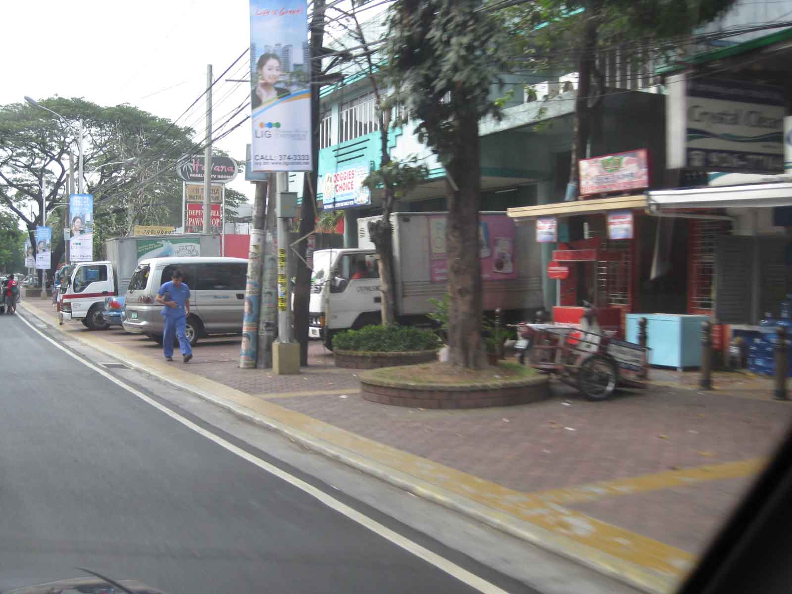
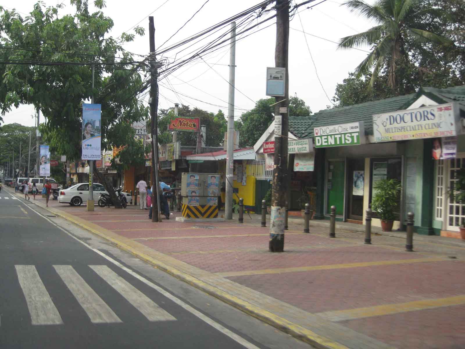
 Unusual traffic management scheme along Ortigas Avenue
The study from the National Center for Transportation Studies that was mentioned in both articles was actually first featured in a Yahoo! Philippines article – “Traffic congestion costs Metro Manila P137B per year” – that appeared a month earlier in Aug. 28, 2012. The study being referred to is actually a paper presented by Dr. Jose Regin F. Regidor in his Professorial Chair lecture at the University of the Philippines Diliman’s College of Engineering Colloquium in early August 2012. A copy of the paper may be found below:
Prof Chair 2012 JRFR 02July2012
The main reference for this paper is the study on congestion costs that was produced by the National Center for Transportation Studies back in 2000. Credits go to the core team of Dr. Ricardo Sigua (Institute of Civil Engineering of UP Diliman), Dr. Noriel Tiglao (now with the National College of Public Administration and Governance) and Dr. Val Teodoro (now in the US) for the study. The
Economic Impacts of Traffic Congestion in Metro Manila – Cover+Chap 1 and 2
Economic Impacts of Traffic Congestion in Metro Manila – Chap 3
Economic Impacts of Traffic Congestion in Metro Manila – Chap 4 and 5
Economic Impacts of Traffic Congestion in Metro Manila – Appendix
A much needed update may be possible in the next two years once the traffic model for Metro Manila is updated and calibrated using new data from Household Informations Surveys (HIS) and other transport and traffic surveys under the current MUCEP study that is supported by the Japan International Cooperation Agency (JICA). Hopefully, such a model can be updated and calibrated more often in order to assess losses due to congestion and our continuing inability to provide the necessary infrastructure to alleviate the situation. While the paper and the study mentioned above focus on productivity losses, it should be emphasized that there are other costs that should be highlighted including those related to health (respiratory diseases and road crash fatalities and injuries), energy (fuel consumption and inefficiencies), and emissions (carbon and other GHG).
–
Walking and parking in Quezon City: West Avenue
Parking spaces and walkways were also constructed along West Avenue. Bollards separate the parking spaces from the pedestrian right of way. As mentioned in a previous post, many commercial establishments benefitted from this “freebie” from the Quezon City government considering many establishments didn’t even have the minimum number of parking spaces as stipulated in the National Building Code. The local government balked at charging parking fees but one opinion is that they should charge fees for on-street parking facilities that generally benefit car-owners more than they benefit non-owners. I personally believe that there should be parking fees in order to recover some funds that could be used for other programs that could have otherwise received funding that also could have benefited more people. Following are photos taken along West Ave.
 Parking along West Ave. in front of an office building
 One advantage of the project was the reduction of on-street parking though there are still those who prefer to wait along the roadside (i.e., those with drivers).
 Parking spaces in front of a fine dining restaurant.
 Parking spaces near the Delta area, which is the intersection of 3 major roads – Quezon Ave., West Ave., and Timog Ave.
–
Airport Rail Link in Bangkok
The last time I was in Bangkok was in 2005 or 2006 and so it has been a while since that last trip that I was curious about how the city would look like after 6 years. Was there anything new? Did it change much since the last time? At the very least, I was expecting to have new experiences and it didn’t take long before I had one, trying out the express rail link between Suvarnabhumi Airport and the city. The rail link was still under construction the last time I was in Bangkok and one had no choice at the time but to take a taxi or a shuttle between the airport and the hotel.
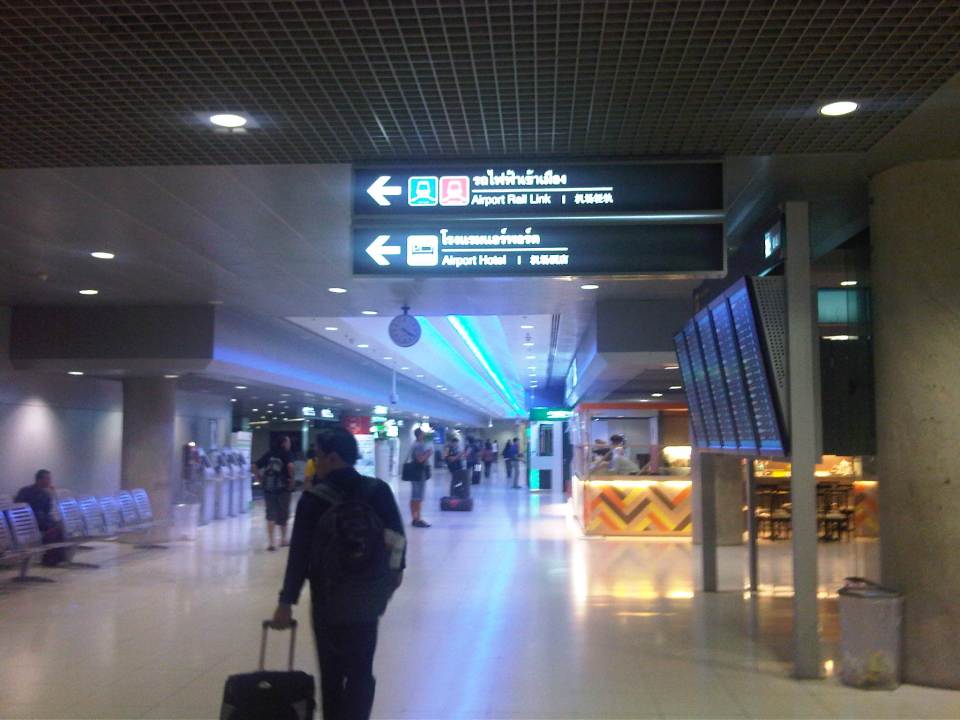 The walk from the arrival area to the Airport Link
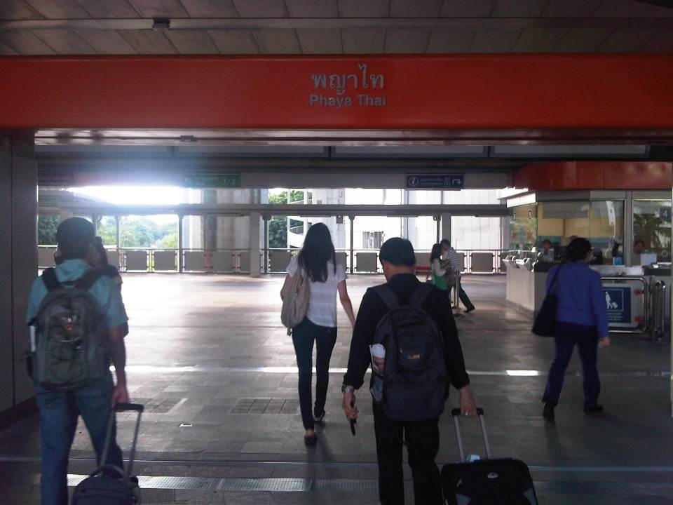
 Ticket vending machine with English instructions upon the press of a button. We purchased tickets for the Phaya Thai Express to transfer to the BTS Skytrain
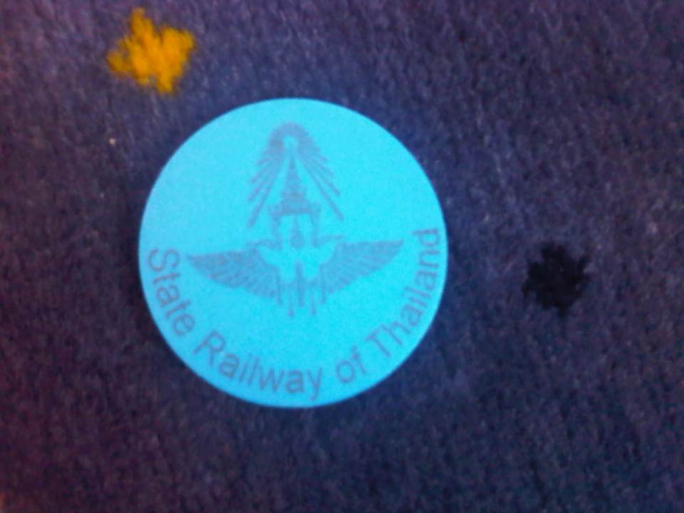 Token for the Express Rail Link trip from the airport to Phaya Thai Station – the link is operated by the State Railway of Thailand, their counterpart of our Philippine National Railways. The trip cost 90 Baht (~ 130 PhP), very cheap compared to taking a taxi.
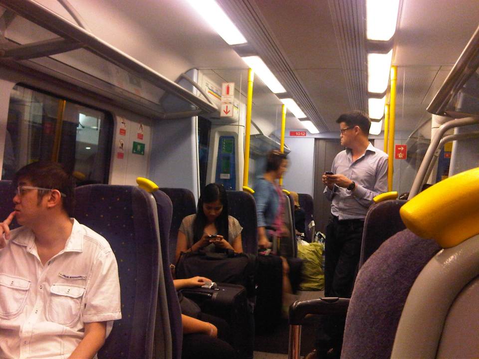 Passengers inside the Airport Link Train
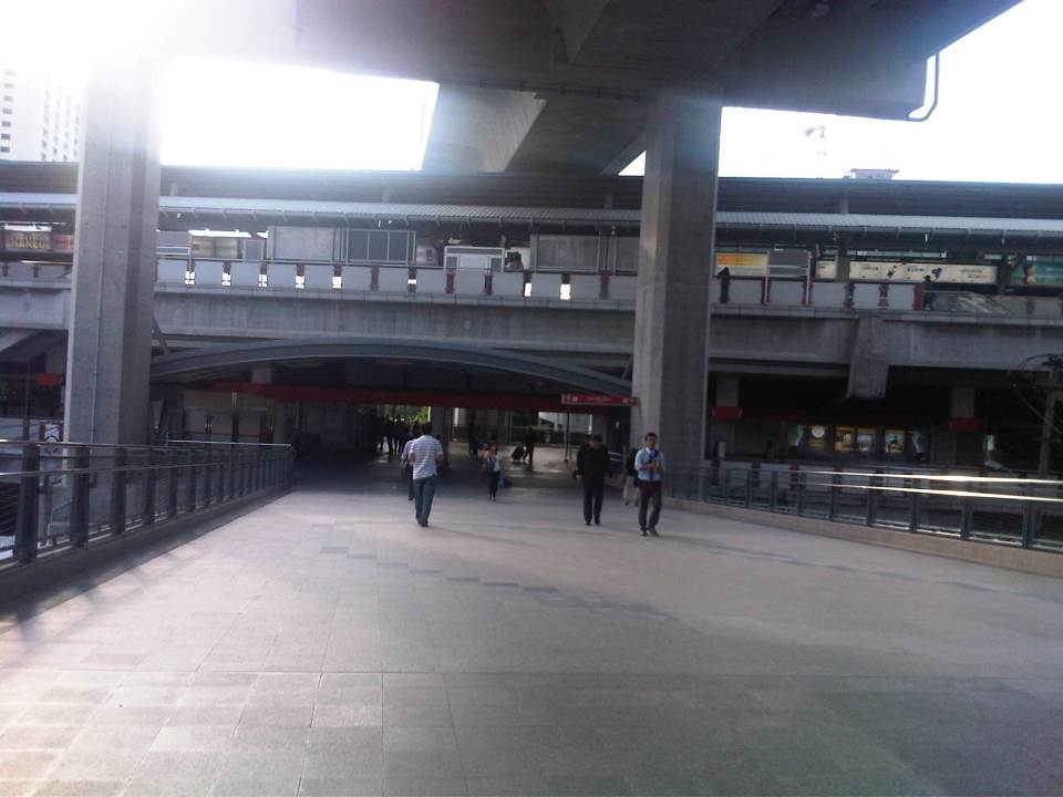 Walk from the Airport Rail Link’s Phaya Thai Station to the BTS Skytrain Station
 Looking back at the Phaya Thai Station
 Phaya Thai Station of the BTS Skytrain
It would be very nice to have a similar rail link between the MRT 3 or LRT 1 Lines and NAIA in Manila. In fact, how difficult would it be for the LRT1 Line to have an extension to the airport terminals of NAIA when it’s depot is just across the road from the old domestic terminal? This would probably be easier than constructing a new monorail or whatever system it is that is being planned between Bonifacio Global City and NAIA. It is definitely much easier and perhaps cheaper compared to the still-born Northrail between Caloocan and Clark. One thing for sure is that we are really behind our ASEAN neighbors when it comes to providing the infrastructure for public transport, in this case airport access.
Walking and parking in Quezon City: Visayas Avenue
I’m initiating a series of posts on Quezon City – focusing on the pedestrian and parking facilities that were constructed not so long ago. As part of a city-wide project using local funds generated from QC’s internal revenue allotment (IRA) and other incomes, the city constructed pedestrian sidewalks and off-street parking spaces along its major roads. These included roads like Quezon Avenue, Visayas Avenue, West Avenue and Tomas Morato Avenue. I believe that these facilities provide example of good practices for other cities seeking to enhance walkability while addressing on-street parking issues.
Following is a photo journal of pedestrian and parking along Visayas Avenue.
Spacious pedestrian walkways along Visayas Ave. visible upon turning right from the Elliptical Road.
 Combination of parking and pedestrian walkway along Visayas Ave. along a line of commercial establishments, mostly restaurants and shops along the road. There are bollards to separate parking spaces from the walkways.
 Despite the opportunities during the project, many lamp or electric posts have not been moved/transferred. These create obstructions in addition to the common practice of delivery trucks backing up and blocking pedestrian paths.
 Commercial and residential buildings along Visayas Ave. have benefited from the project as there were no off-street parking along most sections of the road and pedestrian facilities were often the token sidewalks that are also often obstructed with debris or vendors.
 There are few other cities in the Philippines with off-street parking such as this that does not intrude into the rights of way for pedestrians. Then again, there are also limited opportunities where space is generally not available for such projects.
 Most establishments along this side of Visayas Ave. had adequate frontage space or buffers (likely part of the road’s ROW) that made it possible to have pedestrian and parking spaces.
In the last local elections, parking fees for these spaces became an issue. Since government money was used to construct the parking facilities where there were none despite minimum parking requirements for establishments as stipulated under the National Building Code, some councilors proposed parking fees to recover the cost of construction. Some sectors including the businesses rejected the proposal stating that these benefit the general public. In an unusual move, the Catholic Church in QC even stated in a pastoral letter (!) that parking fees were anti-poor, something that was difficult to understand given that car-owners were the first to benefit from off-street parking. I doubt if what we regard as poor people would own cars. Parking fees were never implemented along this road and others like it.
–
Another look at the Marcos Highway bikeways and pedestrian walkways
The improvement of Marcos Highway included provisions for pedestrian walkways and bikeways along both sides of the highway. The inclusion of such provisions was a welcome development as both sides of the highway, particularly along the stretch from Dela Paz to Santolan, lacked pedestrian facilities. This situation has forced a lot of people to walk on the carriageway, putting them at risk of being sideswiped by motor vehicles like jeepneys and cars that are often speeding along Marcos Highway. I experienced this walking from SM Marikina to Robinsons Metro East one time I couldn’t get a ride from the Santolan Station. One had to watch out for puddles and canals in addition to watching one’s back for speeding vehicles that often come close to the roadside.
 Concrete barriers along the curbside of the highway – the intention seems to be to protect pedestrians or cyclists from wayward motor vehicles in addition to the preventing the same vehicles from mounting the sidewalks
 Pasaway? – taxis at an LPG station parked or standing along the bikeways and pedestrian sidewalks.
 Taxis maneuvering as if all the space is for them including the space designated for pedestrian and bicycle use.
 Spacious walkways and bikeways along westbound side of Marcos Highway. Lamp posts are installed to provide sufficient illumination not just for motor vehicles but for pedestrians and cyclists as well.
 Obstructions? – some lamp posts seem to be in the middle of the walkways and bikeways , posing hazards to cyclists. This issue can be addressed at the very least by painting the posts so that they will be visible especially at night time.
I will be writing more about walking and pedestrian facilities in the coming weeks in order to highlight good practices in the Philippines. I am currently looking forward to a trip to Thailand where I hope to collect photos of transport and traffic in Bangkok. It’s been a while since I last traveled to Bangkok so I am quite eager to see how Bangkok looks like particularly considering the destructive floods of last year when the waters of the Chao Praya River breached its banks.
–
Airport congestion and options to decongest NAIA
Airport congestion refers to two things – congestion at the passenger terminal and congestion at the runway(s). The first may be found in several areas of an airport terminal. Among these areas are at the check-in counters, the immigration counters, customs and the baggage claim counters. Congestion may also refer to the areas allotted to well-wishers although depending on the terminal layout or design, these can be integrated with the check-in or arrival areas. The second concerns aircraft take-offs and landings, and queuing is present both on the ground and in the air. Congestion on the ground can be observed at the end of a runway from where aircraft may be queued according to air traffic control. Congestion in the air is observed in the form of aircraft circling the vicinity of the airport at various designated distances (radius) and altitudes.
Congestion of the first kind is a given at most major airports in the Philippines especially for international flights where security is tighter and there are immigration and customs processes that passengers need to go through. In most cases including domestic flights, airports are usually congested due to the well-wishers taking passengers to the airport or welcoming the same as they arrive. It is not uncommon to see jeepney-loads or tricycle-loads of well-wishers at Philippine airports as it is customary to take relatives or friends (hatid) to the airport or fetch (sundo) people at the terminal
The second type of congestion hogged the headlines earlier this year and during the summer months of April and May when take-off and arrival delays plagued aircraft at Manila’s Ninoy Aquino International Airport (NAIA). Some flights were even cancelled, causing much headaches for passengers and particularly those with connecting flights both for domestic and international destinations. The culprit, technically, seems to be the limited capacities of NAIA’s intersecting runways. Some critics, however, have pointed out that the airlines should share part of the blame for having schedules packed during the day times and offering so many promos. While they have a poin there in as far as scheduling is concerned, one can’t blame airlines from offering such as day flights are more attractive to passengers.
 Aircraft queued along the taxiway leading to NAIA’s main runway
 A newly arrived plane cuts into the queued along the taxiway towards the eastern end of NAIA’s main runway
There are currently several options to decongest the airport in Manila. Many of these are actually proposals that are impractical if not too expensive. One option is to transfer international operations to Clark, which is about 220 kilometers from NAIA or 200 kilometers from Quezon City via the North Luzon Expressway (NLEX). It seems to be the most viable solution and has been compared with the location of other international airports like Narita and Suvarnabhumi, which are outside the metropolitan areas. The thing here is that there needs to be a good link between the airport and the metropolis, which presumably generates much of the demand for the airport. So far, there is already the NLEX for road transport and it should not take so long for someone to travel from, say, Quezon City to Clark. Meanwhile, a rail link has taken so much time in the planning (or procrastinating?) stage that it seems more and more that the Northrail will never become a reality in the foreseeable future.
Two other options have been put forward recently, one by a major corporation that has now expanded its portfolio to include infrastructure, particularly on transportation, and another by a consortium that has developed reclaimed areas along Manila Bay. The head executive of the San Miguel Corporation, which now controls Philippine Airlines, announced plans to build their own airport, initially likely to be somewhere in the province of Bulacan, which is just north of Metro Manila and a shorter distance away compared to Pampanga, which hosts Clark. No details were given making a lot of interested parties including airport aficionados think about which areas in Bulacan are viable and spacious enough to host an airport of international standards. More recent is the idea for the development of the Sangley Point airport that will require reclamation and still another airport link towards the reclaimed areas that include PAGCOR City and the SM MOA. This last proposal seems to be morphing into something that San Miguel is said to be considering based on at least one report that came out today. I think the bottomline here, which ever option is taken, is that we need to have a modern airport that will be able to handle current and projected passengers and freight given our aspirations for commerce and tourism plus the fact that more and more Filipinos are traveling given the OFWs abroad. Decisions will have to be made and government should have a say here considering it is a major piece of infrastructure being considered. One opinion is that we simply cannot rely on the private sector to decide on this and such decisions need to be guided based on the public interest and good.
–
Quezon Ave. underpass at Araneta Ave.: some expectations and issues
The underpass along Quezon Ave. at its junction with Araneta Ave. is set to open to general traffic this coming week. I got this from a reliable source who was involved in the project as well as friends from the DPWH and the MMDA. If the opening pushes through, the underpass is expected, based on analysis, to ease traffic along both major roads with Quezon Avenue’s through traffic having the most benefit from the uninterrupted flow provided by the underpass. At-grade traffic management at the intersection will still be provided mainly by traffic signals but the substantial reduction of traffic attributed to the through movements along Quezon Ave. The reduction of congestion comes as a relief to a lot of travelers as well as businesses affected by the construction of the underpass in the last year. Fortunately, there has been little delay in the construction and so it seems that lost times due to construction-related congestion (translated here as sacrifices for those who had to endure daily traffic congestion and had to adapt to the situation) will finally be compensated for. Many, indeed, have been anticipating the eventual opening of the underpass, expecting the facility to solve congestion in the area.
The area has been subject to flooding considering its proximity to the San Juan River. Official data for flood occurrences in the area can be accessed through the Department of Science and Technnology’s (DOST’s) Nationwide Operational Assessment of Hazards website where it is clear that flooding will be an enduring problem for the underpass and surrounding areas. Recent reports (from last week until today) indicate that there is still the specter of flooding that will have to be addressed given that prior to the construction of the overpass, this issue had already been flagged by various stakeholders including the Quezon City Government. It is for this reason that the underpass will have pumps to ensure that water will not accumulate and lead to the closure of the facility in times of heavy rains resulting in flash or regular flooding.
–
Comparative study of jeepneys: LPG Jeepney
The University of the Philippines Diliman, through its National Engineering Center (NEC), National Center for Transportation Studies (NCTS) and the Department of Mechanical Engineering’s Vehicle Research and Testing Laboratory (VRTL), is conducting a comparative study on jeepneys. Three jeepneys will be the subject of road and laboratory tests including one conventional (diesel), one LPG, and an electric jeepney. The study is supported by the Department of Energy (DOE) through its Energy Utilization and Management Bureau (EUMB).
The following photos show the LPG jeepney provided by Pasang Masda that will be used for the study. Road tests will simulate actual operation along an actual jeepney route. The DOE secured permits from the Land Transportation Franchising and Regulatory Board (LTFRB) for the deployment of the 3 jeepneys for the UP-North EDSA (SM) route. A similar permit was also secured from the Metropolitan Manila Development Authority (MMDA) for the jeepneys to be exempt from the number coding scheme.
 LPG jeepney unit used in the study
 The LPG jeepney provided by Pasang Masda was assembled by David Motors, the pioneer of the LPG jeepney, and is owned by the jeepney group’s leader himself, Ka Obet Martin.
 NCTS and David Motors staff work on the LPG jeepney’s engine in preparation for road tests. All jeepneys must be in tip-top condition prior to the tests in order for the comparisons to be objective.
 A look at the LPG jeepney engine
 The jeepney’s engine is supposedly not a converted one from a gasoline engine but is said to be an original Hyundai LPG engine.
 The LPG engine needed some maintenance work as it was apparently not well-maintained according to David Motors’ staff.
 Fuel indicator for the LPG jeepney
 It turned out that it wasn’t only the engine that needed some attention. David Motors staff had to check everything that may affect the performance of this jeepney unit.
 9The brakes on this unit seemed to be defective; something that will affect the performance in both road and lab tests to be conducted.
As of this writing, the road and lab tests have not been conducted for the LPG jeepney due to the many issues about the unit provided by Pasang Masda. Apparently, the group was not doing its part in the study and it was as if they were passing on the costs of fixing the unit they provided to the study team. We hope it was not a conscious effort on their part, which if it did meant they were dealing with us in bad faith – not a good thing if they wanted to be a partner in this research collaboration.
–
Take public transport…it’s good for you!
An article came out of the Philippine Daily Inquirer where a contributor wrote about her experience riding a jeepney ride from Ateneo to UP Diliman and then back after having lunch and some fishballs somewhere at the Shopping Center (more likely at the Coop rather than at the SC). The link to the article may be found below:
After being shared on social media like Facebook, the author and her article received a lot of flak from people whom I think didn’t quite get the lesson of the story – something deeper than how the writer related her story of her commute. Some found it amusing but others focused (more like ridiculed) on the Arneow aspect of the article. There is even a parody of the article where a blogger wrote about his “experience” riding an MRT train. I won’t post that here despite it being humorous as it is irrelevant to the points I will highlight in this post.
I think we should encourage more people who probably mainly travel by car and have little experience taking public transport to try taking a jeepney or bus ride. This experience (an honest one I believe for the writer) will be something that hopefully changes their perspective of transport (and life in general). Who knows? The person might one day be in a position to make a significant impact on our transport system. And we do need decision-makers who take public transport rather than private cars if only to have an appreciation of how it is for most other people who take public transport in this country.
I am reminded of experiences commuting in other countries where they have good public transport and people from most income levels take these everyday. Cars are used mostly during the weekends or when it is really necessary (e.g., emergencies, fetching someone at the airport, etc.). Snooty as some may seem, people have to be educated and have the experience of riding public transport in order to enlist them among the many clamoring for better transport services and facilities. Who knows that person might be able to influence well-placed people to make the decisions that will lead to the improvement we seek for public transportation. If you don’t use or haven’t used public transport, you likely to be detached from the reality that most other people encounter everyday as they travel between their homes and the workplaces or schools.
I reproduce the article from the Inquirer below for reference now and the future:
Lessons from a jeepney ride
Nicole Ki
Philippine Daily Inquirer, 12:43 am | Friday, September 7th, 2012It was lunchtime. My blocmate, who so badly wanted to go to the University of the Philippines (UP) for lunch, suggested that we go.
We were walking in the heat of the sun, and it had just started to get even warmer when we finally reached the underpass. Many jeepneys were parked, as barkers tried to lure passengers to ride.
I went through the motion with my blockmates and did whatever else they did throughout the commute; I was allowed to take public transportation only in college. I sat quietly, recalling how much I hated the thought of riding a jeepney, but how real it was that I was actually in one.
It didn’t turn out so bad; I didn’t experience the one-foot-in-and-the-jeepney-suddenly-jerks-pulling-you-in, like I did when I was a kid. That was my first jeepney ride, by the way.
I thought all jeepney drivers were impatient, like in the first ride I had. I guess I was wrong.
The jeepney came to a stop; finally we were at UP.
A short walk brought us to its Shopping Center. It had all sorts of stuff—photocopying shops, computer shops, a clothing store, mini restaurants, a barber shop, a hair salon, even a Bayad Center and Western Union; everything you could possibly ever need for school and more.
It was amazing. I had wanted to stop to look in every store, but we had a little less than an hour, and we still didn’t have a place to eat.
We continued walking until we reached a cafeteria which served cheap home-cooked meals. We all ooh-ed and ahh-ed with each bite, not only because the food was good but also because food here was cheaper than at Ateneo. Even if we were already full, we had set our minds to try out the famous UP isaw, kwek-kwek and fish balls.
We stumbled upon a stall which offered only fish balls. It took some 15 minutes for the food lady to fry them. As we looked at our watches, we knew we weren’t going to make it on time.
We walked some more to the nearest waiting shed to hail a jeepney. With our consolatory fish balls in hand, we saw kwek-kwek—but too late.
I had not expected the ride back to go as smoothly as the ride to UP. First off, I wasn’t seated in the farthest end anymore, nearest the door; I was nearest the jeepney driver. Just the thought of how I’d get off the jeepney at our stop made me cringe.
With all this negativity, I was genuinely surprised at how interesting my seat turned out to be! This was where the action happened, and I’m so glad I got to be in it.
“Para po.”
“Bayad ho.”
“Senior.”
“Estudyante.”
New language
When I first heard the passengers say these lines, I was amazed. It sounded like a new language to me altogether. The words sounded sincere and friendly. And since I was seated just behind the jeepney driver, most of the payments coming from these seemingly interesting human beings were passed to me. It felt like I had a sudden connection with all the passengers. I was suddenly part of something. I was wide-eyed in wonder. I got my P8 out of my pocket; “Bayad ho,” I said.
“Para po. Sa may National,” I said to the driver.
“Excuse me, bababa lang po,” I said to the person beside me, as I wiggled out.
And as I stepped down the jeepney and my feet hit the ground, a sudden realization hit me. Both of the jeepney rides I had that day, I realized, were a lot like life.
Our first experiences may not always turn out to be so great, like my first jeepney ride. We start just wanting to only try out things, and to test the ground, but as if with a sudden jerk, we’re pushed into a world we don’t know about yet. This would leave an unwelcome mark in our hearts, plus a bad memory, and this is usually the reason we stop and don’t give it another chance; we’re afraid to fail again.
But sometimes, life leaves us no choice; like this jeepney ride I was forced to take. I had unintentionally given public transportation another chance.
So if you tried something new for the first time and it didn’t turn out so well, try again. Don’t be like me, who had to wait for about 10 years just to be able to appreciate something. Who knows? It might be the most wonderful thing to ever happen to you.
It’s interesting how two simple jeepney rides can change your outlook in life. And guess what? I can honestly say I enjoyed them.
–
Some thoughts on transport and traffic while commuting between Cainta and Antipolo
Commuting from the Ortigas (Cainta) end of Imelda Ave. to its other end at Marcos Highway (near where Pasig, Marikina, Cainta and Antipolo meet), one should be able to observe and make a quick assessment of the positives and negatives of our local transport system. While there are more negatives at Cainta Junction and along Imelda Avenue, Marcos Highway definitely has improved particularly in terms of walkability. It is a commute that I have taken so many times since my childhood days and I can only now remember times when one could walk safely from one end to the other when there were far less vehicles than the volume that flows along Imelda Ave. these days.
Junction is still quite the mess despite some road widening at the intersection owing to various factors including the fact that the intersection simply cannot handle the volume of vehicles using it even after the elimination of some turning movements from Ortigas Ave. in favor of U-turns particularly for traffic coming from the eastbound side of Ortigas. It seems the traffic signal settings can no longer handle peak period traffic and manual traffic management probably aggravates the situation especially when enforcers employ the buhos technique of trying to dissipate as much of the queued vehicles per approach or movement. The latter technique does not take into consideration that the longer a movement or group of movements are allowed to move, there are corresponding build-ups in traffic along all other approaches. It is a vicious cycle (pun intended) that is supposed to be addressed by an optimally times signal system. Saturated conditions, though, are inevitable due to the sheer volume of vehicles using the intersection given that Junction is a catchment for vehicles from Rizal Province that ultimately uses Ortigas Ave. to head into Metro Manila in the mornings. The reverse is true in the afternoon to evening periods.
Imelda Avenue, which was also known for a time as Francisco Felix Ave., is plagued congestion due to notoriously bad pavement conditions, so many median openings, and high vehicle trip generation rates from the many residential subdivisions or village along the road. The pavement conditions are due mainly to damage brought about by trucks and, during the wet season, frequent flooding along many sections of the avenue. Bad pavement conditions and flooded streets significantly slow down traffic as Imelda Ave only has two lanes along each direction and is divided by a narrow median island that’s just enough for a few plant boxes and lamp posts.
There are mostly middle class subdivisions including the large Vista Verde, Village East, Karangalan, and Pasig and Cainta Green Parks along the road. There is also a DMCI medium rise development has its main access road also connecting to Imelda Ave. These villages generate much vehicle traffic and each have their own median openings that practically function as intersections along the entire stretch of the avenue. These openings create a lot of conflict between through traffic and vehicles entering and exiting the villages, especially those taking left turns to or from their gates.
While there are commercial establishments along the avenue, most were small and traffic generation characteristics were not so significant as to cause severe congestion. The first major generator in the middle of the avenue was a branch of the membership-concept Makro supermarket cum depot. Makro generated significant traffic but did not cause much congestion along the stretch in front of the Village East gate. It was eventually acquired by commercial giant SM and the branch is now an SM Supercenter that seems to be generating much more traffic than Makro did at its peak. While traffic studies are usually the norm before such developments are constructed given the trips attracted by SM, the congestion experienced along Imelda Ave has been reported to be generally un-managed despite the need for more disciplined loading and unloading by public transport, pedestrian movements and vehicle entries and exits.
Jeepneys are the main public transport mode along Imelda Ave. although there are tricycles serving the various subdivisions that often not only cross the road but also travel along Imelda Ave. for short distances. I remember in the 1970’s and early 80’s that the tricycles used to be the primary mode of transport from Junction and the Cainta Public Market as Imelda was not yet connected to the still to be completed and unpaved Marcos Highway. There was even a Metro Manila Transit Corp. bus service (probably missionary route and with low frequency of service) along Imelda Ave. that turned around near Kasibulan Village, one of the first subdivisions in the area. Many jeepneys are noticeably the patok or popular type known for their loud stereos and reckless driving. Still, there are the smaller, older jeepneys whose route connects either ends of Imelda Avenue. Most patok jeepneys are from the many longer routes between Rizal towns and Cubao overlapping along Imelda Ave (e.g., Angono-Cubao, Antipolo-Cubao, Binangonan-Cubao, Taytay-Cubao, etc.).
–
