
Update on the Katipunan jeepney terminal
I wrote before about the Katipunan Jeepney terminal after reports and posts on social media about it being removed. I opined that the terminal would not be removed. Still, I saw and read many socmed posts stating it would be removed; even accusing the MMDA of being anti-commuter. The latter turned out to be just part of the some conspiracy theory type of mongering that’s going around socmed. Some friends would refer to this as woke drama.
Here is a photo I took while we were stopped and queued before the Aurora Blvd. – Katipunan intersection:
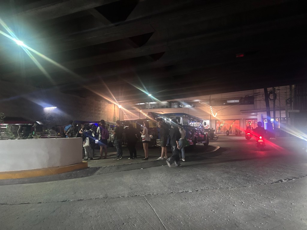
The terminal space is less than before. That means less jeepneys parked at the terminal. So perhaps the jeepneys are parked elsewhere if they’re not operating along this high demand corridor where 3 major schools (UP, Ateneo and Miriam) and a mall (UP Town Center) are located.
–
Road crash along Ortigas Avenue Extension leads to Carmaggedon – impacts on traffic
The crash involving a truck, a car and a jeepney last Saturday led to severe traffic jams. Taytay traffic management decided to apply a one way alternating scheme while they were conducting emergency and clearing operations at the site. The result was very long queues along Ortigas Avenue Extension/ Corazon Aquino Avenue.
Travelers were forced to use alternate routes going down from Antipolo. That led to these alternate routes becoming congested as well as streets were generally narrow and were not meant for heavy traffic.
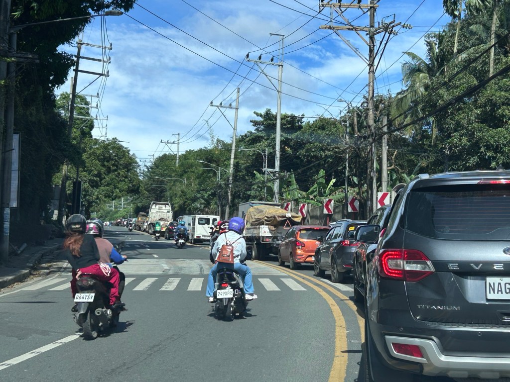
While the crash was severe and probably led to a fatality if not more, there was actually space for two way traffic. There would still be congestion but at least traffic would have been moving instead of at a standstill for long periods of time. While this may appear to be insensitive to those involved in the crash, this is the practical thing to do for traffic management. This is also to lessen the impacts of such crashes on the network and transport operations (i.e., movement of people and goods).
–
Road crash along Ortigas Avenue Extension leads to carmaggedon in Antipolo – The crash
A terrible crash across Fibertex along Ortigas Avenue Extension. The outcome most likely led to fatalities given the severity of the crash and the conditions of the vehicles involved. Here are photos my daughter took as we passed the scene of the crash as we headed towards Tikling Junction.
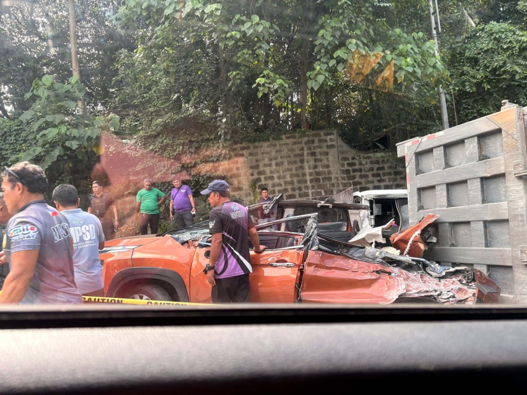
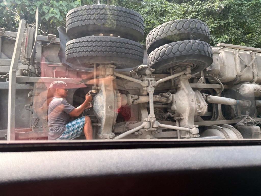
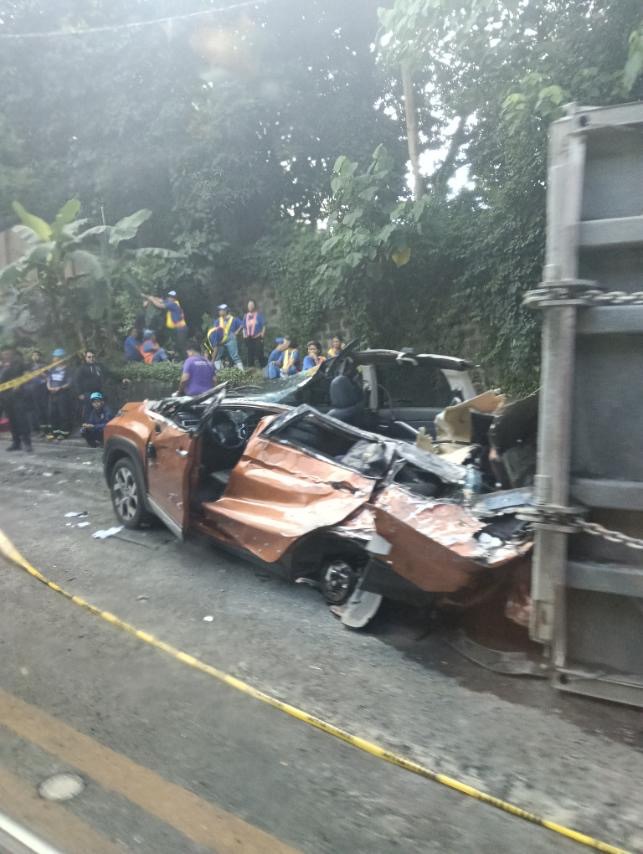
I will write about the aftermath of the crash in the next post.
–
Some thoughts on bus transportation for Metro Manila and beyond
There are two recent news items about buses in Metro Manila and adjacent areas:
- A proposed study on bus lanes for Quezon Avenue, Ortigas Avenue and C5
- Bus transport supplement for LRT Line 2
Did you know that there was a Pre-Feasibility for Bus Rapid Transit (BRT) along several thoroughfares in Metro Manila back in 2007? I am sharing this paper presented at the Transportation Science Society of the Philippines (TSSP) 2014 conference that synthesizes the references including the 2007 Pre-Feasibility Study on Bus Rapid Transit (BRT) for Metro Manila (supported by the USAID) and the 2011 Mega Manila Public Transportation Planning Support System (MMPTPSS) Study funded by the then DOTC. I hope these studies, which are still very relevant though no longer recent, can be utilized. There is no need to reinvent the proverbial wheel.
Sigua, R.G. (2014) “Identification of BRT Corridors in Metro Manila,” Proceedings of the 22nd Annual Conference of the Transportation Science Society of the Philippines, Iloilo City.
LRT Line 2 is an example of government not having the foresight of acquiring new rolling stock (i.e., trains) despite passenger demand steadily increasing over the years. Yet here we are and the old train sets are now deteriorating with some already retired. And then there is the proposal and study by the LTFRB and LRTA about buses supplementing the Line 2 operations. A quick check and there is already a bus service supplementing Line 1 – the Antipolo-Cubao route that is also serviced by jeepneys. This existing route can be tweaked or expanded so there are several lines serving not just Antipolo but also other Rizal towns and the City of Marikina. From Cubao there are already jeepney routes parallel to Line 2. Perhaps instead of just jeepneys, these can be rationalized to buses, which have higher capacities than PUJs? I don’t think you need to have a deep dive on this if you are familiar with public transportation along the Line 2 corridor.
–
Successful 32nd TSSP Annual Conference
The 32nd Annual Conference of the Transportation Science Society of the Philippines (TSSP) was a success. A total of 16 papers were presented at 4 technical sessions while the main sponsor GIZ facilitated the practical session on e-mobility. While most participants came from Cagayan State University (CSU), there were many from Metro Manila and Mindanao (Iligan and Zamboanga cities).
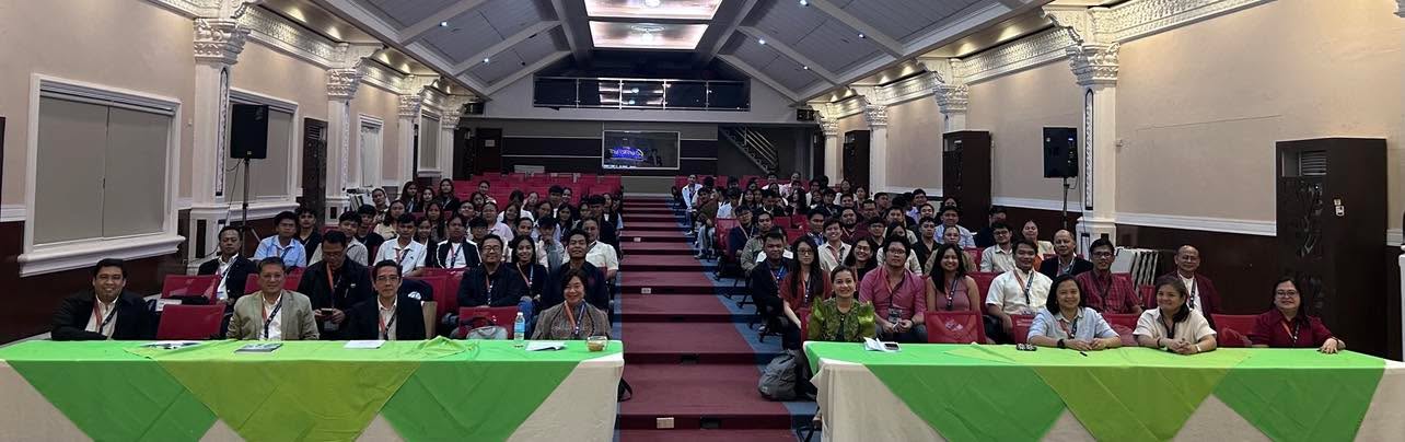 Closing group photo – this was taken after the concluding program for the conference. Instead of forming at the stage, our photographers asked us to be seated instead.
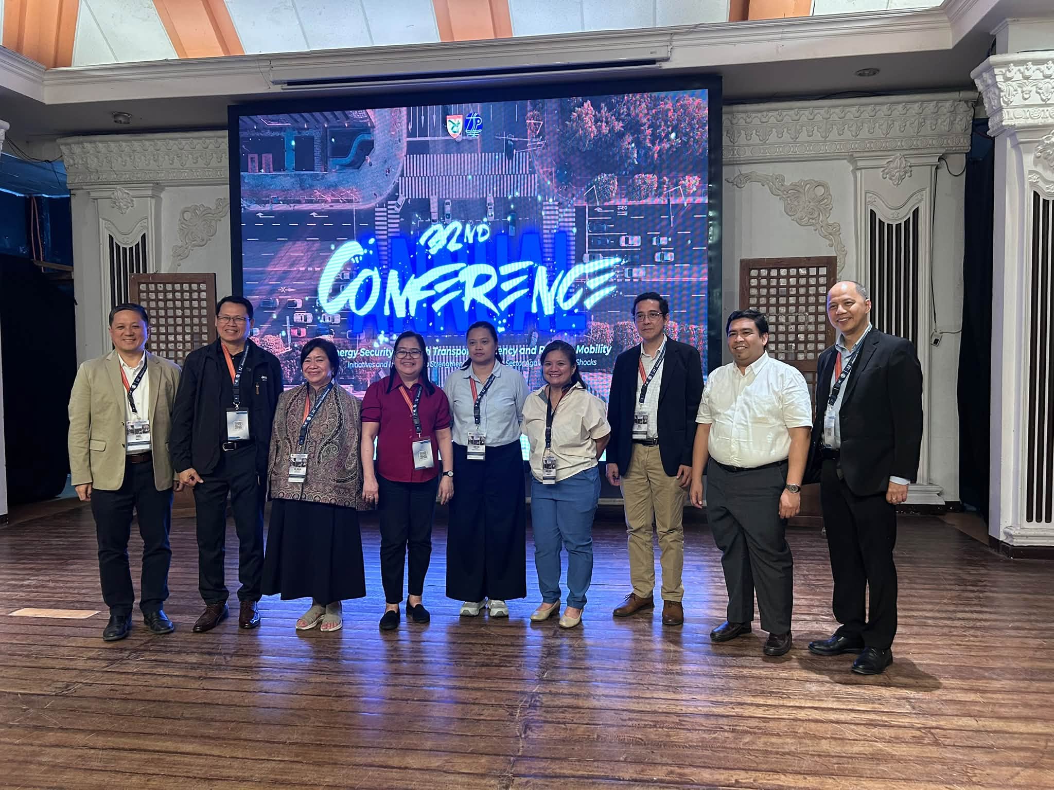 This year’s conference committee was chaired by Dr. Daniel Mabazza of UP Diliman’s College of Social Science and Philosophy (Department of Geography). From L-R: Dr. Dan Mabazza, Dr. Marloe Sundo (UPLB-CEAT-DCE), Dr. Sheilah Gaabucayan-Napalang (UPD-SURP), Ms. Alorna Abao (UPD-NCTS), Dr. Sandy Gaspay (UPD-COE-ICE), Dr. Danielle Guillen (UPD-AIT), Dr. Karl Vergel (UPD-COE-ICE), Dr. Regin Regidor (UPD-COE-ICE) and Dr. Noriel Tiglao (UPD-NCPAG).
There was no formal announcement for next year’s conference though as TSSP is still considering the schedule in relation to next year’s EASTS Conference to be held in Adelaide, Australia sometime in September 2027. A strong candidate host though is Naga City, which already has an active core group for transportation based in the Bicol State College of Advanced Science and Technology (BISCAST). Of course, the LGU itself is ably led by its current Mayor Leni Robredo. I will post an update on this soon as I get some firm info from the society, which is currently also being supported by GIZ. GIZ, incidentally, also has an engagement with Naga City so the timing seems perfect for the next conference to be held there. Naga City is well known for its academic institutions including the Ateneo de Naga and University of Nueva Caceres. Naga, of course, is in Region 5 (Bicol) and there are certainly a lot of universities and colleges there including Bicol University and UST-Legazpi (Aquinas University) and many other SUCs and private HEI’s that probably have students and faculty doing transportation studies.
–
5th Workshop for Young Researchers (WYRe) at TSSP 2026
We successfully held the 5th Workshop for Young Researchers or WYRe today. The workshop was held at the Claude Andrews Convention Center at the Cagayan State University Andrews campus.
There were 2 talks – 1 on the importance of doing research and another on how to get published. These were followed by workshops on abstract writing, and outline drafting.
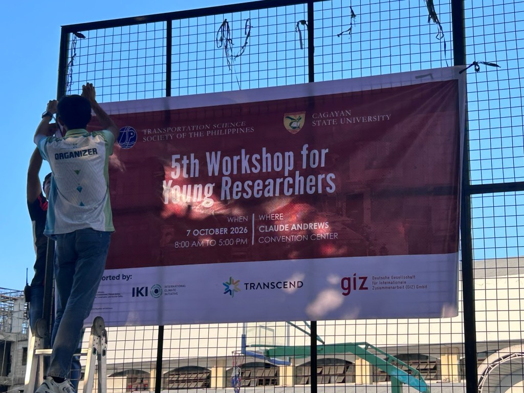

WYRe was inspired by a similar workshop conducted by the Eastern Asia Society for Transportation Studies (EASTS) back in 2017 to help young researchers including graduate students and early career researchers and academics develop skills particularly for proposal drafting and publication of their outputs.
–
TSSP 2026 Conference Program
I reproduce below the conference program of the 32nd Annual Conference of the Transportation Science Society of the Philippines:
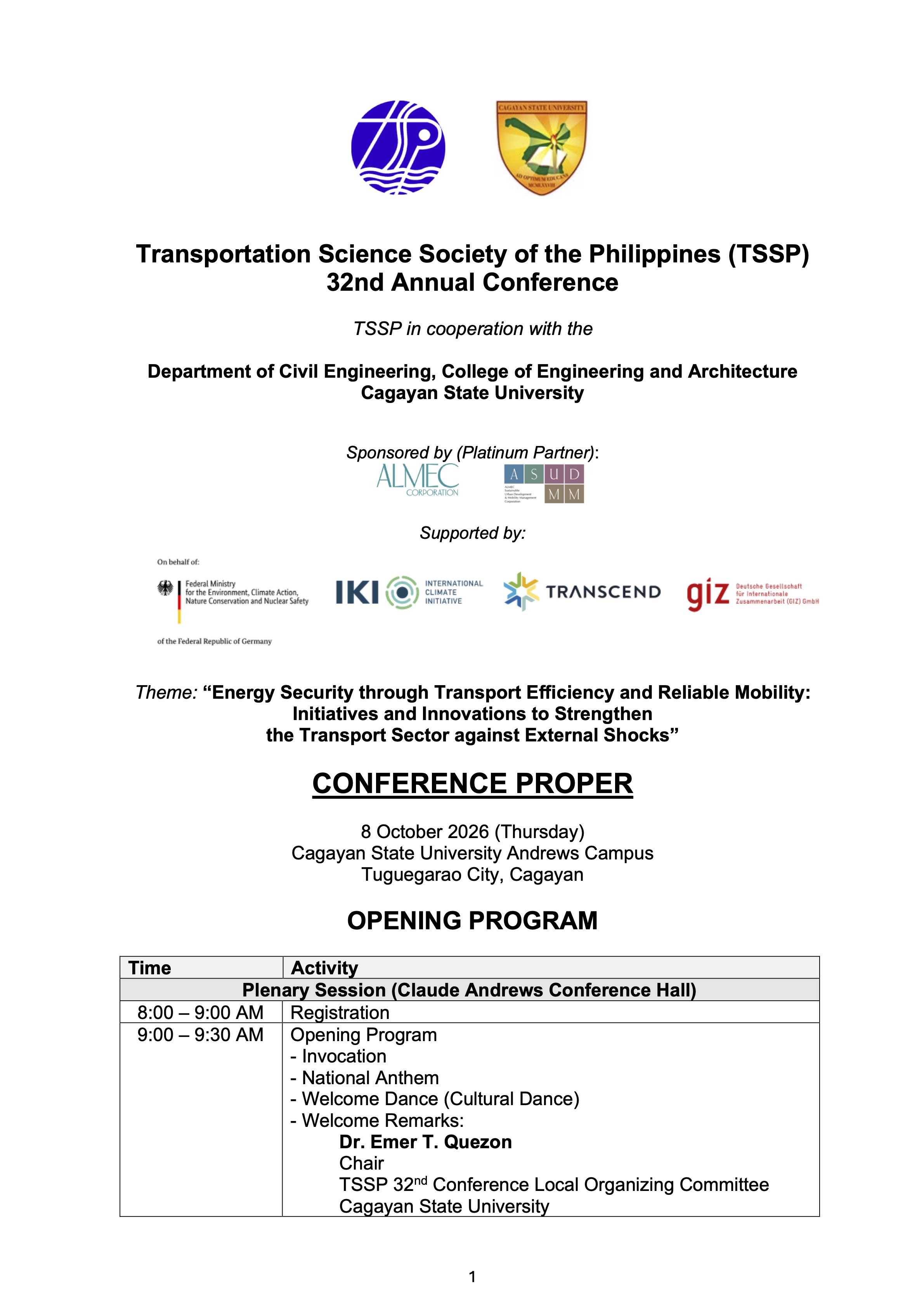
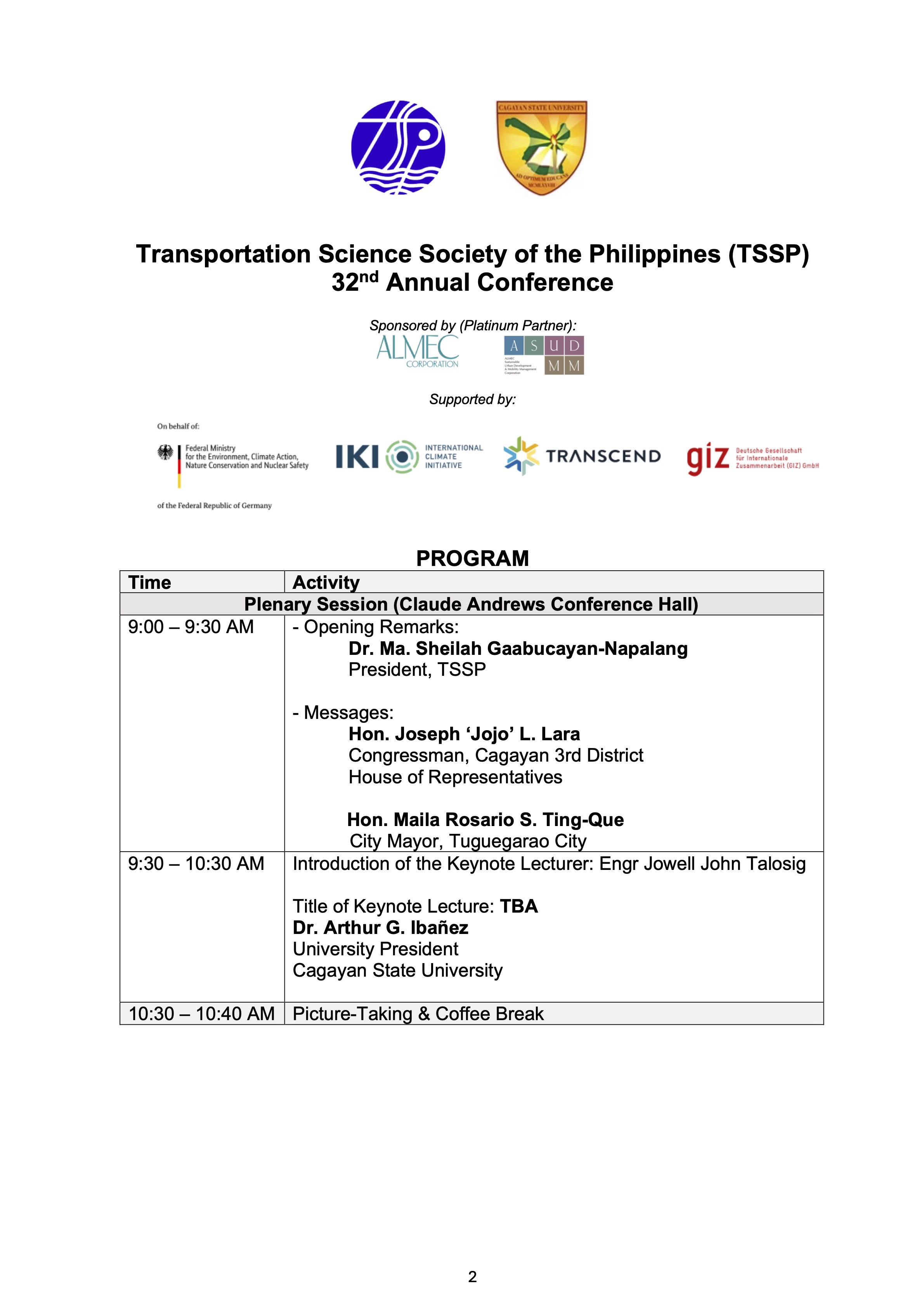
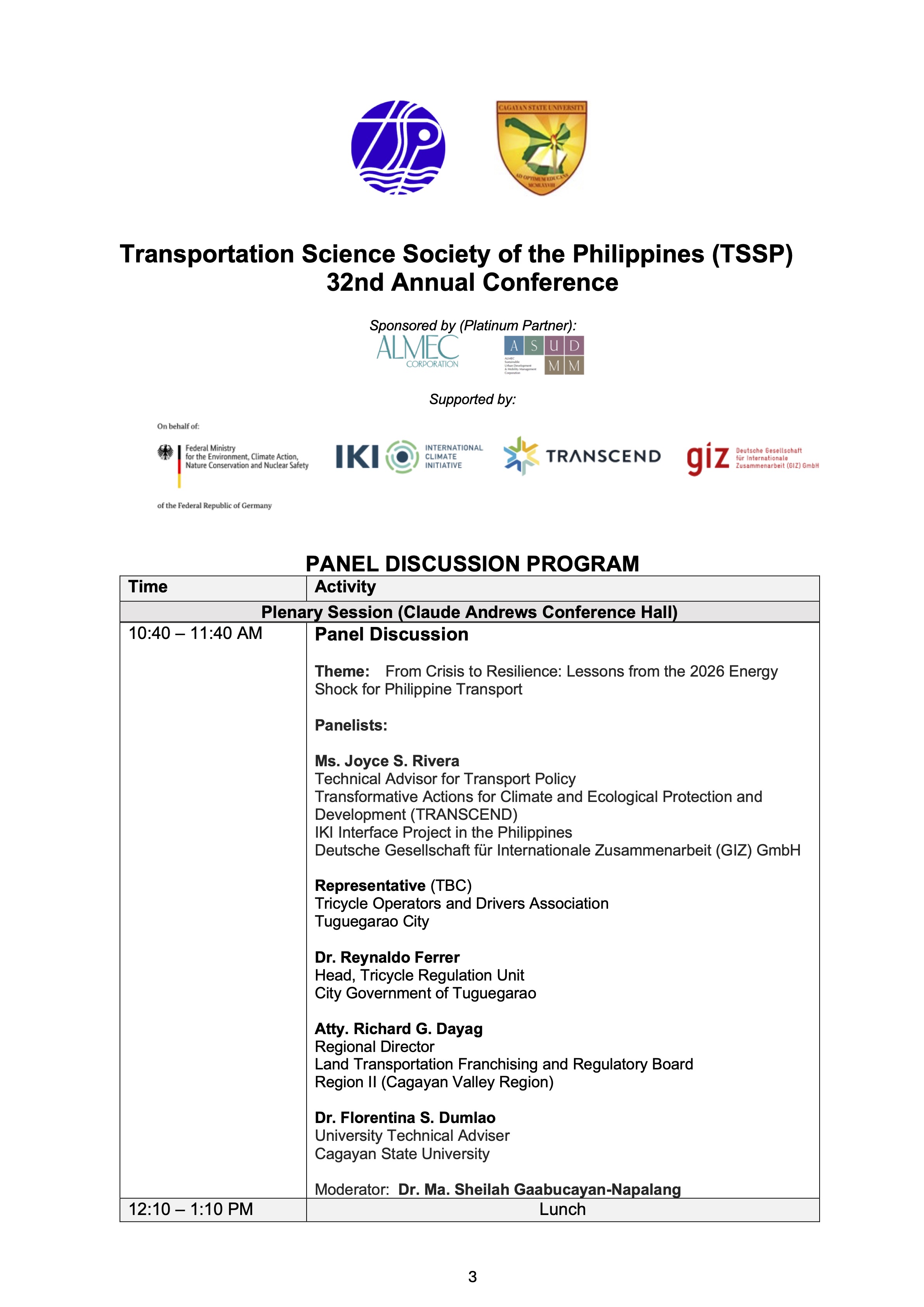
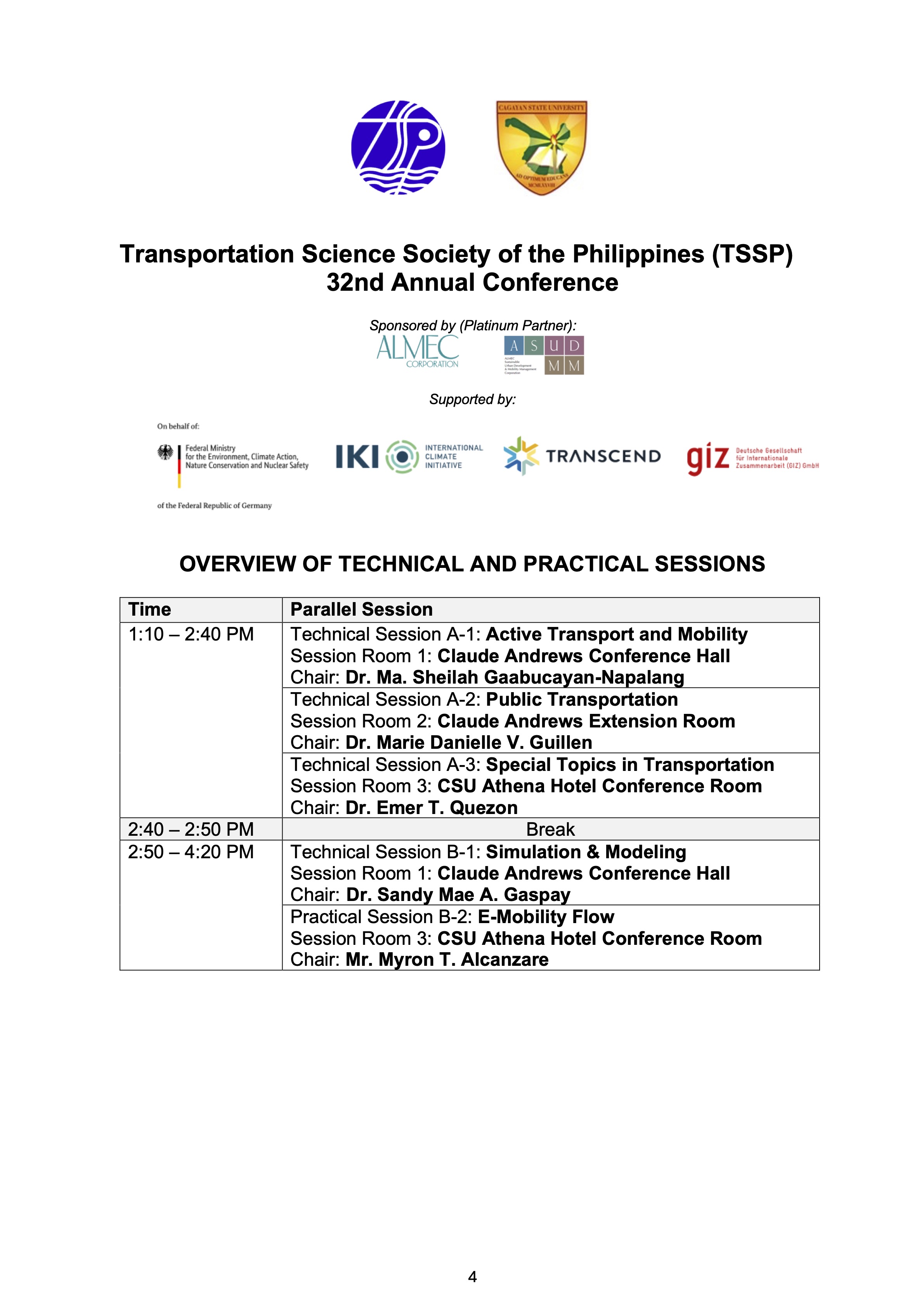
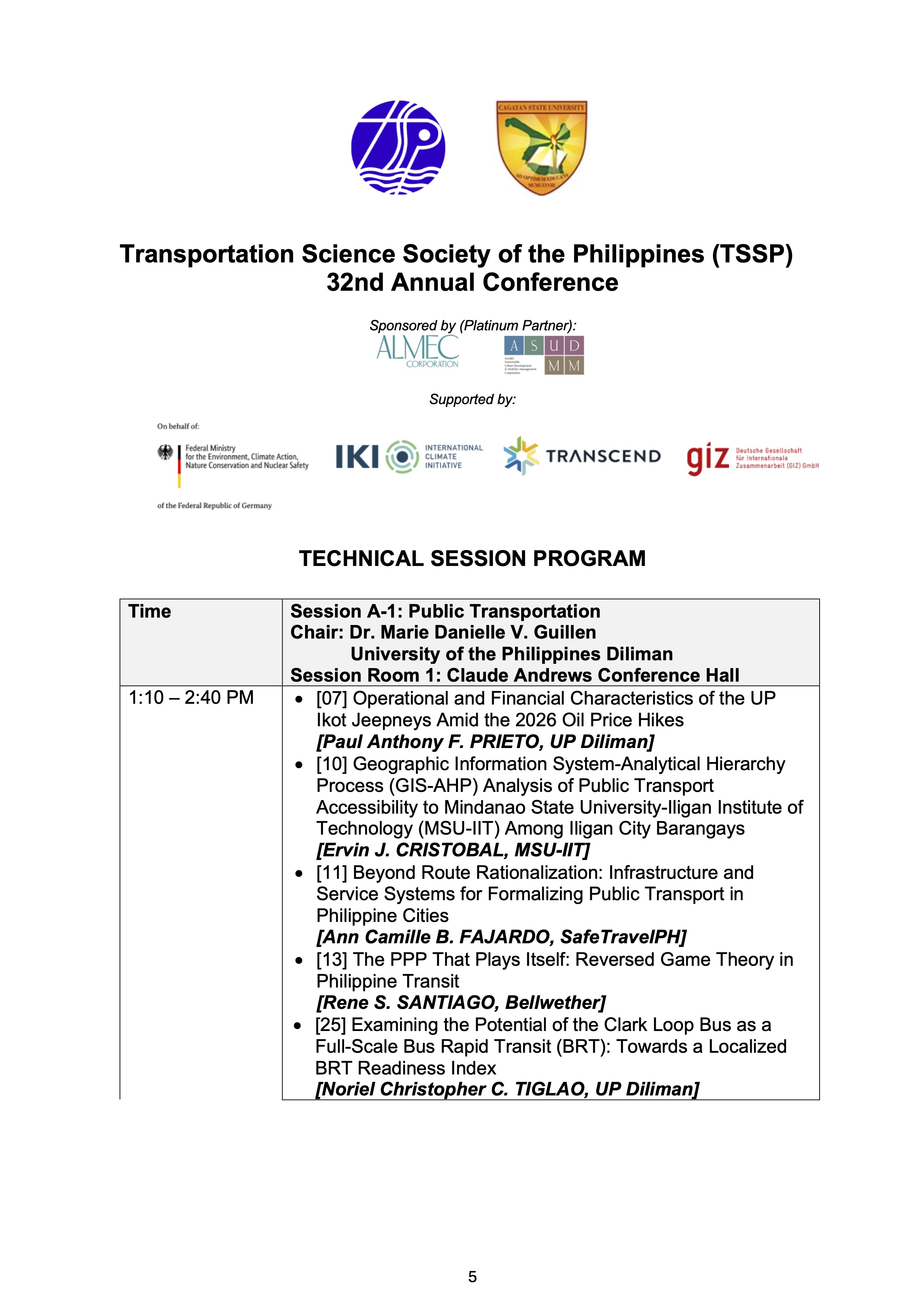
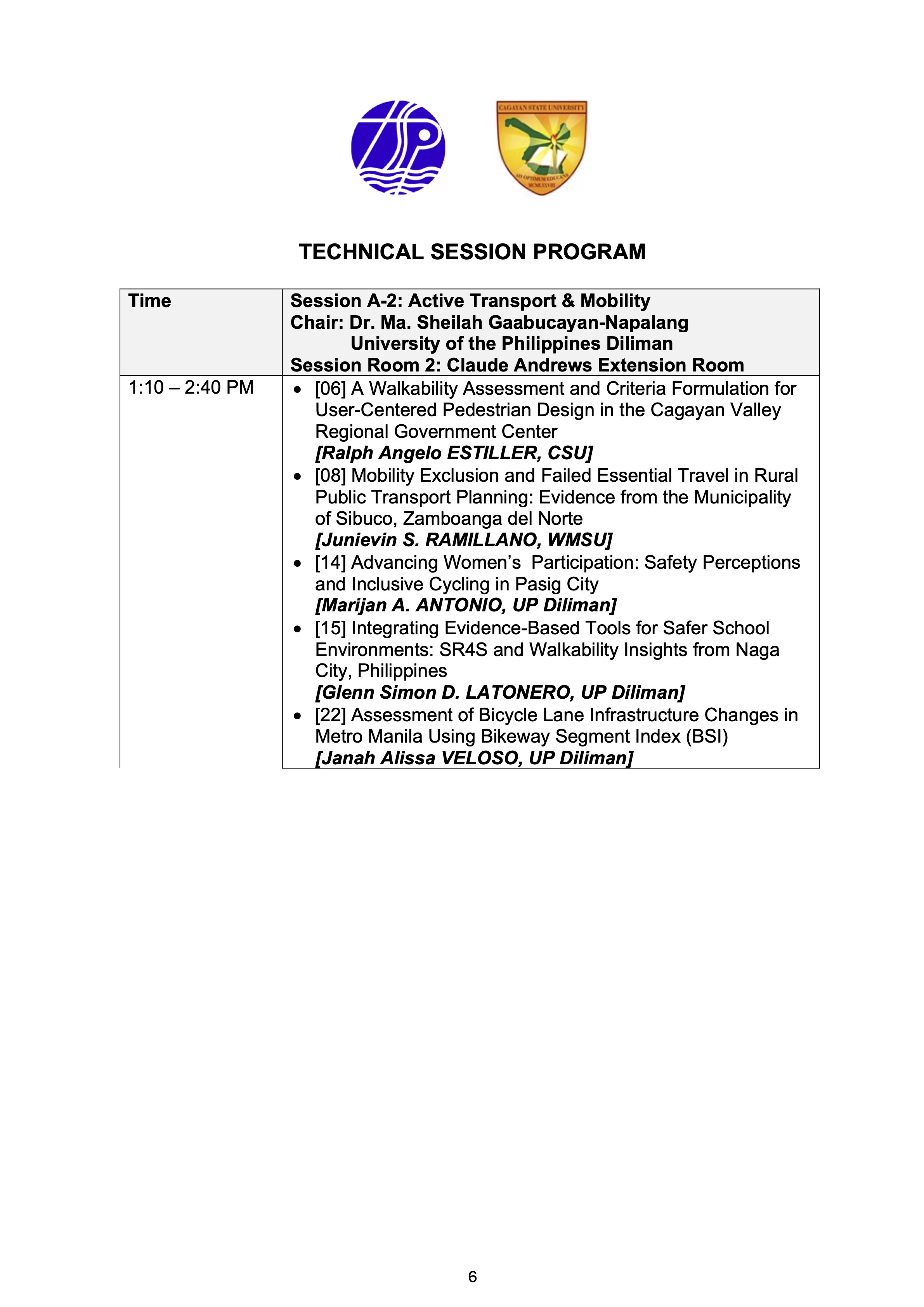
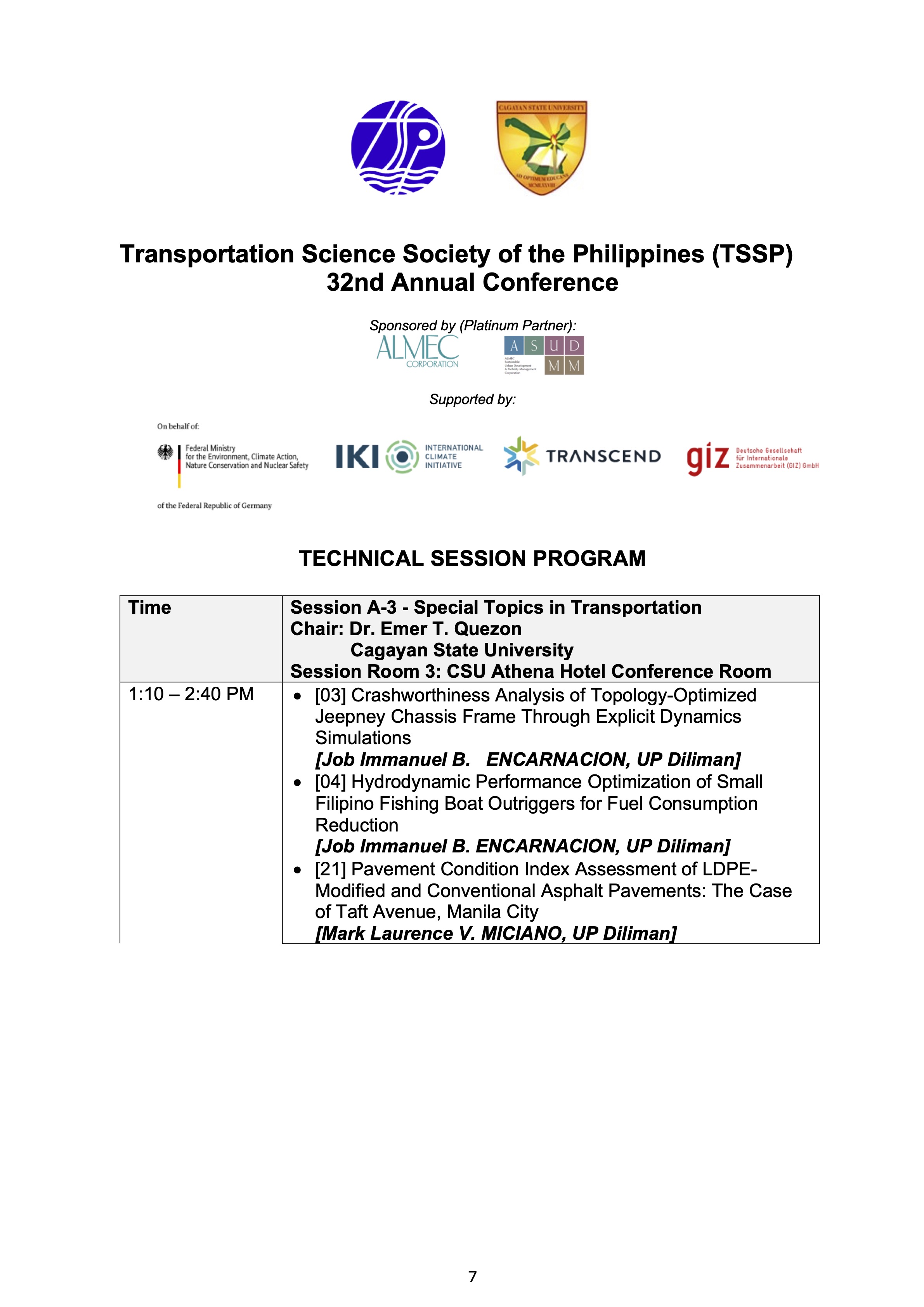
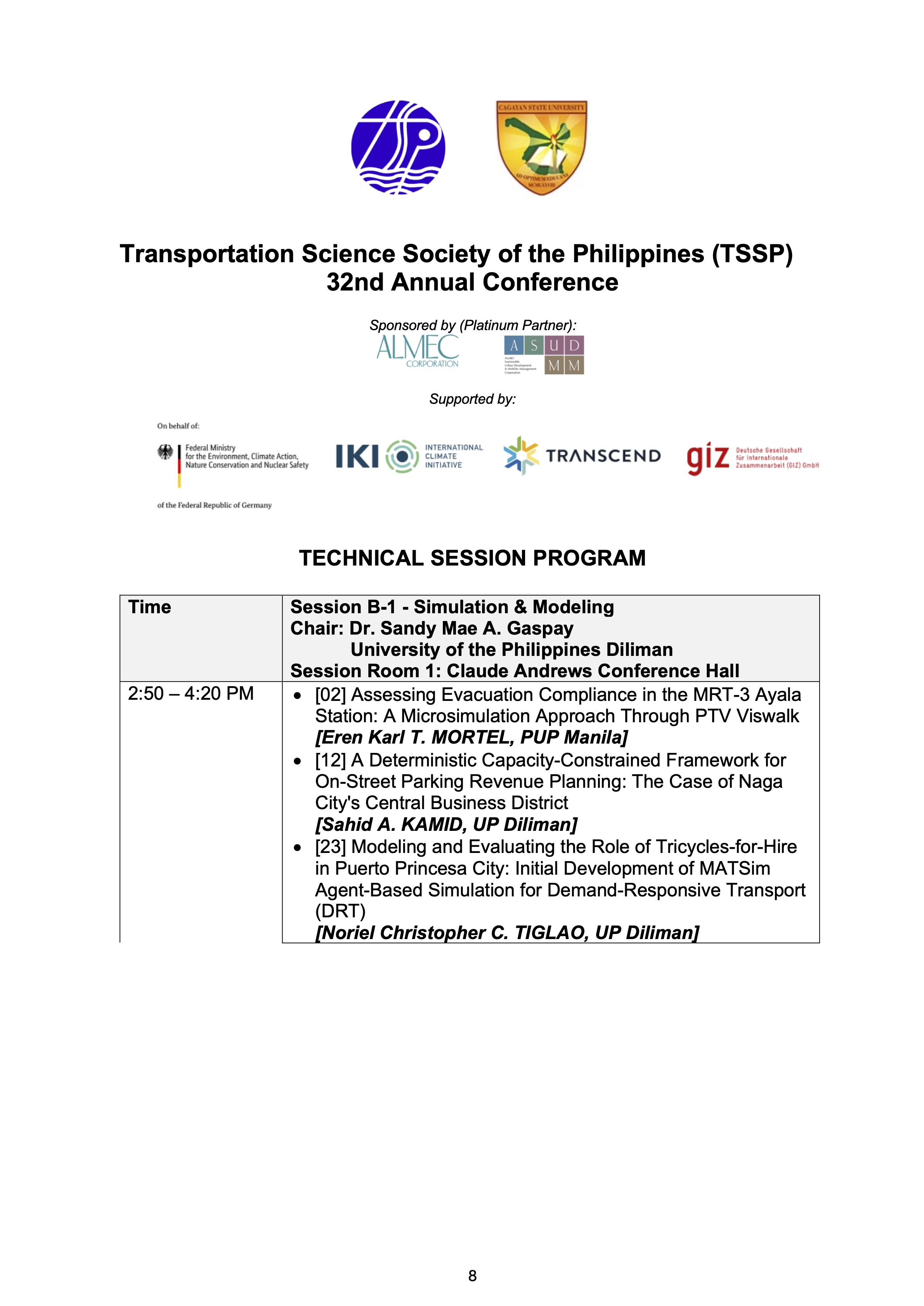
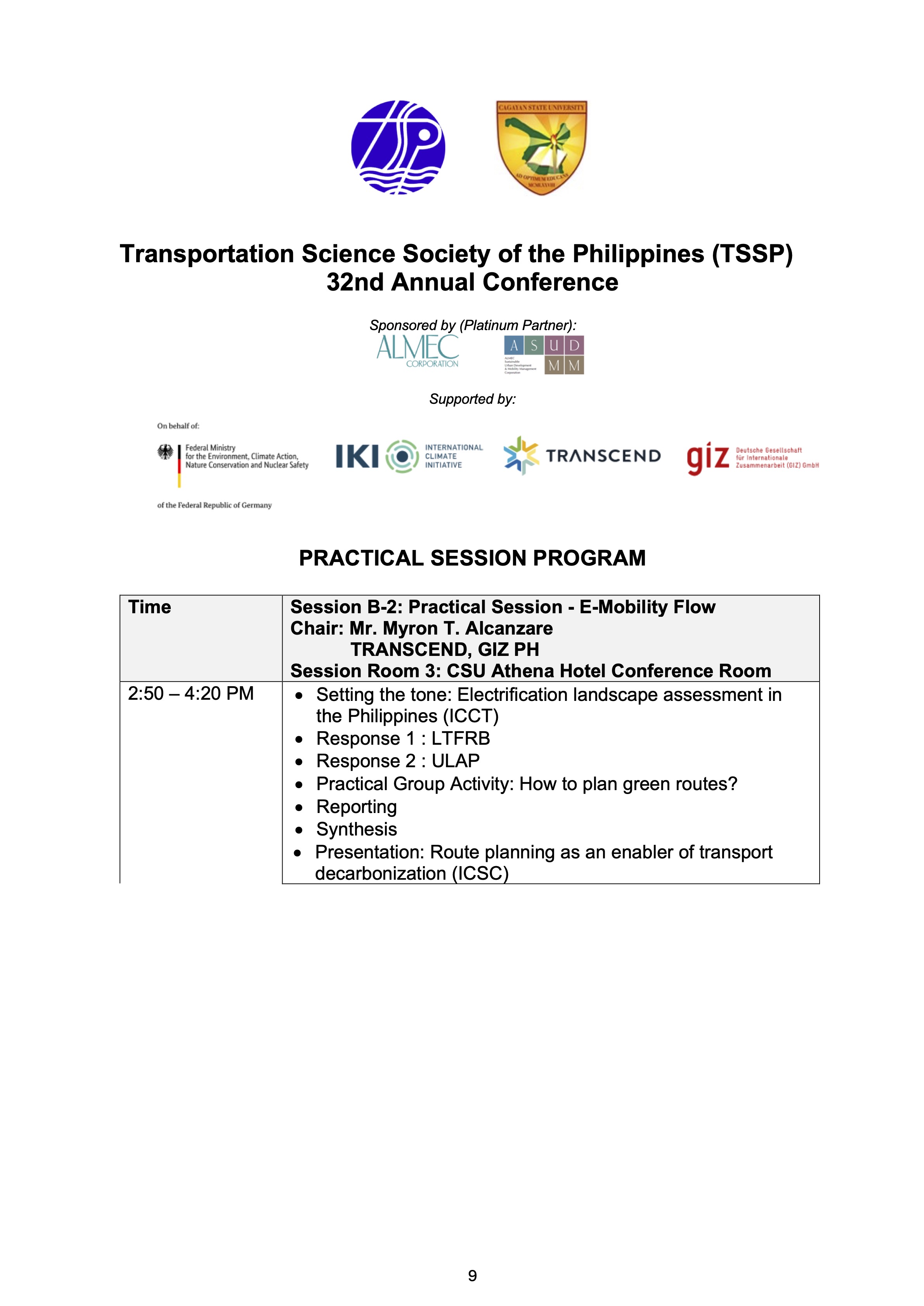
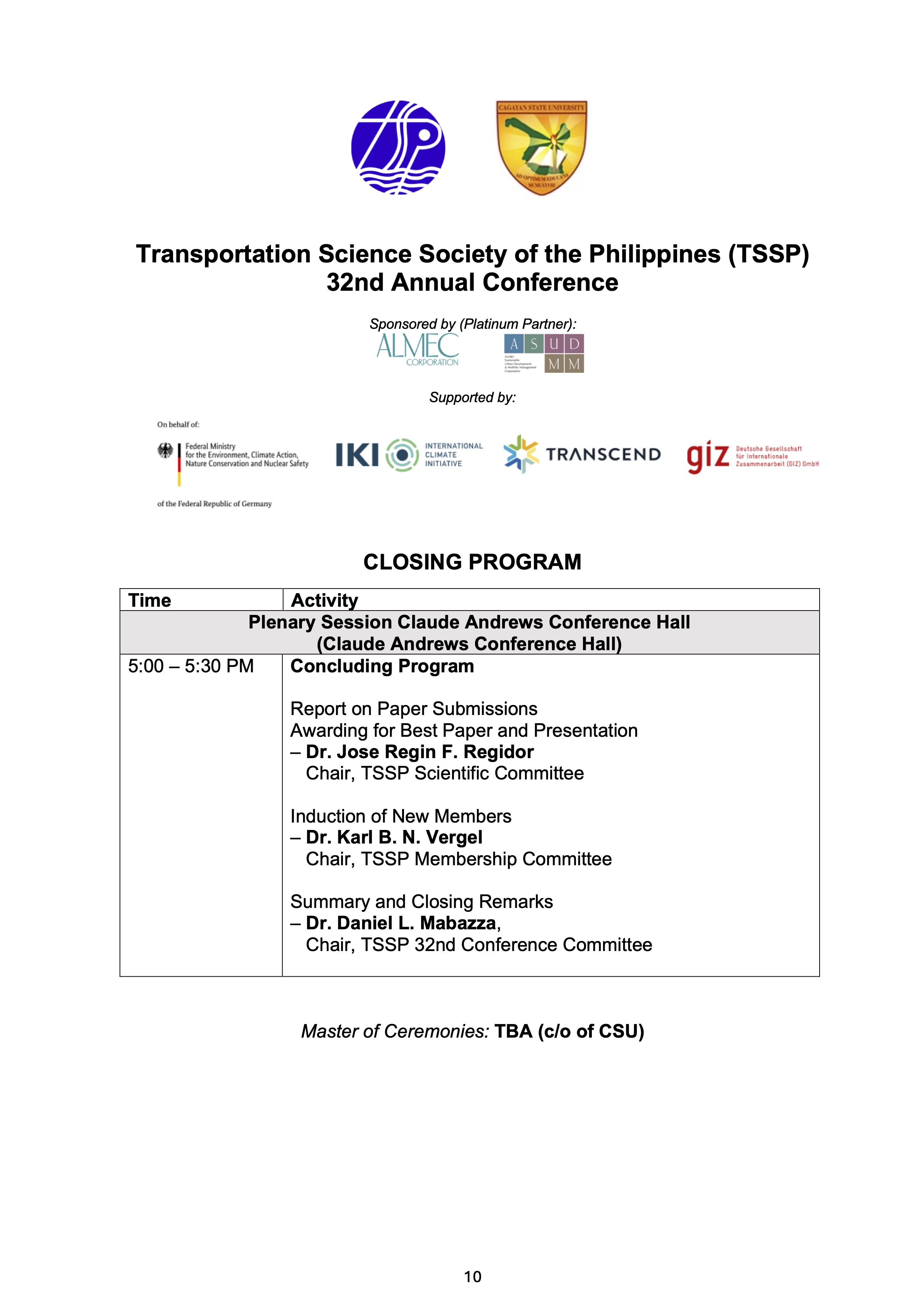
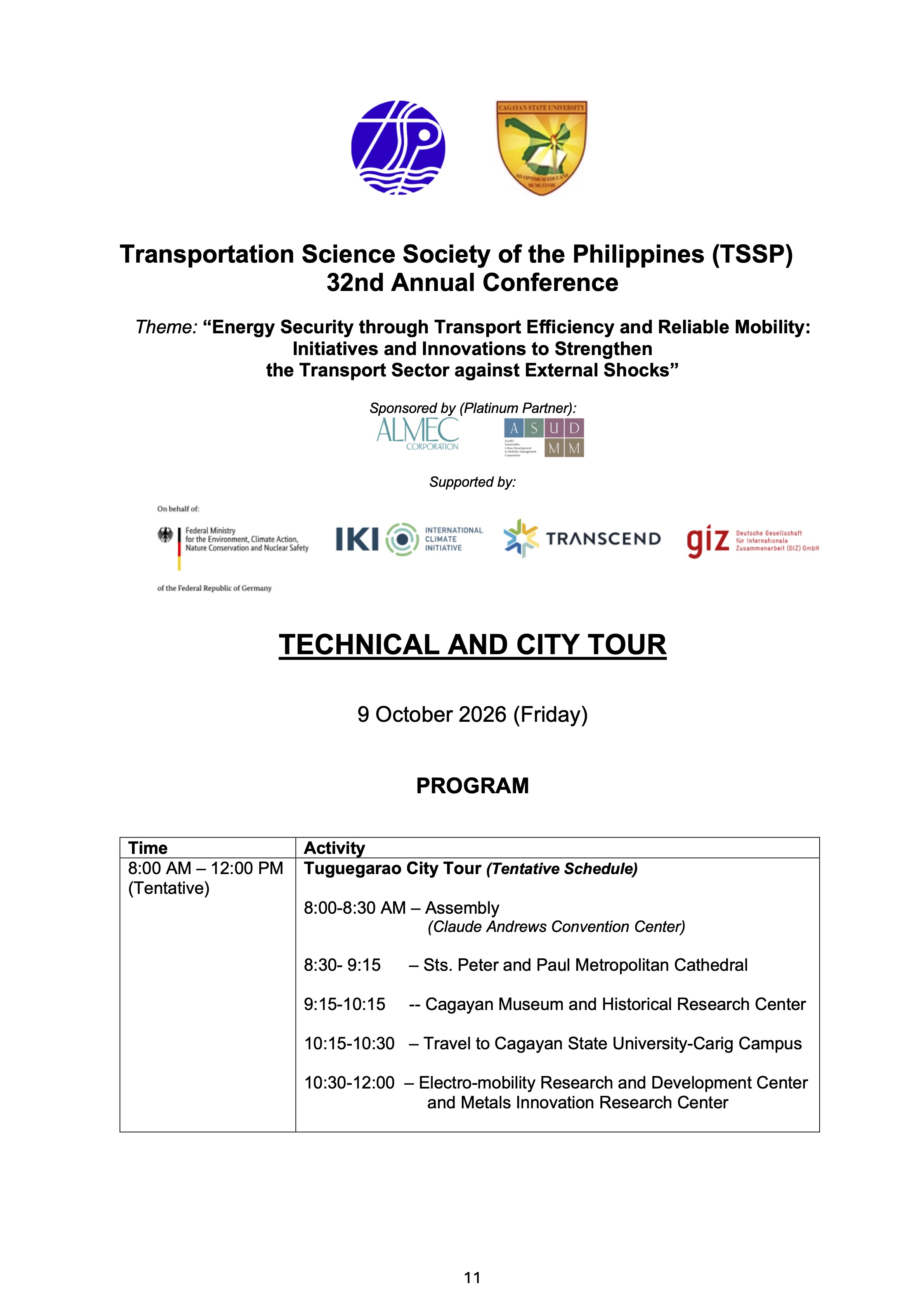
There is actually a pre-conference activity in the Workshop for Young Researchers (WYRe) also organized by TSSP. However, the workshop is by advance registration and limited considering it is for young researchers that include graduate students and young professionals embarking on research work.
–
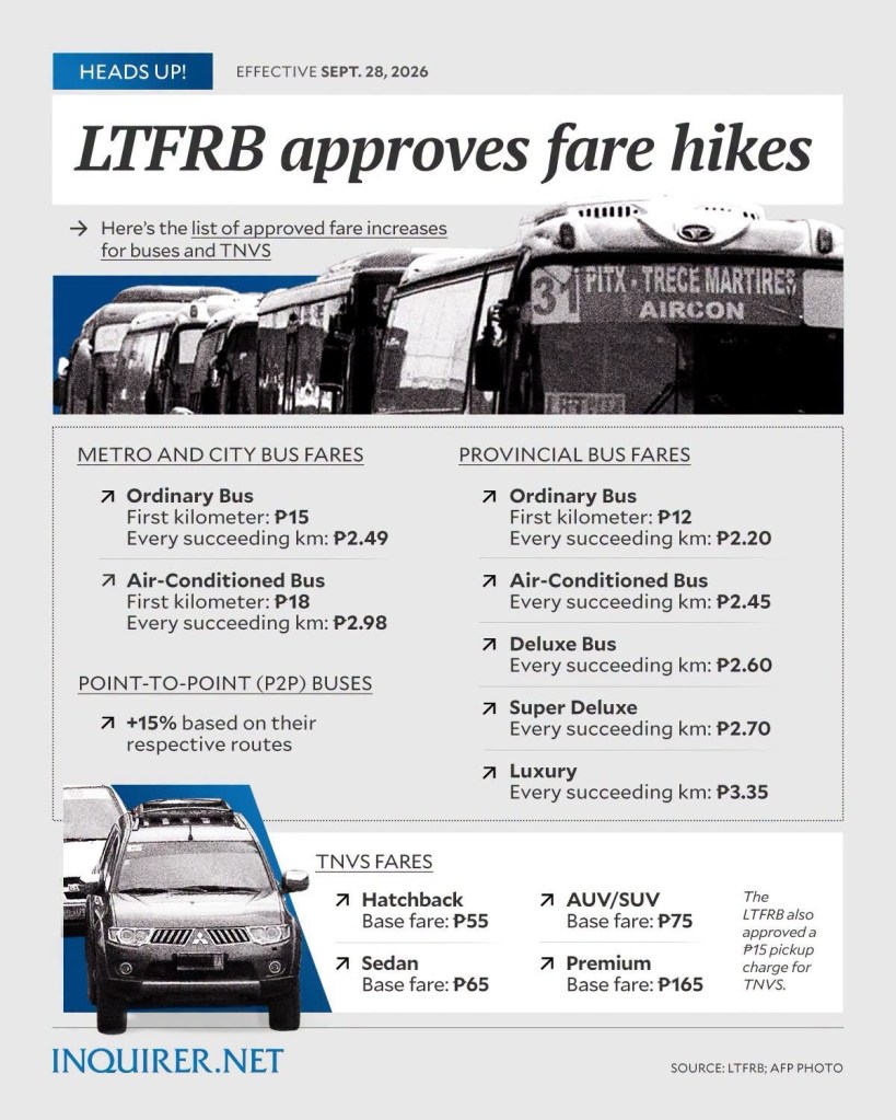
On the recent public transport fare increase
The government recently approved public transport fare increase. While it’s supposed to help alleviate the financial situation of public transport operators and drivers, the chain reaction involving the riding public is inevitable. Transportation already eats up a significant % of a typical family’s income. This will add to their budget allocation for commuting.
Here’s the graphic from Inquirer:
Shifting to electric and hybrid vehicles is obviously not the best solution for our transport woes. Active transport also has limited impacts considering many people are live far from workplaces and schools. Many also are invested in private vehicles. And the latter should not be limited to cars but motorcycles as well. I think private transport shares for trips, particularly the share of motorcycles, is largely underestimated. We need to verify this as the assumption that about 90% are taking public transport as the main modes for their trips may be one reason we can’t find the right combination of solutions for transport and traffic issues.
–
Article share: On bike buses
Here’s a quick share of an article on bike buses. It’s a good idea that can probably be adopted by schools where most or many students live or reside within a ‘bikeable’ distance of the school.
Chudwin, E. (August 28, 2025) “Bike Bus Pedals in New Era of School Transportation,” Planning Magazine. American Planning Association.
I recall that there was an attempt to replicate this in Metro Manila (Quezon City?). However, there is no update on whether that was just a pilot or a one-timer or something that is now a regular thing for school commutes.
–
More flash floods due to intense downpours
Yesterday’s commute to our home was much longer than usual. It took us around 2 hours to get home even after leaving our office around 6PM. We experienced the wake or aftermath of congestion caused mainly by the flash floods and electrical damage to the LRT Line 2. The flash floods were caused by the intense rains after noon time. Floods were reported around Metro Manila but the one that ultimately affected us were the flood along Ortigas Avenue Extension near the Valley Golf gate. A long stretch was impassable to most vehicles. Our daughter got home 2.5 hours after her school dismissal when it usually only took around 1 hour on typical mid afternoon traffic along that corridor. The route we took home via Marcos Highway was affected by so many passengers getting stranded by the Line 2’s suspension of services between Santolan and Antipolo Stations. People occupied the traffic lanes of Marcos Highway as they positioned themselves to get to the next available jeepney or bus. Many chose to walk towards Ligaya and even Sta. Lucia Mall where many jeepneys bound for Rizal towns turnaround.
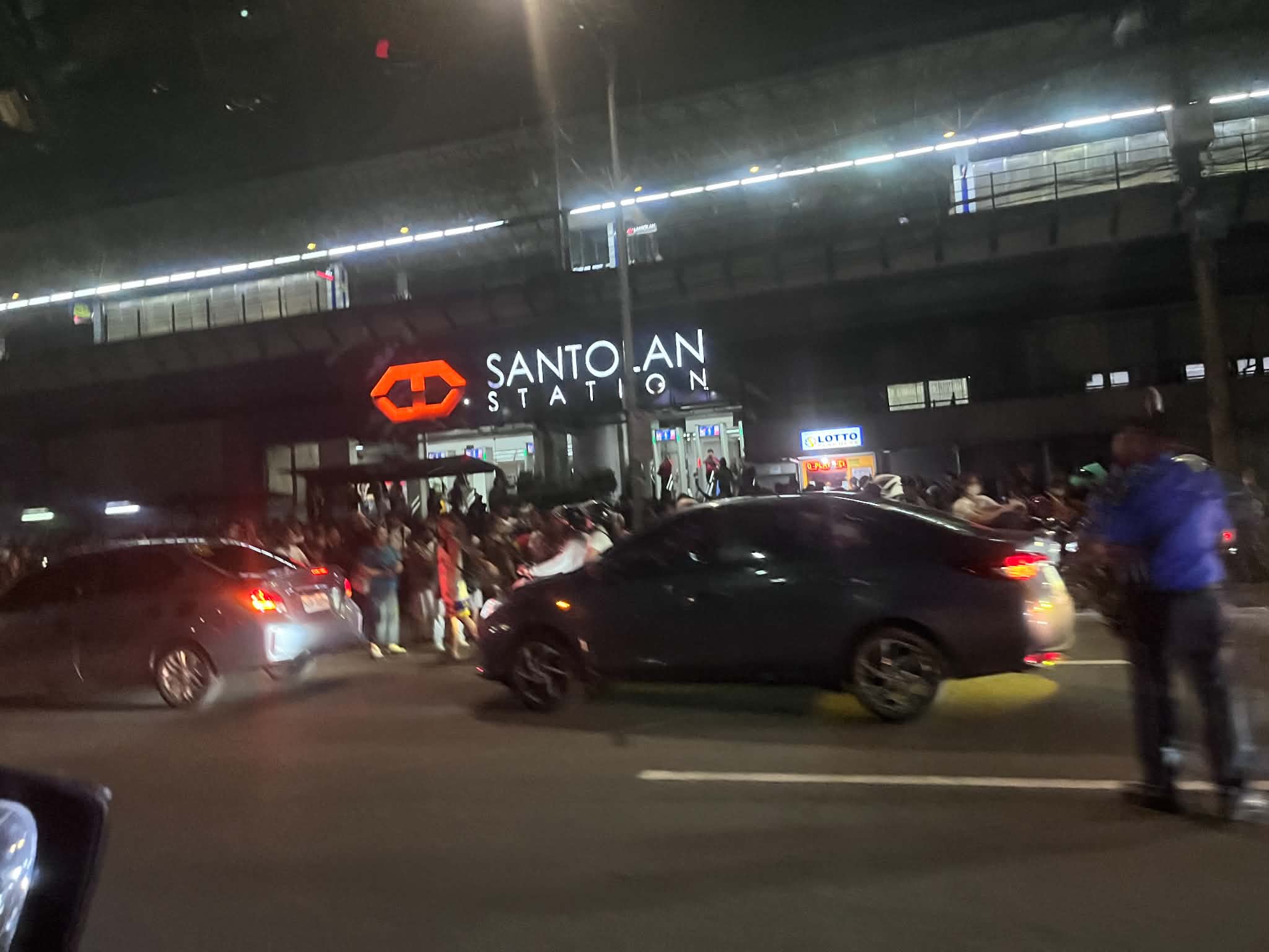 Line 2 suspended operations between Santolan and Antipolo Stations due to electrical damage sustained after a lightning strike damaged the catenary that transmitted power to the trains.
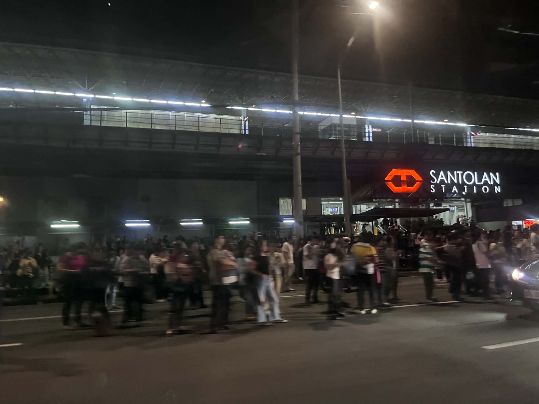 Passengers occupied the traffic lanes of Marcos Highway; many already tired from a day’s work or school. LRTA did not seem to have a plan or protocol to address such situations. Perhaps a call to bus companies or even the MMDA and LGUs like Antipolo, Cainta, Marikina and Pasig could have alleviated the situation of commuters? Antipolo did send vehicles to ferry passengers but they were not enough for the demand. These are exactly the situations that make public transportation unattractive to many people.
I hope we’ve (read: authorities including national and local governments) learned from this year’s weather-related problems and will address these so we can have less disruptions and losses in the coming years. It is predicted that we will have an intense El Niño so that means a long dry spell and also hotter days ahead. Perhaps nature’s message this year is that there’s enough water (from rain) and she is challenging us to come up with a system and facilities that will retain such amounts of water for the dry seasons?
–

