
The Streets of Intramuros: Muralla Street
Intramuros is known as the “old” Manila as the enclave was practically The City when the Philippines was under Spain. Streets are generally narrow as they were designed at a time when there were no motor vehicles like automobiles, jeepneys, buses or trucks. People walked or rode on horses. Luxury vehicles were carriages while goods were carried by carts or people. The following photos show the stretch of Muralla Street from the Victoria Street (Bayleaf Hotel) to Real Street (Lyceum University).
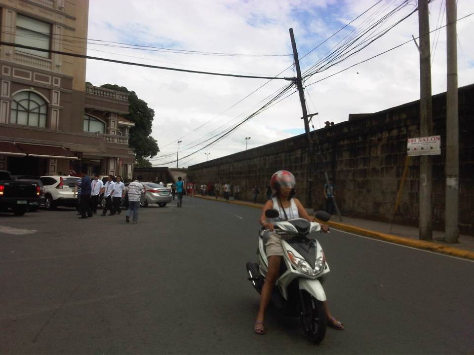 Entrance to Muralla Street with the Bayleaf Hotel at left, which is run by Lyceum University
 Muralla Street runs along the eastern wall of Intramuros. It is a one way street and so the photo shows a pedicab (also called padyak or sikad), a non-motorized tricycle, running counter to the flow of traffic.
 These streets were made for walking – Intramuros has narrow streets and can barely accommodate two way traffic so many have been designated for one-way flow.
 There are schools along the left side of the road including the Mapua Institute of Technology, Lyceum University and Colegio de San Juan de Letran. As such, there are usually many students in the area walking around, having their meals at the nearby canteens/eateries (right side) or perhaps just sitting and admiring the view from the top of the wall.
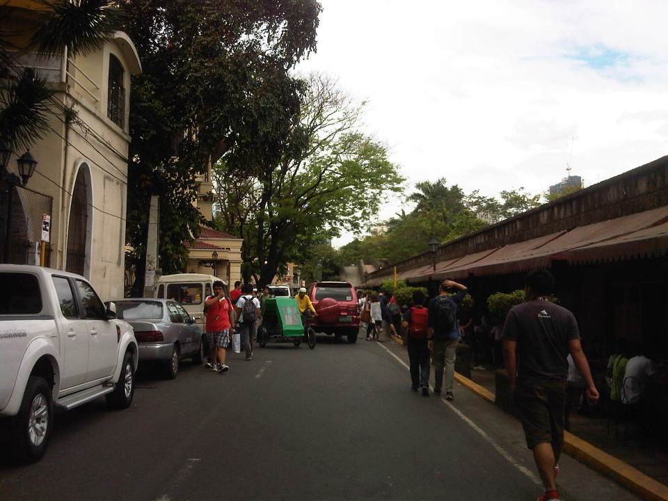 Parking is a major problem in Intramuros and one would see vehicles parked along one side of the street (evident in most of the photos in this post), obviously taking valuable space away from people and other motor vehicles (i.e., reduced road capacity).
 There are many eateries or small restaurants along Muralla St. and just under the wall. These are patronized mainly by students so meals are inexpensive.
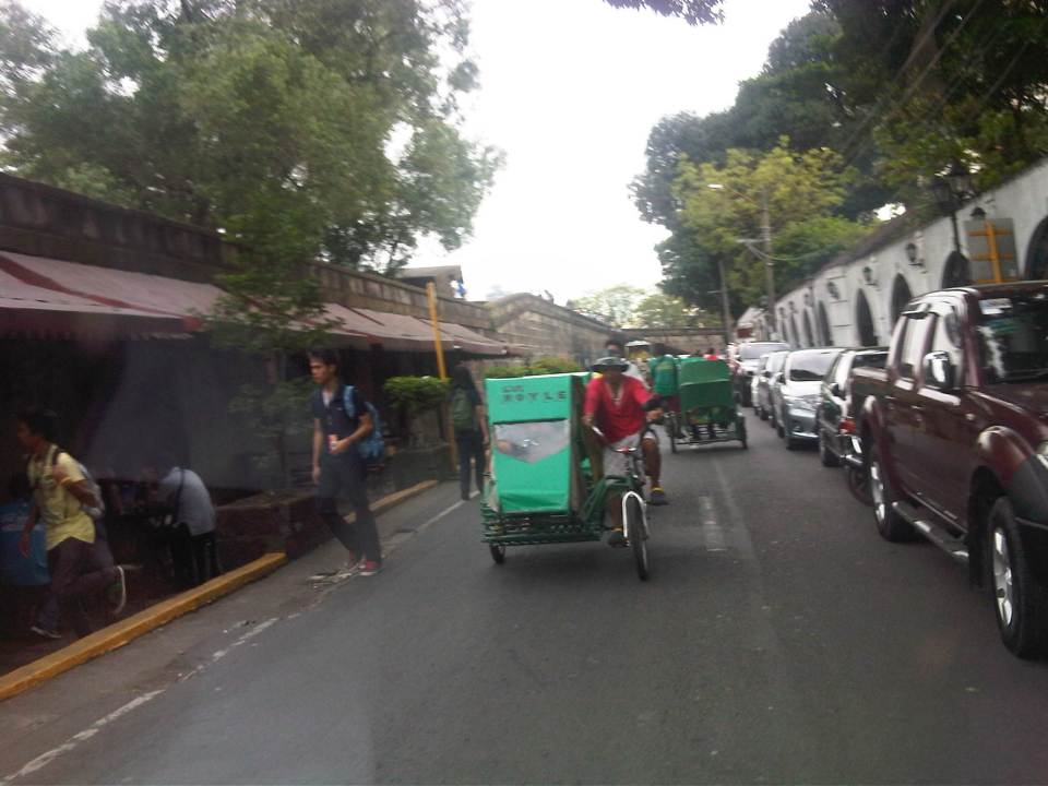 There are many pedicabs in the area with long queues at the gate waiting for passengers coming from the general direction of Padre Burgos Ave., where people can transfer to and from jeepneys serving the area. Frankly, I think there is an excessive number of pedicabs in Intramuros considering roads in the enclave can be transformed into walkable streets, just like they were during the Spanish and American periods. Notice again the on-street parking along one side of the road.
 More students and more pedicabs along Muralla Street. People are used to traffic mix and generally stay clear of the space allocated for motor vehicles.
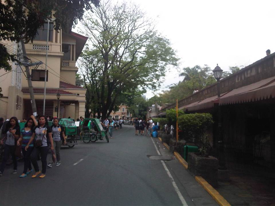
 Security personnel posted along the walls are appropriately dressed as Katipuneros or Rayadillos (honor guards). The building down the street is a dormitory just beside the buildings of Lyceum University, whose buildings are split up by public streets making it tricky to define a campus for the university.
 Junction of Muralla Street and Real Street with a private dormitory building at the center of the photo. Muralla Street continues along the side of the wall and proceeds all the way to Plaza Espana and the old Intendencia. Meanwhile, Real Street proceeds to the left of the dormitory. Also shown at the left is the entrance to one of the buildings comprising Lyceum University. Other buildings are behind the dorm.
–
Interviews
I had quite a busy week last week with several meetings for a couple of projects I am doing. It became a hectic week after a major media company featured a paper I wrote last year on its 9PM new program anchored by an award-winning, popular media personality. I was quite surprised as the reporter went over key points of my paper but I am glad that he seemed to have read the paper and understood the main points. The following day, our office fielded a few calls from a major daily and two other major TV stations.
The paper was one I wrote after delivering my Professorial Chair Lecture in last year’s colloquium at our college at UP Diliman. It is something I regard as a tool to initiate discussions about the state of our transportation system. And so requests for a copy of the paper were entertained by our librarians/information managers whom I provided a digital copy of the paper that they could give to those asking for a copy of the material. Meanwhile, there were also requests for interviews including one interview for TV the day following the news report on the news channel. I am no stranger to such interviews and rather than have the reporter insistently follow-up on when he can interview me, I agreed to give the interview the same day. To be fair, I granted 2 more radio interviews yesterday (Friday) morning and another this (Saturday) morning.
Yesterday’s interview was quite special as it was on prime time AM radio with the former Vice President of the Philippines who is among the top media personalities in the country. I learned the previous day that the person mentioned my paper on his program and so was making a follow-up feature of the topic on his Friday program. That went very well as the right questions were asked and I was able to explain clearly about the loss of productivity we are experiencing in Metro Manila that colleagues first estimated in 2000. I was quite happy to say something about sustainable transport and the promote walking and cycling. More importantly, I knew that the interview would be heard by a lot of people including government officials and decision-makers, and somehow be able to send the message about sustainable transport and the need for transport infrastructure in metropolitan areas.
This morning’s gig was quite different as I was a “guest” in a radio program co-hosted by a newly re-elected Senator. I guess it was something that one could consider a virtual guesting since I was on the phone while they were in the studio of a major AM radio station. It was also a long discussion that I engaged in as I was on air for about 40 minutes and was part of a nice exchange with the hosts. It was also another productive interview as again good questions were also asked about transport problems and what was required to address them. I must admit though that I was caught a bit off-guard when they asked about “grading” the 17 cities of Metro Manila and I had to draw on some stock knowledge and experience about the cities. It was a difficult question and an awkward one given that I would always like to think that all these cities probably are giving it their best with the resources that they have in solving their problems. This last interview left me hopeful as I thought the Senator was honestly concerned about the state of traffic and transport in our cities (not just Metro Manila) and would likely include something on transport and traffic on his legislative agenda once the 16th Congress opens in July.
–
Whatever happened to…?
Today, we step back and review a few items we have written about in this blog. I’ve chosen my top ten of what I thought were transport programs and projects that deserve to be checked. Here they are with notes on what went on from the year 2010 and the current state on these items. They are not arranged in any order so there is no item prioritized over the others.
Whatever happened to:
1. Wangwang – In 2010, the current administration through the Land Transportation Office (LTO) and the Philippine National Police (PNP) implemented a program practically eradicating our roads of illegal users of sirens (wangwang) that have become a major irritant (and perhaps pet peeve) to many road users. At present, there are many reports of politicians and other (feeling) VIPs employing PNP escorts to part traffic. In some cases, motorcycle police or bodyguards in escort vehicles rudely engage other motorists and there have been allegations of some pointing guns at other drivers to force them to give way.
2. LRT Line 2 extension to Masinag – In 2010, plans to extend LRT Line 2 from Santolan to Masinag were revived. The extension is supposed to be a no-brainer considering the design of the elevated line including the two stations comprising the extension could be based on the existing Line 2. The only major modifications here would be if the stations were to be connected to the shopping malls in their areas (Sta Lucia or Robinsons Metro East at Imelda Ave/P. Tuazon and SM at Masinag). Do we really need to have another study to tell us how many people will be riding Line 2 should it be extended to Masinag? The number of people waiting at Katipunan, Santolan and the Metro East/Sta. Lucia and the number of jeepneys cutting trips are strong indications of demand. In fact, I believe the line should be extended all the way to Cogeo but then the design there is more challenging as that extension would be up the mountains of Antipolo.
3. EDSA-MRT capacity expansion – The past 3 years have seen a steady increase in users of rail mass transit in Metro Manila and particularly as congestion along our roads continue to worsen. EDSA is always congested and the experience of last Monday’s monstrous congestion along the corridor reminded us of just how important a higher capacity MRT Line 3 would be to ease congestion along EDSA. The bidding for the rolling stock have been delayed and there might be a need to expand stations in the future to accommodate the longer trains required to serve the demand for this line. Needless to say, the only option now is to increase service frequencies but these have limitations.
4. Cebu Bus Rapid Transit (BRT) – Much work has been rendered for the Cebu BRT, which was touted as the less costly (compared to rail transit) solution to traffic woes in Philippine cities. After a presentation of the Cebu BRT in Malacanang, the President was supposed to have asked for a “proof of concept” for the transit system before giving his approval for the project to be implemented. This boggles our minds because it is not like the BRT is a conceptual system. In fact, there are BRTs that are currently operational in many countries including our neighbors in ASEAN. Among the most successful lines are found in Brazil (Curitiba) and Colombia (Bogota), and there is also the success story of the Lagos (Nigeria) BRT where the transit system has succeeded despite the odds it faced from the start.
5. NAIA Terminal 3 parking building – I have written about this before and it remains a pet peeve of mine considering I and the wife are frequent flyers who used Terminal 3 every month in 2011 and 2012. It’s difficult to get parking space at Terminal 3, especially slots for leaving one’s vehicle overnight or a few days (e.g., for business trips). The news is that the government is now working towards having T3 fully operational by 2014 and so there is hope that the multi-level parking facility will also be finally opened for use by the public.
6. Organized Bus Route (OBR) – Unlike the UVVRP or number coding, which has evolved little since its inception in the 1990s, the OBR has somewhat mutated but with little impact along the stretch of EDSA where it is supposed to contribute to significant improvements to traffic. The latest version is a dispatching system using computer tools. The jury is still out there regarding the success or failure of the system but the scheme still does not address the root cause of problems regarding bus operations along EDSA including the perceived over-supply of buses, colorum (illegal) buses, and overlapping routes.
7. Metro Manila BRT – The Pre-Feasibility Study for a Bus Rapid Transit (BRT) was completed back in 2006. The MMDA has attempted to come up with its version of the BRT but has failed to implement plans along EDSA and C5. In the last 2 years, however, there has been some activity with the World Bank pushing the DOTC to identify a corridor for a Metro Manila BRT line. Two corridors so far have been studied: Ortigas Avenue (Aurora Blvd to Tikling) and Quezon Ave./Espana (Philcoa to Lerma). The project so far has also been subject to the “proof of concept” challenge.
8. Clark Airport expansion – The number of flights at Clark is steadily increasing as more passengers have been using the airport for both domestic and international flights. Flights are served by budget airlines like Cebu Pacific and Air Asia, and allows passengers from Central and Northern Luzon a close airport for international travel. There is a need for a larger terminal for Clark and the master plan for the airport has called for a facility that would allow the airport to handle passengers of the magnitude currently being served by NAIA. Unfortunately, there is no pronouncement yet about whether NAIA, Clark or both will serve as the gateway(s) to the National Capital Region and surrounding regions.
9. Northrail – The rail line was supposed to provide a high speed connection between Metro Manila and Clark, connecting what is now Bonifacio Global City (Fort Bonifacio) and the Clark International Airport, which are developments that were under the Bases Conversion and Development Authority (BCDA). After so many years and several proponents, there are now plans for an airport express train connecting Metro Manila with Clark but it seems something that is still at the study stage and quite far from being implemented.
10. NAIA Terminal 1 renovations – In 2010, a group of architects and designers came up with a plan to renovate and upgrade NAIA’s Terminal 1. The government dropped this proposal in 2011 and had the project bidded out with the original designer of T1 emerging as the winner. Nothing happened after that and now the news is that the DOTC is engaging the designers to work with the winning firm to finally work on the much maligned T1. This is a project a lot of people would like to see implemented as T1 serves most of the international flights connecting to Manila. Currently, only PAL, Ceb Pac and ANA use T2 and T3. All other airlines use T1, which means most foreigners likely have a first impression of the country based on what they see in T1.
–
Construction and congestion along the Manggahan East Bank Road
The East Bank Road along the Manggahan Floodway stretches from Pasig City through Cainta and Taytay in Rizal Province. It provides an alternate route for people traveling to/from the Rizal towns of Cainta, Taytay, Binangonan and the City of Antipolo from/to Metro Manila. The East Bank Road is directly connected to Amang Rodriguez Ave. and Ortigas Ave. while local roads connect it with C-6 and the Manila East Road. It is also an alternate route for people living in the residential areas of Pasig, Cainta and Taytay that are accessible via the many local streets connecting to the East Bank Road. After the Manggahan Bridge along Ortigas Ave Extension, there are two more bridges that travelers can use to cross the floodway. These are the Javier Bridge, which people can use to get to Raymundo Ave. or Sixto Antonio Ave. to eventually get to C-5, and the Barkadahan Bridge, which connects Highway 2000 in Taytay to Ejercito Ave. in Pasig in an area that’s contested by 3 LGUS (Pasig, Taytay and Cainta).
Sections of the East Bank Road are currently being rehabilitated. However, the contractors have started by working on the middle lane of a carriageway that’s 3 to 4 lanes wide with significant on-street parking on both sides of the road. There were minimal or no semblance at all of any traffic management on the side of the contractor, the MMDA or the LGUs involved in the project and so congestion occurs as it’s practically every driver/rider for him/herself along the road. I managed to take a few photos of the road and traffic conditions as we traveled towards Taytay and the Barkadahan Bridge from Ortigas Ave. and I can’t imagine how traffic is during the peak periods. I leave that up to the imagination of my readers.
 Middle lane undergoing pavement rehabilitation
 Construction and waste materials and equipment

–
Flash floods and traffic congestion
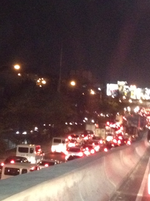
Traffic last night along most of Metro Manila’s roads were a nightmare. It took many people hours before they could reach their homes from their offices and schools. The main reason cited for the horrendous traffic jams was the weather. It has been raining almost every afternoon in Metro Manila and its surrounding areas due to the combination of a tropical depression east of the island of Luzon and the intensified monsoon rains (Habagat). Rainfall intensity combined with a high percentage of the water translating into runoff contributed to flash floods all around Metro Manila including some that were waist-high, rendering the road impassable to most vehicles. However, while a lot of motorists and commuters were simmering along many roads last night, I couldn’t help but notice that most vehicles in the photos circulating in social media sites and news footage are private vehicles. Buses along EDSA occupied only the outermost lane for most stretches of the road. Meanwhile, conspicuous is the space in the middle of EDSA, which is the ROW for the MRT-3 tracks.
One lesson we learned last night was something we already knew all along and have failed miserably to address – we need better public transport in Metro Manila. Could there have been less cars on the roads affected by flash floods brought about by the heavy rains yesterday? Could commuters have had an easier way of traveling between their offices or schools and their homes? The answer is yes, that is, we could have built the necessary public transport infrastructure years ago. While there is a need to be transparent and have a corruption-free (is there such a thing?) process for planning, funding, designing, and constructing public transport infrastructure, we must realize that these are all systems that we should have had long ago, and further delay only dooms mobility and accessibility in our cities. Our leaders seem to be too engrossed with processes and making sure they won’t get entangled in controversies or lawsuits that they forget that time is ticking and all other people are caught in the mess that is the traffic congestion we experience every day. I wonder if at least some of our decision-makers for transport and traffic were caught in the monstrous jams last night? Maybe getting caught in one would change their perspectives and give them a sense of urgency for the task at hand? Or maybe, and likely, they were sitting behind their cars and burning time on their notebooks or tablets while their drivers were trying to maneuver in traffic? Frankly, we deserve better transport than what we have but then we don’t get to decide what gets built and when such infrastructure will be built, if at all. We could, however, do our part in lobbying (or demanding) for better transport.
Taken by a good friend commuting to his home last night:

From the GMA News website:
–
There goes the neighborhood!
Being frequent visitors to Tagaytay, we couldn’t help but be dismayed with the recent developments there featuring high rise buildings. The first to do this was Robinsons Land, which constructed the first tall building in the Summit Ridge hotel and residential condominium along the national highway, just past the Taal Vista Hotel.
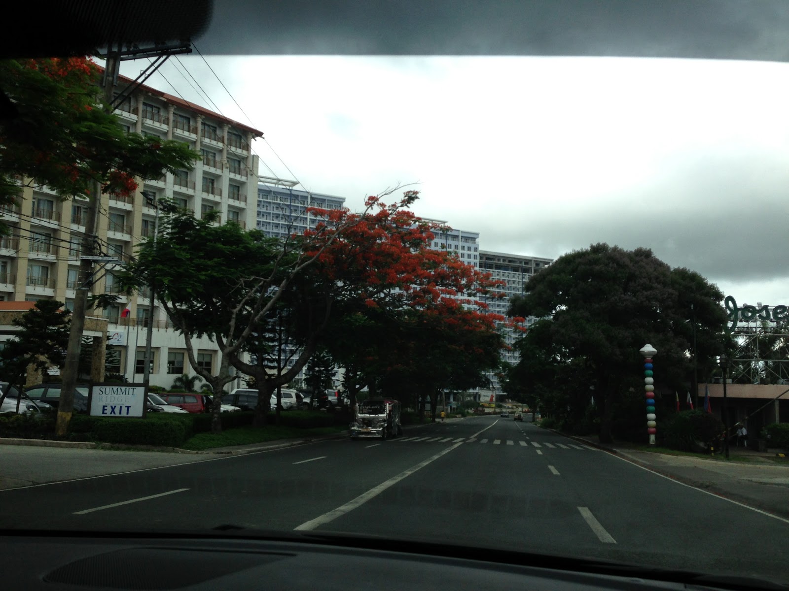 |
| A traveler’s view from the highway – Robinson’s Summit at left is surrounded by SM’s Wind. The sign of Josephine’s Restaurant is visible at right in the photo. |
This project meant the inevitable entry of competitor SM in the area. What we initially thought was a smart move by SM in acquiring the Taal Vista Hotel paved the way for the retail giant to acquire more land for development, which included the much hyped Wind Residences beside (and surrounding Robinsons’ Summit Ridge.
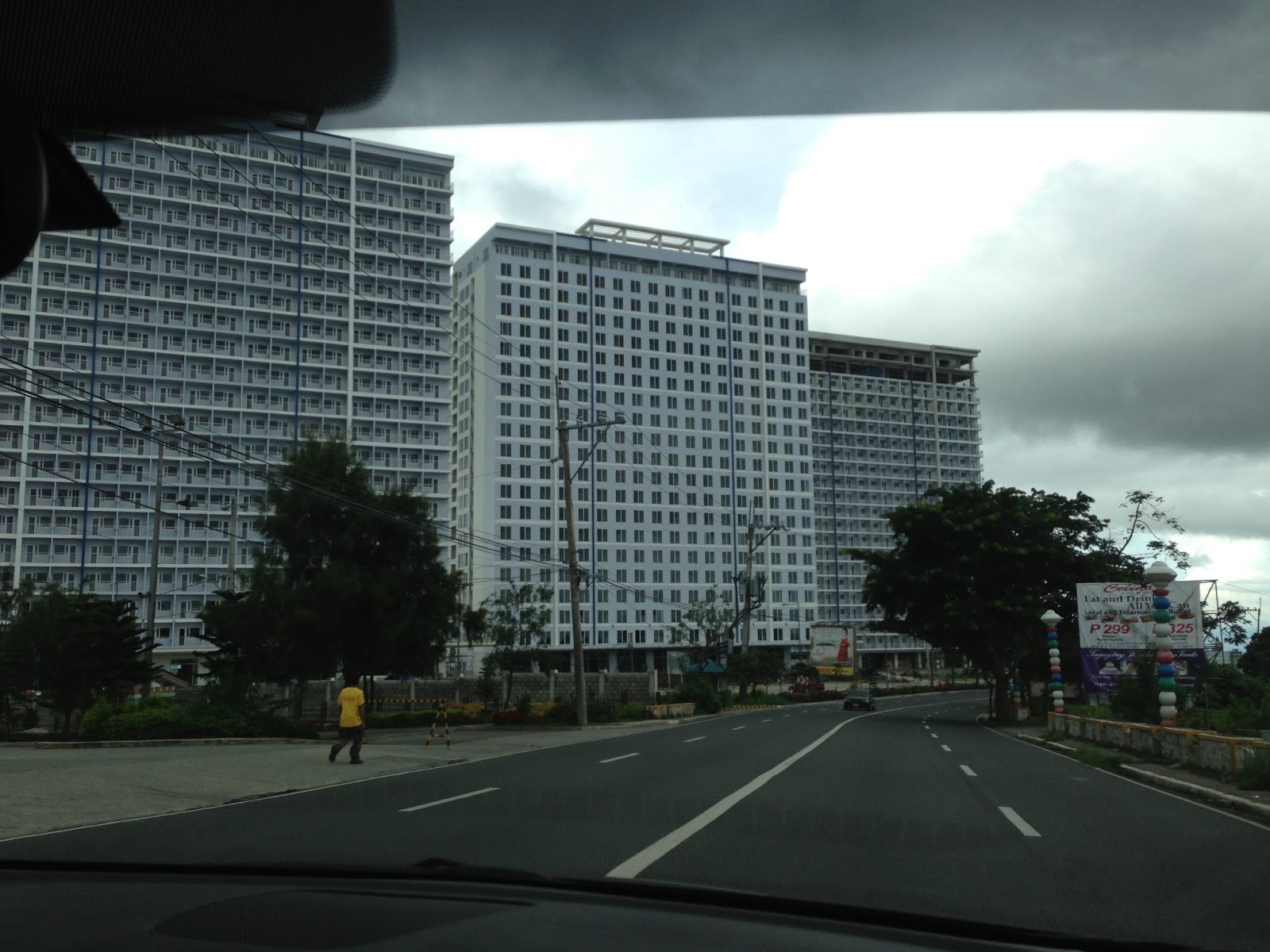 |
| SMDC’s Wind Residences in Tagaytay |
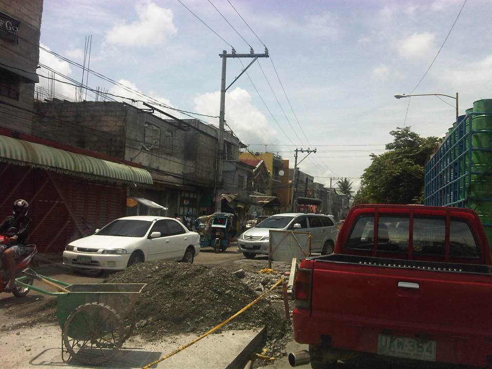
Closely following SM is a development by Cityland near the rotunda, which eerily looked like just one of the ill-conceived boxes they call condominiums in Metro Manila. We couldn’t help but notice that there is generally a lack of landscaping or open spaces to complement the high-rise buildings so there is little or no effort in making the buildings and the lands where they’re built blend with the environment.
For a tourist destination like Tagaytay, it seemed to me that it would be in their best interest to have no buildings perhaps beyond medium rise ( 4 or 5 floors max?). The prevailing perception now is that the city did not do its job in regulating such high density developments. Granted, there are many people who wish to have their own houses in Tagaytay and property values there are climbing. Why else would major players be racing to build high-priced residential developments? And it seems that some developers thought that best approach which addresses demand seems to be the high-rise option. Unfortunately, “best” here seems to be equated to “most profitable” rather than “most sustainable.” Nevermind that the buildings now obscure the view and the sun for many residents of the surrounding areas (not just those living along the ridge). Nevermind that these developments will require much water and other resources for the maintenance alone. Were these elements even considered in the impact assessments of these developments? Did the Environmental Management Bureau do its part in ensuring that the developments conform to standards and regulations?
Now comes what is touted as the tallest ferris wheel in the country, which brings me to the question of why do people go to Tagaytay? To ride a Ferris Wheel? I don’t think so… The local government seemed too eager to approve major projects here and there without looking at a sustainable future for the city. High intensity developments such as the high rise residential buildings currently under construction in the city will eventually put too much pressure on precious resources including water supply and also scar the landscape (I don’t want to use the term cityscape.) with structures that basically do not conform with the character of Tagaytay. These are also sure to add to vehicle traffic that’s already concentrated along the national highway and there are poor facilities for pedestrians including a lack of sidewalks/walkways and safe crossings along the highway.
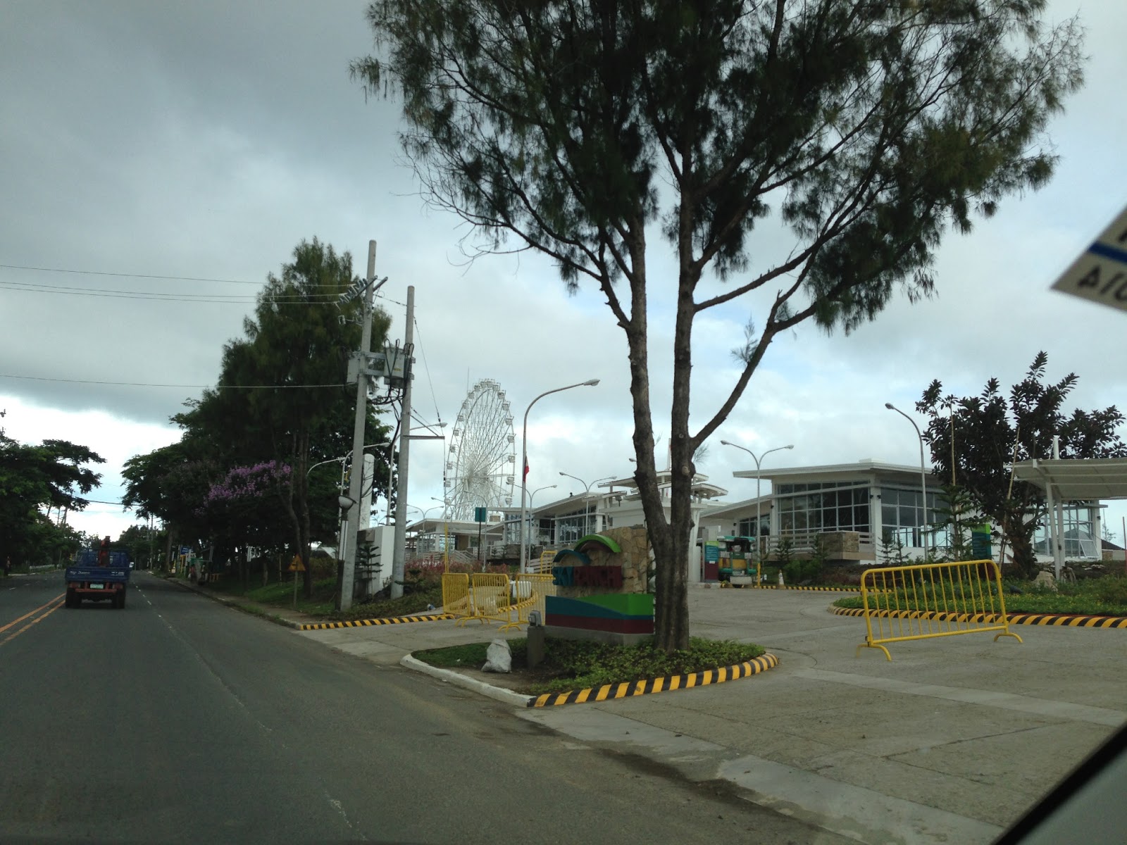 |
| Amusement park and convention center facilities beside the Taal Vista Hotel |
Of course, this is only my opinion and one of so many other opinions regarding development. Perhaps people living in the area accept such developments as they represent income for the LGUs (Tagaytay, Silang and Amadeo are the ones most directly benefiting from the developments.) and jobs for people residing in the area. These were definitely considerations in the process of approval for these projects and probably weighed more than other factors that required attention. I just hope that a sustainable future was not sacrificed by people who opted to earn a quick buck from these projects.
–
Criminality along congested roads
There’s been a rash of criminality along congested roads in Metro Manila. Recently, there have been reports of hold-ups and snatching along Circumferential Road 5 near its junction with Kalayaan Avenue. The suspects are said to be youngsters, teenage boys or even street-smart children, who roam the area and keeping an eye on opportunities for snatching among the hundreds of vehicles crawling along C5 during the peak periods. They look for unlocked doors of cars or taxis and in many cases team-up to confuse the driver and/or the passenger(s). In some instances where they can’t find unlocked doors they supposedly create opportunities by banging the body of the vehicle and goading the driver to step out of the vehicle.
 Vehicles at a standstill along C5 approaching the intersection with Kalayaan Ave – the center island is visible in the photo.
A few years ago, there was a feature on so-called “batang hamog” (roughly translated as children of the dew) opening doors of vehicles caught in traffic jams along EDSA. They snatch items like bags, cellphones or other items that they see through the vehicle’s windows as they loiter along the carriageway. CCTV footage from the MMDA show them to be quite quick in making their getaways. In some footage they are shown as climbing up the wall of the EDSA MRT, which is in the middle of EDSA, crossing the tracks and then climbing down on the other side, oblivious to the dangers of an oncoming train and the crash it might cause that could injure (even kill) many passengers.
A few weeks ago, a colleague and I saw some youths suspiciously scanning jeepneys caught in traffic near the Manila City Hall. My friend remarked that they might be searching for unwary passengers whom they can rob of their bags or jewelry. This modus operandi or mode of operation seems to be a favorite among snatchers in Metro Manila. I myself was almost a victim one time I was heading home on board a jeepney along Shaw Boulevard in Mandaluyong when a guy tried to make for my watch as the jeepney started to move. Fortunately, he failed as I reacted quickly and I saw a smirk on his face as our jeepney sped away.
Now, this kind of criminality is not something that our authorities cannot address. Surely, the Makati and Taguig police together with the MMDA can make a regular sweep of the length of C5 where these suspects are supposed to loiter given that the latter’s activities are quite predictable in time and modus operandi. It’s both frustrating and disappointing when officials make excuses on TV and radio interviews why they cannot catch or deter these criminals from harassing motorists and pedestrians. Hindi naman siguro talaga pwede magamit ang patrol car kapag ma-traffic at pinaka-epektibo ay magkaroon ng foot patrol sa lugar. They can have police and enforcers roam the same areas at the same times when there’s traffic congestion and therefore, a high likelihood that the suspects will be there.Those people aren’t supposed to be roaming the carriageway or loitering along the center island of C5 in the first place since to do that they would be jaywalking along a very busy road and risk being hit by a motor vehicle.
I believe police visibility is only effective if they are actually visible and when required, give chase of the suspects. The problem seems to be that the police and enforcers are usually just at the C5-Kalayaan intersection, focused on number-coding violators, and those who are supposed to be patrolling don’t want to leave the comfort of their vehicles. Surely again, we expect our law enforcers to be fit and ready to run after suspected criminals. After all, that’s what they are supposed to be doing in the first place. It would be nice to see them patrolling the area on foot and accosting people who are not supposed to be in the area.
–
Sandiganbayan underpass
There is an underpass at the intersection of Commonwealth Avenue and the Batasan Road at Sandiganbayan. The underpass is for left turning traffic coming from Batasan to the Elliptical Road-bound side of Commonwealth. I took a few photos of the underpass recently as we were coming from a meeting at the Batasan.
 Approach to the left turn underpass – the rightmost lanes of the Batasan Road are for right-turning traffic going in the direction of Fairview.
 The underpass has three lanes.
 It is well lighted and so motorists are not plunged into darkness unlike some underpasses that are not well-maintained.
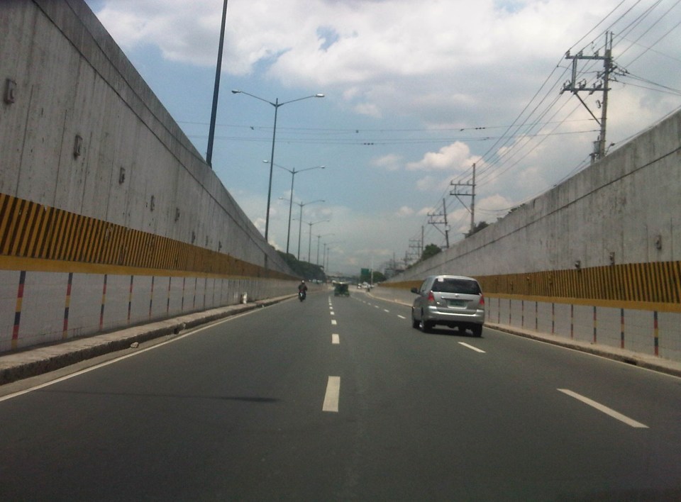 Emerging from the underpass, vehicles have enough space to merge with traffic along Commonwealth Avenue.
 The underpass emerges as 3 middle lanes along the wide Commonwealth Avenue. There are 4 to 6 lanes to the left and 2 lanes to the right of the underpass lanes. The rightmost lanes are supposed to be for public utility vehicles.
I have not heard of or read anything anywhere about this underpass being flooded during times of heavy rains. These include the particularly heavy rains of Ondoy (Ketsana) in 2009 and the Habagat episodes last year. As such, I believe that the design of the underpass (including its elevation and drainage) is for all weather conditions.
–
Traffic congestion and the limits of quick fixes
One time last summer night, it took me 2.5 hours to get to the airport from where I reside when it should only be an hour or 1.5 hours (on a typical bad day). Very early mornings (between 2 to 4 AM), it only takes me 40 minutes between my home an the airport. The route I usually take is mainly along Circumferential Road 5 (C-5); a route that basically has sparse public transport (mostly jeepneys along different sections) but is a truck route. It was summer though and one would have thought that there would be less vehicles along the road with school still out. I was wrong in that assumption and that cost me both time and fuel that night.
Traffic congestion in Metro Manila and other Philippine cities have been issues for such a long time that one tends to assume there’s nothing being done to fix the problem. In Metro Manila, the Metropolitan Manila Development Authority (MMDA), in cooperation with the various local governments and national agencies, has implemented various schemes including the number coding, truck ban and a bus dispatch system along EDSA. Yet, congestion persists and only last week, the President got caught in traffic as he traveled from Malacanang Palace in Manila to the DOST Compound in Taguig. The news was filled with a comment that he supposedly made to the MMDA Chair about the delay he and his entourage experienced. The bad news is that this congestion will not go away and will only worsen if there are no steps taken to address the problem. And this happens not only in Metro Manila but in other highly urbanized cities in the country. Quite obviously, quick fixes are no longer enough and we have reached the limits of their applicability.
 EDSA during the morning rush hours
 EDSA during the afternoon peak, which actually extends to an evening and even nighttime traffic jam
So how do we alleviate traffic congestion? Here’s three things that come to mind as they seem to be quite logical and very obvious:
1. Build the mass transit infrastructure required – these infra include rail and bus rapid transit systems and are urgently needed in Metro Manila, Metro Cebu, Davao and other highly urbanized cities. A shift from private vehicle use to public transport will not happen if people have no attractive options for commuting. In Metro Manila, there is a backlog of mass transit projects with lines that should have been constructed and operational years or even decades ago.
2. Rationalize transport services – the long standing practice is to increase the number of existing modes of transport as the demand increases. This logic is one that is most abused as a doubling of demand is conveniently but incorrectly interpreted as requiring a corresponding doubling of the number of tricycles or jeepneys, for example. What is required is for our cities to “graduate” from low capacity and less efficient modes to higher capacity and more efficient ones. Many cities seem plagued with tricycles as their main modes of transport within their CBDs when these should have been restricted to residential areas and mainly in the periphery rather than allowed to dominate (and clog) urban streets.
3. Build more walkways and cycling facilities – its difficult to encourage people to walk and cycle if there are no space for pedestrians and cyclists to travel safely and efficiently. Most trips are actually short ones and do not require motor vehicles so it makes sense to invest in pedestrian and cycling facilities so people get the clear message of support for such options for travel. Such investment is also one for healthy living as walking and cycling are forms of exercise and it is well established that these modes of transport promote healthier lifestyles and therefore, healthier people in cities.
–
Common causes of traffic congestion along Philippine roads
As a follow-up to a previous post on traffic congestion, I am writing on some of the most basic causes of congestion along Philippine roads. I say most basic because these are the usual situations we see along the road as we commute. And these are also supposed to be easily solved or addressed by the most basic approaches – enforcement. Here are a couple of photos and commentaries on this matter.
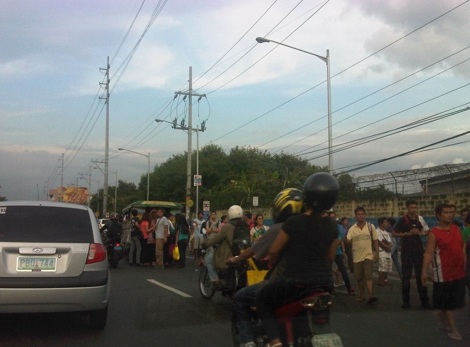 Commuters occupying two lanes of the road as they wait for public transport along Marcos Highway in Pasig – PUVs like the jeepney in the photo stop in the middle of the road to load/unload passengers. Were there traffic enforcers/aides in the area? Sometimes. Were they doing their jobs? Definitely not. In many cases, I’ve seen enforcers using the congestion (i.e., slowed traffic) to apprehend number coding violators. Now, number coding is premised on motorists being discouraged from traveling during certain times of the day to reduce congestion from vehicle volume. In the photo above, it’s pretty clear that the problem isn’t number coding violators but the mayhem caused by public transport and commuters. Something that traffic enforcers/aides could have acted on and with regularity and persistence so that they can positively influence jeepney driver and commuters towards orderly conduct.
 On-street parking and pedestrian activity along Manila roads – many cities such as Manila are guilty of not having any serious initiatives to address on-street parking. In many cases, its tolerated particularly in commercial areas as local governments don’t like to engage business in what they assume to be the small issue (or non-issue) of parking. In the case of pedestrians, it is a behavioral thing that requires a bit more effort than police or enforcer visibility (or the occasional apprehension). As a result, people will generally cross wherever they want and walk along the carriageway, not minding their safety. Of course, such behavior is encouraged by the absence of space for walking as vehicles, merchandise and other stuff occupy space that’s supposed to be for pedestrians.
–
