
Home » 2013 (Page 11)
Yearly Archives: 2013
UP Village transformation
UP Teachers Village in Quezon City is a good example of a residential area that has been transformed over a few years. This transformation was enabled mainly by its streets, particularly Maginhawa Street, being open to general traffic. Teachers Village roads are often used as short cuts between major roads like Commonwealth Avenue and C-5/Katipunan (via C.P. Garcia Street), and Elliptical Avenue, Kalayaan Avenue and V. Luna. Due to both significant foot and vehicle traffic, what used to be homes along the streets have become restaurants, shops, offices, or even schools. There are many cases of homeowners who have found their houses less livable due to the noise and air pollution attributed to traffic (Note: There are so many tricycles in the area.). These have sold their property to people who used it instead for business. Unfortunately, despite the approval of the local government of the changes in land use, most establishments clearly have not satisfied basic building code requirements such as those for parking and pedestrian facilities.
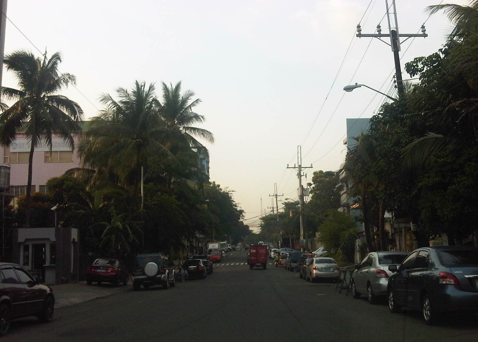 On-street parking along both sides of Maginhawa Street in Teachers Village
 Schools and commercial establishments like restaurants and shops are found along Maginhawa Street. Most do not have adequate parking spaces for customers.
Maginhawa Street has been widened to accommodate more vehicular traffic. Unfortunately, widening the road has only led to more on-street parking as shown in the preceding photos. People also are often forced to walk along the carriageway because because sidewalks are usually blocked, with some establishments using the space for al frresco set-ups. Developments need to be inspected to check if they comply with basic requirements such as parking and pedestrian facilities. Development and land use changes can be justified but proponents must be made to comply with the minimum requirements of the National Building Code in order to mitigate potential impacts to the community.
–
Rizal Avenue – Part 2: Tayuman to Pampanga Street
In the last post on Rizal Avenue, the featured photos show conditions under the LRT Line 1, which included visual evidence of certain issues like on-street parking, poor lighting and even sanitation (i.e., garbage) along the corridor. This post features more of the same and perhaps worse in some cases that are used as proof of the blight caused in part by the LRT superstructure. I say in part because LRT Line 1 is not wholly to blame for problems under and around it. Local governments and the private sector share responsibility for the decline of the areas within the direct influence of the rail line. Napabayaan. But of course, this does not absolve proponents of the LRT Line 1 for poor station design.
 Approach to Tayuman Station along the northbound side of Rizal Avenue.
 Tayuman Station – shown in the upper part of the photo is one end of the northbound platform.
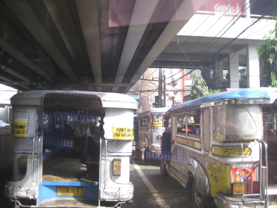 Underneath the station, jeepneys clog the lanes as they load/unload passengers. LRT Line 1 stations are poorly designed for intermodal transfers (e.g., LRT to jeepney, LRT to bus, etc.).
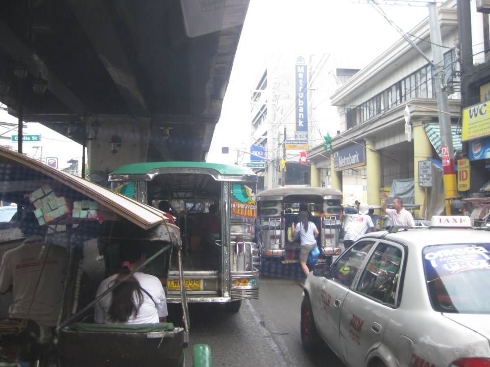
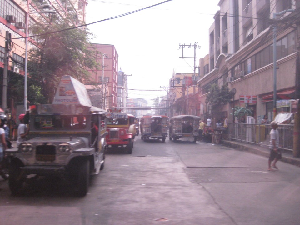 Tayuman Road is a busy street in Manila that’s served by jeepneys connecting to major streets like Lacson Avenue to the east and Abad Santos and Juan Luna to the west. The photo shows a view to the east of the LRT Tayuman Station.
 Approach to the junction with Herrera Street
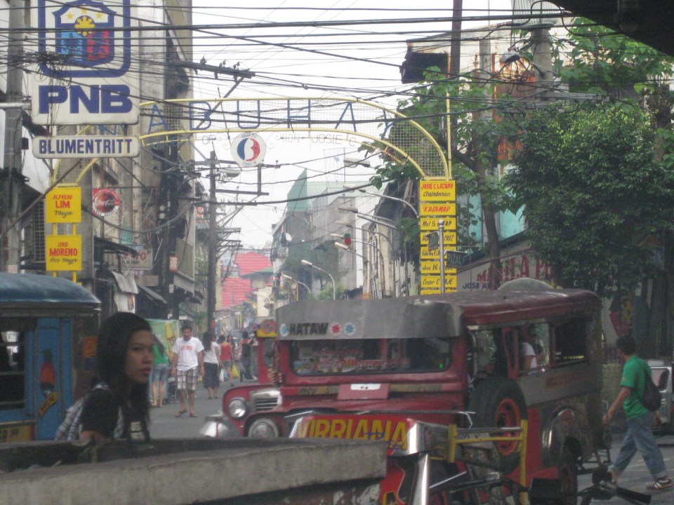
 Approach to Blumentritt Station – the station is named after Ferdinand Blumentritt, an Austrian who was a close friend of the national hero Jose Rizal. The street leads to a large public market close to the station (near the intersection) that is also named after the fellow and one of the more crowded markets in the metropolis. There are many jeepney lines with Blumentritt as part of their routes.
 Birds and other creatures being sold as pets around Blumentritt – many have been painted to attract children and other buyers curious at the colored birds.
 Vendors line the Rizal Avenue, Blumentritt and the other side streets in the area, which is usually crowded no matter what day of the week it is.
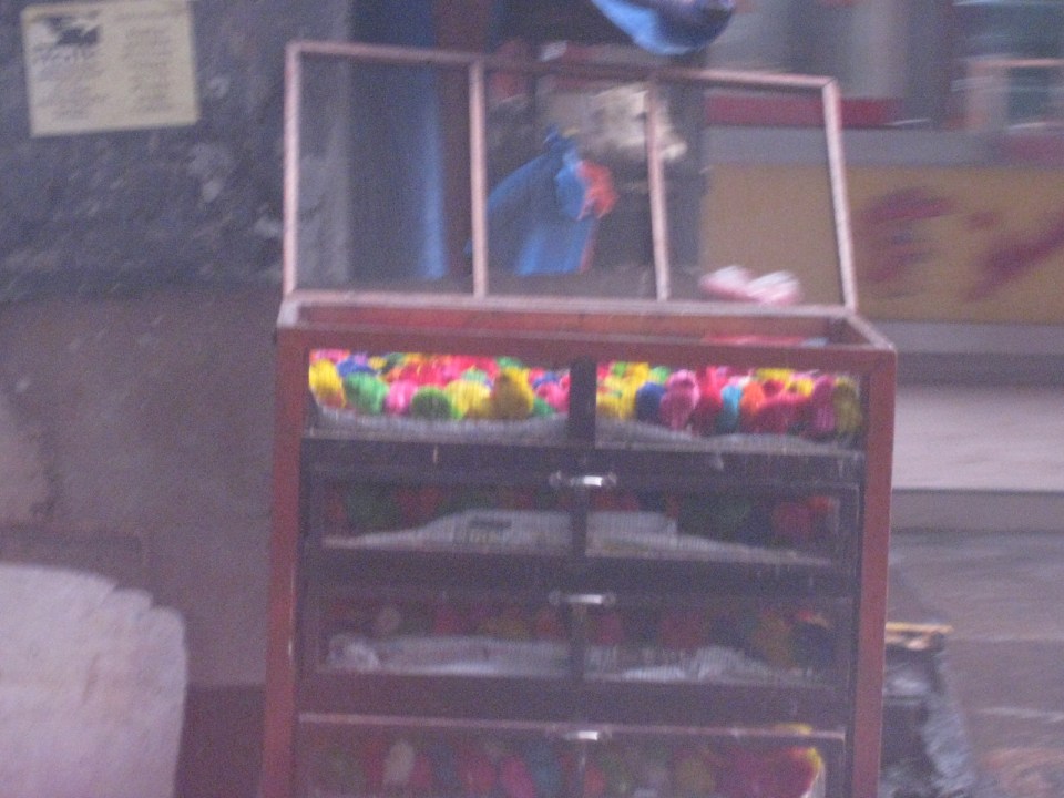 Angry birds? A closer look reveals the birds as chicken chicks colored by the vendors to attract interest. Sadly, many of these do not survive to become full grown chickens and children (and adults) will be disappointed to discover later that the color comes off pretty quick when the chicks come in contact with water.
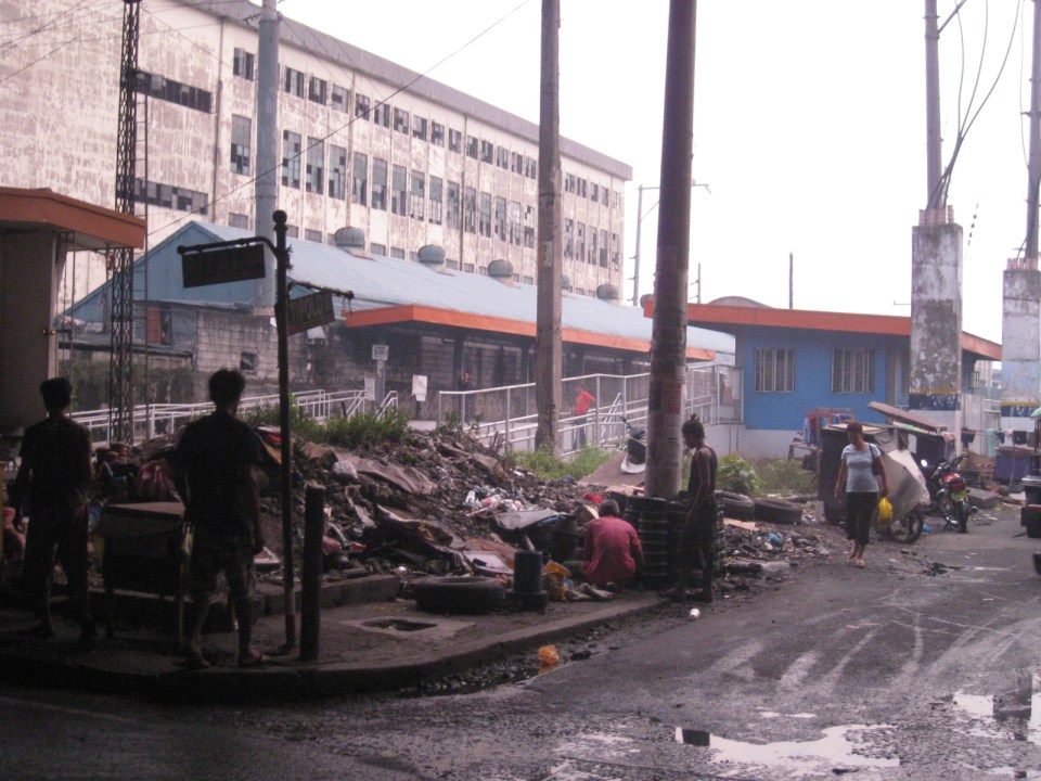 There is a PNR Blumentritt Station and unless there’s been some radical clean-up of the area, this is pretty much what you’d see around the station – garbage, dirt, informal settlers and other characters. The building behind the station is a public school.
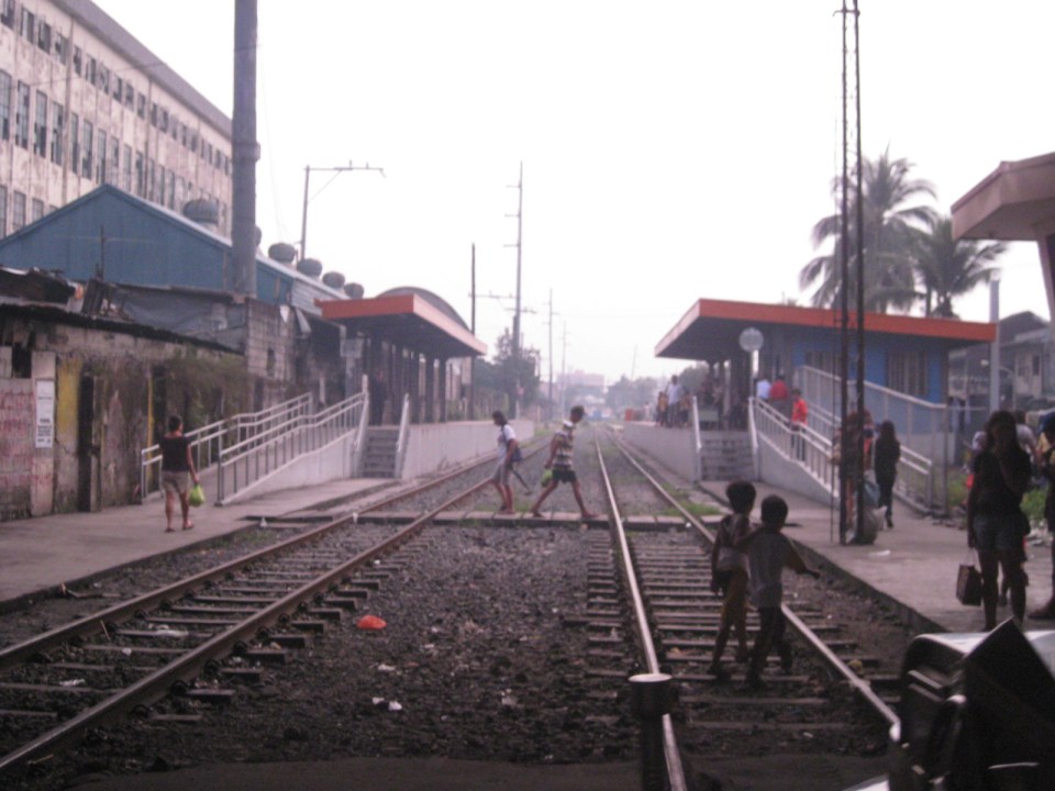 The PNR Blumentritt Station has two platforms on either side of the double track. Security is quite lax and people, including children, cross the tracks freely. Fortunately, train service frequencies are quite low (about 1 per hour) so the risk of getting hit by a train is also low. The photo shows the view to the east of Rizal Avenue.
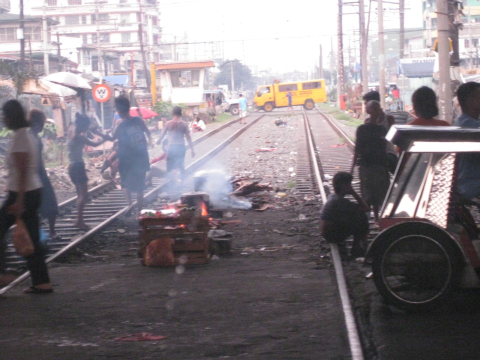 On the left side of Rizal Avenue is a scene where people are oblivious to the railways with some even doing their cooking between the tracks.
 Blumentritt Avenue is a very crowded street with a public school (building at right) just across the public market (at left). There are many vendors lined along the street and people as just about everywhere and without regard to vehicular traffic.
 Traffic congestion along Rizal Avenue is attributed mainly to the market and median barriers were constructed to reduce pedestrian crossings anywhere along the road. Commercial establishments line either side of Rizal Avenue, basically contributing to congestion in the area.
 Commercial establishments plus customers plus paratransit equal to traffic congestion
 16A busy side street in the Blumentritt area – there are no sidewalks so pedestrians and motor vehicles mix it up along the road.
 Bulacan Street serves as an informal terminal for jeepneys. The road appears to be newly paved but there are no sidewalks and tents are found along the road often bearing the names of politicians sponsoring the tents for various purposes such as wakes and parties.
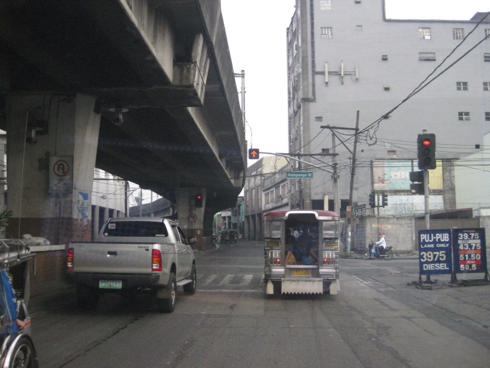 Intersection with Pampanga Street, just before Rizal Avenue and the LRT line turns towards Aurora Boulevard and proceed to Caloocan City and Monumento.
More on Rizal Avenue in future post…
–
MNTC Donation to UP-NCTS Road Safety Research Laboratory
The Manila North Tollways Corporation (MNTC) recently donated software and equipment to the University of the Philippines Diliman’s Road Safety Research Laboratory (RSRL) at the National Center for Transportation Studies (NCTS). Gracing the Turnover Ceremony were no less than MNTC Chair Manuel V. Pangilinan and UP System President Alfredo E. Pascual. Dr. Hilario Sean O. Palmiano, the current NCTS Director, welcomed guests from MNTC and its parent firm Metro Pacific Tollways Corporation as well as from UP and the media. Dr. Ricardo DG. Sigua provided a background on the RSRL and how the donated equipment would help in the implementation of researches. The following photos show some highlights of the Turnover Ceremony last April 11, 2013.
 UP President Alfredo E. Pascual shaking the hands of MNTC Chair Manuel V. Pangilinan after they delivered messages during the Turnover Ceremony held at the NCTS. Looking on are Road Safety Laboratory Head Dr. Ricardo Sigua and NCTS Director Sean Palmiano.
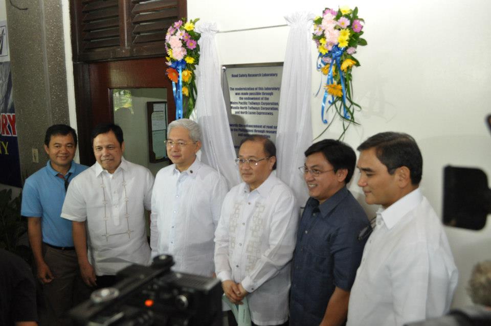 Unveiling of the plaque by (L-R) Dr. Ric Sigua, MNTC President & CEO Rodrigo Franco, UP Pres. Alfredo Pascual, MNTC Chair Manny Pangilinan, Dir. Sean Palmiano, and Metro Pacific President & CEO Ramoncito Fernandez
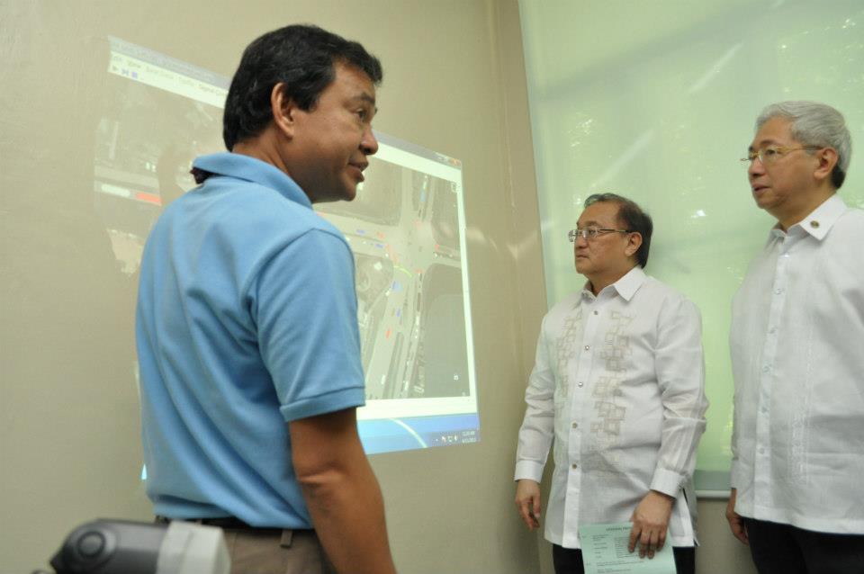 Dr. Sigua demonstrating VISSIM, one of the software donated by MNTC to UP-NCTS
 MNTC Chair MVP making a point about the microsimulation demo as UP Pres. Pascual looks on.
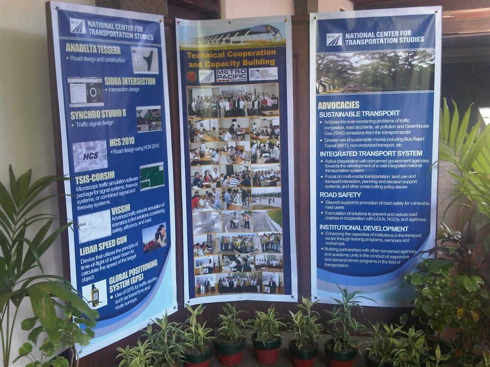 Tarps on display showing a list of donated software and equipment, photos of technical cooperation and capacity building between NCTS and MNTC/MPTC, and the advocacies of NCTS.
The following links are for news items on the turnover:
AKSYON TV ANDAR NG MGA BALITA Road Safety Lab binuksan para sa pagaaral ng kaligtasan sa kalsada
http://article.mediabanc.ws/stream/default.aspx?cc=T0T06d8bb4U%3d&file=k177n0SVBnt2RaICvoFJhiFjxgfZyCtN6NoXOXnMSGyal1UJ64YKNpL2BU77bIOvciz4Fow7jHs%3d&title=t52vKVnKl2UOiPwLKMoBIY7qOmbKBwO1BvxSsh3vvK9bxrfWReUGvonLroiSCcRES9sS3xiZeZJwE1Fge2YBny9SUwnOgsxVTV5 AKSYON Dalawang aksidente kada minuto nangyayari sa buong mundo
ayon sa pag aaral
http://article.mediabanc.ws/stream/default.aspx?cc=T0T06d8bb4U%3d&file=k177n0SVBnsls4maYTmszSUZ5hGB8cannnCtIw38rXSPzVAYSki5Ja9OXLfu2SRW0MoCtizKBHI%3d&title=lpnzG7ZYupO9oIfbLTmmnyPuzDcsckTf7KQri2OPzrjD3PZBucpQvITV0xUGBlObShdIgViH%2fltBVsTf70AwjRR5y3I
+hqdT0uag3PAgkU0%3d
[Note: To view the videos, you must have Microsoft Silverlight installed on your computer.]
–
Night time congestion along C-5
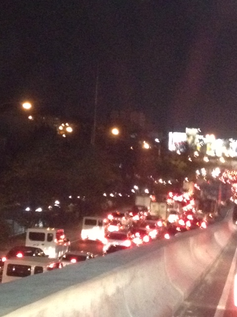
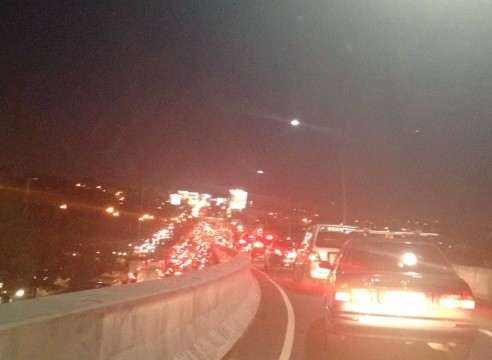
Traffic congestion along Circumferential Road 5 is experienced practically throughout the day with the worst congestion along the southbound direction during the mornings between the Riverbanks Road in Quezon City and Kalayaan Avenue in Makati City, and the northbound direction between Bonifacio Global City and Eastwood from noon to nighttime. The following photos taken by my wife as I fetched her one night from her office shows the traffic jam along C-5 as we turned from the flyover past Market! Market! towards the highway.
 Congestion along the C-5 northbound is a regular thing during the weekdays from the afternoon to late at night. While apps like the MMDA’s Traffic Navigator and Waze allow us to have an idea of how congested C-5 is during such periods, the actual experience is much worse than what many of us can just imagine from the apps.
 As far as the eye could see – congestion in the form of the taillights of vehicles along the northbound side of C-5 indicate just how many people are caught in traffic from Taguig all the way to Pasig and beyond. The giant billboards from Kalayaan Avenue to Pasig Boulevard including those seen along the bridge crossing the Pasig River. Most of these people are office workers coming from Makati and Global City and heading home to Quezon City, Pasig, and the towns of Rizal. After 7 PM, trucks add to the traffic
Many people are asking if there is a solution in sight for congestion along C-5. To be frank, there is none in the immediate future. There are proposals to introduce a public transport system along the corridor with one option being a Bus Rapid Transit (BRT) and another an elevated rail transit line. The BRT line is a recommendation of a Pre-FS for Metro Manila BRT conducted around 6 years ago though there was a proposal for a bus system (Philtrak) along the same corridor back in the late 80’s and pursued for some time during the 90’s. Not much have been done towards realizing any of these proposals. An efficient mass transit system along the corridor could encourage people to shift from private to public transport and help reduce vehicular traffic along C-5 considering that even as I write this post, vehicle ownership is increasing in Metro Manila and its environs and this could only mean more congestion along C-5 and other roads.
–
Ferry to Marinduque
A friend, Dr. Jonathan Salvacion, posted some photos of a trip he made to Marinduque. I noticed a couple of photos showing the ferry their group took between the Port of Lucena and Marinduque Island. After getting his permission to use the photos, I am post both here to show the typical ferry used in inter-island, roll-on roll-off (RORO) transport in the Philippines. Being an archipelago, providing safe and efficient inter-island transport is a continuing challenge for the country. A lot of progress, though, has been made regarding infrastructure and services. The improvements include the nautical highway system comprised of highways and seaports where the past and present administrations have invested heavily during the past decade.
 Passengers boarding the ferry to Marinduque – the port is designed with a ramp for vehicles to easily “roll-on/roll-off” the vessel [Photo credit: Jonathan Salvacion]
 Inside the ferry, vehicles are parked while passengers are seated above on deck. [Photo credit: Jonathan Salvacion]
–
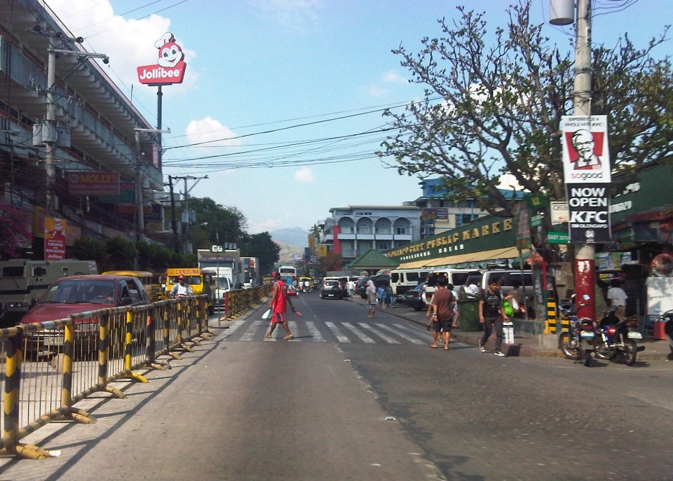
Streets of Olongapo: Rizal Avenue
Olongapo City is located in the Province of Zambales, the only city in that province, and beside the Subic Freeport. It is a pioneer in public transport service innovations in the form of the first initiative on the color-coding of jeepneys according to their routes. Despite what seemed to be forever being linked to the Freeport in terms of economic development, the city has enjoyed continued growth and is currently experiencing more challenges attributed to this growth. Among these challenges are those pertaining to traffic congestion and public transport services for the city. A Transportation and Traffic Management Plan Study was conducted by UP Diliman through the National Center for Transportation Studies and is up for formal adoption of the city.
Following are photos taken along the city’s main street, Rizal Avenue, where many of the city’s transport and traffic problems are manifested.
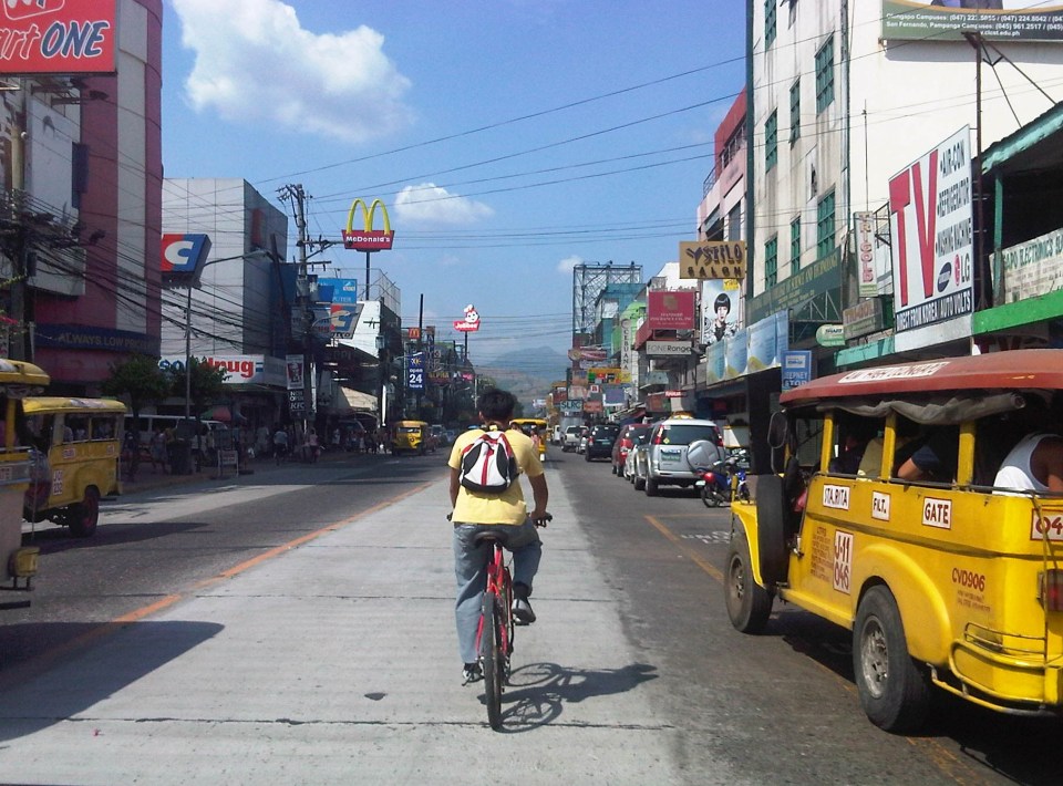 Cyclist pedaling along Rizal Avenue beside a yellow jeepney taking passengers at the designated stop at curbside. Downstream are parked vehicles along the road.
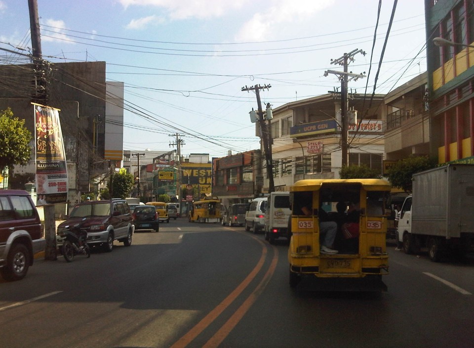
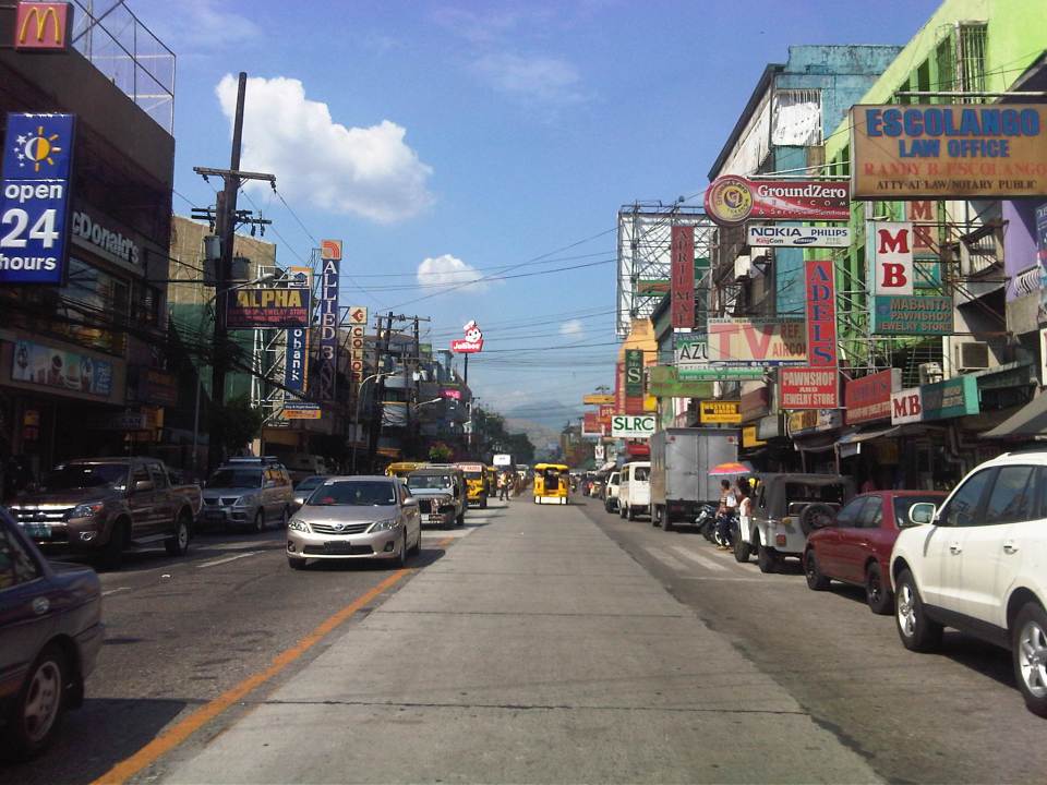 More parked vehicles at either side of Rizal Avenue effectively reducing road capacity for the 4-lane street.
 On-street parking is a problem for the city as there are few, if any, off-street parking facilities in the city. On-street parking turnover is quite low since many of the parked vehicles are not clients or customers but establishment owners or managers.
 Most of Rizal Avenue is undivided but there are median barriers along the section in front of the public market to reduce jaywalking among pedestrians.
 The section in front of city hall – just across are many commercial establishments and on-street parking.
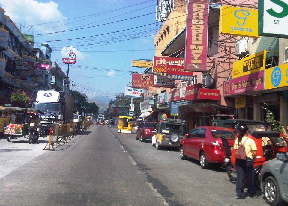
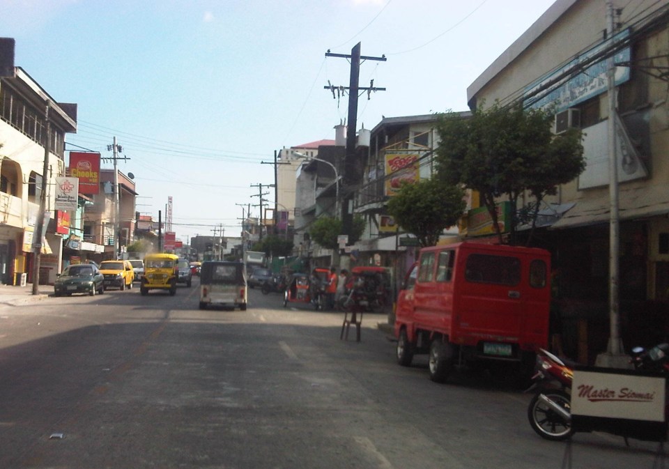
 Another view of the Rizal Avenue, this time along the westbound side, with the the market on the left side. The yellow jeepneys are quite conspicuous and remind me of the UP Ikot jeepneys.
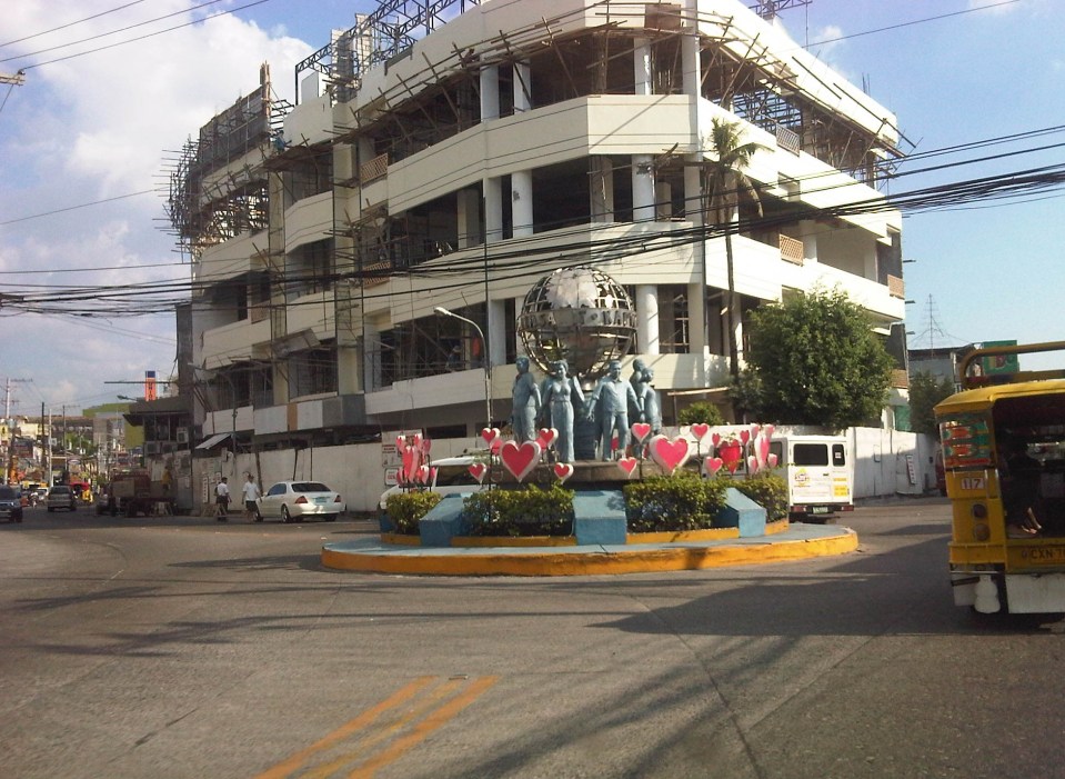
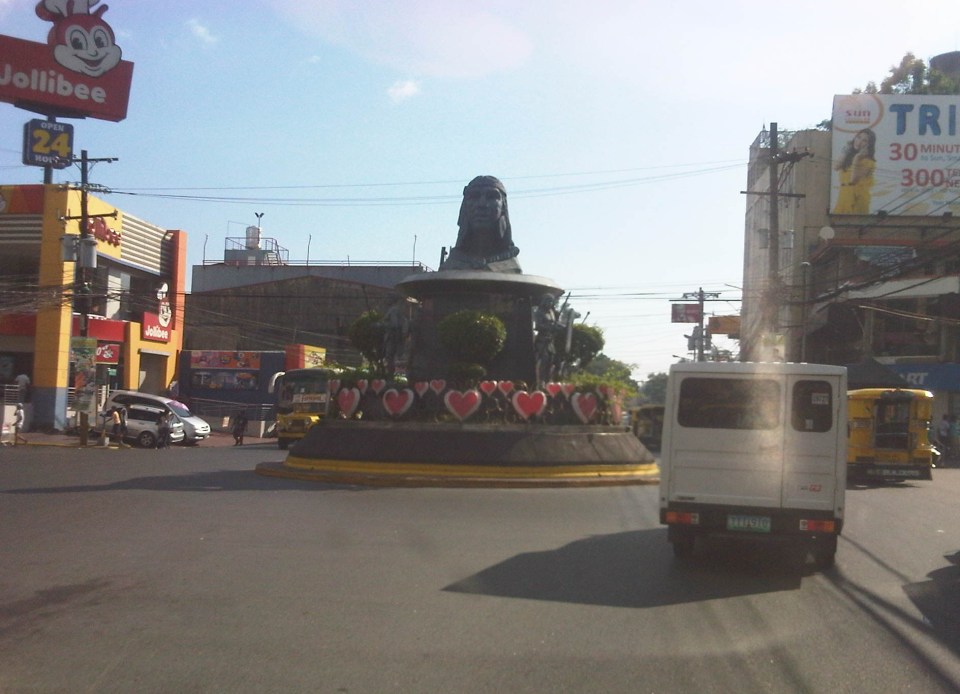 A monument to the Ulo ng Apo, from which the name of the city is said to be derived from, is right in the middle of a rotunda at a major intersection along Rizal Avenue. Around the rotunda are commercial establishments and a major provincial bus terminal.
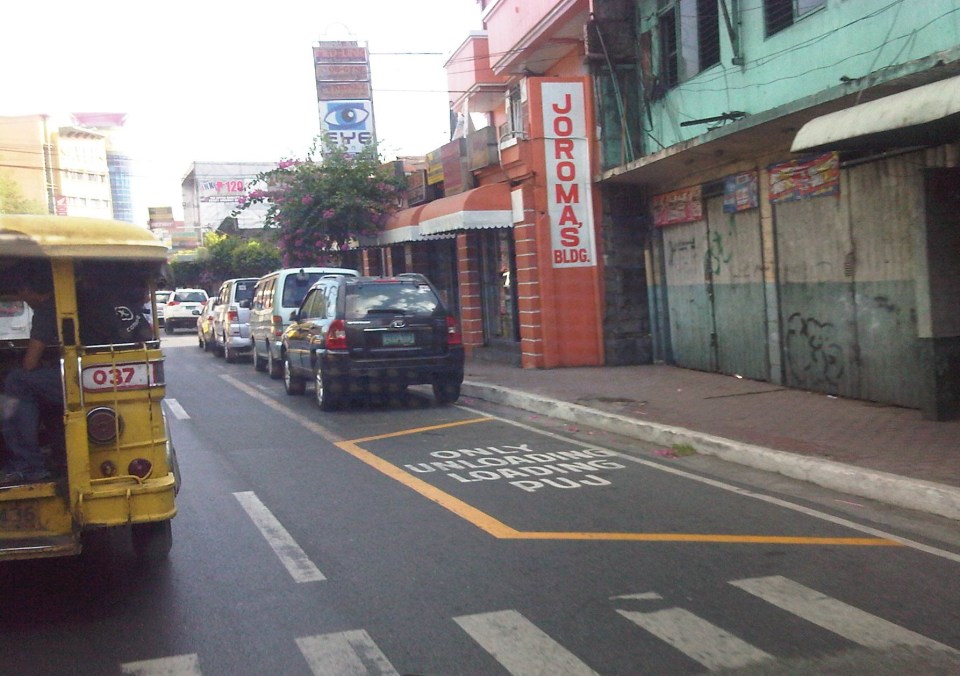 There are designated stops for jeepneys along the avenue but these are often crowded out by parked vehicles. As a result, jeepneys could not maneuver properly and end up unloading/loading passengers in the middle of the road.
 On-street parking along curves tend to impede the flow of traffic. There are also issues where electric posts like the one shown in the photo have not been transferred, posing risks to vehicular traffic.
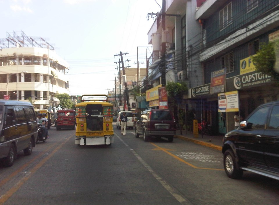 Another example of a designated jeepney stop along the avenue where parked vehicles constrict maneuvering space for jeepneys.
 A monument to the volunteers of Olongapo during the Mt. Pinatubo episode after the closure of the U.S. Naval Base in what is now a Freeport. I wonder if the building under construction in the photo has enough parking spaces for the traffic it generates.
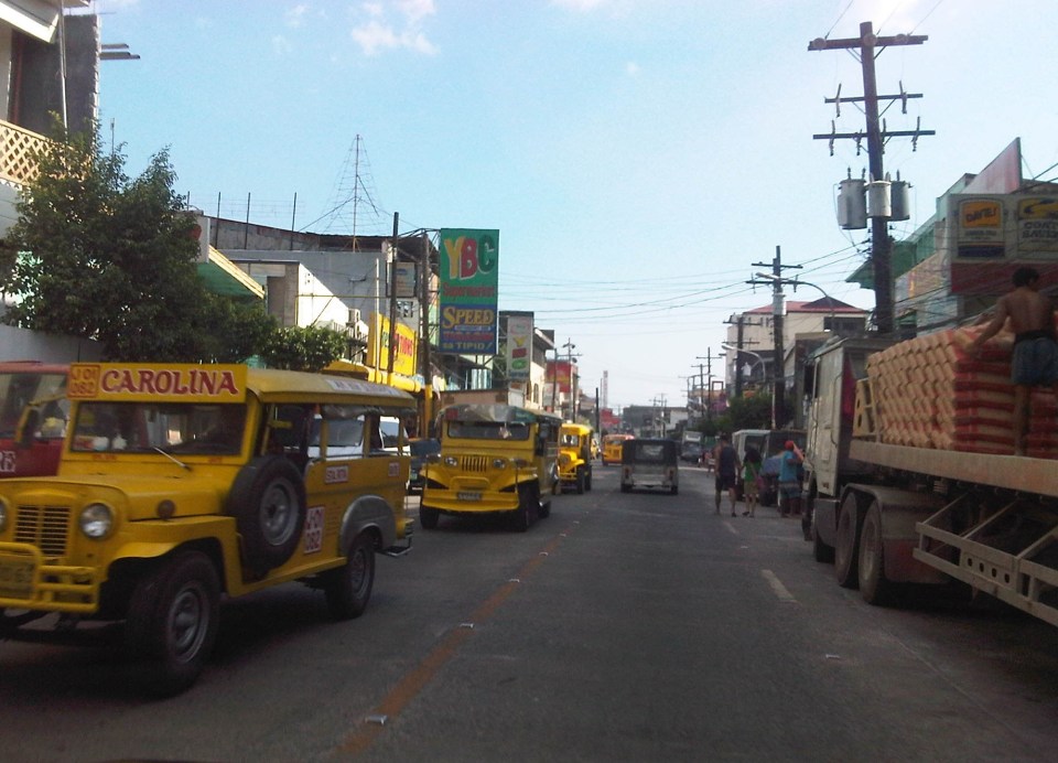 More jeepneys and more on-street parking – there is a perception that there are too many (oversupply) of jeepneys. Note though that most PUJs in Olongapo are not the bigger 20 to 24 seater jeepneys we see in Metro Manila but the older, 16 to 18 seaters like the ones shown in the photo.
 Some on-street parking spaces are “reserved” by establishments. I didn’t mention that on-street parking is free of charge and such situation probably encourages longer parking durations. Perhaps the city should seriously consider parking fees to reduce long-term parking and ensure smoother flow of traffic along its streets. There are examples of these parking schemes in other cities including Makati City that Olongapo can adopt and adjust.
–
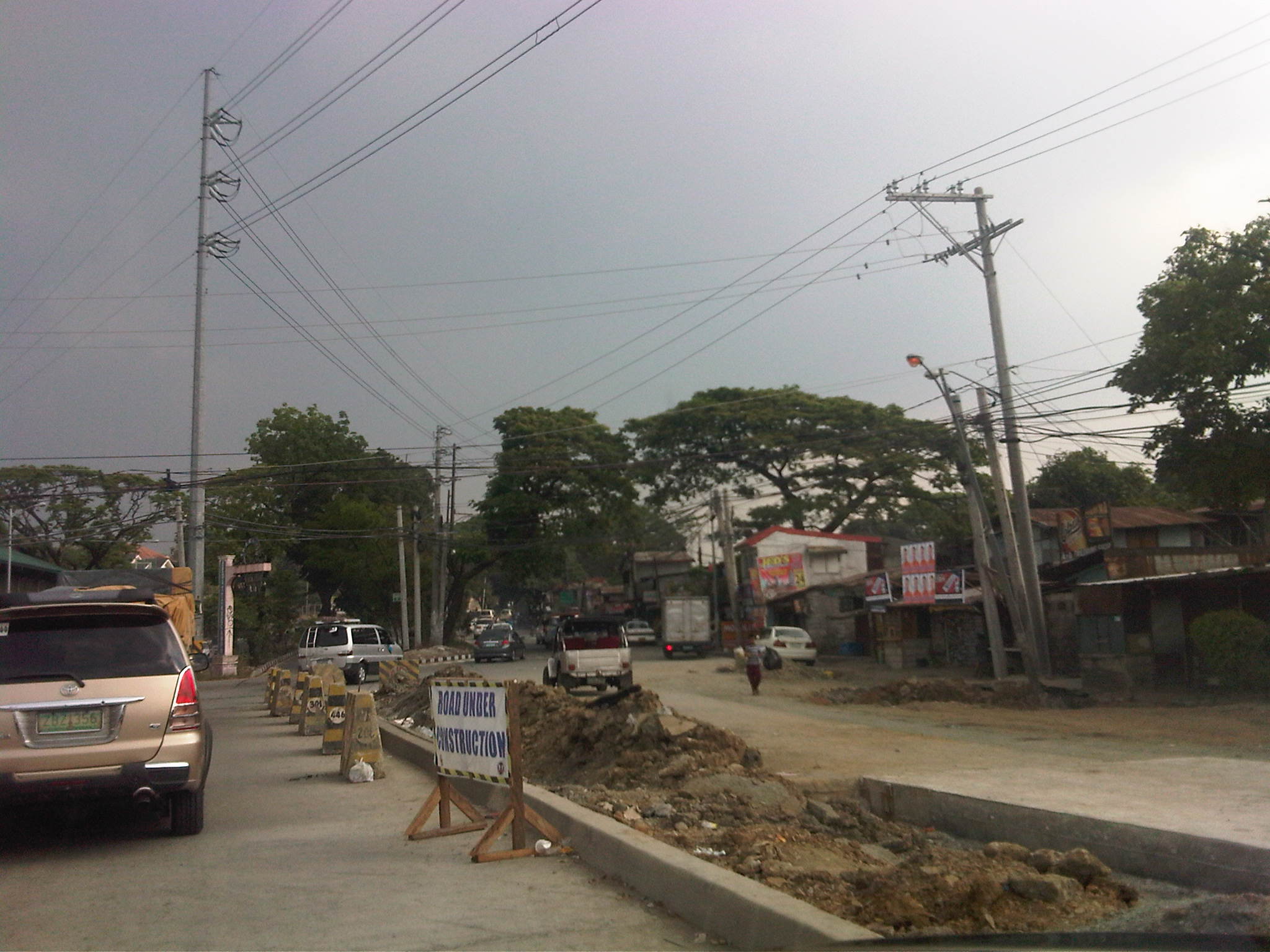
Tandang Sora Avenue road widening
The stretch of Tandang Sora Avenue between Commonwealth Avenue (Luzon Avenue Flyover) and Capitol Hills Drive is currently being widened as part of the Luzon Avenue project. Work here has been delayed by not a few glitches including the issues regarding the right-of-way acquisition. This area used to be home to a lot of informal settlers, including many who have lived in the area for decades as they were tolerated by the land owners. Many had to be relocated and were compensated to give way to the section of Tandang Sora that connects to the also unfinished Luzon Avenue.
The following photos were from a month ago when work was still ongoing along the southbound side of the road. This southbound side is actually the old 2-lane, 2-way section of Tandang Sora that was rehabilitated following completion of work on the expansion northbound lanes.
 Heavy equipment are everywhere along the section like the roller (pison) on the right side of the photo working on base layer of the pavement. The concrete barriers are used to prevent vehicles from entering the work zone.
 Both northbound and southbound traffic were using the northbound side of the road. The median island separating NB and SB sides of the the road is shown in the photo. The building on the right is actually a condemned structure.
 Concrete pavement has been laid out along the SB lanes but was still undergoing curing.
 Approach to the intersection with Capitol Hills Drive
Yesterday, I was able to take a few photos of the same section and found that the rehabilitated southbound lanes were already usable to traffic.
 Tandang Sora junction with Luzon Avenue
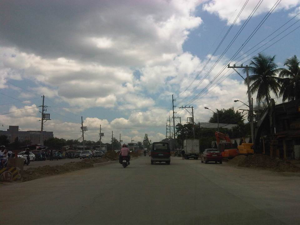 Newly opened southbound lanes – 3 lanes are of PCCP but there are still construction work ongoing including drainage and sidewalk construction.
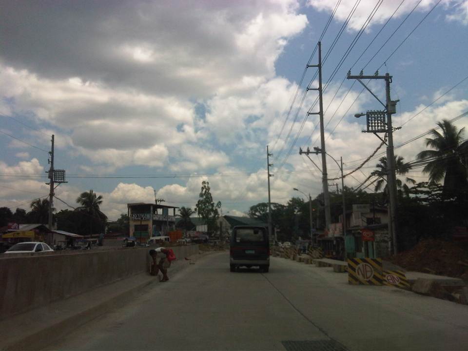 Sidewalk and median barriers are in various stages of construction along the section. I think they built barriers to anticipate problems regarding jaywalking.
 Approach to the intersection with Capitol Hill Drive – one problem that needs to be solved along Tandang Sora is roadside parking. Informal settlers who own vehicles park these along the road. There are also stores, eateries and vehicle repair shops along the section that occupy sidewalks and encourage parking by customers.
Once the section is completed and with the future completion of Luzon Avenue, it is expected that traffic will increase along this section. The improved capacity of the road is also expected to ease traffic along the Capitol Hills Driver-Zuzuaregi Street route, which has become congested due to vehicles traveling between Commonwealth and C-5 whose drivers want to bypass the usually constricted Tandang Sora section.
–
The commute to the airport
Traveling from our home in Antipolo to the airport in Clark, I decided to take the MRT to the Quezon City Air Terminal (QCAT) from where I would be taking the Clark Airport Rail Express (CARE) to the sparkling new terminal at what is a fast growing aerotropolis north of Metro Manila. It was an easy commute from the station near my home and a convenient one considering the e-Pasahe integrated commute card that I could also use for the C5 subway line or the Quezon Avenue BRT. Soon, all the jeepneys and buses would be accepting the card for fares. 100% of taxis were already accepting the card for payments and the electric tricycles were surprisingly ahead with 90% accepting the e-Pasahe card. I made sure my card was topped up when I left the university yesterday so I could also use it to buy a drink or a meal while at the airport. The convenience of the card reminded me of the Suica and Pasmo cards I used while traveling in Japan.
Upon arriving at the QCAT, I proceeded to the check-in counters to drop-off my luggage. I had already checked-in online so I just had to leave my bag at the express lane. I was already excited about the direct trip to New York, on board Cebu Pacific’s newly delivered A380, where I would be meeting up with the wife who’s already there for a conference. Unfortunately, we won’t be on the same flight home as she was taking the PAL’s non-stop Dreamliner service to NAIA.
On-board the CARE train to the airport, I had a quick but good view of Metro Manila as the train emerged from the underground tunnel for its surface run from Bocaue, Bulacan. It was still early in the morning and the sun was just rising. It felt good to see that there was much less smog covering the metropolis. All those electric and hybrid vehicles have made a significant impact on reducing air pollution and improving air quality. I decided to have a power nap for the rest of the trip and awoke minutes later to find out everything was just a dream.
🙂
Happy April Fool’s Day!
Buses speeding along Commonwealth Avenue
Traveling along Commonwealth Avenue last Holy Thursday, we couldn’t help but notice the buses racing against each other along the wide highway. One bus speeding along the motorcycle lane almost hit a motorcycle along that lane. Traffic was free flowing and speed limits obviously were not being enforced or followed. Running at 60 kph, our vehicle was always passed by buses and cars alike, their drivers probably enjoying the wide space and the knowledge that there will be few if any traffic enforcers along Commonwealth. We saw a few underneath the Tandang Sora flyover but they were relaxed and seem to turn a blind eye over speeding violations along the highway. The video below was taken last Thursday and showed three buses speeding along Commonwealth, occupying lanes that they are not supposed to be using (Note: Public transport are supposed to run along the two outermost lanes of the highway marked with yellow lines.)
–
Daily penance: traffic congestion along C-5
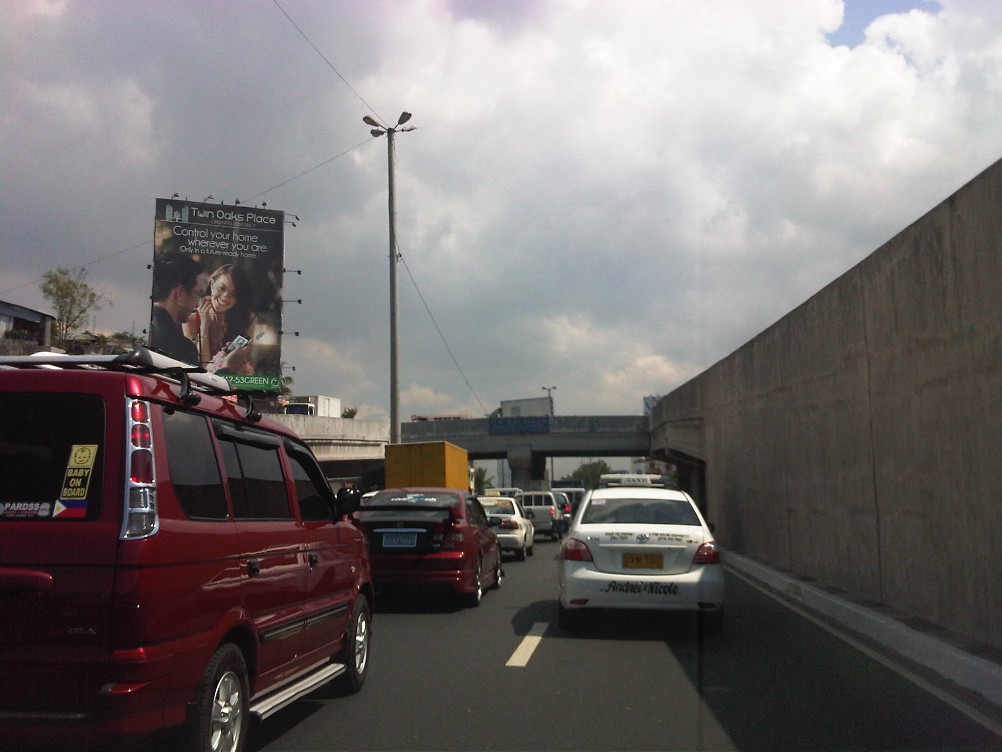
People have been telling me about the traffic congestion along Circumferential Road 5 (C-5) and I am quick to reply that I know the feeling as I’m one of those who have driven or traveled along C-5 and experienced first hand the traffic congestion, which is worst during the mornings (southbound) and late afternoons and evenings (northbound). Midday traffic jams are not uncommon as C-5 is a truck route and large vehicles contribute to clogging especially at bottlenecks like the U-turns slots along the highway and bridge crossing the Pasig River. C-5 has been this way since its opening (or more appropriately the completion of missing links along the main alignment).
It will not get better. It will only get worse. I say so because of the annual increase in vehicle ownership, including motorcycles, in what is now termed as Mega Manila. I dare say so because of the backlog of public transport infrastructure in the metropolis (or megalopolis?). It is well established that efficient public transport infra and services are good incentives for people to commute rather than drive. This means there will be less vehicles on the road and therefore there will be less congestion as basically only those who really need to drive would be using their cars on a regular basis. Of course, it is not as easy at it seems considering trip making and mode choices are in reality complicated matters. But then the availability of viable, acceptable choices for travel, especially in the urban setting allows for people to have better mobility and more equitable use of the transport system than a car-oriented city. Until then, when we do have the public transport system that our cities require, it will be a daily penitensya for many of us traveling and not just along C-5.
 Congestion along the southbound side of C-5 approaching the flyover crossing Ortigas Ave. The flyover can be seen in the horizon.
 Congestion along C-5 southbound in the Bo. Ugong area approaching the junction with Lanuza Avenue. An overpass was proposed for construction along this section but now it doesn’t look like it will do any good considering the bottleneck is the Pasig Flyover and the bridge across Pasig River.
 Congestion along C-5 southbound at the Pasig flyover. The flyover has 2 lanes per direction and vehicle breakdowns or road crashes have resulted in terrible traffic jams.
 Congestion along C-5 northbound at the C-5/Kalayaan junction. The north U-turn flyover, one of two in the area, is shown in the photo. An underpass was initially proposed, designed and approved (with budget from a JBIC loan) at the junction. A previous MMDA Chair, however, didn’t agree and successfully maneuvered for the twin U-turn flyovers to be constructed instead.
–
