
Home » 2013 (Page 12)
Yearly Archives: 2013
The rains and traffic
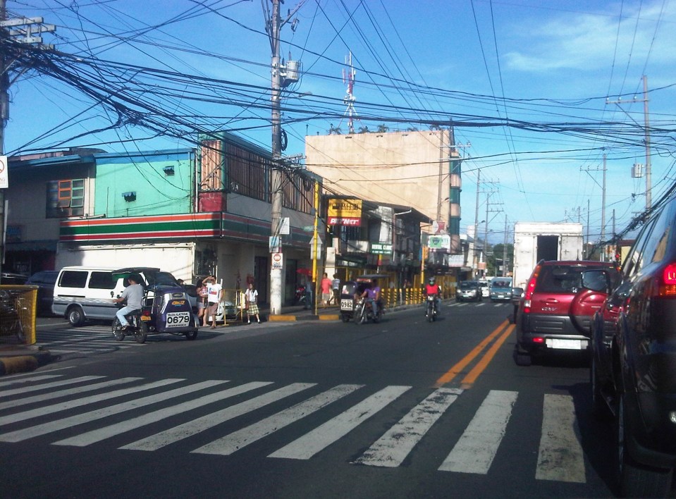
Last Friday, the midday downpours resulted in flash floods around Metro Manila. The rains were not really a surprise given that PAGASA and other weather reports already stated the high probability of rain that day. It was the volume of rains that day in most parts of Metro Manila and the surrounding areas that caught a lot of people unprepared as many areas including streets experienced flash floods. Most cases were due to drainage systems unable to take in the rainwater because many were ill-designed or were clogged by debris (e.g., garbage, leaves, soil/dirt, etc.). The rains caused or worsened traffic congestion along many roads including C-5, Quezon Ave., and other flood prone streets in the metropolis. It was reported that some areas had zero visibility and so a lot of motorists were forced to slow down in order to avoid being involved in a road crash. It is good practice for all to turn on their headlights or hazard lights during times of heavy rains. If a driver has difficulty driving under such conditions, it is recommended that the driver pull off from the road and wait until the rains have weakened for safer driving.
 Atop the C-5 flyover from the Blue Ridge area and moving towards Eastwood, we couldn’t help but quip about the overpass being transformed into an elevated waterway (aqueduct?) as the drainage couldn’t handle the amount of water pouring in from the skies.
 Caught this scene of a boat on a trailer apparently en route for delivery. I thought is was at the same time humorous and ironic as rain was pouring around us and some parts of C-5 was already flooded. Perhaps we’ll need these boats to go around Metro Manila in the future during the wet seasons when heavy rains cause deluges in many areas. My colleague noted that the trailer didn’t have a license plate (Note: Trailers are required to have their own registration with the LTO.) and so wasn’t supposed to be on the road.
–
Rizal Avenue – Part 1: Carriedo – Bambang
Rizal Avenue stretches from Manila northward to Caloocan city from Carriedo to Monumento. What used to be one of the more cosmopolitan streets in Manila was transformed (some say blighted) by the construction of the elevated LRT Line in the early 1980’s. Carriedo, for example, used to be a popular shopping street along with Escolta. Those were times when there were none of the huge shopping malls now scattered in Metro Manila and people came to Manila to shop.
The following photos were taken while we traversed Rizal Avenue as part of a recon we were conducting for a project with the Department of Transportation and Communications (DOTC) back in 2011. I’m not sure if there have been any significant changes along Rizal Avenue and I am not aware of any recent programs to improve conditions under the LRT Line 1.
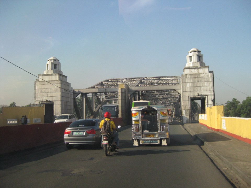
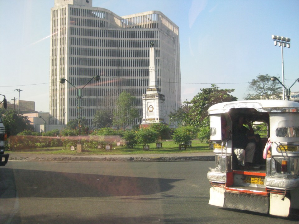
 Approaching the LRT Line 1 Carriedo Station from the McArthur Bridge
 Under Carriedo Station, one experiences first-hand what people have been saying about the area being blighted by the LRT 1 structure
 Poorly lighted? It was broad daylight outdoors when we conducted the recon but underneath an LRT 1 Station it can get quite dark. Of course, aside from the need to improve illumination, perhaps authorities can also improve the environment including the cleanliness of the area under the station. A common complaint is garbage and there are those saying the area smells of piss (i.e., mapanghi).
 Past Carriedo Station, it was brighter and perhaps the area can be developed so that stretches can be pedestrian friendly. Maybe there should also be restrictions on vehicle parking, which tends to make the area look congested. It would be good to have a strategically located multilevel facility in the area where most vehicles can park instead of along the streets as shown in the photo.
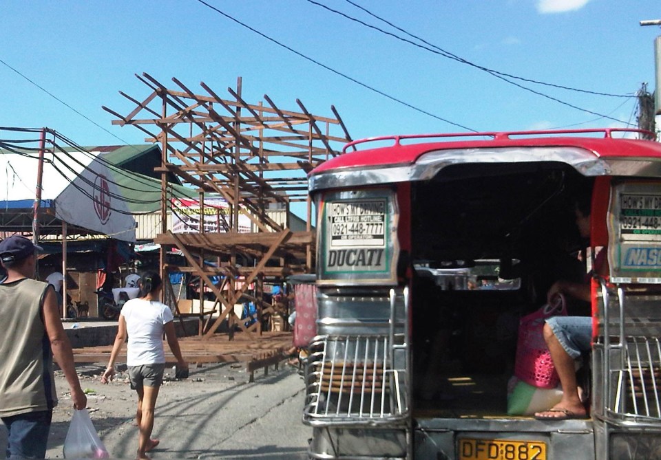
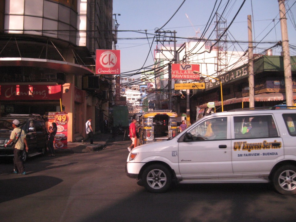
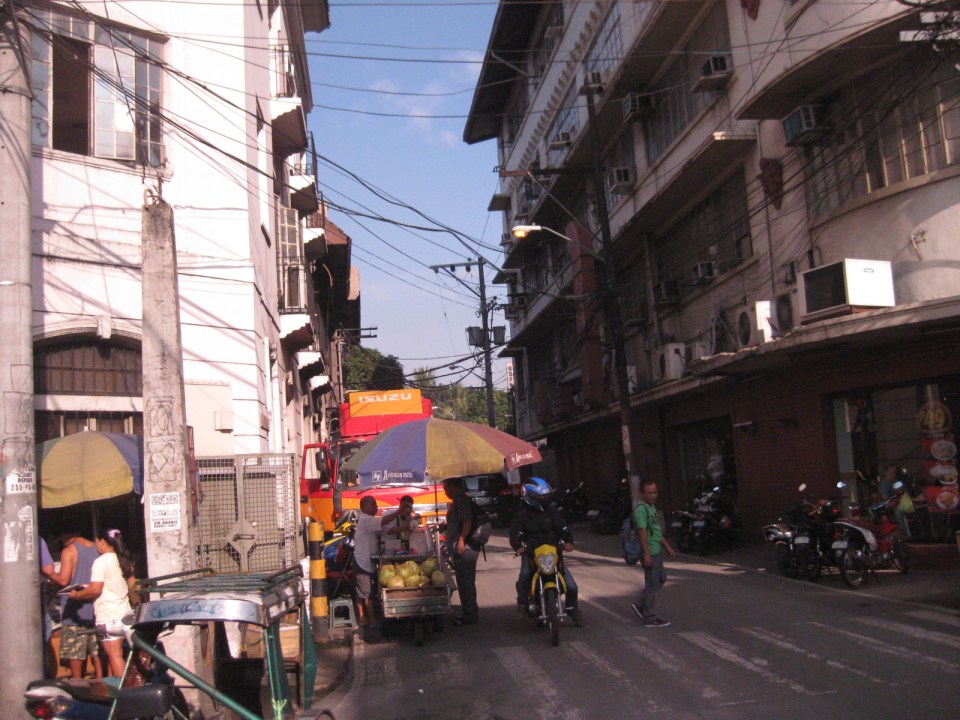
 5More roadside parking plus the presence of tricycles contribute to traffic congestion in the area. People are everywhere walking and crossing anywhere. The arcades where they are supposed to walk along are mainly occupied by vendors or merchandise of stores/shops occupying the ground floors of the buildings along the street.
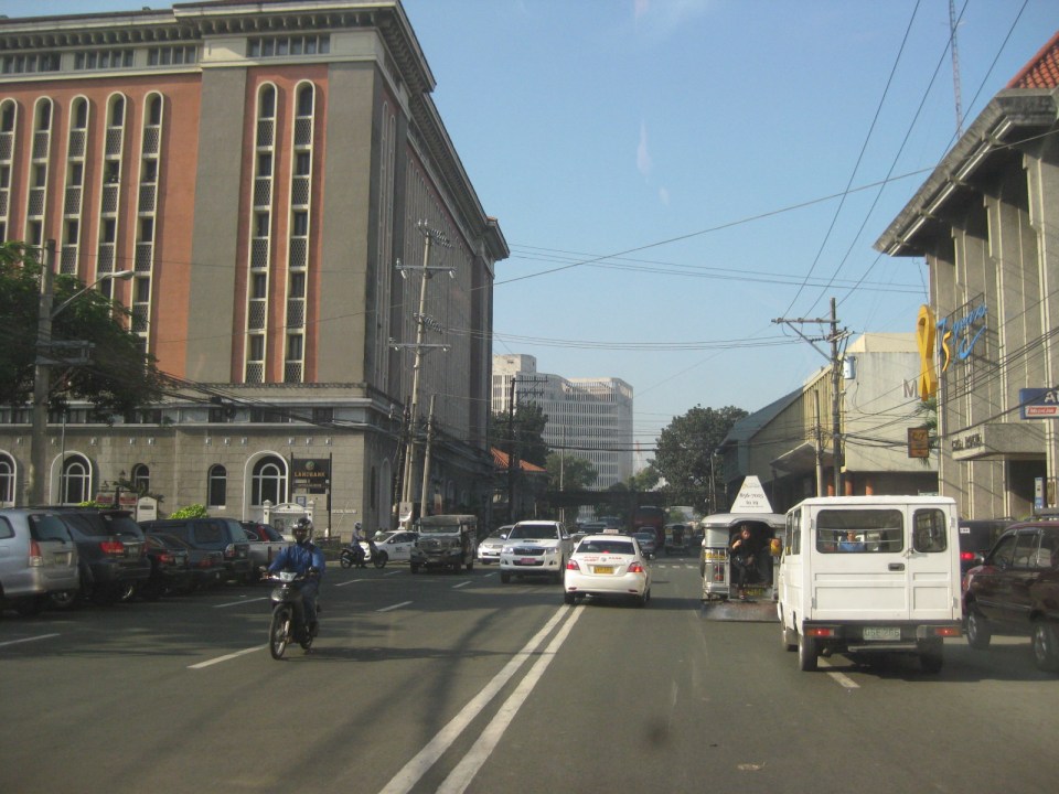
 Each side of Rizal Avenue is surprisingly wide with 3 lanes per direction. One lane is effectively used for on-street parking while the other two are for general traffic. There are no lane markings at the time we passed by the area so there can be confusion as to lane assignments.
 Approach to the junction with Recto Ave. and the LRT Line 2, which is also elevated and at the 3rd level as shown in the photo.
 Rizal Ave.-Recto Ave. intersection – visible downstream in the photo is Doroteo Jose Station
 Provincial bus terminal between Doroteo Jose and Bambang Stations
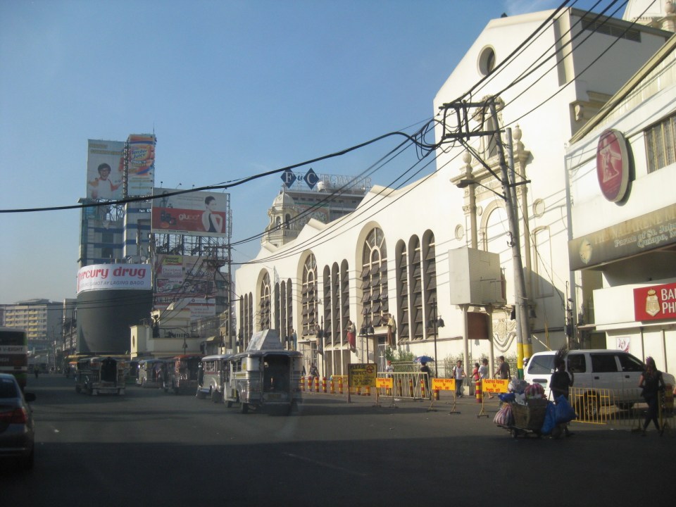
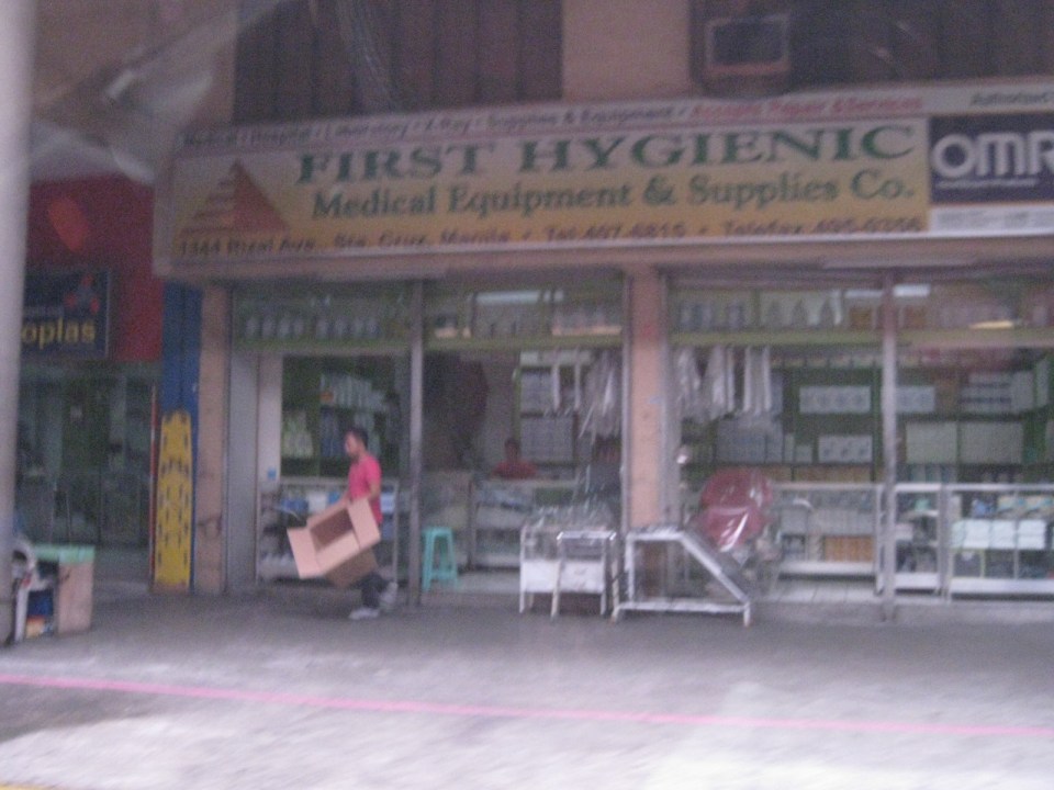 The Sta. Cruz district and particularly the Bambang area is well-known for shops selling medical equipment and supplies. Medical, nursing and other students of allied medical professions as well as professionals come to Bambang to purchase equipment and supplies from these shops, which offer items at lower prices.
 LRT 1 Bambang Station
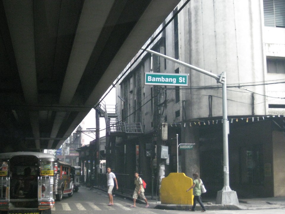 Rizal Ave.-Bambang St. intersection beneath the station
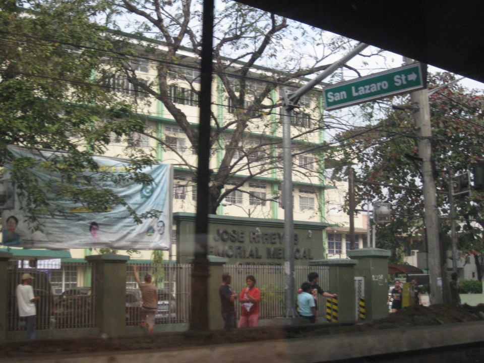 Two large government hospitals are located in the area between Bambang Station and Tayuman Station – San Lazaro Hospital and Jose Reyes Memorial Medical Center. Both are run by the Department of Health (DOH), which is located beside Jose Reyes.
–
Informal transport at PNR Bicutan Station
On our way to a meeting at the Department of Science and Technology (DOST) in Bicutan, Taguig City, we crossed the PNR line running parallel to the SLEX. I quickly took a photo of the scene to the right of our vehicle that showed an informal market and terminal. The informal market or talipapa is one you would usually finally elsewhere in many other places in the city and likely caters to mostly informal settlers residing along the PNR ROW. On our return trip from the DOST, we took the same route and again I quickly took a photo of what was on the other side of the road along the same PNR line. On the other side was the PNR Bicutan Station and what appears to be a clear ROW northbound towards Manila. Much has been accomplished in the clearing of the PNR’s ROW over the past years and the efforts included the relocation of many informal settlers in coordination with the local governments along the PNR line.
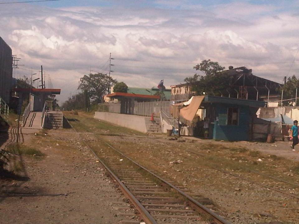 The PNR Bicutan Station on the north side of Gen. Santos Ave. near the SLEX Bicutan interchange
 Non-motorized trolleys on the south side of Gen. Santos Ave. near the SLEX Bicutan Exit
The trolleys are informal transport vehicles serve people living along the PNR ROW including many informal settlements within and without the PNR property. Some of the buildings or structures of these informal settlers are visible in the photo downstream of the railroad crossing. There are similar cases in Manila and elsewhere along the PNR ROW including motorized trolley services in the provinces of Quezon and Camarines Sur, where trolleys are also utilized for public transport and are the means for livelihood by some of the same informal settlers.
There are increasing safety concerns for these vehicles, their operators and their passengers. The trolleys are lifted from the tracks an people clear the way once a train approaches. They return after the train has passed. With the PNR currently experiencing a revival of sorts, and if resources continue along with an increase in ridership, train frequencies should also be expected to increase. As such, there should come a time when trolleys would have to be banned along the entire line in order to minimize the chances for crashes involving trains and trolleys that will surely lead to fatal consequences. Perhaps the local governments along the PNR line should already look into this eventuality and initiate programs to address this issue, which can be associated with livelihood and residential concerns.
–
The Economic Case for Rail Subsidies
Today, I’m sharing a nice article on rail subsidies from The Atlantic Cities:
The benefits of local airline competition in the Philippines
With the announcement of Cebu Pacific (CEB) that it is applying for flights to Australia (Sydney and Melbourne) and Russia (Moscow), a new challenge has been posed by the Philippines’ leading airline to its competitors. This challenge is but a continuation of one they have been issuing to Philippine Airlines (PAL), which used to be the country’s only flag carrier, since the Gokongwei airline started operations in the late 1990’s. Earlier, CEB have announced flights to Dubai starting in the fourth quarter of 2013 as well as international flights connecting Iloilo and Bacolod to Hong Kong and Singapore. The general perception is that such aggressiveness has benefitted travelers though CEB is classified as a budget airline to PAL’s full service status.
While CEB has been carrying the most passengers among local airlines, its network of destinations abroad is still quite limited to mostly regional flights (e.g., Singapore, Hong Kong, Bangkok, etc.) but with higher frequencies than PAL. CEB still has no long haul flights. Meanwhile, PAL has been flying regularly to the United States (Los Angeles, San Francisco, Honolulu, Las Vegas), Canada (Vancouver), and Australia (Sydney and Melbourne) while recently opening service to India (Delhi). The airline used to have flights to Europe and the Middle East but these have been scaled down (read: currently no flights) due to increasing costs and losses. But with CEB’s announcement of Dubai flights, PAL countered with the announcement that it will be flying direct to Doha, Qatar also by the fourth quarter of this year. PAL has been enjoying a resurgence of sorts after a majority stake was acquired by San Miguel Corporation (SMC), which has diversified from its main business of beverages.
 Revving-up! – Cebu Pacific has made orders for more aircraft including its first wide-bodied jets for long haul flights.
 Playing catch-up? – PAL is now being run by San Miguel and has also made orders for additional aircraft as it plans more flights to the US and reviving its European routes.
PAL actually wanted to have more flights to the US including expanding to new destinations like Chicago and New York, where there are sizable Filipino communities, but it is currently restricted by the Philippines being degraded to Category 2 status by the US Federal Aviation Administration (FAA). Now, with the recent favorable assessment by the ICAO, it is expected that other countries outside the US will lift the current restrictions on Philippine carriers. Also, it is expected that the FAA will soon follow with its own evaluation and that a favorable result then will lead to more flights to more US destinations. With CEB also stating its interest to have US flights, it would come as no surprise that fares might just become more competitive for direct flights to the US. Maybe the next step is for either or both airlines to join one of the airline alliances, One World, Asia Miles or Star Alliance, to add their benefits to those already enjoyed by travelers in what has been a healthy competition favorable to both local and foreign travelers.
–
Highway 2000 and Barkadahan Bridge
There is an alternate route from the towns of Rizal Province to Taguig and Makati. The route will allow people to avoid the congested Ortigas Avenue, C-5 and EDSA, which is the typical route between the Makati CBD and Bonifacio Global City and the Rizal Province towns along Ortigas Avenue Extension and the Manila East Road including Cainta, Taytay, Antipolo, Angono and Binangonan. The alternate route utilizes a road that was constructed as part of a network of roads intended to encourage development in idle lands in Taytay that came out of the reclamation that was part of the Manggahan Floodway project.
 One-way section beside the Taytay Public Market
 Parts of the market were under renovation
 Past the market, Highway 2000 becomes a 2-way road. There are no lane markings and the pavement shown in the photo indicates a poorly maintained road.
 Along the road are subdivisions, a few commercial establishments, a columbarium under construction, informal settlers and much open space.
 Junction with the Manggahan East Bank Road and approach to the Barkadahan Bridge
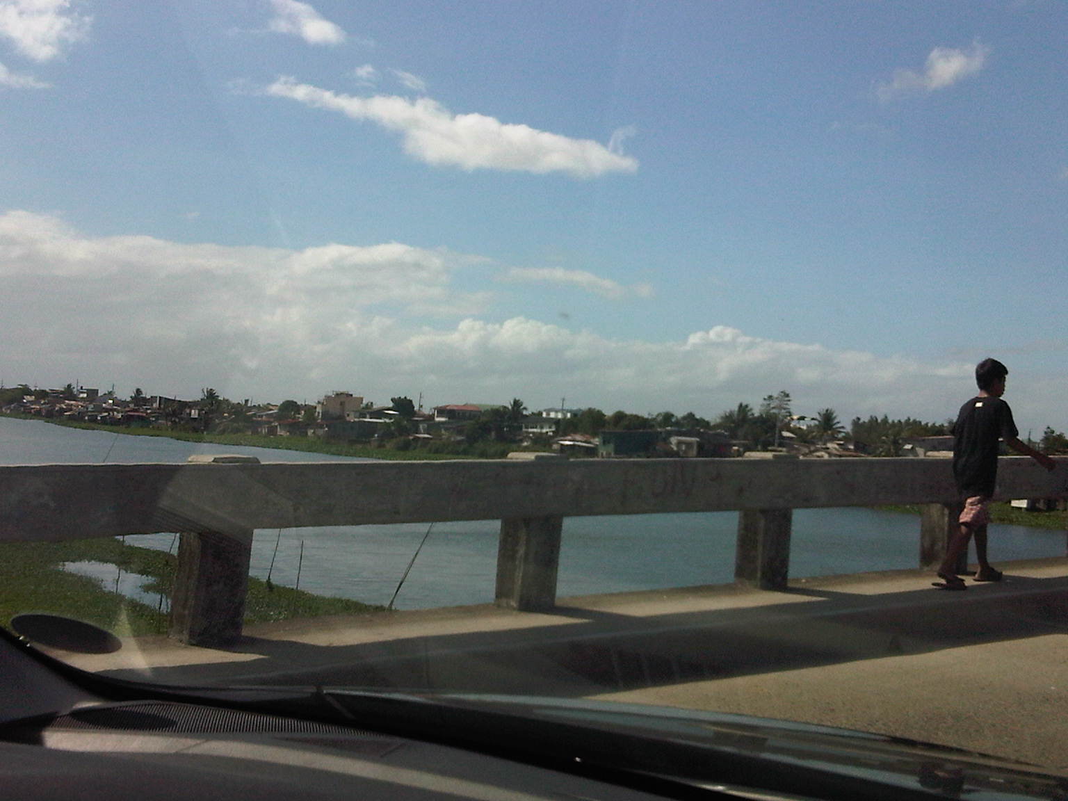
 Crossing the East Bank Road to the 2-lane Barkadahan Bridge, you can immediately notice the narrow sidewalks along each side of the bridge. I think they should have designed this to be wider considering the significant number of people crossing the bridge on foot.
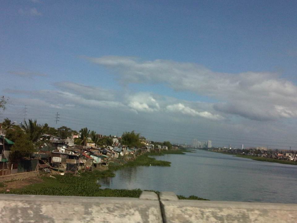
 One can have a good view of the southernmost end of the Manggahan Floodway from the bridge.
 The view shows a lot of informal settlers along both the west and east banks of the floodway and a lot of water lily and kangkong on the waters, which lead to the Laguna de Bay.
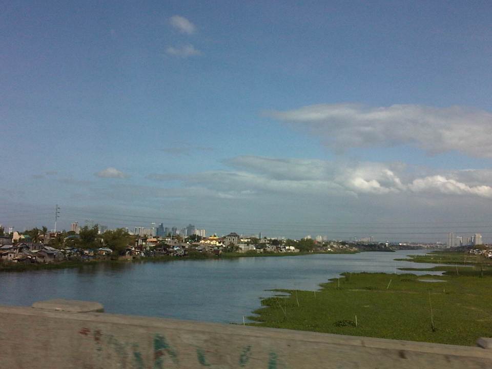
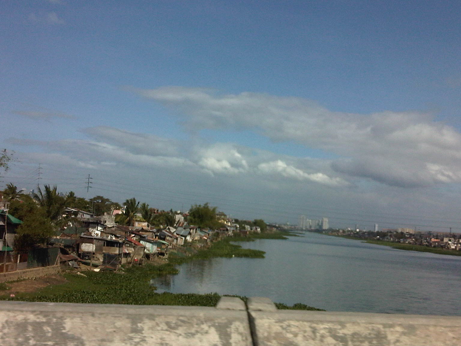
 Shanties along the west bank of the floodway. The tall buildings in the horizon and downstream from the bridge are located in Quezon City’s Eastwood along Circumferential Road 5. Behind Eastwood is the Marikina River, which connects to the Manggahan Floodway via the Rosario Weir.
 The other end of the Barkadahan Bridge is a junction with the Manggahan West Bank Road and a generally residential area that is still part of Taytay, Rizal.
The same route can also be used by those residing in Pasig and Marikina cities to the east of the Manggahan Floodway as there is a direct connection to Highway 2000 and the Barkadahan Bridge via the East Bank Road of the Floodway.
–
A. Bonifacio Avenue in Marikina
The main road leading to Marikina City from Quezon City is one that branches from Aurora Boulevard. A. Bonifacio Avenue is one of two roads diverging from Aurora, the other one being Marcos Highway. The avenue eventually becomes Sumulong Highway at its junction with Angel Tuazon Ave. (Gil Fernando Ave.) at the Blue Wave mall.
 View from the overpass from Aurora Blvd to A. Bonifacio Ave. – in the horizon are the Sierra Madre mountains and closer to the flyover is of course a view of the Marikina Valley.
 A. Bonifacio is a 4-lane, 2-way undivided road
 Section at the exit from Riverbanks
A. Bonifacio Ave. is the main access road to Loyola Memorial Park and so it gets quite congested during the Undas period (All Saints and All Souls Days). The road and adjacent land is flood prone and along the road is the main gate to Provident Village, which was one of the most devastated private subdivisions during Typhoon Ondoy (Ketsana) in 2009 and the heavy rains of Habagat (southwest monsoon) in 2012.
–
Air quality and road safety concerns for public transport
While traveling home one late afternoon, I couldn’t help but take a quick photo of a jeepney in front of me that was belching smoke while also carrying several people as sabit (hangers). Though a bit blurry, the photo still shows clearly the cloud of smoke coming out of jeepney’s tailpipe and the three people hanging behind the vehicle. Not obvious from the photo are the speed and lateral motion of the jeepney as it traversed this section of Marcos Highway.
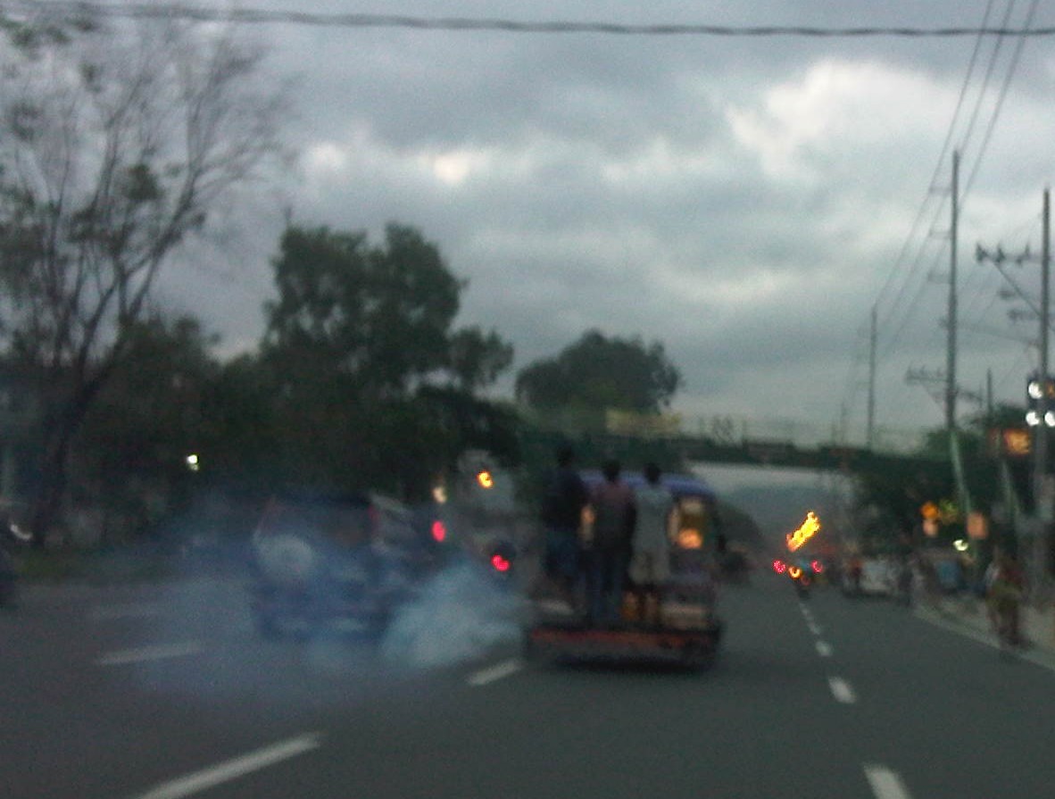
This is a scene we see everyday in our streets despite initiatives or efforts to address problems pertaining to vehicle emissions and safety. The Clean Air Act while enacted more than a decade ago has not been effectively implemented for vehicles. A lot of vehicles are able to register or renew their registrations without really going through a proper emissions test (or smog test for those in the US). “Non-appearance,” the term used for people going through the motions of a test but skipping the measurement itself while getting print-outs stating the vehicle “passed” the test is prevalent throughout the country.
The Land Transportation Office (LTO) has experimented with a lot of schemes to address the problem. These includes the requirement of a photograph showing the actual performance of the emission test on the vehicle. More recent was an initiative where RFID units were supposed to be installed/attached to vehicles and these would be used to ensure that emission tests really were conducted prior to registration. However, with very few Motor Vehicle Inspection Stations (MVIS), the LTO has no choice but to delegate emission testing to private emission testing centers (PETCs). The long standing suspicion, however, is that most of these PETCs collude with vehicle owners and fixers within the LTO to maintain a status quo in “non-appearances” and non-compliance with emission regulations.
Local governments have pitched in with their mobile anti-smoke belching units (ASBUs). In Metro Manila, many cities including Quezon City, Pasig City and Makati City have multiple ASBUs allowing them to set-up several stations along roads in their jurisdictions. These are usually seen along busy roads with policemen assisting them in flagging down vehicles (mostly trucks) observed to be smokebelchers. These vehicles are tested and penalties are imposed on emission regulations violators. The equipment of these ASBUs, however, are only for diesel engines and so are operations of these mobile units are limited in scope from the start. There have also been allegations that some ASBUs have been taking advantage of erring drivers resulting in bribery so as not to be issued violation tickets and penalties.
The bottom line for most cases of emission violations is that most violators are not properly educated about emission regulations including the requirement for them to pass emission tests at any time and not during the registration process only. This is a fact that most drivers or vehicle owners do not understand or choose not to understand, usually because of maintenance cost implications. Nevertheless, we will continue to be in the losing end of the war against air pollution if we cannot properly enforce provisions of the Clean Air Act, particularly for mobile sources that contribute most of the air pollution we experience in this country.
–
Quiapo, Manila
The Quiapo district of Manila is one of the oldest CBDs in the metropolis and is a major end point for public transport similar to Cubao and Divisoria. Quiapo is best known for its church, which is dedicated to the Black Nazarene, and one of the most visited by pilgrims in the Philippines along with Baclaran (Our Lady of Perpetual Help) and Antipolo (Our Lady of Peace and Good Voyage). Fridays are usually the most congested days in the area as it is the day designated for services for the Black Nazarene (Note: Wednesdays are for Baclaran.).
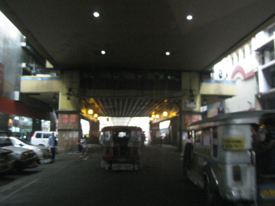
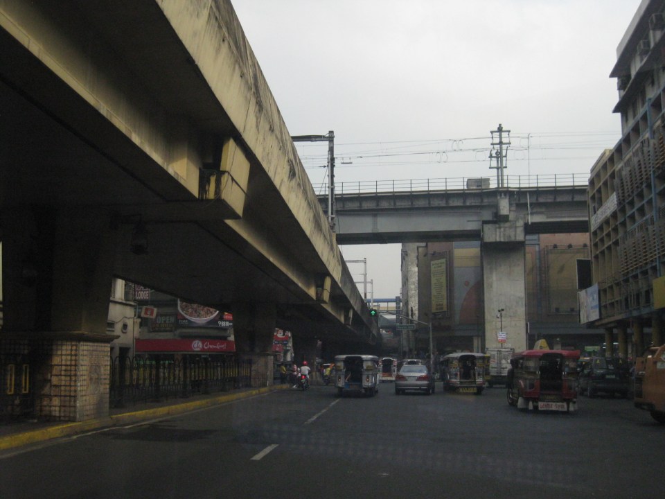
 Underpass along Quezon Boulevard – the Far Eastern University is at the left while the bridge downstream is the elevated LRT Line 2 that is directly above Claro M. Recto Avenue. At right are commercial and residential buildings surrounding the Manila City Jail. The building at the right behind the LRT 2 is the Isetann mall.
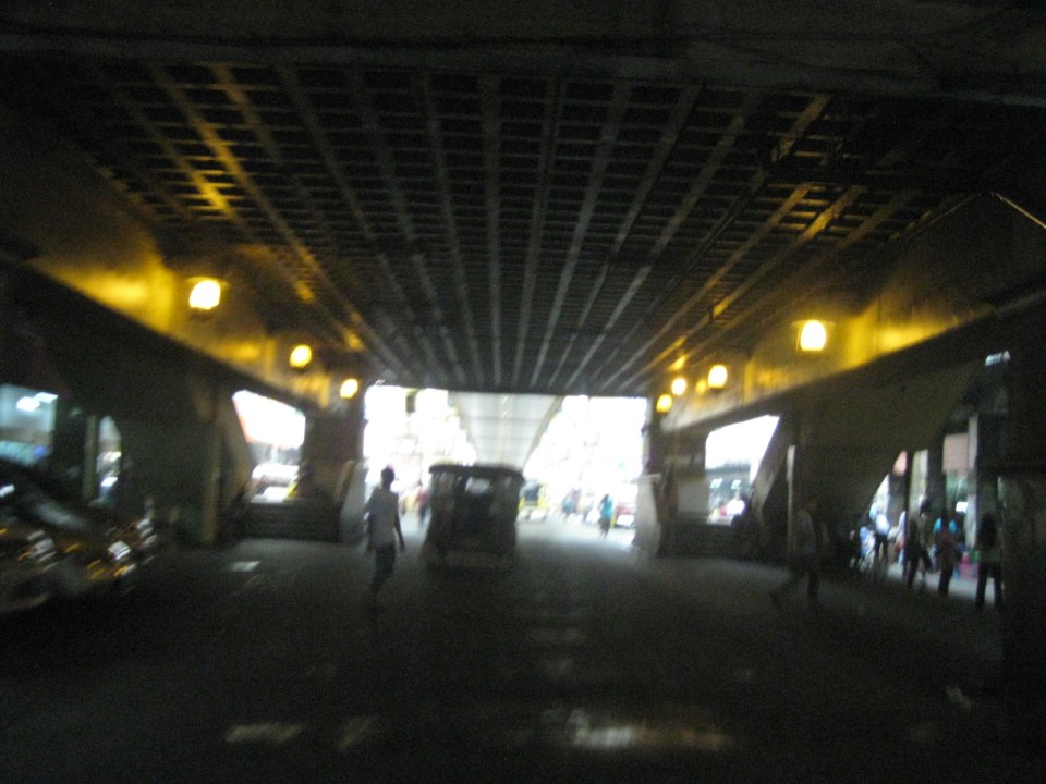
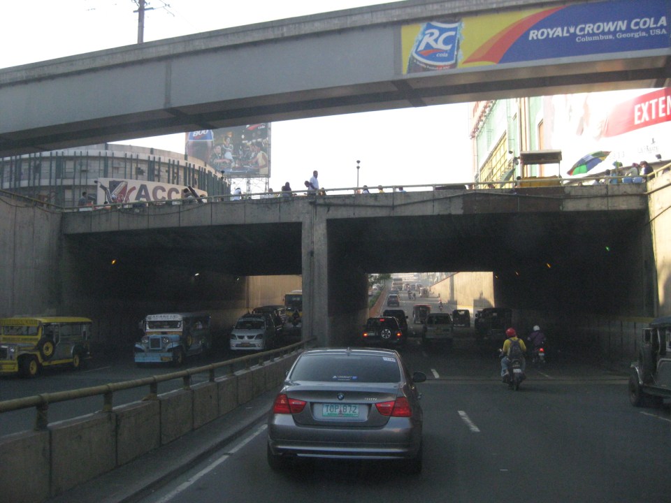 Grade separation – the Quezon Blvd. underpass running beneath LRT Line 2 and Claro M. Recto Ave. has 3 lanes per direction.
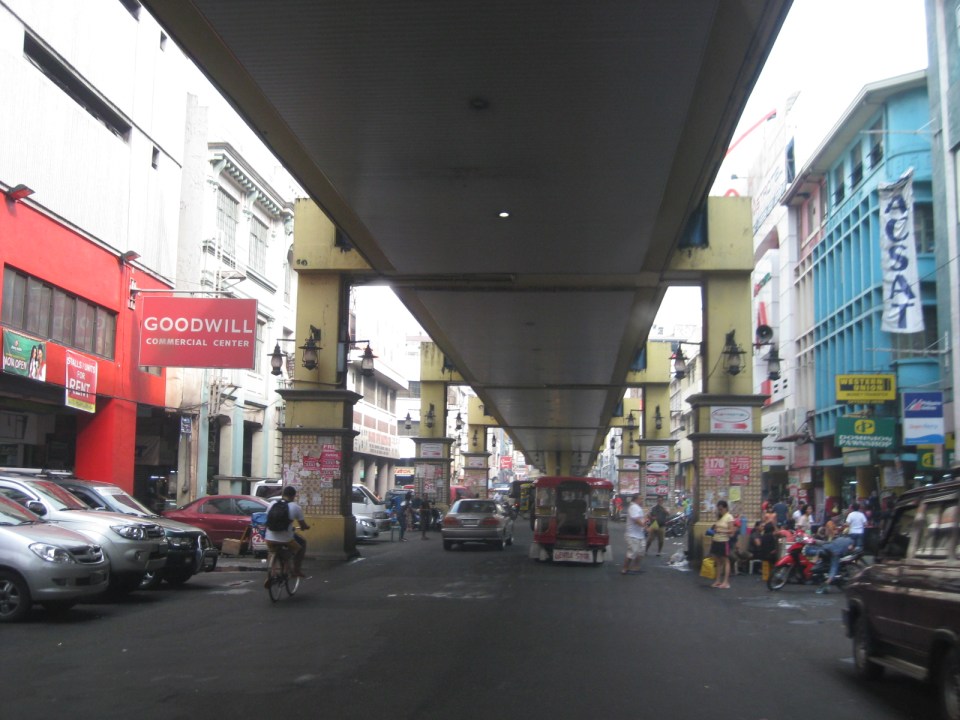
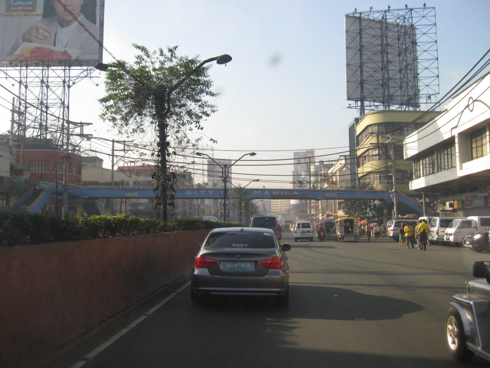 The Intramuros-bound direction of Quezon Blvd. has five (5) lanes but these are confused due to the lack of lane markings. Effectively, there are only 4 lanes due to road-side parking and pedestrian activity. While many old buildings are designed in the arcade style where pedestrians are supposed to have right-of-way, these are usually occupied by merchandize, signs and other obstacles to pedestrian flow. As such, pedestrians walk along the carriageway as seen in the photo.
 One of the side streets in Quiapo is Raon, popular for electronics and camera shops. People came and continue to come here for good deals on music players, karaoke machines, speakers, digital cameras and other electronic goods. However, one has to be attentive or alert as there are supposedly many snatchers and pickpockets in the area.
 The Quiapo Church is a shrine dedicated to the Black Nazarene. The Feast Day every January attracts hundreds of thousands of people in a procession that now starts from the Quirino Grandstand in Rizal Park and ends at the church.
 The giant screen usually shows ads by the sponsor, a major drugstore chain, and popular television shows. The screen is quite bright at night and you can see many people gathering around for when it features primetime TV shows.
 Plaza Miranda in front of Quiapo Church has been the site of many events including the infamous bombing of a political gathering in 1972 that led to the imposition of Martial Law in September of that year. Common around the plaza are vendors peddling herbal medicines, religious items, and even religious services like praying for the client in exchange for a small fee. There are also fortune tellers and other characters.
 Past the Quiapo church is the ramp towards the Quezon Bridge. Underneath and faintly visible in the photo is an underpass along which is Carlos Palanca Street that leads to Rizal Avenue in the northwest and P. Casal in the southeast. There are many shops along this road where the Quinta Market is also located at the corner of Quezon Blvd. and Palanca Street. Among these shops are those selling handicrafts and the notorious ones selling bootleg DVD movies.
 Approach to Quezon Bridge, one of the oldest bridges in Manila spanning the Pasig River. It’s steel truss design has been an example used in many civil engineering and architecture classes.
 A closer look at Quezon Bridge.
–
Streets of Intramuros: Calle Real del Palacio
I haven’t had a good chance to take photos of the streets in Intramuros, Manila. The historic streets within what was for hundreds of years regarded as Manila deserves a more detailed treatment. Recently, I have been able to go around a little bit thanks to meetings at the DPWH and a lecture at the Mapua Institute of Technology. I took full advantage of the opportunity to take photos along some streets along the way to my meetings and am posting these in a few articles about what I think should be a good example for heritage conservation including the street names and old structures within the walled city.
The original name of Andres Soriano Jr. Avenue, the main road stretching from Plaza Mexico along the Pasig River to A. Bonifacio Drive in the Port Area, was Calle Real del Palacio. I believe they should have stuck with the original name in order to preserve this piece of history. Our politicians have a penchant for renaming streets after their kin, heroes, or for purposes like claiming that we should exorcise names associated with our colonial past. While the latter seems to be a basis for changing names elsewhere (not just in the Philippines), perhaps the remedy here is to still retain the original name under the new one.
 Ruins of the aduana or customs building, visible upon turning from the Muelle Del Rio at Plaza Mexico towards Andres Soriano Jr. Ave.
 The road is a four lane, two-way street. It is usually congested because of public transport loading and unloading operations (usually in the middle of the street) and roadside parking, which is tolerated. In fact, there are parking aides in charge of collecting fees from drivers parking along the streets. Intramuros is host to a lot of offices, commercial establishments and schools – all major traffic generators that attract so many vehicles thereby requiring a lot of parking space. The building to the left is the reconstructed building where the old ayuntamiento used to stand.
 The new building where the ayuntamiento was is now supposed to be the new offices of the Bureau of Treasury.
 The open space at left is the along which are many parked cars is the Plaza Roma, which is in front of the Manila Cathedral. The building right after the plaza is where the Palacio del Gobernador used to be. It is now the offices of the Bureau of Treasury.
 Cabildo Street, one of the side streets from across the Plaza Roma, which ultimately leads to Fort Santiago.
 6Another look at the building where the old Governor’s Palace used to be. Visible downstream along the Soriano Ave. is the gate leading to the Simeon de Anda monument located at a roundabout along A. Bonifacio Drive.
 At right is Gen. Antonio Luna Street, which is another main road that has one end at Puerto Real, the southernmost gate of the Intramuros and the other at Fort Santiago. Curiously, this road was also called Calle Real del Palacio as it passed in front of the Palacio del Gobernador.
 A view along Gen. Antonio Luna Street towards Fort Santiago, which is a one-way street.
 Western entrance to Intramuros along Soriano Ave. leads to Bonifacio Drive and the Port Area.
 Arzobispo Street, which also leads to Fort Santiago but also passes along the Archbishop’s Palace, the office of the Archdiocese of Manila and with its southernmost end at San Agustin Church.
 The Simeon de Anda monument at the Anda Circle along Bonifacio Drive.
–
