
Home » 2014 (Page 9)
Yearly Archives: 2014
Daang Bakal and Antipolo’s attractions
I recently wrote about the old railway line that used to run between Manila and Antipolo via a route passing through the town of Cainta that used what was probably the gentlest slope at the time – through what is now Valley Golf, Victoria Valley and Fairmont Subdivisions. Here are some more photos along Daang Bakal, the old Manila Rail Road line that is now a road.
 Daang Bakal is a scenic route and one can only imagine how this place looked like when it was still a railway line and the areas along it were still undeveloped.
 Hinulugang Taktak has been designated as a National Park and the areas along Daang Bakal at least have been preserved. Users of this road are quite limited to residents of exclusive subdivisions with gates along the road and trips generated by the Immaculate Heart Parish near the Fairmont gate. Public transportation is provided by tricycles that have a terminal at the intersection of Daang Bakal and Taktak Road.
 The temporary fence that was made out of tarpaulin material is now in tatters. There is road construction work ongoing though but mainly for the access roads connecting to Pinagmisahan. The concreted area at the right side of the road in the photo seems to be for parking rather than road widening. Traffic is low along Daang Bakal and will probably not require road widening for the foreseeable future.
 The main entrance and facilities for Hinulugang Taktak are still closed and there seems to be no activity to indicate that the rehabilitation project is not moving at all.
–
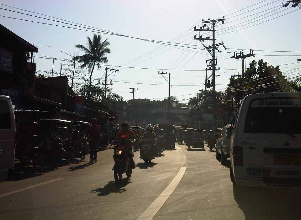
Traffic mayhem in Antipolo
I had written earlier about traffic management in Antipolo City. My daily commute allows me to observe transport and traffic in this pilgrimage city east of Metro Manila. For a highly urbanised city (HUC), its traffic management is quite rural or provincial at best with enforcers trying to do their thing based more on gut feel rather than sound knowledge of traffic principles. Intersection traffic management, for example, needs a lot of improvement as enforcers are pre-disposed to apply the buhos approach to dissipating queues that actually lead to longer queues, tremendous delays to travellers, and therefore low levels of service (LOS) at the intersections. The signalised Masinag Junction is probably one of the worst intersections outside of Metro Manila with queues along the south approach (Sumulong Highway from Antipolo) stretching to Mambugan (about 2 km) even on a Saturday. Along the east approach (Marcos Highway from Cogeo) the queues can stretch all the way to Cherry Foodarama supermarket (about 1 km).
Masinag, of course, is a big intersection with heavy traffic due its being the junction for 2 major highways (Marcos and Sumulong) that collect much of traffic from Rizal and Marikina bound for the general direction of Quezon City and Manila. Marcos Highway is the main alternative corridor to Ortigas Avenue, which is itself a very congested road, between the eastern towns and Metro Manila. There are many other problematic intersections in the city, which are mostly unsignalized where traffic is managed manually by enforcers. I’m sure there are some minor intersections that are manageable at most times of the day and may not actually require enforcers if motorists give way to each other. However, there are those intersections that require stricter and more systematic (if not scientific) methods to manage traffic. For example, along roads leading to the Antipolo cathedral where there are a lot of people posing as parking attendants going over to aggressively engage motorists at the intersection. Enforcers routinely turn a blind eye to these people who pose as safety risks along the roads.
 Tricycles occupying the outermost lane along Ortigas Ave. Ext. and Oliveros Street at the junction with Sumulong Memorial Circle and just across from the Rizal Provincial Capitol – to exacerbate the situation, jeepneys and UV Express vehicles usually stop in the middle of the road to load/unload passengers. Such informal terminals should not be allowed in these areas considering it is a chokepoint for traffic along these busy roads. So far, enforcers around the capitol seem oblivious to the mayhem caused by these terminals and turn a blind eye to the disruptive manoeuvres of tricycles in the area.
 Dangerous intersection along Sumulong Highway – there is road at the right (where a tricycle is coming from) that is used by trucks and other vehicles coming from Marcos Highway. Olalia Road connects to Marcos Highway and there are many residential subdivisions along this road that generate the traffic to and from Marcos and Sumulong Highways.
More on Antipolo traffic soon!
–
On road safety and courtesy
I spotted what apparently was a father and daughter riding tandem on a foldable bicycle along Katipunan and heading to the University of the Philippines campus in Diliman. Both were dressed quite appropriately for the weather and for cycling. It was good to see that they both at least have their helmets on; though ideally it would have been better if they wore elbow and knee pads and “reflective” clothing for them to be easily seen on the road.
 Waiting for a chance to cross – the cyclist was waiting for a chance to cross Katipunan towards the University of the Philippines’ Magsaysay gate. True to form, motorists along Katipunan’s southbound directions do not slow down to allow for others to make a left turn to UP. Motorists bound for the university have to inch their way and create gaps for themselves to cross. Often, one has to rely on the Katipunan jeepneys whose drivers are braver than others in forcing their way to be able to cross the road. The father and daughter tandem were able to cross safely, taking advantage of a screen of motor vehicles (including ours) that made a left turn to enter UP.
I have observed that jeepney and truck drivers are more likely to stop and give way than private car drivers and motorcyclists. Motorists generally don’t give way to others even in heavy traffic, often blocking intersections just because the green light is still on for them. Many do not give way to pedestrians and do not know how to share road space with cyclists. Worse are motorcyclists who use sidewalks and bully pedestrians to give way to them! Meanwhile, you have pedestrians who throw all caution to the wind to cross anywhere and anytime along roads like Commonwealth, commuters occupying the carriageway as they wait for their rides, and cyclists hogging the middle of the road when there are actually lanes designated for them. These are manifestations of how poorly people are trained for road use and often an indictment of a failed licensing system as well as traffic education in general.
 Pedalling along – after successfully crossing Katipunan, the father and daughter tandem finally enters the more friendly roads of the UP campus. UP Diliman already has bicycle lanes along its academic oval and the community is generally aware of the rights of pedestrians and cyclists as road users. I would like to think that people who have a connection with the University and those who are also advocates of walking, cycling and road safety respect each other’s rights. But as always there will be those irresponsible people (e.g., pasaway, barumbado, etc.) who will disregard traffic rules and put lives in danger with their behaviour on the road.
In many cases these days, we just need a little common sense and perhaps more of courtesy to make travel safer and better for everyone. Everybody needs to learn and practice respect for each other’s rights on the road and courtesy extends to everyone so we can have order in our streets. It doesn’t take a genius (or experts, international or local) to point out things that are basically common sense and require common courtesy if not decency.
–
Scenes by the roadside at the port area in Manila
Traveling along Radial Road 10, you get to see how life in Manila really is. It is not the glitzy new developments that people try to present as the face of the city. The real deal is in places like Tondo, the Baseco compound and Smokey Mountain. The areas along R-10 starting from across from the North Harbor to Smokey Mountain (yes, it is still there) provide us with a peek into everyday life in this part of Manila.
 Carpenters working on the body of what would become karaoke machines. The TV or screen will be installed at the upper shelf and the machine and controls will be installed in the lower part. These are popular around the country and are often rented out for parties. The quality varies but I would say that there are really good quality karaoke machines with digital quality equipment providing crisp music and the correct lyrics to karaoke lovers.
 As these are informal communities, houses do not have water or electricity connections. As such, people purchase water from nearby establishments or houses, and many have illegal water and power connections for them to have water and electricity. Such illegal connections have led high losses to utility companies that translate to costs passed on to legitimate customers.
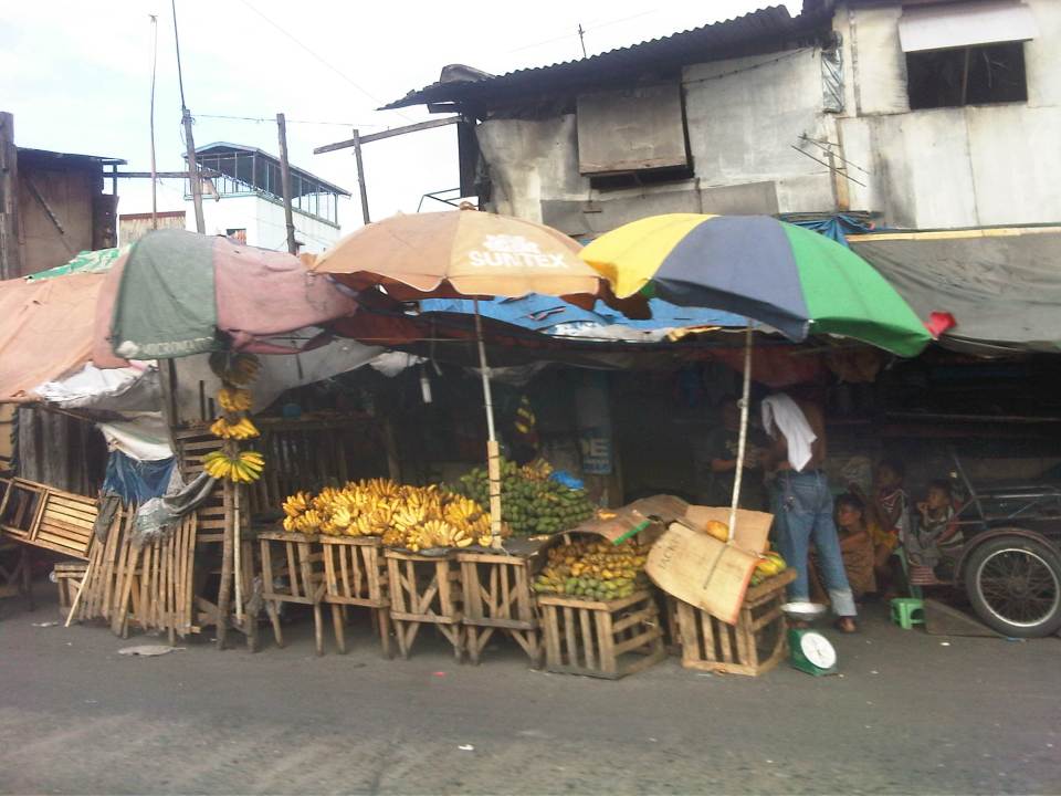 Many roadside stalls sell a variety of fruits like the bananas shown in the photo. It’s actually interesting to note that just across from the stalls is the port area whose walls don’t seem to be enough to discourage people from trying to pilfer the containers and crates containing various stuff shipped through the Port of Manila.
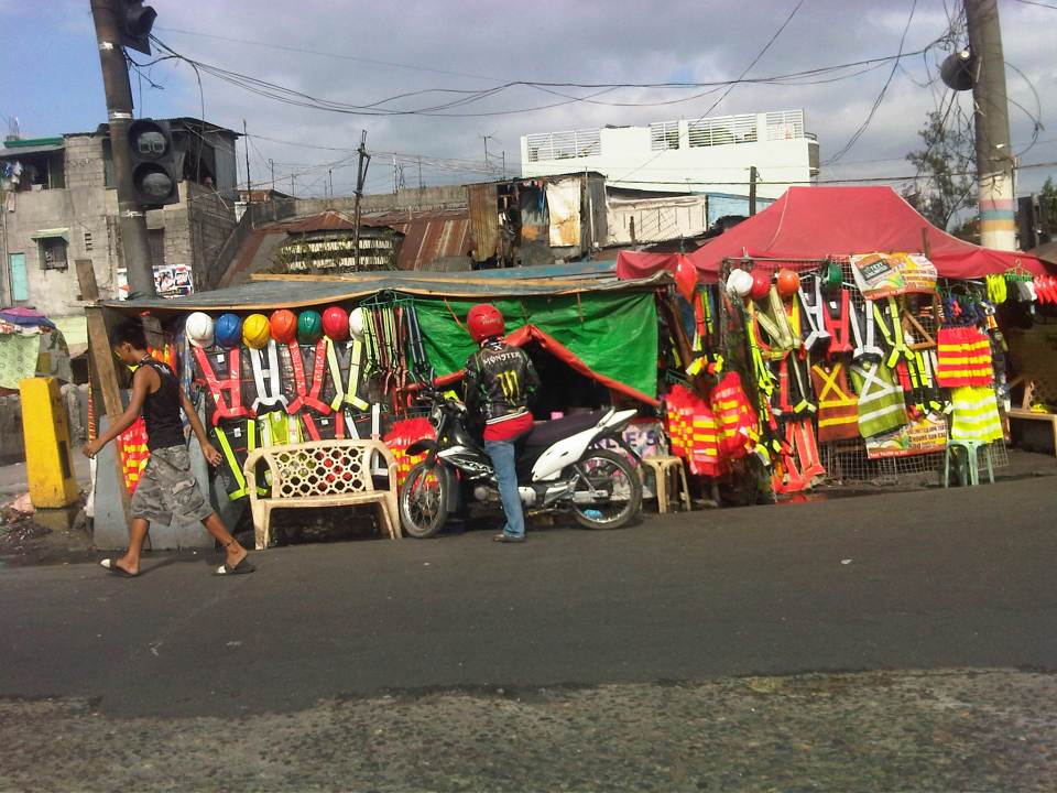 Roadside stalls selling practically anything and everything. This one is selling hard hats and reflective vests. These vests can be used by construction workers as well as traffic enforcers. Recently, motorcycle riders have been required to put on vests for them to be more visible to other road users.
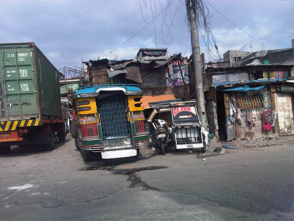 Shanties line up along the road, actually on the road as these were built on top of the space already allocated for R-10. Many sections have already been paved where shanties have been built. These shanties are now the subject of a program to remove them and open up the space for traffic to ease congestion along this road, which has much truck traffic.
 It seems that a lot of people have pedicabs as a means for livelihood. While there is nothing fundamentally wrong with this, the issue is mainly with regards to their excessive numbers and suitability as a public transport mode given their operations and propensity to go against traffic rules and regulations.
 The mass housing in the Smokey Mountain area are multi-storey apartments that look like they definitely have seen much better days. These buildings actually look like multi-storey shanties (similar buildings elsewhere including BLISS projects look much better or are better maintained). Many units have been extended and the structures now pose hazards (e.g., fire, earthquake, etc.). Alleys are not passable to emergency vehicles like fire trucks as residents have maximized occupancy of the spaces at the ground level. These look like the perfect cases for how NOT to develop mass housing.
–
Risky business with motorcycling
I spotted what appeared to be a family of four riding the same motorcycle as I was traveling to work this morning. While they were traveling slowly, likely to be careful considering there were 4 riders, I could’t help but imagine (not really wonder) what was going on in the minds of the adults here. The children were obviously oblivious to the dangerous situation and I even saw one child smiling and apparently enjoying the ride. I am sure that the father is trying his best to be careful as he is surely aware that a mistake would likely doom his entire family.
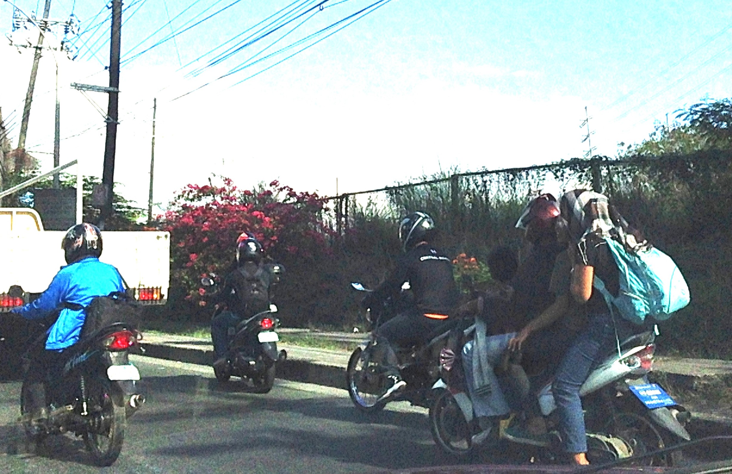 A family of 4 with one child (the younger one) in front and another child sandwiched between the adults riding a single motorcycle. The children didn’t even have helmets so if an untoward incident happens, there is a very high likelihood that the children will be killed in a crash.
These are common sights in Metro Manila and elsewhere in the country. Its worse in other places where there’s weak enforcement of road safety laws including the helmet law and the limitation in the number of passengers (yes, there is a law against passenger overloading for vehicles). I was actually wondering how these people in the photo were able to evade MMDA and LGU enforcers along major roads. And to think that there are many checkpoints to inspect those “riding in tandem.” Clearly, this is a violation of existing regulations and the only way to discourage such practices and effect behaviour change is for authorities to clamp down on such risky situations, even forcing them to discontinue travel in addition to issuing a ticket and fine for the violation. Are we really serious in promoting road safety and ensuring safety for everyone? If so, why the lax enforcement when it is perhaps, and arguably, the most important element in order to influence people’s mindsets regarding road safety.
–
More snippets of Manila streets
The City of Manila has always been fascinating from the perspective of transport and traffic due to the many peculiarities and contradictions you’ll find around the city. Here are a few more photos and some comments on the Manila’s transport and traffic.
 Pedestrian overpass along Espana Avenue right after P. Campa Street and just before Morayta Street. Most overpasses in Metro Manila are roofless so this overpass is an exception. Most roofless overpasses were constructed when Bayani Fernando was MMDA Chair and were made so to discourage vendors from setting up on the overpass. The roof, however, makes sense considering the high pedestrian traffic (mainly students) in this area, which is dubbed the University Belt due to the many universities and colleges located here.
 Another overpass in Manila, this time roofless, along Quezon Boulevard. Notice the large umbrellas in the photo? Under these are informal vendors who have set-up shop atop the overpass, effectively constricting pedestrian movement on the facility. Notice, too, the signboard bearing a message from the incumbent Mayor of Manila who happens to be a former Philippines President. The message in Filipino translates to “There’s hope for a New Manila.”
 Non-motorized pedicabs proliferate in Manila and particularly in and around Intramuros, the historic walled city that was Manila during the Spanish period. There are just too many of these 3-wheelers in this city and most if not all drivers are oblivious to traffic rules and regulations. In Intramuros they have narrow streets and most destinations of interest don’t really require a vehicle. Walking is the most suitable transport within the walled city. These pedicabs are quite peculiar for a district that is supposed to be walkable and very accessible to public transport along its main streets. Manila has tolerated (some say spoiled) the operators of these vehicles and has made “livelihood” as the standard excuse for their existence and proliferation especially in low income areas of the city.
 There are a lot of “tambays” or people just loitering around or spending (wasting?) time in the open spaces near and at the Liwasang Bonifacio just across from the Manila Central Post Office and Manila City Hall. Many of these are homeless people that the city as well as the Department of Social Welfare and Development (DSWD) have not attended to. Their presence are just too obvious to passers by and mingling among them if not they themselves are snatchers, muggers and other unwelcome elements of our society. The tarpaulin is placed over a sign stating trucks are prohibited from using Roxas Boulevard. The new truck policies in Manila have been a hot topic since early this year but everything now seems to be back to “normal” after somewhat spirited reactions from truckers that again exposed issues pertaining to the traffic impacts of the Port of Manila.
–
NAIA Terminal 3 revisited
I was back at NAIA Terminal 3 to fetch someone who was flying in from Bacolod last Palm Sunday. Going around while waiting for the plane to arrive, I took some photos of the newer shops and restaurants in the terminal. Here they are with a few photos at the waiting area and outside the terminal.
 The overnight parking spaces were not yet full. It was a Palm Sunday so I guess many people haven’t taken their vacations yet. I remember fetching the wife one Maundy Thursday morning and the parking lot was just full of vehicles. I had to park at a slot that required some walking to get to the terminal building.
 Taxi station at the arrival level of NAIA – only airport accredited taxis are allowed at this station and many, if not most, are not metered (i.e., do not have or use taxi meters). There is a dispatcher at the station and rates are basically higher than regular metered taxis.
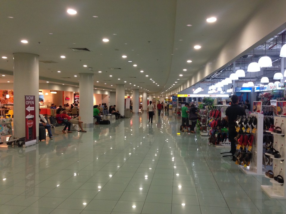 There are more shops, restaurants and cafes at Terminal 3. The old ones are still there but noticeable are the newer shops and restaurants when you explore the 3rd level of the terminal.
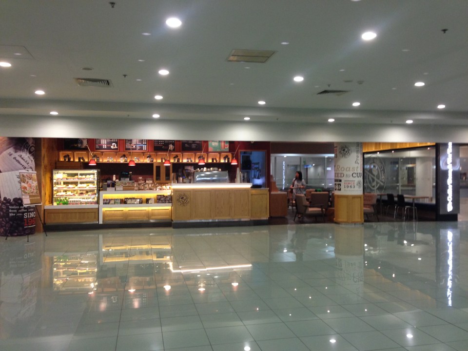 The Coffee Bean & Tea Leaf branch at Terminal 3.
 Wendy’s fastfood restaurant.
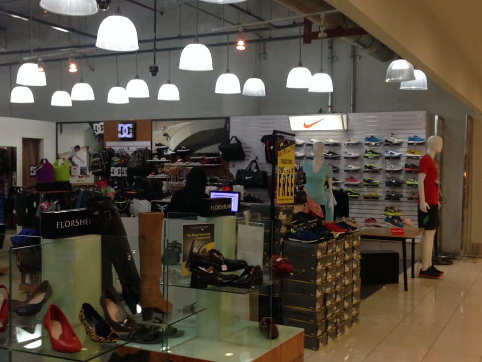 Shoes on display at one of the older shops at the terminal that offers a lot of different merchandise like luggage and apparel and accessories.
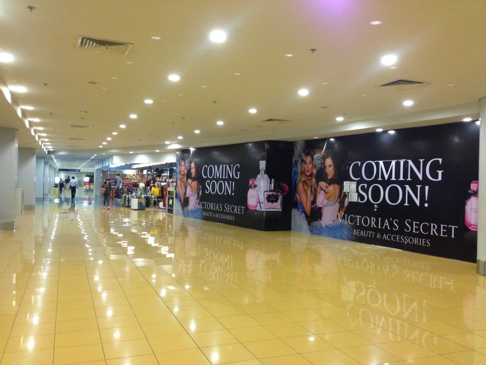 Victoria’s Secret shop opening soon and likely before other international airlines move to Terminal 3 when renovations for Terminal 1 move to full gear.
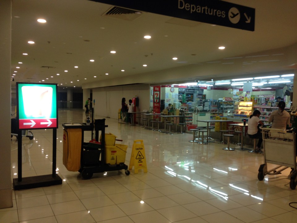 This Seven Eleven store is relatively new. There’s a Mini Stop store near the escalator to the 3rd level of the terminal.
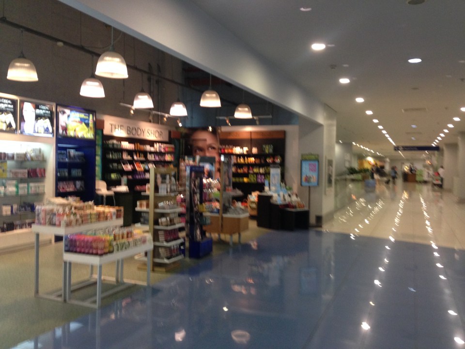 The Body Shop store.
 Not so many people at the Cebu Pacific domestic check-in counters around 8 PM. At this time, most domestic airports in the country are already closed as they are not equipped for night time operations. Thus, there are few flights at this time likely from the handful of modern airports – Cebu, Davao, Iloilo and Bacolod.
 Well-wishers meeting arriving passengers at the spacious arrival area concourse.
 Signs provide directions to passengers and well-wishers.
 Crowds form at the exits to check passengers filing out of the arrival area. International passengers come out from the left while domestic passengers from the right.
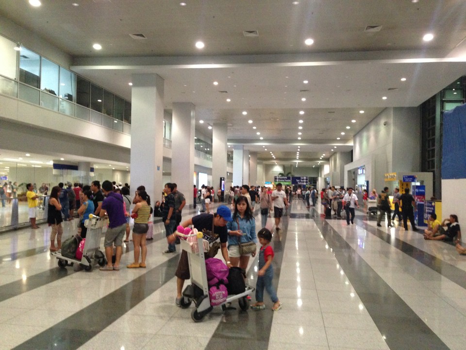
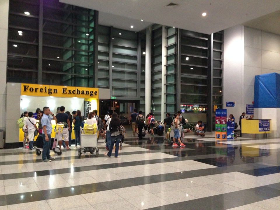
 There are more foreign exchange counters now at Terminal 3 and this is likely due to the increased number of international flights served by the terminal.
 People go out of the terminal at one of the many exits at ground level. However, there are only two entrances to the terminal at the arrival level where security checks are made.
–
Daang Bakal
The right of way for the old railroad line going up to Antipolo is still there and is now a regular road. Daang Bakal rises from what is now Valley Golf Subdivision (Celso Tuazon Ave. and Taktak Drive) in Cainta, Rizal through Victoria Valley Subdivision (Taktak Drive), Fairmount Hills Subdivision and Hinulugang Taktak (Daang Bakal though often referred to as Taktak Road, which is actually a different road and on the other side of the river), and until part of the Sumulong Memorial Circle in the vicinity of the Antipolo Church (Shrine of Our Lady of Peace and Good Voyage). I took a few photos of Daang Bakal on our way to the Parish of the Immaculate Heart of Mary for Palm Sunday Mass. The photos have been modified as I took it at dusk. The originals were quite dark so I adjusted the brightness. Still, I can only imagine now how this route could have looked like back in the day when the Manila Rail Road line passed through this area. It could have been one of the most scenic rides as it is still a scenic route today.
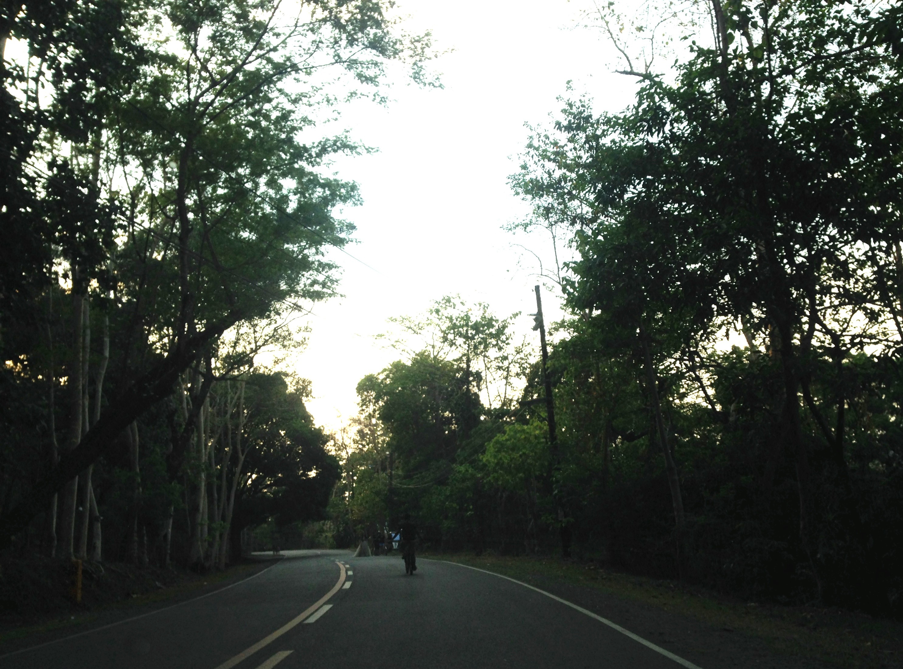


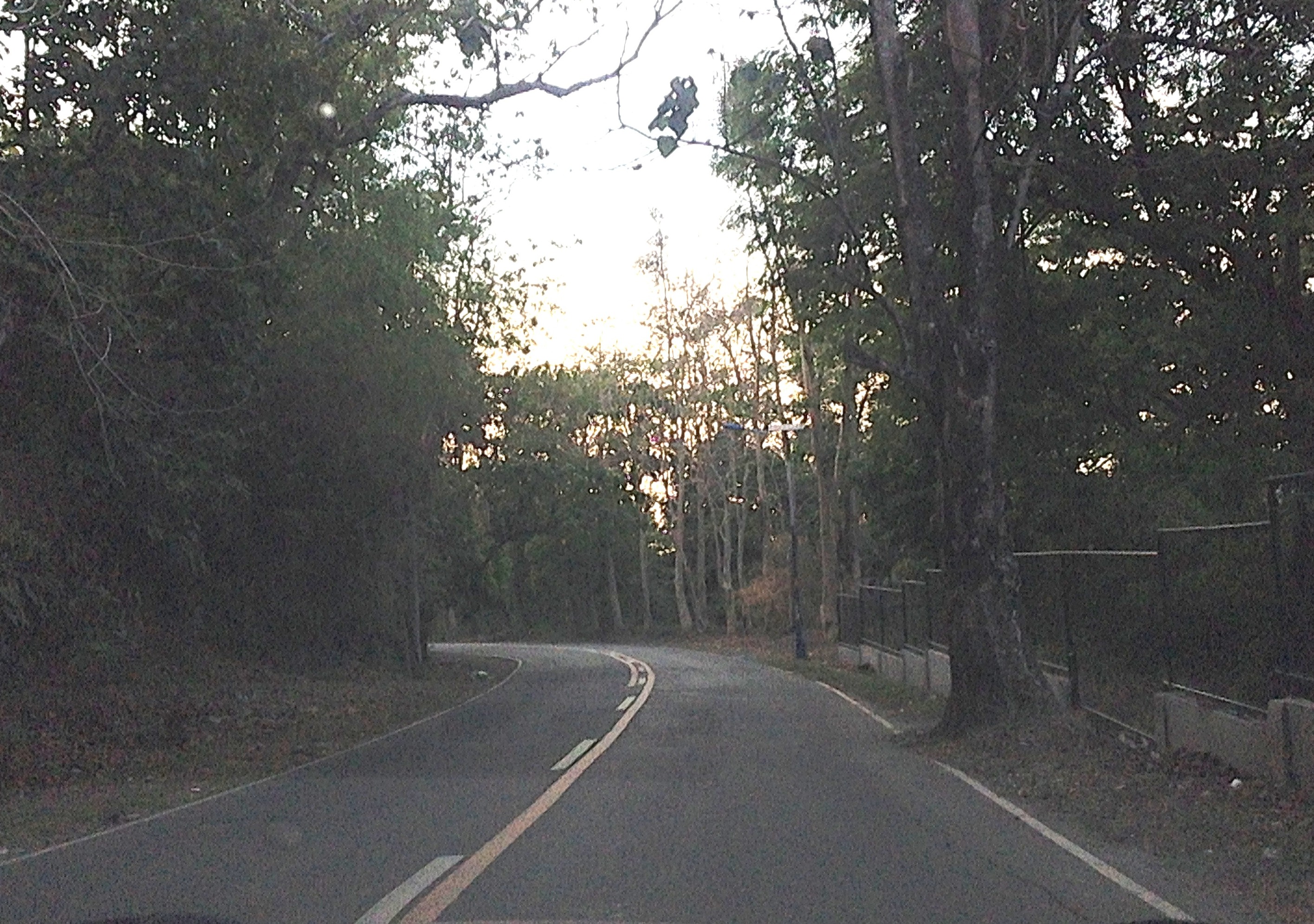
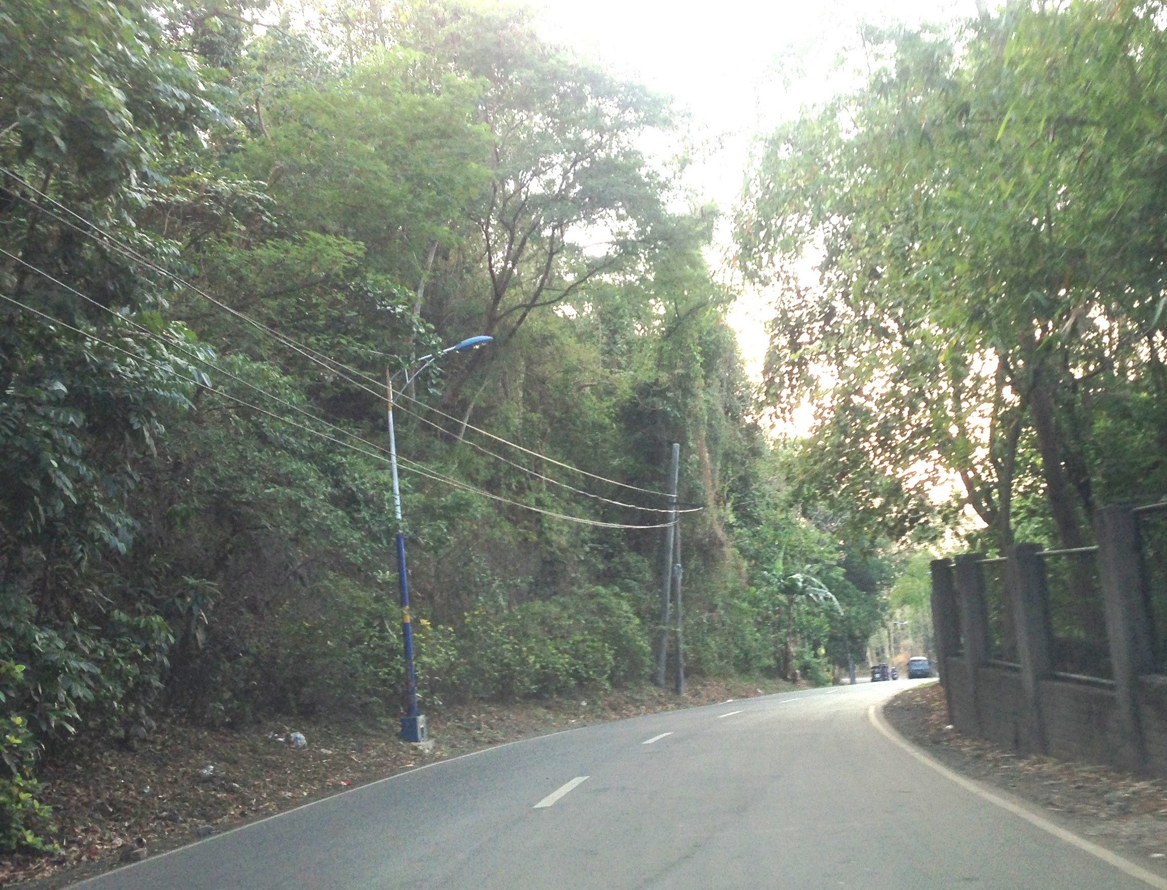
At right in the photos is a fenced property designating the Hinulugang Taktak National Park. Hinulugang Taktak refers to the water falls that used to be one of the more popular destinations in Antipolo. There is actually a popular folk song inviting people to come to Antipolo (“Tayo na sa Antipolo at doon maligo tayo…”) to enjoy the falls. The falls have deteriorated through the years as it has been affected mainly by the settlements around it. There seems to be an effort to rehabilitate the area but it is still closed to the public. The road though is in excellent condition and has low motor traffic volumes. It is popular among cyclists as well as joggers. This Holy Week, the area should have a lot of visitors because of the Parish church in the area, which has an impressive architecture and gardens. The church is perfect for those doing Visita Iglesia or perhaps people just wanting to go to a quiet place for some meditation and prayer.
–
Traffic consultants for Philippine cities?
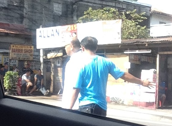
I was driving to the office one morning, and as I was slowing down to stop at the Masinag junction I spotted a familiar face giving instructions to Antipolo traffic personnel. Robert Nacianceno was formerly the General Manager (Undersecretary level position) with the Metropolitan Manila Development Authority (MMDA) when it was chaired by Bayani Fernando, the first MMDA Chair to gain a cabinet level post (previously the MMDA Chair was not a Secretary level position). He was in an office barong while leading Antipolo staff in positioning orange traffic cones to mark the lanes for turning traffic along the Sumulong Highway approach from Antipolo.
Nacianceno is a cyclist so I would like to think that he can take that perspective in transport planning and traffic management for Antipolo. Unfortunately, his track record at the MMDA does not provide strong evidence as to his competence in transport planning or traffic management. Insiders say most policies and schemes during BF’s time was the latter’s ideas (e.g., U-turns, bike lanes, etc.) and he had his own consultant (and reportedly an inner circle) for various matters including traffic. In fairness to the man, Nacianceno probably has tremendous experience on the job but one has to note that there were other people with the MMDA who also dabbled in transport and traffic. Also, as GM he had other things to attend to during his stint including waste management and flood control.
 Remember this guy? He used to be the MMDA GM during BF’s stint at the agency.
I recall that the previous traffic consultant of Antipolo City was also a former MMDA official, Ernesto Camarillo. Unfortunately, I couldn’t say that Antipolo traffic improved during the last few years. Based on what I have seen in my daily commute, transport and traffic conditions have degenerated. Antipolo is overrun by tricycles and people generally do not follow rules and regulations. Informal terminals dot the city and you don’t have to go far to find inappropriate terminals as these are in plain view and across from the Rizal Provincial Capitol. Antipolo has a new mayor in the former Rizal Governor and his mother now sits as governor of the province. I’m crossing my fingers as to how they will improve transport and traffic in Antipolo if there is really a desire to do so. For starters, is there a transport and traffic plan for this Highly Urbanized City (HUC)? There should be one as the city needs it badly together with a land use plan to bring some order in development.
Antipolo is rapidly developing but at the same time conditions (including traffic) are also rapidly deteriorating. Hopefully, the LGU will address these issues and eventually make this city a modern one and fit for its being an HUC as well as a popular pilgrimage site for decades if not centuries due to the Shrine of Our Lady of Peace and Good Voyage (Is there some irony here?). Nacianceno’s work has just started and I hope he is up to the challenge of bringing order to Antipolo’s chaotic transport and traffic situation. I hope, too, that he will take note of good practices in other cities (Philippine or foreign) and won’t be relying purely on his experiences in Metro Manila. And hopefully, whatever improvements from the traffic schemes he will be introducing and implementing will be felt immediately by travellers. Good luck!
–
Quiapo traffic
Fridays in Manila are associated with Quiapo and the devotion to the Black Nazarene. People flock to Quiapo Church to hear Mass or pray at the Basilica, which is arguably among the most popular for Roman Catholics. Fridays are regarded as feast days dedicated to the Black Nazarene and since many people go to Quiapo Church throughout the day, there is almost always traffic congestion in the area. These days, however, any weekday is a congested day in that area what with more vehicles and more people coming to this area or just passing through.
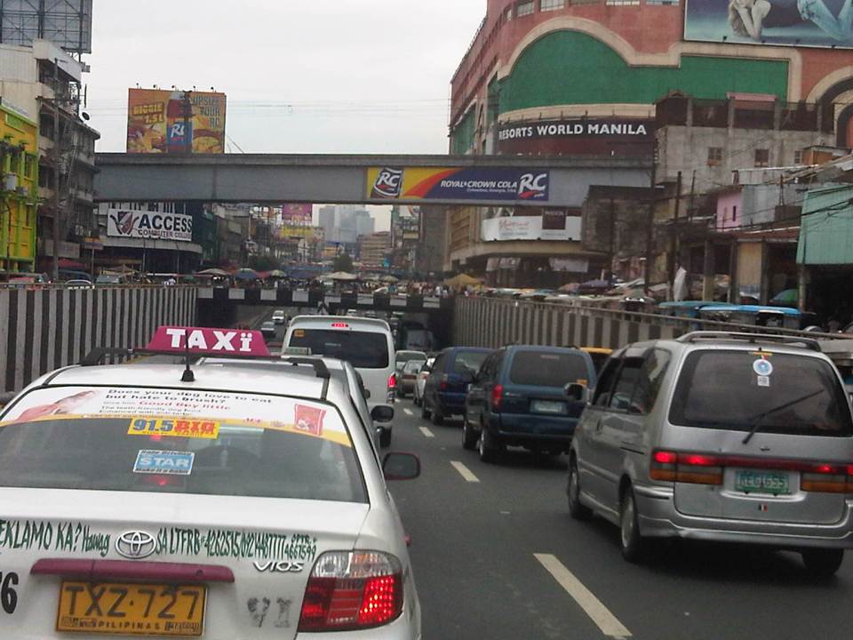 Espana Avenue ends at its junction with Quezon Boulevard and turning left leads the traveler to the Quiapo District. The photo shows heavy traffic along the underpass and the elevated LRT Line 2.
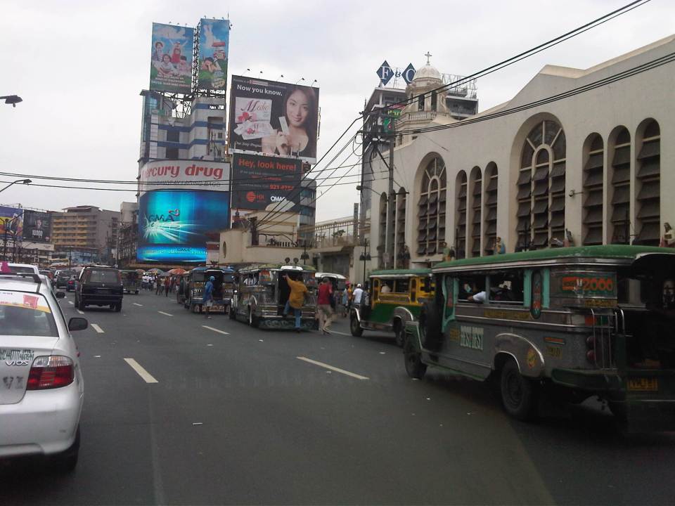 Quiapo Church is just beside Quezon Boulevard and jeepneys loading and unloading passengers occupy up to 3 lanes nearest to the church.
 There is a door at the side of the church along Quezon Boulevard and people seem to be everywhere even the middle of the road as they walk or wait to ride a jeepney.
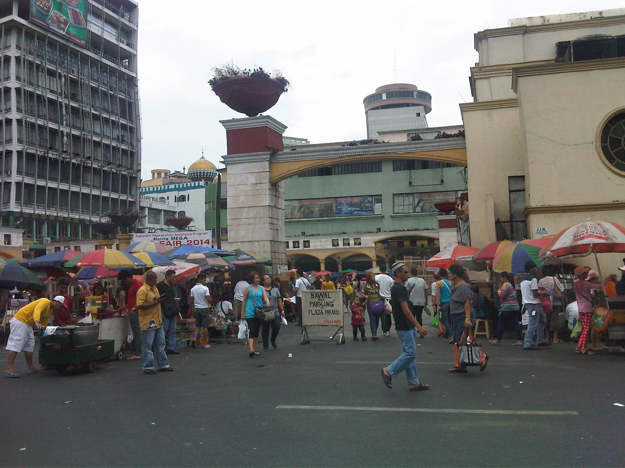 Historic Plaza Miranda in front of the church is witness not only to a lot of the frenzied processions during the feast day of the Black Nazarene every January. Plaza Miranda has also been a venue for many political rallies including the infamous one in the early 1970s that was among the triggers for Martial Law. On “normal” days, the plaza is home to vendors, fortune tellers and other denizens of this area.
There are other popular churches around Metro Manila that attract a lot of people throughout the year and not just during feast days. Among these are Baclaran in Pasay City (Our Lady of Perpetual Help), St. Jude in Manila, Sto. Domingo in Quezon City, San Agustin and the Manila Cathedral in Intramuros, Manila. Nearby in Antipolo is the Shrine to Our Lady of Peace and Good Voyage. These churches are among the busiest especially on certain days of the week (e.g., Wednesdays are for Baclaran, etc.) and with the coming Holy Week, a lot of people are again expected to flock to these churches for the Visita Iglesia tradition. Hopefully, these devotions are really a manifestation of faith rather than the pretentious kind where the road trip is more touristy than religious or prayerful.
–
