
Unprepared and incomplete – realizations from the APEC transport experience
Before I forget about what transpired during the holding of APEC in Manila a week ago, here’s a couple of photos I found over the internet and shared via social media.
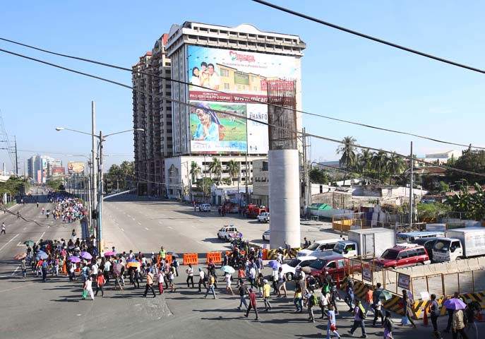 Commuters along Roxas Boulevard walk past a column of the unfinished NAIA Expressway, one of the transport infrastructure projects that has not been finished. [Photo from The Manila Bulletin]
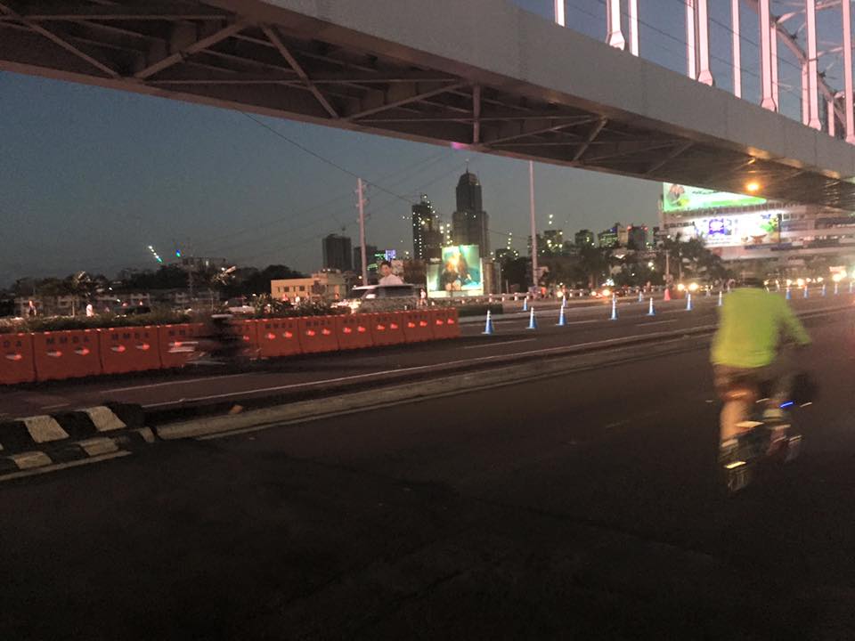
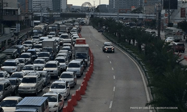 APEC lanes and severe traffic congestion along EDSA – there’s an opportunity here for a prrof of concept test for BRT. [Photo from Facebook]
I saw many memes and read some articles mentioning BRT specifically as one solution to Metro Manila’s transport problems. The second photo above was modified to replace the car travelling along the APEC lanes with a bus.
It is easy to imagine what could have been if the government decided to use the event and the lanes they allocated for APEC vehicles to do a ‘proof of concept’ run of BRT services or at least express bus services (what some DOTC people call high quality bus services). Perhaps what could have been done for part of the 10 billion PHP expended for APEC was to buy a fleet of brand new buses and provided these for free public transport for people who would need to commute during APEC. Services along two corridors would have sufficed – these two would have been EDSA and Roxas Boulevard. [The other option would have been to talk to bus operators and cooperate with them to organize express bus services along EDSA and Roxas Blvd.] Aggressively promoting these free services ahead of APEC would also have meant commuters, including those who usually used their own vehicles, could have opted for these transport services and not affected by the ‘carmageddon’ that ensued over that period. There should have been services to the airport terminals, too, but I will write about this in another article.
The dry run could have yielded essential data for assessing the feasibility of such bus services as an alternate to rail systems that would take much time to build. Incidentally, if the LRT Line 1 Extension to Cavite was built right after the current administration took over, that line could have already served tens of thousands of passengers from the south who regularly commuted to Metro Manila for work and school. The first photo above does not lie about just how many people could have benefited from that rail project. Meanwhile, MRT Line 3 remains dysfunctional and with its reduced capacity could not handle the demand for transport that it should have been able to carry if services had not deteriorated over the years.
–
Improvements to alternative route between Rizal and Makati
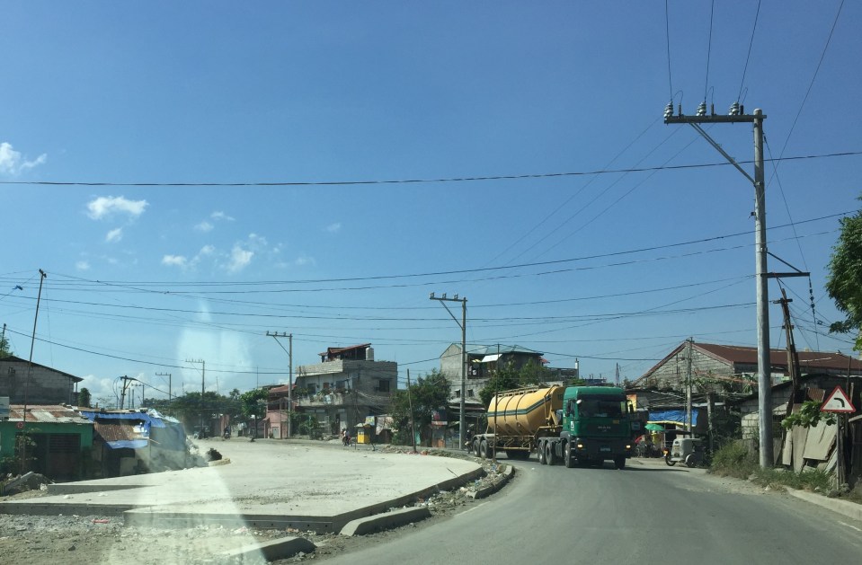
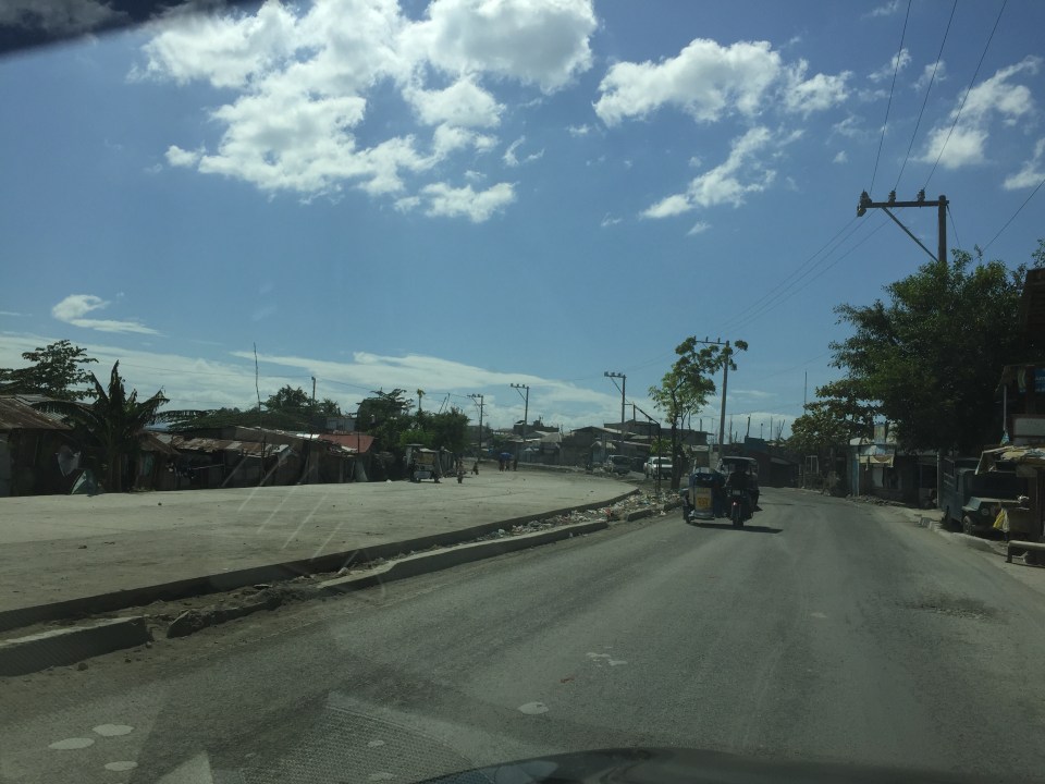
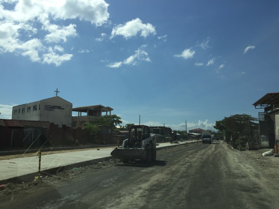
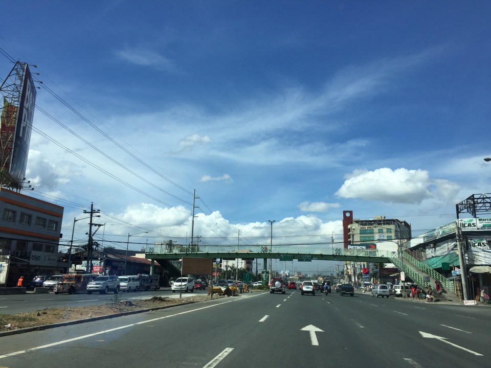
I finally got another look at the conditions along the alternate road to Highway 2000 and C-6 Extension a couple of weeks ago while en route to Bonifacio Global City. Traffic along Ortigas Ave. is usually terrible these days even during the weekends due to the road and drainage works between Cainta Junction and Brookside. I am glad to say that there have been significant improvements to the section of Don Hilario Cruz Ave nearest to the Manggahan Floodway and beside the Megawide plant. There have been significant developments, too, along C-6 Extension in the Lupang Arenda area of Taytay, Rizal. Here are some photos of the area.
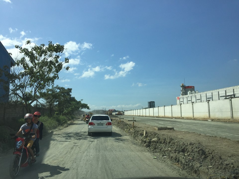 Don Hilario Cruz Ave., the road beside the Megawide plant and parallel to Highway 2000, is being improved with half the carriageway already prepared for paving. The other half appears to be graded is being used by vehicles.
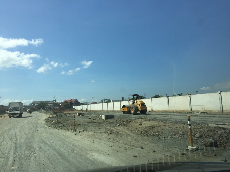 A roller runs along the base layer of the road that’s being paved. These sections were usually muddy and full of craters during the wet season and very dusty and still full of potholes during the dry season.
 Sections of C-6 Extension at the Lupang Arenda area have been widened and the expropriated lands are now being transformed into paved roads. The original sections have been overlayed with asphalt to improve their ride-ability.
 Another section in Lupang Arenda shows finished PCCP for the eastbound side of C-6.
 Another photo of C-6 extension. Once the finished lanes are usable, authorities will probably divert traffic there so they could also pave the rest of the road.
Travelers between Rizal and Makati/Taguig will benefit the most from the improvements along these roads. These will increase road capacity as well as travel speeds along this route. Now, if only authorities can also improve C-6 itself in Taguig…
–
Working with big data on transportation
There have been a few initiatives working on big data from government agencies whose responsibilities are primarily on transportation. Among them are past projects implemented by the University of the Philippines Diliman (UPD) and current projects being implemented by UPD, Ateneo de Manila University (ADMU) and De La Salle University (DLSU) with support from the Department of Science and Technology (DOST). While these projects are more oriented towards some specific objectives often linked to research & development (mandates of DOST and these academic institutions), there are still a lot of data out there that needs to be digitized, processed and analyzed. UPD has done this to some extent through its National Center for Transportation Studies (NCTS), which had been a repository for data and reports from DOTC and DPWH. However, the center does not have a funded program to undertake that repository or archival function it is expected to do. Despite much lip service from DOTC, DPWH and NEDA, no support has been extend by these agencies in the past many years.
I recently came upon this excellent work from a private firm specializing in data science. Here’s a link to one of their recent ‘stories’ showing us relevant statistics on road safety in Metro Manila:
http://stories.thinkingmachin.es/road-danger-pedestrians/
Their website says the data set the stats and graphs are based from are from the Metropolitan Manila Development Authority (MMDA), which maintains the Metro Manila Accident Reporting and Analysis System (MMARAS). This is good work and something road safety experts can use to be able to come up with programs and projects to improve safety in Metro Manila. I hope they could also get a hand of the DPWH’s Traffic Accident Reporting and Analysis System (TARAS) data that covers national roads. Unfortunately, the DPWH has stopped encoding TARAS data recently (the PNP still collects data though) so I am not sure how recent their data set is.
We need more of such work on a lot of data our agencies are producing including data from the Land Transportation Office (LTO) and the Land Transportation Franchising and Regulatory Board (LTFRB). Such information could be used to understand our transport systems including determining how to optimise supply and demand when combined with other data sets such as geographical information systems (GIS) and socio-economic data from the census.
–
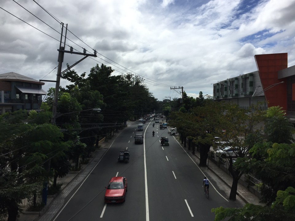
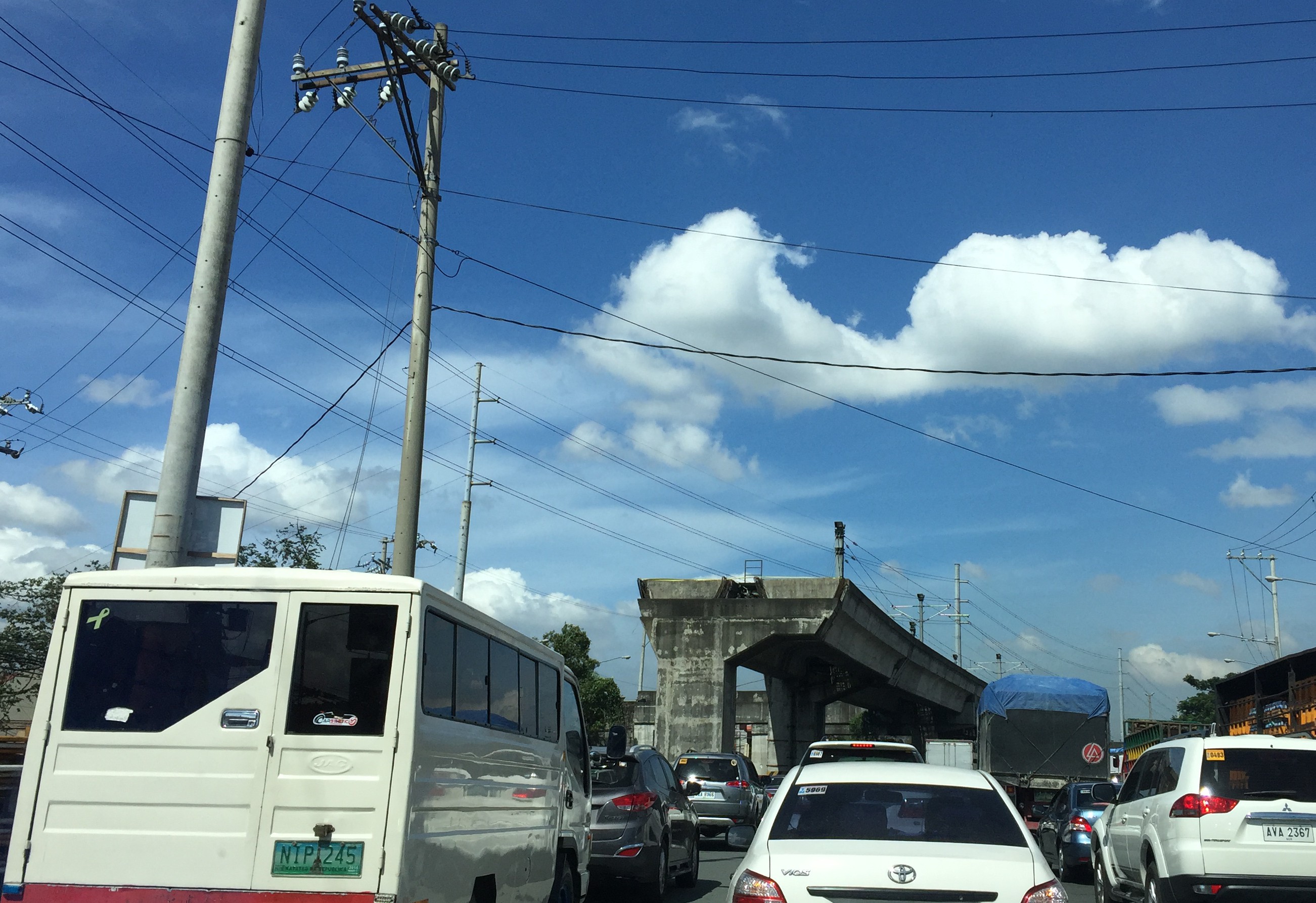
Caught up in trAPEC
It’s a corny title to this post and perhaps is practically what people would call ‘click bait’. But then it is a very appropriate one considering it describes what happened last Monday and is still happening today and for the rest of the week affected by the Asia Pacific Economic Cooperation (APEC) forum hosted by the Philippines and held in Metro Manila. Yes, Metro Manila. And many people have been asking loudly or in their mind why the capital city when the government was supposed to be promoting and bragging about growth in other cities (inclusive growth anyone?). I would have thought and preferred to have APEC in either Subic or Clark, which have been touted as rapidly growing areas and as international gateways. In fact, Clark is being pitched as the location of a potential new city in the Clark Green City project as well as the aerotropolis currently being developed (slowly) near the airport and the SCTEX Clark South interchange.
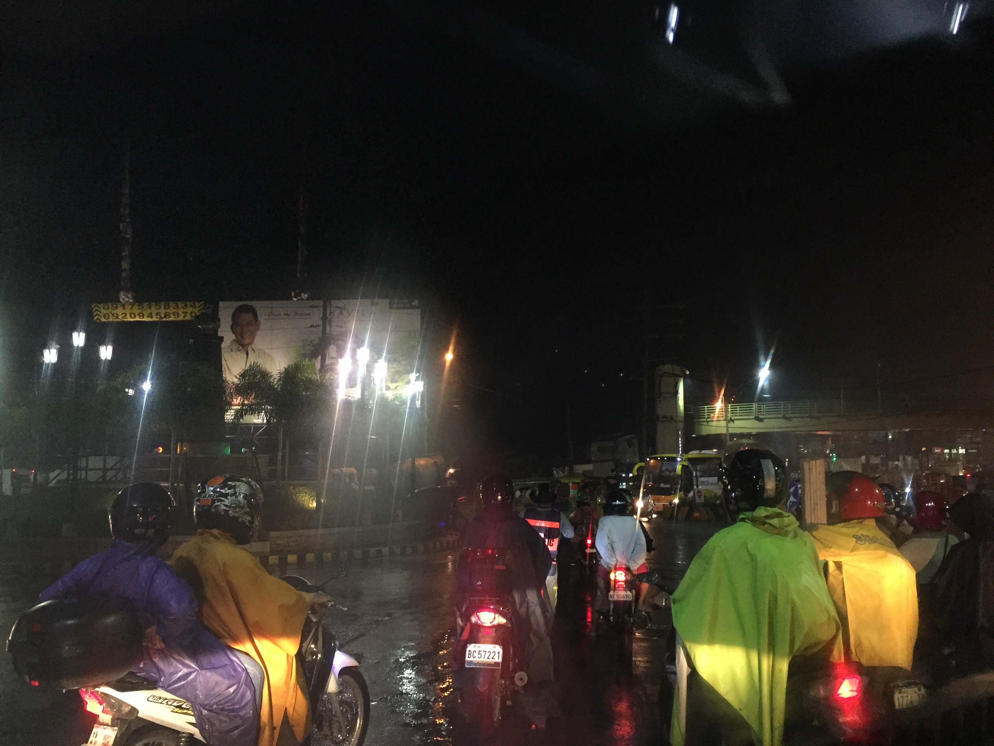
Instead, we have the APEC forum and all its attendant activities in Metro Manila. And it seems that the forum has maximized its detrimental impacts on the economy as it practically shut (some people even say shat) down the capital because of severe traffic congestion and a lack of public transport infrastructure and services to carry commuters safely and efficiently between their homes and work places. The Manila Bulletin posted the following photo last Monday:
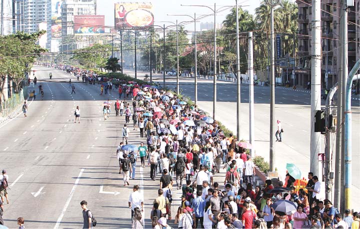 Commuters were forced to walk along Roxas Boulevard just to get to work.
Here are a few more photos courtesy of an old friend from high school:
 A lone cyclist pedaling along a practically empty section of EDSA (photo credit: Bong Isaac)
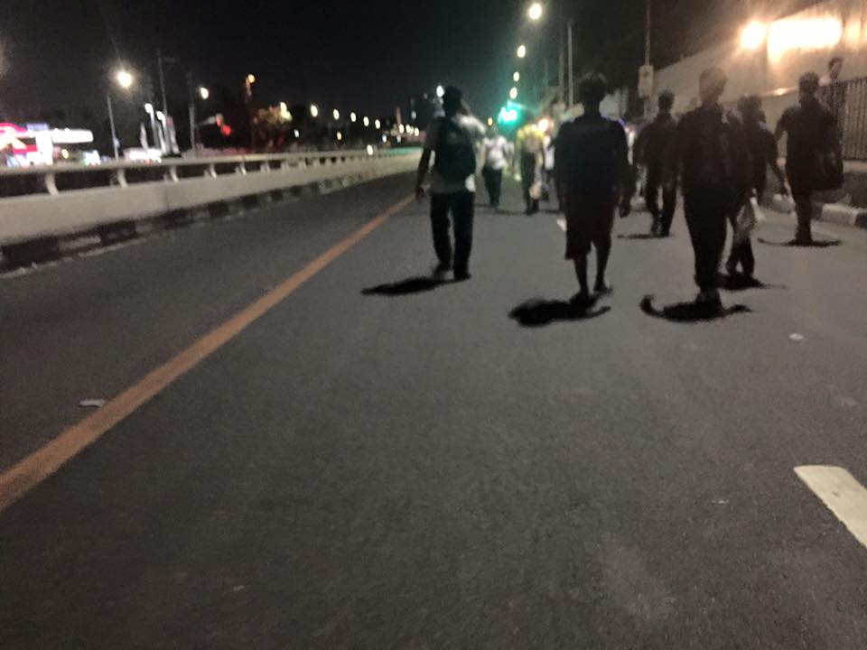 Walkers? – commuters took to walking along EDSA, one of the country’s busiest and most congested thoroughfares. I was amused of the memes about the ‘Walking Deadsa’ referring to people seemingly walking like zombies after a hard day’s work just to get home. (photo credit: Bong Isaac)
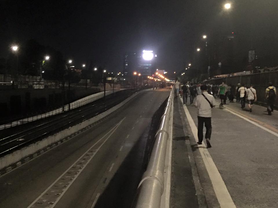 Commuters walking along a vehicle-less EDSA. The MRT 3 line at the left in the photo also seems to be ‘lifeless’ at the time (evening I was told) the photo was taken. (photo credit: Bong Isaac)
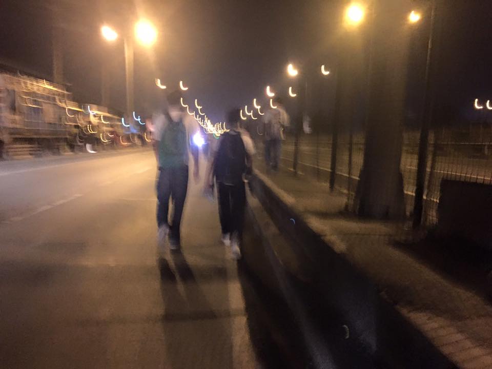 People walking along the service road along the SLEX – most affected of the road closures were people from the southern parts of Metro Manila including those from Laguna and Cavite. (photo credit: Bong Isaac)
I remember being asked once during an interview if it was possible to determine the cost of congestion due to a single event such as a road crash or perhaps a rally. I replied that it is possible given the available tools and expertise in making such assessments. What could be the cost of such a week-long event? Would the holidays for Metro Manila have lessened the economic impacts on traffic of the APEC? Or was it assumed that agreements and the media mileage we got from APEC more than enough to cover economic losses?
Could this disastrous traffic mess have been averted or at least mitigated despite APEC in Manila? Yes, perhaps, if the transport infrastructure particularly the LRT Line 1 Extension to Cavite, the upgrading of the MRT Line 3 and an airport access transit system were completed prior to APEC. These along with other major projects for Metro Manila were promised years ago and yet have not been realized. Add to this the apparent lack of contingencies (BRT-like express buses? bicycles?) that could have eased the pain of hundreds of thousands of commuters affected by APEC traffic schemes. Government has no right to tell people “I told you so” when government efforts for the benefit of its own commuting citizens have been deficient these past years.
–
Looking back at EST social marketing
With all that are happening today that are related to sustainable transport, I tend to pause and look back with a smile on how it was more many years ago when we were struggling to promote environmentally sustainable transport (EST). At that time, most local government units were not yet into sustainable transport and were unaware of the principles. There were a few who already had a project or program in place but didn’t know that these were classified as EST.
CAPACITY-BUILDING AND SOCIAL MARKETING FOR ENVIRONMENTALLY SUSTAINABLE TRANSPORT
Under the project, we identified several local good practice examples for EST and invited representatives of those LGUs to spread the word to other LGUs. Those who regularly went with us to promote EST were representatives of the Marikina City Bikeways Office, and San Fernando, La Union’s City Planning Office who shared their experiences in phasing out 2-stroke motorcycle-run tricycles.
I recall that one major Visayan city wasn’t so receptive at the time as the City Planning Coordinator seemed more interested in international trainings and foreign assisted projects than the city actually developing sustainable programs and projects on its own. The irony now is that despite his being not so excited about sustainable transport that city now has good examples for EST including a bicycle corridor and pedestrian and bike-friendly riverside developments.
But there was the case of the very receptive and progressive City Planning Coordinator of another major Visayan city who helped us immensely in promoting EST. His eagerness, particularly for public transport options, paved the way for Bus Rapid Transit (BRT) to gain a foothold in the discussions paving the way for more efficient transit systems to be considered (and now planned and designed) for his city. That interest led to his city getting the attention of an international agency that brought in then former mayor and now the recently re-elected Mayor of Bogota, Colombia, Enrique Penalosa, to do talks about his city’s Trans Milenio BRT system. I remember a couple of visits of Mr. Penalosa including a series of dinner meetings sponsored by the private sector in Makati City who were interested in the Bogota’s transport success story.
We always wondered who, when and how EST would be advocated by others and particularly by a younger generation who would turn out to be more outspoken and aggressive in promoting EST. These include those calling for better public transport systems, those advocating for pedestrian and bicycle facilities, those pushing for safer roads, and those lobbying for clean air. With all that we are seeing now around us (Congratulations Firefly Brigade for a very successful Tour of the Fireflies last Sunday!) and on various media platforms, I strongly believe that we are on the right path towards achieving better quality, sustainable and equitable transport for everyone.
–
Some advantages of rail over road transport
In my previous article, I mentioned how rail transport is important as part of a country’s transport system, particularly on land. I also mentioned a study conducted by our undergraduate students that was completed back in April 2012.
Our students conducted a simple survey, as part of their research, to determine the travel times and costs for public transportation between several origin-destination pairs. These O-D pairs were selected to simulate costs and travel times of commutes using either primarily rail or all road transport. Note the choices of either ‘school’ or ‘office’ paired with ‘home’ somewhere in the south of Metro Manila.
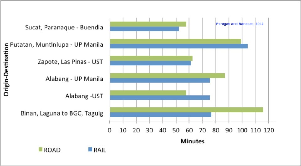 Travel time comparisons for commutes using road and rail public transportation – ‘Road’ refers to the entire commute using road-based transport (i.e., buses and jeepneys) while ‘Rail’ refers to commutes utilizing mainly the PNR but with road transport used in the end parts of the journeys (e.g., jeepney ride from near the PNR Espana Station to UST).
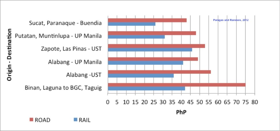 Travel cost comparisons for commutes using road and rail public transportation
Relevant to understanding the above are the following
- Fare rates have changed since 2012. However, this presents a constant change over the fares that are being compared so the basic differences will remain the same across origin-destination pairs.
- PNR services had to be discontinued for some time due to derailments because of poor conditions of tracks.
- Road traffic has worsened since 2012 with several “carmaggedon” episodes showing how vulnerable commuters are when using solely road transport.
- Road public transport services are frequent and practically 24/7. PNR services are of very limited frequency. Waiting times for the trains typically add to travel times in the form of delays, which make commuting by rail an unattractive option due to their unreliability of service.
–
Antipolo public market pedestrian overpass
I took some photos atop the pedestrian overpass connecting the New Antipolo Public Market and the Robinson’s Place mall. The overpass is across Sumulong Highway, which terminates nearby at the intersection with Antipolo Circumferential Road (Daang Bakal), which is currently being widened.
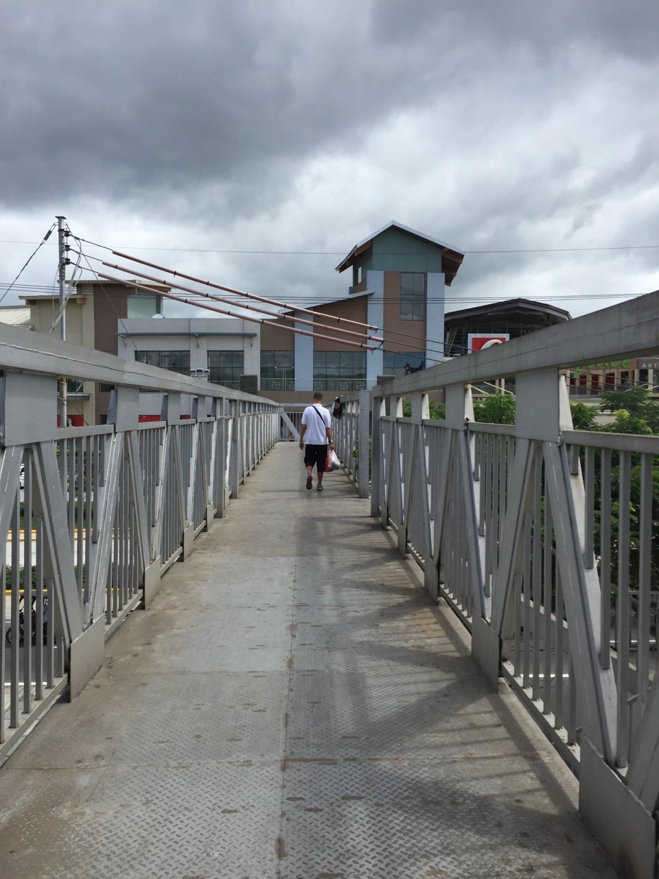 The overpass is a steel structure, including the flooring, which reminded me of factories. This industrial look is not new as there are other overpasses that have been constructed in Metro Manila similar to this.
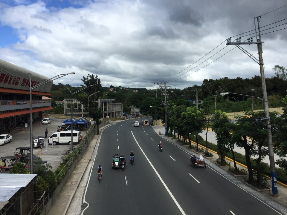 A look at Sumulong Highway towards Masinag. The highway has 4 lanes and at this section has sidewalks on either side of the road. There is no median island to separate opposing flows of traffic. The Antipolo Public Market is on the left side.
 A view of Sumulong Highway towards the Antipolo Shrine of Our Lady of Peace and Good Voyage. The Public Market is at the right and the mall is at the left.
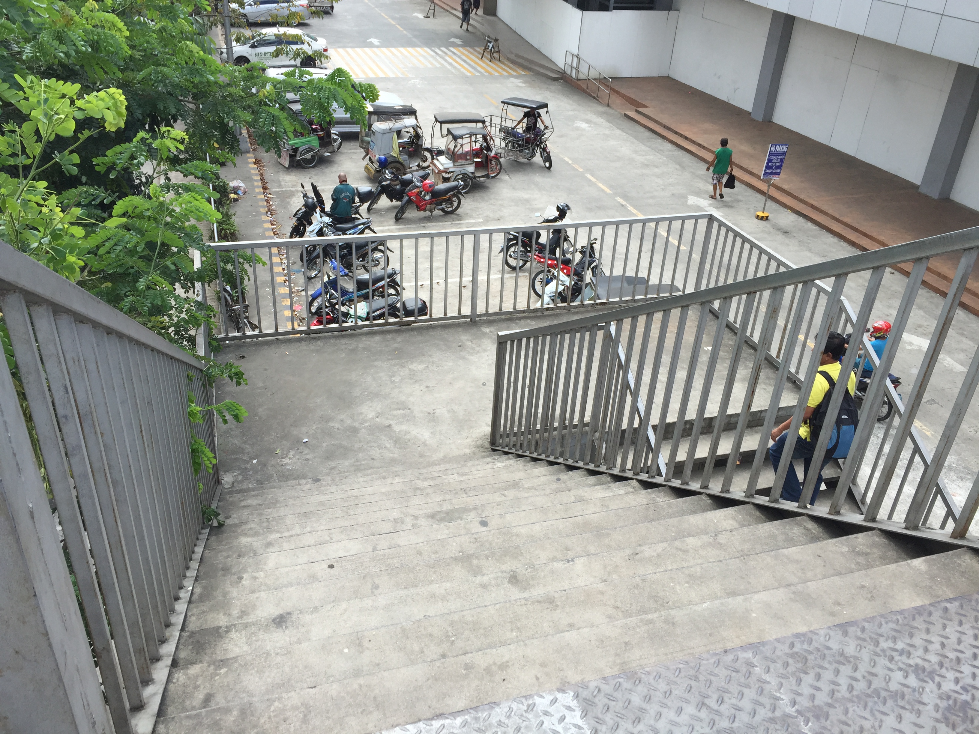 The overpass’ stairs are a bit steep and perhaps not so friendly to senior citizens. There should probably be a ramp for persons with disabilities or for cyclists to use as they carry their bicycles to cross using the overpass.
Despite calls from some advocacy groups for pedestrians to be prioritised and for them to cross at-grade, the reality is that we are still far from achieving safe roads for pedestrians given the way motorists run their vehicles. In the case of Antipolo, many jeepneys, UV Express and tricycles (freely roaming the city) are operated by reckless drivers. Private vehicle drivers are not so different and I have seen scenes of road crashes along Marcos Highway and Sumulong Highway where those involved are private vehicles including motorcycles. Clearly, many of these people should not have driver’s licenses in the first place given their mindset when driving. So until this improves, pedestrians are safer when they do use these overpasses. Of course, that goes without saying that the location and design of overpasses need to be thought over carefully so that these facilities will be used and not just become white elephants.
–
On the severity of traffic congestion along Ortigas Avenue and the necessity of a mass transit line
With the worsening congestion along Marcos Highway due to the construction of the LRT Line 2 Extension to Masinag, I have been using Ortigas Avenue as an alternate route to go home. Granted, the stretch from the Park Place gate near Cainta Junction and Brookside is currently undergoing roadworks elevating that entire section (which is prone to flooding), and this is the main cause of much congestion as fewer lanes are usable to traffic. However, what is perceived to be relief from traffic once the project is completed will eventually and surely revert to a very congested Ortigas Avenue.
Traffic congestion along Ortigas Extension is primarily due to a dependence on road transport, particularly private vehicles, by people living along Ortigas Ave. and the roads feeding into it. The Manila East Road, for example, passes through the most populous towns of Rizal outside of Antipolo City. The dependence on road transport (especially private vehicles) is due to limited options for public transport. There are buses, jeepneys and UV Express but these, too, contribute to congestion due to their increased numbers and limited capacities given the high demand for public transport. Among the infrastructure proposed along this corridor is an overpass along Ortigas Ave. at Cainta Junction. A mass transit system has also been required along this corridor for a very long time but for some reason, such infrastructure has not been provided.
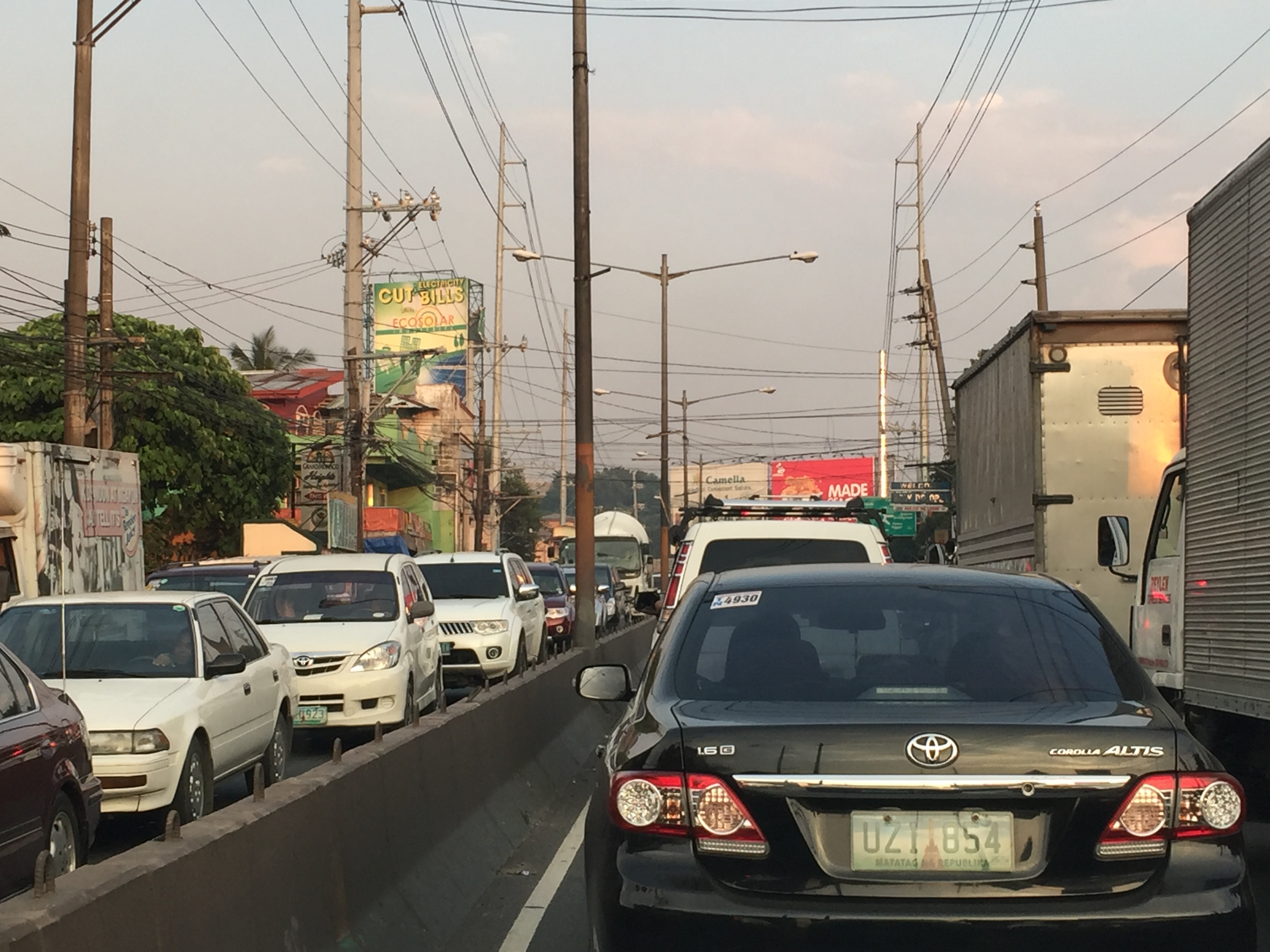 Severe traffic congestion along both directions of Ortigas Avenue Extension
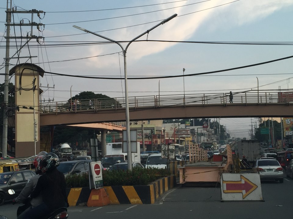 Congestion stretches all the way along the Manila East Road
 Night-time traffic congestion at the Tikling Junction
There is a proposal for a mass transit system along this corridor. Following are references to the project:
From the PPP Centre: https://ppp.gov.ph/?ppp_projects=ortigas-taytay-lrt-line-4-project
From CNN Philippines: http://cnnphilippines.com/metro/2015/07/22/neda-approves-naia-lrt-ppp-projects.html
I found it quite odd that the stations are not referenced according to the more common place names for the locations. For example, ‘Bonifacio Avenue’ should be ‘Cainta Junction’ and ‘Leonard Wood’ should be ‘Kaytikling Junction’. Nevertheless, this is the least of our concerns pertaining to transport and traffic along this corridor.
Perhaps the conditions are ripe now to finally implement transport infrastructure projects along this corridor. The proposal and approval of a rail transit line by NEDA means the corridor has the national government’s attention. The local government leaders along this corridor are also more progressive and aggressive than their predecessors. These include a very dynamic mayor in Cainta and the former governor-turned mayor in Antipolo. A collaboration towards better transport among these two LGUs alone would be influential and instrumental to improving travel along Ortigas Avenue.
–
Updates on the LRT 2 Extension – no more trees!
It’s been a while since I last passed by along Marcos Highway. This morning, I was a bit surprised by what I saw (or perhaps, more appropriately, what I didn’t see). The median along the section between Imelda Avenue all the way to Santolan has been cleared of trees. This was already expected as the contractor was already clearing the median for the past weeks. The work entailed fencing off the inner lanes of Marcos Highway and has caused congestion with the highway’s capacity significantly reduced and many motorists slowing down to observe what was going on (usyoso). Following are a few photos of Marcos Highway taken this morning.
 DMCI removed the barriers securing the inner 2 lanes to reveal a median clear of trees. The median will be where the columns for the elevated LRT Line 2 extension to Masinag will be constructed.
 I wonder what will become of the pedestrian overpasses along Marcos Highway. These structures would have to be redesigned with respect to the elevated structure of the LRT Line 2.
 Here’s the conspicuously clear median along Marcos Highway approaching Ligaya. The Ayala development can be seen on the right side along the Quezon City bound side of the highway.
 Waiting – Line 2 currently terminates just after Santolan Station where trains make the switch for the return journey.
–
Railway network for the Philippines?
We start November with an article about railways. There seems to be a lot of buzz about rail these days including talks about the prospects of a subway line in Metro Manila and long distance north-south lines for Luzon Island. These projects, though, will take a lot of time to be constructed and operational, even if these projects started immediately (i.e., next year). That is perhaps one reason why these projects need to be implemented sooner rather than later. And the more these projects are delayed, they become more expensive and also difficult to build (e.g., there are other developments such as roads that may hamper rail and other mass transit projects).
I had a couple of students who did research a little over three years ago on the state and operations of the Philippine National Railways (PNR). Aside from the research manuscript, their work has not been published. The results, however, seems quite appropriate these days as the country and Metro Manila in particular grapples with problems pertaining to commuting that is dominated by road-based transport. I will write about their results here but only show some excerpts as we intend to have part of their work published.
As a first salvo, here’s a map that they were able to get from the Philippine National Railways (PNR). The map shows current and proposed railway lines throughout the country. These include the PNR Main Line South (MLS), which extended to Laguna, Batangas, Quezon, Camarines Norte, Camarines Sur and Albay. There is also what used to be the PNR Main Line North (MLN) that extended to Bulacan, Pampanga, Tarlac, Pangasinan and La Union. Panay Railways, the only other long distance railway system aside from the PNR as late as the late 1970s, is also in the map along with the proposed Mindanao Railways.
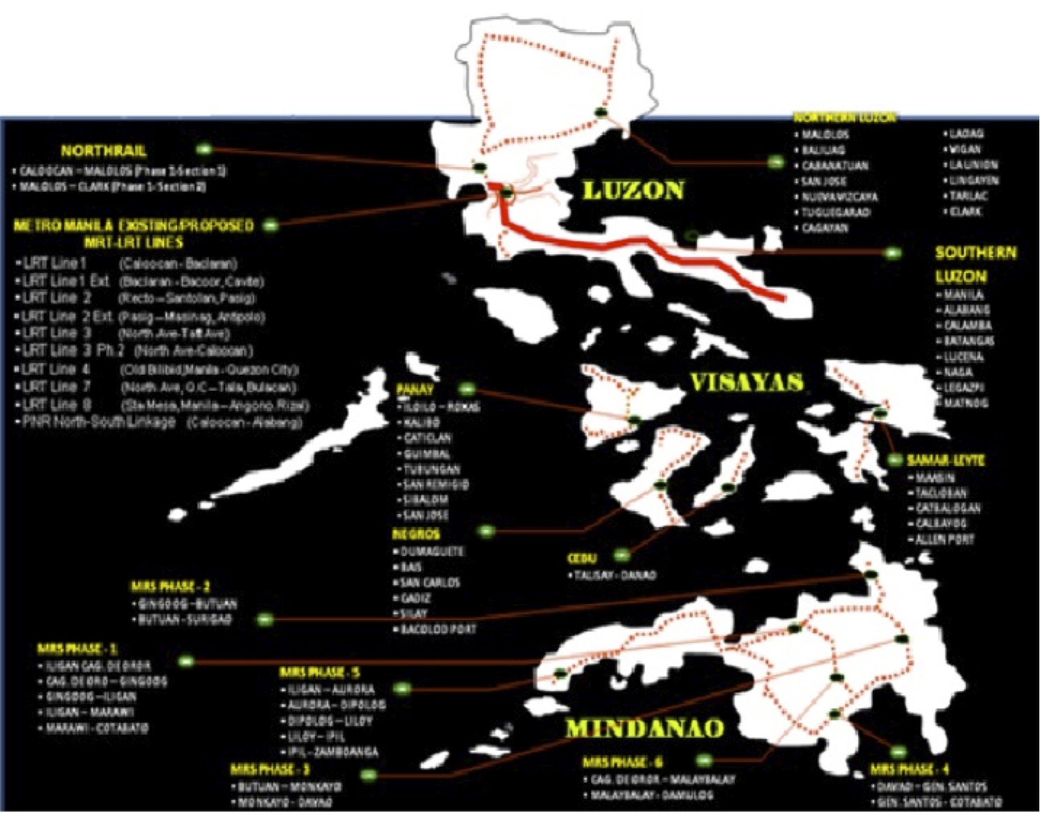
This map was provided by the PNR and likely includes data coming from the Rail Transport Planning Division of the Department of Transportation and Communications (DOTC). Contrary to the perception of many in the current administration, a lot of railway planning was conducted by past administration and many were sound ideas that justified feasibility studies. As usual, the main obstacle for railways would be the competition with road transport. It was road transport and the construction of expressways and other highways, after all, that dealt the PNR its decline (and death in the case of the MLN) to what remains today.
[Reference: Paragas, L.K.B. and Rañeses, M.K.Q. (2012) Assessment of the Philippine National Railways Commuter Line System, Undergraduate Research Final Report, April 2012.]
–
