
Changi Jewel and transit
The trip to Sri Lanka afforded me some hours at Singapore’s Changi Airport. En route to Colombo, we made sure to go around the complex and check out one of the attractions of the top airport in the world. Changi’s Jewel is very impressive and can make you forgot you were actually inside an airport terminal. Here are some photos taken as we trekked to the Jewel via Terminal 2 and 3.
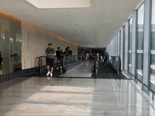
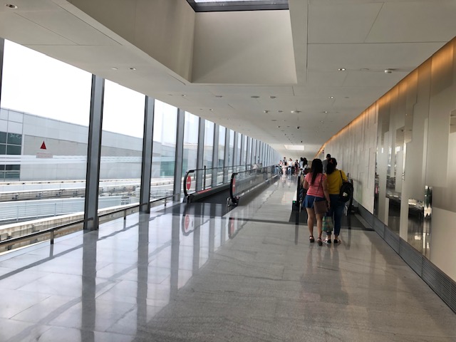 Visitors have the option of walking by themselves or using the moving walkway whenever these were available.
 The automated guideway transit (AGT) system of Changi allow you to transfer from one terminal to another with the exception of Terminal 4.
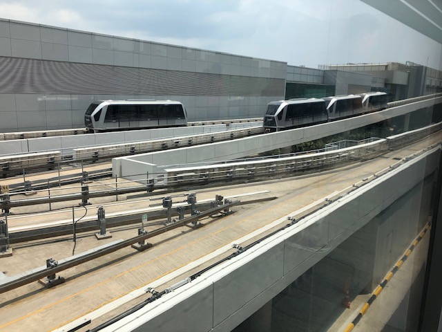 I took this photo of the guideway and the AGT as reference for my lectures
 Another view of the corridor connecting Terminal 3 to the Jewel
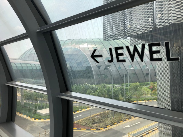 Directional sign to the Jewel
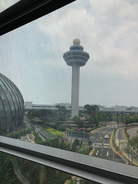 Changi’s air traffic control tower
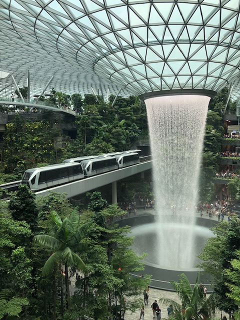
 The main attraction is this gigantic waterfall located at a man-made complex that’s designed to imitate conditions at a rainforest.
 Changi AGT slow down for passengers to have a good close view of the Jewel
 All the water used is recycled and one can get mesmerised by the vortex where all the water falls and seem to be sucked into.
 Here’s another look at the Jewel and the airport AGT
 There is a mall with shops, restaurants and cafes around the Jewel.
 Another photo of the AGT guideway above the road system at Changi
 Taxis queued along airport roads
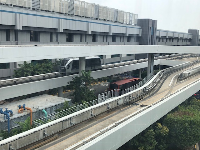 More guideways
 A look back at the way from the Jewel
More photos of Changi soon!
–
Paseo Recoletos
The sidewalks around the University of San Jose Recoletos in Cebu City are named Paseo de Recoletos and Paseo de San Jose. Here are a few photos on Paseo de Recoletos.
 Arcade-type walkway along the perimeter of the University of San Jose Recoletos. This part is the Paseo de Recoletos along Magallanes Street and across from the Freedom Park Market. The other is Paseo de San Jose but is not wholly covered. The latter is along P. Lopez Street.
 The Paseo leads to the church of Our Lady of Mt. Carmel, which is on the second level from the ground.
 View of the Paseo de Recoletos from our vehicle. Note the architectural details on the USJR building.
 Another view of the Paseo de Recoletos
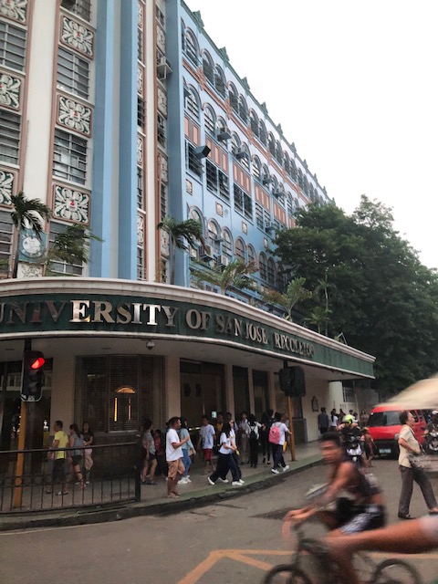 The main gate of the USJR is at the corner of Magallanes and P. Lopez Streets. The photo capture the view towards P. Lopez and the side of the university along this street is Paseo de San Jose.
 Frontage of Our Lady of Mt. Carmel Parish Church, which is integrated with the main building of the university, which is run by the Order of Augustinian Recollects (OAR).
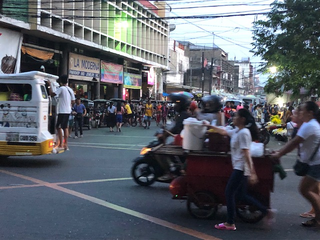 Scenes along the Paseo de Recoletos included overloaded jeepneys, motorcycle taxis and various vendors both mobile and those who’ve set up shop across the street.
 Vegetable vendor pushing a cart containing his merchandise
Scenes like these are common in many Philippine cities especially the old ones that have narrow streets and have retained much of the commerce in many areas around the city centre. It gives you a glimpse of the marketplace and commerce before the arrival of the large malls. Of course, there are what are already termed as malls around the area but these are more like large department stores than the types of SM City, Ayala Center and Robinsons Place.
–
The Barkadahan Bridge situation
The Barkadahan Bridge is currently undergoing rehabilitation. To be accurate, the old bridge is being rehabilitated and upgraded/retrofitted to be able to carry the traffic projected to use it being a vital link between the Province of Rizal and Metro Manila via Pasig and the C-6 corridor. The bridge is named after the “friendship” established among Rizal municipalities and Pasig City for an area that has been subject of a territorial dispute among them. These are the municipalities of Cainta and Taytay (Rizal Province) and the city of Pasig. The bridge spans the Manggahan Floodway, much of which is in Pasig City.
To increase the capacity for this crossing, which is the most direct route to C-6 and popular among many headed to Taguig/BGC and Makati, a new bridge had been constructed to the south of the old one. The older one had 2 traffic lanes and was no longer sufficient for the volume of vehicles crossing it after the expansion of C-6 resulting to it steadily gaining more users over the years. Use of this route cut down travel times between Rizal and BGC and Makati by at least 30 minutes based on our experiences using the route.
Late last year as far as I could recall, the new bridge opened and immediately increased capacity but then congestion quickly set-in due to two factors: the traffic management at the intersection with the East Bank Road and the constrained (two-lane, two-way) leg of Highway 2000. Add to this the lack of discipline by local traffic in the form of tricycles and motorcycles counter-flowing in the area.
Earlier this year, signs were posted around Rizal about the then impending project for the rehabilitation of the old bridge. The signs advised for most travellers to avoid using the Barkadahan Bridge due to the congestion in the area because of the project. It turns out that what was thought by most as a project retrofitting the old bridge alone was actually a bigger one involving increasing the capacity of the Highway 2000 leg of the intersection with the East Bank Road. Following is a photo posted at the official Facebook page of the Rizal Provincial Government showing the demolition of buildings and other structures along the Highway 2000 leg. The photos were taken from the new Barkadahan Bridge approaching the intersection, the southbound direction of the East Bank Road, and from the westbound side of Highway 2000.
 Demolition and clearing of ROW for the expansion of Highway 2000 in relation to Barkadahan Bridge [Photo collage from the Lalawigan ng Rizal Facebook page]
From the photos above, it is clear that at least 2 lanes will be added to Highway 2000 and that this leg will soon be well-aligned with the Barkadahan Bridge, which will also have a total of 4 lanes. Hopefully, this project will be completed soon and within the year (before December?) in order to alleviate the commuting woes of Rizalenos working in the BGC and Makati CBD areas. Of course, that goes without saying that there is also a need to optimise the traffic signals at the intersection and to strictly enforce traffic rules and regulations vs. erring motorists in the area.
–
NAIA Terminal 3 departure 2019
My recent travel to Sri Lanka allowed me to take photos at 3 airports – NAIA, Changi and Bandaranaike. For NAIA, I used Terminal 3. For Changi, I had the opportunity to take photos at Terminals 2, 3 and 4. And Bandaranaike was my new airport for 2019. Here are photos I took at the departure area of NAIA Terminal 3. There were a few new items here from my last overseas trip using this terminal (I traveled onboard Emirates last year to and from Europe).
 Directional signs greet you as you clear immigration
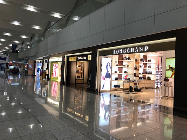 Shops at Terminal 3
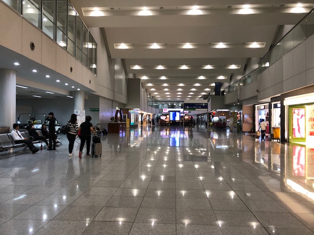 Long corridor leading to the boarding gates is lined with shops at either side
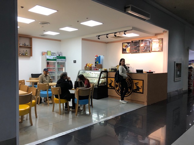
 Local cafe at the departure area
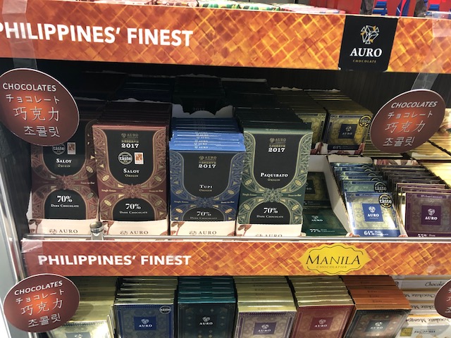
 Chocolates for sale
 I was very happy to see that the best of Philippine chocolates are being sold at the duty free shop. These include Malagos (the Davao brand, which I think is the top quality chocolate in the country), Auro (also from Davao and with high quality comparable to Malagos), and Theo & Philo (another good quality chocolate). At the bottom of the shelf are high quality liquor.
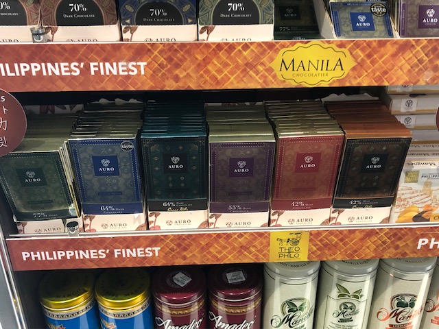 Close-up of the selection of Auto chocolates.
 At the other side of the shelf are boxes of chocolate-covered dried fruit. For me, the chocolate-covered mangoes are the top picks.
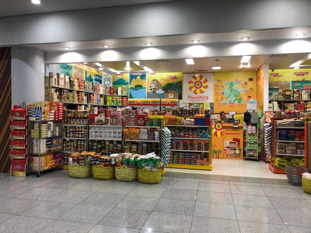 Souvenir shop specialising in local delicacies from different regions of the country.
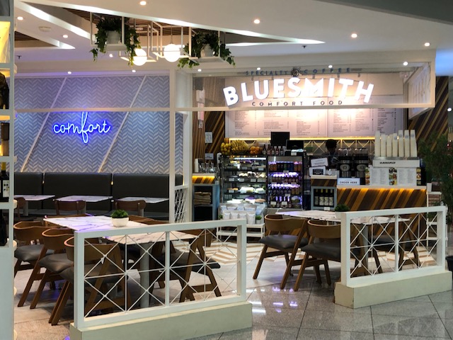 It was the first time I saw this cafe at the T3 departure area
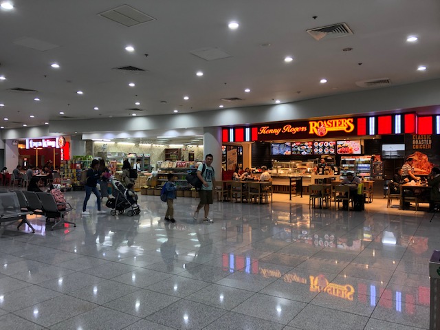 There are also the familiar and reliable restaurants like Kenny Rogers’
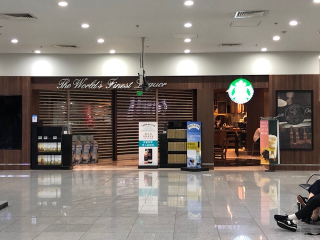 Starbucks for those who prefer their drinks and food. Don’t get me wrong. I also patronise their drinks and food and they are a sure thing compared to other brands you are not familiar with.
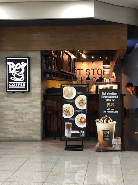 Bo’s Coffee might be preferable to many Filipinos. This is another brand that originated in Davao.
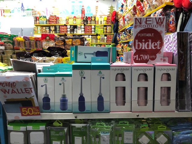 We were amused by this somewhat novel product – portable bidet
 This is the second airport where I’ve seen WHSmith. The other is Mactan Cebu International Airport.
 Another local cafe at the terminal
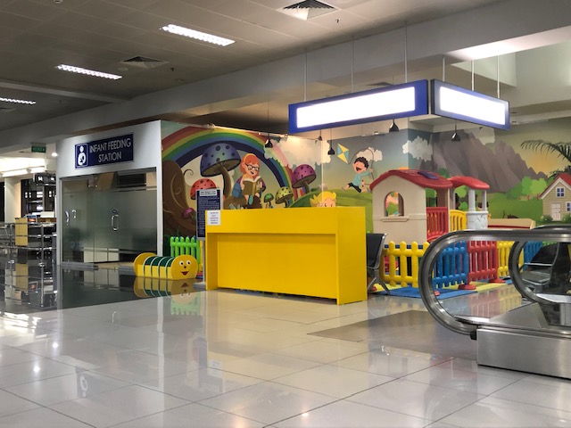 Children’s play area and infant feeding section at the terminal
–
On commuting characteristics in Metro Manila – Part 2
Late last month, I wrote some comments about a recent survey conducted by a group advocating for improved public transport services in Metro Manila. In that post I stated that perhaps its not a lack of public transport vehicles but that they are not traveling fast enough to go around. Simply, the turnaround times for these vehicles are too long and that’s mainly due to congestion. But how do we translate the discussion into something of quantities that will allow us to understand what is really happening to road-based public transport.
As an example, and so that we have some numbers to refer to, allow me to use data from a study we conducted in 2008. Following are a summary of data we collected on jeepneys operating in Metro Manila and its surrounding areas.
| Route Class | Coverage Distance | Distance traveled per day, km |
| Short | 5 kilometers or less | 68.75 |
| Medium | 6 – 9 kilometers | 98.24 |
| Long | 10 – 19 kilometers | 111.22 |
| Extra Long | 20 kilometers & above | 164.00 |
[Source: Regidor, Vergel & Napalang, 2009, Environment Friendly Paratransit: Re-Engineering the Jeepney, Proceedings of the Eastern Asia Society for Transportation Studies, Vol. 7.]
Coverage distance refers to the one-way distance between origins and destinations. If we used the averages for the coverage distances for each route class, we can obtain an estimate of the number of round trips made by jeepneys for each route class. We assume the following average round-trip distances for each: short = 3.5 x 2 = 7km; medium = 7.5 x 2 = 15km; long = 14.5 x 2 = 29km; and extra long = 50 km. The last is not at all unreasonable considering, for example, that the Antipolo-Cuba (via Sumulong) route is about 22km, one way, and there are certainly other routes longer than this.
The number of round trips can then be estimated as: short = 68.75/7 = 9.82 or 10 roundtrips/day; medium = 98.24/15 = 6.54 or 6.5 roundtrips/day; long = 111.22/29 = 3.84 or 4 roundtrips/day; and extra long = 164/50 = 3.28 or 3 roundtrips/day. Do these numbers make sense? These are just estimates from 2008/2009. Perhaps everyone would be familiar with certain routes for their regular commutes and the number of roundtrips made by jeepneys (or buses or UV express) there then and now. Short routes like those of the UP Ikot jeepneys might have more roundtrips per day compared to other “short” route jeepneys since there is practically no congestion all day along the Ikot route. It would be worse in the case of others especially those running along the busiest corridors like Ortigas Ave., Marcos Highway, Commonwealth, Espana Avenue, Shaw Boulevard and others. If you factor current travel speeds into the equation then it can be pretty clear how these vehicles are not able to come back to address the demand for them.
In a recent Senate hearing tackling the transport issues in Metro Manila, a certain study was mentioned. This was the EDSA Bus Revalidation Study conducted in 2005/2006. The findings of that study and subsequent ones showed that there was an oversupply of public transport vehicles in Metro Manila. These studies also recommended for the rationalisation or optimisation of road public transport routes in the megalopolis. I think it is timely to revisit these reports rather than pretend there never were formal studies on public transport in Metro Manila and its surrounding areas.
–
Another look at the Francisco Bangoy (Davao) International Airport – Departure Part 2
This is the last part of the feature on the Davao International Airport. Here are the last batch of photos I took of the airport departure areas.
 Spacious departure level containing the airline check-in counters
 Passengers wait for their check-in times and counter for travel tax payments
 Passengers with their luggage filing into the terminal
 View of the airline check-in counters from the escalator
 Another view of the airline check-in counters and the departure area. This photo also shows the shops at the second level.
 View of the terminal entrance from the escalator
 Another view of the ground floor area showing the airline counters and the escalators and stairs to the departure level lounges
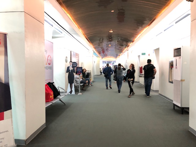 After clearing the final security check, passengers pass through this corridor towards the departure lounge and boarding gates
 Passengers waiting for their boarding calls.
Coming up soon are photos of Changi (Singapore) and Bandaranaike (Sri Lanka) airports. I haven’t been to Singapore in 7 years and it was my first time to go to Sri Lanka so I made sure to take a lot of photos at those airports.
–
EASTS 2019 Conference
The 13th International Conference of the Eastern Asia Society for Transportation Studies (EASTS 2019) is currently underway. This conference is hosted by the domestic society of Sri Lanka from September 9-11, 2019. The conference was almost canceled or relocated due to the safety and security concerns following the bombings in Colombo last April. After assurances by the organisers plus the full support from government, the conference was decided to push through in Colombo.
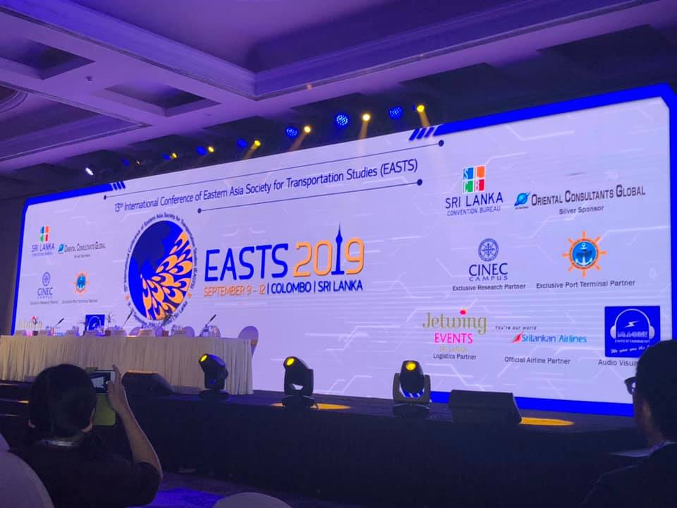 Backdrop of the opening program
 Delegates from the Philippines pose with EASTS President Prof. Tetsuo Yai and other friends from Japan
More information on the conference and others about the domestic society may be found on the EASTS homepage, which also has a link to the organizers’ website.
–
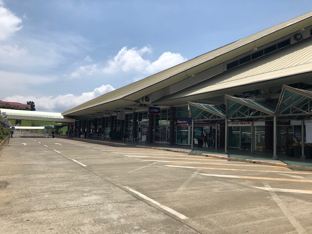
Another look at the Francisco Bangoy (Davao) International Airport – Departure Part 1
To continue on the series on Davao’s international airport, here are a few photos on the airport upon our departure last week.
 Taxi stand at the airport There are two lanes here along which taxis are queued to pick-up passengers. The other two lanes to the right in the photo are for dropping-off passengers.
 Passengers walking towards the terminal. Those with lots of luggage may avail of the porter services. The porter assists you until the check-in process.
 Driveway for private vehicles and VIPs
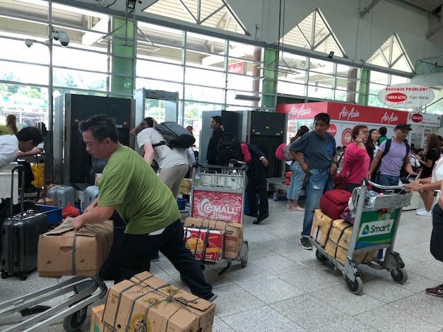 Typical scene right after the first security check at the airport
I will be completing this series with another post on this airport soon. Meanwhile, I am preparing for a trip to Sri Lanka via Singapore. That means more photos of airports. I have not been to Singapore in a while. The last one was in 2012 when Changi still had a budget terminal (terminal for low-cost carriers like Cebu Pacific and Tiger Airways) and I have not been to Sri Lanka at all. And so I am looking forward to there travels and will be sharing the experiences through photos and some narratives in future posts.
–
Another look at the Francisco Bangoy (Davao) International Airport – Arrival Part 2
This is a continuation of the post on the Davao International Airport. I made sure to take photos upon our arrival as I haven’t been to Davao in a while. So here’s a second set of photos on the airport.
 Upon exiting the terminal, one is greeted by a spacious are with covered walkway towards the taxi stand and the parking area.
 A view of the sidewalk and path to the departure wing of the terminal. Note the signs indicating the airline offices nearby.
 Crossing to the taxi stands and pick-up areas
 A look back to the terminal building
 Driveway for private vehicles picking-up or dropping-off passengers at the terminal
 Taxi stands at the terminal. These are taxis picking-up passengers.
 Queue at the taxi stand
 The taxis on the other lanes are those dropping-off passengers at the terminal. There are two lanes each for taxis dropping-off or picking-up passengers.
 Passengers are given by airport security personnel a small sheet of paper where the information on the taxis are written. These are for future reference or use in case there is an issue or concern such as things left on the taxis.
 Taxi bearing a sticker of Hirna, a popular taxi hailing app in Davao. This homegrown company gives good competition to the industry leader Grab. I thought that we probably need more of these than Grab Cars.
I have always admired taxi operations in Davao. My experience there since my first time to visit the city is that it was easy to get a taxi and their drivers generally follow rules and regulations. The system in Davao seems to be effective in encouraging drivers to be honest and obedient to traffic rules and regulations.
More on the Davao International Airport soon!
–
Another look at the Francisco Bangoy (Davao) International Airport – Arrival Part 1
I have not been to Davao for some time now. I think the last time was over 6 years ago at a time when there was still no inkling of its mayor becoming the Philippine President. In fact, that was the time he was Vice Mayor to his daughter who was mayor the last time I was in the city. And so I was curious how it was in the city where certainly the popularity of the First Family should be at the highest in the land. Note that aside from the President, the first daughter is again Mayor, a son is Vice Mayor and another son is Congressman. But no worries for the DDS among my readers, I will not talk about politics in this post. I will just be sharing photos of the airport and some commentaries here and there.
 View of the airport terminal as we deplaned
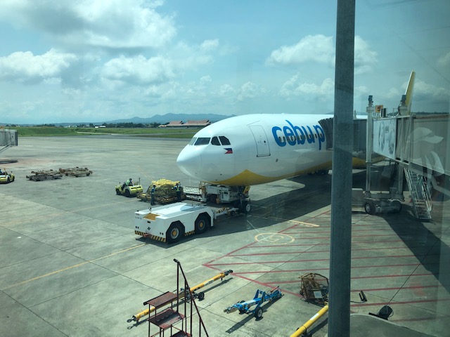 A look back at the Airbus 330 jet that brought us to Davao
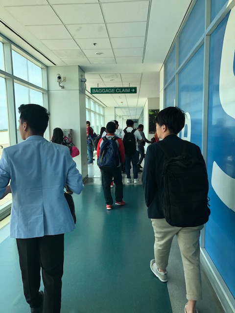 Passengers walking towards the baggage claim area, which is on the ground floor of the terminal
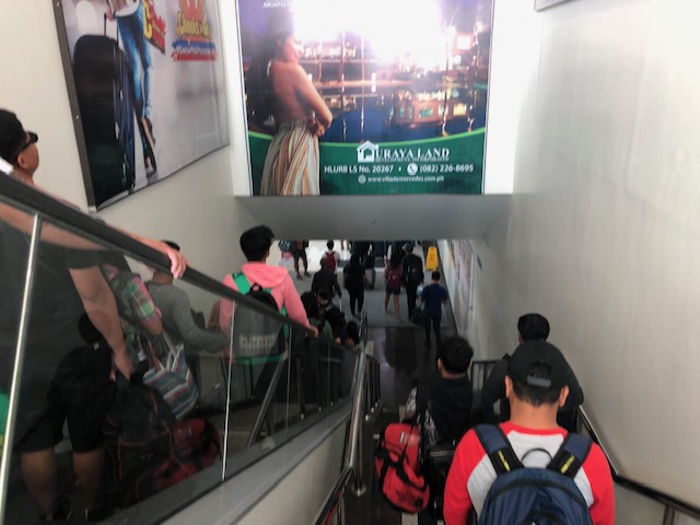 Passengers using either the escalator or the stairs to the baggage claim area
 Passengers walking towards the baggage claim area pass by an area where sometimes quarantine is performed and people step on a mat that’s treated vs. foot and mouth disease (FMD).
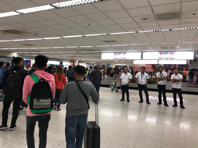 Porters line up to welcome arriving passengers and offer their assistance
 Information desk at the arrival area
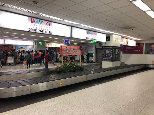 Baggage carousels – there were only two for domestic flights
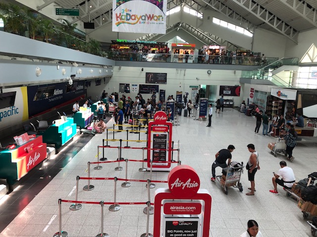
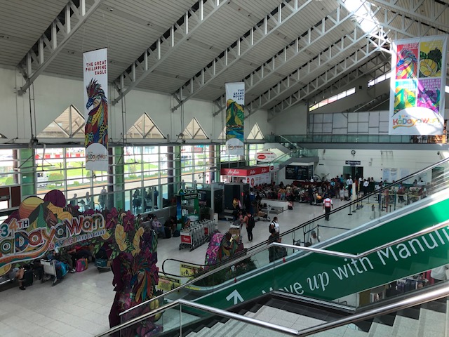
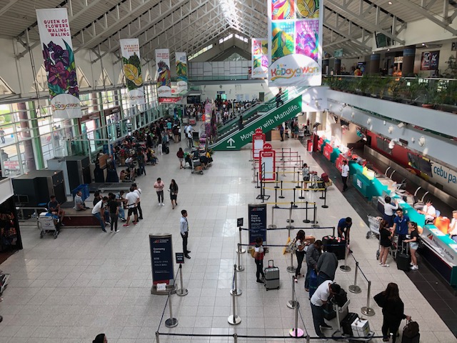
 We arrived in time for the last days of the city’s Kadayawan Festival
 Passengers surround the carousel to await their checked-in luggage
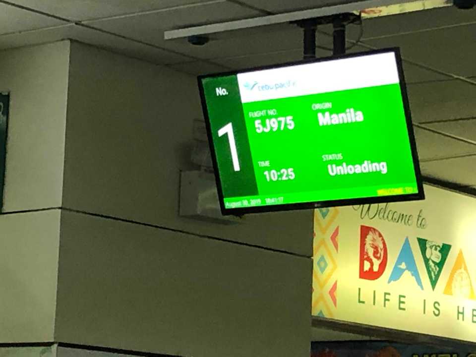 There is a screen informing passengers that their baggage are being unloaded. I thought it would have been helpful if Philippine airports provide more details like how its done in other countries. In the latter, they usually announce when the first and last bags are on the carousel for specific flights.
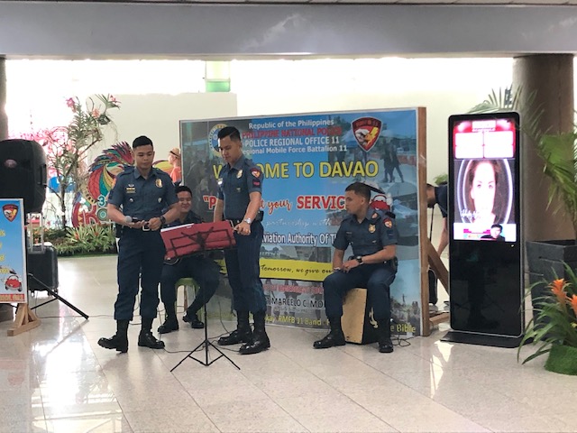 Policemen performing musical numbers at the airport terminal is a pleasing sight and sound and is certainly an effective P.R. initiative for the PNP and the city.
 Another look at the still crowded carousel area. It took a while for our luggage to come out.
 Hotel desk at the terminal for those inquiring about accommodations or perhaps their airport transfer services.
 Another Kadayawan photo op feature at the terminal
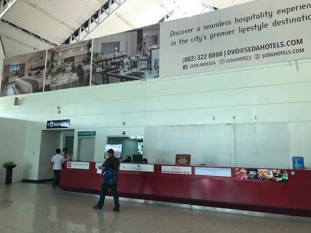 Another look at the hotels’ desk at the terminal just before the exit
I took a lot of photos at the airport so I will be sharing these in several posts. More photos soon!
–
