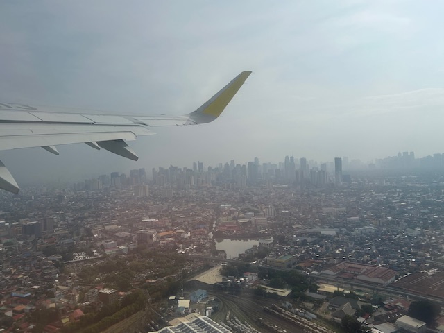
We flew to Iloilo just after the Habagat floods that ravaged much of Metro Manila and its surrounding provinces. As our plane took off from Runway 13-31, I figured there was an opportunity to take a few photos of Metro Manila especially as I was seated by the window of the plane.
That’s the LRT depot in Pasay City at the bottom of the photo. The waterway in the photo is the Estero de Tripa de Gallina, which is supposed to be the largest or longest creek in Metro Manila.
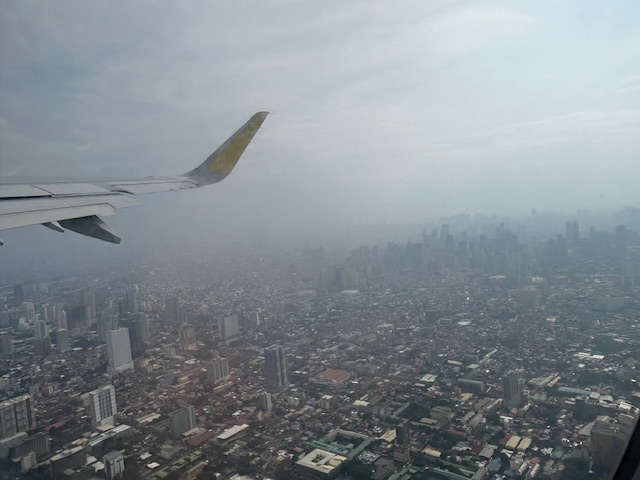
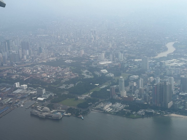
Makati and Manila buildings
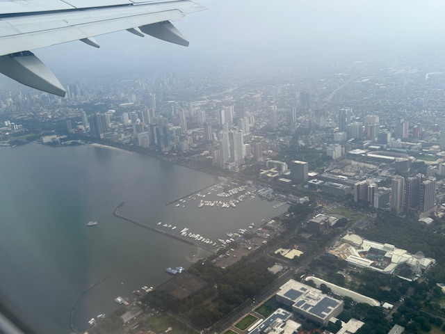
The Manila Yacht Club (center), the Cultural Center of the Philippines (to its right) and the US Embassy (upper left)
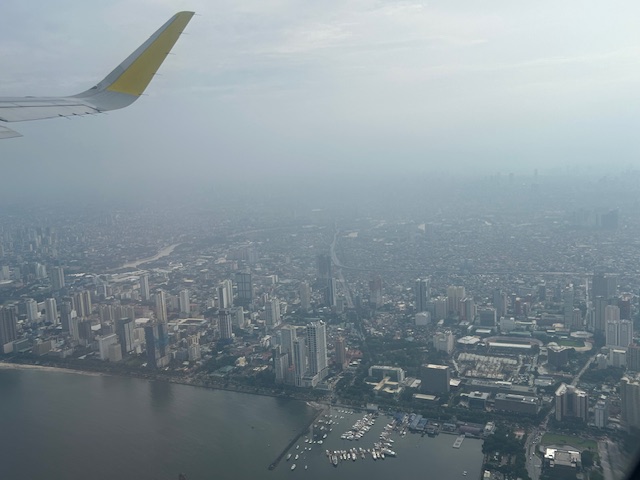
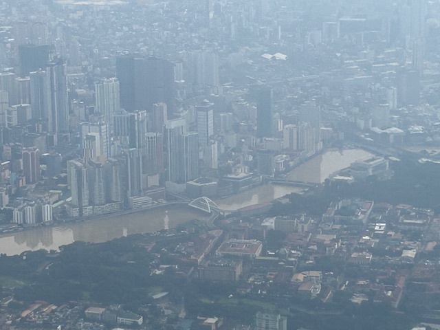
Closer view of Manila – the major road in the middle of the photo is Quirino Avenue (Circumeferential Road 2) and visible in the photo is the Skyway Stage 3 turning to the South Superhighway. The green area just above the yacht club is the Manila Zoo.
The photo shows Rizal Park, Manila Ocean Park, the Manila Hotel, the US Embassy, and Intramuros. That’s the Pasig River on the middle right snaking to the left and above Intramuros.
The Manila South Harbor with the SuperFerry terminal to the left of the Manila Hotel. Rizal Park, Manila Ocean Park and Intramuros are in the photo. Across from Intramuros at the top in the photo is the Binondo District. Also shown at the left is the Baseco Compound.
Close-up showing the Binondo-Intramuros Bridge, the Jones Bridge (leading to Escolta and Quintin Paredes), and the McArthur Bridge (leading to Carriedo). Between the Jones and McArthur Bridges is the Manila Central Post Office Building that was heavily damaged by fire last year.
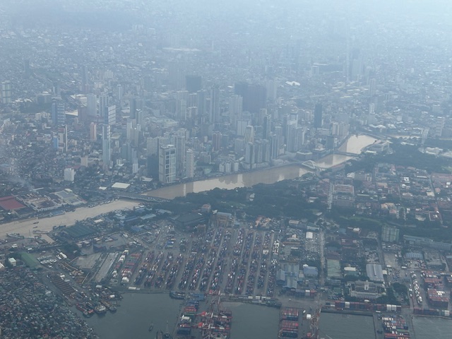
Another view of Intramuros, Binondo and the Port Area
Close-up of part of the Baseco Compound and the port area. The bridge at the center of the photo is the Manuel A. Roxas Bridge that is part of Radial Road 10. Fort Santiago is the green area to the right of the bridge.
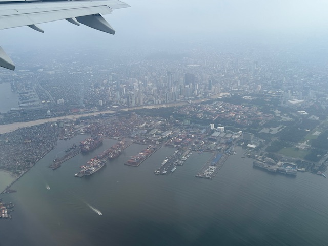
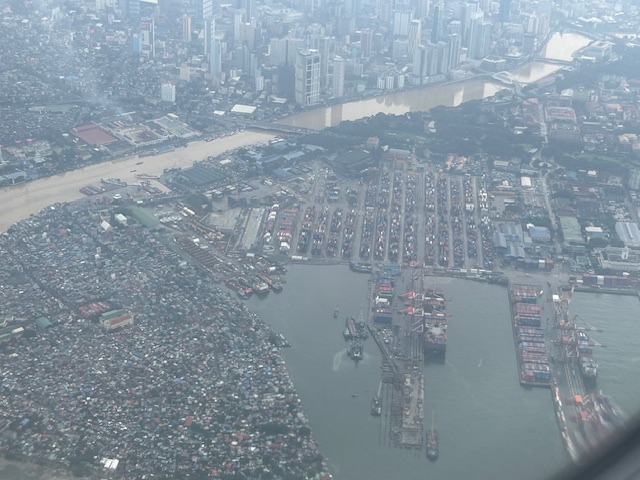
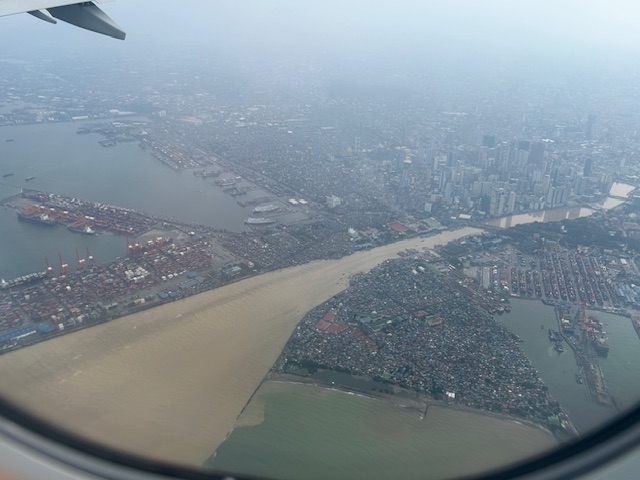
Aerial view of the mouth of the Pasig River showing the Baseco compound to the right and the Manila International Container Terminal (MICT) to the left. Note the contrast in the color of Manila bay and the brown waters of Pasig River. The Manila North Harbor is shown at the top of the photo.
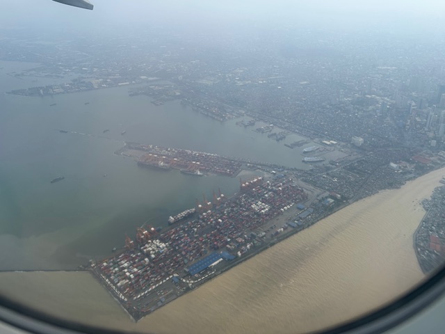
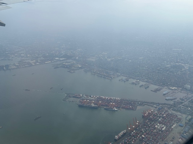
The MICT, the Manila North Harbor and Isla Puting Bato (extending to the top from the base of MICT in the photo). Note the piers of the North Harbor are even-numbered (Pier 2, 4, 6, and so on) while the South Harbor’s piers are odd-numbered (1, 3, 5, and so on).
Isla Puting Bato was developed into another container terminal and is where the Bureau of Customs has its Port District Office. Also seen in the photo is the Manila Harbor Center, to the north of which is the Navotas Fish Port. I was hoping to get a photo of the fish port but our plane already banked to the left before I could get a good shot.