
On unwanted traffic
I just want to end this first month of 2025 with a commentary on unwanted or undesirable traffic. Last year, one of our neighbors leased their property to a trucking company. This was without information to the homeowners’ association and certainly without the knowledge or notice to neighbors, particularly those near their property and along the routes the trucks use. The result was unwanted truck traffic along roads that we usually used for our daily walks. Truck drivers’s usually drove the vehicles as if they were not in a residential area. That is, they were usually fast and belching smoke. Add to this the drivers hanging around and even loitering around the village. Many neighbors complained about this but the resident did not respond favorably or in a neighborly manner. And so each one of us had to confront the drivers ourselves and reminded them to drive carefully and slowly as they were in a residential subdivision. The village security was also told about them and the roving guards also reminded the drivers about safe driving.
And so I was pleasantly surprised when during my first walk of the year, I found that there were no more trucks along the road and parked in their property. I thought this was a nice New Year’s gift and ended what is generally regarded as an external cost to society.
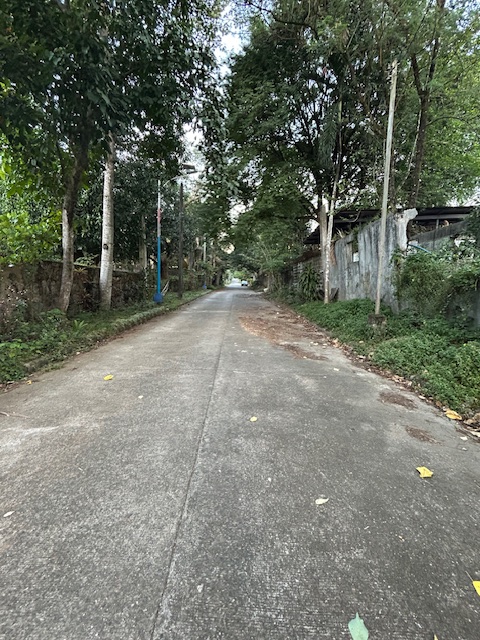
The now clear street in our neighborhood used to be lined with trucks. This street was quite busy, noisy and smelled of emissions from idling trucks. It’s good to recover the road space for walking again. Do you have something similar happen in your neighborhood?
–
On civil works for transferring cables and wires underground
I got messages this week about the civil works to be implemented in relation to transferring overhead cables and wires underground at the Ortigas Center in Pasig City. This is a screenshot of what’s been circulating the past days:
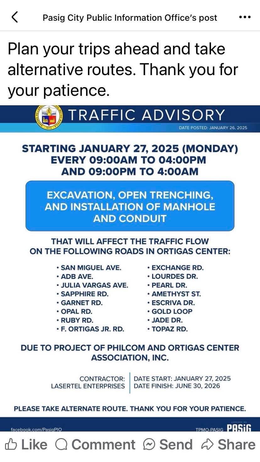
I think this follows the examples of cities like Iloilo and Davao already transferring or placing power and communications cables and wires underground. Prior to these, Bonifacio Global City (BGC) in Taguig City already did so but that was from the start considering BGC is a masterplanned development. Other masterplanned developments are already consciously doing this so there will be no overhead cables and wires that are often criticized as unsightly or ugly. Such works will require traffic management as excavations will surely reduce road capacities and lead to more congestion. The timeline or schedule can also be affected once they do the excavations as conflicts among utilities are expected. Note that water lines and drainage are already underground and there will be the need to resolve the intersections of these with the power and communications lines to be transferred.
Perhaps we can learn from this experience that Ortigas Center will undergo until 2026 as other Metro Manila LGUs also consider transferring their overhead cables and wires underground. Quezon City, for one, is already at the early stage of identifying an area or corridor to serve as a pilot for the city. That can be a road like Commonwealth Avenue or Visayas Avenue or perhaps the Araneta Center in Cubao.
–
Roads, railways support needed for airport upgrades — analysts
Here’s a quick share on an article on the infrastructure needed to support airport development:
Source: Roads, railways support needed for airport upgrades — analysts
Unlike many capital airports including Malaysia’s Kuala Lumpur International Airport and Bangkok’s Suvarnabhumi International Airport, Ninoy Aquino International Airport does not have rail or mass transit access. It will eventually have rail access via the currently under construction Metro Manila Subway. The airport construction in Bulacan should also have transit access in order to make it more accessible to passengers and other airport users. Railways will provide an alternative to road-based transport that would probably require much road space and likely lead to congestion just like what we experience around NAIA at present.
–
Tips for walking
I was at a clinic last week and found this special edition of a certain magazine that had meditation and mindfulness as the main themes. Walking was a topic of one article in the magazine and I got the following “tips” for walking:
- Walk when you wake up
- Walk to get lost
- Walk in the cold
- Walk in silence
- Walk after you eat
I will leave these tips as is for now and won’t be expounding on these. I will try to write about each in future posts. The reader is free to interpret or identify with these tips. I’m sure that many people will have experiences with at least one of the tips.
–
The journey to PHL’s railway renaissance
Here is a quick share of an article on railway development in the Philippines. It certainly took a while for railway development to get underway with considering rail transit would probably had a major impact on commuting particularly in Metro Manila and highly urbanized cities like Cebu and Davao that require mass transit systems to alleviate congestion.
Source: The journey to PHL’s railway renaissance
The article though doesn’t contain a narrative on the journey but rather only a summary of the rail projects that are currently being implemented as well as those in the pipeline. It would be a nice to have a more historical approach to this so-called journey so we can have an objective look at what happened to our railways from the 1970s when its decline began until the last few years when a so-called renaissance came to be.
–
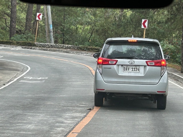
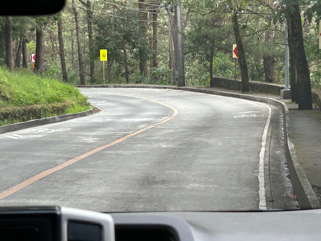
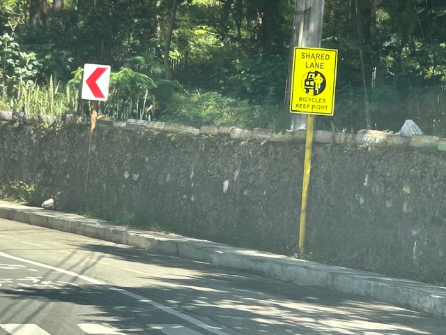
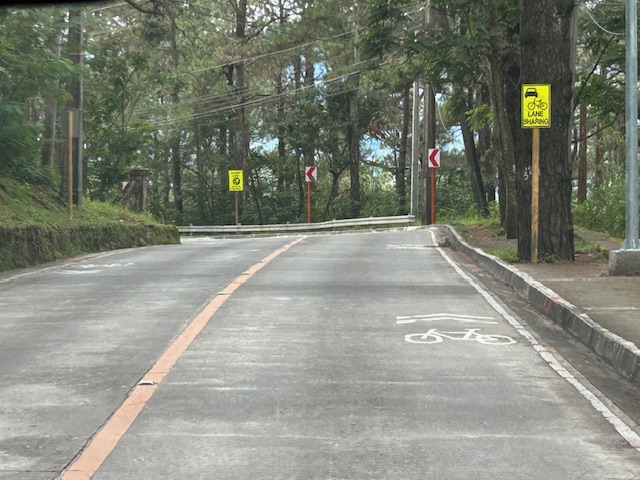
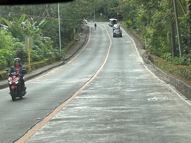
Shared lanes in Baguio City – Loakan Road
I have several drafts of articles about our recent travel to Baguio City. Those include write-ups about roads to/from and in Baguio City. Before I post about Kennon Road and Marcos Highway, I want to share some examples of shared lanes I was able to take photos of while going around the city. The following photos were taken along Loakan Road near Camp John Hay. It is the same road that takes you Baguio’s airport.
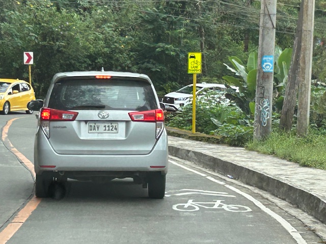 Note the use of the international standard for bicycle pavement marking. This is different from the rather odd bicycle marking in the DPWH guidelines that looks like a person on a treadmill (among other interpretations).
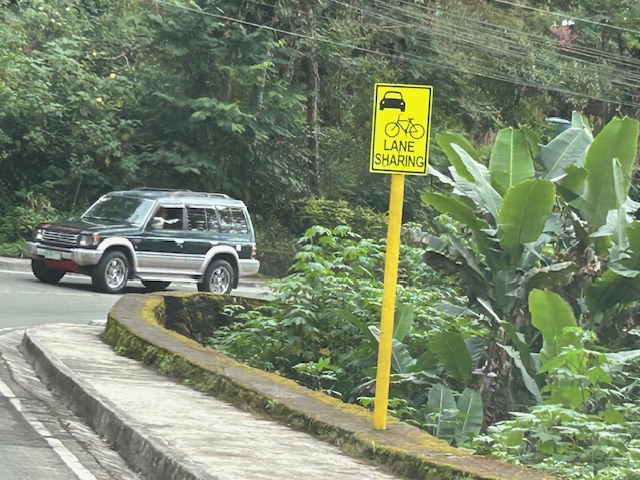 The signs are also not standard and somewhat small as you can probably see in the photos.
 Chevron signs for the curve
 Another example of a curve section
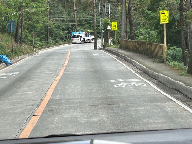 There are actually two types of signs installed along the road – both state lane sharing but with the other directing bicycles to keep right.
 Two signs alternated along Loakan road. This one directs bicycles to keep right.
 Signs and pavement markings are closely spaced. Perhaps the intervals are less than 5 meters for the pavement markings?
 Section showing pavement markings for shared lanes
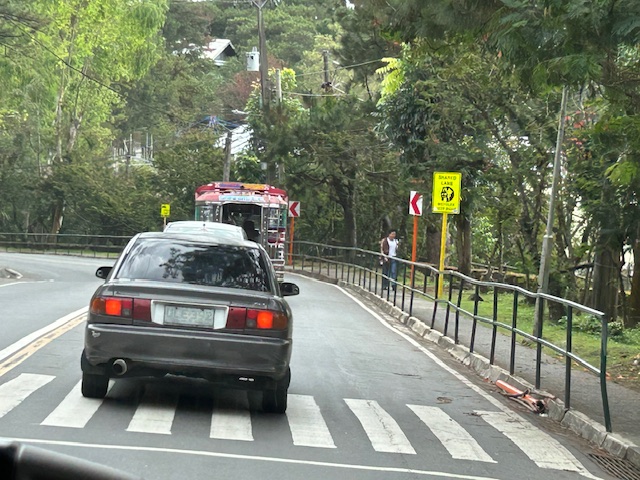 Pedestrian crossing and fenced sidewalks
While shared rights of way (sharrows) or shared lanes is not preferred where there is space for bikes, these can be implemented for 2-lane roads with adequate lane widths such as Loakan Road. It is clear from the photos that there is ample if not generous space for cyclists and motorists to share a single lane. The premise for safety here is that motorists will not be hogging the road space, being mindful of cyclists, and will move at safe speeds.
–
Davao 8th, Manila 14th worst in Tomtom Traffic Index
I just want to share this news report here:
Source: Davao 8th, Manila 14th worst in Tomtom Traffic Index
I have to admit that I still have to figure out in detail how exactly their data were collected and evaluated. However, knowing and experiencing traffic in these cities, I would like to opine that traffic is still worse in Metro Manila cities compared to Davao and perhaps others across the country.
Another look at the Candaba viaduct’s new lanes
I recently wrote about the new lanes along the Candaba viaduct and my thoughts about them being used as variable lanes (i.e., more lanes assigned along the peak or heavier traffic direction). Only this January 2, I observed that the lanes were being used instead for the southbound traffic as the older southbound viaduct appeared to be closed to traffic. Perhaps that side is up for rehabilitation or maintenance work?
 The new lanes between the two viaduct structures are now in use.
 These are assigned to southbound traffic while the original lanes appear to be closed off.
–
Landmarks – the Lion’s Head, Kennon Road
The main landmark along Kennon Road is the Lion’s Head. I think most people heading to or coming from Baguio have taken a photo of if not with the Lion. Here are photos I took as we descended from Baguio via Kennon Road last December 2024 after participating in a workshop.
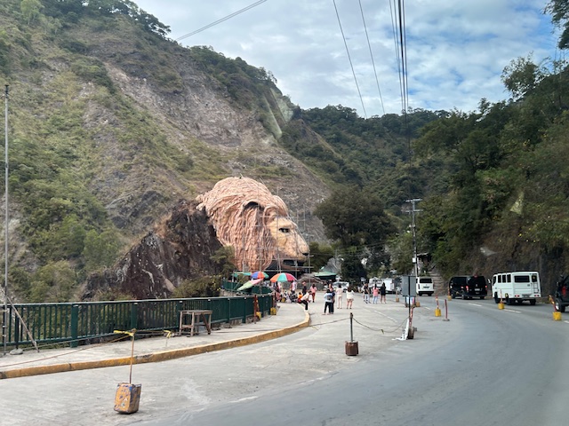 Approaching the Lion’s Head along Kennon Road, the monument appears to be under maintenance with scaffolding around the head.
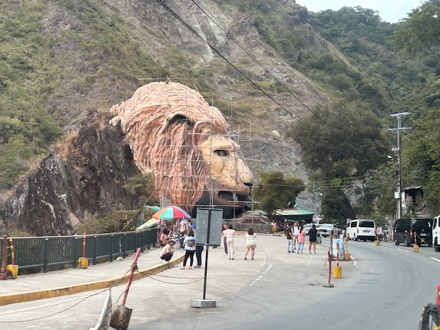 An entire section is cordoned off, likely for tourists or visitors. The lane though looks newly paved, perhaps part of a road widening project.
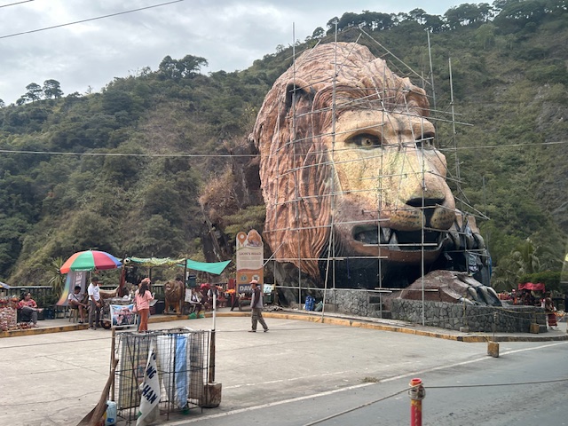 A closer look of the Lion’s Head and the touristy things in the area. Notice there weren’t too many tourists at the time and there weren’t so many shops and vendors set-up.
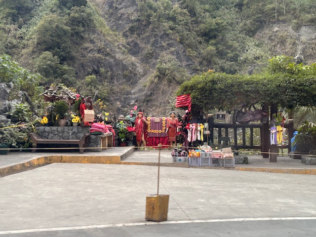 Among the activities are dressing up in local costume and taking photos wearing these with the mountains or the monument in the background.
–
–
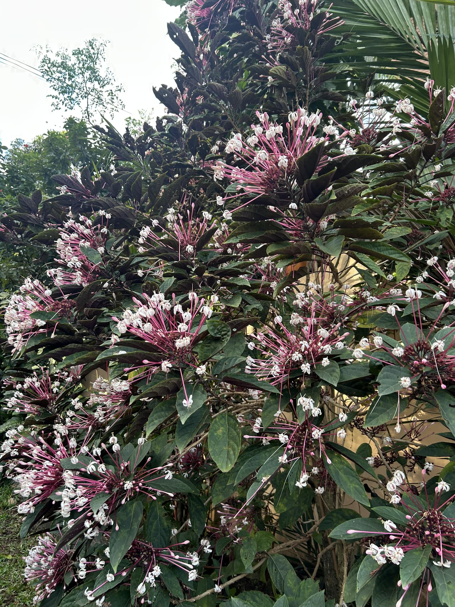
Happy New Year 2025!
Before I start writing again about transportation, traffic and related topics, I just want to greet everyone a Happy New Year!
My walking route includes a street where one of the houses has this starburst plant. I always think of this as nature’s version of showing fireworks that don’t actually involve fire.
–
