
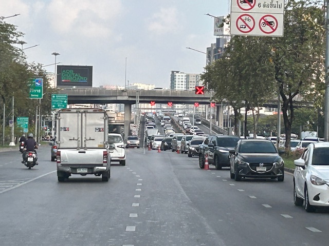
A new bottleneck along Marcos Highway in Antipolo City?
I’ve been wondering why there seems to be much congestion along the westbound side of Marcos Highway in the morning just before we reach SM Cherry. It is usually flowing there but the past weeks when we used the route instead of Sumulong Highway, traffic was really bad. As I am quite observant about the traffic and always looking for reasons or causes, I found that this was due to the alternative route Antipolo ‘opened’ that many motorists now take when traveling between Marikina and the side of Antipolo heading in the general direction of Cogeo.
The alternate route connects Marcos Highway and Sumulong Highway via TOCS Avenue (which intersects Marcos Highway near SM Cherry) and Sampaguita Street (which intersects Sumulong Highway past Masinag Junction and near the Hillside Centre Plaza before Soliven Avenue). If you’re coming from Marikina and heading in the direction of Cogeo or even Antipolo Simbahan then this route may provide shorter travel time as you won’t have to go around Masinag Junction to make an effective left turn to Marcos Highway (direct left turns at Masinag are not allowed).
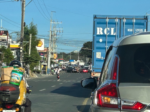 This is the view from the queue approaching the intersection of TOCS Avenue with Marcos Highway from the eastbound side of the highway. Note that traffic is not flowing from the junction along the eastbound (Metro Manila bound) side of the highway.
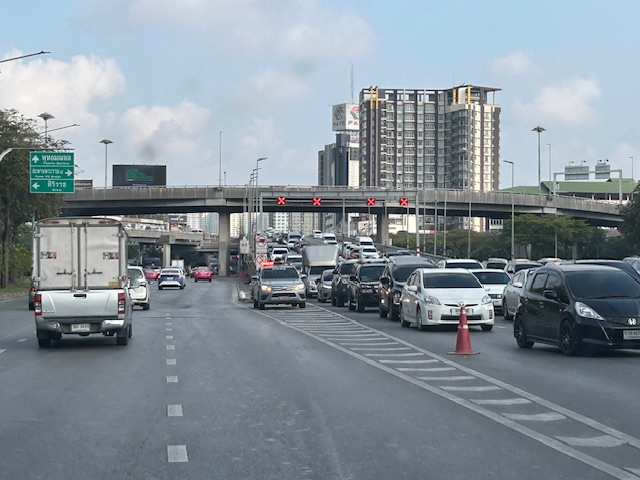
 A closer look with vehicles turning left to Marcos Highway from TOCS Avenue. There are usually Antipolo traffic enforcers facilitation (read: favoring) traffic from and to TOCS Avenue. This results to build-up along Marcos Highway where most traffic is through traffic.
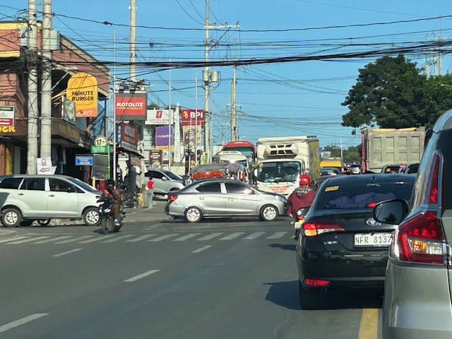
 The resulting congestion affects many travelers including freight along the westbound (Metro Manila-bound) direction of Marcos Highway.
While the alternate route likely provides shorter travel times for those coming from Marikina to Antipolo/Cogeo and vice versa, this is at the expense of more people and goods who and that travel along Marcos Highway. Antipolo should realize this even with basic observations on the traffic build-up in the area. Traffic for that alternate route should not be prioritized to the detriment of travelers along Marcos Highway.
–
On walkable spaces for senior citizens
Here is a quick share of an article on walking and walkability, and the relation with dementia:
Steuteville, R. (March 10, 2025) “Living in a walkable place reduces dementia,” , https://www.cnu.org/publicsquare/2025/03/10/living-walkable-place-reduces-dementia [Last accessed: 3/29/2025]
To quote from the article:
“When we live in a walkable place, we move more, naturally. Unsurprisingly, exercise is linked to better cognitive health. Regular exercise increases memory, and boosts hippocampal volume by 2 percent.
Also, walkable neighborhoods are more stimulating. They are built on connected street networks, which give individuals more choices on how to get around and reward those choices with diverse physical paths linked to spatial memories. And they are mixed-use.
“Street layouts with better connectivity and walkability are associated with a reduced risk of cognitive impairment. Access to local amenities, such as food stores, community centers, and healthcare amenities, supports cognitive health,” the authors note.
Social connections also probably help. When you walk to a destination, you are more likely to have friendly interactions, which have been shown to reduce the risk of depression, and walkable places also boost the sense of community.”
As there are many senior citizens in our village, the topic is quite relevant. Most seniors probably won’t take a walk if they felt it was dangerous or risky even inside residential subdivisions. In our neighborhood, there are a few of them going around using their motorcycles or scooters. Most I see walking around perhaps for exercise or leisure rather than to go to a store or restaurant in the area. But increased traffic due to customers of restaurants that sprouted around the village has increased the risk for those who walk. Hopefully, the induced motor vehicle traffic generated by these establishments can be managed and regulated for the overall welfare of residents.
–
Sentimental for Yokohama
A visit from a couple of professors from Yokohama National University (Yokohama Kokuritsu Daigaku) triggered the sentimental part of me. Among the materials presented were information about life on campus and in Yokohama, which is the second biggest city in Japan after Tokyo. There were also giveaways including a nice folder featuring a photo of Yokohama showing the campus on the foreground and many landmarks in the background.
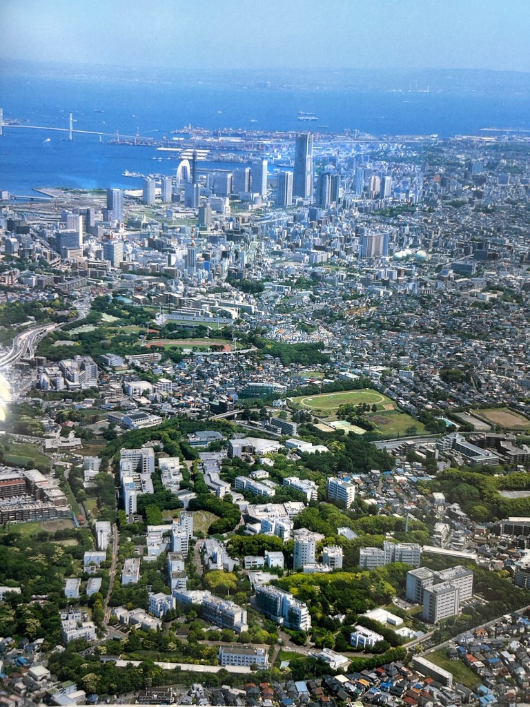
Landmarks in the photo include the Landmark Tower that used to be the tallest building in the country. There is also the Yokohama Bay Bridge that eventually connects to the Aqua Line. And, of course, the Port of Yokohama, which has long been one of the international gateways to Japan.
I have not been to Japan for more than a decade so I look forward to doing another sentimental journey to again visit familiar places and explore new ones.
–
On accessibility for airline passengers with disabilities
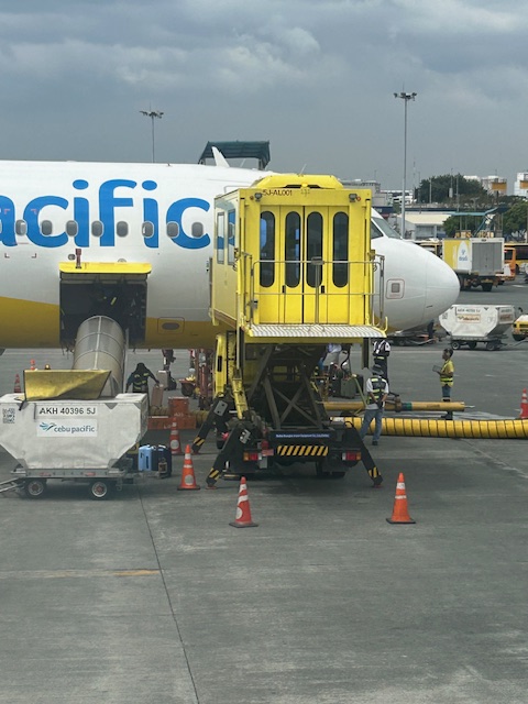
We already know about the ramps they use for boarding and deplaning for most if not all passengers including those on wheelchairs. As we boarded our plane to Legazpi last month, I noticed that there was another way to board aircraft if the passenger was on wheelchair. Here are some photos I took of the elevator access at NAIA Terminal 3.
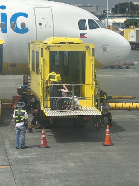 I took this photo of a female passenger being wheeled into the elevator compartment after the ramp was elevated to the compartment level. Notice that there is another wheelchair-bound passenger waiting in the shade at the right in the photo.
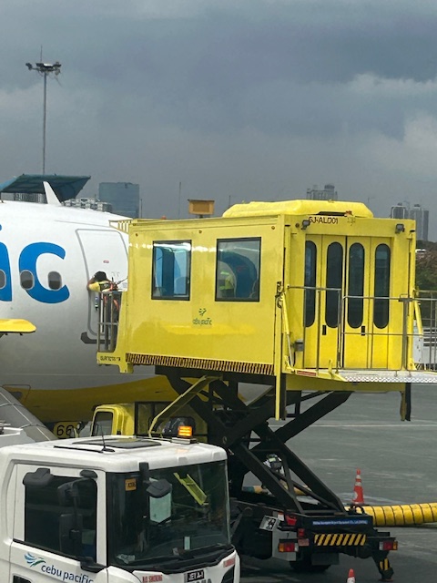
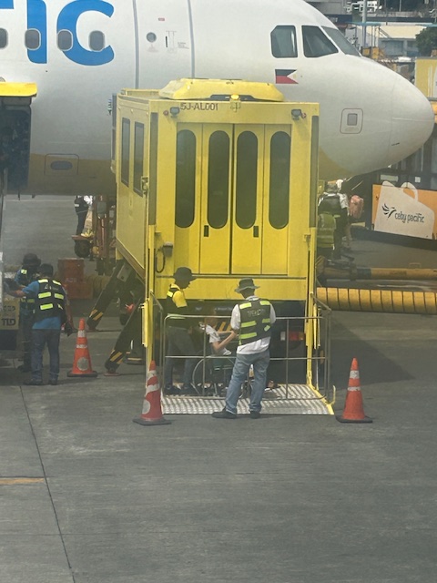 After the female passenger is inside the compartment, the ramp is lowered and the male passenger is wheeled unto the ramp.
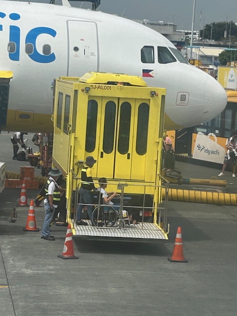 The ramp elevates towards the compartment door.
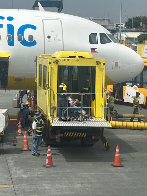 When level, the doors open for the second passenger to enter.
 The doors close and the main elevator goes up with the 2 passengers and the ground personnel assisting them.
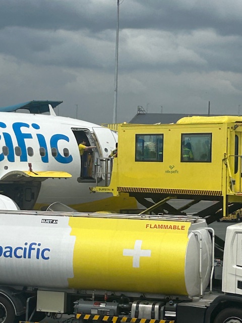
 The platform is elevated until its door and ramp is aligned with the plane’s door.
 Ground personnel assisting the wheelchair-bound passenger knocking on the door for flight attendants to open it for the passenger.
 Airline crew opening the door for the wheelchair-bound passengers
This was the first time I saw this equipment at an airport. I wonder if there are similar elevators at the other NAIA terminals or in other Philippine airports where there are no tubes or bridges connecting the aircraft to the terminal buildings.
–
Old Versus New Traffic Safety Paradigms
Here is a quick share of an article on road safety:
Source: Old Versus New Traffic Safety Paradigms
To quote from the article:
“This issue is, of course, complex. Vehicle travel reductions are not the only way to reduce crashes — traditional traffic safety strategies are also important, and the two approaches are often complementary. For example, many targeted traffic safety strategies such as graduated driver’s licenses, special driver’s tests for seniors and anti-impaired driving campaigns become more effective and politically acceptable if implemented with multimodal planning, TDM incentives and Smart Growth policies so youths, seniors and drinkers can find convenient alternatives to driving.”
–
On the collapse of a bridge in Isabela
A hot topic these days is the collapse of a span of a newly built bridge in Isabela. The alleged causes of the collapse included truck overloading, design flaws and inferior construction. Initial news reports and statements put the blame on the trucker and the designer with only a few suspicions thrown at the contractor. And then the current President of the country together with his DPWH Secretary inspected the site together. BBM was later quoted as saying the cause was a design flaw.
The bridge’s designer came out to state that it is not his fault. That could have been perceived as a self-serving statement until you delve into his explanation and check his credentials. The designer happens to be one if not the most experienced bridge engineer in the country. He obtained his Bachelor’s and Master’s degrees in reputable institutions (UP and Virginia Tech in the US, respectively). He taught bridge engineering in universities and is perhaps instrumental in civil engineers choosing to specialize in bridges. And he was a past president of the Association of Structural Engineers in the Philippines (ASEP). He knew what he was doing and the process requires for his design to be reviewed and approved by the DPWH prior to having the bridge constructed. If it passed the DPWH review and approval process, then it should be determined if the contractor was faithful to the execution of the design. Photos spreading over social media shows problems where the structure failed. And the quick assessment of many who are knowledgeable about structural engineering and construction is that apparently, the failure is due to the construction.
What happened? Wasn’t construction progress monitored? Were there inspections to determined whether the design was followed? One result of the suspicions being thrown at the people responsible for the bridge is the proliferation of ‘corruption’ as the root cause of the collapse. There are already clever memes of the bridge employing ‘steal design’ and ‘steal reinforcement’ obviously replacing ‘steel’ in the terms. While we inject humor into the situation, we cannot deny how serious the matter is and the implications of design specifications as well as the emergence of new truck types with higher payloads is to pavement engineering in general and bridge engineering in particular.
–
Amusing vehicle accessories or features – are these legal?
I was amused by some memes and reels I saw on social media about cars getting these accessories that made them look like characters in the Disney series ‘Cars’. I finally saw the real thing as I was queued before Cainta Junction and on a truck.
 A truck with eyes might be staring at you in traffic
So are these legal? I haven’t found anything yet that says they are. Perhaps they can be distracting to some people but they are not blinding like the super bright headlights (and even tail lights) that people install on their cars. What do you think about these accessories?
–
A suddenly spacious NAIA Terminal 3 outdoor parking area
The news of NAIA being taken over by San Miguel Corporation initially drew many criticisms. I won’t talk about these here but somewhat many things have changed aside from the airline assignments among the three remaining terminals. I said three because Terminal 4, what used to be the Manila Domestic Terminal, was already demolished. Among the changes are the suddenly spacious parking areas at the terminals. Here are some photos we took en route to the multi level parking prior to a trip.
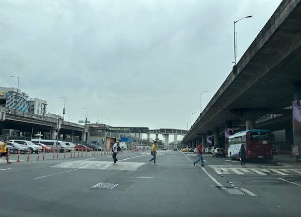 What used to be islands separating the Terminal 3 building from driveways and the open parking lot is no more.
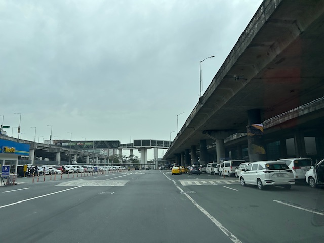 The area is suddenly very spacious allowing for more parking slots as well as a wide driveway for vehicles.
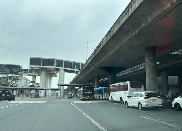 The buses also benefitted from the space as they can line up at the terminal stop without blocking other vehicles.
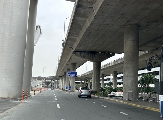 The section leading to the multi-level parking building is not as congested. Most intending to park there including those leaving there vehicles for a few days enter via the upper level driveway. Rideshare vehicles generally use the ground level entrance.
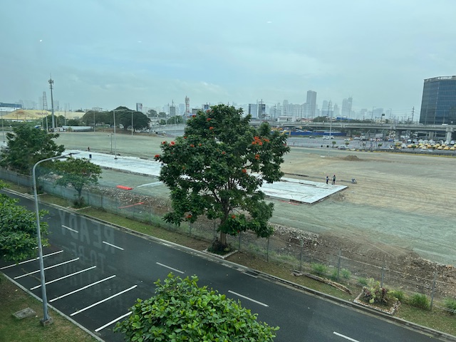 The graded open area that was just usually dirt or mud is now being paved. Perhaps this will provide additional parking spaces considering a significant part of the multi-level parking building has been committed to ride share and taxis.
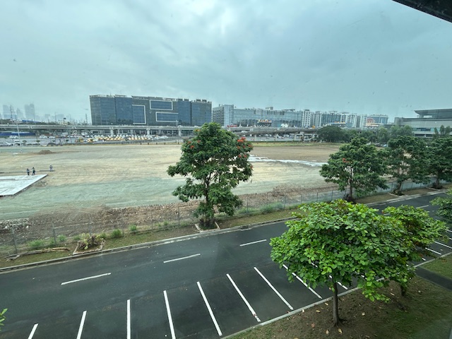 This used to be the area that was burned along with so many cars last year. Gone are the abandoned vehicles and perhaps these will all be paved. But was it necessary to just pave everything rather than have something porous and less heat generator than pavement? It would have been better to go for a multi-level facility and at the same time do some landscaping to have more trees and plants in this area.
–
On the pushback vs. bike lanes
I saw this short article at Planetizen that linked to another article that was the original one about cities dismantling or removing bike lanes. This is a very concerning trend in the US but something that’s also happening here. The Department of Public Works and Highways (DPWH) has always been lukewarm to bike lanes (parang napipilitan lang), the Metro Manila Development Authority (MMDA) seemed never to understand it (even during BF’s time as Chair), and many local government units that jumped on the bike lane bandwagon during the COVID-19 pandemic have reneged on their declared commitments. Currently, it seems that only cities like Quezon City and Iloilo City have sustained bike lanes development. Others have removed protected bike lanes or have not enforced vs. motor vehicles encroaching on the bike lanes.
Johnson, R. (February 18, 2025) “Cities Start to Backpedal on Bike Lanes: A Growing Crisis for Cyclists,” Momentum Mag, https://momentummag.com/cities-start-to-backpedal-on-bike-lanes-a-growing-crisis-for-cyclists/ [Last accessed: 3/2/2025]
To quote from the article:
“Bike lanes have become a culture war where those in favor are seen as “woke” or some other terrible conservative slur. But, most who use bike lanes are just regular people who want to save some money, and get the mental and health benefits to cycling to work.
Urban cyclists, bike commuters, and advocates for safer streets, have all noticed a troubling trend. What was once a symbol of progress toward sustainable transportation and safer roads for all is being reversed in multiple cities across North America.”
Will bike lanes and cyclists suffer similar setbacks here? Will the Department of Transportation (DOTr) continue to champion bike lanes? Will the agency be more aggressive and assertive of bike lanes development? Your guess is as good as mine!
–
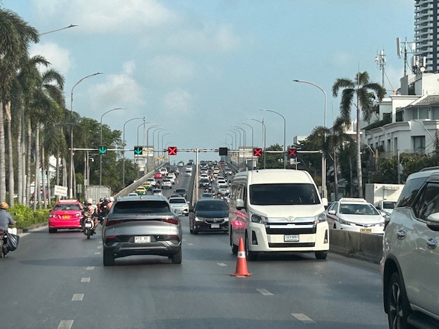
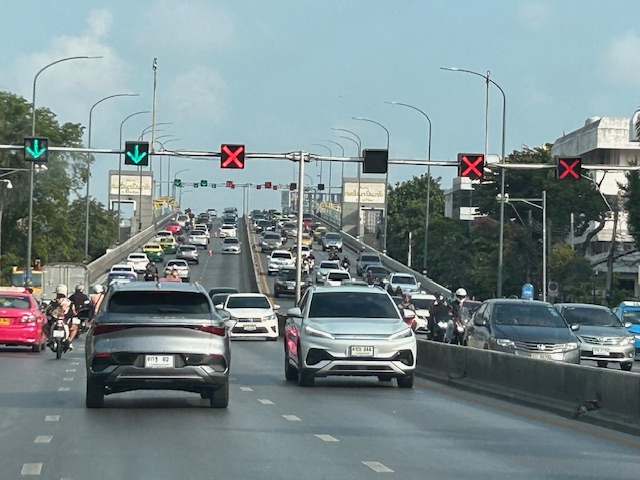
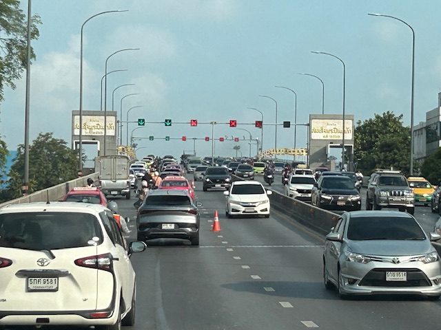
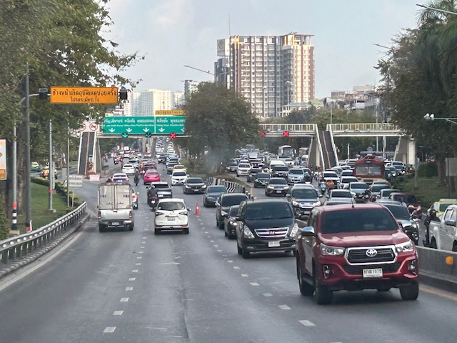
Counterflow lanes in Bangkok, Thailand
I almost forgot again about this set of photos showing the implementation of a counterflow scheme along a long stretch of road in Bangkok. Heading out of Bangkok, I was able to take photos of the counterflow lanes and variable traffic signs used for this purpose. We were northbound meaning we were traveling outbound of the metropolis and opposed to the peak direction (southbound was inbound to Bangkok).
 Approaching an overpass where variable traffic signs are installed overhead (i.e., on a gantry).
 It is easy to see which lanes are assigned for our direction and which ones for the opposite flow.
 On the overpass, you can see that the variable signs are installed at regular intervals. There are a few cones that act as physical separators (not really barriers) between opposing flows.
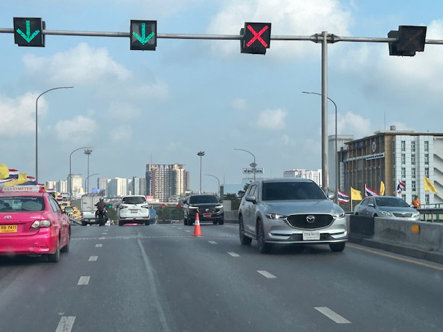 Sort of a close up of the variable signs and a cone. I assume the cones are placed there by traffic authorities. They might be transferred to the other side of the overpass if the counterflow was in favor of our direction.
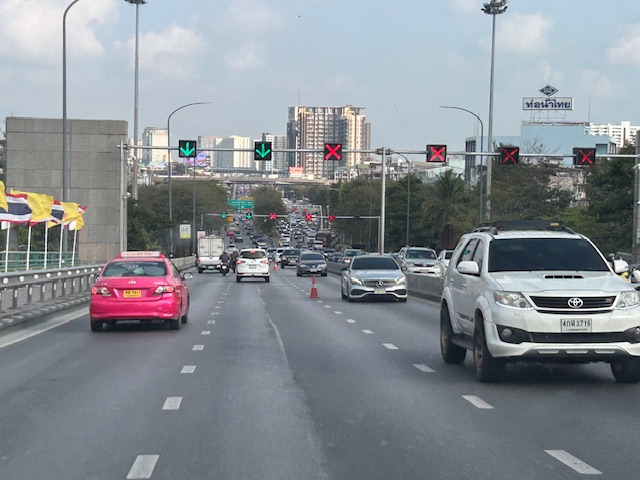 Another photo showing the installed variable signs towards the other end of the overpass.
 Four lanes are assigned to inbound traffic while only two are for outbound traffic.
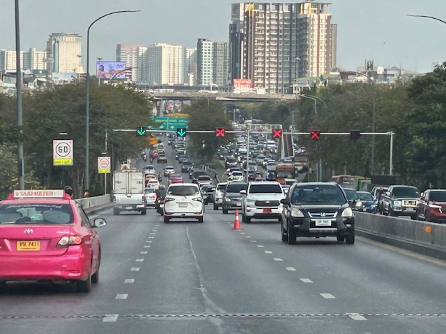
 At the foot of the overpass is a pedestrian overpass. The stairs appear to be quite steep based on the photo. I’m not aware of criticisms of the pedestrian footbridges in Bangkok. I would have to ask my Thai friends about their designs.
 Another overpass where all lanes are assigned to the southbound direction
 The parked vehicle on the chevron is with the traffic authority of Bangkok.
I actually started writing this in April last year. I will try to finish some drafts I started last year this month while also posting about my recent travel to Bicol.
–
