
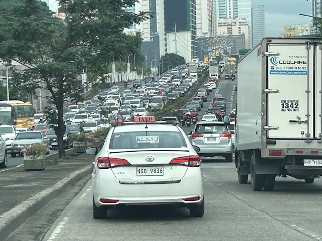
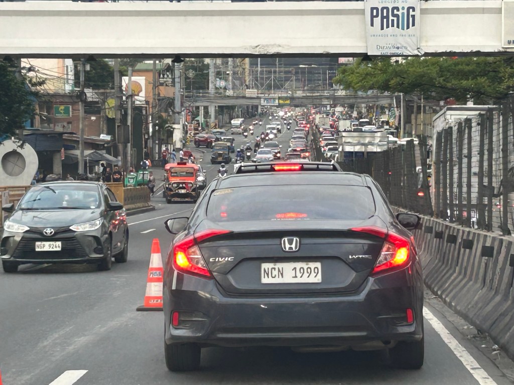
Green GSM spinoff?
Yesterday, we saw what looked like a Green GSM taxi in Antipolo. The color scheme was certainly the same and the vehicle was of the same Vietnam-made model (Vinfast).
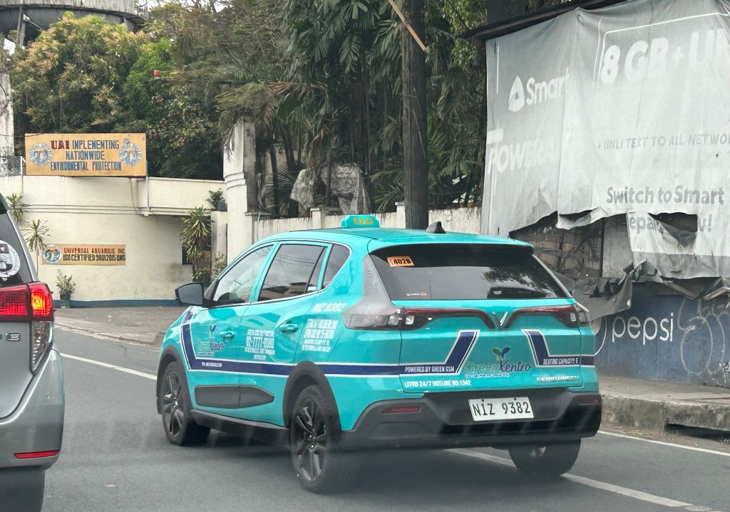
The operator is Green Xentro. Xentro refers to the company operating a few small malls in Rizal and Marikina.
It’s probably related to Green GSM, which might be the mother company. This brings the taxi service closer to Rizal towns. I also have seen a few maintenance shops in Antipolo having a sign indicating they can service Vinfast vehicles. This is welcome if it means we ‘ll see more of these taxis around Rizal towns.
–
Good Transit Is Simple: Lessons in Good Route Design
Here is a quick share of an article on transit route design:
Source: Good Transit Is Simple: Lessons in Good Route Design
I will not preempt the reader (you) on the content but there’s a lot of tips for stop spacing and route design based on the author’s experience in Chicago as transit planner.
–
More buses please
The modernization and rationalization initiatives of the government seem to have slowed down. While there are many modern or modernized jitneys on the road, these are mostly in the big cities including Metro Manila and comprise a small percentage of the total jeepneys currently operating around the country.
Buses have been in the mix of these initiatives especially after the pandemic when jeepney operations were suspended and buses were the first to be activated. In the case of Antipolo City in Rizal, bus services between the city and Cubao in Quezon City were introduced. We even thought that they will replace the jeepneys that dominated the routes. Now they are competitors along with Line 2.
There was a real opportunity there for rationalization that involved upgrading to a higher capacity vehicle but that didn’t materialize. In most cases, the so-called modern jeepneys (many really are mini buses) just added to the conventional jeepneys. Were the number of vehicles reduced while increasing passengers capacities? No.
“We need more buses!” is an understatement. We really need more buses but to replace lower capacity vehicles on the road. The inconvenient truth is that we need to phase out jeepneys along certain routes and replace them with buses. Jeepneys may still operate but along shorter routes and would serve as feeder/collector with respect to the main lines operated by rail and buses.
–
Street legal vehicle?
I saw this motorcycle being driven along the main road to the Shrine in Antipolo. It seems more like a toy than a mode of transport. Say what you will about people’s right to transportation but it is a risky mode to use as the user can be invisible to most motorists. And I’m talking about jeepneys, buses and trucks. Huwag na lang mga SUVs and cars since the mere mention of these trigger the “car-centric” reactions.
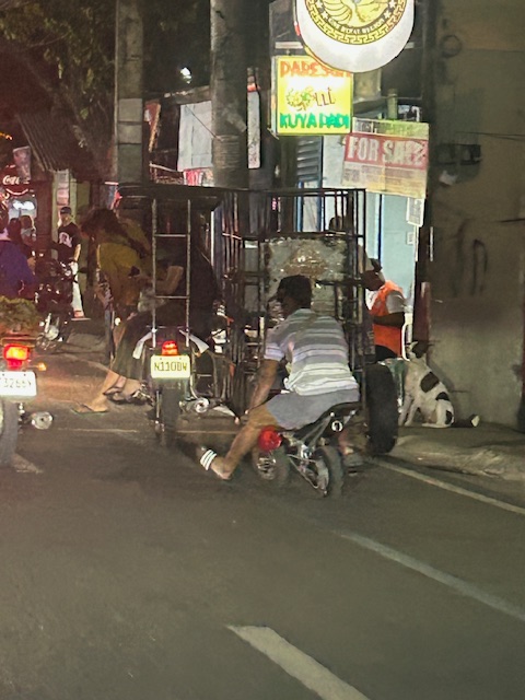 Rider seemed to be struggling with balancing on this “toy” transport. You can compare the rider to the trike in front of him.
 The rider and the vehicle in mixed traffic
I don’t think these can be classified as micromobilty. It would be a stretch. A colleague says these mini motorcycles are actually used for racing. We should draw the line between what is safe and unsafe given the conditions and situation along our streets rather than what is declared as the desired conditions. It is better to err on the side of safety rather than push for advocacy that will lead to road crashes involving these vehicles and their riders.
–
Congested Katipunan again
During the Christmas break, we were reminded just how Katipunan Avenue can be congested due to the trips generated by the institutions along it. These are mainly the schools such as Ateneo, Miriam and UP. Based on my observations and experiences over the past decades though (I started attending UP in the late 1980s), the main culprit is Ateneo with all the private vehicles it generates for its students in all levels (Grade School, High School and College).
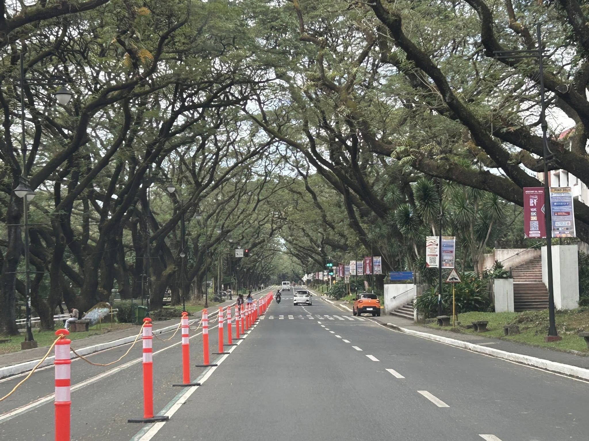
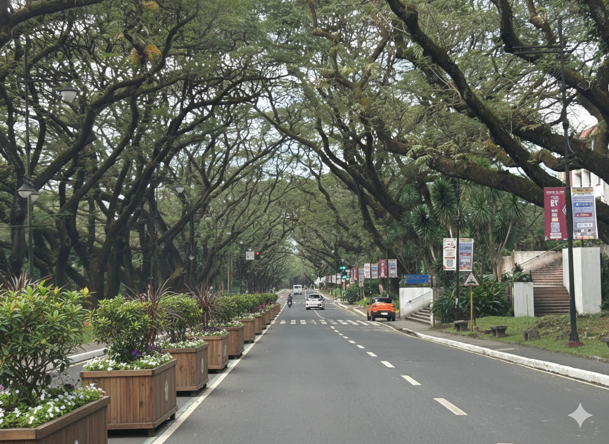
 What “normal” traffic looks like on a typical weekday along Katipunan Avenue
My commute during the break is usually under 1 hour (e.g,, 40-50 minutes). But during the times when there’s school, it’s always more than an hour (e.g., 75 to 105 minutes). Will the situation improve? Will there be a mass transit system along C-5 to alleviate the traffic conditions? We can probably hope so but it doesn’t seem to be in the near horizon right now. The Metro Manila subway, after all, is expected to be operational in the 2030s!
–
On street transformations using AI
My social media feed is full of images generated by artificial intelligence (AI). The street transformations are generated using a variety of AI tools. I’ve tried Canva and Gemini in producing similar images of street transformations; an exercise I’ve included in my undergraduate and graduate classes for more than a decade now but using their sketching and software (CAD, Sketch-up, etc.) skills to do the transformations. The photos below show an example of transformation along the University of the Philippines Diliman Academic Oval using Google Gemini.
 The original photo I took at the UP Academic Oval
 The first attempt at replacing the orange bollards/barriers with something that blended with the campus.
 The second attempt showing plant boxes instead of the fence in the previous photo.
I think it’s possible to have excellent transformations of whatever roads or streets there are. One just needs to prompt or instruct the AI well enough to obtain these alternative designs. While the transformations are nice though, context is still important. Many of the transformations circulating on social media call for almost all major streets to be transformed. (Kulang na lang pati expressway gawan ng transformation.) Advocacy is good but context-sensitive solutions require a more constructive and cooperative. It certainly can do without being combative or antagonistic.
–
Ortigas Avenue Extension counterflow
One traffic scheme that has been constant along Ortigas Avenue Extension is the counterflow scheme. The scheme is applied in the mornings for westbound (outbound from Rizal) traffic. It has been implemented for as long as I can remember; perhaps since the early 1980s. One variant before was a form of “Buhos” where eastbound traffic is stopped for several minutes at certain intervals (6:30am, 7:00am, 7:30am and so on), and westbound traffic is allowed to take all the available lanes during the periods.
Considering this scheme has been implemented for more than 4 decades now, there must be some measure of effectiveness there. It is an example where the directional distribution during the peak hours allow for such scheme to be implemented. Note that the scheme pre dates number coding and similar counterflow schemes elsewhere in other major roads in Metro Manila (correct me if I’m wrong).
The scheme though only shows that there should have been a better transport system put in place along the corridor, which has had a steady growth in travel demand. There should have already been a transit line along this corridor a long time ago. What happened? Was it not in the government’s radar? There was a line proposed and shown in various master plans before.
–
On the chronic congestion along Ortigas Avenue Extension
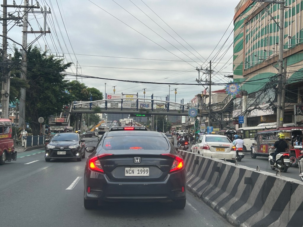
I previously wrote about the counterflow scheme along Ortigas Avenue Extension. While this is usually implemented during the mornings. A similar scheme is not applied in the afternoons or evenings. Apparently, the directional distribution in the afternoons and evenings is not suitable for a counterflow scheme. The photos below show the typical eastbound traffic as seen from the Manggahan Floodway bridge.
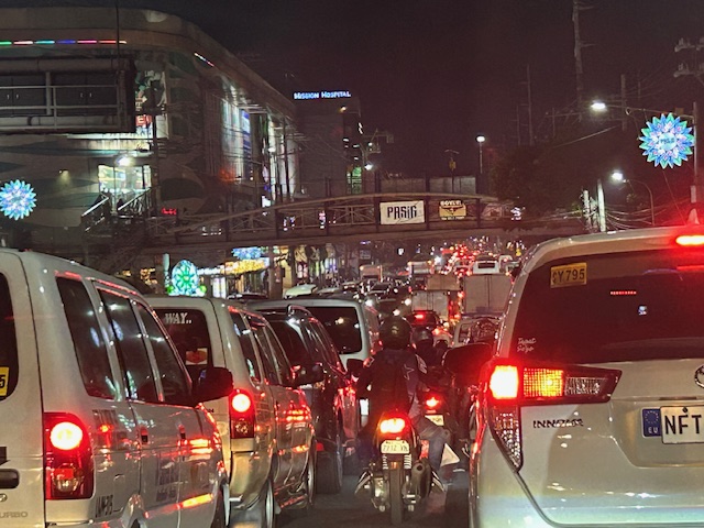 Typical weekday evening traffic along Ortigas Avenue Extension
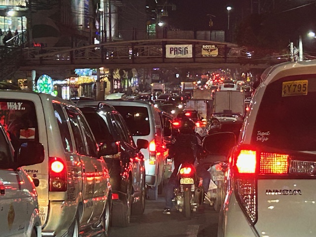 The photos show that the traffic along the opposing direction (westbound) is as heavy as the eastbound traffic. This means a counterflow scheme similar to that in the mornings cannot be implemented during this period.
I have mentioned in the previous article that the corridor already required a mass transit system since the 1980s. Despite the operations of several bus companies over the past decades, these have not been enough (together with jeepneys and vans) to serve the demand along the corridor. It is not uncommon to find so many people stranded along the corridor and waiting to get a ride even during the early mornings. While Lines 2, 3 and 7 were being constructed, people in Rizal who have long endured the traffic along Ortigas Avenue Extension could only wonder why a transit system has not been provided for them. Will the proposed Line 4 be finally constructed? When will it be completed? What could be the traffic impacts of construction considering the limited space available for the construction? Should commuters prepare for more miserable travel once construction is underway?
–
Bus service between UPLB and UP Diliman
Last December, I was supposed to take the bus directly connecting the UP Diliman and Los Banos campuses. I was supposed to attend the annual conference of the Transportation Science Society of the Philippines (TSSP) hosted by the UPLB Department of Civil Engineering. I was looking forward to riding the bus being somewhat nostalgic to the Tritran buses I used to ride between the two campuses back in the 1980s and 1990s.
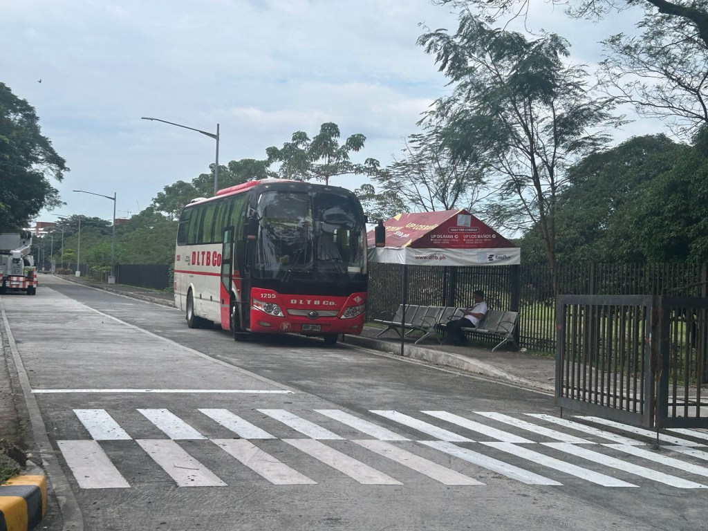
Unfortunately, I was not able to attend the conference due to an emergency. So, I will have to wait for the next opportunity to take the bus to Los Banos and back.
–
Just keep on walking
After an eventful end to 2025 and start of 2026, I finally was able to get back to walking. I passed on January 1 as there was a haze that blanketed our area. That was due to the fireworks. With more residents in our village and surrounding areas, there has been an increase in fireworks users the past few years. Last weekend, it was nice to have better air quality for my morning walks.

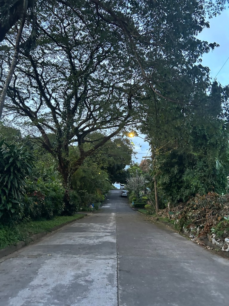
My average step count decreased last year due to a variety of factors including weather. I intend to start strong again this January and hopefully be able to sustain this for the year. It’s really a good thing for my health and wellbeing. And it’s something I would strongly recommend for others- be more active. Set some time for walking whether it’s in the morning, noon or evening.
–
