
Quick escapes
We decided to take an unplanned trip to one of our happy places. Our daughter loves Panglao and this was our nth trip with her. The weather though appears to be uncooperative.
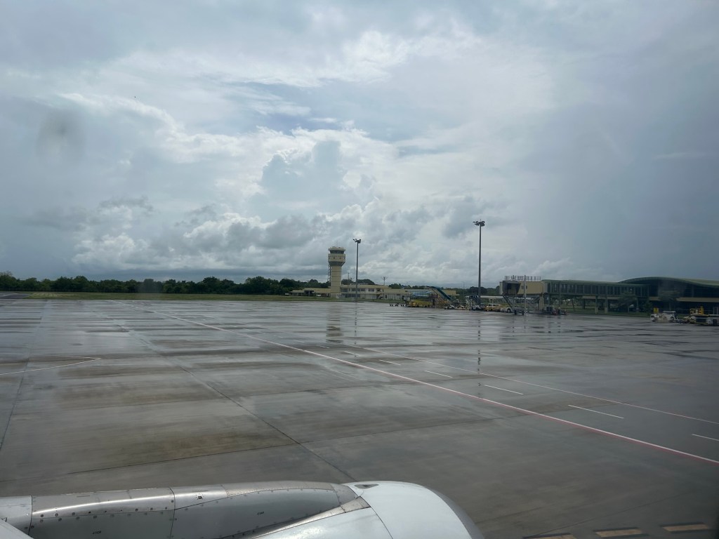
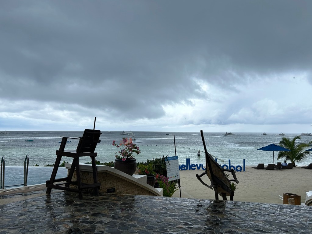
We are hopeful that tomorrow will be better. At least the forecast is fair weather for both Saturday and Sunday. I’m not sure if we will have an unplanned boat ride. This is a short, quick escape so perhaps we’ll just stay at the resort. Quick trips like this is really for recharging one’s batteries given all the stress especially at work.
–
Article share – Planning for Love, Part 1: The link between urban form and dating
There’s this interesting series on the relationship between urban form and dating. To quote from Part 1:
“Even though dating is considered a lesser concern than other social issues, it’s one of the many ways humans seek love and connection. Love, in whatever form it takes, remains one of the most fundamental parts of being human.
So, if the design of cities shapes just about every form of social life, it seems worth finding out whether cities shape this one too.”
Here is the article:
A brief exploration of dating through history highlights how the spaces in which we live and move shape our social lives and relationships.
Source: Planning for Love, Part 1: The link between urban form and dating
Congestion Costing Reality Check, Part 1: Congestion evaluation best practices
Here’s a quick share of an article from Todd Litman on congestion evaluation:
Widely cited studies claim that traffic congestion is a huge and growing problem. They exaggerate. Let’s examine how to correctly calculate congestion costs and roadway expansion benefits.
Source: Congestion Costing Reality Check, Part 1: Congestion evaluation best practices
On desire paths
I found this article on desire paths. These are paths made by people based on their preferred ways to get from one place to another. Often, the paths or ways that are constructed and paved are not the shortest or most desirable ones and appear to force people into following them. Perhaps the built pathways are planned or designed to follow a certain aesthetic in as far as infrastructure is concerned. Desire paths often are the most direct routes from one place to another. These shortcuts are defined over time by the wear along the path. In some cases, they eventually become formalized when they are paved or maintained one way or another including trimming of foliage along the paths.
https://www.boredpanda.com/desire-paths-pictures/?utm_source=share&utm_medium=top&utm_campaign=user
Here’s an example at the National Science Complex grounds of the University of the Philippines Diliman:
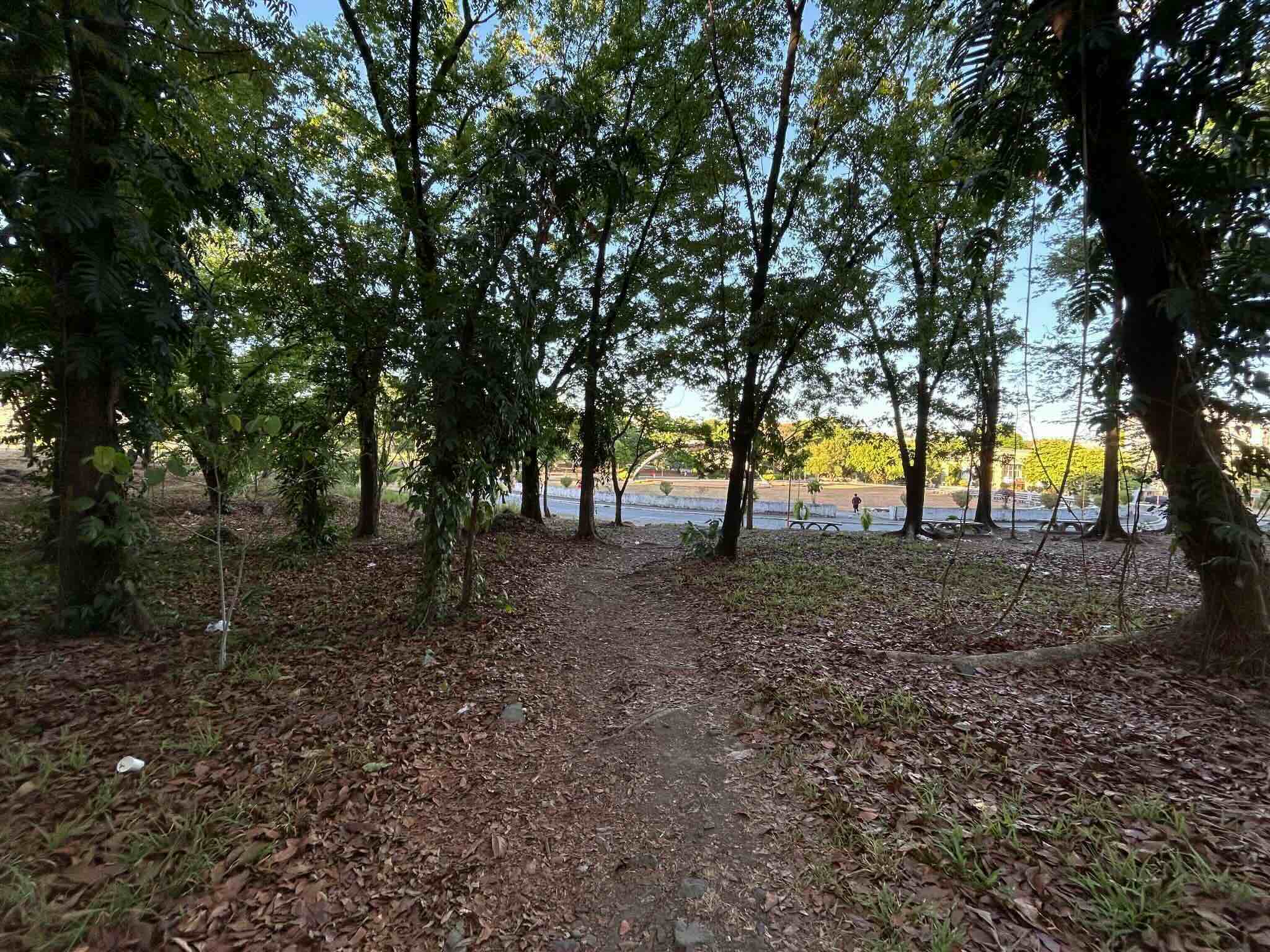 Desire path created by students and staff as a shortcut from the complex core to one of the outlier buildings.
–
Trip purpose, Antipolo City
In the same workshop with Antipolo LGU staff, the following graph was presented showing the purposes of trips made by residents of the city. The data was gathered with the assistance of barangays, which deployed personnel to do a version of the household information surveys (HIS) usually conducted to collect data on transportation and trip making among residents.
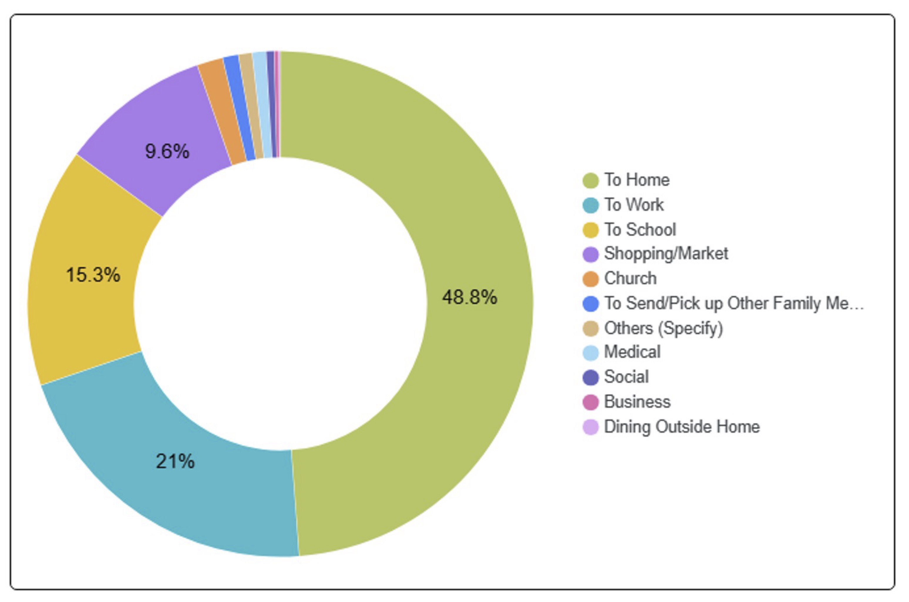
It is important to note that most if not all trips eventually end up at home (i.e., coming home from the workplace, school, market, etc.). Thus we can interpret the graph in a way where we can derive the trip purpose other than “to home”. For example, perhaps the real % of work trips is not 21% but 41.0% of trips made other than “going home.” School trips come in second with 29.9% of trips. Third would be shopping trips at 18.8%. These three combine for 89.7% of all trips made by Antipolo City residents. Work and school trips are most likely the most regular or frequent trips. These are the purposes associated with daily commutes whether by public or private transportation. In the next post, I will share data on mode share and try to relate the latter to the trip purpose.
–
Travel time maps for Antipolo City
Yesterday, we facilitated a workshop for Antipolo City where technical staff of the city presented on the outcomes of various activities related to the formulation of a Sustainable Urban Mobility Plan (SUMP) for the city. One interesting output from one of the groups is this map showing the travel times within selected driving times with the destination being the Antipolo Shrine (“Antipolo Simbahan” if you will refer to the PUV signboards of those plying routes to Antipolo). The maps are the equivalent of travel time contour maps that can be generated with travel speed or travel time data.
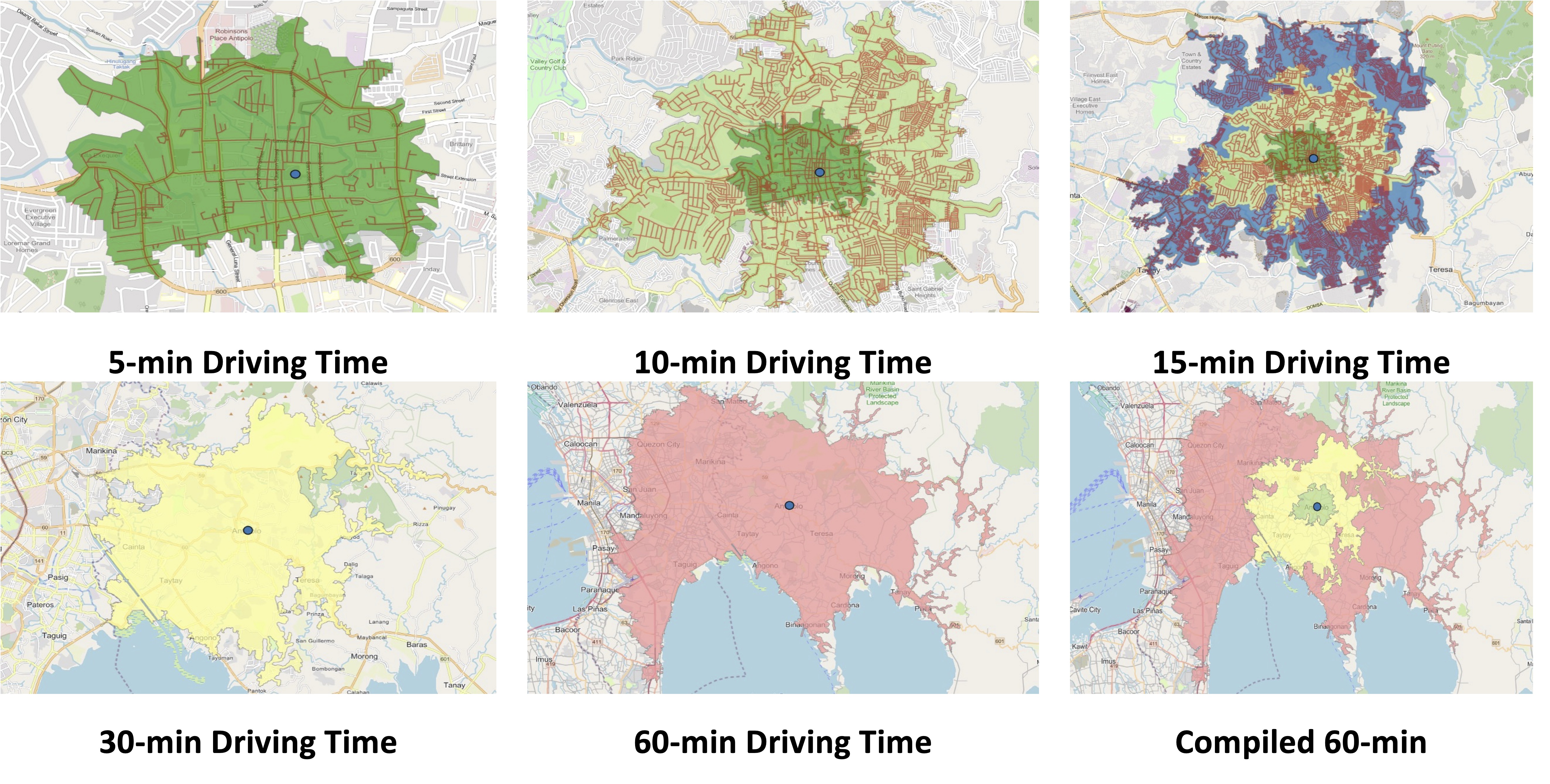
While shown are driving times and assuming car use, similar maps can be produced for public transportation, motorcycles, bicycles and even walking. It is just a matter of collecting the data and plotting them. Alternatively, the data can probably be obtained or derived from sources like Google Traffic or Waze. Some effort, of course, is required in order to have more accurate maps especially considering the road network and traffic circulation. Note that the travel times indicated are also centered on the Antipolo Shrine, which for presentation purposes was used to represent the center of the city. Other maps can be produced in aid of planning travel and transportation for the purposes of the city (e.g., how long it takes between Antipolo and Cubao for a regular commute, etc.).
–
Alternative reasons for the rise of SUVs in the Philippines
I recently shared an article about the rise of large vehicles in the US and how they have negatively affected road safety in that country. There are mentions there of the elements that led to people preferring SUVs including the usual technical specifications of SUVs and trucks (what they call the pick-up) that proliferate US roads. These are probably safer for transport from the perspective of the occupants including the driver. However, they are unsafe to other road users especially pedestrians and cyclists. I guess the reasons for owning large vehicles are similar for the Philippine case but there are other stories and reasons behind the preference of large vehicles in many parts of the country. A couple of these are quite common reasons that has nothing to do with people having car-centric mindsets. The latter is probably far from their consciousness.
One reason for preferring larger vehicles is practicality. I first encountered this reason during vacations in Iloilo in the 1970s and 1980s. People had pick-ups and owner type jeeps built for the rough roads at the time. Cars would not have survived the road conditions with the shock absorbers and tires being the first to go. This would probably be the same reason in other provinces as well. The unpaved and poorly maintained roads necessitated pick-ups and the SUV models of those times. Eventually, these evolved into the Pajeros, Patrols and Land Cruisers and later the Monteros, Everests and Fortuners. Add to these the AUVs (e.g., Innova, Adventure, etc.) that also became preferences depending on the affordability to people.
Another reason for preferring larger vehicles is not just about practicality but survival. People from flood prone areas tend to have larger or taller vehicles. Ground clearance is a criteria for vehicles as these have to be able to navigate flooded highways and streets. Most flash floods are probably ankle or gutter deep. But there are more severe situations where floods can be knee or waist-deep. And so people preferred vehicles that can get them out of their flooded homes if not get to their not flooded home but via flooded roads. This comes from first hand experience. After Typhoon Ondoy inundated much of Mega Manila, sales of SUVs and AUVs were up. People replaced their vehicles with these rather than regular cars. They generally didn’t transfer homes as many decided to stay as they probably couldn’t afford to get a new hour or have gotten used to the flood situation in their places. Floods, after all, are seasonal and the Ondoys are not so frequent.
The stories or reasons I cited above are real and will probably be attested to by many who share the experiences in flood-prone and/or rural areas. These narratives though have been set aside or dismissed in favor of the car-centric narrative that’s the in thing these days. If we really look more deeply, the failures of infrastructure development, whether pertaining to basic roads or drainage systems, have tremendous impacts on our lives including our preferences for vehicle types or models. In fact, weren’t those also among the questions for resisting electric vehicles? Kaya na niyan ang rough roads? Kaya ba niyan ang ahon? Kaya ba niyan ang baha? Of course, housing location preferences and options (along with affordability) are also factors. Why live in a flood prone area after all? But that’s another topic that I plan to write about as well very soon. I think I wrote something about this here or in my other blog. I should write about it again and probably in light of the flood control projects that have been the hot topics these past months.
–
A most beautiful street this time of year – University Avenue
Perhaps one of the most beautiful streets in the country this time of year is the University Avenue of the University of the Philippines Diliman campus. That’s mainly thanks to the sunflowers that are now in full bloom.
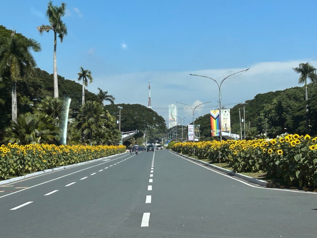

Imagine our streets lined up with flowers or trees? Not only could we probably have aesthetically nice streets but they would be more environmentally compatible. They would probably also contribute to make our days and nights cooler. The sunflowers will also probably keep zombies away 🙂
–

