
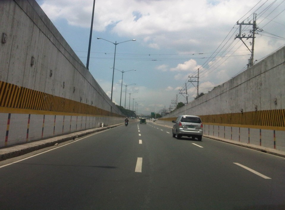
Sandiganbayan underpass
There is an underpass at the intersection of Commonwealth Avenue and the Batasan Road at Sandiganbayan. The underpass is for left turning traffic coming from Batasan to the Elliptical Road-bound side of Commonwealth. I took a few photos of the underpass recently as we were coming from a meeting at the Batasan.
 Approach to the left turn underpass – the rightmost lanes of the Batasan Road are for right-turning traffic going in the direction of Fairview.
 The underpass has three lanes.
 It is well lighted and so motorists are not plunged into darkness unlike some underpasses that are not well-maintained.
 Emerging from the underpass, vehicles have enough space to merge with traffic along Commonwealth Avenue.
 The underpass emerges as 3 middle lanes along the wide Commonwealth Avenue. There are 4 to 6 lanes to the left and 2 lanes to the right of the underpass lanes. The rightmost lanes are supposed to be for public utility vehicles.
I have not heard of or read anything anywhere about this underpass being flooded during times of heavy rains. These include the particularly heavy rains of Ondoy (Ketsana) in 2009 and the Habagat episodes last year. As such, I believe that the design of the underpass (including its elevation and drainage) is for all weather conditions.
–
Traffic congestion and the limits of quick fixes
One time last summer night, it took me 2.5 hours to get to the airport from where I reside when it should only be an hour or 1.5 hours (on a typical bad day). Very early mornings (between 2 to 4 AM), it only takes me 40 minutes between my home an the airport. The route I usually take is mainly along Circumferential Road 5 (C-5); a route that basically has sparse public transport (mostly jeepneys along different sections) but is a truck route. It was summer though and one would have thought that there would be less vehicles along the road with school still out. I was wrong in that assumption and that cost me both time and fuel that night.
Traffic congestion in Metro Manila and other Philippine cities have been issues for such a long time that one tends to assume there’s nothing being done to fix the problem. In Metro Manila, the Metropolitan Manila Development Authority (MMDA), in cooperation with the various local governments and national agencies, has implemented various schemes including the number coding, truck ban and a bus dispatch system along EDSA. Yet, congestion persists and only last week, the President got caught in traffic as he traveled from Malacanang Palace in Manila to the DOST Compound in Taguig. The news was filled with a comment that he supposedly made to the MMDA Chair about the delay he and his entourage experienced. The bad news is that this congestion will not go away and will only worsen if there are no steps taken to address the problem. And this happens not only in Metro Manila but in other highly urbanized cities in the country. Quite obviously, quick fixes are no longer enough and we have reached the limits of their applicability.
 EDSA during the morning rush hours
 EDSA during the afternoon peak, which actually extends to an evening and even nighttime traffic jam
So how do we alleviate traffic congestion? Here’s three things that come to mind as they seem to be quite logical and very obvious:
1. Build the mass transit infrastructure required – these infra include rail and bus rapid transit systems and are urgently needed in Metro Manila, Metro Cebu, Davao and other highly urbanized cities. A shift from private vehicle use to public transport will not happen if people have no attractive options for commuting. In Metro Manila, there is a backlog of mass transit projects with lines that should have been constructed and operational years or even decades ago.
2. Rationalize transport services – the long standing practice is to increase the number of existing modes of transport as the demand increases. This logic is one that is most abused as a doubling of demand is conveniently but incorrectly interpreted as requiring a corresponding doubling of the number of tricycles or jeepneys, for example. What is required is for our cities to “graduate” from low capacity and less efficient modes to higher capacity and more efficient ones. Many cities seem plagued with tricycles as their main modes of transport within their CBDs when these should have been restricted to residential areas and mainly in the periphery rather than allowed to dominate (and clog) urban streets.
3. Build more walkways and cycling facilities – its difficult to encourage people to walk and cycle if there are no space for pedestrians and cyclists to travel safely and efficiently. Most trips are actually short ones and do not require motor vehicles so it makes sense to invest in pedestrian and cycling facilities so people get the clear message of support for such options for travel. Such investment is also one for healthy living as walking and cycling are forms of exercise and it is well established that these modes of transport promote healthier lifestyles and therefore, healthier people in cities.
–
Common causes of traffic congestion along Philippine roads
As a follow-up to a previous post on traffic congestion, I am writing on some of the most basic causes of congestion along Philippine roads. I say most basic because these are the usual situations we see along the road as we commute. And these are also supposed to be easily solved or addressed by the most basic approaches – enforcement. Here are a couple of photos and commentaries on this matter.
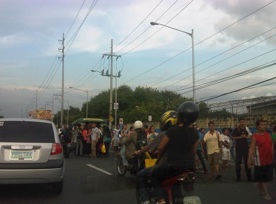 Commuters occupying two lanes of the road as they wait for public transport along Marcos Highway in Pasig – PUVs like the jeepney in the photo stop in the middle of the road to load/unload passengers. Were there traffic enforcers/aides in the area? Sometimes. Were they doing their jobs? Definitely not. In many cases, I’ve seen enforcers using the congestion (i.e., slowed traffic) to apprehend number coding violators. Now, number coding is premised on motorists being discouraged from traveling during certain times of the day to reduce congestion from vehicle volume. In the photo above, it’s pretty clear that the problem isn’t number coding violators but the mayhem caused by public transport and commuters. Something that traffic enforcers/aides could have acted on and with regularity and persistence so that they can positively influence jeepney driver and commuters towards orderly conduct.
 On-street parking and pedestrian activity along Manila roads – many cities such as Manila are guilty of not having any serious initiatives to address on-street parking. In many cases, its tolerated particularly in commercial areas as local governments don’t like to engage business in what they assume to be the small issue (or non-issue) of parking. In the case of pedestrians, it is a behavioral thing that requires a bit more effort than police or enforcer visibility (or the occasional apprehension). As a result, people will generally cross wherever they want and walk along the carriageway, not minding their safety. Of course, such behavior is encouraged by the absence of space for walking as vehicles, merchandise and other stuff occupy space that’s supposed to be for pedestrians.
–
The Streets of Manila: Dagupan Street and side streets
After reading on the brouhaha caused by a negative description of Manila in a novel written by a popular author, I decided to look for some recent photos I took while en route to a meeting in Manila. We were going to the Philippine National Railways (PNR) office in Tutuban for a meeting and I couldn’t help but take a few photos along Tayuman and Dagupan Streets, trying to find “proof” of the “hell” that is supposed to be Manila. While I have some comments myself, I will leave it to my readers what they see from the photos and make their own comments.
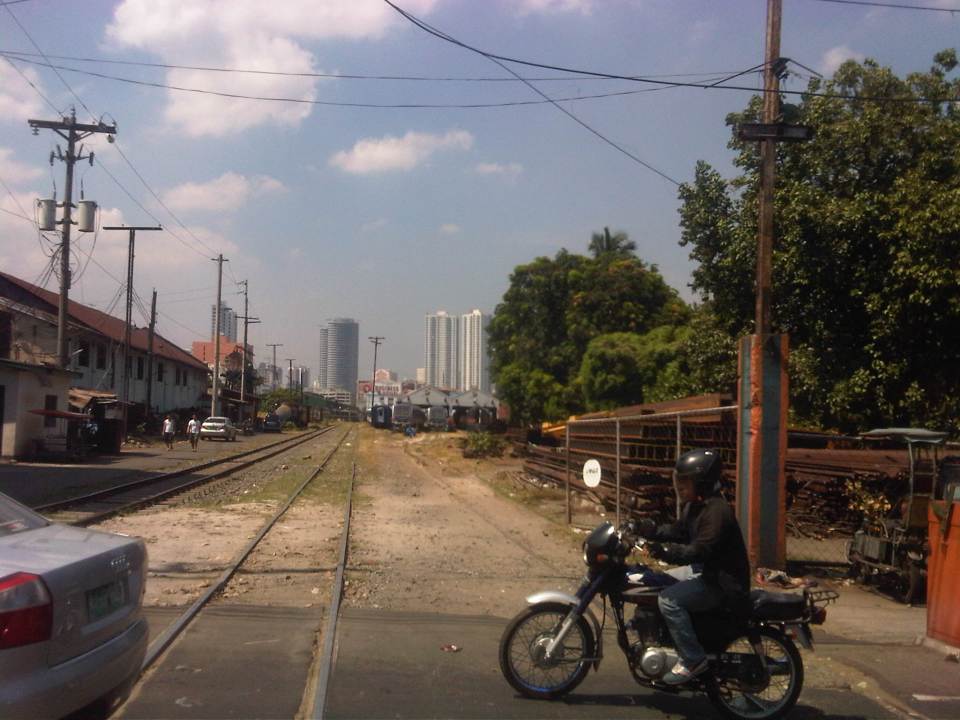 View of the PNR tracks from along Tayuman Street
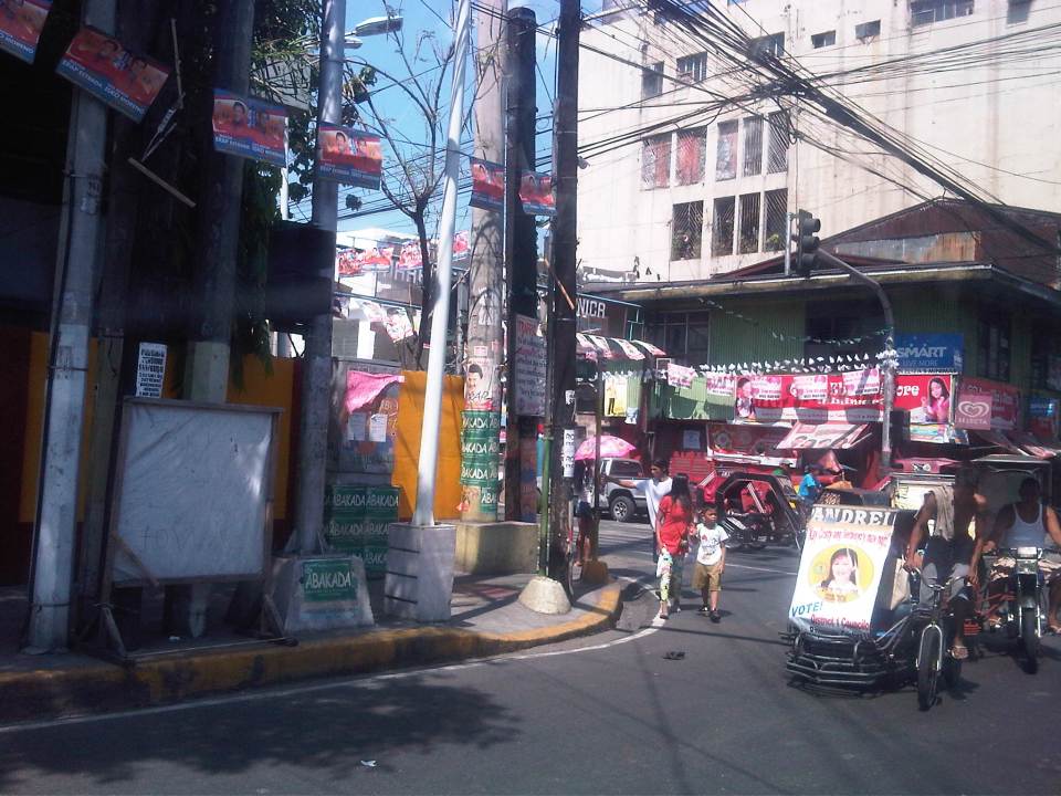 Intersection of Tayuman Street and Dagupan Street – the intersection has traffic lights but it can be confusing with pedicabs generally not following the signals.
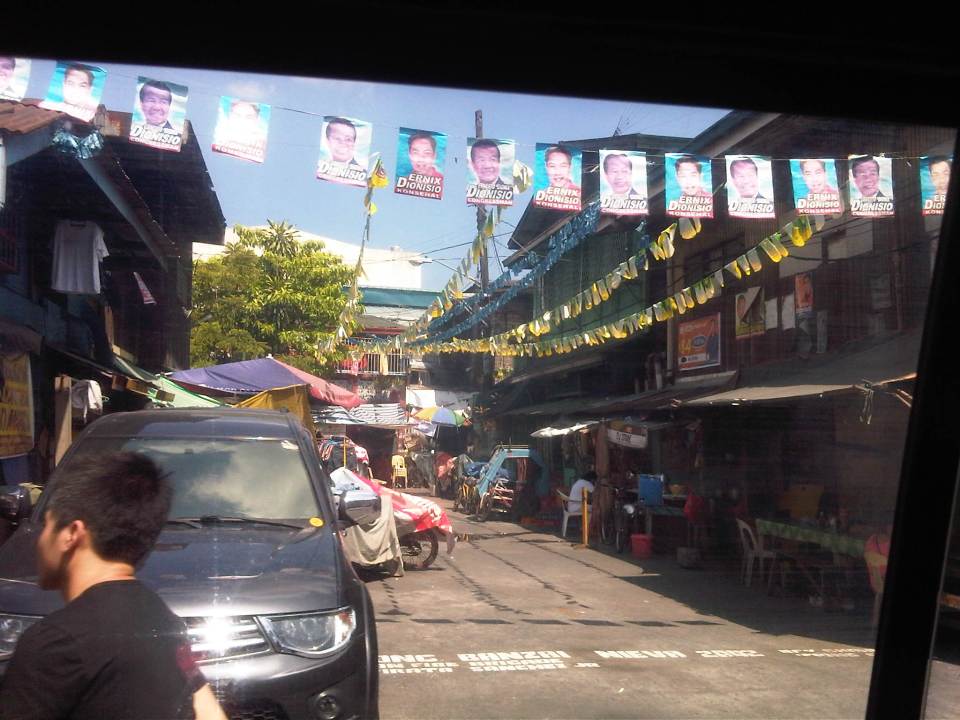
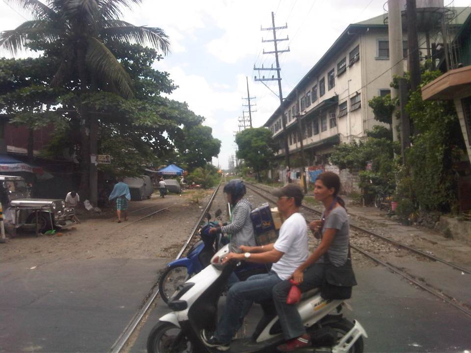
 Dagupan Street is a 4-lane road that serves a predominantly residential area across from the PNR station and depot in Tutuban. And where there are residential areas in Manila, there are pedicabs, or non-motorized 3-wheelers like the ones shown with the motor tricycle (center) in the photo.
 The two shoulder lanes are occupied by parked vehicles; effectively reducing the capacity of the street for traffic. In addition to the on-street parking, motorists would have to deal with the pedicabs whose drivers will not give way and seem not to care about their impeding the flow of traffic. It seems the area had or were having their fiesta when we passed by and with the May elections, many politicians took advantage by illegally placing banners and other campaign material with the fiesta banderitas.
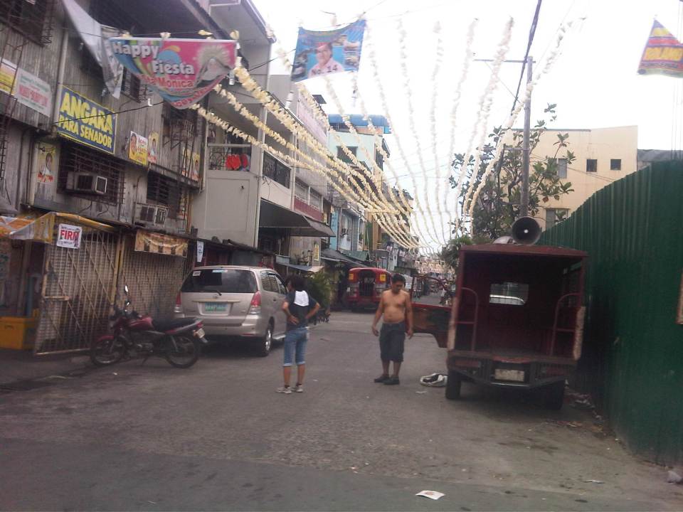
 Side streets along Dagupan Street are all narrow and many appear to be one-way streets given that half of the carriageways are occupied by parked vehicles.
 Some side streets appear to have dead ends like this one with a house in the middle of the road. In some cases, there are basketball courts or tents set-up for wakes in the middle of the streets. More illegal campaign materials by local politicians running for office in Manila are shown in the photo.
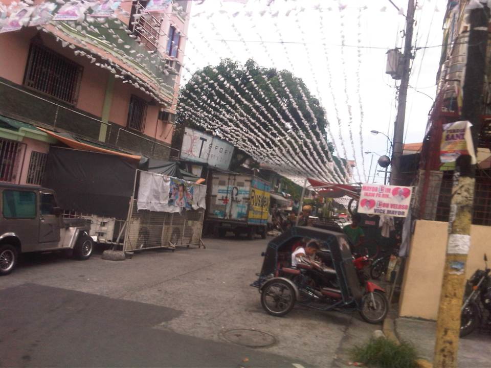
 Another side street but with less vehicles parked along the road. Many residents are affluent enough to own vehicles but have no garages. The city tolerates on-street parking but not just for local roads like this one but even along major thoroughfares!
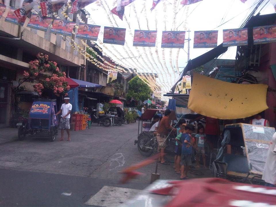 There’s not a few eateries, stores and other establishments along this street. Most if not all of these establishments take up road space for tables and supplies (like the soft drink cases in the photo). Among their customers are workers and pedicab drivers who park their vehicles on the road.
 Along this street, some residents have allotted space for makeshift garages or extensions of their buildings. These can be in the form of tents or steel partitions that act to secure a vehicle.
 A look at the PNR tracks from Tayuman Street downstream is in the general direction of Caloocan (part of what was Main Line North). The building on the right is a TESDA facility.
Coming soon: the streets of Intramuros.
–
Whatever happened to the NAIA redesign/renovation proposal
I forgot to include a link to the design presentation that came out a few years ago. It was quite promising and lot of people (including me) hoped that the project would push through. Of course, we now know we are nowhere near an upgrade of Terminal 1. Following is a video of the redesign proposal on YouTube attributed to renowned designers Kenneth Cobonpue, Royal Pineda and Budji Layug.
I leave it to the reader to Google about new reports of what happened with the project and the bidding that was supposed to have been conducted. It’s been 1.5 years now since that proposal, and there’s certainly and practically nothing happening at NAIA Terminal 1.
–
Crowded NAIA Terminal 1 arrival area
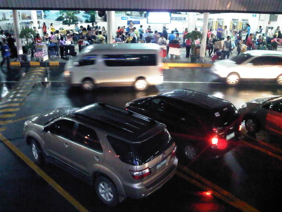
NAIA Terminal 1 remains as the main international terminal for Manila. This is where most international airlines are served. Terminal 2 is exclusively for Philippine Airlines while Cebu Pacific and All Nippon Airways are the only airlines with international flights via Terminal 3. And so it’s easy to see that Terminal 1 can get quite crowded especially as one international arrival comes after another during the peak hours of the airport. One A320 aircraft alone can carry about 150 passengers and wide bodied aircraft like the the A330’s and A340’s can carry more than 250 passengers each. Even larger B777’s and B747s carry more than 350 and 400 passengers, respectively. These are just too many for Terminal 1 to handle resulting in long queues at the immigration counters, crowded baggage claim areas and long queues again for customs. These passengers eventually converge along the arrival area driveway across from the well-wishers’ waiting area (i.e., a two story building) behind which is the open parking area of the airport.
 When flights arrive one after another in short headways, the terminal becomes too congested from the immigration counters to baggage claim and the pick-up areas.
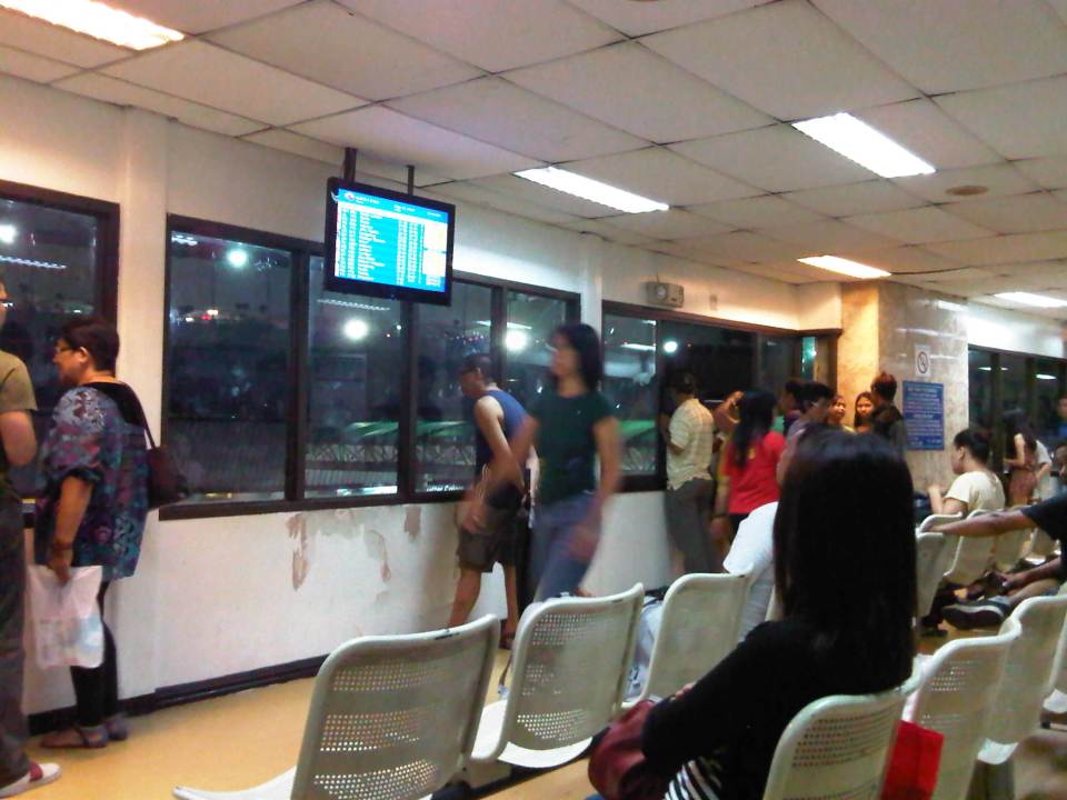 Well-wishers waiting for relatives or friends glance at the screen for information on arrivals while others look through the window to check out the people waiting along the driveway.
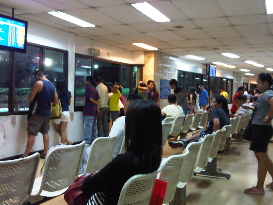 While others are seated, some people opt to stand at the windows, anticipating the arrival of relatives or friends. The second of the building that serves as the waiting area for well-wishers is air-conditioned but there open windows like the one shown in the photo. That window alone could cost a lot in terms of power consumption by the air-conditioning units.
The ground level is even more crowded and there’s always people wanting to cross over to the other side of the driveway to meet relatives as they arrive from the ramp. Airport security try their best to keep order but some people are quite insistent and in certain cases taunt or berate the guards for not letting them through. I think this behavior of people was quite unfair to the guards as the latter were only doing their jobs and its only right that they keep people from flooding the arrival driveway. It’s already too crowded and more people will only bring more mayhem if allowed to mix with the arriving passengers.
Terminal 1 was the subject of calls for renovations and an upgrade from what it is now, a bad first impression of the country. I remember a group of architects and designers came up with a plan to renovate Terminal 1 including improving the layout of the terminal and parking facilities. The Department of Transportation and Communications (DOTC) was supposedly tasked to follow through with this project but ended up offending people by bidding the project out. Another design firm was supposed to have won the bid but until now, there has been no activity related to this long-delayed major improvement. Perhaps there was hesitation as they agency struggles to decide whether NAIA should continue to serve as the main international gateway to the country? Well, it is certainly still the main gateway and will continue to be so in the foreseeable future as the prospects for Clark and other proposals remain hanging in the air. We should live with this reality and carry on what needs to be done to improve Terminal 1, and quickly!
–
Batangas port passenger terminal
The center I am affiliated with recently held its planning workshop off-campus in a venue on the island of Mindoro. To get there, they had to travel from Quezon City to the province of Batangas where ferries and other vessels provide the transport link between Luzon (where Batangas was located) and Mindoro. A colleague snapped a few photos of the passenger terminal in Batangas, which are shown below.
 Smoking room in the passenger terminal (Photo credit: Sheilah Napalang)
 Colleagues pose for a souvenir photo at the passenger terminal (Photo credit: Sheilah Napalang)
The Batangas port passenger terminal is a good example of a modern seaport facility in the Philippines. I think it is a better facility compared to the terminals in Cebu and Tagbilaran, as well as the Eva Macapagal Terminal in Manila. Of course, my opinion is limited by the terminals I’ve seen so far and I would like to see the ferry terminals in Sorsogon, Samar, Leyte and Surigao , which are part of the Eastern Nautical Highway and has been the main land-sea route between Luzon, Visayas and Mindanao. Here’s looking forward to more posts on maritime transport and terminals in the future!
–
NAIA Terminal 3 check-in
I was again at NAIA Terminal 3 for a very early flight. I always enter Terminal 3 from the ground (arrival) level, whether I am coming from the open parking lot or am driven to the airport by a driver. There are less people lining up to enter the terminal at the arrival level so its usually faster compared to the departure level, which seem to be always crowded. It’s only logical because it is the departure level and most people would automatically proceed there. The layout of Terminal 3, though, allows for the passengers and well-wishers to circulate within the arrival and departure areas that are open to the public, including the restaurants and shops located at the third level of the terminal.
 Check-in counters for PAL and PAL Express flights
 Important information for passengers of PAL and PAL Express includes info for counters for senior citizens, persons with disabilities (PWD), and persons who have checked-in using the internet.
 Crowded Cebu Pacific check-in counters for domestic flights – Terminal 3 is the home terminal or hub for Ceb Pac in Manila. As the country’s largest airline in terms of both aircraft and passengers, their international and domestic flight counters are are almost always crowded.
–
Poverty should not be entrusted to economists | Social Watch
Saw this article shared on Facebook. I thought it was a relevant piece with respect to a work I am currently doing, relating transport infrastructure and services with economic growth in the Philippines. With the release of the latest poverty statistics in the country late last month, there has been a lot of discussions regarding inclusive growth as poverty incidence across the country is still quite high though there have been gains in many provinces based on the statistics.
Poverty should not be entrusted to economists | Social Watch.
I suddenly remember the experience we had while doing field work in the island of Samar where we performed a road safety audit for a national road. While coordinating with the barangays along the highway for our traffic surveys, we observed that people were generally poor but in the financial sense – they didn’t have money and many didn’t have regular jobs. I say this because I would like to qualify the way we define poverty that is biased on the monetary aspect. From what we saw, people were not hungry as they had food like fruits and vegetables. Perhaps to get other items, they trade or barter what they have with what they needed (e.g., vegetables for rice, fish for rice, etc.). Still, the point is for these same people to generally benefit from the economic gains that is supposed to be experienced by the country. Is the growth trickling down to these people and therefore inclusive? Or is it enjoyed only by a few and especially our elite classes, and therefore exclusive? So far, what I have seen out there is the latter case and not the former.
–
Here’s to walking!
I was lucky to be able to take a couple of photos as our vehicle passed along Marcos Highway to be able to capture images of people walking along the sidewalks between Ligaya and De la Paz. The driver maintained his position along the right side of the road so I had a good view of the pedestrians and cyclists making their way from Ligaya in the general direction of De la Paz and the two shopping malls downstream (the signs of one mall are visible in the photo).
Ligaya is a transfer point for people traveling to and from Pasig, Pateros and Marikina who use the jeepneys connecting these towns. They typically get off at the junction of Marcos Highway and Amang Rodriguez. From here, one can take a jeepney to the towns of Rizal or perhaps to Quezon City (Cubao). These days, however, it is not so easy to get a ride at Ligaya and one cause of congestion emanating from the junction are people taking two lanes of the road as they position themselves to board stopping jeepneys. Instead of waiting for the jeepneys and whatever limited seats are available, many people have decided to walk towards the junction with Imelda Avenue. There located are commercial establishments including two shopping malls and the terminals of public transport whose routes terminate at the area. There, it is relatively easier to get a ride home though during the early evenings it can also be difficult to get a ride to the Masinag and Cogeo districts of Antipolo (And that’s part of the reasons why the LRT Line 2 extension is necessary!).
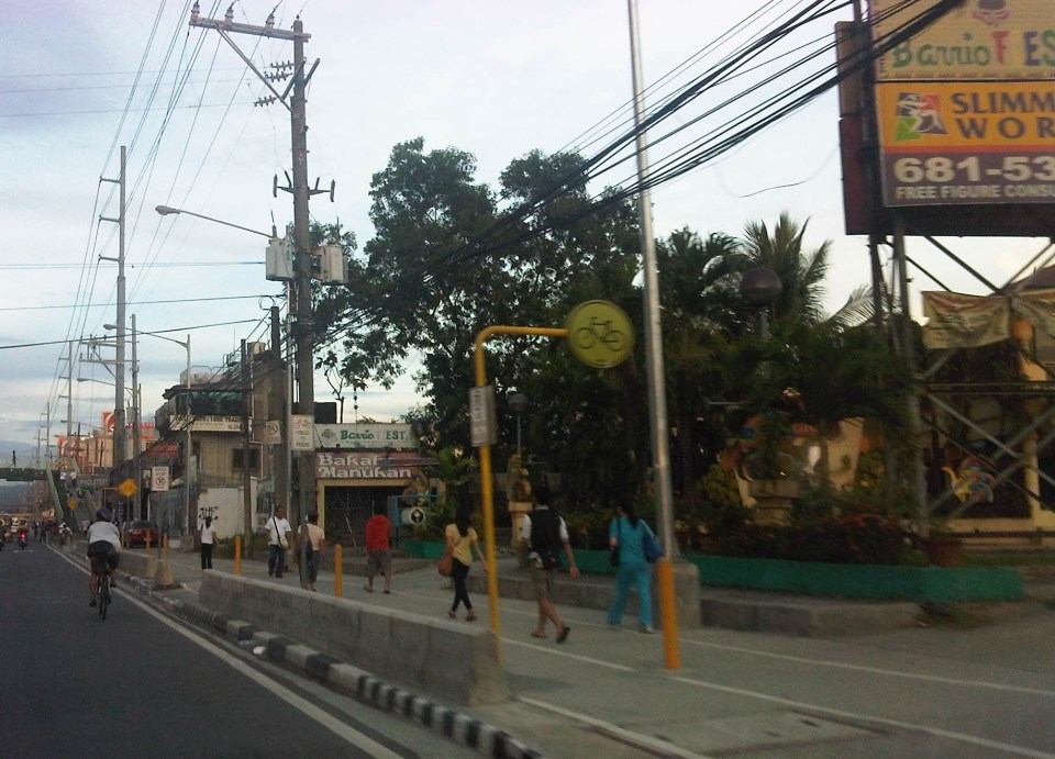 Pedestrians walking towards De la Paz or the shopping malls a little further on. There is actually a bicycle lane beside the pedestrian walk similar to how the Marikina Bikeways were designed but most cyclists opt to use the curbside lane of Marcos Highway.
 Pedestrians walking from Ligaya include workers and students.
The walkways are generally clean and well-lit during the night time, though I think portions are still quite dark. I also think the more people opting to walk means it can be safer to walk (strength in numbers?). The observation that many people walk encourages other people to do so, and is a deterrent for unlawful elements of society. Perhaps to further reinforce the safety and security aspect of walking, Pasig Police or the MMDA could have some of their personnel walk along this path. Police visibility here, especially at night, would help deter muggers and hold-uppers who might see the pedestrians as potential victims.
–
