
How the Built Environment Affects Your Mood
Here’s a nice read as we do our storm watch, and probably explains why when we reminisce about college or university as “the best years of our lives”.
Source: How the Built Environment Affects Your Mood
To quote from the article:
“It is not for nothing that older adults often regard college as “the best years of your life” because in some cases it truly is. College years serve as a gateway drug to all the amenities and benefits of urban-core living — until you graduate that is. Then you have to return to your parents’ suburban home (as many Americans do) and suddenly all the amenities you had disappear. Your newfound college friends might make up for the lack of a diverse built environment. Nope, they all have moved back to their sprawling neighborhoods too, probably dozens of miles if not hundreds of miles away from your town. You might get a new car to celebrate your graduation and your new 9 to 5 corporate job. Work will keep you busy! But you know what else? Driving. No more waking up 10 minutes before class and arriving just on time. You might now have to wake up a few hours early to drive to your job through rush hour morning traffic, and do it all again in the afternoon.
You might also gain weight — not because you are eating more, but because you are walking less. Various studies demonstrate the link between car usage and obesity, showing “greater levels of obesity in communities where the private automobile is the dominant means of transportation.” And let’s not forget that obesity leads to other health issues such as diabetes and hypertension, among others. Mental health conditions such as depression are more prevalent in adults with obesity. Hence once college ends, graduates stop socializing, stop enjoying public amenities every day, start driving everywhere, stop walking and hence gain a little more weight in the process. Then it is no surprise that young graduates feel unfulfilled, and sometimes even depressed after college — for them, it feels they were robbed of an integral part of their new lives.
Our surroundings impact our mental and physical health. Living in neighborhoods with negative qualities can increase the risk of mental health conditions such as depression. At the same time, the pandemic made us appreciate diversity in our lives and what happens when we are deprived of it. Walkable cities are not “just a preference”; they develop happiness by fostering community trust, promoting physical activity, and offering nearby amenities. As learned, these spaces encourage healthy behaviors, reduce car dependency, and create opportunities for social interaction — all things that are crucial for our well-being.”
Based on this, no wonder I love to stay at the University of the Philippines campus in Diliman. I’m sure my colleagues in UP Los Banos feel similarly.
–
Campaign garbage
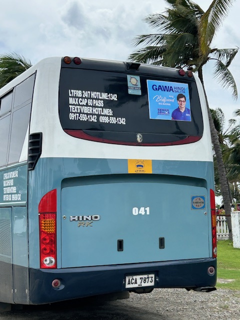
Politicians have used various media to further their personal interests and aspirations. Foremost perhaps of these interests and aspirations is getting elected. More effort it seems goes to promoting themselves however they can. While its months away from the campaign period, there are already a lot of campaigning going on with what I perceive as hard sells already having a head start when they shouldn’t be doing so at this time. You see the likes of Abalos, Marcoleta and Lee whose faces are scattered among buses, bills, billboards and tarps. And then there are the familiar names including re-electionists and relatives of incumbent or outgoing officials also ‘reminding’ people of their candidacies as if we owe them our votes.
Here is the case of this former mayor of Metro Manila City who is also a former cabinet secretary who is aspiring to become a senator. His campaign materials are on buses, billboards and posters around the country. Samahan daw nation sa Senado. Why? If he’s already doing something blatantly anomalous at this stage, I would not expect anything except more anomalies from him.
It is very frustrating that the Comelec is not doing anything vs. these premature campaigning, even stating that these are not illegal. Well, these definitely cost a lot of money. And how do you think these politicians will recover their ‘investments’?
I will post about these garbage in future posts. I just need to compile more examples to share here.
–
Another fatal crash along Marcos Highway
Another crash happened at a location where a similar crash occurred not so long ago. This was along Marcos Highway where Antipolo, Cainta and Marikina practically converge. The landmark is the Phoenix gas station along the westbound side of the highway. Large trucks may be found parked along Marcos Highway at night and early mornings before dawn, timing their travel with the truck ban being enforced in Metro Manila. According to reports, the car was supposedly making a U-turn and it slammed against one of the parked trucks. I would assume that a turning vehicle in the area would be doing so carefully and would not be speeding. It would be difficult not to notice a parked truck in the area. I would know as this is one of my alternative routes on my daily commutes. The result, a total wreck as shown in the photo below, betrays the speed of the vehicle as well as how risky a maneuver the driver was trying to pull off. Does this look like the aftermath of a slower moving vehicle making a U-turn and slamming into a parked truck? The damage strongly suggests a fast vehicle with the driver losing control (for whatever reason or condition he was in) and slamming mightily against an immobile vehicle.
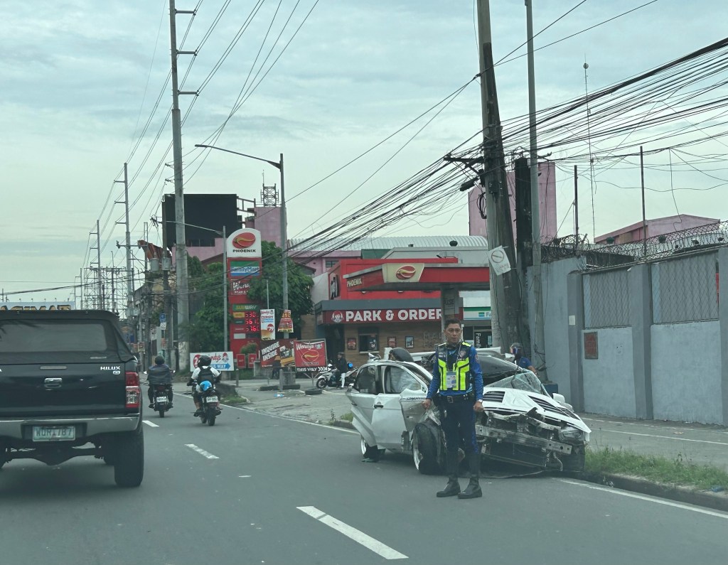
This one was also fatal, claiming the lives of the passengers of the car. Even with arguments on how our roads are supposed to be car-centric or the product of car-centricity, the inconvenient truth is that a major problem with road safety are the ones behind the wheel and driving these vehicles. Even with a ‘perfect’ road, aggressive and unsafe driving or riding behavior will always imperil people. There are also reports of many speeding (even racing) along Marcos Highway. These will likely involve impetuous young people looking for a thrill. They endanger other people with their behavior. So the challenge is for authorities to look into the matter and do their work to reduce the incidence of speeding and risky maneuvers along Marcos Highway and other roads like it.
–
On bike lanes contributing to safer roads
Do bike lanes make roads safer? There are obviously mixed reaction to this question especially if you look as social media. If we are level headed about this topic and look at the evidence out there, the answer is yes. But there can be caveats as we try to contextualize in the local setting. The formal studies so far are in countries where the drivers arguably more disciplined than ours here in the Philippines. Driver behavior, after all, is a major factor for road traffic safety. Here is a good article for reference in the discussions and arguments for bike lanes:
Tu, Maylin (November 5, 2024) “How Bike Lanes Slow Drivers and Save Lives,” Next City, https://nextcity.org/urbanist-news/how-bike-lanes-slow-drivers-and-save-lives [Last accessed: 11/10/2024]
To quote from the article:
“Bike lanes with physical delineators (cones or bollards) were more effective than paint-only lanes at calming traffic, echoing a popular mantra for bike activists: “Paint is not protection.” (The lanes were not protected, however, because drivers could drive over the delineators.) For vehicles turning right, top speeds were reduced by 28% and average speeds by 21%. Paint-only bike lanes slowed driver speeds by up to 14% and drivers going straight slowed down by up to 8%…
The study adds that pop-up bike lanes are a cost-effective solution for studying the effects of more permanent solutions — after all, you could just borrow the traffic cones. A city could quickly implement pop-up or temporary infrastructure. Then, armed with data and community feedback, they could invest in making the changes permanent.”
The article also points to a technical paper or scientific article on the traffic calming effect of bike lanes. Here is the link to the article published in the Journal of Urban Mobility: https://doi.org/10.1016/j.urbmob.2024.100071
–
On whether bike lanes cause more traffic congestion
I previously share articles on whether bike lanes cause more traffic. This question has been asked so often as we have returned to the “old normal” levels of traffic and bike lanes that were put up during the pandemic have been neglected or removed in favor of motor vehicle traffic. The perception for those in-charge of traffic and transportation in local government units is that the space occupied by bike lanes take up the space demanded by motor vehicle use. Thus, the view that bike lanes cause congestion. Here is another article share in support of bike lanes:
Mortillaro, N. (October, 2024) “Do bike lanes really cause more traffic congestion? Here’s what the research says,” cbc.ca, https://www.cbc.ca/news/science/bike-lanes-impacts-1.7358319 [Last accessed: 01/11/2024]
To quote from the article:
“One would think that building more roads with more lanes for cars would reduce congestion, but research shows that’s not the case, thanks to something called induced demand. The more traffic lanes that are put in, the more it appeals to people who may not otherwise have chosen to drive, thereby putting more cars on the roads and increasing congestion.
“So for a short period of time, there might be a slightly improved [reduction], but within a year or two, or perhaps three, traffic is as bad or worse than it was before the lanes were added in the first place,” said David Beitel, data services lead at Eco-Counter, a Montreal company that collects and analyzes pedestrian and bicycle traffic data.
Conversely, if you put in more dedicated bike lanes, people tend to feel safer and demand for use increases, said Shoshanna Saxe, an associate professor at the University of Toronto’s department of civil and mineral engineering and Canada Research Chair in sustainable infrastructure.
“As soon as you build a bike lane, within a year, two years, the latent demand shows up,” she said.
Bike Share Toronto statistics show that ridership on its network of shared bikes has increased dramatically since 2015, when 665,000 bike trips were made annually. In 2023, that shot up to 5.7 million trips.”
I think many people here are already aware of the concept of induced demand. However, this is usually shrugged aside as realities in their situations (e.g., commuting options, locations of residences and workplaces, etc.) lead them to choosing private vehicles (i.e., cars and motorcycles) over public or active transport. The last paragraph there is significant though as there never was and so far a decent estimate of bike trips in any city in the Philippines. Granted that there are attempts to measure bike trips but the volumes published so far are not as reliable as we want them to be in order to be convincing decision-makers to put up more bike lanes. Of course, the convincing part is always challenging if decision-makers have already made up their minds in favor of the car.
–
Old maps of Rizal Province
I found these two old maps of the Province of Rizal. I was trying to trace their sources but couldn’t find them yet. These were shared from social media pages.
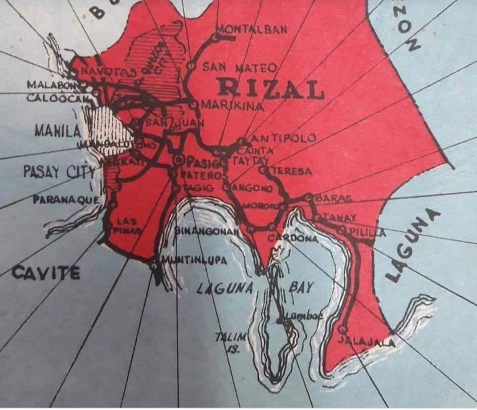
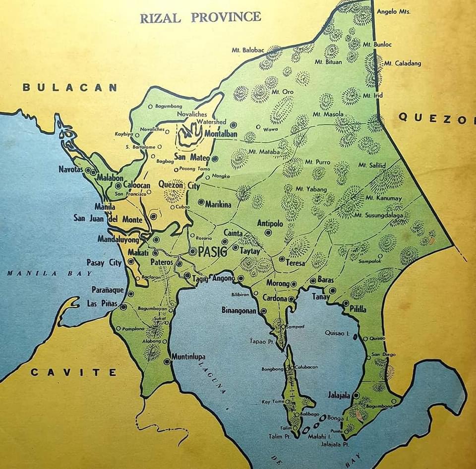
The second map clearly shows the Rizal towns that eventually became part of Metro Manila in the 1970s. These include Navotas, Malabon, Caloocan, Marikina, Pasig, Tagig, Mandaluyong, Makati, Pateros, Paranaque, Las Pinas and Muntinlupa. Pasig used to be the capital of the province; hence, Kapitolyo, which is still in Pasig. Note, too, that Caloocan was connected via a narrow strip between Quezon City and Bulacan. That part of Bulacan is the then town of Valenzuela that was also integrated with Metro Manila. I wrote about a ‘what if’ a while ago where politics would have been different in the province if it remained as it is before the creation of Metro Manila. History teaches us a lot of things including decisions made that led to how we are today. That certainly applies to transportation and definitely applies to politics if you come to think of it particularly for Rizal.
–
More political garbage along our roads
I was telling some friends who were planning to go to Antipolo this long weekend that they should not be distracted by the images of demonyos and demonyas they’ll see along the way to the Shrine of Our Lady of Peace and Good Voyage.
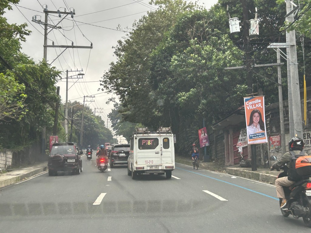
These are electioneering and those who vote for these clowns have no right to complain about their economic situation. You only perpetuate these scums in government.
–
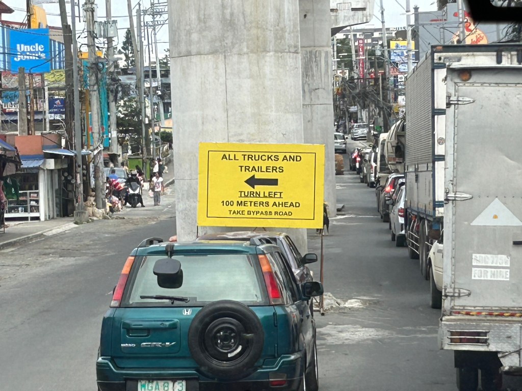
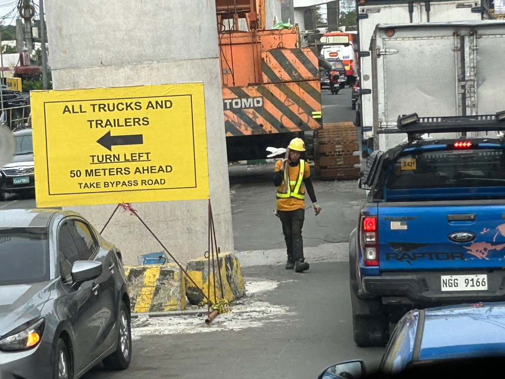
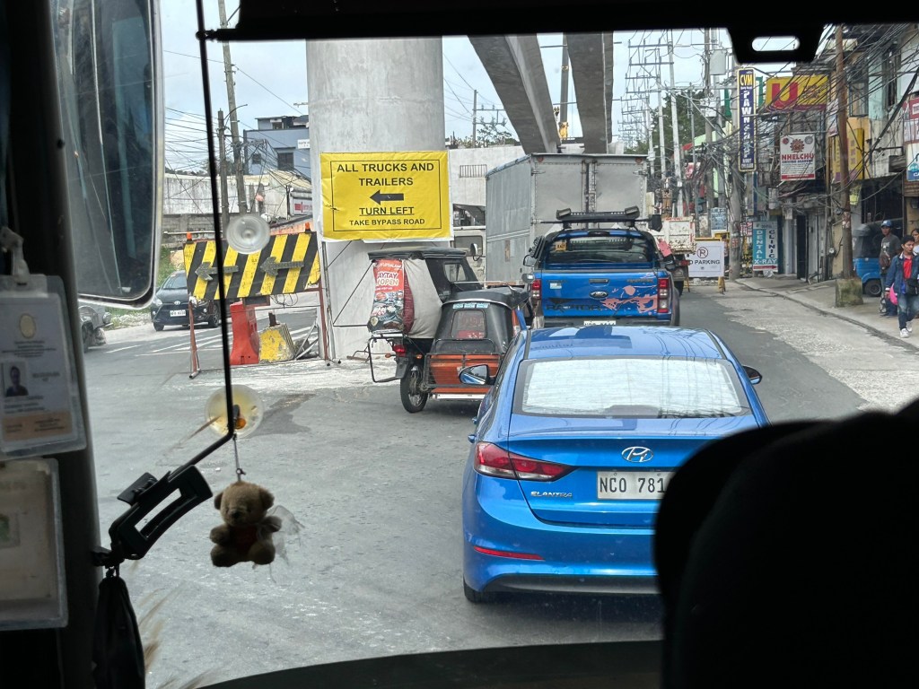
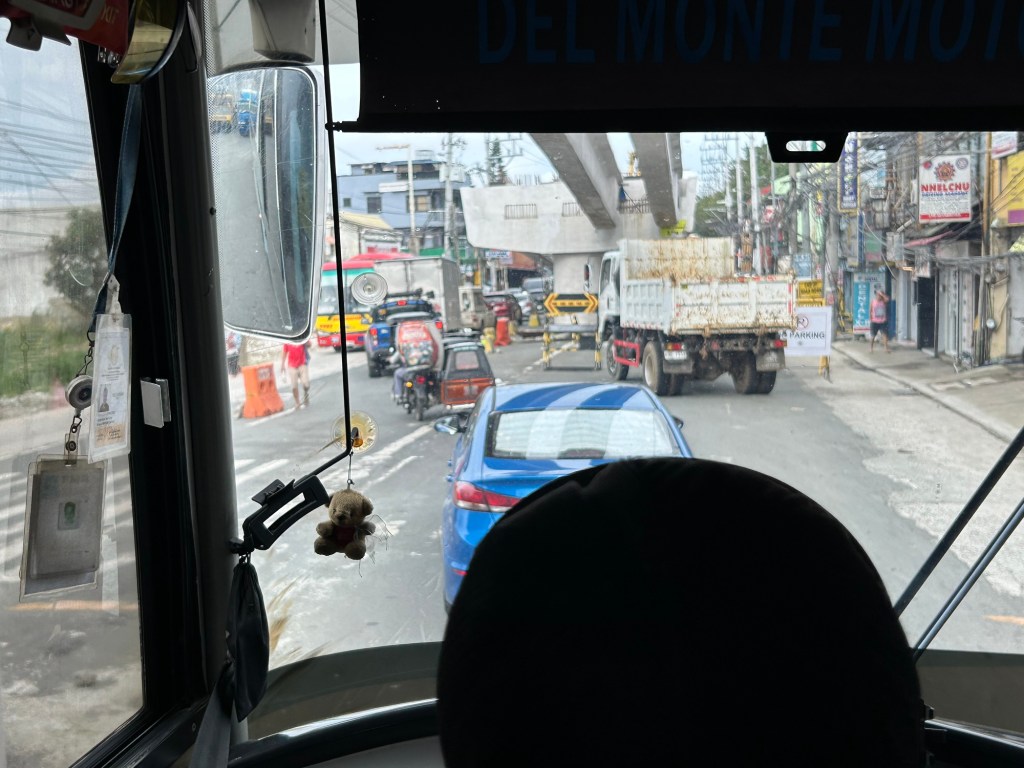
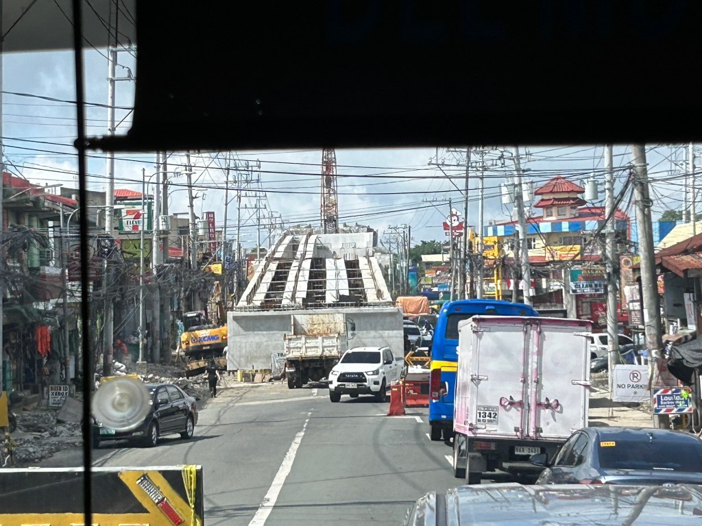
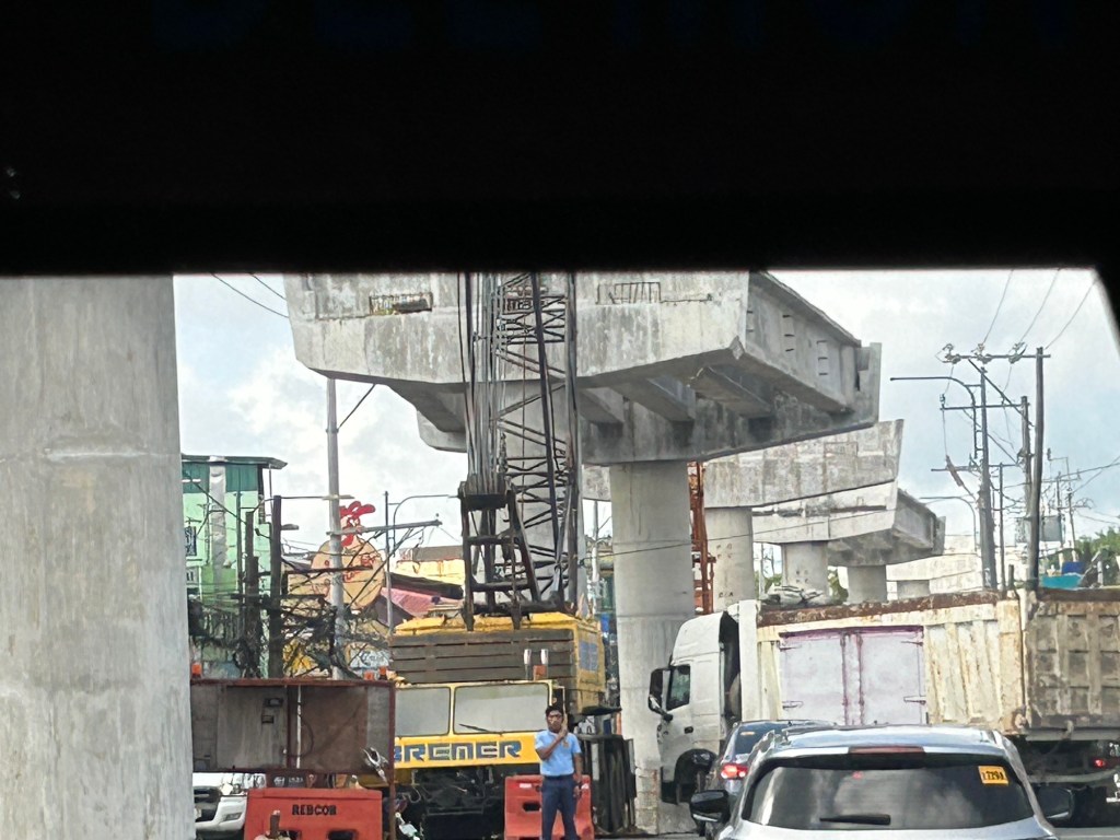
Congestion due to flyover construction: Tagaytay-Nasugbu Road – Part 2
I showed photos of the construction of an overpass along the Tagaytay-Nasugbu Highway coming from Tagaytay in the previous post. This time, here are some photos taken along the opposite direction.


–
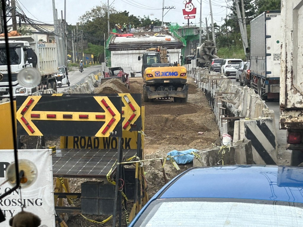
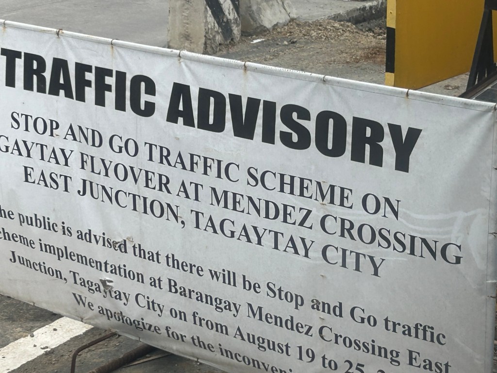
Congestion due to flyover construction: Tagaytay-Nasugbu Road – Part 1
There is significant traffic congestion along the Tagaytay – Nasugbu Highway due to the construction of an overpass along the highway at its junction with the Tagaytay – Mendez Highway.


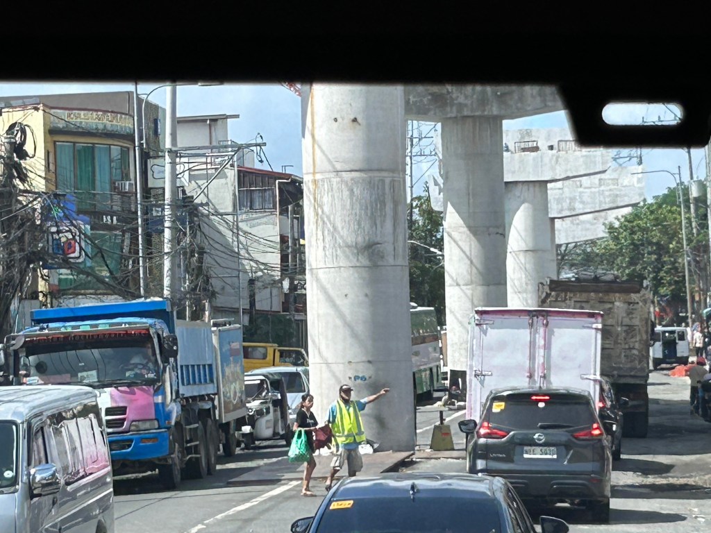
Was there a need for a flyover here? Otherwise I would suggest instead a set of good old-fashioned traffic signals and geometric improvements to the intersection.
–
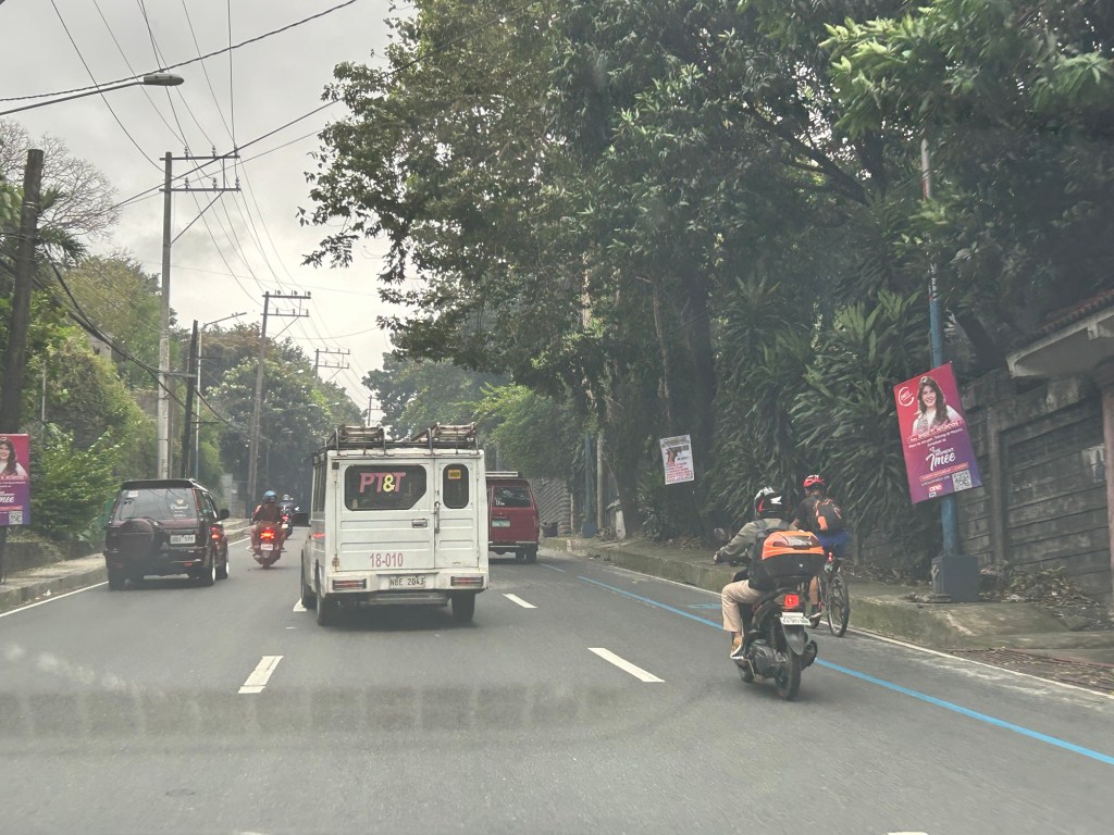
Political garbage along our roads
While it is not formally campaign season, you’ve probably seen all those ads, posters, tarps and other obviously campaign materials that have sprouted around the country. Even before the filing of COCs, there were already a lot of political garbage (as I refer to them) along our roads. Many that you see on large billboards promote their purported TV or radio shows. Others pretend to be concerned about your safety while traveling (e.g., “Ingat sa biyahe!”, “Ride safe!”, etc.).

The government, particularly the COMELEC, seems to be inutile and inept about these brazen, even flamboyant displays by politicians. And so we end up with a lot of literal and figurative garbage along our streets. These are the politicians that people continue to vote while stating they want changes and reforms in government and society. You vote for these clowns and you get exactly the misery and incompetence that dooms us especially during times of difficulties and calamities.
–
