
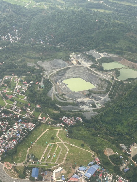
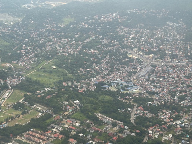
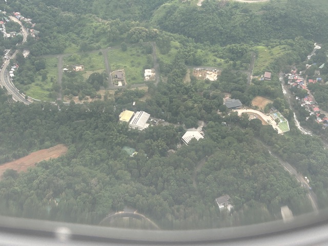
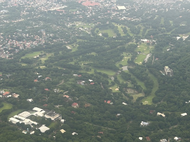
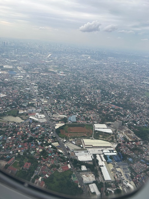
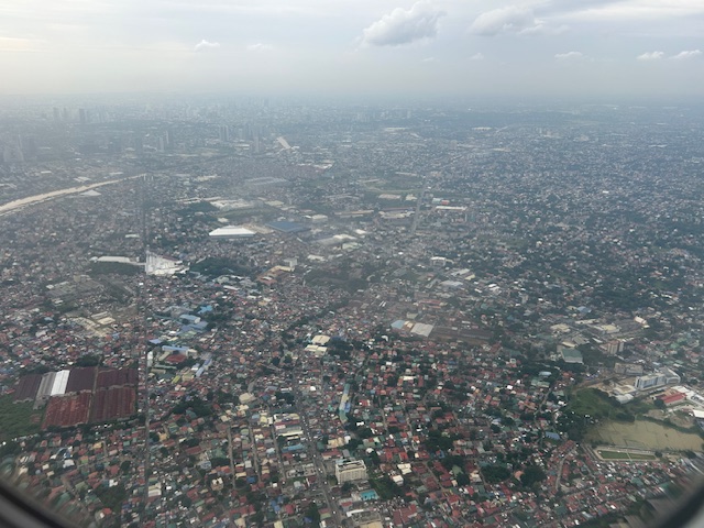
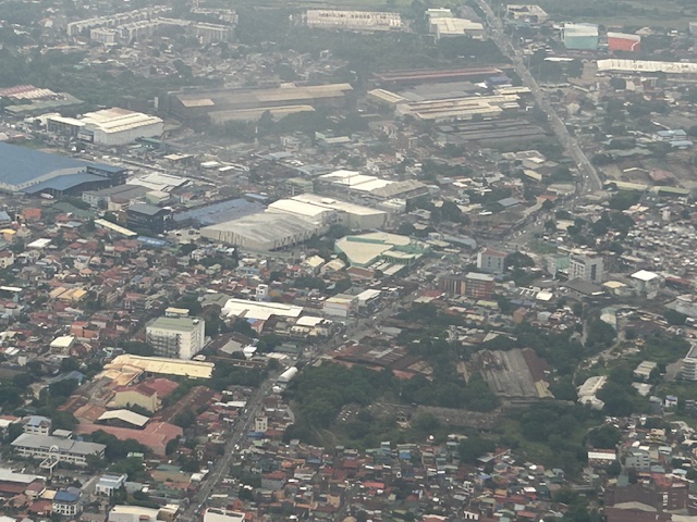
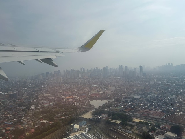
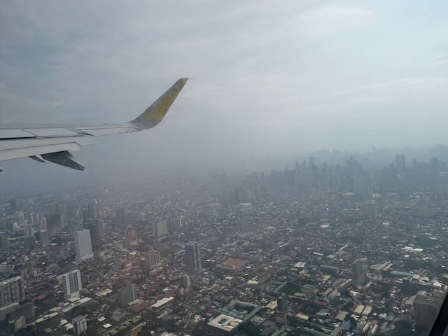
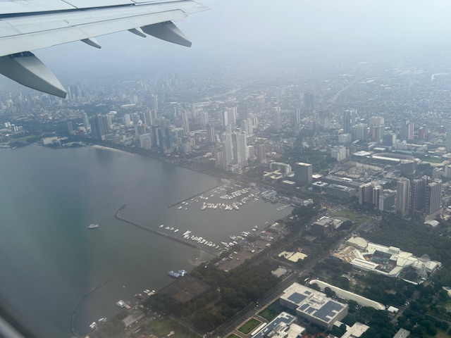
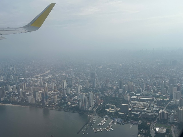
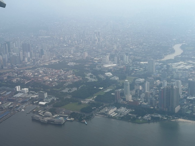
Aerial photos of Rizal
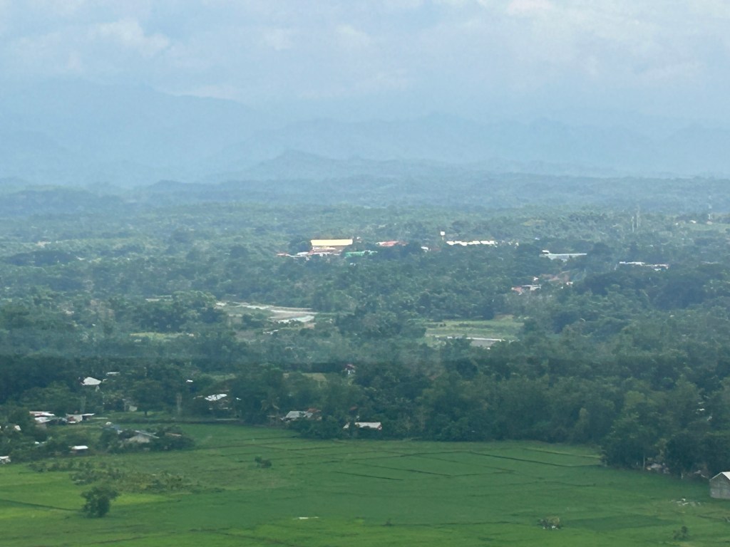
Following is a continuation of my recent post on aerial photos I took when I went to Iloilo for some meetings. This set is from our plane’s approach to land at NAIA. The path led us through Rizal province and the following photos mainly of Antipolo and Cainta.
–
On mountain biking and its history
Here is another quick share of a rather informative and amusing article about cycling, particularly about mountain-biking:
Septer, Q. (June 29, 2024) “The Poetry of Cycling,” Medium.com, https://medium.com/the-new-outdoors/the-poetry-of-cycling-dffeb752b510 [Last accessed: 8/24/2024]
To quote from the article:
“Mountain biking continues to ascend in popularity. New trails are built. New records are set. New technologies are fine-tuned to the subtleties of the sport’s sub-disciplines. But the ethos of mountain biking hasn’t changed all that much since the days of the Buffalo Soldiers, more than a century ago, when folks simply wondered how far a bicycle might take them.”
–
Pedestrian-Friendly Cities: The Impact of Walkability Grants
Here is a quick share of an article on how to encourage cities to be more pedestrian-friendly:
Source: Pedestrian-Friendly Cities: The Impact of Walkability Grants
Many of our cities, particularly the highly urbanized ones, are not as walkable as we want them to be. Lacking are the most basic facilities such as sidewalks and safe crossings. Walkability Grants such as those in the US can encourage cities to build and/or enhance pedestrian infrastructure. Many designs such as those footbridges along EDSA and Commonwealth Avenue, for example, are anti-walking. Grants may be used to come up with better designs for walkways and footbridges.
To quote from the article:
“Walkability grants are awards for programs and projects creating innovative pedestrian infrastructure, such as new sidewalks, crosswalks, plazas, street lights and green spaces. For example, in February 2023, the Biden-Harris Administration announced the Safe Streets and Roads for All Grant Program, delivering $800 million in monetary awards for 511 projects addressing public safety and road improvements…
Reshaping the built environment into a walkable haven helps boost the local economy and sustainability. By changing the urban landscape, citizens are more inclined to walk instead of drive, allowing cities to reduce emissions, improve air quality and create healthier neighborhoods. This is critical, considering air pollution is responsible for 7 million early deaths yearly.”
Perhaps we can have similar grants coming from national government via the Department of Interior and Local Government (DILG) in cooperation with the Department of Transportation (DOTr) and the Department of Public Works and Highways (DPWH)? There was some funding for bikeways during the pandemic but this new one should put more emphasis on walkability.
–
Article share: on how transportation impacts your health
I’ve written or shared articles here about transportation and health. I share another article concerning how transportation impacts our health. Here’s our first article share this August:
Harris, A. (August 1, 2024) “Getting there is half the battle: how transportation impacts your health,” The Flint Courier News, https://theflintcouriernews.com/getting-there-is-half-the-battle-how-transportation-impacts-your-health/ [Last accessed: 8/14/2024]
To quote from the article:
“In health, transportation is essential to how people access health care and maintain health,
whether it is getting to the doctor, picking up medication from the pharmacy, going to the
grocery store to maintain nutritional needs, or walking around their neighborhood to get more
exercise.”
–
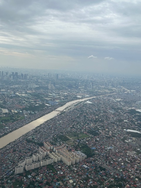
Post Habagat Aerial Photos
We flew to Iloilo just after the Habagat floods that ravaged much of Metro Manila and its surrounding provinces. As our plane took off from Runway 13-31, I figured there was an opportunity to take a few photos of Metro Manila especially as I was seated by the window of the plane.
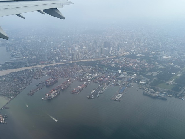
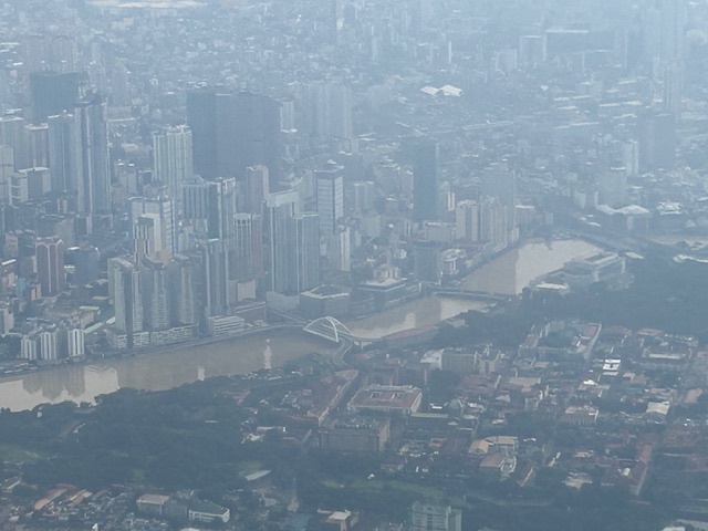
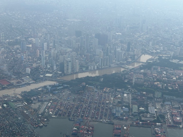
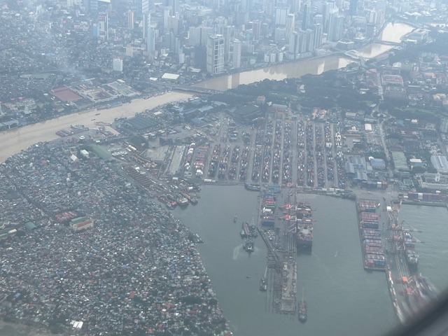
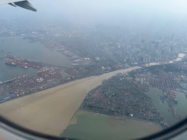
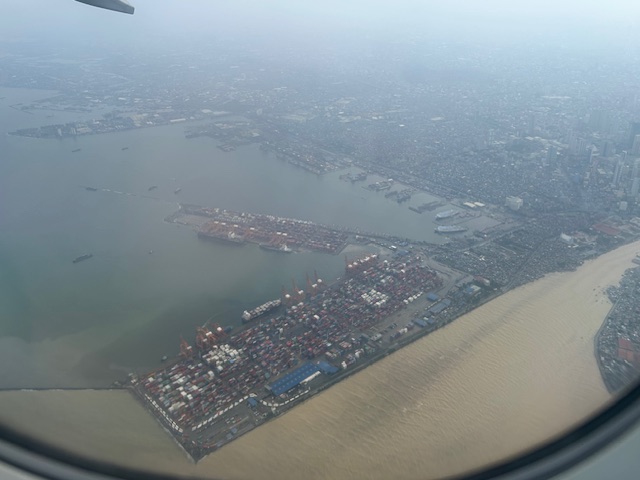
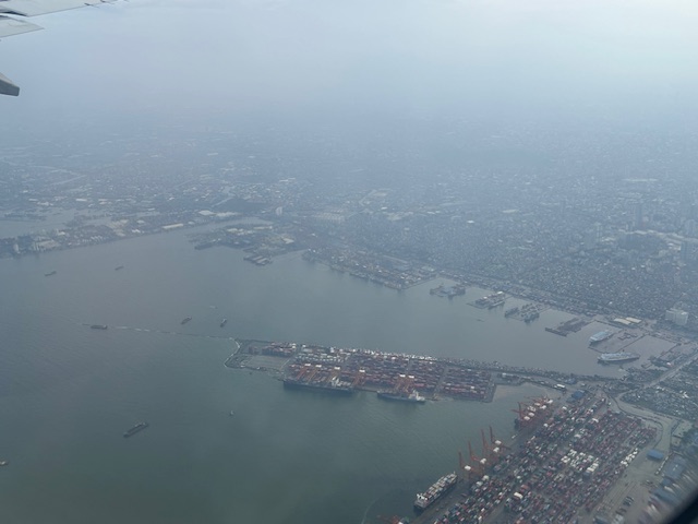
More aerial photos to be posted here soon!
–
Foggy roads in Tagaytay – Part 1
It’s been a while since the last time I was in Tagaytay. We used to go there at least once a month. Eventually, we grew tired of the traffic and the city becoming quite crowded. Of course, our schedules also became more busy so the drives for a weekend getaway turned into trips for music lessons (for our daughter) and meet-ups with friends. It was a welcome return last July when I had to go to Tagaytay Highlands for a meeting and then join up with our college for a workshop on the other end of the city. Here are some photos of the foggy roads that reminded me of the Tagaytay of old.
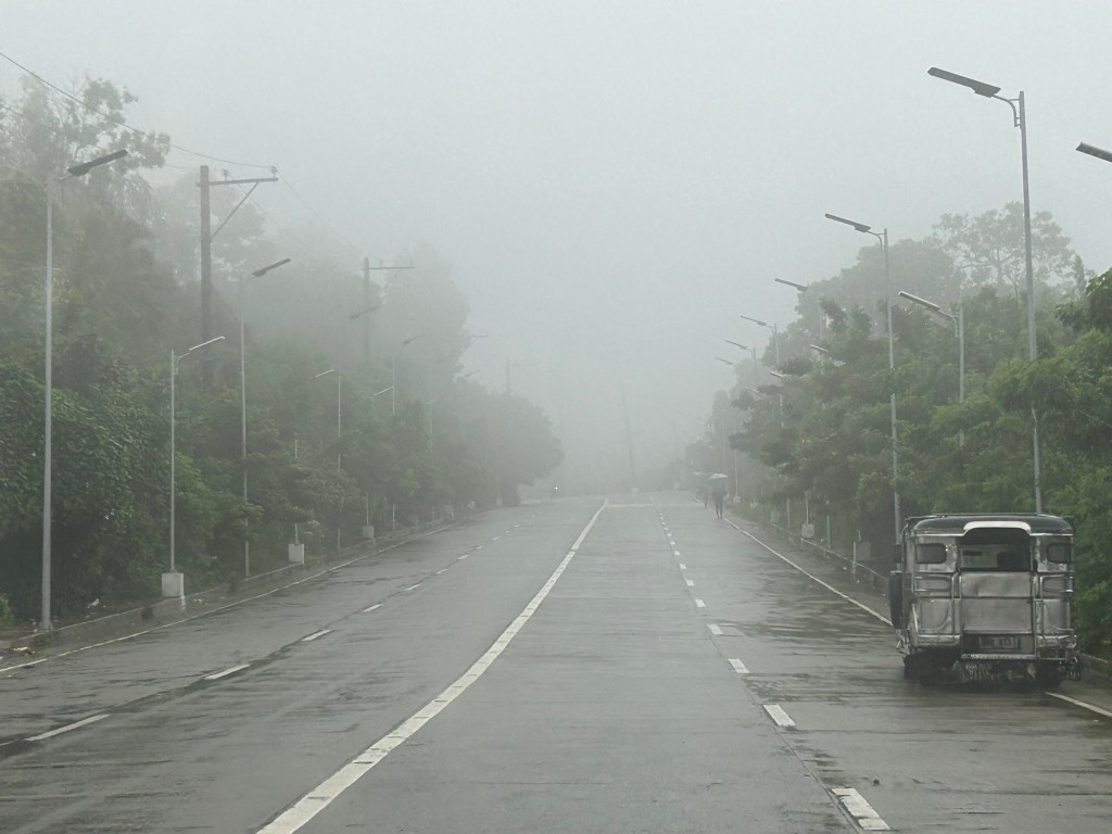
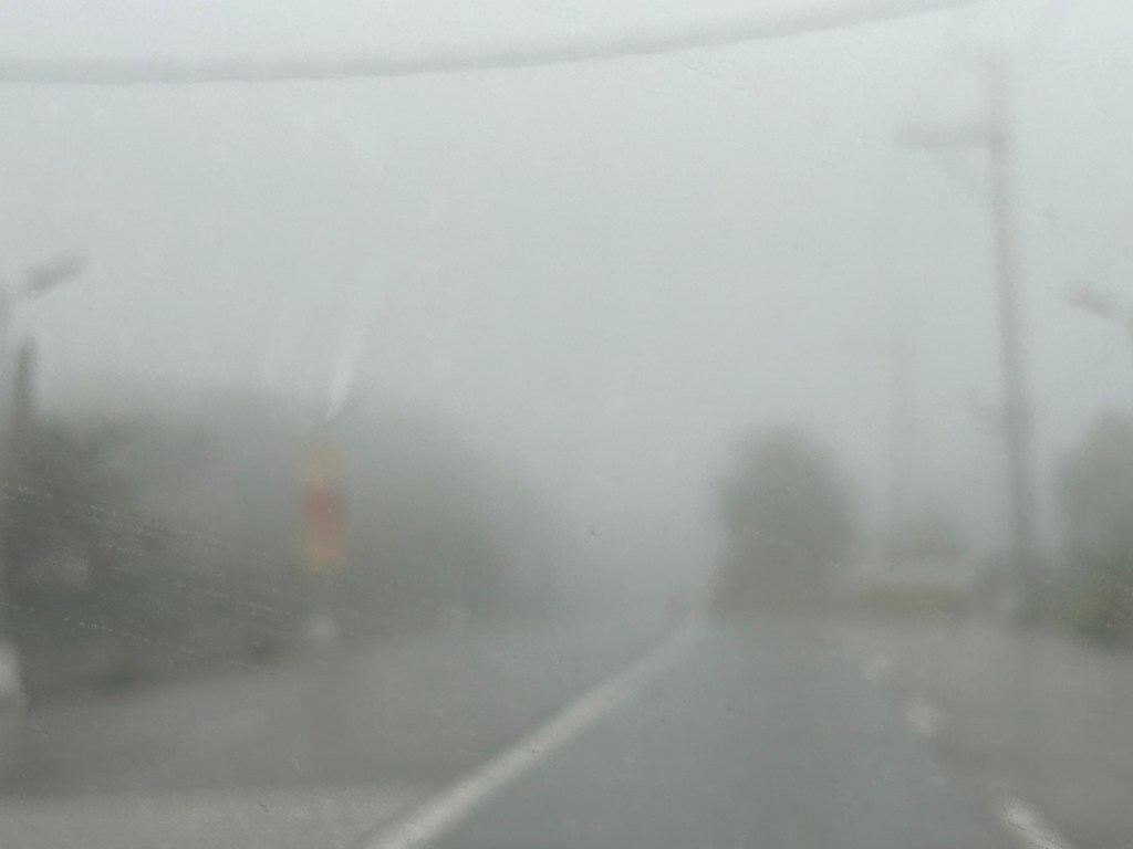
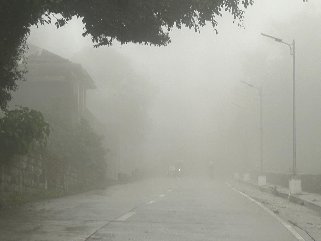
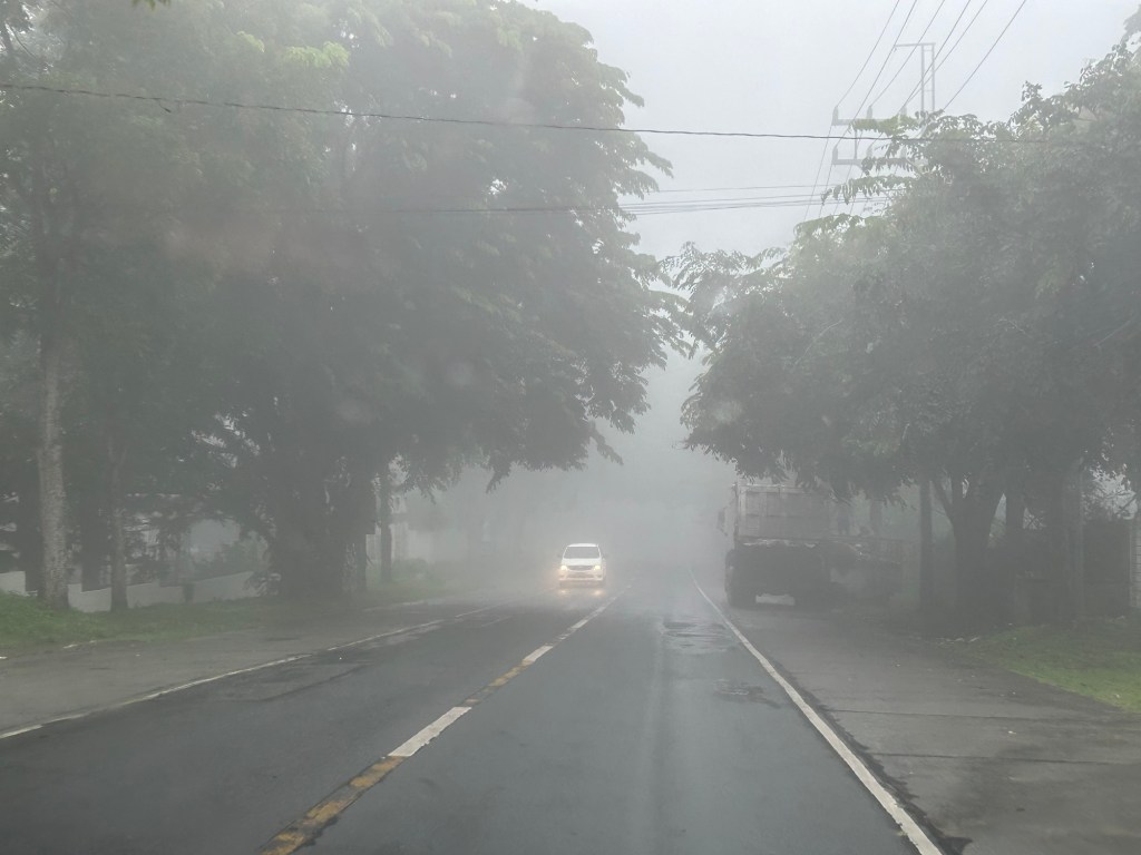
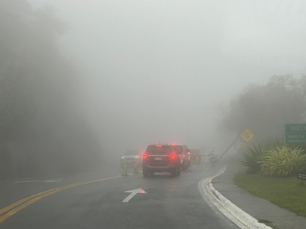
More photos of the foggy roads in the next post!
–
On a city’s part in making bike and scooter shares succeed
I recently posted about Bonifacio Global City (BGC) and the bike and scooter share they have there. There was one bike share there and in the Ortigas Center before the pandemic. But those fizzled out for various reasons including not so many people using it. Here’s a report on bike and scooter shares in the US and the observation that cities are not making it easy for these to succeed:
Tu, M. (July 29, 2024) “Report: People Want to Ride Shared Bikes and Scooters, But Cities aren’t Making it Easy,” Next City [Last accessed: 8/2/2024]
To quote from the article:
“Even long standing bike share systems can fall victim to the whims of leaders who are not committed to investing in greener modes of transportation. Houston recently lost its bike share system, ending 12 years of operations for BCycle after a new mayor hostile to bike and pedestrian improvements overhauled the METRO Houston board.
If cities want to encourage people to ride a bike or scooter instead of getting into a car, they will have to figure out how to fund it — or in other words, put their money where their carbon reduction goals are.”
Though we’re still a long way to achieving the bike and scooter shares they have in other countries such as the US, we should be wary about their experiences. The lessons learned here should already be in mind to those who will be setting up bike and/or scooter shares in Philippine cities. There is a demand for these facilities as people find cycling convenient and safer in some cities. However, LGUs need to invest more and commit to safer and more connected bicycle facilities in order to convince more people to use this active transport mode instead of motorized transport including motorcycle taxis.
–
Skyway to the south
Instead of going via C5 and then SLEX en route to Tagaytay last week, we opted to take the Skyway via Quezon Avenue. The travel was smooth between 6:30 AM and 7:30 AM maybe because it was a Thursday and regular classes have not yet resumed (i.e., less trips). Note the counter flow lane adjacent to the median? This is implemented likely due to the experience of heavier traffic along the northbound (Metro Manila-bound) direction during the mornings. I wonder if the reverse is implemented in the afternoons/evenings.

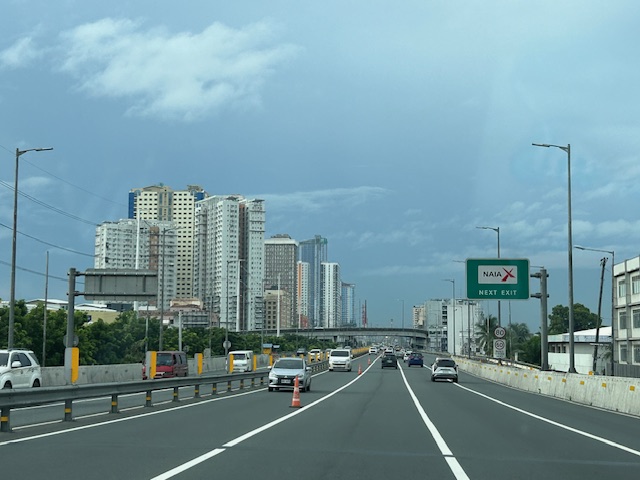
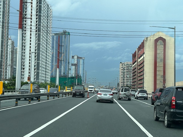
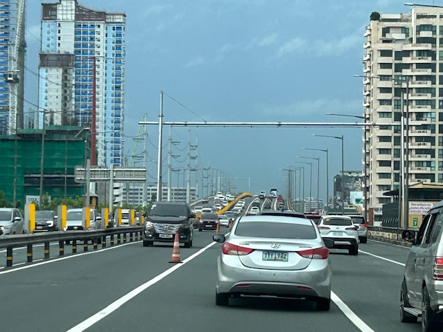
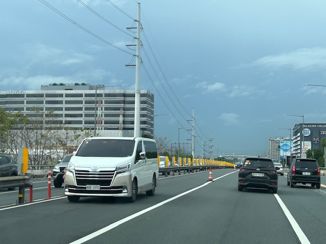
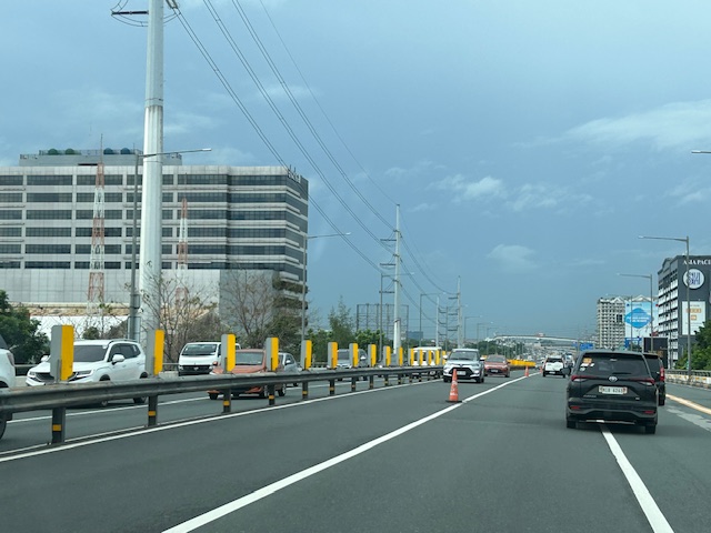


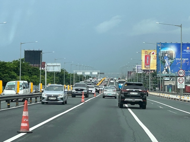
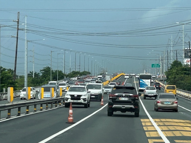
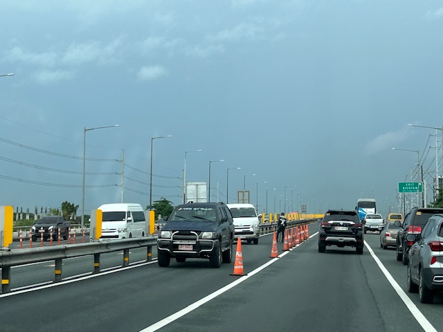
Note that there was more traffic as we traveled between Makati and Muntinlupa. The traffic represented commuters residing in the south and traveling to Metro Manila for work purposes.
Back in Iloilo
I’m finally back in Iloilo after a very long while. It’s a quick visit so I won’t be able to go to our ancestral home in Cabatuan. The visit to the city though will still be a sentimental one and perhaps update me on the developments there.
I will be posting on this trip soon as I plan to take photos of the bike facilities along the Diversion Road and walk along the Esplanade.
–
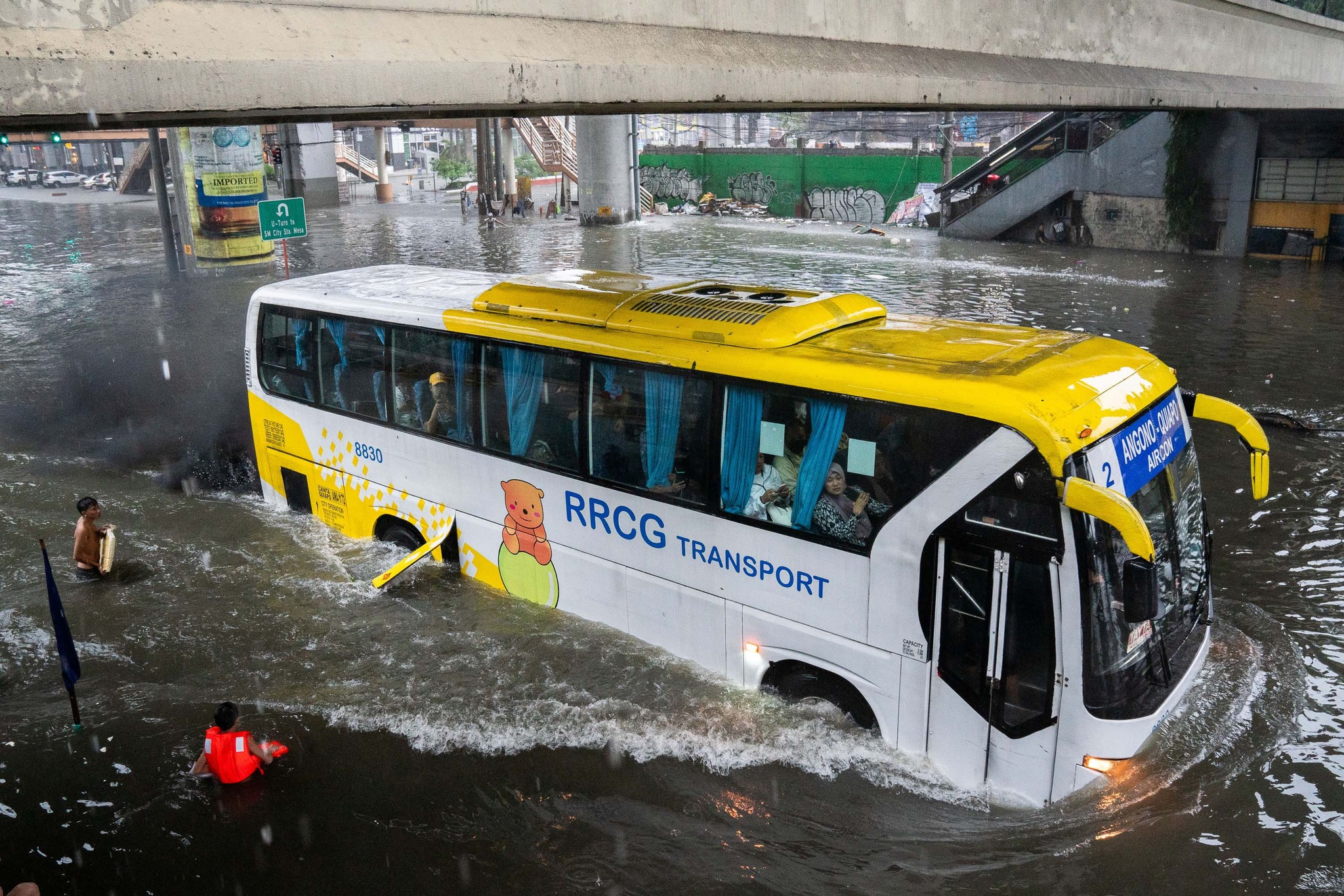
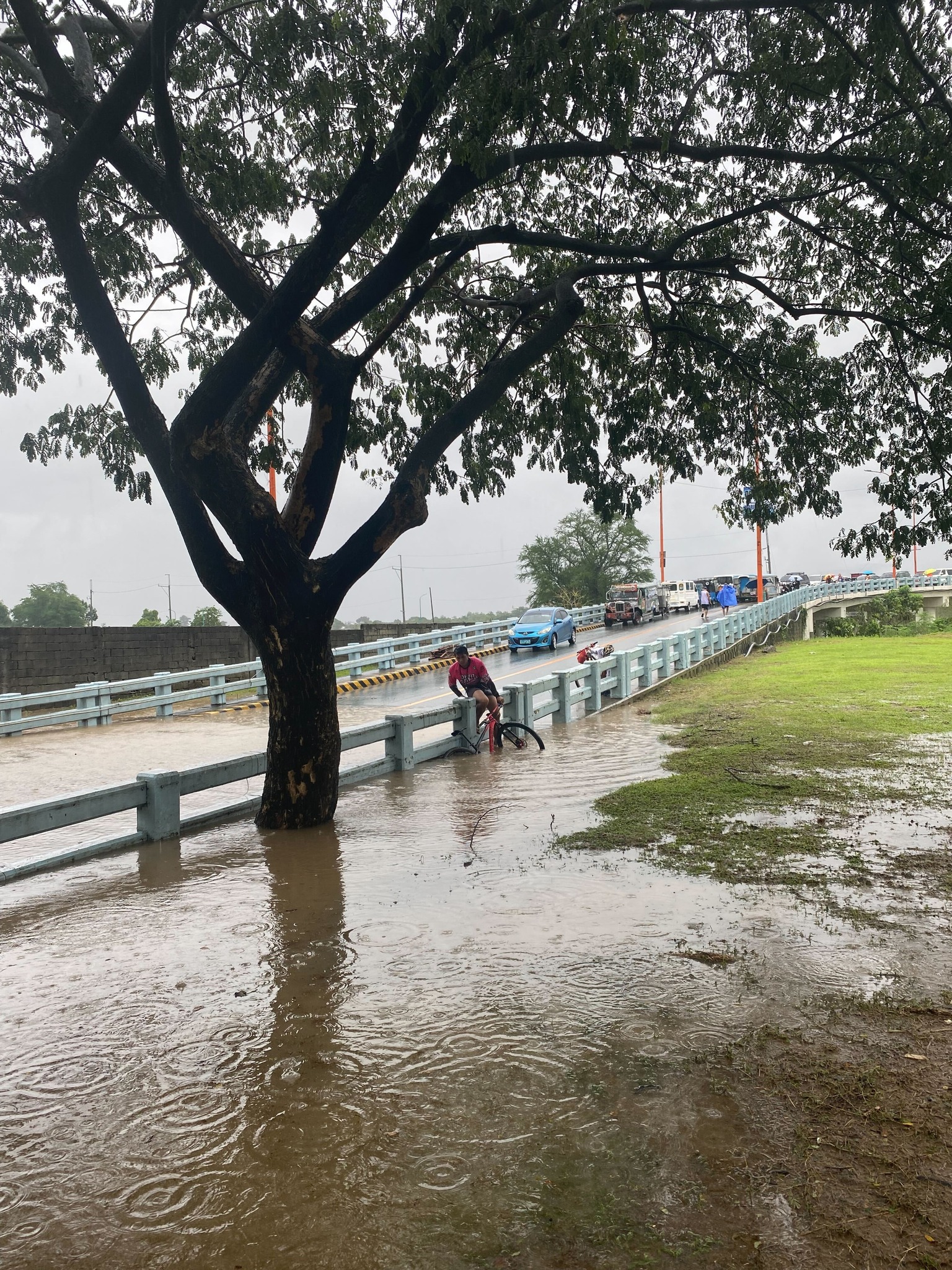
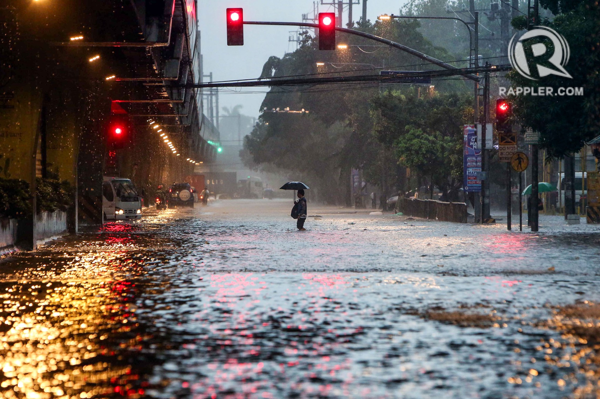
On transportation and floods
Some people say transport and traffic concerns take a backseat to floods and related concerns, which affect other aspects of our lives aside from our commutes. The heavy rains the past days have rendered many streets impassable to most types of vehicles. That means people cannot go to work, school or come home. Lives are disrupted by floods this way. But even more disruptive and disastrous are the damages brought about by flooding in many communities. Homes are submerged. Properties are damaged, many beyond repair or replacement. There is also the psychological aspect of floods especially for those who will experience them for the first time. These will surely add to the already fragile mental health of people still reeling from the effects of the COVID-19 pandemic.
As I write, the Marikina River has breached and many areas of Metro Manila and surrounding provinces of Bulacan, Rizal, Laguna and Cavite are flooded. The floods are now being mentioned along with those brought about by Ondoy (Ketsana) in 2009.
Here are some photos from the internet being shared by various social media accounts including the official pages of Rappler and Inquirer:
–
