
On transportation and floods
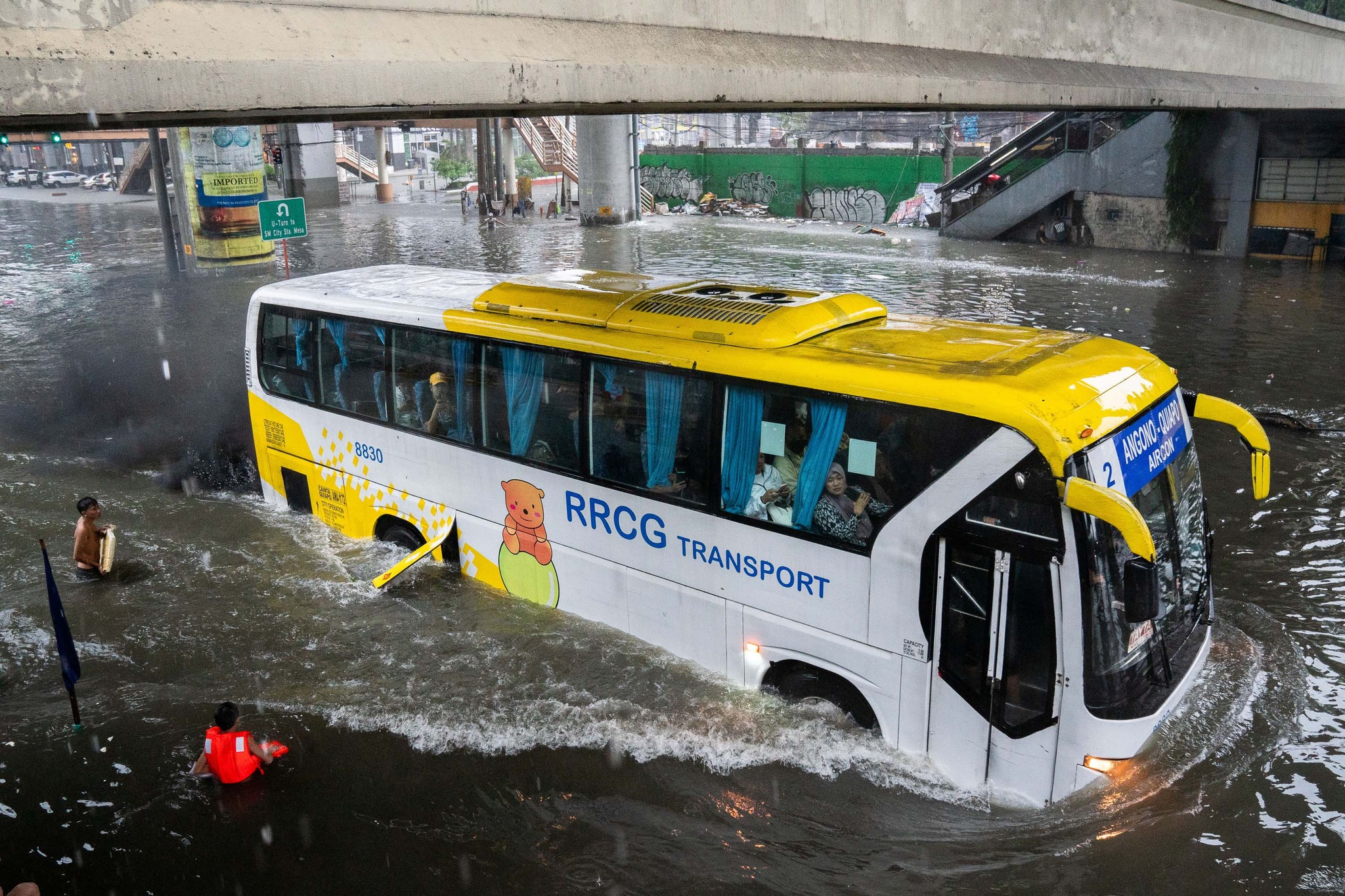
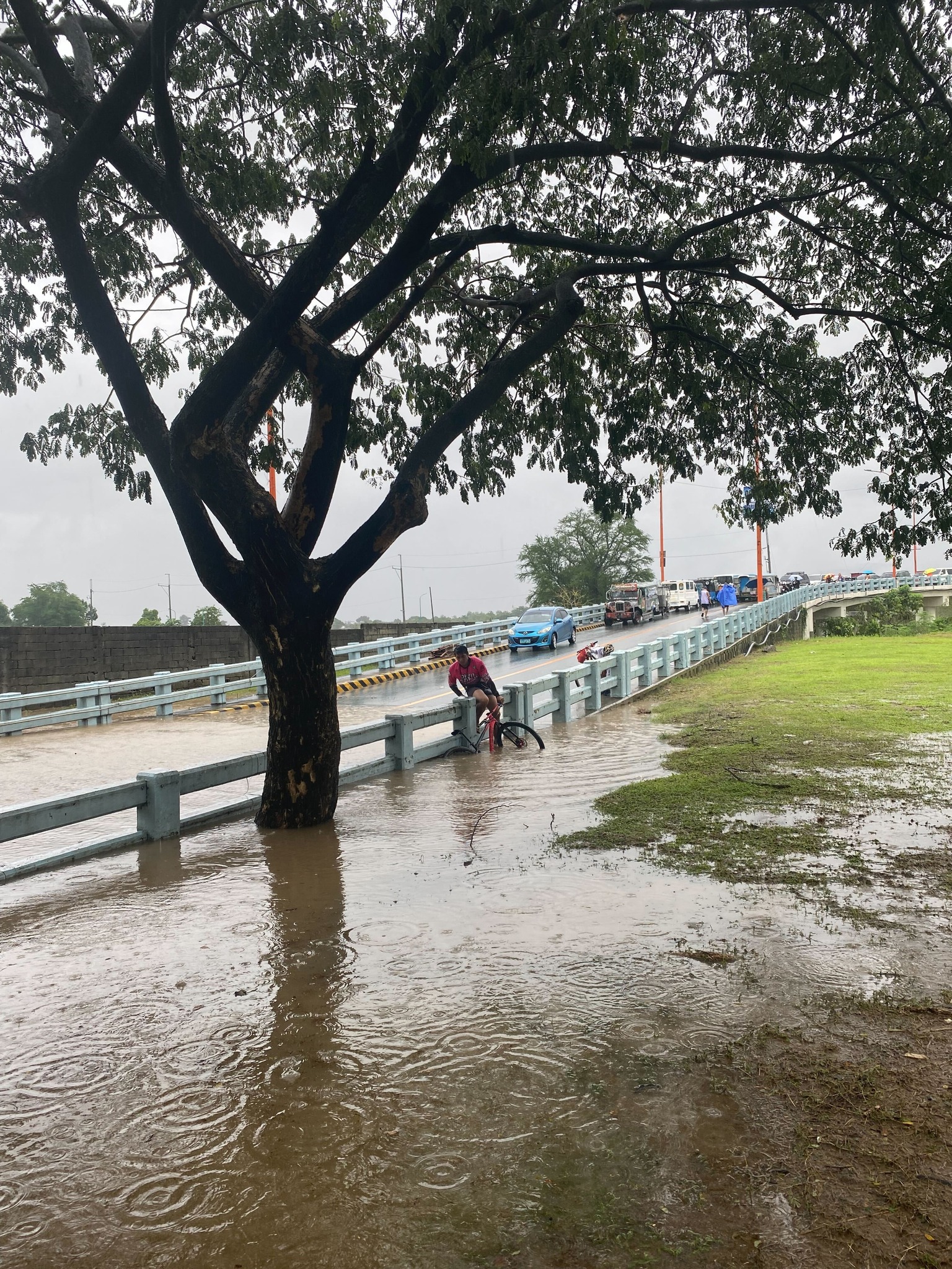
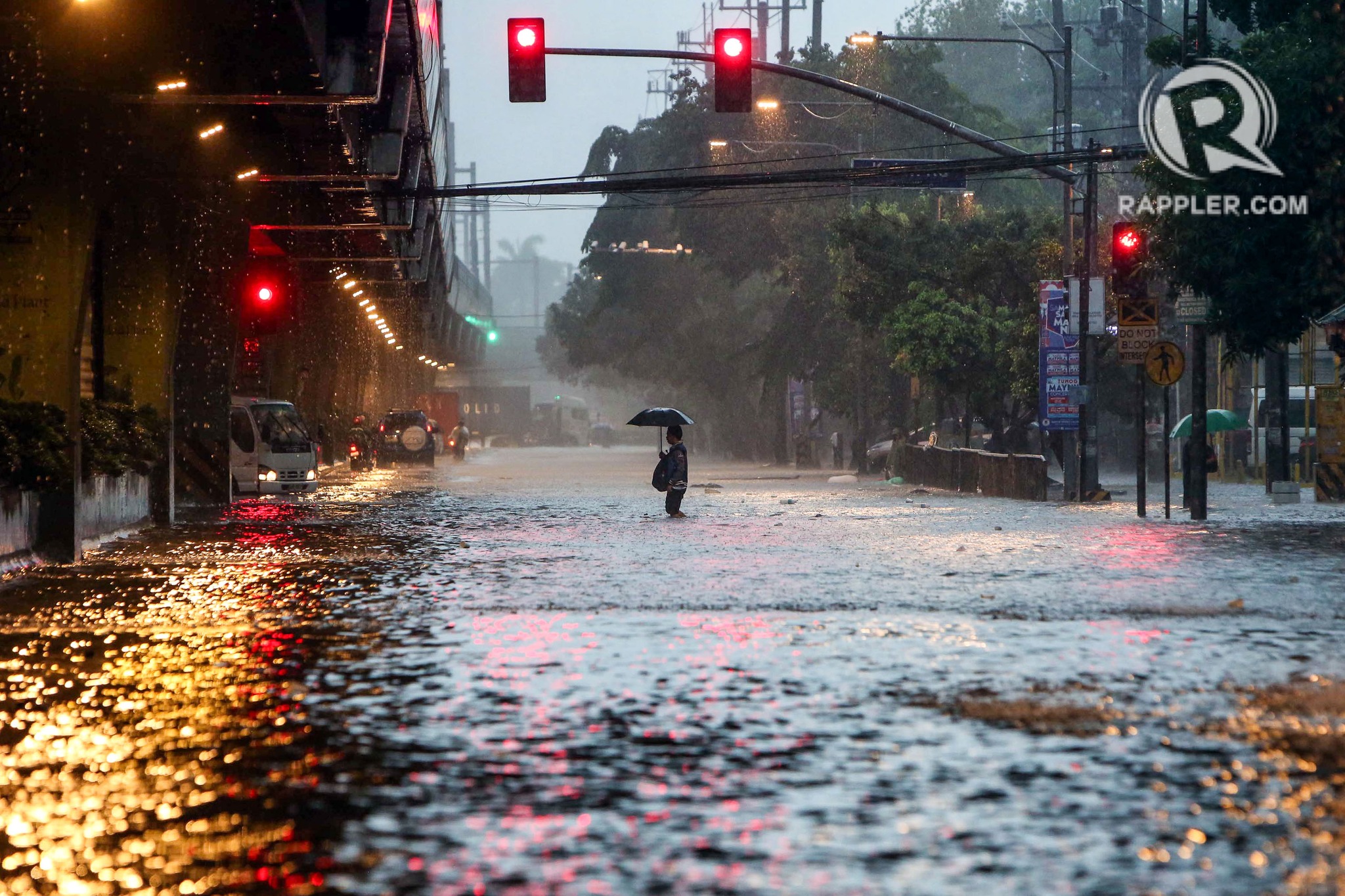
Some people say transport and traffic concerns take a backseat to floods and related concerns, which affect other aspects of our lives aside from our commutes. The heavy rains the past days have rendered many streets impassable to most types of vehicles. That means people cannot go to work, school or come home. Lives are disrupted by floods this way. But even more disruptive and disastrous are the damages brought about by flooding in many communities. Homes are submerged. Properties are damaged, many beyond repair or replacement. There is also the psychological aspect of floods especially for those who will experience them for the first time. These will surely add to the already fragile mental health of people still reeling from the effects of the COVID-19 pandemic.
As I write, the Marikina River has breached and many areas of Metro Manila and surrounding provinces of Bulacan, Rizal, Laguna and Cavite are flooded. The floods are now being mentioned along with those brought about by Ondoy (Ketsana) in 2009.
Here are some photos from the internet being shared by various social media accounts including the official pages of Rappler and Inquirer:
–
Back in Tagaytay
It’s been a while since I’ve been to Tagaytay. I think the last time was before the pandemic and with family. There used to be a time when we went there at least every month not counting the seminars and workshops we attended there. It was an easy drive from our home in Antipolo to Tagaytay via C6, SLEX and the Sta. Rosa-Tagaytay Road. We had our favorite stopovers with breakfasts usually at the Paseo de Sta. Rosa. Later, as Tagaytay became more crowded and congested, the trips became fewer. Of course, our schedules also became busier but then it wasn’t like we looked forward to the traffic and the crowded attractions there. I’m doing a project there now with my team at the office and that means I get to go there for work. Since we’ll be there anyway, we could have some side trips to eat some good meals (bulalo!) and maybe take some photos of Taal volcano.
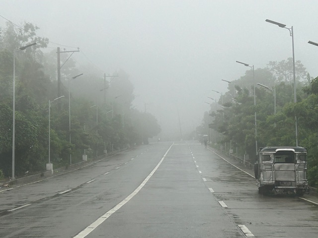
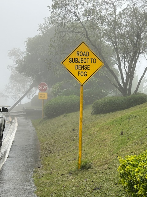
The fog was a quick reminder of the Tagaytay of old that we frequented before. But what we noticed was that it wasn’t cool. It was still somewhat warm if there was no breeze or wind blowing. This was certainly not smog as you can smell the pollution if it was. We even joked that it probably wasn’t because of the volcano as the smell of sulphur would probably be strong. We were in Tagaytay during the weekdays so there were fewer people and traffic. We were told that it was worse on weekends. That was to be expected. And with CALAX, Tagaytay became more accessible to visitors. I will write about the developments there in the next post. I feel there’s just too many buildings and the intense development has made Tagaytay less attractive. I have similar memories and feelings about Baguio but that’s another story to tell or write about.
–
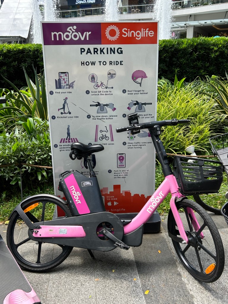
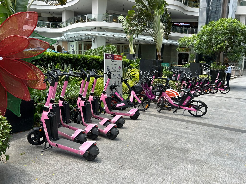
Mobility options in BGC
I haven’t been to Bonifacio Global City (BGC) in Taguig in a while. Unlike before (during the pandemic) when we could just stay at the condo some days to chill at our unit and explore BGC for lunch or dinner. We have high speed internet at our condo unit so we can work from there. I can do my lectures via Zoom and the wife could have her meetings online. Fast forward and we decided to have our unit leased so we couldn’t go there as frequently as before. The lease ended last month and we’re using the condo unit for ourselves while we refurbish the unit for future use, whether for our purposes or for leasing again.
It’s good to know that there are now active transport options for going around BGC. The previous bike share closed shop before the pandemic and it took a while for moovr to set up. Here are a few photos of the station near our condo.
–
Article share: Applying the New Traffic Safety Paradigm
Here is a quick share of an article on traffic safety from Todd Litman of the Victoria Transport Policy Institute. Source: Applying the New Traffic Safety Paradigm
In the article, the author discusses the use of ‘exposure’ as a measure of risk in as far as safety is concerned. The variable ‘vehicle miles traveled’ or in our case ‘vehicle kilometers traveled’ may be considered a risk factor. That is, higher or more VMT or VKT may lead to more crashes and casualties (and additionally damage to property). The objective is to reduce VMT or VKT in order to improve traffic safety.
To quote from the article:
“The new traffic safety paradigm recognizes the additional risk resulting from increases in low-risk vehicle travel and so favors strategies that reduce total vehicle-miles such as improved public transit services with free service for students, efficient school parking pricing to discourage driving, and more compact communities that reduce distances between homes and schools. In addition to reducing traffic risk these strategies also reduce household costs, traffic congestion and pollution problems making them win-win solutions. “
–
SPRINT principles for bicycles
Here is the link to how to improve your city’s or municipality’s bicycle facilities based on scores guided by the SPRINT principles: https://cityratings.peopleforbikes.org/create-great-places
SPRINT stands for:
S -Safe Speeds
P-Protected Bike Lanes
R-Reallocated Space
I-Intersection Treatments
N-Network Connections
T-Trusted Data
The site provides links and examples of good practices of actual bike projects in the US. Many of these can be replicated or adapted to Philippine conditions. These are something that the active transport section of the Department of Transportation (DOTr) should look into and perhaps provide a reference for developing and improving bicycle facilities in the country.
–
On a ‘tipping point’ for bikeability in cities
Here’s a nice article on bikeability and pertains to cities in the United States that developed bikeways or bike lanes during the pandemic. Like many cities that have ‘discovered’ cycling as a viable mode of transport particularly for commuting during the COVID-19 pandemic, it is postulated that there would be a threshold when people would switch to cycling and/or demand for more cycling facilities.
Wilson, K. (June 25, 2024) “Has Your City Passed the ‘Bikeability Tipping Point’?,” StreetsBlog USA, https://usa.streetsblog.org/2024/06/25/has-your-city-passed-the-bikeability-tipping-point [Last accessed: 7/2/2024]
To quote from the article:
“A whopping 183 American communities achieved a score of 50 or higher on PeopleForBikes annual City Ratings this year, up from just 33 in 2019. The means 183 communities have scored at least half of the available points on the group’s signature “SPRINT” rubric that includes such measures as protected bike lanes, safe intersection treatments, and reduced speed limits that are unlikely to kill a cyclist in the event of a crash, among other factors.
And when a city clears that 50-point threshold, the authors of the ratings say that its local bike culture has firmly taken root — and that every new roadway improvement will inspire more improvements, rather than a fierce fight against a car-dominated status quo.
“Once you’ve hit 50, your city probably has a pretty good low-stress bike network,” said Martina Haggerty, the senior director of local innovation at PeopleForBikes. “[That’s] not to say that there aren’t still improvements to be made [but it] probably means that more people are riding bikes in those communities because they feel safe and comfortable. And when more people start riding bikes, those people tend to become advocates for better bike infrastructure and for pro-bike policies, which, [in turn,] will get more people riding.”
There are many links found in the article itself that are “click worthy”. I recommend the reader to explore the rubric from PeopleForBikes and see for yourself how this can be adopted for your city. Is such a rubric applicable to the Philippines? Perhaps, but there would be a need to assess the the situation in each city or municipality. So far, there have been mixed reviews among cities, especially those that appeared to have been more progressive and were more aggressive than others in putting up bicycle facilities including bike lanes. Perhaps the rubric can be applied to see how our LGUs measure up?
–
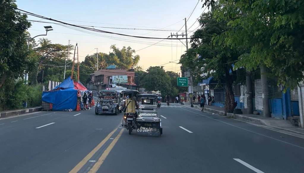
Another misplaced pedestrian footbridge?
There are soil tests currently being performed along L. Sumulong Memorial Circle across from Dela Paz National High School. This would probably be for the foundations of a pedestrian footbridge in the area that will, in theory, reduce if not eliminate pedestrian crossings in the area. On most days when there’s school, there are a lot of people, mostly students, crossing here. The result is traffic slowing down along both sides of the road that happens to be near the junction with Pinagmisahan Road. Is this enough reason to build a footbridge here? Probably and tempting enough for those who look for ‘easy’ solutions rather than come up with something that is less car-centric than a footbridge where the crossing is short and quick if done on the ground rather than via an overpass.
 Soil tests across from Dela Paz National High School.
There should be a solution here along the lines of complete streets rather than the usual pedestrian footbridge that’s a favorite of local and national government officials, planners and engineers who appear to be too lazy to come up with a more suitable treatment to improve safety in a high pedestrian and vehicle traffic area.
–
On BRT being the solution to many cities’ public transport problems
Here is a very informative article about the benefits of a bus rapid transit (BRT) to a city:
Renn, A.M. (June 17, 2024) “The Bus Lines That Can Solve a Bunch of Urban Problems,” Governing, https://www.governing.com/transportation/the-bus-lines-that-can-solve-a-bunch-of-urban-problems [Last accessed: 6/25/2024]
To quote from the article:
“One benefit of BRT is that it is much more capital-efficient and faster to implement than light rail. For many years, urban advocates have promoted light rail over bus transit, impressed by the success of light rail systems such as the one in Portland, Ore. But today’s light rail lines are extremely expensive. One proposed in Austin, Texas, for example, is projected to cost $500 million per mile. Also, most of the cities that have desired light rail are low-density cities built around cars and with little history of extensive public transit ridership. Converting them to transit-oriented cities would be a heavy lift.
BRT is much cheaper. The 13-mile Red Line BRT in Indianapolis, opened in 2019, cost less than $100 million — not per mile, but in total. The much lower financial lift required for building bus rapid transit makes it more feasible for cities to raise the required funds.
Because they typically run on city streets, BRT systems also offer the chance to perform badly needed street and sewer repairs during construction. Sidewalks can be rebuilt or added. Traffic signals can be replaced, along with new features such as prioritizing buses over auto traffic and additional pedestrian safety measures. The reduction of traffic lanes itself is sometimes a worthwhile street redesign project.”
It’s been more than a decade (almost 2 decades to be more accurate) since a BRT was proposed in Cebu City and in Metro Manila. So far, there is still none operating in the Philippines. The EDSA Carousel probably wants to be one but is far from being a BRT based on operations and performance. Cebu’s is supposed to be currently in implementation but it seems Davao might just beat them to it with its high priority bus project. The Philippines requires a proof of concept of the BRT in one of its cities that could be the inspiration for similar projects in other cities especially those that are already highly urbanized.
–
Some aerial photos as we approached Panglao
Here are a few more photos from our plane as we journeyed to Bohol last week. This time, it is from the approach to Panglao. I was expecting the approach for the plane to pass above Cebu. I was rewarded with the following photos:
 Mactan Cebu International Airport as seen from our plane making its approach to Panglao Airport
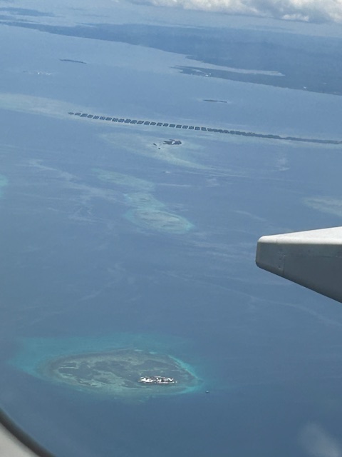 A view of the islands off Mactan and between Cebu and Bohol. There was a view of Olango Island but I wasn’t able to take a photo.
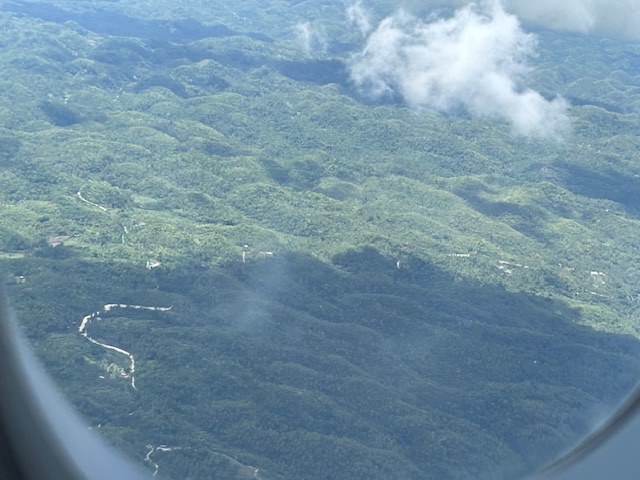 A quick shot of some of the hills at Bohol Island. I am not sure these are the Chocolate Hills but the formation, the geology is the same as the heritage site’s.
–
Some photos after taking off from NAIA
I took a few photos as our plane took off last week on our way to Panglao. The photos are not as good as I wanted them as I wasn’t seated at the window.
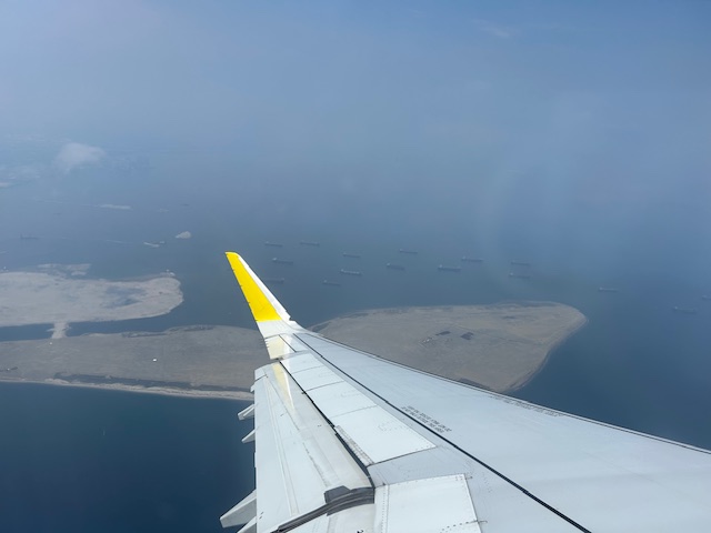 Reclamation at Manila Bay – there are currently several reclamation projects with various proponents. The projects were halted at one point during the start of the current administration. Some if not all have resumed implementation.
 A closer look at one of the reclamation areas. Note, too, the ships anchored around the area.
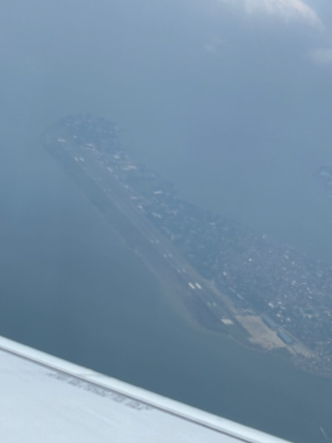 Sangley Point airbase as seen from our airplane. This is proposed to be the location of an airport recommended by a JICA study to replace NAIA. Not in the photo is the controversial former resort that is now a suspicious enclave.
The reclamation projects are also quite controversial considering many of the proponents involved Chinese companies. I have it from a reliable source who was involved in two of the projects that the project land values are sky high. So who would be able to afford settling, locating or residing in whatever will be developed in these reclaimed land? It would be very expensive for the typical Filipino and many local companies will probably balk at the property values. Whatever the developments would be, let’s just hope they don’t go the way of the former Island Cover Resort that is now allegedly a POGO facility.
–
