
Article share: The Benefits of Trees
Here is a quick sharing of this article on the benefits of trees. I thought such articles are always timely and relevant especially if you frame this in the context of road or highway development as well as the complete streets concept that is currently being promoted to improve transport conditions including road safety.
Source: The Benefits of Trees
What’s new at NAIA Terminal 2
NAIA’s Terminal 2 now only serves domestic flights. It currently hosts Philippine Airlines and Air Asia flights to major cities. I haven’t been to the parking area or had the opportunity to go around the terminal’s arrival area for some time now. I used to go to NAIA frequently the time when my wife was a frequent international traveler with her former office. If she had trips to the US West Coast (e.g., Los Angeles or San Francisco) she would likely take the direct flights via Philippine Airlines.
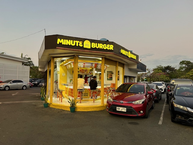 Minute Burger at the kiosk near what was the international (North) wing of NAIA Terminal 2
 What used to be a Figaro branch at one end of the terminal is now Seattle’s Best Coffee
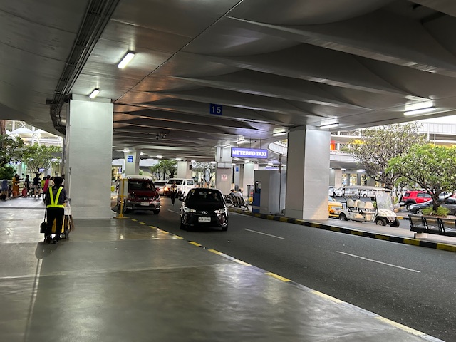 The arrival level driveway at the terminal
 Coupon taxi stand at the terminal
 Grab station at the NAIA Terminal 2 arrival level driveway
 There is a Denny’s at the other end of the terminal. There used to be no restaurant or cafe at what was the domestic (South) wing of the terminal.
As I’ve mentioned earlier, I haven’t been able to go around the NAIA terminals aside from the usual departure and arrival areas when I’m traveling. So this one Sunday that I picked up my father as he returned from Iloilo, I took advantage and took photos to share here.
–
Article share: on subsidies to public transportation
Here’s a nice article that presents arguments for subsidies to support transit or public transportation:
Wilson, K. (February 5, 2024) “Study: Subsidizing Transit Actually Makes It More Efficient,” Streets Blog USA, https://usa.streetsblog.org/2024/02/05/study-subsidizing-transit-actually-makes-it-more-efficient [Last accessed: 2/18/2024]
Subsidies to public transportation can be quite tricky and may require quite a balancing act. There seems to be few options outside of the straightforward subsidies national and local governments in the Philippines provide. Rail transit, for example, is heavily subsidized but these are rare for road-based public transportation. The concept of service contracting has been considered but it also has a few variations. While there seems to have been a proof of concept tested during the pandemic, it required so much funds that government apparently lost interest (i.e., the funds were also needed by other sectors). Local governments meanwhile, or at least those that had resources, decided to operate their own public transport (e.g., Quezon City bus).
To quote from the article:
“Newmark’s study doesn’t definitively determine why, exactly, high subsidies seem to correlate with better efficiency and transit agencies collecting more fares, but he has some theories. Some systems, he says, use subsidies to increase service frequency or install dedicated lanes to speed routes up along heavily-utilized corridors — and riders are responding, predictably, by showing up in droves. (Route expansion can help, too, he said, but only if agencies expand service to places “where there’s actual demand.”) Others use subsidies to keep ticket prices low, but not to eliminate fares outright, which Newmark argues is a smart move.
“People value stuff they pay for, and they pay for stuff they value,” Newmark added. “An underlying point in this paper is that transit offers something [valuable], and it’s worth trying to capture that value, whether through fares or in other ways.”
If transit networks and the taxpayers who support them can get that recipe right, it could create a virtuous cycle.
“If people see the benefits [of subsidies], that may make them more willing to invest [their taxpayer dollars],” he adds. “Good transit leads to a real social movement for more subsidies.” “
What do you think about subsidies to public transport in the Philippine setting? Of course, we are referring to ‘formal’ public transportation here. There are many ‘informal’ or paratransit modes like tricycles and non-motorized pedicabs. There are also motorcycle taxis providing services or filling in the gaps in transport services.
–
More than just painted lines – good practice examples of bike lanes
I’m sharing this article on the best bike lanes in the United States:
Holbrook, A. (February 12, 2024) “The 5 Principles That Make America’s Best Bike Lanes: A Lot More Than Painted Lines,” Velo, https://velo.outsideonline.com/urban/urban-gear/five-principles-the-best-bike-lanes/ [Last accessed: 2/15/2024]
This is a follow-up on an article on the best new bike lanes or bikeways that I shared earlier. This article features an interview of the author of the previous article about what features distinguish these bike lanes over others that have been implemented. Definitely, bike lanes should be designed beyond the usually painted lines that offer little protection to cyclists.
Here are examples of bike lanes in the Philippines:
 Painted bike lanes along Ortigas Avenue Extension, Cainta, Rizal
 Protected bike lane along Katipunan Avenue (C-5), Quezon City
–
Widening of Gen. Santos Avenue, Taguig City
This is a very late post. I saw this draft that I made more than 7 months ago when I passed by General Santos Avenue in Taguig en route to Laguna where I was to attend a nephew’s wedding. General Santos Avenue is the road connecting C6 with the South Luzon Expressway (SLEX).
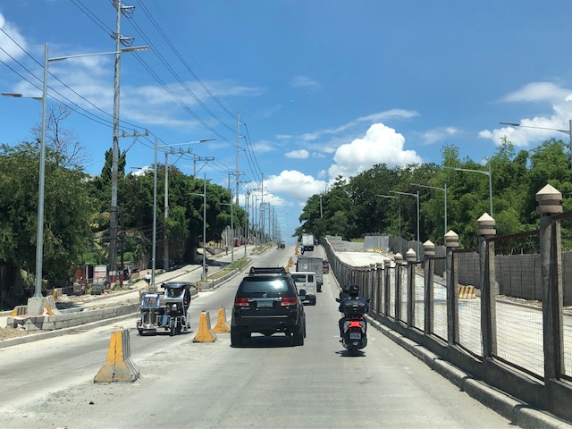
 Fence dividing traffic along either side of the road
 The fence stretches along a significant length of the avenue, effectively preventing people from crossing the street anywhere.
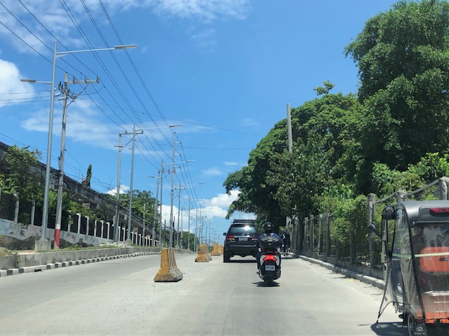
 Unfinished section (should be done by now) showing the original carriageway on the left. The new lanes due to the road widening project is on land acquired from the DOST lot on the right.
 It becomes clear in this photo that the median of the widened road is actually where the walls of the DOST compound used to be. Note the dead end where DOST land has not been expropriated yet for the road widening project.
 Either side of the road are DOST lands. The main compound is at right while the left is the MIRDC compound.
 The experimental Automated Guideway Transit (AGT) is found at the MIRDC compound.
More on similar cases in future posts. Road widening projects are very popular with the DPWH, and the agency has been criticized for being somewhat lazy or applying a non-imaginative approach to solve traffic problems. The project is a good example of DPWH fulfilling its mandate. Never-mind that this is not a sustainable approach to addressing transport problems.
–
What’s new at Zamboanga Airport?
We were back in Zamboanga last week to do some follow-up work on a project on road safety. We also paid a courtesy call to the new City Administrator to reiterate our commitment on helping the city address concerns about child road traffic injury prevention. Of course, I was able to take some new photos of places and food. Among the typical photos I take is of the airport.
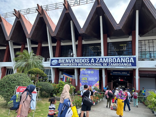 Passengers arriving at the Zamboanga Airport
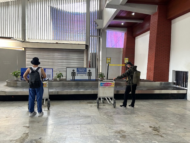 We were greeted by what looked like a new baggage carousel at airport
 This actually looks like the old one transferred to this position. The new one is currently being set up where the old one was and will probably be operational very soon. That means the airport will be able to separately handle baggage from two arriving planes.
 Colorful vintas on display at the arrival area just next to the baggage claim area
–
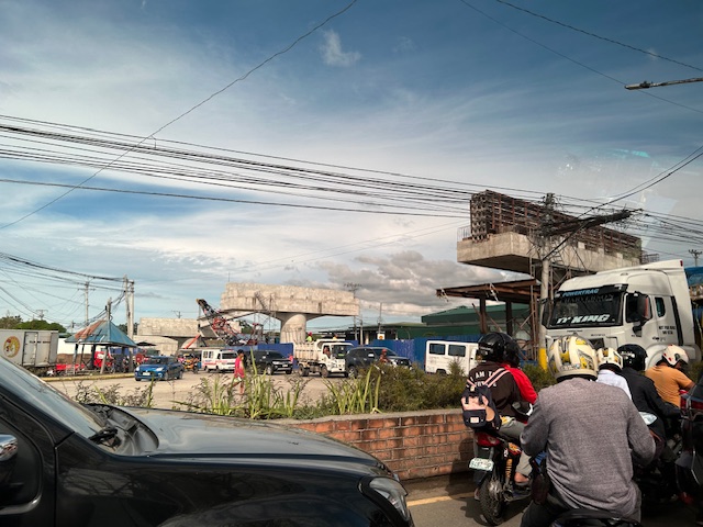
Zamboanga’s first flyover
We passed by the construction site of Zamboanga City’s first flyover at the intersection of the Pan Philippine Highway (AH 26) and Veteran’s Avenue. I recall there was a lot of pressure from DPWH for the city to approve its construction. The previous mayor didn’t want to approve the project because the perception was that it was not required and there were other options to consider before a flyover was to be constructed. However, many people including the then congressman and now mayor probably thought the flyover would be the solution to the congestion experienced at the intersection. Add to that the perception that the flyover is also somewhat a symbol of progress.
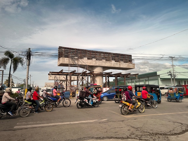
We won’t know until its completion and the ‘normalization’ of traffic in the area to determine whether the flyover has ‘solved’ traffic congestion in the area. The problem with this approach to ‘solving traffic’ is that it is usually a short-lived alleviation of a symptom of the real problem, which is transportation. Zamboanga City has deferred rationalization of public transport routed despite analysis and plans pointing to a streamlined and optimized transportation system if this was pursued. The City commissioned a Transportation and Traffic Management Plan Study in the previous administration but the plan and its recommendations have been shelved, another example of such being casualties of a change in administration of an LGU.
–
On urban noise
We open February with an article share. The article is about noise in urban areas. Not surprisingly, most noise comes from transportation and the solutions mentioned in the article not only addresses transportation noise but at the same time addresses other concerns about transportation, including safety.
Durand-Wood, E. (January 25, 2024) “Why Are Cities So Noisy? And Can We Do Anything About It?“ Strong Towns, https://www.strongtowns.org/journal/2024/1/25/why-are-cities-so-noisy-and-can-we-do-anything-about-it [Last accessed: 2/2/2024]
To quote from the article:
“In 2011, the WHO set recommendations for daytime and nighttime environmental noise levels, and found the maximum safe noise level for daytime is 55db (somewhere between moderate rain and normal conversation) and at night, 40db (about the level of a quiet library). Beyond these levels, prolonged exposure to environmental noise has been shown to cause health problems, and not just hearing-related ones.”In 2011, the WHO set recommendations for daytime and nighttime environmental noise levels, and found the maximum safe noise level for daytime is 55db (somewhere between moderate rain and normal conversation) and at night, 40db (about the level of a quiet library). Beyond these levels, prolonged exposure to environmental noise has been shown to cause health problems, and not just hearing-related ones.
Until recently, most analysis related to urban noise has focused on noise as an annoyance or disruptor to humans. But with these new guidelines, there was an acknowledgement that too much environmental noise can actually have grave health consequences, noting that “at least one million healthy life years are lost every year from traffic-related noise in the western part of Europe.”
We now know that higher levels of environmental noise raise heart rate and blood pressure, cause harmful sleep interruptions, and are linked to cardiovascular disease, dementia, and cognitive impairment in children, among others. And as with environmental pollution, there are racial and socioeconomic disparities with noise pollution.
In a 2022 report, the United Nations identified urban noise pollution as a top environmental risk.”
Have you noticed how noisy it is in our cities? Many actually choose to live in the suburbs as the perception is its quieter especially during the night. The health risks due to noise are well-established as presented also in the article. However, there are ways to address this and reduce the noise, particularly the type attributed to transportation and traffic.
–
On the Pasig River esplanade project
My news feed was full of articles on the Pasig River esplanade, or at least the recently completed section at the Manila Central Post Office building. This is a proof of concept type of project that hopes to be expanded or extended to cover both sides of the river much like the Iloilo River Esplanade project. If you are wondering what the section looked like before the project, here are two posts I wrote in 2012 that features a lot of photos of the Muelle del Rio:
These were way before the fire that damaged the Post Office building. However, even at that time, there were already calls for the renovation, even repurposing of the Post Office building. Such projects or proposal draw inspiration from Singapore where old buildings have been preserved and many repurposed (e.g., how about the Post Office building transformed into a hotel?). Perhaps such will breathe life and lead to a revival of this part of Manila?
–
Maulan, ma-traffic
I just wanted to share this photo taken a couple of weeks ago when there were a few rainy days. These were not light rains but downpours that caused some flash flooding on streets along my commuting route. The flash floods plus vehicles generally slowing down due to the rains lead to traffic congestion. I thought this was what brought about the saying “maulan, ma-traffic” that translates into “it’s rainy so expect traffic congestion”.
 Vehicles caught up in a traffic jam along Ortigas Avenue Extension
–
