
On improving public transport services to increase or retain ridership
Here is another quick post; sharing a nice article on how to improve public transport services:
Miller, A. (2019) “From the Bus Stop to the Fast Lane: How Cities Can Speed up Buses, Improve Ridership”, Medium.com, https://medium.com/frontier-group/from-the-bus-stop-to-the-fast-lane-how-cities-can-speed-up-buses-improve-ridership-f96d473c1cc7 [Last accessed: May 4, 2019].
While the article drives the point towards increasing ridership, I think the challenge for Philippine cities is more of retaining ridership. This is because there is pressure of public transport ridership decreasing as a result of increasing car ownership (owning their own vehicles is still an aspiration among many Filipinos), the popularity of car sharing/ride-hailing, and the still rapid increase in motorcycle ownership.
–
On unlocking the potential of shared transportation
Here’s a quick share of a very nice article that’s very informative and therefore useful to people seeking to tap into the potential of shared transportation to help alleviate transport woes in their cities and towns:
Miller (2019) “9 Ways Cities Can Unlock the Potential of Shared Transportation”, Medium.com, https://medium.com/frontier-group/9-ways-cities-can-unlock-the-potential-of-shared-transportation-66a53b2c841 [Last accessed: May 3, 2019]
So far, we only have few examples of shared transportation in the Philippines. These include a few bike shares in Metro Manila and does not count ride-hailing/ridesharing, which we now know is not really a sustainable form of transport.
–
Public transport coverage in Metro Manila
I saw several posts circulating on social media about public transport routes in major cities that included stylised maps presented like the transit maps you usually see for cities like Tokyo, Hong Kong and Singapore. These show what the makers identify as the equivalent of stops or stations along the public transport “lines”. These, of course, are a simplification because what appears as a single line may actually be comprised of several. Also, the overlaps seem to be also quite simplified compared to what may be found in reality. This post will not attempt to show how complicated road public transport is for Metro Manila. Instead, I am sharing the maps prepared from a previous study we conducted for the then DOTC (ca. 2012) that show the coverage of three road public transport modes: buses, jeepneys and UV Express.
 PUB coverage for Mega Manila with distinction of EDSA and non-EDSA routes (2012)
 Jeepney route coverage for Mega Manila (2012)
 UV Express route coverage for Mega Manila (2012)
I hope these maps have already been updated or are going to be updated in order for us to have good visual references for public transport planning including the identification of locations for integrated terminals as well as connections with rail transit.
–
Bike patrol
Wouldn’t it be healthier and more effective for law enforcers to have bike patrols? Many of them seem to be detached from the communities they’re supposed to serve when they aren’t on foot or pedals but instead go around on motor vehicles. It also seems a waste that the motor vehicles assigned to these people are being used to train them for driving. Thus, you often see patrol cars (even motorcycles) that are supposed to be recent model vehicles but seem so battered already. Do they really use these for chases? Or are they damaged due to their being used as “training” vehicles?
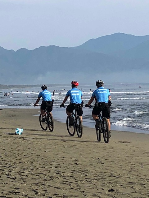 PNP officers on bike patrol along the beaches in Baler, Aurora
To be more effective, police officers should probably be roaming on foot or bicycles. They can be more in touch with the communities as there will be opportunities to mingle compared to if they were on cars or motorcycles. In one thread on social media, for example, there was a call for our local police to adopt the “Koban” style of the Japanese police where officers roam the communities mainly on foot and where many are recruited from the community for the latter and former to have some familiarity with the people and areas they are assigned to. Going around on foot or bicycle would also be a healthier option as surely they will be able to go more than the 10,000 steps (or equivalent) necessary to be classified as active.
–
Arko along the highways
I tried to take photos of the arches that used to typically mark the boundaries between cities, municipalities and provinces en route to Baler, Aurora. I didn’t find many despite the numerous towns we passed along the way. Here are the one’s I saw, with some apparently rebuilt after the road widening projects of the DPWH.
 Welcome arch to the Province of Nueva Ecija as we exited Tarlac Province – the first town after La Paz, Tarlac is Zaragosa, Nueva Ecija
 Welcome arch of the Municipality of Aliaga, Nueva Ecija
 Cabanatuan City’s arch as we exited towards Llanera
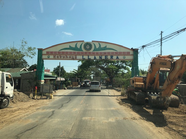 Welcome arch of Llanera, Nueva Ecija
 Relatively new and modern arch design of Rizal, Nueva Ecija
More on these arches soon!
Do you have photos of arches in your place that you can share? Post them on the comments section! 🙂
–
On the Holy Week rush and long distance trips
It’s that time of year again when people travel a lot of mostly to go back to their hometowns to spend the Holy Week break there. Many will also be going on leisure trips; heading to tourist destinations such as beaches, which are likely the most attractive places during this sweltering summer season. Most people will likely travel on land and would be taking public transportation in the form of provincial buses (while there will be more cars on the roads, more people will be on high occupancy vehicles).
 Provincial bus terminal near the end of Gil Puyat Ave. (formerly Buendia Ave.)
One wonders if the mode shares for these provincial trips could have been different at least for Luzon Island if the old PNR northern and southern lines were retained, maintained and modernised. What used to be the Main Line North stretched all the way to San Fernando, La Union with stations at most major cities and towns in Bulacan, Pampanga, Tarlac and Pangasinan including Malolos, San Fernando (Pampanga), Angeles City, and Dagupan City. Meanwhile, the Main Line South stretched all the way to Legazpi City in Albay with stations in the provinces of Laguna, Quezon, Camarines Norte, Camarines Sur and Albay. These included stations in Calamba, Los Banos, Sta. Cruz, Lucena and Naga. Surely, more people would have taken the trains for these long distance trips if the rolling stock were a lot like those operation by Japan Railways?
–
Visita Iglesia itinerary?
I spotted this ad at a nearby SM mall listing churches that can be part of a Visita Iglesia itinerary in the Province of Rizal. I took the following photos showing the major churches in the province. These include old churches found in the older towns including those in Morong (ca. 1620), Taytay (ca. 1630), Pililla (ca. 1672), Baras (ca. 1686), San Mateo (ca. 1716), Tanay (ca. 1783), and Binangonan (ca. 1800). Antipolo has one old church – Boso Boso Church (ca. 1669). The Shrine of Our Lady of Peace and Good Voyage while being the more famous of the two was completed in 1954. The first church though was completed in 1632 but was destroyed several times due to unrest, earthquakes and the Second World War. Cainta also had an old church (ca. 1707) that was destroyed several times including during WW2, and the new church was completed in 1968.


We’ve visited many of these churches before but are no longer into the Visita Iglesia considering our experiences of traffic congestion the past years when this tradition became more of a tourist thing or gig. We’d rather go to a nearby church to pray or stay at home to enjoy the peace and quiet; not to mention the comforts of being at home.
–
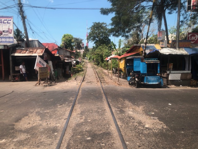
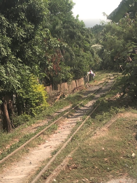
Another look at the PNR tracks in Bicol
Before I post on more recent photos I took from our road trip to and from Baler, Aurora, I just wanted to share photos I took of the PNR railway tracks from an earlier trip to Naga City.
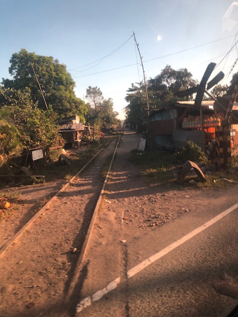
 Railway crossing somewhere in Quezon – there are many crossings such as these in many towns in Laguna and Quezon
 Notice that this is a single track set-up, which means only one train at a time along either direction may use the railway tracks.
 Another railway crossing with an informal tricycle and sled terminal. Yes, that’s another paratransit on the right that runs along the seldom if ever uses railway tracks.
 There seems to be no trace of railway ties or sleepers here.
 The tracks here look like they are not longer in use even by sleds.
 Old railway barrier that looks like its no longer functioning
 Idle tracks as evidenced by the grass and the parked vehicles. A narrow road runs parallel to the tracks; giving access to homes along the riles.
 There are railway ties/sleepers along these tracks that seem to be still in use judging from the limited growth of grass and the space being clear of obstructions.
 More idle tracks including rails buried in the ground
 Another railway crossing along the national highway
–
More irrational public transport?
I spotted a new vehicle serving a new route between Cogeo in Antipolo and SM Aura in Taguig. I see these vehicles along Marcos Highway from Masinag to Santolan. Friends have spotted the same along C-5 at Eastwood and at Tiendesitas; confirming the route this mash-up between the jeepney and bus is running along. The route overlaps with existing public transport lines along Marcos Highway (mostly jeepneys connecting the eastern cities and towns with Cubao) including the elevated Line 2.
 Jitney running along Marcos Highway in Antipolo (section between Masinag and Cogeo)
The jeepney has a sign stating it is a DOTr project. So is this an experimental run to determine the viability of the route in place of the traditional approach using what was termed as RMC (Route Measured Capacity)? I am not aware of any other ways by which the DOTr or the LTFRB are able to estimate the number and type of public utility vehicles to serve certain routes. There are, however, initiatives to open what they call “missionary routes” but this term used to refer to really new and unserved (referring to formal public transport) corridors or areas rather than those that are already being served by several modes of public transport. The results of this interpretation of “missionary routes” are more overlapping routes that further complicate and undermine efforts for rationalising or simplifying public transport services in the Metro Manila and other cities as well.
I will soon post here three maps showing the public transport route coverage for Metro Manila more than half a decade ago. These show the coverage of buses, jeepneys, and UV express services at the time. I now wonder how these would look like with the new routes overlayed unto the maps.
Article on sustainable transport’s role in “saving the world”
Here is another quick post on another article I am sharing showing the importance of sustainable transport:
Milner, D. (2019) How sustainable transport can save the world, medium.com, https://medium.com/@djjmilner/how-sustainable-transport-can-save-the-world-f2f64517dc52 [Last accessed: 4/9/2019]
It goes without saying that sustainable transport has a lot of potential for helping mitigate climate change and other issues but much is expected of our leaders for policies and program & project development & implementation towards achieving sustainable transport in our cities and municipalities.
–
