
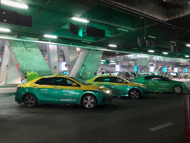
On EDSA transport and traffic, again
There’s a recent decision by the Metro Manila Council (MMC) comprised of the mayors of the cities and municipality of Metro Manila and chaired by the Metro Manila Development Authority (MMDA) Chair that vehicles bearing only one passenger (the driver) will be banned from travelling along EDSA. The problem with this is that by banning cars with one passenger from EDSA, you only succeed in making other roads like C5 more congested. It’s a simple case of transferring traffic and worsening it elsewhere since you’re not doing anything to alleviate congestion along those roads. Did MMDA run this and other scenarios using analytical or simulation tools at their disposal? If so, can these be shown and used to explain the soundness of this policy approved by the MMC? I suspect they didn’t and likely depended more on gut feel based on the data they have including what is often reported as 70% of vehicles traveling along EDSA having only one passenger. Meanwhile, the state of mass transit along EDSA still sucks.
 A very crowded Boni Avenue Station platform (photo courtesy of Mr. Raul Vibal)
Of course, the pronouncement from the MMDA launched quite a lot of memes on social media. Some people shared the typical quotes on planning (you know, like the ones about planning for people vs. planning for cars). Some offered their own ideas about how to “solve” traffic along EDSA. And so on…that only succeeded in showing how everyone had an opinion about transport and traffic. Everyone is an expert, so it seems.
Some thoughts and not in any order:
- The government can initially dedicate a lane each for express buses (a la Bus Rapid Transit or BRT). This idea has been circulating for quite some time now and has a good chance of succeeding. The DOTr is already deploying buses that they say are supplementing the MRT 3 trains (i.e., there aren’t enough trains running so passengers have the option of taking a bus instead). Running along the inner lanes of EDSA would mean, however, that they would have to find a way for passengers to cross the road and one idea would be for the stations to be retrofitted for this purpose.
- Those cars along EDSA are not necessarily for short trips so walking and cycling while needing space may have less impact in the immediate term for such a corridor. In the meantime, serious consideration should be made for bike lanes whether on the ground or elevated and improvements to walking spaces.
- But these efforts to improve passenger (and freight) flows should be a network-wide thing and not just along EDSA.
- It’s time to have serious discussions and perhaps simulations (even a dry run) of congestion pricing in Metro Manila. Congestion pricing for all major roads and not just one or two. Funds collected goes to mass transit, walkways and bikeways development. DOTr was supposed to have already discussed an Electronic Road Pricing (ERP) system like Singapore’s with the company and people behind the same in the city-state. That doesn’t seem to be moving along.
- Working and studying from home might work in terms of reducing vehicular traffic but then we generally have lousy internet services so that’s a barrier that needs to be broken down.
- How about legalizing, once and for all, motorcycle taxis? Many are opposed to this citing safety concerns but then we are running out of options outside the usual motherhood statements pertaining to building transport infrastructure. Think about it. Give it a chance. These motorcycles might just surprise us in a nice way; that is, helping alleviate congestion.
- Carpooling and lanes dedicated to High Occupancy Vehicles (HOV) would be good but the LTFRB made a pronouncement about these being illegal as they would be considered ‘colorum’. Such statements do not make the situation any easier and sends mixed signals as to the government’s being serious in considering all possible angles to improve transport and traffic particularly for commuting.
Do you have other ideas to share?
–
On healthier cities and encouraging walking
It’s a Sunday and the sun is up after days of rain so it would be a good time to be outdoors. Here is a nice article for the fitness buffs out there. Many of us have sedentary lifestyles and this has come as no surprise with the how we work and study as well as the influence of tech in our everyday activities. Even as I write this, I am sitting in front of my desk and have only my fingers and hands working. The rest of me is inactive except perhaps my senses and my brain. 🙂
Merle, A. (2018) “The Healthiest People in the World Don’t Go to the Gym,” medium.com, https://medium.com/s/story/the-healthiest-people-in-the-world-dont-go-to-the-gym-d3eb6bb1e7d0 [Last accessed: 8/1/2018].
I miss the times when I was living in Japan and when we were living in Singapore mainly because I was able to have a more active lifestyle in the cities where I lived. I walked and biked a lot when I was in Yokohama, Tokyo and Saitama, and later walked a lot around Singapore. I/we didn’t need a car as the public transportation was excellent and so were the pedestrian infrastructure. I recall walking between our laboratory at Yokohama National University and the dormitory, and later the Sotetsu Line Kami-Hoshikawa Station almost everyday. And then climbing up and down the hills of Yamate on Sundays. I can walk around Tokyo on my own and finding my way through shopping streets especially in Akihabara and Ueno. Of course, my favourite places would always include Kamakura, which can be reached via a train ride from Yokohama Station. The wife and I loved walking around Singapore and exploring places on foot. Indeed, you can be healthy and have a workout everyday without being too conscious about it!
–
On immigration lines at NAIA Terminal 1 – again
Much has been said and written about the congestion at the immigration area at the Manila’s Ninoy Aquino International Airport. My most recent experience was a mix of good and bad as the lines were quite long prior to my departure for Bangkok.
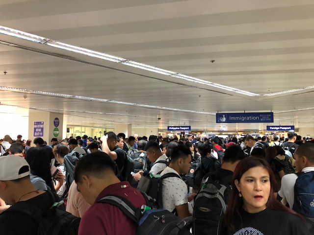 A very crowded immigration area when I joined the line. Note how far I was to the immigration booths and the meandering arrangement to maximise the space for queued travellers. I reckon that it took me almost an hour to get to a booth. Perhaps the airport can place some signs indicating how much time is estimated for one in line to get to the front? I wrote about this back in 2014 and proposed something similar to what I saw at airports like Narita and Incheon.
Meanwhile, the lines were shorter and faster upon my arrival a week later as shown in the following photo:
 Believe me these lines are shorter and faster moving. There were many immigration personnel the night of my arrival including an old friend from high school. Only, there were only 2 plane loads of passengers so it will definitely be worse during the peak hours when larger aircraft with more passengers arrive at the terminal.
It is a good thing that the airport is installing machines for express lanes soon. That will surely expedite processing for, at least, Filipinos returning from abroad. I think the departures would be quite tricky since there are many requirements particularly for workers leaving for their overseas assignments as well as government employees who require travel authority (TA) for them to travel abroad for whatever purpose. I think its Terminal 1 that is more notorious for the long queues as I didn’t have similar experience when using Terminals 2 or 3. Airport and immigration officials should exert more effort to ensure such congestion is minimised especially as the country targets more passenger traffic through its international airports.
–
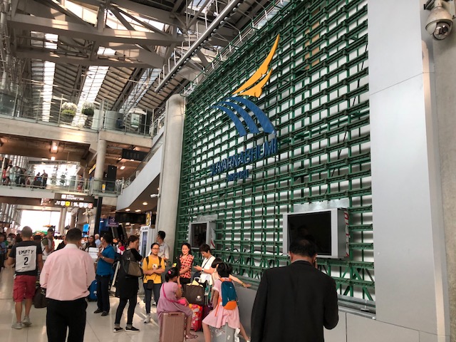
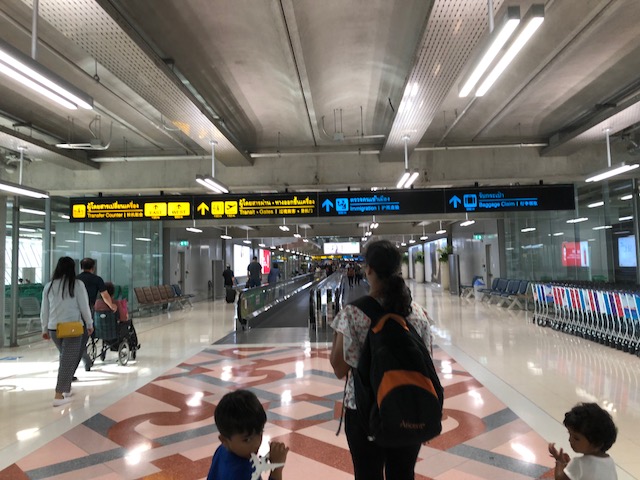
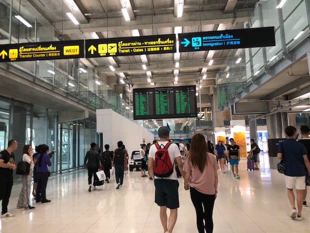
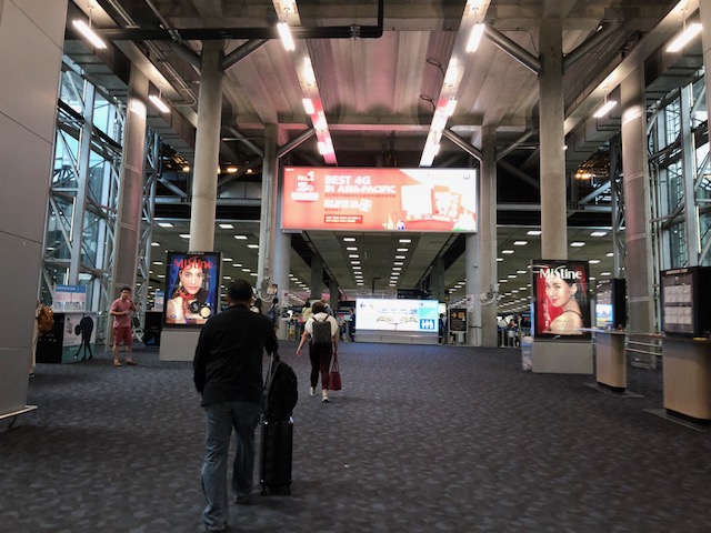
Another look at Suvarnabhumi Airport – arrival, part 2
Here are more photos taken when I arrived at Suvarnabhumi Airport in early July.
 Duty free shop at the baggage claim area
 Exit through customs
 Travelers and their companions meet-up right after passengers exit the arrival area
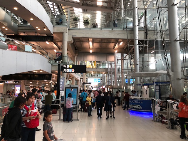
 It can get quite crowded at some areas of the concourse especially near the airport/tourist information and the currency exchange booths where people usually congregate.
 Another photo taken on my way to the escalators to get to the taxi stand at the lower level of the airport
 Escalator to the lower level of the airport where one can get a taxi to the city centre.
 A view of the ground level where there are seats for people waiting for arriving passengers or passengers biding their time before taking a taxi.
 The area is much less crowded than the upper levels
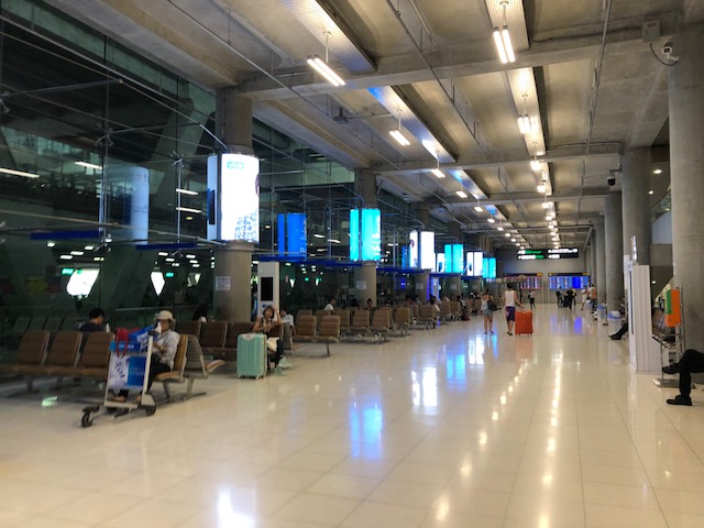 Here is another photo showing the spacious area with few people.
 Entry to the taxi stands – note the distinction among regular taxi (middle), large taxi (right)
 Typical regular taxis at Suvarnabhumi Airport. The large taxis are generally AUVs.
 Travelers are issued this ticket showing the lane where the taxi is parked, the name of the driver, car type and license plate number. You can also get a receipt from your driver upon arrival at destination and payment.
–
Another look at Suvarnabhumi Airport – arrival, part 1
Here are photos of Suvarnabhumi Airport upon my arrival in Bangkok earlier this month. Here’s the first set of photos taken upon my arrival at the international terminal.
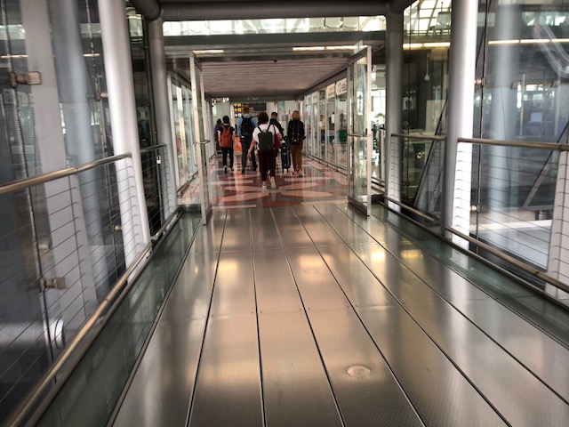
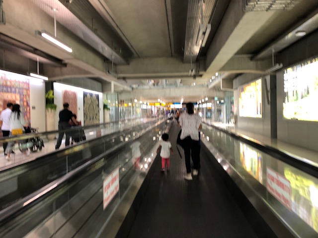 Moving walkway/ Walkalator
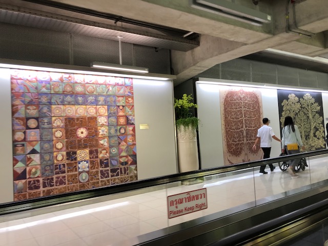 Artwork along the way to immigrations
 Directional signs are quite important for an airport of this size

 More directions and a map
 Another artwork
 Digital/electronic information board
 Information board on aircraft arrivals and departures
 Entry to the immigrations area where photographs and video are not allowed. I dare not be caught violating this rule in a foreign country.
 Baggage claim area

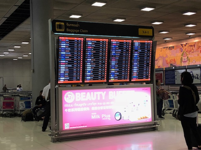 Information on which carousel to go to pick-up your luggage are on this board. There are so many arrivals at the airport and so many carousels so its important to look it up for reference and direction.
 More artwork, this time at the baggage claim area
 Luggage going around on the carousel
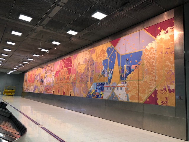
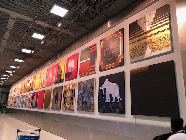 Here are more artworks – I think this is a good idea to showcase the country’s artists at its main gateway. Perhaps Philippine airports should also make a similar effort? I recall Mactan Cebu International Airport featuring a local artist Boy Kiamko’s work at the terminal.
–
Increasing the number of TNVS units? Not so fast!
The Land Transportation Franchising and Regulatory Board (LTFRB) is planning to increase the number of TNVS units (i.e., rideshare vehicles) in Metro Manila to meet what is perceived as the demand for them based on the numbers provided by TNCs like Grab. The problem with this number they want to eventually achieve, 65,000 units supposedly, is that this is based on current transport conditions in the metropolis. Also, this is based on data that is biased for the interests of TNCs, which obviously want to increase their driver and vehicle base in order to maximise profits. Here is a nice article that should provide some context from abroad where rideshare vehicles are actually generating more car traffic and taking people away from public transport.
Fried, B. (2018) “Uber and Lyft Are Overwhelming Urban Streets, and Cities Need to Act Fast,” Streetsblog, https://nyc.streetsblog.org/2018/07/25/uber-and-lyft-are-overwhelming-urban-streets-and-cities-need-to-act-fast/ [Last accessed: 7/26/2018]
Currently under construction are the Line 7 and Line 2 Extension projects and soon there will also be the Line 1 Extension. Also, in the pipeline are the proposed subway and rehabilitation of PNR that is supposed to revitalise its commuter line. These are examples of projects that will likely be game changers in terms of commuting with the objective of drawing people away from car use. In the bigger scheme of things, perhaps there is a need to rethink numbers for TNVS and instead focus on improving taxi services in Metro Manila. The same can be said for other cities as well where there is already a need for better public transport services to avert a transport future similar to what Metro Manila is already experiencing now.
–
25th Annual Conference of the Transportation Science Society of the Philippines
The Transportation Science Society of the Philippines (TSSP) will be holding its 25th Annual Conference in Cagayan De Oro City next week. Here is the program and you can get more details about the conference and the society from its homepage and Facebook page.


–
The future of walking?
Here’s another nice article on the most basic of all modes of transport for people – walking.
Levinson, D. (2018) “What will the footpath of the future look like?”, foreground.com.au, https://www.foreground.com.au/transport/future-footpath/?platform=hootsuite [Last accessed: 7/18/2018]
My only comment about this article is that perhaps the matters mentioned here pertaining to technology that is often associated with the mention of the word “future” is something that the more advanced countries might be concerned with. They are not necessarily applicable to many if not most cases in the developing world much like the talk about autonomous vehicles being exciting in developed countries but not so in others. So yes, the future of walking should still be for people to walk and for authorities to provide the facilities for this activity. Active transport, after all, is not about moving machines but for people to be on the move.
–
Safe and healthy journeys to school
I recently attended a workshop organised by UNICEF in cooperation with UN Environment and the WHO. The main topic was about road safety, particularly for children and focusing on their journeys between homes and schools. This is definitely a big issue and the concern is not without basis. Take the example shown in the photo below where two motorcycles are carrying more passengers than what they are designed for.
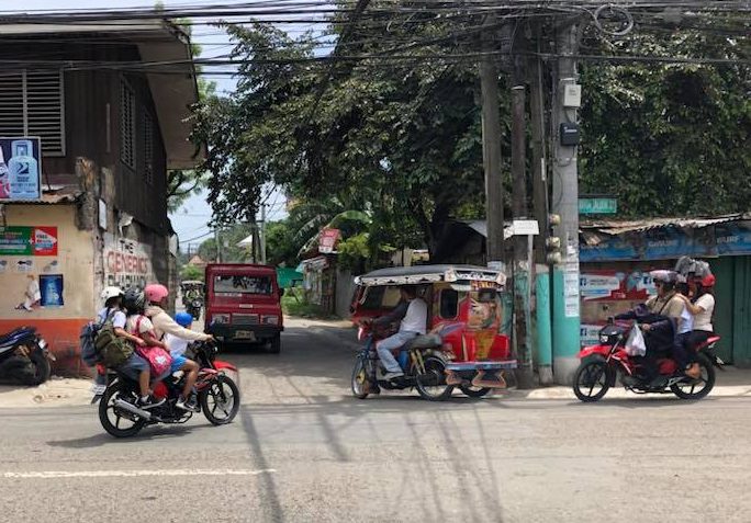 Children on-board motorcycles bound for a school in Zamboanga City
The passengers are children being taken by what looks like a parent or parents driving the motorcycles. Such are common scenes in Philippine roads and in many cases, the children are at risk of being involved in a crash. Most will have no protection and will likely be seriously injured or be killed in case of a crash. Then there are the cases of children walking between their homes and schools and are exposed to the dangers brought about mainly by motor vehicle traffic along the roads they travel on. It is a wonder how there are few crashes occurring despite these conditions (or is it because few are reported and recorded?)!
I will be pursuing research topics related to safe journeys to schools more than other road safety topics that the staff and students I supervise are usually taking on. Hopefully, too, my new advisees this coming semester will be interested in related topics particularly graduate students who work for the Department of Public Works and Highways (DPWH).
–
Why does it seem to be congested on the way out of BGC?
Why does it seem like its more congested in BGC nowadays especially during the afternoon peak hours when people are heading home from work? The simple answer to the question may be found in the set-up of barriers from the exit ramp of the flyover from Market! Market! I took some photos of the situation the wife related to me. This was along her regular commute and now she avoid the area; taking the Kalayaan route instead and using the U-turn flyover to get to the northbound side of C5.
 Familiar scene along C-5? What’s new here is that authorities have extended the barriers from the foot of the flyover from BGC and effectively blocked vehicles from merging early with C-5 through traffic.
 It doesn’t seem obvious but 2 lanes of vehicular traffic merge into 1 lane in order to merge left.
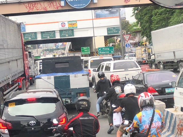 Most vehicles are northbound. The sign in the photo points to which lanes to take if you are northbound (Pasig) or turning towards Pateros. The U-turn flyover effectively blocks traffic from the rightmost lane (including those along the service road) from merging with northbound traffic in the inner lanes.
 Note the the barriers segregating northbound traffic from Pateros-bound traffic.
I think this is a simple case where the barriers shouldn’t have been extended the way they are now and restricting space for merging. The effect on C-5 traffic is minimal while causing unnecessary congestion along the flyover and into BGC. What seems like a solution to some (i.e., certain people in authority) clearly leads to more problems – in this case more congestion.
–
