
Home » active transport (Page 5)
Category Archives: active transport
On a city’s part in making bike and scooter shares succeed
I recently posted about Bonifacio Global City (BGC) and the bike and scooter share they have there. There was one bike share there and in the Ortigas Center before the pandemic. But those fizzled out for various reasons including not so many people using it. Here’s a report on bike and scooter shares in the US and the observation that cities are not making it easy for these to succeed:
Tu, M. (July 29, 2024) “Report: People Want to Ride Shared Bikes and Scooters, But Cities aren’t Making it Easy,” Next City [Last accessed: 8/2/2024]
To quote from the article:
“Even long standing bike share systems can fall victim to the whims of leaders who are not committed to investing in greener modes of transportation. Houston recently lost its bike share system, ending 12 years of operations for BCycle after a new mayor hostile to bike and pedestrian improvements overhauled the METRO Houston board.
If cities want to encourage people to ride a bike or scooter instead of getting into a car, they will have to figure out how to fund it — or in other words, put their money where their carbon reduction goals are.”
Though we’re still a long way to achieving the bike and scooter shares they have in other countries such as the US, we should be wary about their experiences. The lessons learned here should already be in mind to those who will be setting up bike and/or scooter shares in Philippine cities. There is a demand for these facilities as people find cycling convenient and safer in some cities. However, LGUs need to invest more and commit to safer and more connected bicycle facilities in order to convince more people to use this active transport mode instead of motorized transport including motorcycle taxis.
–
Mobility options in BGC
I haven’t been to Bonifacio Global City (BGC) in Taguig in a while. Unlike before (during the pandemic) when we could just stay at the condo some days to chill at our unit and explore BGC for lunch or dinner. We have high speed internet at our condo unit so we can work from there. I can do my lectures via Zoom and the wife could have her meetings online. Fast forward and we decided to have our unit leased so we couldn’t go there as frequently as before. The lease ended last month and we’re using the condo unit for ourselves while we refurbish the unit for future use, whether for our purposes or for leasing again.
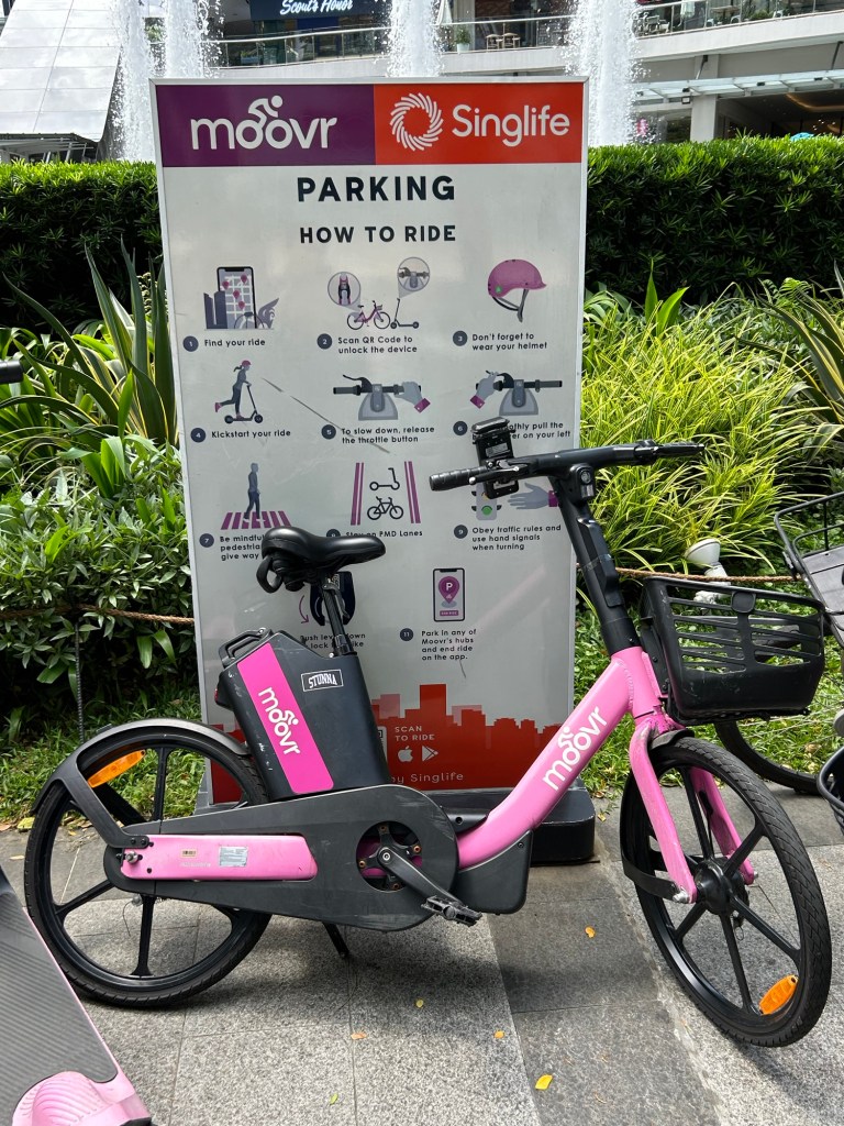
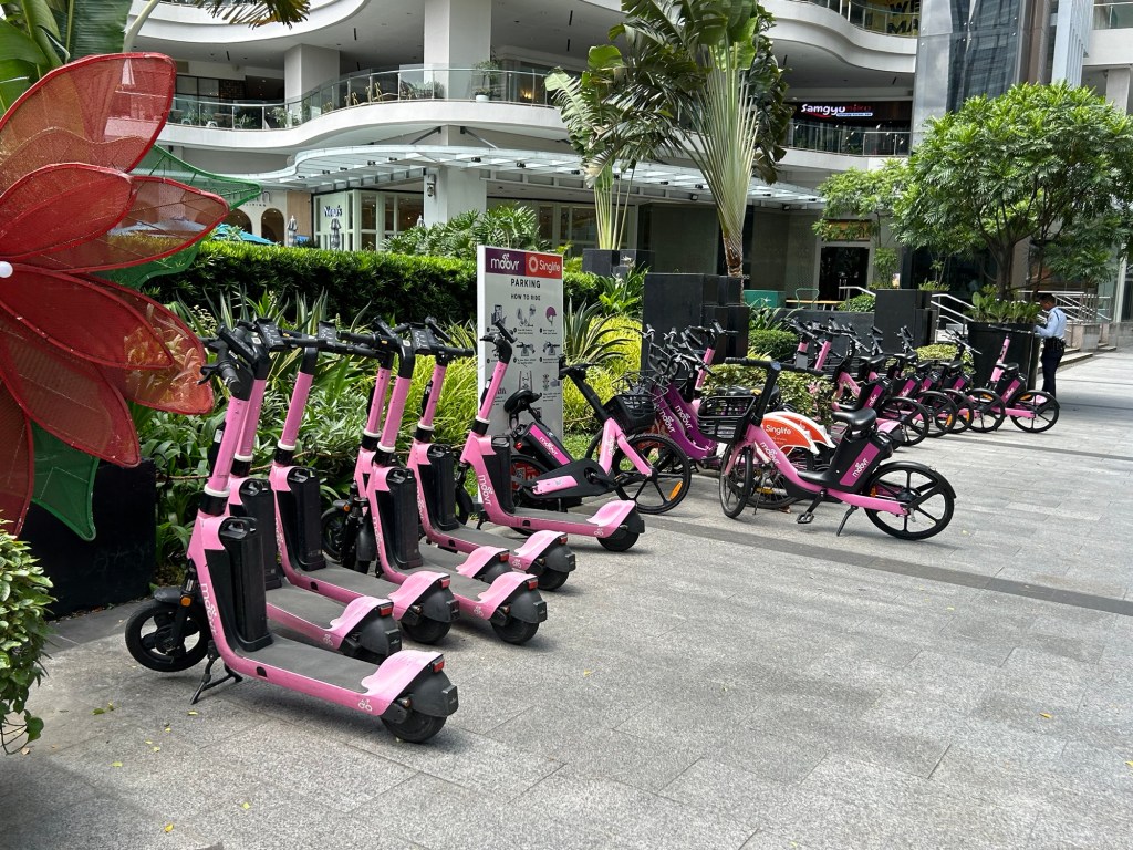
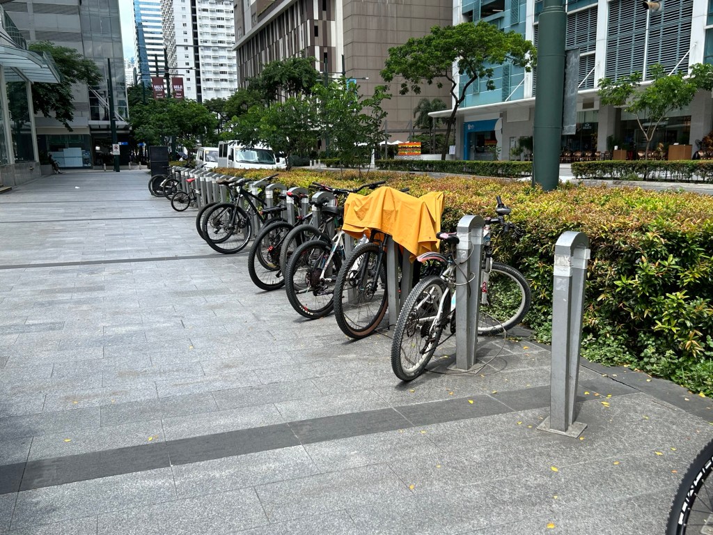
It’s good to know that there are now active transport options for going around BGC. The previous bike share closed shop before the pandemic and it took a while for moovr to set up. Here are a few photos of the station near our condo.
–
SPRINT principles for bicycles
Here is the link to how to improve your city’s or municipality’s bicycle facilities based on scores guided by the SPRINT principles: https://cityratings.peopleforbikes.org/create-great-places
SPRINT stands for:
S -Safe Speeds
P-Protected Bike Lanes
R-Reallocated Space
I-Intersection Treatments
N-Network Connections
T-Trusted Data
The site provides links and examples of good practices of actual bike projects in the US. Many of these can be replicated or adapted to Philippine conditions. These are something that the active transport section of the Department of Transportation (DOTr) should look into and perhaps provide a reference for developing and improving bicycle facilities in the country.
–
On a ‘tipping point’ for bikeability in cities
Here’s a nice article on bikeability and pertains to cities in the United States that developed bikeways or bike lanes during the pandemic. Like many cities that have ‘discovered’ cycling as a viable mode of transport particularly for commuting during the COVID-19 pandemic, it is postulated that there would be a threshold when people would switch to cycling and/or demand for more cycling facilities.
Wilson, K. (June 25, 2024) “Has Your City Passed the ‘Bikeability Tipping Point’?,” StreetsBlog USA, https://usa.streetsblog.org/2024/06/25/has-your-city-passed-the-bikeability-tipping-point [Last accessed: 7/2/2024]
To quote from the article:
“A whopping 183 American communities achieved a score of 50 or higher on PeopleForBikes annual City Ratings this year, up from just 33 in 2019. The means 183 communities have scored at least half of the available points on the group’s signature “SPRINT” rubric that includes such measures as protected bike lanes, safe intersection treatments, and reduced speed limits that are unlikely to kill a cyclist in the event of a crash, among other factors.
And when a city clears that 50-point threshold, the authors of the ratings say that its local bike culture has firmly taken root — and that every new roadway improvement will inspire more improvements, rather than a fierce fight against a car-dominated status quo.
“Once you’ve hit 50, your city probably has a pretty good low-stress bike network,” said Martina Haggerty, the senior director of local innovation at PeopleForBikes. “[That’s] not to say that there aren’t still improvements to be made [but it] probably means that more people are riding bikes in those communities because they feel safe and comfortable. And when more people start riding bikes, those people tend to become advocates for better bike infrastructure and for pro-bike policies, which, [in turn,] will get more people riding.”
There are many links found in the article itself that are “click worthy”. I recommend the reader to explore the rubric from PeopleForBikes and see for yourself how this can be adopted for your city. Is such a rubric applicable to the Philippines? Perhaps, but there would be a need to assess the the situation in each city or municipality. So far, there have been mixed reviews among cities, especially those that appeared to have been more progressive and were more aggressive than others in putting up bicycle facilities including bike lanes. Perhaps the rubric can be applied to see how our LGUs measure up?
–
Another roadblock for active transport?
The Metro Manila Development Authority (MMDA) recently released what they claim to be their counts of bicycle traffic along major roads in Metro Manila from 2020 to 2023.
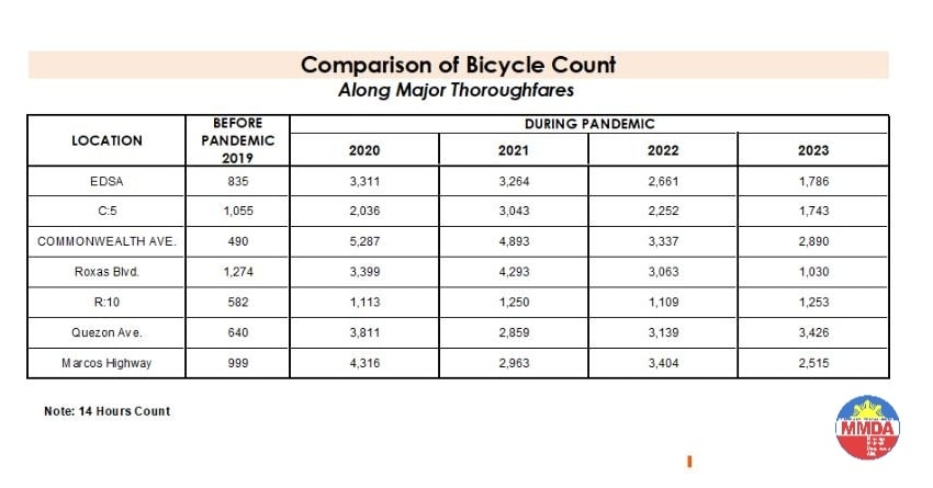
These are supposed to be official data as it is issued by the government agency in-charge of traffic management for Metro Manila roads (aside from its other functions and roles). What are not stated, and are actually very important details, are the locations of the counts and when the counts were conducted. The Traffic Engineering Center (TEC) that was under the DPWH and currently with the MMDA used to publish traffic volume maps for major roads in Metro Manila. So along EDSA, for example, the volume per section are shown on the map. The same for other major roads like Commonwealth, Quezon Avenue and SLEX. The thicker lines mean higher volumes along those sections, and vice versa. However, they did not consciously count bicycles (only motor vehicles) and perhaps MMDA only started counting during the pandemic (i.e., 2020). So there is no one value to represent a road. And counts vary over time of day, day of the week and even throughout the year (i.e., monthly variations).
There were many reactions to the MMDA’s posting of the data and most were critical and even derided the agency for what to them appeared to be inaccurate data. The problem is that it seems there are no other counts that can validate and perhaps refute the MMDA data. Previous bike counts were not conducted according to how the MMDA and DPWH count vehicles. That is, counts are typically done over a 14 or 16-hour period and ideally on several days in a year. Expansion and conversion factors are applied based on established stations along major roads that are supposed to have more frequent if not continuous counts. This methodology is how Annual Average Daily Traffic (AADT) is computed. Call it car-centric if you like but the methodology is very much applicable to bicycles as well. Peak hour counts for bikes are not enough and the peak hour factor for motor vehicles does not apply to bicycles (if this is to be used to expand/convert peak volumes to daily values). In fact, if you go into the math, there should be a peak hour factor for each type of vehicle considering each vehicle’s volume will vary differently over time. So yes, the solution here is to conduct bicycle counts according to how MMDA or DPWH counts vehicles and these should be done along several stations along major roads (e.g., those in the table above) to validate the MMDA counts.
More on this topic in the next post!
–
When Driving Isn’t an Option: Steering Away From Car Dependency
Here is another quick share of an article from Planetizen. The article relates about people who cannot drive so driving for them is not an option:
Source: When Driving Isn’t an Option: Steering Away From Car Dependency
Quoting from the article:
“Zivarts shows that it is critical to include people who can’t drive in transportation planning decisions. She outlines steps that organizations can take to include and promote leadership of those who are most impacted—and too often excluded—by transportation systems designed by and run by people who can drive. “
There are actually many who can drive and who would like not to drive but then opt to drive because of limited and inconvenient or uncomfortable options. I think government agencies and local government units are supposed to work on this but like people who try to ‘solve’ traffic by isolating it from other factors such as housing, they ultimately gain little ground if not fail. It doesn’t help that the decision makers such as government officials and politicians drive or are driven. Of course, there is still such a thing as empathy so let’s not discount those who do use cars for their commutes but also work hard to improve transportation. It’s just that such people are rare these days and may not be in a position to move things to enable significant improvements to the transportation system.
–
A risky mode choice – recumbent bike
I spotted this cyclist along Ortigas Avenue Extension. He would be hard to notice considering how low the vehicle is and his position astride the bicycle.
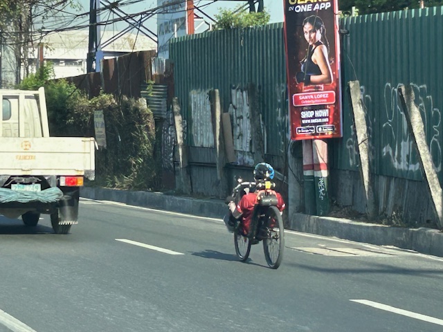 Man on a recumbent bike probably on his daily commute. Note the bike and its rider as compared with the small truck.
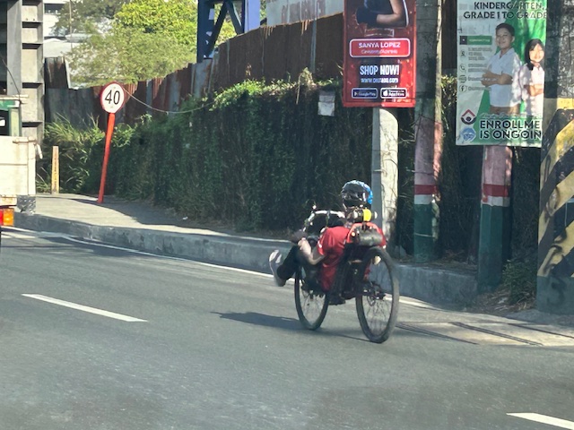
The problem is concerning his visibility to regular or typical road users. He might not be visible for the larger vehicles like trucks and buses, even jeepneys and vans whose drivers may be distracted by other vehicles in the traffic mix.
 Comparison with a typical cyclist, who is quite visible as shown in the photo
–
International Shrine of Our Lady of Peace and Good Voyage
It’s Maundy Thursday today and there will be the Alay Lakad later this afternoon. Here are photos I took yesterday morning at the shrine including the road closures sign or tarp posted at the intersection of P. Oliveros Street, Ortigas Avenue Extension and L. Sumulong Circle near the provincial capitol site.
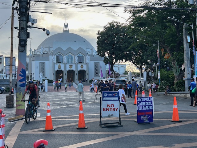 Access was already being limited as of yesterday morning. On regular days, there will be a queue of vehicles mostly new and to be blessed at the shrine. There’s limited parking at the shrine itself so visitors or pilgrims would have to find parking around the church including the nearby mall.
 View of the shrine from the entrance to the complex
 The main altar of the shrine
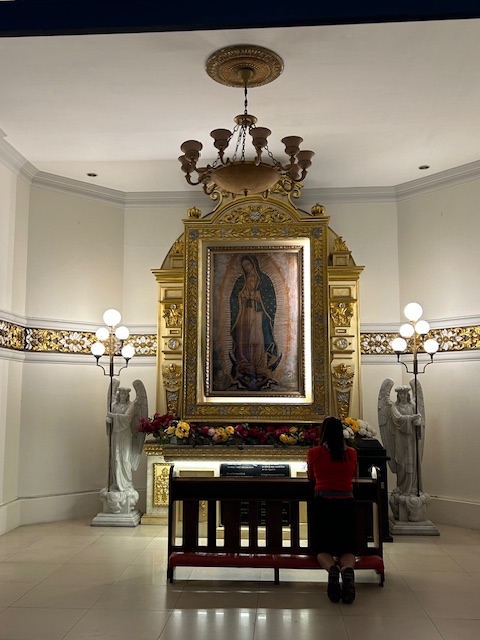 Retablo to Our Lady of Guadalupe
 The main road to the shrine, P. Oliveros Street, is an extension of Ortigas Avenue Extension from the Provincial Capitol site. This will be the main route to the shrine and will be filled with people later this afternoon and overnight.
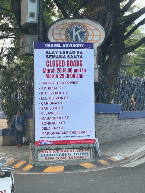 Road closures from 6:00 PM today until 6:00 AM tomorrow (Good Friday)
The Alay Lakad is a spectacle by itself and probably rivals if not exceeds the Traslacion of the Black Nazarene in Quiapo, Manila in terms of the number of participants.
–
30th Conference of the Transportation Science Society of the Philippines
I am sharing here the First Call for Papers for the 30th Annual Conference of the Transportation Science Society of the Philippines (TSSP). The conference will be held in Iloilo City almost to the day of the last time it was held there in Sept. 12, 2014.
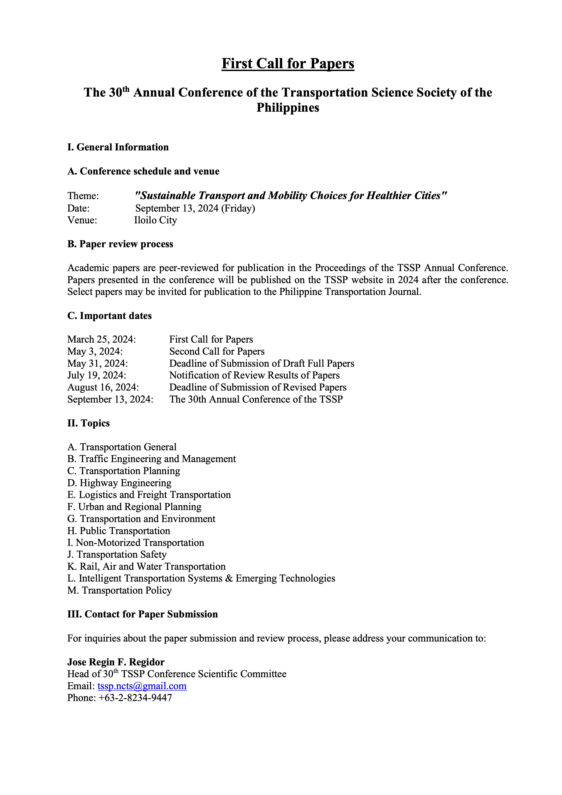
Information on past conferences may be found here: https://ncts.upd.edu.ph/tssp/conferences
–
On the Pasig River esplanade project
My news feed was full of articles on the Pasig River esplanade, or at least the recently completed section at the Manila Central Post Office building. This is a proof of concept type of project that hopes to be expanded or extended to cover both sides of the river much like the Iloilo River Esplanade project. If you are wondering what the section looked like before the project, here are two posts I wrote in 2012 that features a lot of photos of the Muelle del Rio:
These were way before the fire that damaged the Post Office building. However, even at that time, there were already calls for the renovation, even repurposing of the Post Office building. Such projects or proposal draw inspiration from Singapore where old buildings have been preserved and many repurposed (e.g., how about the Post Office building transformed into a hotel?). Perhaps such will breathe life and lead to a revival of this part of Manila?
–

