
Home » Governance (Page 43)
Category Archives: Governance
Memorandum Order No. 25, Series 2011
MALACAÑAN PALACE
MANILA
BY THE PRESIDENT OF THE PHILIPPINES
MEMORANDUM ORDER NO. 25
RECONSTITUTING THE INTER-AGENCY TECHNICAL COMMITTEE ON TRANSPORT PLANNING (IATCTP)
WHEREAS, transportation infrastructure has the biggest share in the country’s infrastructure investment program and will continue to be among the critical drivers of the country’s economic growth;
WHEREAS, a number of government agencies are involved in transport planning activities within their respective areas of jurisdiction;
WHEREAS, the Department of Transportation and Communications (DOTC) is the primary policy, planning, programming, coordinating, implementing, regulating and administrative entity of the government in the promotion, development and regulation of dependable and coordinated transportation network in the country;
WHEREAS, the Department of Public Works and Highways (DPWH) is the lead agency for the planning, design, construction and maintenance of the national road network, which continues to dominate the country’s transport system;
WHEREAS, the Philippine Ports Authority (PPA) is mandated to facilitate the implementation of an integrated program for the planning, development, financing, operation and maintenance of ports or port districts in the country;
WHEREAS, the Maritime Industry Authority (MARINA) is tasked to integrate the development, promotion and regulation of the maritime industry in the country;
WHEREAS, the Philippine National Railways (PNR) is the first instrumentality of the government mandated to provide railway system and services within the integrated national transport system;
WHEREAS, the Light Rail Transit Authority (LRTA), by virtue of Executive Order (EO) 603, is responsible for the construction, operation, maintenance and/or lease of light rail transit systems in the country, which are recommended and envisioned to alleviate traffic and transportation situation in a congested metropolitan area within the context of rational land use planning;
WHEREAS, the Metropolitan Manila Development Authority (MMDA) is tasked, among others, to coordinate development planning, transportation and traffic management, urban renewal and land use planning, urban protection, pollution control and public safety in Metro Manila which is the country’s premier economic and financial capital;
WHEREAS, the Civil Aviation Authority of the Philippines (CAAP), created on 04 March 2008 by virtue of Republic Act (RA) 9497, is mandated to be the technical regulator of air transport;
WHEREAS, the University of the Philippines-National Center for Transportation Studies (UP-NCTS) aims to, among others, conduct research activities on transportation, provide extension services to various government agencies and the private sector, and provide information services on transportation; and,
WHEREAS, transportation affects the country’s economic development and therefore there is a need to effectively coordinate its planning and policy formulation process led by the National Economic and Development Authority (NEDA) in order to achieve the objectives of sustainable economic growth in the country.
NOW, THEREFORE, in consideration of the foregoing premises, the IATCTP is hereby reconstituted in view of the important roles of the other transport agencies in achieving a comprehensive and integrated coordination function in transport planning. The Committee shall now be composed of the following:
| Deputy Director-General, NEDA-National Development Office | – Chairperson |
| Assistant Director-General, NEDA-National Development Office | – Member |
| Director, NEDA-Infrastructure Staff | – Member |
| Director, NEDA-National Planning and Policy Staff | – Member |
| Director, NEDA-Project Monitoring Staff | – Member |
| Director, UP-NCTS | – Member |
| Head of Planning Service/Unit, DOTC | – Member |
| Head of Planning Service/Unit, DPWH | – Member |
| Head of Planning Service/Unit, PPA | – Member |
| Head of Planning Service/Unit, MARINA | – Member |
| Head of Planning Service/Unit, PNR | – Member |
| Head of Planning Service/Unit, LRTA | – Member |
| Head of Planning Service/Unit, MMDA | – Member |
| Head of Planning Service/Unit, CAAP | – Member |
The Committee shall continue to perform the following duties and functions:
a. Formulate and recommend to the NEDA Board Committee on Infrastructure (INFRACOM) comprehensive and integrated transport plans;
b. Formulate standards and guidelines for the preparation of agency plans for transport development;
c. Develop a transport information system that shall serve the information needs of all transport planning and other relevant agencies;
d. Coordinate the conduct of studies, researches and data-gathering on various aspects of the transport sector;
e. Formulate areas of cooperation and coordination among the various agencies and instrumentalities of the government involved in transport programs and projects to avoid duplication of efforts;
f. Provide the NEDA Board with up-to-date information needed in the review and evaluation of transport plans and projects; and
g. Serve as a forum for the resolution of operational problems of transport agencies.
The Committee shall submit to the NEDA Board INFRACOM any issues/concerns that require adoption/resolution by the latter.
The Committee shall meet for the purpose of discharging its functions and may create sub-committees as may be necessary. Other relevant transport agencies and organizations may also be invited to attend meetings when warranted.
The NEDA Infrastructure Staff shall provide secretariat services to the Committee.
All heads of departments, bureaus, offices and instrumentalities of the government are hereby requested to extend full cooperation and assistance to the Committee to ensure the successful execution of its tasks.
This Memorandum Order (MO) shall take effect immediately and shall supersede MO 473 (1974).
DONE, in the City of Manila, this 26th day of October in the year of our Lord Two Thousand and Eleven.
(Sgd.) BENIGNO S. AQUINO III
By the President:
(Sgd.) PAQUITO N. OCHOA, JR.
Executive Secretary
Katipunan parking predicament
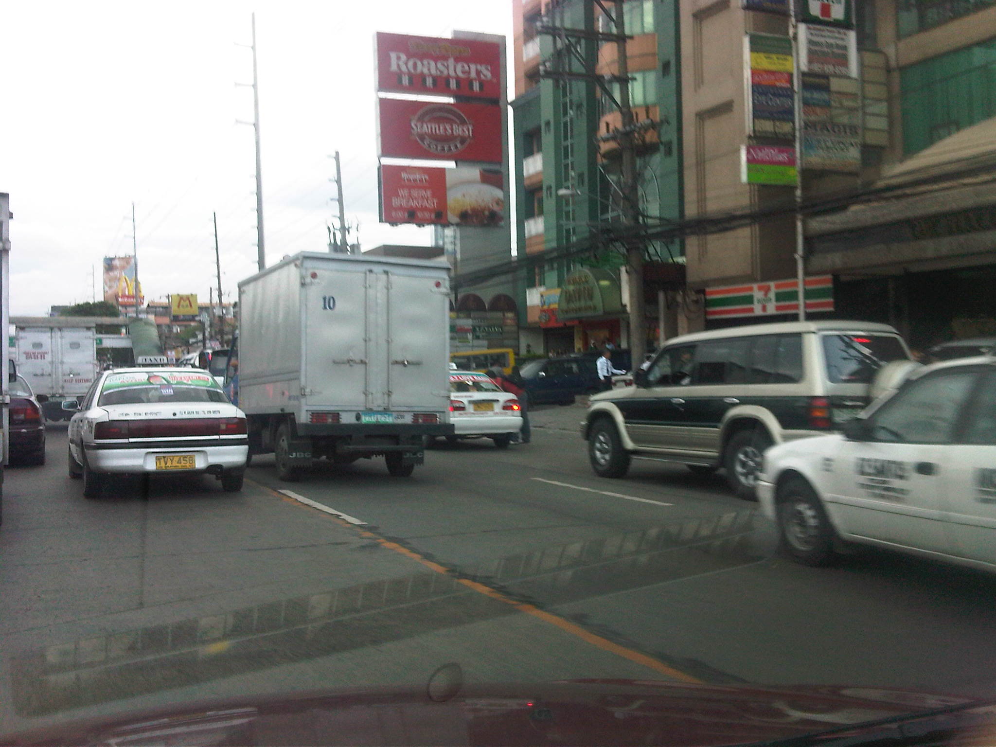
Developments along Katipunan Avenue in Quezon City are good examples of fragmented land use and transport planning in Philippine cities. The developments, particularly the high rise condominiums have been the subject of much opposition from residents of subdivisions in the area as well as two major institutions of higher learning that have defined the stretch of Katipunan that has been developed in the 15 years. I mention 15 years because this is the period during which most of the high density developments along Katipunan have been constructed, apparently with the blessings of city hall. It is also in the last decade that schemes such as road widening and the U-turns were implemented.

On-street parking along Katipunan at lanes that used to be part of what was a west service road. In many cases, onstreet parking has been the result of a violation of a very basic provision of the National Building Code, which prescribes the minimum number of parking slots for establishments such as restaurants, shops, banks and offices. Despite being quite outdated and disconnected with more progressive parking generation principles, the NBC should have been a basis for the local government to assess whether minimum guidelines are satisfied, and perhaps impose penalties on those who are not able to comply such provisions. This is a fundamental case where individuals (owners of parked vehicles) impose external costs (e.g., congestion and crash risk) upon the general public.

Another look at onstreet parking just beneath the pedestrian overpass across from Ateneo’s Gate 2 – restaurants along Katipunan are major traffic generators and despite the presence of public transport (jeepneys and tricycles) a significant number of trips generated by these establishments use private vehicles including cars, vans and SUVs. Katipunan’s pedestrian facilities are inadequate as there are practically no sidewalks, thereby forcing people to walk along the road. This exposes many and particulrly students to risks like getting sideswiped by vehicles driven by reckless drivers.

Waiting vehicles effectively occupying 2 lanes of Katipunan – many employ drivers who can stay with the vehicles while the occupants eat, shop or transact at establishments. In most cases, standing vehicles are practically parked vehicles as they occupy road space. High-rise residential condominiums along Katipunan may have complied with minimum parking requirements stipulated in the NBC but their trip generation characteristics considering the commercial establishments located at the same buildings surely require many more parking spaces than what are available.

Congestion along Katipunan’s southbound side – may be caused by onstreet parking, standing (waiting), or vehicle maneuvers with respect to the limited parking slots fronting most establishments along the road. One tutorial center located near a U-turn slot, for example, generates significant vehicle traffic that it affects both U-turn and through traffic. Meanwhile, traffic enforcers seem either ineffective or helpless in their efforts to manage traffic, including preventing vehicles from taking 2 lanes of Katipunan.

Standing/waiting vehicles in front of a new development along Katipunan – the new building hosts several establishments including a major bank, a book shop, a popular gym, and several restaurants or cafes. Despite the potential for vehicle attraction, only a few parking spaces were provided, leaving all other vehicles and their drivers on their own to find parking spaces or just occupy road space in front of the building. The footbridge across Ateneo’s Gate 3 has been extended to the building but this obviously has marginal impact in reducing vehicle generation and parking demand.

Another photo showing the parking situation in front of the new building – while traffic is generally a manifestation of economic activity, one opinion is that many developers are irresponsible by designing buildings that have inadequate parking and resulting in the general public bearing the burden of traffic externalities. Add to this local governments that turn a blind eye on such discrepancies in design (who reviewed the design that obviously violated the building code?) only to be on the receiving end of complaints. In some cases, LGUs probably will be forced to shoulder costs of providing solutions that developers should have covered in the first place if they were responsible enough or made responsible for mitigating negative impacts of their projects.
In the end, it is inevitable that we need to address the root of the problem, which pertains to land use planning and the zoning policies LGUs are implementing. Consistency is one thing and being circumspect about established guidelines is another. Sustainable development, after all, does not pertain to continuous transformation from low to high density development but more about balancing elements that would preserve the character of neighborhoods and communities, particularly and most importantly to ensure that quality of life is not compromised.
Experiences and lessons on land use and zoning along Katipunan
Last Friday, a rally was held just outside the Ateneo De Manila University along Katipunan Avenue to protest the construction of Blue Residences, one of the SM group’s high-rise condominium projects that is located near the corner of Katipunan Ave.-Aurora Blvd. where a mini golf course and a few small shops used to be. The protesters wielded placards stating what could have been applicable to many of the developments now standing along Katipunan and just across from Ateneo and Miriam College. This is not really a new issue the protesters were dealing with but something that, dare I say, has festered for quite some time now.
The issue of land use and zoning along Katipunan is a continuing struggle against what the Quezon City government has maintained as its policy for “spot” zoning to accommodate high density residential and commercial development along a stretch of Circumferential Road 5 that used to be predominantly low density with small shops and restaurants lining the west side of the road and separated from the main highway by an island and a two-way service road where local traffic including tricycles flowed. This was the Katipunan I first started to be familiar with in the late 80’s when I entered UP as a freshman. Miriam was still known as Maryknoll at the time and was run nuns prior to it becoming the secular but still Catholic institution that it is today.
Traffic was more manageable along Katipunan then and a fleet of blue school buses served the Ateneans. It was a case of high occupancy transport that sadly has digressed to high vehicular volume, low occupancy traffic that Ateneo and Miriam are associated with today. Tricycles then were confined to the west service road and crossed Katipunan only at the intersections, which were strategically located just across from the main gates of Ateneo and Miriam. These intersections used to be signalized but the settings were often manipulated to favor Ateneo and Miriam traffic during the peak periods, much to the frustration of through traffic.
Fast forward to the present when the service road was removed along with the island to given way to what the previous MMDA dispensation referred to as a clearway policy to encourage faster traffic speeds combined with the much maligned U-turn scheme as applied to Katipunan. The smaller shops and restaurants have been replaced by condominiums and other establishments that have generated much traffic (not that Ateneo and Miriam have not been responsible for congestion) and which obviously do not have enough parking resulting in cars parked all over along the avenue and effectively reducing road capacity.
An article written by Randy David through his regular column at the Philippine Daily Inquirer came out today to speak about the Professor’s personal experience about Katipunan and his granddaughter’s views on development. Entitled “Katipunan Blues,” it presents a very honest and a very common observation of what Katipunan has become through the years and what different generations think about the development (or degeneration) along the particular stretch of the avenue. Its conclusion is something to ponder about and applicable not only for Quezon City and the rest of Metro Manila but for other cities across the country as well.
Is it too late for Katipunan given all the developments that have been permitted along this road? Did the universities do their part to prevent this in the first place? Or were they part of what Katipunan is today? Does Quezon City (or other local governments for that matter) even know what land use planning is about and what its policies on accommodating development have brought about in many other place? Could the DENR through its EIA process or the HLURB through its own instruments have prevented the deterioration of communities? There seems to be too many questions and we’re running out of answers for these.
Perhaps the answers were there but authorities and officials responsible refused to take heed of these or turned a blind eye to the issues. Perhaps the various developments and SM Blue were allowed because local governments became too eager for developments that also have been equated with revenues for the cities. Still, established systems and processes like the DENR-EMB’s and the HLURB’s are supposed to be there to ensure responsible and appropriate development.
We are often dumbfounded at what has actually happened and the outcomes clearly show our failures. Perhaps we are too blinded with the notion of development that we forget that it is also our responsibility to guide proponents. A lot of soul-searching should be undertaken to rethink how we plan and develop our cities. Such should properly incorporate principles of sustainability including those that address issues pertaining to transport and land use. We have a long way to go towards sustainable development as applied to city planning and development. But we need to start now if we are to even achieve a fraction of what we’d like our cities, our communities to become. We also need for champions to come forward among our current leaders and officials if only to bring order to what is perceived as chaotic development.
Is there a need for a transport infra master plan? – responses to comments and questions
Is there a need for a transport infra master plan?
The NCTS crafted an issue paper for Bantay Lansangan entitled “Is there a need for a transport master plan?” partly as an exploratory initiative to widen the perspective of the organization from its current focus on roads.
Master plans are supposed to be guides for both government and other interested parties such as the private sector for determining what projects are to be prioritized. They also should be able to provide the basic cost estimates and other requirements that should pave the way for more detailed planning and design for specific or particular projects. As such, the absence of master plans or perhaps outdated ones is considered as handicaps in the prioritization and implementation of projects.
However, despite the availability of master plans, there is the question of the acceptance of their recommendations. There are also questions pertaining to how comprehensive these plans are and how would be able to address social, economic, environmental and even political issues should certain projects be implemented and the plan realized. On the last concern on the political aspect there are also those projects that are altered, apparently according to the whims of national or local leaders. Such deviations can be unnecessary and may lead to increased costs for project implementation. As it there have been many master planning studies conducted for the Philippines, the main issue tackled by the paper is the lack of an integrative document, a master plan for all master plans so to speak, that will clearly show how each and every major project is linked with the others.
The paper aimed to:
- Situate what has been initiated in the past vis-à-vis infrastructure master plan;
- Discuss the present framework (if any) that guides government’s long-term investments, policies and projects in infrastructure;
- Highlight the key concepts and processes involved in the formulation of an infrastructure master plan;
- Identify gray and problematic areas; and
- Identify recommendations and ways forward.
I reproduce below the concluding section of the paper:
“Master planning studies are generally directed to the government and provide frameworks for where investments should go. These include recommendations concerning prioritization that is reflected in the implementation periods or targets mentioned in the plan. Projects where the private sector may invest in should seldom deviate from those included and proposed in a master plan. This ideal situation would presume that unsolicited proposals are generally classified among non-priorities. Otherwise, it would seem that the master plan is flawed and failed to identify projects that are attractive for investments. More often than not, private sector entities will also have their own views on which projects will be most profitable and therefore most attractive for them to venture into. It is the government’s responsibility to ensure that plans are implemented according to their importance or urgency.
There is a need for long-term infrastructure master plans. However, these should be updated on a regular basis and not premised on the availability of foreign funding support as the long-term eventually becomes part of the medium-term and ultimately the short-term. Infrastructure master plans should also be flexible as it serves as a guide not only for potential loan packages but the participation of the private sector in putting up the infrastructure essential for the sustainable progress of the country. Lastly, it is important that coordination be clear in the master plans should these be formulated according to the different transport sub-sectors. Elements must be integrated to ensure that the different transport infrastructure projects complement each other rather than appear as isolated or disconnected.”
The paper was presented last August 1, 2011 at the DPWH-BL Fair held at the DPWH headquarters at the Port Area in Manila. It was generally enthusiastically received based on the feedback I got from our technical staff who presented the paper before a predominantly DPWH audience. I will address questions and comments forwarded to me in the next posting.
Pedestrian overpasses along Commonwealth Avenue
Commonwealth Avenue is still regarded as a “killer” highway despite the efforts to reduce road crash incidence along this thoroughfare. Many of these crashes involve pedestrians who continue to cross the highway on at-grade or on ground level at many points of the highway despite this being prohibited or discouraged. To cross the avenue, pedestrian overpasses have been constructed at strategic locations along the highway including those at Fairview Market, at Ever/Shopwise and at Tandang Sora, at U.P. (2 overpasses – one at AIT/CHK and another at Technohub), and at Philcoa. Despite these facilities being constructed and possibly with a few more to be constructed in the future, many people still choose to jaywalk. Among the reasons cited are stairs being too steep and the long distances they have to walk to and from the overpasses.
Following are photos taken on a Sunday drive from Novaliches to UP showing the conditions on and around overpasses along Commonwealth Avenue. Noticeable are overpasses across Fairview Market and Ever/Don Antonio where vendors have set up shop and impede the flow of pedestrian traffic.
 Pedestrian overpass across Commonwealth at Litex and before Fairview Market (section is at Commonwealth southbound) – the overpass is surprisingly free of vendors despite its being well within the influence area of the market.
 Overpass across Fairview Market (section is across Commonwealth southbound) where vendors have set up to sell various merchandise. Notice the umbrellas to shield vendors from the elements. Note, too, the jeepneys congregating under the overpass and taking up 2, 3 or even 4 lanes of road space and thereby causing congestion along the wide avenue.
 Overpass after Fairview Market and across densely populated areas that are mostly informal settlements. Jeepneys and buses usually congregate under this overpass and another downstream which is across from the Sandiganbayan. The bollards to the left are to segregate a lane with recently laid concrete (re-blocking of certain lanes along Commonwealth).
 Overpass across Ever Commonwealth where vendors have also set up to sell merchandise. The design evokes those of old steel truss bridges in Manila across the Pasig River like the Quezon and Ayala Bridges. Notice the congestion at the overpass at the left portion of the photo.
 Overpass across Tandang Sora where the middle portion descends under the T. Sora flyover in an unusual design that calls to mind the adjustments made for pedestrian facilities constructed across EDSA, and above or below the MRT3 alignment. Notice the countdown timer for the signals at this major intersection.
 Overpass across AIT and CHK of UP Diliman. The canopy is one of two set up atop the overpass for MMDA personnel taking random speed samples to enforce the 60 kph speed limits along Commonwealth. On most days I travel along Commonwealth, there is usually no one taking measuring speed along the NB direction of the highway.
The overpass across the UP Technohub is relatively new but it is free from vendors. In fact, the two overpasses across UP are free from vendors and are regarded as safe and secure because of guards (and even MMDA enforcers) posted at the overpasses to ensure the safety of users of the facilities, especially students and employees of UP and of the Technohub. However, the Philcoa overpass continues to be occupied by vendors despite its roof being removed by the MMDA a few years ago with reasoning that this would deter vendors from setting up atop the overpass.
The problem of vendors on the overpasses is an enduring issue and one that is quite easy to solve if authorities are serious about addressing it. In fact, it is so easy for enforcers or police to prevent or even apprehend/accost vendors as frequent as the latter attempt to set up on the overpass. The continued presence of vendors suggest that there is no sustained effort against these vendors. There are those who even suspect (and are perhaps correct in certain cases) that enforcers or police are being paid to turn a blind eye to these vendors. This is a story that is replicated in many parts of Metro Manila as well as in other cities across the country where overpasses become small time malls or shopping streets, thereby defeating the purpose of having these facilities in the first place. The challenge is for local government units to do what is right in such cases if only to ensure that facilities for pedestrians are safe, secure and unimpeded for efficient flow.
Too late?
A friend posted her disappointment over what she regularly observed through her condominium window overlooking EDSA Guadalupe. The traffic jams along EDSA seemed to be a 24-hour thing and she lamented about whether Metro Manila could solve this problem on congestion. She continues to be an active advocate for the environment and we have worked together on the electric jeepney that is now operating a 3rd route in the City of Makati and is also found operating elsewhere in other cities where its applications, to be fair, is still quite limited.
My response to her is something I have also mentioned in other venues including previous posts on this blog and interviews granted to major media networks that have asked me what’s wrong about transport and traffic in our country. It’s really simple – we have failed to build the necessary infrastructure when they needed to be constructed. And we continue to NOT build the infrastructure that could have saved us much in terms of fuel costs alone and perhaps contributed much more to our economy, and definitely outweighing the costs that have often been cited as if it were a deterrent to the realization of a mass transit network for Metro Manila.
Being one who has lived in both Tokyo and Singapore where they have good public transportation systems, I could not help but become excited when, returning from Japan before the turn of the century I came upon plans for Metro Manila’s rail network. I was excited because the decade before I was first exposed to similar plans for MM at a time when other capital cities in Southeast Asia like Bangkok, Jakarta and Kuala Lumpur where also planning for their own mass transit systems. In fact, they were also planning expressways in their respective metropolitan areas (i.e., Bangkok Metropolitan Area or BMA and Jakarta-Bogor-Depok-Tangerang-Bekasi or Jabodetabek/Greater Jakarta). Flash forward to the present, it is frustrating, if not depressing, to see that Bangkok and Jakarta were able to implement many of their plans that were critical for the growth of these metropolitan areas and definitely contributed to the overall sustainable development in those countries. Granted, Bangkok and Jakarta still experiences congestion like the legendary jams along urban highways in Bangkok. But which city around the world does not experience congestion? The key is to provide a viable and more efficient (also convenient and comfortable) alternative to taking one’s car. That should be in the form of a mass transport system that is comprehensive enough that it will allow for both mobility and accessibility to the traveler/commuter. The following figure from the 2005 World Transit Maps envisioned a network that is still now unrealized and, for the existing lines, have become the subject of controversy and other issues that include the absence of a single ticketing system similar to the smart and octopus cards found in other countries.

Can we imagine what could have been the experience of commuting in a Metro Manila where such a rail system would have been in place? My former students have related to me about how it was so convenient to move about in Singapore, Tokyo and Hongkong where the mass transit systems where comprehensive and integrated such that rail and bus systems could provide for the transport needs of commuters. I would like to believe that we have all the plans with us by this time and that the construction of transport infrastructure has long been delayed for our cities (not just Metro Manila but also other metros such as Cebu and Davao) so much so that we continue to suffer from the lack of critical systems that could definitely alleviate congestion and improve the plight of the general public. Perhaps people taking their cars and motorcycles will be convinced to shift to public transport if they see the benefits of doing so. For others who are still captives of our inefficient public transport systems, I am sure that the experience of having improved systems (and an expanded network) will be liberating considering their daily sacrifices just to make ends meet while losing much quality time, productive time stranded in traffic.
Enforceable?
Whenever laws and regulations are crafted, one basic question that needs to be considered pertains to whether there is capacity to enforce such laws or regulations. This is quite logical and appeals to common sense since laws and regulations are practically prints on paper that will not have any impacts if not enforced properly and fairly. I mention “fairly” here because laws and regulation may also be the subject of abusive enforcement. That is, there have been cases where motorists are flagged down and charged with violations that are taken out of the context given the traffic conditions, and where the number of apprehensions are related to quotas set by authorities.
Take the case of the unwarranted or illegal use of sirens (wangwang) in the past. There were laws and regulations for its use but for a long time these laws and regulations were not enforced properly, leading to the wangwang’s abuse by many unscrupulous people. Almost everyone have practically given up on this abuse of the siren when a newly elected President expressed his dismay and ordered the eradication of illegal sirens. Almost overnight, “wangwangs” were confiscated by authorities inspired by the Commander-in-Chief’s orders or removed by owners themselves for fear of the law bearing down on them. This was enforcement at its best. Unfortunately, it was not replicated for other traffic laws and regulations, wasting valuable momentum and the opportunity to make things right along our streets and highways.
Quezon City’s Green Building Ordinance is quite good and well-meaning. It is very timely and relevant, and even includes provisions for upgrading transport in that city. Among others, it requires that tricycles be transformed into cleaner vehicles by stipulating the replacement of 2-stroke and even 4-stroke motorcycles with LPG or electric models. To date, nothing significant has been achieved to address issues pertaining to the tens of thousands of tricycles in Quezon City. The construction of green buildings in Quezon City cannot be mainly attributed to the ordinance but rather to owners and designers who are now much more aware of climate change and its impacts, and are progressive enough to design buildings that are environment-friendly. Of course, there are those who take to the “green” bandwagon but do nothing towards this end. Are these subject to evaluations and inspections that are the equivalent of enforcement?
Now comes a bicycle ordinance from Pasig City that is formally the “Bicycle Transportation Promotion Ordinance of 2011.” It is also good and well-meaning but the jury will definitely be out there if this initiative will be a successful and sustainable one. I am quite hopeful that it would be and not just end up as an example of coming up with laws because anything about the environment is in these days. The provision in the ordinance designating bicycle lanes and requiring establishments to provide bicycle racks for parking are all good but we have seen this before in an even bigger scale in the City of Marikina. There they constructed bikeways practically connecting all parts of the city and they were quite aggressive even after foreign support had ended. Politics and shortcomings (I wouldn’t say failure.) in encouraging people to cycle have made much of the on-street bicycle lanes practically taken over by motorized transport. Bicycle racks there are also being used by motorcycles and scooters. Pasig should learn from these experiences and it is hoped that the city succeed and become another example of EST to be replicated in other Philippine cities.
Traffic Congestion in Metro Manila: Is the UVVRP Still Effective? -Conclusion
The MMDA always reports what it claims as improvements of travel speeds along EDSA that past years. They have pointed to this as evidence that traffic congestion is being addressed and that programs like the UVVRP are effective in curbing congestion. However, many traffic experts have cautioned against making sweeping generalizations pertaining to the effectiveness of schemes especially if the evidence put forward is limited and where data seems to have been collected under undesirable (read: unscientific) circumstances.
The MMDA also has been using and to some extent overextending its use of a micro-simulation software that is employs to demonstrate the potential effectiveness of its proposed traffic schemes. The software has an excellent animation feature that can make the untrained eye believe in what is being shown as The problem here is when one realizes that computer software will only show what the programmer/operator wants, and is perhaps an example where the term “garbage in, garbage out” is very much applicable. And this is especially true should the computer model be uncalibrated and unvalidated according to guidelines that are well established, and extensively discussed and deliberated in a wealth of academic references. The fallacy of employing advanced tools to demonstrate how one’s proposal is better than another was highlighted when the DPWH acquired the same tool and came up with an entirely different result for an analysis being made for the same project by that agency and the MMDA. Surely this resulted in confusion as the outcomes of the simulation efforts of both agencies practically negated each other.
It should be pointed out that such micro-simulation software is unsuitable for the task of determining whether metro-wide schemes such as the UVVRP is still effective given the actions of those affected by the scheme. What is required is a macroscopic model that would take into account the travel characteristics of populations in Metro Manila and its surrounding areas (cities and towns in the provinces of Rizal, Bulacan, Cavite, Laguna). There are quite a few of these models available but most if not all were derived from the one developed under the Metro Manila Urban Transport Integration Study (MMUTIS) that was completed in 1999. The main beneficiary from the outcomes of MMUTIS happens to be the MMDA but for some reason, that agency failed to build capacity for maintaining and updating/upgrading the model. As such, the agency missed a great opportunity to invest in something that they could have used to develop and evaluate traffic schemes to address congestion and other traffic issues in Metro Manila, as well as to assess the impacts of new developments.
Metro Manila has come to a point where its options for alleviating congestion are becoming more and more limited. The combination of a still increasing rate of motorization and private vehicle use have definitely contributed to congestion while there are also perceptions of a decline in public transport use in the metropolis. The share of public transport users in most Philippine cities and municipalities range from 80 – 90 %, while in many highly urbanized cities the tendency seems to be a decline for this share as more people are choosing to purchase motorcycles to enhance their mobility and as a substitute to cars. This trend towards motorcycle use cannot be denied based on the steep increase in ownership and the sheer number of motorcycles we observe in traffic everyday.
Metro Manila needs to retain the substantial public transport share while accepting that motorcycle ownership will continue to chip off commuters. The latter phenomenon can be slowed down should authorities strictly enforce traffic rules and regulations on motorcyclists, effectively erasing the notion that the latter group is “exempted” from such. The bigger and more urgent issue is how to put up long overdue mass transport infrastructure that is direly needed in order to create another opportunity for rationalization transport services. We seem to like that word “rationalization” without really understanding and acting on what is required to once and for all address transport problems in the metropolis. We are not lacking for examples of good practices that are both effective and sustainable including those in the capital cities of our ASEAN neighbors. However, we seem to be unable to deliver on the infrastructure part that we have tended to over-rely on a TDM scheme that has long lost much of its effectiveness. The evidence is quite strong for this conclusion and perhaps we should stop being in denial in as far as the UVVRP’s effectiveness is concerned. Efforts should be turned towards building the necessary infrastructure and making public transport attractive so that private car and motorcycle users will be left with no excuse to shift to public transport use. It is inevitable that at some time they will understand the cost of congestion and that they will have to pay for their part in congestion like what is being done along tollways or, in the more sophisticated and mature example, Singapore. But this cannot be realized if we continue to fail in putting up the infrastructure Metro Manila so direly requires.
Is it “Commonwealth” or “Commondeath” Avenue?
There is an excellent article appearing today in the Philippine Star written by Arch. Paulo Alcazaren aptly titled “‘Commondeath’ Avenue.” I stumbled on when it was shared by a friend, Dr. Dayo Montalbo, who is a faculty member of the UP School of Urban and Regional Planning. It provides a rare insight into the history of our highways and streets in Metro Manila. It is required reading for planners and engineers with backgrounds in civil engineering, architecture, urban planning, etc., and, I must say, for anyone who can appreciate history and how we seem to not have learned (or refused to learn) from it. It certainly should be required reading for students who want to become future planners and engineers.
When the MMDA “discovered” plans where it was indicated how wide the RROW for Commonwealth should be and started acquiring land left and right from those who were supposed to have been encroaching on the avenue, including UP Diliman, it apparently didn’t study the old plans and the context by which the capitol, Commonwealth, UP and other institutions where laid out back in the day. That interpretation translated into what we see now as probably the widest highway in the country.
I see the article as something that can be used by the DPWH and the MMDA as an input to whatever planning or engineering they plan along Commonwealth. The avenue is just too wide and definitely not friendly to people. Perhaps it should be transformed into the parkway it was meant to be in the first place.
