
Home » Highway Engineering (Page 3)
Category Archives: Highway Engineering
Zamboanga’s first flyover
We passed by the construction site of Zamboanga City’s first flyover at the intersection of the Pan Philippine Highway (AH 26) and Veteran’s Avenue. I recall there was a lot of pressure from DPWH for the city to approve its construction. The previous mayor didn’t want to approve the project because the perception was that it was not required and there were other options to consider before a flyover was to be constructed. However, many people including the then congressman and now mayor probably thought the flyover would be the solution to the congestion experienced at the intersection. Add to that the perception that the flyover is also somewhat a symbol of progress.
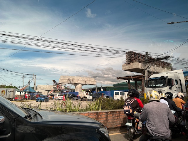
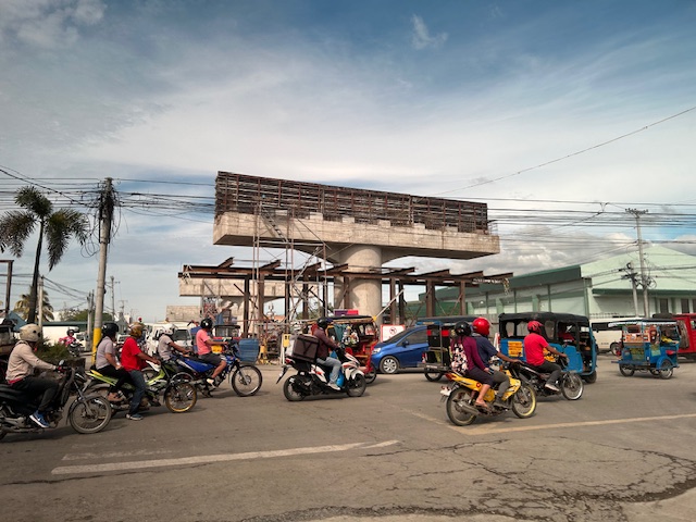
We won’t know until its completion and the ‘normalization’ of traffic in the area to determine whether the flyover has ‘solved’ traffic congestion in the area. The problem with this approach to ‘solving traffic’ is that it is usually a short-lived alleviation of a symptom of the real problem, which is transportation. Zamboanga City has deferred rationalization of public transport routed despite analysis and plans pointing to a streamlined and optimized transportation system if this was pursued. The City commissioned a Transportation and Traffic Management Plan Study in the previous administration but the plan and its recommendations have been shelved, another example of such being casualties of a change in administration of an LGU.
–
On bike lanes network development – examples in the US
I am sharing this article on the best new bike lanes in the United States:
Haggerty, M. (January 12, 2024) “The Best New U.S. Bike Lanes of 2023,” People for Bikes, https://www.peopleforbikes.org/news/the-best-new-u.s.-bike-lanes-of-2023 [Last accessed: 1/23/2024]
Quoting from the article:
“Even for the most ardent naysayers, it’s difficult to deny that the landscape of bicycling in America is transforming (although not as quickly as many of us would like to see). While we have yet to see any U.S. cities emerge with truly bold citywide plans for bike networks as we’ve seen in places like London, Paris, and Bogota, many are (slowly) beginning to envision a future where cycling takes center stage. Although there remains a substantial amount of work ahead of us to cultivate a safe and comfortable environment for people of all ages and abilities to ride bikes in the U.S., it’s well worth pausing to commemorate the significant infrastructure victories U.S. cities achieved in 2023.”
The quote above also applies to us in the Philippines where there are still few examples of safe and comfortable bike lanes. I shared the same article on my social media page asking aloud if there’s something like this in the Philippines. I am aware of the Mobility Awards but that’s supposed to cover everything on mobility and particularly walking and cycling. The list is about bike lanes and touches on the various designs (note that in the US, while there are federal guidelines, most if not all states and cities would have their own that they use for planning and design of bicycle facilities). It would be nice to have our cities develop guidelines while also referring to the minimum standards in the DPWH Guidelines. Of course, the challenge is to come up with good if not the best designs and not just comply with the minimum.
 If there was an award for best new bike lanes in 2023, I think Quezon City will have several nominees and even win the award with one. Picture above is the bike lane along Katipunan Avenue/C5.
–
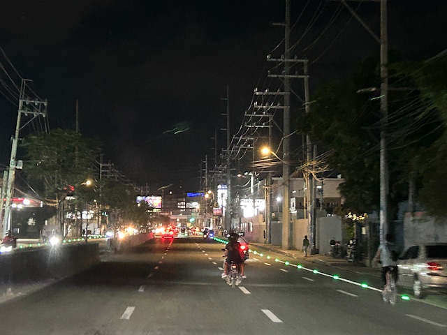
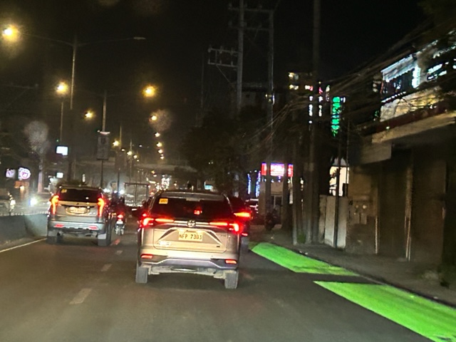
Solar road studs for Ortigas Avenue Extension bike lanes
The bike lanes along Ortigas Avenue Extension now have solar road studs for these to be more visible at night time or when it is dark. Following are photos of the bike lanes at night.
While the studs enhance the visibility of the bike lanes and perhaps also the safety of cyclists, the latter is not assured. The bike lanes are not protected and physical barriers like those installed along Quezon City roads are most effective in ensuring the safety of cyclists against motor vehicles. The solar studs do not deter motor vehicle drivers from encroaching on the bike lanes so they appear to have minimal impacts on safety.
–
Article share: on making roads greener
I came upon this article on ‘greening’ roads:
Goldfarb, G. (December 23, 2023) “This Radical Plan to Make Roads Greener Actually Works,” Wired, https://www.wired.com/story/this-radical-plan-to-make-roads-greener-actually-works/?bxid=5bd6761b3f92a41245dde413&cndid=37243643&esrc=AUTO_OTHER&source=Email_0_EDT_WIR_NEWSLETTER_0_DAILY_ZZ&utm_brand=wired&utm_campaign=aud-dev&utm_content=WIR_Daily_010324&utm_mailing=WIR_Daily_010324&utm_medium=email&utm_source=nl&utm_term=P8 [Last accessed: 1/4/2024]
To quote from the article:
“The very notion that a road can be “green” seems oxymoronic: A vast body of scientific literature demonstrates that roads befoul air and water, fragment ecosystems, introduce non-native species, and obliterate wildlife.”
That was a pretty damning or severe statement about roads considering such infrastructure are necessities in today’s world. Perhaps we should revisit road planning and design to address these issues referred to. Aside from that quote, the article related a number of good examples worth replicating. In fact, I recall that many Philippine roads were envisioned, even designed, to have greenery along them. The tragedy is when the DPWH and LGUs departed or deviated from these plans. The road widening projects of the past years are examples on how national and local agencies have proven the article’s author right about green roads being oxymoronic.
–
Speeding, road crashes and nuts behind the wheel
A recent road crash involving a car slamming into a truck along Marcos Highway in Antipolo City highlights one of the main concerns affecting road safety in the Philippines – speeding. Video from a CCTV camera installed at an establishment near the crash site showed a truck making a U-turn and doing it correctly (i.e., the maneuver) and safely. What followed was a car that was obviously speeding but seemingly not out of control. The car slammed the back of the truck in what was a fatal and tragic crash.
Are the roads to blame? While roads and bridges are static, design elements are the main culprits for why these facilities can be unsafe to users. Straight, level and wide sections of roads invite speeding among drivers and riders alike. The so-called ‘ideal’ sections of roads encourage drivers and riders to speed up, regardless of the speed limits. Thus, roads like Commonwealth Avenue in Quezon City and Marcos Highway in Antipolo, Cainta, Marikina and Pasig have many speeding vehicles. The design speeds for these roads are definitely above the speed limits. I still maintain though that it takes two to tango. That is, even with the above conditions, disciplined, experienced drivers and riders should not have been speeding or doing any other risky maneuver. That could have reduced the likelihood of such crashes. I think that’s pretty plain and common sense.
–
Bike lanes along Ortigas Avenue Extension, Cainta, Rizal
The bike lanes along Ortigas Avenue end at the border of Pasig City and Cainta (or Metro Manila and the Province of Rizal). This is just after SM East Ortigas if you are eastbound, headed towards Cainta Junction. Last Friday, I was able to take a photo of the newly painted bike lane along Ortigas Avenue Extension’s eastbound side but which starts just after Cainta Junction across from the main gate of Brookside Hills Subdivision.
 The new bike lane along Ortigas Avenue Extension used luminous paint, which makes it glow at night especially when exposed to vehicle headlights.
There have been bike lanes in Rizal prior to this development. Marcos Highway and Sumulong Highway have painted bike lanes. The Manila East Road from Tikling Junction also has bike lanes. This ‘missing link’ between the boundary of NCR and Rizal and Tikling is long overdue. Hopefully, this will encourage more active transport users particularly from “bike to work” and “bike to school” trips.
–
Central Luzon Link Expressway (CLLEx)
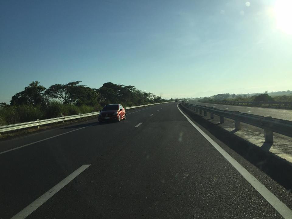
The recently opened Central Luzon Link Expressway (CLLEx) is a freeway spanning the provinces of Tarlac and Nueva Ecija towards the Cagayan Valley side of Luzon. With the ends at Tarlac City, Tarlac and San Jose City, Nueva Ecija, Phase 1 currently terminates at Aliaga town; connecting to the Guimba-Aliaga Road. That is 18 kilometers of the planned 30.7 kilometers of the first phase, which is to end at Cabanatuan City, Nueva Ecija. Here are some photos taken by colleagues as they traveled to Tuguegarao this weekend.
 Section of SCTEX leading to the junction where the road branches to either the TPLEX or the CLLEx. SCTEX is a tollway operated by Metro Pacific via its Manila North Tollways Corp. while TPLEX is a tollway operated by San Miguel Corp. CLLEx is currently a freeway under the DPWH.
 SCTEX off-ramps to CLLEx (left) or Tarlac City (right)
 The expressway currently has 2 lanes per direction plus shoulder along either direction. The median barrier is a post & rail semi-rigid structure.
 Many of the traffic signs have yet to be installed
 Not so much traffic along the freeway as shown in the photos. These were taken on a Sunday though and we wonder if there will be more vehicles during the weekdays.
 As the freeway is still uncompleted, the end section in Nueva Ecija is two lane-two way with only cones and bollards separating opposing traffic.
 Exit ramp towards the Guimba-Aliaga Road
There are no stops yet along the freeway. I am not aware if there is a timetable for it to become a tollway. Traffic is still quite low so perhaps making it a tollway will take some time as it might be difficult to have a profitable operation. It would be good to have it as a limited access freeway to establish demand and use for the road.
–
Why do we keep widening roads?
I’m just going to share this article here. The article from The NY Times asks a question that has been bugging planners and engineers, particularly those who are in government and perhaps under the agencies like the DPWH, DOTr and NEDA. This also applies to planners, engineers and those from other disciplines involved in transportation infrastructure development and particularly roads or highways.
–
On intersection treatments for bicycles
With the increasing popularity of bicycles as a mode of transport particularly for commuting (e.g., bike-to-work, bike-to-school), we should be redesigning our intersections to include elements essential for the safety of all users, whether on motorized or non-motorized modes. Here is a short but very informative article on how a simple intersection treatment can significantly improve safety for everyone especially cyclists and pedestrians:
Grief, N. (December 2, 2022) “How Green Paint Can Save Cyclists’ Lives,” Bicycling.com, https://www.bicycling.com/news/a42124210/bike-boxes-intersections/ [Last accessed: 12/3/2022]
To quote from the article:
“A bike box, on the other hand, seems to be the ideal middle ground and the option of the three that these researchers recommend. Cyclists feel more comfortable when compared to the free-for-all of a mixing zone because they have a designated area to be and they’re out ahead of vehicles, but according to the eye movement analysis, they remain alert and watchful for vehicles.”
Here are a couple of drawings showing bike boxes at intersections from the recent Bike Lanes Master Plan for Metro Manila, Metro Cebu and Metro Davao that was developed by DOTr with assistance from the UNDP:
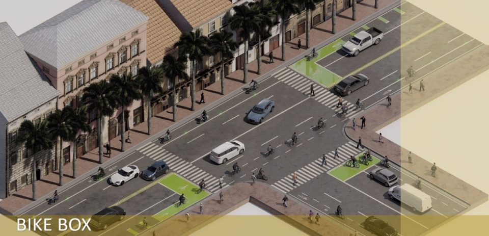 Bike boxes on a typical three-leg intersection (DOTr and UNDP, 2022)
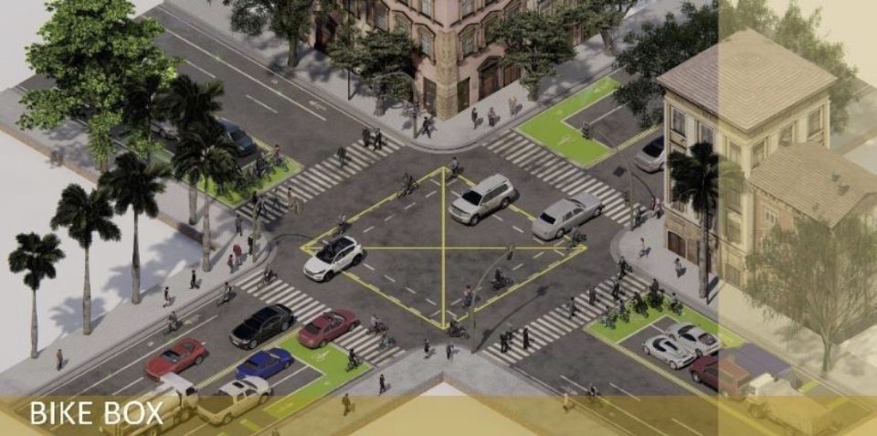 Bike boxes on a typical four-leg intersection (DOTr and UNDP, 2022)
The preceding drawings adhere to the DPWH design guidelines that mainly follow AASHTO Guidelines. Of course, there are other design references such as NACTO and the manuals of other countries (e.g., Netherlands, Australia, Singapore, etc.) were the best practice designs can be adopted for local applications.
–
On emergency vehicles, speeds and road widths
I recall an online discussion about how roads need to be wide to accommodate emergency vehicles such as fire trucks/engines, ambulances and police vehicles. There are also videos shared on social media about how, with wide roads, motorists could move their vehicles to the sides to give way to emergency vehicles. These are used to support the argument that we need wide roads and that speeding for emergency vehicles is justified because of their purpose. The following article attempts to make a counter-argument:
Lewis, M. (November 21, 2022) “Ambulances vs. Pedestrians,” Planetizen, https://www.planetizen.com/blogs/119785-ambulances-vs-pedestrians [Last accessed: 11/24/2022]
To quote from the article:
“the “emergency response” argument in favor of wide streets only makes sense if the risk of death from a too-slow ambulance outweighs the risk of death from a speeding car.”
Certainly, the data on road crashes due to speeding should support the perception that there’s a higher risk of death from speeding vehicles compared to the risk of dying in relation to the emergency that’s supposedly being responded to. And in our country, perhaps this counter-argument is valid considering the “wang-wang” type of emergency vehicles moving about.
–
