
Home » Highways and Streets
Category Archives: Highways and Streets
A most beautiful street this time of year – University Avenue
Perhaps one of the most beautiful streets in the country this time of year is the University Avenue of the University of the Philippines Diliman campus. That’s mainly thanks to the sunflowers that are now in full bloom.
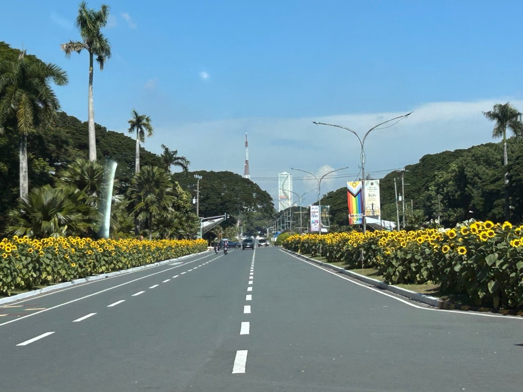

Imagine our streets lined up with flowers or trees? Not only could we probably have aesthetically nice streets but they would be more environmentally compatible. They would probably also contribute to make our days and nights cooler. The sunflowers will also probably keep zombies away 🙂
–
More urban expressways for Metro Manila?
I’ve written about expressways before and particularly about where they probably are most suitable and where they shouldn’t be constructed. Here is the article I posted here in 2021: https://d0ctrine.com/2021/05/03/in-defense-of-expressways/
I will not comment anymore about the alignment of the proposed SALEX but here is a “without” and “with” elevated tollway that’s based on a photo of Padre Faura we took while doing a recon around the PGH compound last Friday.
 Photo of section of Padre Faura Street fronting U.P. Manila’s Museum of Ideas
 AI-assisted image showing the transformation of the section once the proposes SALEX is constructed. The elevated tollway should be higher than the renders you see on social media because there is the Line 1 along Taft Avenue.
Can the trees be saved? Maybe and by saved we don’t mean that they will be transferred. They should be retained where they are.
Why is San Miguel so intent in constructing these tollways? Is it really to “solve” Metro Manila traffic? Most objective, level-headed experts will tell you that the solution involved public and active transportation rather than more tollways. Who is whispering to Ramong Ang’s ears and advising him to build more of these tollways (and bridges)? Your guess is probably as good as mine…
–
A tollway over Padre Faura?
We had a recon survey of the streets surrounding the UP Manila and UP PGH compound this morning. We walked the entire time and got to see firsthand the conditions along the streets including Pedro Gil and Padre Faura. I’ve seen and read a lot about the proposed SALEX with an alignment that will have the proposed tollway above Padre Faura.
I can’t imagine the blight that the elevated tollways will have on Padre Faura. It will surely affect traffic along the street during construction. There is a lot of AI-generated renders of what it will look like. However, not clearly shown would be the effect of the tollway on a narrow street like Padre Faura. It will be higher than the Line 1 along Taft Avenue though so most renders you see on social media are incorrect in terms of elevation.
Were the establishments along Padre Faura consulted before the alignment of the proposed tollway was submitted for approval? That alone seems to be a glaring flaw in the PPP law considering the location of the tollway. Why is another tollway for construction in the metropolis when what are required are mass transit lines and better public transport?
–
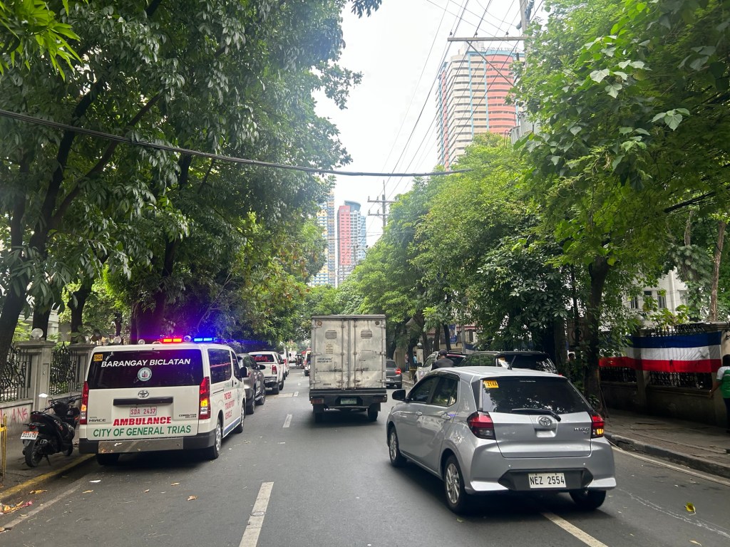
New wide roads lead to more crashes?
I was in Tagaytay several times the past year and recently and couldn’t help but notice all the wide and widened roads in Cavite Province. Driving our vehicle, I also noticed how many were speeding along these roads and that many refuse to give way at intersections unless it’s signalized. We caught the terrifying images of a fresh crash this morning as we traveled home from Tagaytay. There were three wrecks at the intersection of the Crisanto Delos Reyes Road and the East West Road. It took quite some time for the rescue people to get there based on how long we got stuck in traffic just a few hundred meters from the crash site.
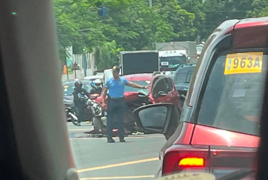
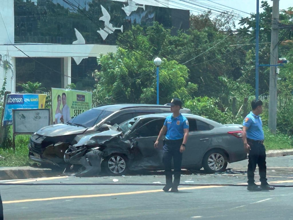
Wide roads and aggressive driving are just two major factors or contributors towards road crashes. I wonder what are the crash rates along these roads in Cavite Province. I also wonder how fast first responders, especially medical staff, could arrive on site for these crashes. The police were there first but looked helpless and couldn’t attend to those involved in the wrecked cars. Are they even trained for first aid? Or was this part of their training to just wait for competent medical staff to arrive?
–
From Blog to Vlog
I was checking the submissions of our students for an assignment that was given to them earlier in this concluding semester. As I watched and rewatched the vlogs they were supposed to create in relation to civil engineering, I was surprised to see this blog being cited by at least 3 students who chose topics related to transportation. I am not into creating videos or vlogs like those you find on YouTube or TikTok (at least not for now?) but I appreciate the production and creativity of many of our students as they attempted to articulate civil engineering and civil engineering history through their videos. Most amusing to me were one student who sang the entire vlog about her commute along Marcos Highway and another who used Minecraft for his vlog about construction. While I can’t share their work here due to privacy policies at the university, I can say that these among other excellent works by our students show that most of them understood what civil engineering was all about.
–
Flash floods in May
It finally rained all over Metro Manila and Rizal today. This morning’s rains were light. The drizzle was enough though to prevent me from walking the dogs. The afternoon rains were more intense though in bursts rather than sustained. Still, this resulted in flash floods everywhere. The photo below shows the situation along Katipunan Road in White Plains.
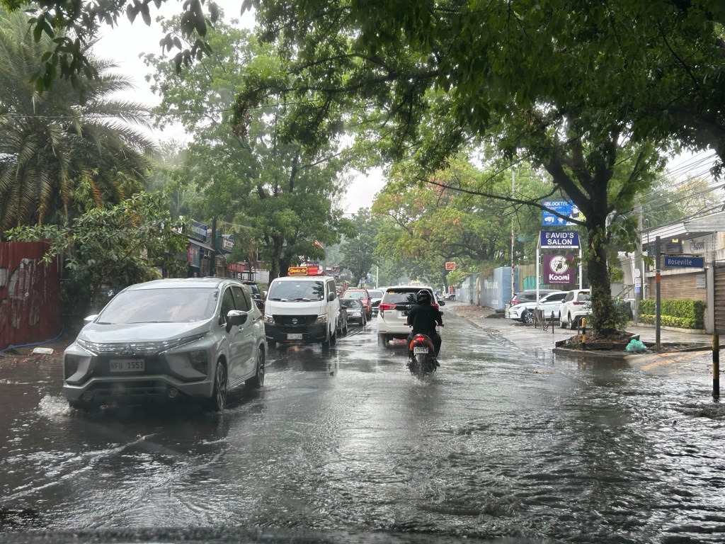
The flash floods bring us again to the flood control mess that remains unresolved. It is not just a problem of the poor, or the middle class but of everyone affected by the floods. It’s just that many are more severely affected than others. The photo above might be a slight concern of the more wealthy people in that neighborhood. They probably don’t need to worry of flood waters entering their homes and damaging properties. Other people are not as lucky and have to deal with floods for a major part of the year. The suffering is real and it’s also because many chose to elect inept, incompetent and corrupt people who themselves enabled other inept, incompetent and corrupt people to proliferate and operate with no regards for morality, even humanity.
–
Article share: Why Complete Streets Design Benefits Everyone
Here is another quick share of an article; this time on Complete Streets. I guess many are aware of the AI-generated street transformations that are now being shared across many social media platforms. These show street transformations of many sections and intersections.
Source: Why Complete Streets Design Benefits Everyone
Again, it is important to have context sensitive solutions. This extends to street transformations. Some may look cool (AI tools have enabled non-architects, non-engineers, etc. to produce nice renderings) but should be tempered for the street or highway functions as well as the actual volume of people and vehicles running along these.
–
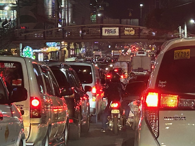
Congested Katipunan again
During the Christmas break, we were reminded just how Katipunan Avenue can be congested due to the trips generated by the institutions along it. These are mainly the schools such as Ateneo, Miriam and UP. Based on my observations and experiences over the past decades though (I started attending UP in the late 1980s), the main culprit is Ateneo with all the private vehicles it generates for its students in all levels (Grade School, High School and College).
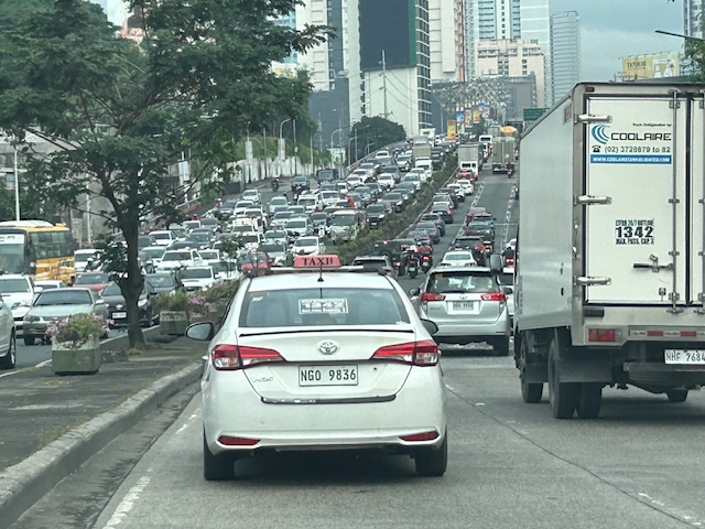 What “normal” traffic looks like on a typical weekday along Katipunan Avenue
My commute during the break is usually under 1 hour (e.g,, 40-50 minutes). But during the times when there’s school, it’s always more than an hour (e.g., 75 to 105 minutes). Will the situation improve? Will there be a mass transit system along C-5 to alleviate the traffic conditions? We can probably hope so but it doesn’t seem to be in the near horizon right now. The Metro Manila subway, after all, is expected to be operational in the 2030s!
–
On street transformations using AI
My social media feed is full of images generated by artificial intelligence (AI). The street transformations are generated using a variety of AI tools. I’ve tried Canva and Gemini in producing similar images of street transformations; an exercise I’ve included in my undergraduate and graduate classes for more than a decade now but using their sketching and software (CAD, Sketch-up, etc.) skills to do the transformations. The photos below show an example of transformation along the University of the Philippines Diliman Academic Oval using Google Gemini.
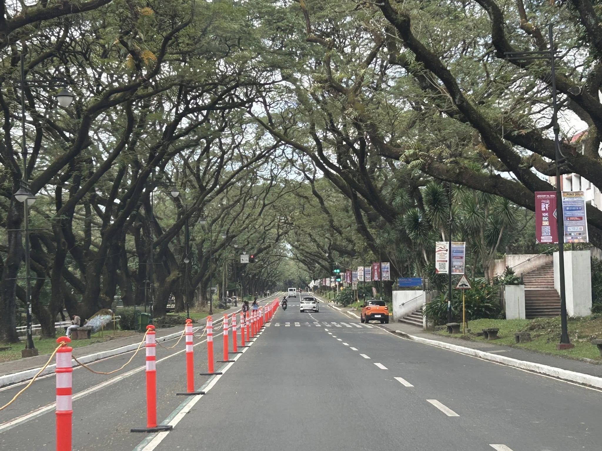 The original photo I took at the UP Academic Oval
 The first attempt at replacing the orange bollards/barriers with something that blended with the campus.
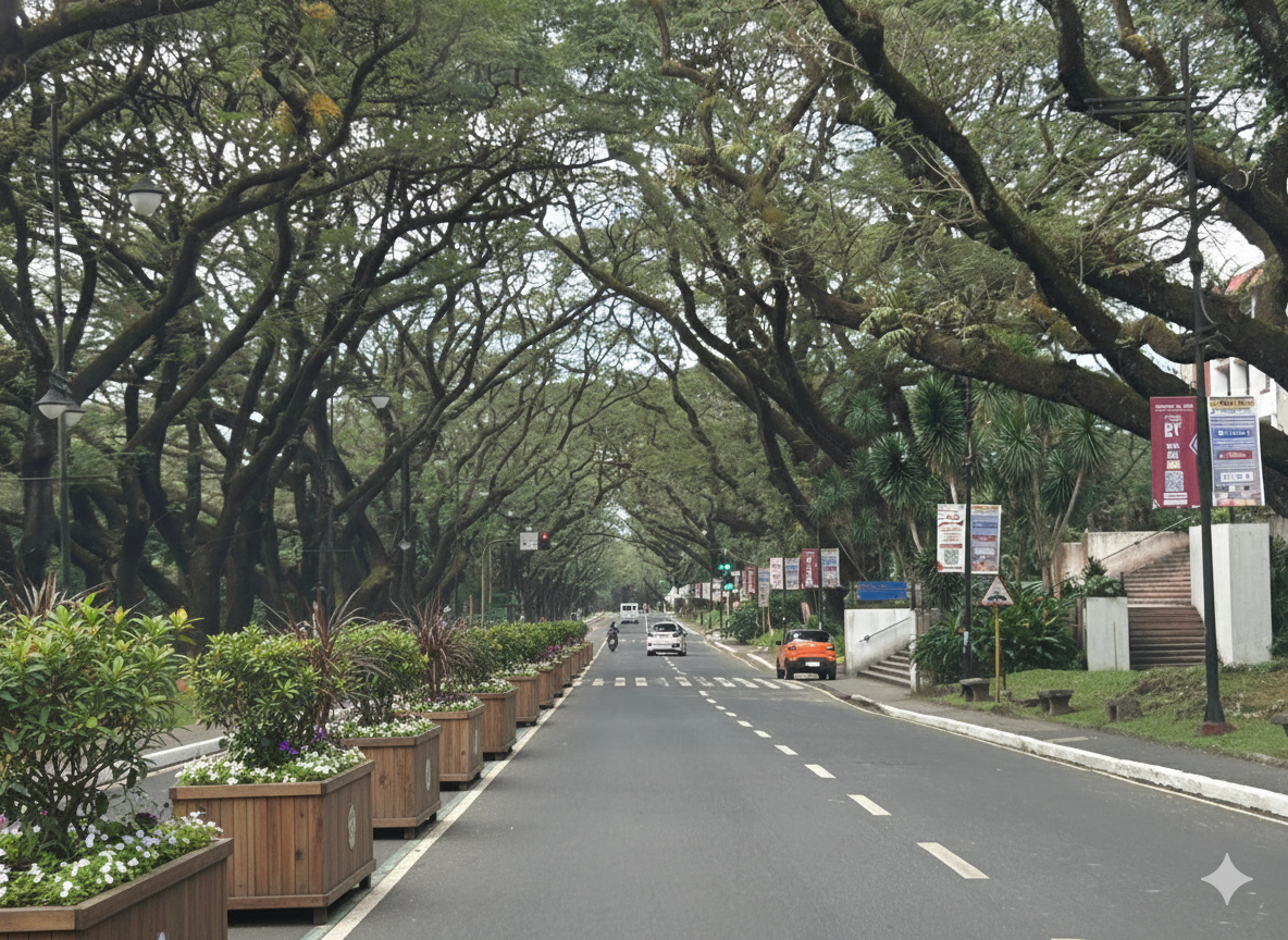 The second attempt showing plant boxes instead of the fence in the previous photo.
I think it’s possible to have excellent transformations of whatever roads or streets there are. One just needs to prompt or instruct the AI well enough to obtain these alternative designs. While the transformations are nice though, context is still important. Many of the transformations circulating on social media call for almost all major streets to be transformed. (Kulang na lang pati expressway gawan ng transformation.) Advocacy is good but context-sensitive solutions require a more constructive and cooperative. It certainly can do without being combative or antagonistic.
–
On the chronic congestion along Ortigas Avenue Extension
I previously wrote about the counterflow scheme along Ortigas Avenue Extension. While this is usually implemented during the mornings. A similar scheme is not applied in the afternoons or evenings. Apparently, the directional distribution in the afternoons and evenings is not suitable for a counterflow scheme. The photos below show the typical eastbound traffic as seen from the Manggahan Floodway bridge.
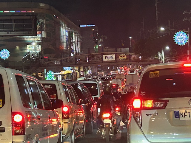 Typical weekday evening traffic along Ortigas Avenue Extension
 The photos show that the traffic along the opposing direction (westbound) is as heavy as the eastbound traffic. This means a counterflow scheme similar to that in the mornings cannot be implemented during this period.
I have mentioned in the previous article that the corridor already required a mass transit system since the 1980s. Despite the operations of several bus companies over the past decades, these have not been enough (together with jeepneys and vans) to serve the demand along the corridor. It is not uncommon to find so many people stranded along the corridor and waiting to get a ride even during the early mornings. While Lines 2, 3 and 7 were being constructed, people in Rizal who have long endured the traffic along Ortigas Avenue Extension could only wonder why a transit system has not been provided for them. Will the proposed Line 4 be finally constructed? When will it be completed? What could be the traffic impacts of construction considering the limited space available for the construction? Should commuters prepare for more miserable travel once construction is underway?
–
