
Home » Highways and Streets (Page 18)
Category Archives: Highways and Streets
More community road works
I came back from a trip to find the road in front of our home suddenly become a busy road. The road is the only alternate route to the main road in our subdivision and with the rehabilitation work on the main road, residents from the inner parts of the village have no choice but to go through a longer route when leaving and returning home.
 Start of roadworks – my first observation was that there was no proper curing applied to the new concrete pavement.
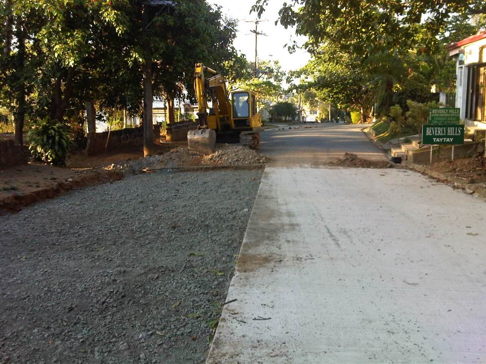
 Crushed rock base layer beside Portland Cement Concrete Pavement (PPCP) slab
 Completed lane without curing – proper curing means the slab should have been watered as concrete releases heat as it hardens. With the hot weather we experience during the dry season, curing is all the more important for the concrete to achieve the desired strength over the typical period of 14 to 21 days.
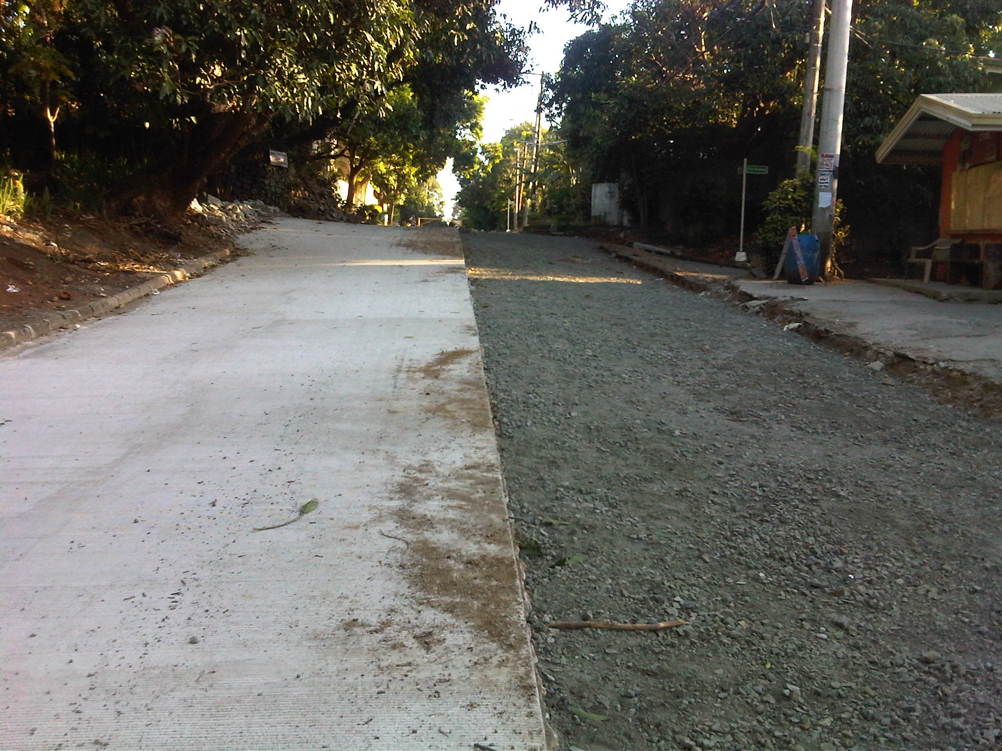
 End of the project – the project is with the City of Antipolo and part of our subdivision is in the Municipality of Taytay. The concreting ends at the boundary of Antipolo and Taytay.
 A look back at the section under rehabilitation
With the increased number of trucks entering the subdivision due to the many residential construction projects currently on full swing, I hope that the concrete slabs will not be damaged and require major repair. The fact that the contractor did not cure the concrete properly brings questions whether the concrete was able to achieve full strength over the prescribed period. This is actually a reflection of current construction practices in the country that were subject of several researches we’ve made and presented in several venues. The issue remain generally disregarded by the DPWH and likely by most local government units for projects under them.
–
Road widening along Sumulong Highway
Sumulong Highway is the main road connecting Antipolo City with Marikina City and ultimately to Cainta, Pasig and Quezon City via Marcos Highway. It is basically a 4-lane, 2-way undivided road with several sections that have 3 lanes total probably due to ROW acquisition issues when the highway was widened from the original 2-lane road. I came back from a trip recently to find road works along my commute and took some photos of what would definitely be an improvement to the highway. The uneven number of lanes along several sections of Sumulong has led to road crashes and surely many near misses among motorists and cyclists using the highway. There is also a need to provide space for pedestrians and others on foot considering the highway is one of the major routes to the Shrine of Our Lady of Peace and Good Voyage – a major pilgrimage site for Filipinos.
 Road widening for an additional lane along the inbound lane approaching Sumulong’s intersection with Olalia Road
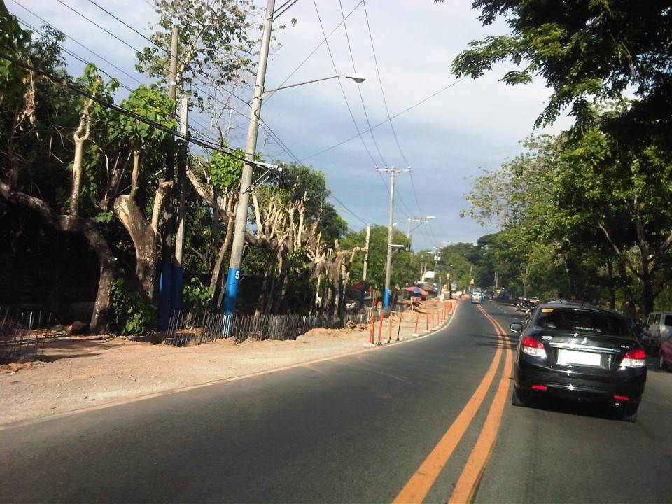 Construction along the inbound direction of Sumulong Highway include drainage works aside from the construction of an additional lane to make the number of lanes even (2 per direction). At present, there are 2 lanes along the outbound direction and a single lane (shown clearly in the photo) along the inbound lane. The section shown is near the Garden of Gethsemane and Palos Verdes subdivision.
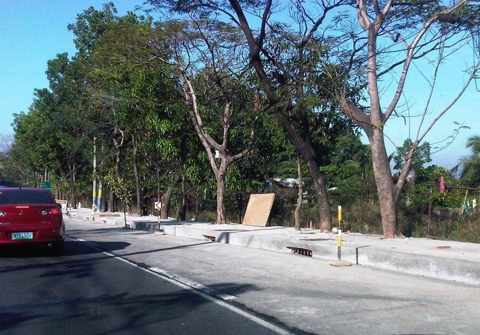 Completed lane, drainage and sidewalk along the outbound direction of Sumulong Highway right after Metro View subdivision.
 Widening along the outbound direction between Metro View and Valley Golf includes drainage works. There will be a sidewalk on top of the drainage that should enhance safety for walking/trekking.
 There are many informal settlers as well as formal ones encroaching on the RROW. Part of the project is to remove these and other obstructions. I just hope that the sidewalks and the curbside lane will remain clear of obstructions.
The completion of the road widening project is expected to improve the flow of traffic along Sumulong Highway as there will be a continuous 2 lanes available along either direction for safe and effective passing. The additional lane also means public transport may stop along the roadside without blocking through traffic. Trucks and slow moving vehicles (tricycles?) may also be required to take a designated lane. Moreover, since there is a significant volume of bicycle users along Sumulong Highway, there will be enough safe space for them to travel. The current volume of motorised vehicle traffic along the highway requires only 1 lane per direction (2 lanes total) and these are the innermost lanes of the road. Traffic slows down usually because of trucks or tricycle operations/maneuvers. In theory, the 2 outer lanes can be used only for overtaking, stopping and cycling. These should be clear of parked vehicles particularly along areas where there are communities and businesses (e.g., vulcanising, auto repair shops, etc.) along the roadside.
–
Alternative to Highway 2000, Taytay, Rizal – Part 2
The stretch of Don Hilario Cruz Avenue between Megawide and the Manila East Road is paved and generally wider than Highway 2000. While there are residential villages along this stretch as well as a significant traffic generator in Club Manila East, which is a resort, traffic is usually light. There are actually few establishments and informal settlements along the road, which retains its exclusive subdivision feel.
 Section in front of Club Manila East
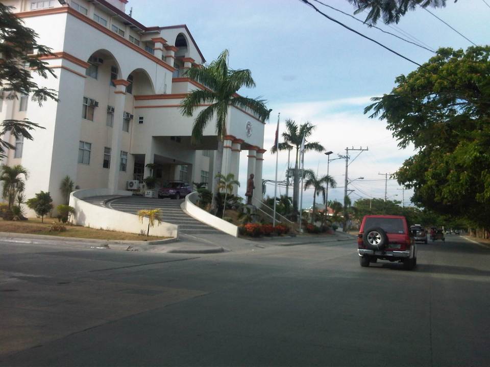 Taytay (Rizal) Municipal Hall – the Land Transport Franchising and Regulatory Board (LTFRB) office is just beside the municipal hall and often you could see taxis lined up along this road to have their meters calibrated and sealed.
 This entire area used to be an exclusive subdivision and Don Hilario Cruz Ave. was a private road. The old guardhouses are still there and heavy vehicles may not use this road without paying a toll fee.
 On-street parking is prevalent along the section connecting to the Manila East Road because of the clothes/garments market on either side of the road. Taytay, Rizal is well-known for its garments factories and tailors.
 Section approaching the Manila East Road
The only setback when traveling using this alternate route to Highway 2000 is that stretch beside Megawide. It very dusty during the dry season and muddy during the wet season. The road can be quite rough and will damage cars over time. You definitely cannot speed up along this section even if you are on an SUV and are familiar with the bumps along the road. Hopefully, the Taytay could address this issue and the Rizal Provincial government can also facilitate the paving of this section, which is used by many Rizalenos heading to work or school in Metro Manila.
–
Alternative to Highway 2000, Taytay, Rizal – Part 1
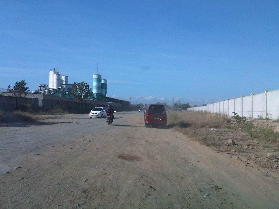
An alternate route to the poorly maintained Highway 2000 in Taytay, Rizal that leads to Barkadahan Bridge and Circumferential Road 6 (C-6) is via Don Hilario Cruz Avenue, along which is the new Taytay Municipal Hall, the Land Transportation Office in Taytay, and Club Manila East. While most of Don Hilario Cruz is paved, there is a significant section that remains unpaved. It is very dusty during the dry season and muddy during the wet season.
 The road section is unpaved but appears to be graded (probably by the tires of all the vehicles using it everyday). The wall on the right is Megawide’s. Megawide is a major contractor.
 Motorcycles are the fastest along these types of roads. Other vehicles including trucks need to slow down so their suspensions will not be damaged by the rough road.
 I have wondered whether Megawide has considered contributing to paving the road considering their stature in the construction industry. This can be their CSR project and one where a lot of people will be very appreciative with the results.
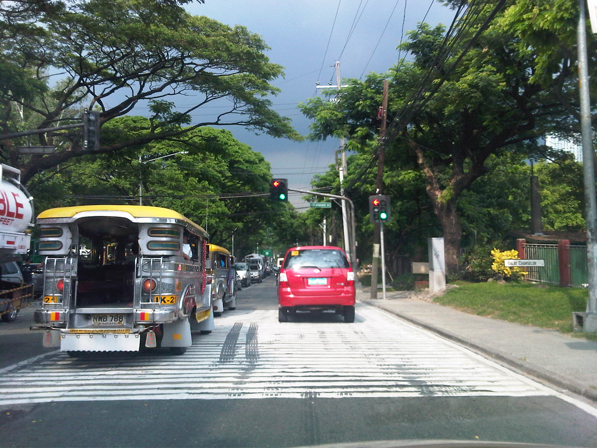
 Intersection with Velasquez Street, which connects to the Manggahan East Service Road to the north and the Manila East Road to the south.
–
All roads lead to Antipolo: rerouting for the Alay Lakad
The Rizal Provincial Government and the Antipolo City Government recently posted traffic rerouting schemes on their Facebook pages. Lalawigan ng Rizal was the first to post schemes that affect traffic in at least 3 major local government jurisdictions – Antipolo, Cainta and Taytay. The schemes affect the two major corridors that basically lead to Antipolo’s National Shrine of Our Lady of Peace and Good Voyage (or Antipolo Cathedral to many) – the Ortigas Avenue corridor and the Marcos Highway-Sumulong Highway corridor. There are many major and minor routes connecting to these corridors and are clearly seen in the maps.
Within Antipolo, there are also re-routing schemes, which the Antipolo City Government posted along with a “clearer” re-posting of the maps from the Rizal FB page. The Antipolo FB page includes information/maps on the rerouting within the city center. These schemes will affect traffic circulation including public transport routes. Critical would be the permanent and temporary terminals and parking areas set-up around the city that should be able to accommodate the thousands of vehicles that are also expected to be used by people who won’t be walking or cycling.
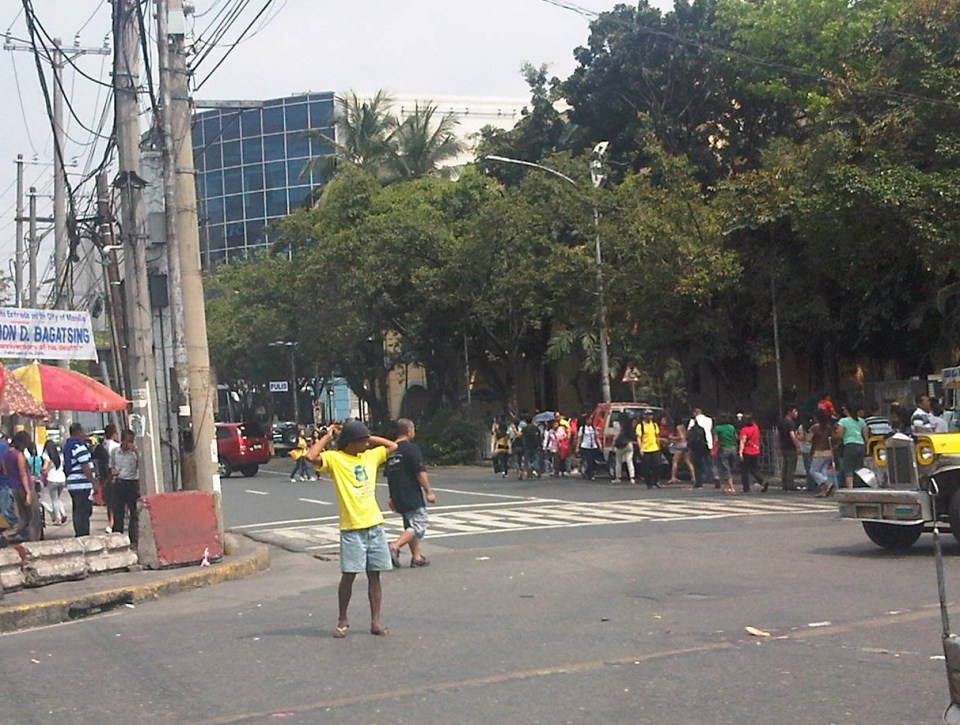
What the maps basically say is that from 4:00 PM today, Maundy Thursday, to 6:00 AM tomorrow, Good Friday, the stretch from Cainta Junction to the Shrine will be closed to traffic. This is to allow the hundreds of thousands expected to make the trek to Antipolo to have the road for themselves. What the maps don’t say is that motorcycles and tricycles would likely be allowed, too. I can understand that motorcycles could easily squeeze into the throngs of people but then allowing tricycles to operate among the walkers and bikers would be risky given their drivers’ behavior. Add to this that they would be making a killing out of charging opportunistic fares.
Technically, the rerouting schemes don’t appear to be as well thought of as can be expected from the LGUs. Baka ito lang nakayanan ng staff o ng consultants nila, and surrender na agad ang Rizal and Antipolo with regards to the coming up with more options for people to travel to the Antipolo Shrine? Not all people can walk or cycle but are willing to an could take public transport for their pilgrimage. The maps themselves are a bit crude and the Province of Rizal and City of Antipolo could have done much better maps given the resources of these LGUs. There are open source tools now available as well as your basic software like PowerPoint or Photoshop (even Word!) that can be used to render good quality images to guide people making the Alay Lakad. This is a regular event and though it happens once a year then perhaps the LGUs could have better plans especially to transport people who cannot make the walk to Antipolo. The objective after all is to convey the masses to and from the shrine safely and efficiently – something a mass transport system can do whether via Marcos/Sumulong or Ortigas corridors.
One reminder to all doing the Alay Lakad: keep your garbage to yourselves if you cannot find a proper waste bin. Do not dispose of your waste along the route and make a dumpsite out of Ortigas Avenue, Marcos Highway, Sumulong Highway or whatever roads you are taking! Kasalanan din po ang irresponsableng pagtatapon ng basura. While you might be forgiven for these “sins” through the Sacrament of Reconciliation (which many will likely take at the Cathedral), nature will have a way of getting back at you for your environmental travesty. –
Streets of Malabon
I happened to be in Malabon one weekend for a get-together with the wife’s relatives who lived in the area. Malabon is an old town that is often mentioned in history books (i.e., during the Spanish period). Though the name of the town is said to have been derived from the term “ma-labong,” which is short for “maraming labong” or plenty of bamboo shoots, it is likely, too, the place was named after San Francisco de Malabon. Here are a few photos we managed to take as we drove along Malabon’s streets. I was not familiar with the area but Waze and Google maps provided ample information for us to navigate our way around.
 Gen. Luna Street in the Malabon city proper is a one way street. Other streets in the CBD have also been designated as one-way streets as all (and not just a few or most) roads are narrow.
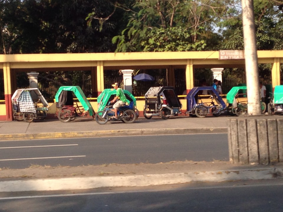
 Non-motorized transport are popular in Malabon and you will see a lot of bicycles and pedicabs along the streets. These are usually in mixed traffic and seem to blend quite well with motorized vehicles. This seems to be a good example of practicable road sharing.
 While the streets are designated one-way for motor vehicles, bicycles and pedicabs generally travel counterflow and oblivious to the risks of doing so. Still, motorists seem to be okay with this and traffic enforcers do not mind the practice.
 There are many people using bicycles and pedicabs in Malabon. Noticeable are the unique designs of sidecars as the bicycles used in the trikes are taller than the usual bikes elsewhere.
 One of the narrow side streets in Malabon. I think these should only be used for walking or cycling and motor vehicles (including motorcycles) should not be allowed to use these. Malabon can be developed as a walkable city and since it has narrow streets, traffic circulation needs take into consideration how to effectively use one way scheme or combinations in the network.
Malabon is a flood-prone area. Combined with its narrow streets, the area needs an all weather transport system. Non-motorized transport like bicycles and pedicabs can provide this as well as buses perhaps, though the narrow streets and tight turns at intersections can definitely be tricky for large vehicles. It would be interesting how the city will continue to develop considering the constraints. The town proper itself is challenged in terms of the area available for development and perennial flooding will always be an issue that will be quite difficult to overcome. Still, the city and its citizens persist and have been able to overcome these challenges. It can only be hoped that the city will continue to thrive amidst the challenges.
–
Repair C6 now!
The existing roads that comprise what has been designated as Circumferential Road 6 is an important link that serves as an alternate route for people and goods traveling between the eastern towns of Rizal province and Metro Manila to urban centres in Makati (Ayala CBD) and Taguig (Bonifacio Global City) as well as the southern areas of Metro Manila all the way to Laguna and Cavite. During the last dry season or summer, the roads conditions have been quite good such that travellers from Rizal could easily reach BGC or Makati in less than an hour give and take typical congestion during the peak periods.
The situation has significantly worsened since the onset of the wet season as the pavement quickly deteriorated with the combination of heavy rains and heavy vehicles utilising the road. Highway 2000 from Taytay, Rizal was already in bad condition during the summer so it became only worse once the rains came. However, it is the C6 segment from Pasig to Taguig that has deteriorated and is now in a state of disrepair. Following are photos that show how bad the conditions are and which have led to travel times worsening to more than double than what it should be if the roads were in good condition.
 Section in Taguig along the shores of Laguna de Bay where even large trucks avoid the deep holes along the road. These situations along C6 constrict traffic everyday.
 C6 section in Pasig City where what used to be asphalt is now a muddy mess.
 Another section in Pasig City where C6 passes through a relocation area (Lupang Arenda) where local traffic affects through traffic and C6 is probably at its narrowest.
The section from Pateros to Taguig was built as a road dike protecting these areas from floods brought about by the increasing level of Laguna de Bay during the wet season. While it is basically a secondary road compared to the other circumferential roads, traffic has significantly increased along C6 due to many people discovering that you can travel faster between Rizal and Makati or BGC via this road. Sadly, there seems to be little or no attention given to its current state.
I understand that the DPWH has a process for determining whether a road needs to be repaired and given limited resources, the agency also applies a process for prioritisation of road repairs (i.e., there are many other roads that also need repairs). However, there should be a way to allocate resources for the repairs of the road and this includes involving the LGUs whose constituents benefit from the use of the road. Rizal province and towns and Pasig City should take the initiative to find ways to improve the conditions along C6. It is also in the interest of Taguig to improve this road as many of its residents use it, too. Hopefully, the road will be repaired sooner rather than later and travel times will improve again. Of course, this should be the case whether or not the proposed C6 expressway is realised.
–
Food for thought – a few articles on transport and traffic
This will just be a quick post for now and I just wanted to share a few recent articles on transport and traffic from a favourite magazine – Wired:
What’s Up With That: Building Bigger Roads Actually Makes Traffic Worse
Why We’re Sad the Best Airport in the World Is Getting Even Better
The Hidden Genius and Influence of the Traffic Light
These are very well written, easy to understand articles on things we encounter everyday (traffic congestion, traffic signals at intersections) and when we travel long distance (airports). They show different perspectives of things we take for granted or assume we understand. An example of the latter includes notions that road widening or road construction will solve traffic congestion problems. Much of what goes around regarding road widening or road construction as solutions do not account for induced demand, which is basically additional traffic generated or encouraged by wider or new roads. The second article talks about Changi Airport, arguably the best in the world, and the high tech approaches they have employed or will employ in order to ensure efficient operations there. Such tools, I think, should be used in our airports especially NAIA where the long standing excuse is the limitations of the runway(s) and the airport terminals. Certainly, there are other issues that need to be addressed and going high tech and employing sophisticated methods for airport operations should alleviate problems until we ultimately build a new airport elsewhere. The third article takes a look into behaviour and mentions a “social contract” we have agreed to in order to reduce mayhem in our roads. This “social contract” as well as others related to it should be revisited and understood as they are very much a part of how we behave when we travel and have a significant effect on others around us.
 Traffic congestion and traffic signals along the 4-lane C.P. Garcia Avenue in UP Diliman
–
More snippets of Manila streets
The City of Manila has always been fascinating from the perspective of transport and traffic due to the many peculiarities and contradictions you’ll find around the city. Here are a few more photos and some comments on the Manila’s transport and traffic.
 Pedestrian overpass along Espana Avenue right after P. Campa Street and just before Morayta Street. Most overpasses in Metro Manila are roofless so this overpass is an exception. Most roofless overpasses were constructed when Bayani Fernando was MMDA Chair and were made so to discourage vendors from setting up on the overpass. The roof, however, makes sense considering the high pedestrian traffic (mainly students) in this area, which is dubbed the University Belt due to the many universities and colleges located here.
 Another overpass in Manila, this time roofless, along Quezon Boulevard. Notice the large umbrellas in the photo? Under these are informal vendors who have set-up shop atop the overpass, effectively constricting pedestrian movement on the facility. Notice, too, the signboard bearing a message from the incumbent Mayor of Manila who happens to be a former Philippines President. The message in Filipino translates to “There’s hope for a New Manila.”
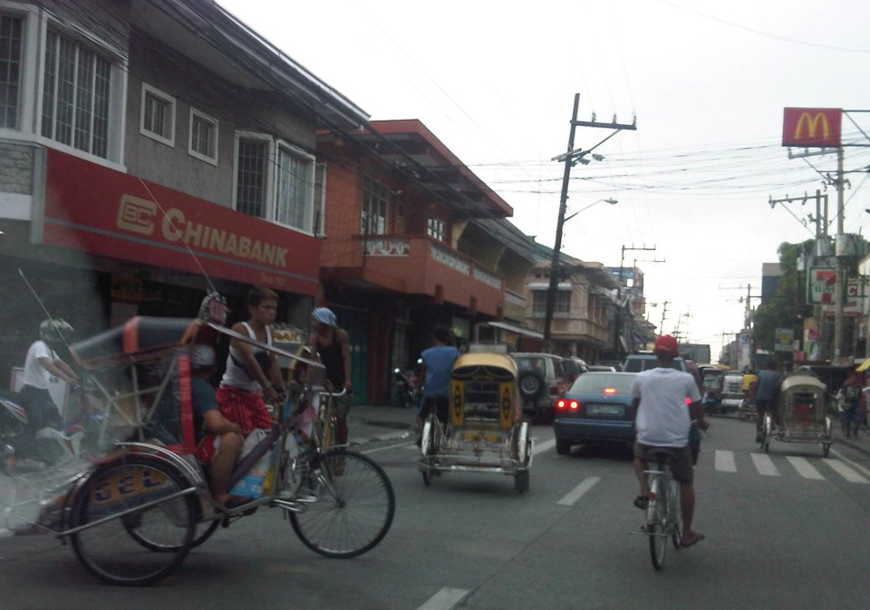
 Non-motorized pedicabs proliferate in Manila and particularly in and around Intramuros, the historic walled city that was Manila during the Spanish period. There are just too many of these 3-wheelers in this city and most if not all drivers are oblivious to traffic rules and regulations. In Intramuros they have narrow streets and most destinations of interest don’t really require a vehicle. Walking is the most suitable transport within the walled city. These pedicabs are quite peculiar for a district that is supposed to be walkable and very accessible to public transport along its main streets. Manila has tolerated (some say spoiled) the operators of these vehicles and has made “livelihood” as the standard excuse for their existence and proliferation especially in low income areas of the city.
 There are a lot of “tambays” or people just loitering around or spending (wasting?) time in the open spaces near and at the Liwasang Bonifacio just across from the Manila Central Post Office and Manila City Hall. Many of these are homeless people that the city as well as the Department of Social Welfare and Development (DSWD) have not attended to. Their presence are just too obvious to passers by and mingling among them if not they themselves are snatchers, muggers and other unwelcome elements of our society. The tarpaulin is placed over a sign stating trucks are prohibited from using Roxas Boulevard. The new truck policies in Manila have been a hot topic since early this year but everything now seems to be back to “normal” after somewhat spirited reactions from truckers that again exposed issues pertaining to the traffic impacts of the Port of Manila.
–
Snippets of Manila streets and traffic
Coming from a forum held at a hotel in Manila, I took a few photos of scenes along our route back to the university. These are snippets of everyday scenes in the Philippines capital city, which now has for its mayor the former President of the country who was ousted back in 2001 for allegations of plunder. He has been on the news quite frequently as his administration has introduced traffic schemes intended to address traffic congestion in that city. These include going after buses without terminals in Manila last year and quite recently an expanded truck ban that renewed discussions about logistics and the Port of Manila (i.e., decongesting the port in favor of Subic and Batangas ports).
 Traffic at the intersection of Bonifacio Drive, Roxas Boulevard and Padre Burgos Avenue. The trucks in the photo are coming from the Port of Manila and at the time this was taken, the window of the extended truck ban in Manila allowed these trucks to travel.
 Barkers meet jeepneys head-on in the middle of the street just past Manila City Hall. A friend posted sometime ago that in Philippine streets, the uneducated dominate the educated and this seems so true in the case of public transport where barkers, paratransit drivers and their lot control how people should get a ride and how vehicles should operate.
 Organized mayhem – pedicabs run along most of Manila’s streets with many even traveling counter-flow. This photo was taken just across from the old, decrepit Metropolitan Theater just before the Quezon Bridge towards Quiapo.
 More pedicabs (also called padyak or trisikad), non-motorized 3-wheelers that notoriously violate traffic rules and regulations as they proliferate in many parts of the city.
 A sign stating “There’s hope for a new Manila.” with the face of former Philippines President Estrada, who was elected Manila Mayor last year.
 A modern public transport stop along the eastbound side of Espana Avenue shows a guide map and electronic message board that informs people who was responsible for the project.
 Another modern bus stop, this time just in front of the University of Sto. Tomas campus, which is along Espana Avenue.
 A side street to Espana Avenue reveals an on-street motorized tricycle terminal. There is a sign at the entrance to the street saying buses are not allowed along the road.
More on Manila in the next posts…
–
