
Home » Highways and Streets (Page 20)
Category Archives: Highways and Streets
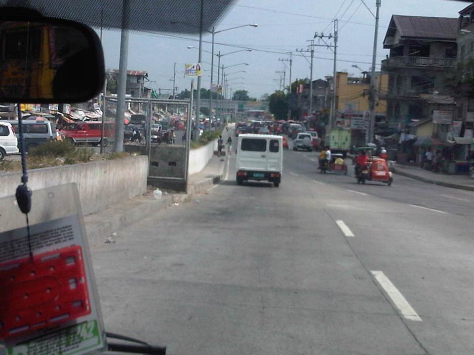
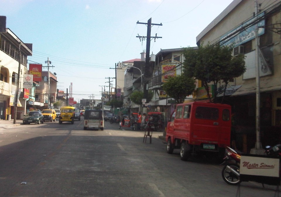
Construction and congestion along the Manggahan East Bank Road
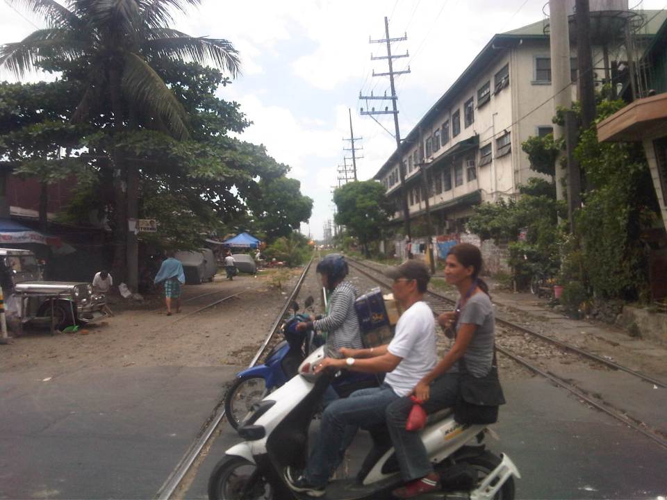
The East Bank Road along the Manggahan Floodway stretches from Pasig City through Cainta and Taytay in Rizal Province. It provides an alternate route for people traveling to/from the Rizal towns of Cainta, Taytay, Binangonan and the City of Antipolo from/to Metro Manila. The East Bank Road is directly connected to Amang Rodriguez Ave. and Ortigas Ave. while local roads connect it with C-6 and the Manila East Road. It is also an alternate route for people living in the residential areas of Pasig, Cainta and Taytay that are accessible via the many local streets connecting to the East Bank Road. After the Manggahan Bridge along Ortigas Ave Extension, there are two more bridges that travelers can use to cross the floodway. These are the Javier Bridge, which people can use to get to Raymundo Ave. or Sixto Antonio Ave. to eventually get to C-5, and the Barkadahan Bridge, which connects Highway 2000 in Taytay to Ejercito Ave. in Pasig in an area that’s contested by 3 LGUS (Pasig, Taytay and Cainta).
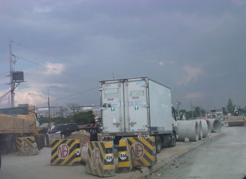
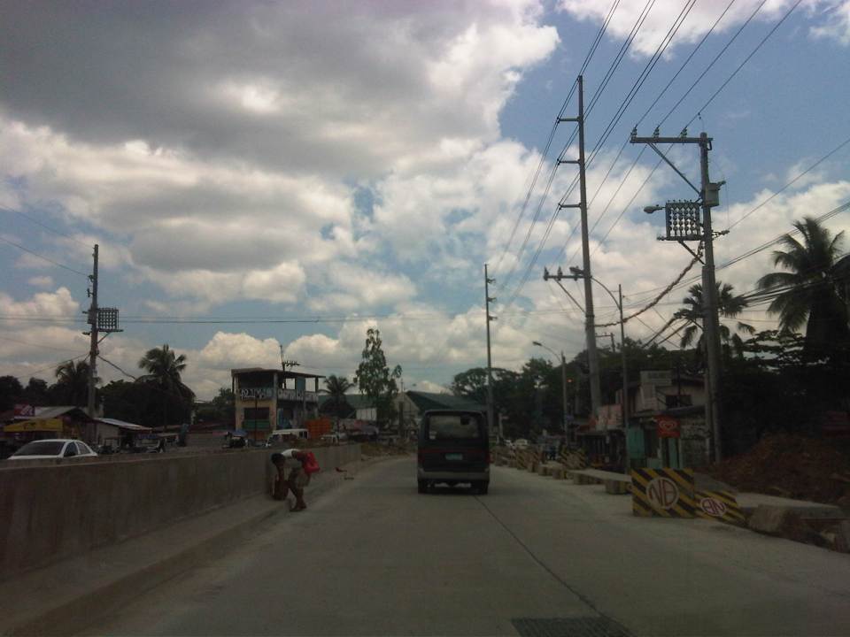
Sections of the East Bank Road are currently being rehabilitated. However, the contractors have started by working on the middle lane of a carriageway that’s 3 to 4 lanes wide with significant on-street parking on both sides of the road. There were minimal or no semblance at all of any traffic management on the side of the contractor, the MMDA or the LGUs involved in the project and so congestion occurs as it’s practically every driver/rider for him/herself along the road. I managed to take a few photos of the road and traffic conditions as we traveled towards Taytay and the Barkadahan Bridge from Ortigas Ave. and I can’t imagine how traffic is during the peak periods. I leave that up to the imagination of my readers.
 Middle lane undergoing pavement rehabilitation
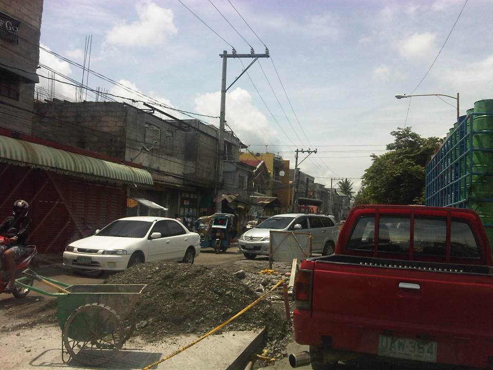 Construction and waste materials and equipment

–
Sandiganbayan underpass
There is an underpass at the intersection of Commonwealth Avenue and the Batasan Road at Sandiganbayan. The underpass is for left turning traffic coming from Batasan to the Elliptical Road-bound side of Commonwealth. I took a few photos of the underpass recently as we were coming from a meeting at the Batasan.
 Approach to the left turn underpass – the rightmost lanes of the Batasan Road are for right-turning traffic going in the direction of Fairview.
 The underpass has three lanes.
 It is well lighted and so motorists are not plunged into darkness unlike some underpasses that are not well-maintained.
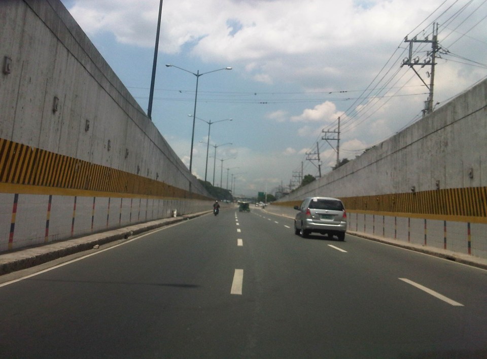 Emerging from the underpass, vehicles have enough space to merge with traffic along Commonwealth Avenue.
 The underpass emerges as 3 middle lanes along the wide Commonwealth Avenue. There are 4 to 6 lanes to the left and 2 lanes to the right of the underpass lanes. The rightmost lanes are supposed to be for public utility vehicles.
I have not heard of or read anything anywhere about this underpass being flooded during times of heavy rains. These include the particularly heavy rains of Ondoy (Ketsana) in 2009 and the Habagat episodes last year. As such, I believe that the design of the underpass (including its elevation and drainage) is for all weather conditions.
–
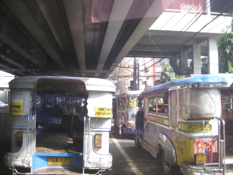
The Streets of Manila: Dagupan Street and side streets
After reading on the brouhaha caused by a negative description of Manila in a novel written by a popular author, I decided to look for some recent photos I took while en route to a meeting in Manila. We were going to the Philippine National Railways (PNR) office in Tutuban for a meeting and I couldn’t help but take a few photos along Tayuman and Dagupan Streets, trying to find “proof” of the “hell” that is supposed to be Manila. While I have some comments myself, I will leave it to my readers what they see from the photos and make their own comments.
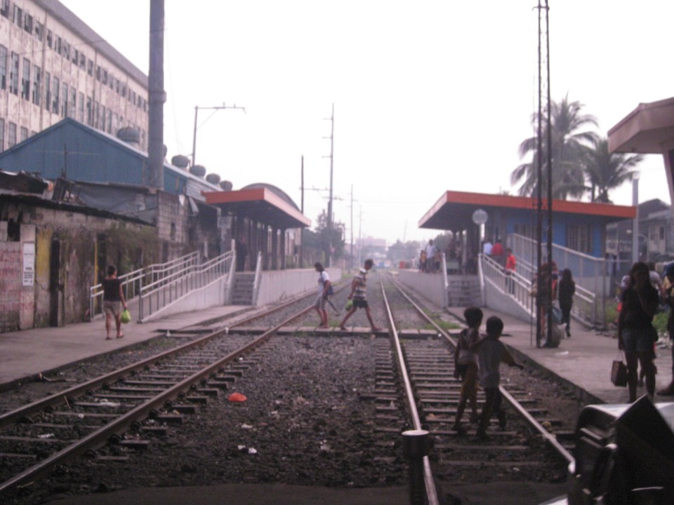
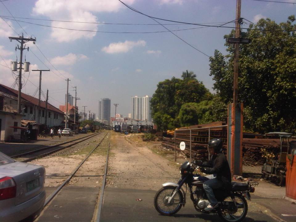 View of the PNR tracks from along Tayuman Street
 Intersection of Tayuman Street and Dagupan Street – the intersection has traffic lights but it can be confusing with pedicabs generally not following the signals.
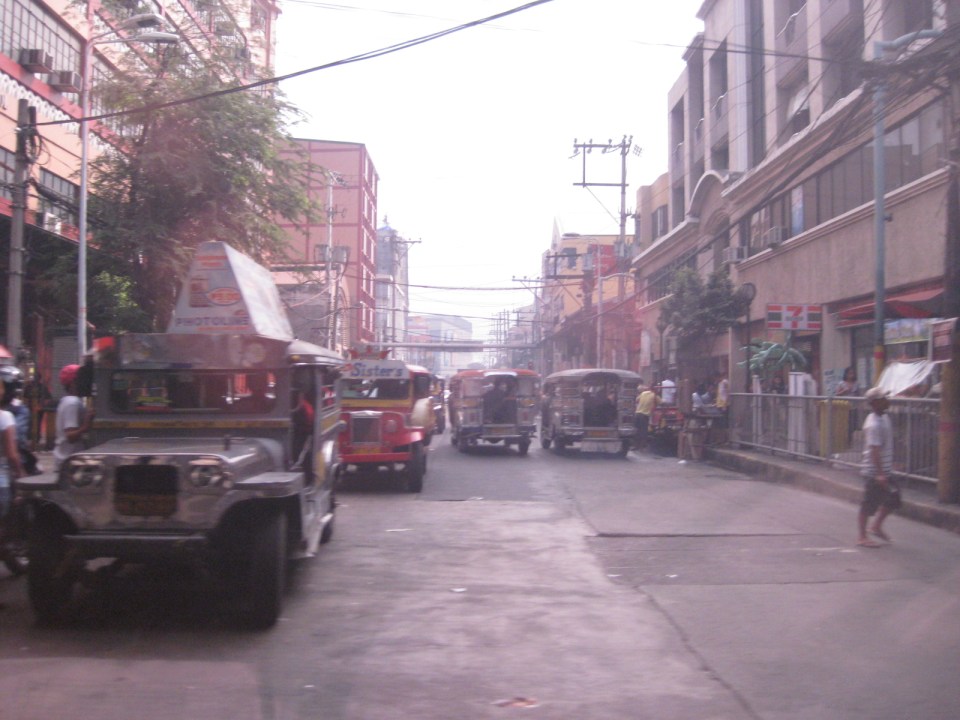
 Dagupan Street is a 4-lane road that serves a predominantly residential area across from the PNR station and depot in Tutuban. And where there are residential areas in Manila, there are pedicabs, or non-motorized 3-wheelers like the ones shown with the motor tricycle (center) in the photo.
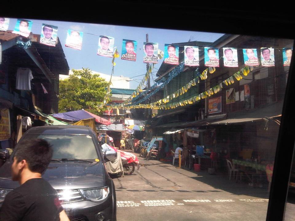
 The two shoulder lanes are occupied by parked vehicles; effectively reducing the capacity of the street for traffic. In addition to the on-street parking, motorists would have to deal with the pedicabs whose drivers will not give way and seem not to care about their impeding the flow of traffic. It seems the area had or were having their fiesta when we passed by and with the May elections, many politicians took advantage by illegally placing banners and other campaign material with the fiesta banderitas.
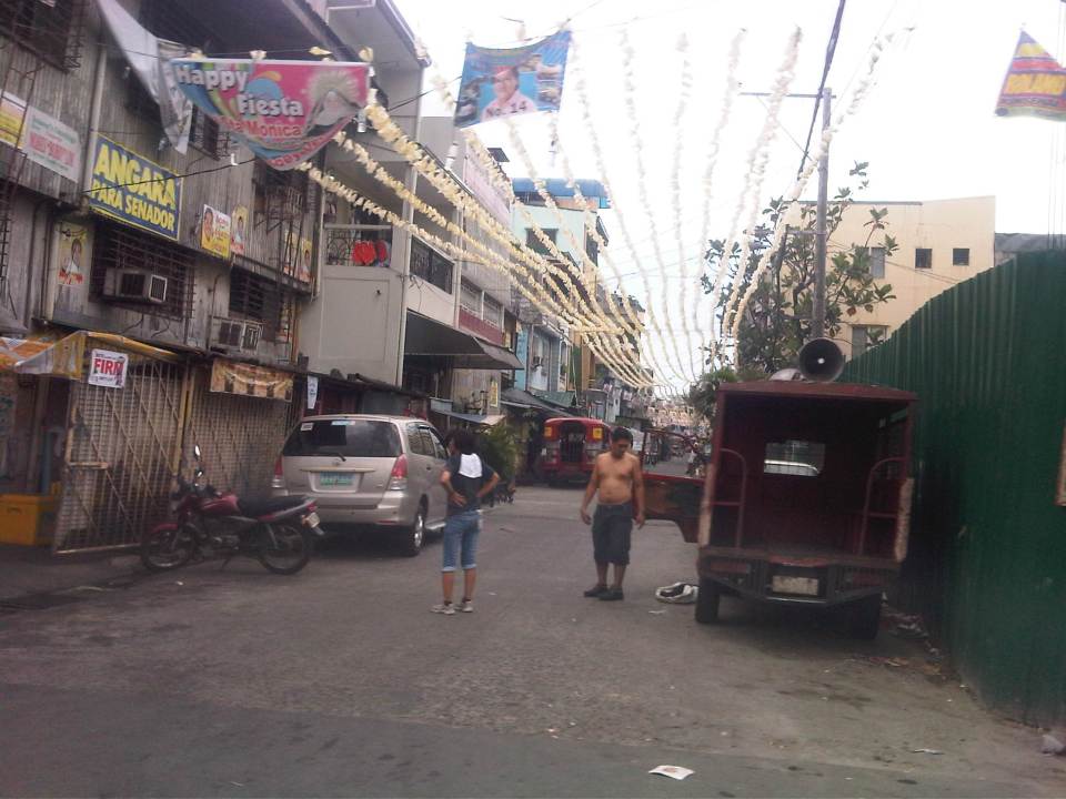
 Side streets along Dagupan Street are all narrow and many appear to be one-way streets given that half of the carriageways are occupied by parked vehicles.
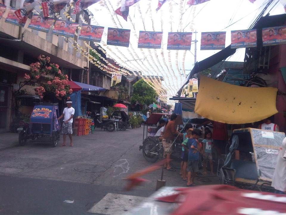
 Some side streets appear to have dead ends like this one with a house in the middle of the road. In some cases, there are basketball courts or tents set-up for wakes in the middle of the streets. More illegal campaign materials by local politicians running for office in Manila are shown in the photo.
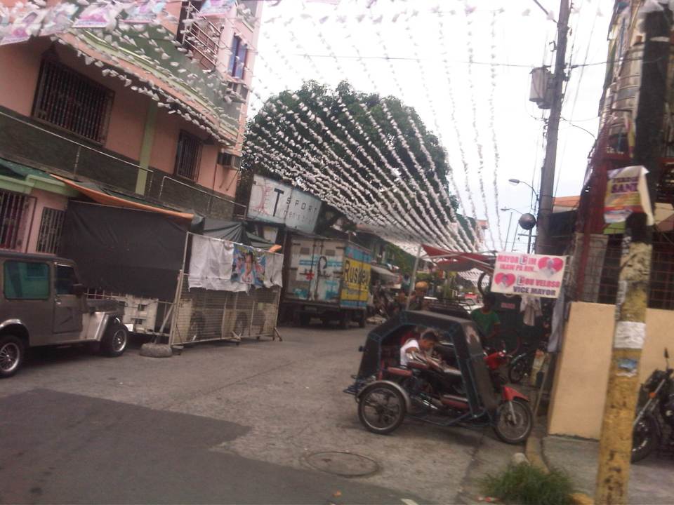
 Another side street but with less vehicles parked along the road. Many residents are affluent enough to own vehicles but have no garages. The city tolerates on-street parking but not just for local roads like this one but even along major thoroughfares!
 There’s not a few eateries, stores and other establishments along this street. Most if not all of these establishments take up road space for tables and supplies (like the soft drink cases in the photo). Among their customers are workers and pedicab drivers who park their vehicles on the road.
 Along this street, some residents have allotted space for makeshift garages or extensions of their buildings. These can be in the form of tents or steel partitions that act to secure a vehicle.
 A look at the PNR tracks from Tayuman Street downstream is in the general direction of Caloocan (part of what was Main Line North). The building on the right is a TESDA facility.
Coming soon: the streets of Intramuros.
–
Luzon Avenue Flyover
The Luzon Avenue flyover spanning the width of Commonwealth Avenue is now open to two way traffic. Previously, only the northbound side was open, allowing vehicles to cross Commonwealth from Tandang Sora Ave./Katipunan Ave. to Luzon Ave. and towards Congressional Avenue. I took a few photos of the flyover and the vicinity of Luzon Avenue en route to NLEX a few days ago.
 The Luzon Avenue flyover has a total of 4 lanes, divided by a median island.
 The lamp posts indicate a well lighted road during night time. The pedestrian walkways on either side are quite narrow and I think the designers of the flyover could have widened this feature of the facility.
 A view of Commonwealth Avenue from the flyover.
 Along the other end of the flyover is Luzon Avenue, which has been widened to accommodate the flyover and the at-grade sections connecting to the QMC-bound side of Commonwealth Avenue.
 A pedestrian overpass was constructed at the foot of the Luzon Ave. flyover so pedestrians will not cross at this critical part of the flyover when vehicles would typically be picking up speed as they descend (or ascend on the other side) the flyover. There are still construction work along the northbound side of Luzon Avenue.
 Luzon Avenue, which is a 6-lane, 2-way road divided by a median, is quite crowded with either side of the road occupied mostly by informal settlers. There is also an informal wet market (talipapa) along the road.
 The pavement is elevated compared to the land on either side of the road. There are stores and shops set up by those living along the road.
 Side streets are narrow and could probably accommodate only cars or small vehicles like tricycles (also shown in the photo traveling along Luzon Ave.
 Some stalls are just along the street like this fruit stand that’s already on the carriageway. The photo also shows a better view of a side street with parked vehicles along one side of the road.
 Approach to Congressional Avenue – there is another pedestrian overpass near the junction with Congressional. Note the height of the plant box on the median that is designed to discourage or minimize jaywalking across Luzon Ave.
 Water works at the junction of Luzon Ave. and Congressional Ave. Luzon Ave. continues as a narrow 2-lane street towards the direction of Bgy. Holy Spirit.
–
Rizal Avenue – Part 2: Tayuman to Pampanga Street
In the last post on Rizal Avenue, the featured photos show conditions under the LRT Line 1, which included visual evidence of certain issues like on-street parking, poor lighting and even sanitation (i.e., garbage) along the corridor. This post features more of the same and perhaps worse in some cases that are used as proof of the blight caused in part by the LRT superstructure. I say in part because LRT Line 1 is not wholly to blame for problems under and around it. Local governments and the private sector share responsibility for the decline of the areas within the direct influence of the rail line. Napabayaan. But of course, this does not absolve proponents of the LRT Line 1 for poor station design.
 Approach to Tayuman Station along the northbound side of Rizal Avenue.
 Tayuman Station – shown in the upper part of the photo is one end of the northbound platform.
 Underneath the station, jeepneys clog the lanes as they load/unload passengers. LRT Line 1 stations are poorly designed for intermodal transfers (e.g., LRT to jeepney, LRT to bus, etc.).
 Tayuman Road is a busy street in Manila that’s served by jeepneys connecting to major streets like Lacson Avenue to the east and Abad Santos and Juan Luna to the west. The photo shows a view to the east of the LRT Tayuman Station.
 Approach to the junction with Herrera Street
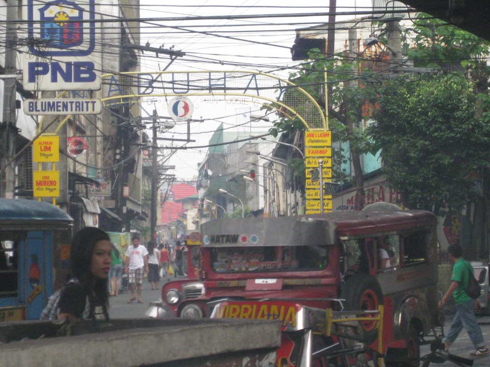
 Approach to Blumentritt Station – the station is named after Ferdinand Blumentritt, an Austrian who was a close friend of the national hero Jose Rizal. The street leads to a large public market close to the station (near the intersection) that is also named after the fellow and one of the more crowded markets in the metropolis. There are many jeepney lines with Blumentritt as part of their routes.
 Birds and other creatures being sold as pets around Blumentritt – many have been painted to attract children and other buyers curious at the colored birds.
 Vendors line the Rizal Avenue, Blumentritt and the other side streets in the area, which is usually crowded no matter what day of the week it is.
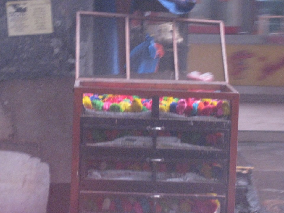 Angry birds? A closer look reveals the birds as chicken chicks colored by the vendors to attract interest. Sadly, many of these do not survive to become full grown chickens and children (and adults) will be disappointed to discover later that the color comes off pretty quick when the chicks come in contact with water.
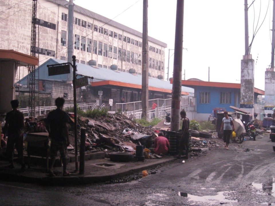 There is a PNR Blumentritt Station and unless there’s been some radical clean-up of the area, this is pretty much what you’d see around the station – garbage, dirt, informal settlers and other characters. The building behind the station is a public school.
 The PNR Blumentritt Station has two platforms on either side of the double track. Security is quite lax and people, including children, cross the tracks freely. Fortunately, train service frequencies are quite low (about 1 per hour) so the risk of getting hit by a train is also low. The photo shows the view to the east of Rizal Avenue.
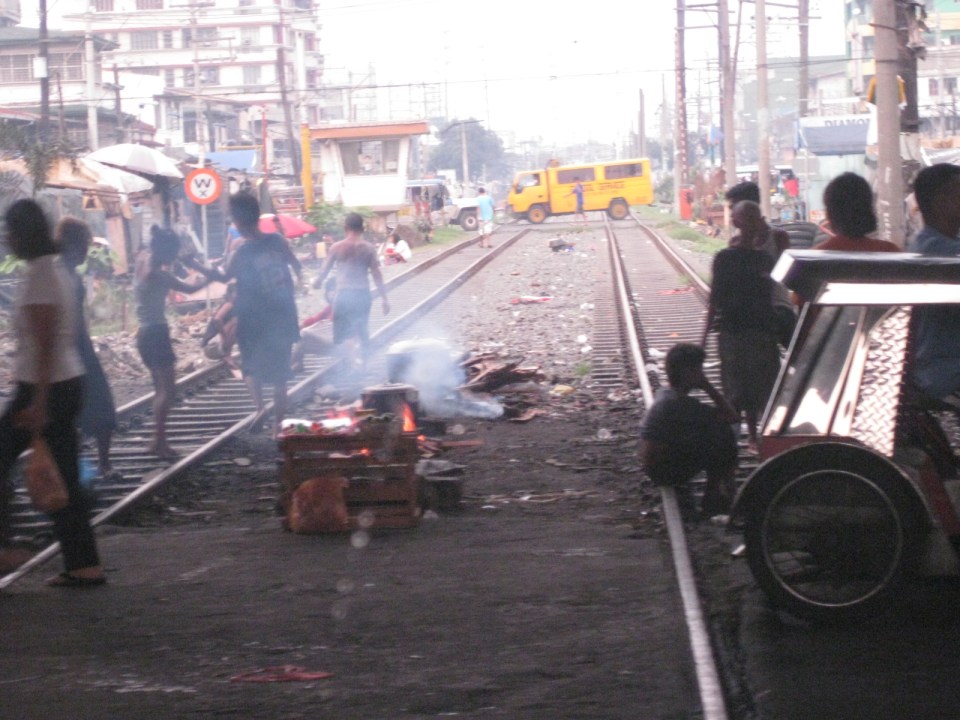 On the left side of Rizal Avenue is a scene where people are oblivious to the railways with some even doing their cooking between the tracks.
 Blumentritt Avenue is a very crowded street with a public school (building at right) just across the public market (at left). There are many vendors lined along the street and people as just about everywhere and without regard to vehicular traffic.
 Traffic congestion along Rizal Avenue is attributed mainly to the market and median barriers were constructed to reduce pedestrian crossings anywhere along the road. Commercial establishments line either side of Rizal Avenue, basically contributing to congestion in the area.
 Commercial establishments plus customers plus paratransit equal to traffic congestion
 16A busy side street in the Blumentritt area – there are no sidewalks so pedestrians and motor vehicles mix it up along the road.
 Bulacan Street serves as an informal terminal for jeepneys. The road appears to be newly paved but there are no sidewalks and tents are found along the road often bearing the names of politicians sponsoring the tents for various purposes such as wakes and parties.
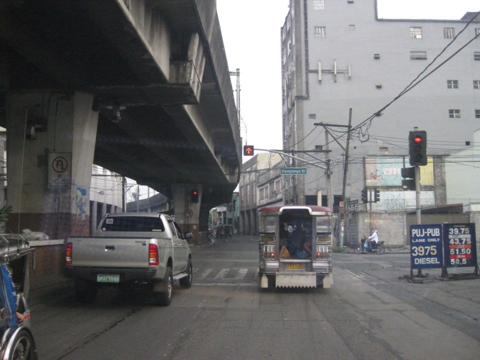 Intersection with Pampanga Street, just before Rizal Avenue and the LRT line turns towards Aurora Boulevard and proceed to Caloocan City and Monumento.
More on Rizal Avenue in future post…
–
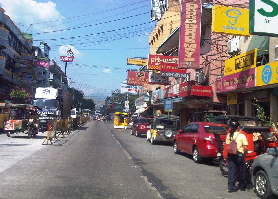
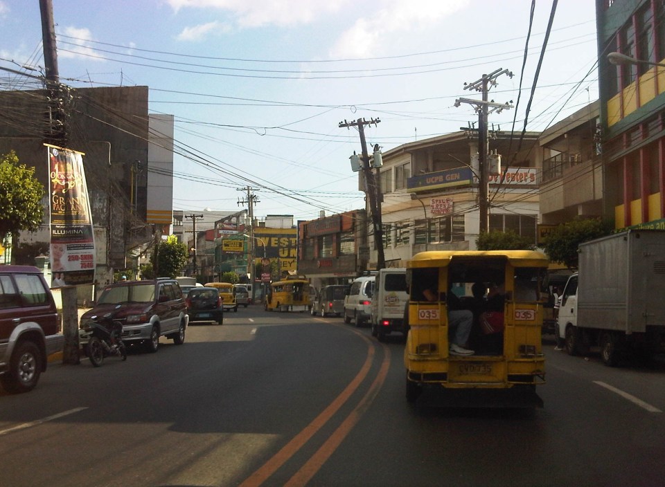
Streets of Olongapo: Rizal Avenue
Olongapo City is located in the Province of Zambales, the only city in that province, and beside the Subic Freeport. It is a pioneer in public transport service innovations in the form of the first initiative on the color-coding of jeepneys according to their routes. Despite what seemed to be forever being linked to the Freeport in terms of economic development, the city has enjoyed continued growth and is currently experiencing more challenges attributed to this growth. Among these challenges are those pertaining to traffic congestion and public transport services for the city. A Transportation and Traffic Management Plan Study was conducted by UP Diliman through the National Center for Transportation Studies and is up for formal adoption of the city.
Following are photos taken along the city’s main street, Rizal Avenue, where many of the city’s transport and traffic problems are manifested.
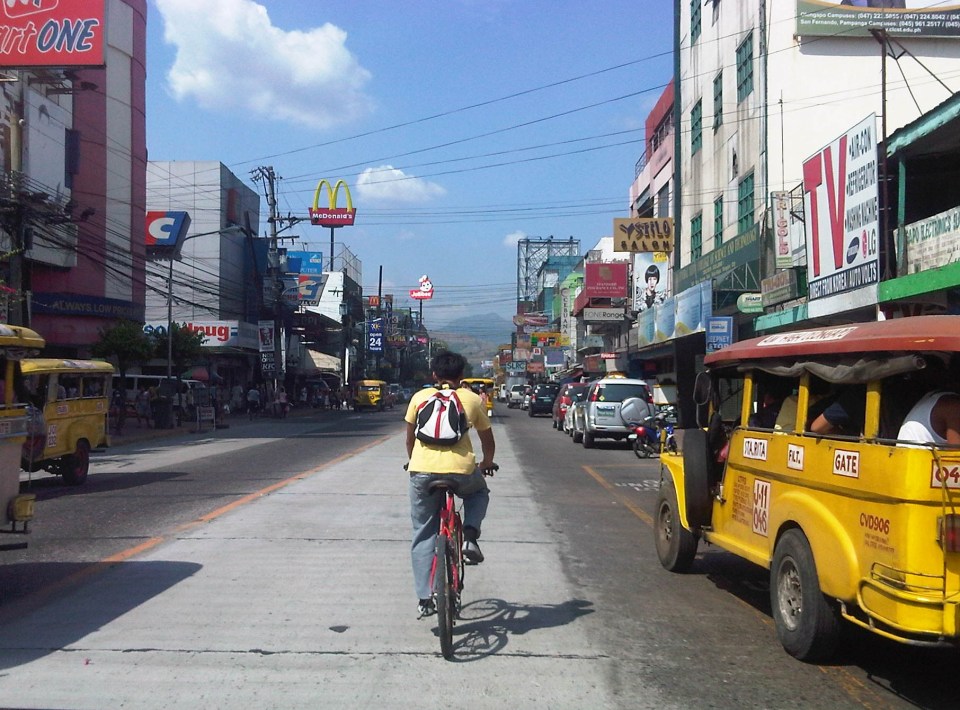 Cyclist pedaling along Rizal Avenue beside a yellow jeepney taking passengers at the designated stop at curbside. Downstream are parked vehicles along the road.
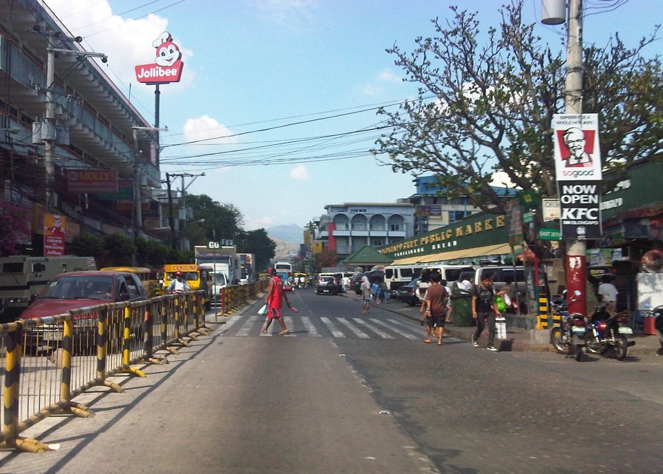
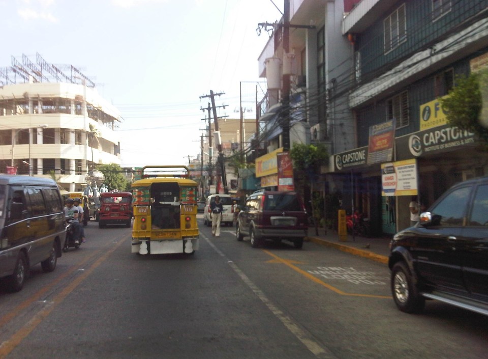
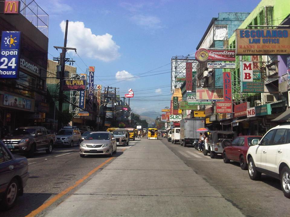 More parked vehicles at either side of Rizal Avenue effectively reducing road capacity for the 4-lane street.
 On-street parking is a problem for the city as there are few, if any, off-street parking facilities in the city. On-street parking turnover is quite low since many of the parked vehicles are not clients or customers but establishment owners or managers.
 Most of Rizal Avenue is undivided but there are median barriers along the section in front of the public market to reduce jaywalking among pedestrians.
 The section in front of city hall – just across are many commercial establishments and on-street parking.
 Another view of the Rizal Avenue, this time along the westbound side, with the the market on the left side. The yellow jeepneys are quite conspicuous and remind me of the UP Ikot jeepneys.
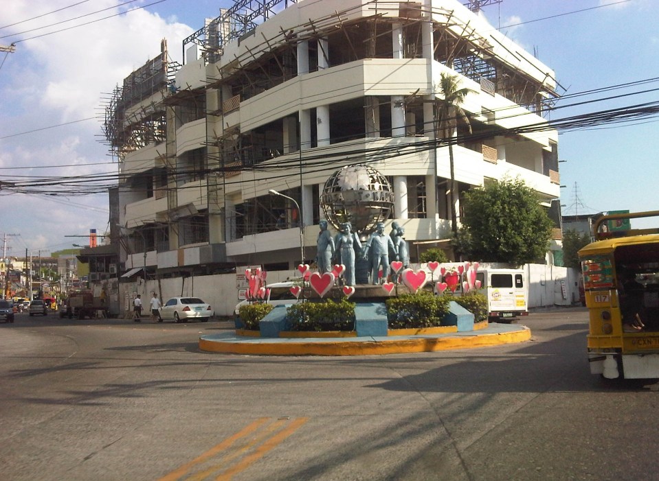
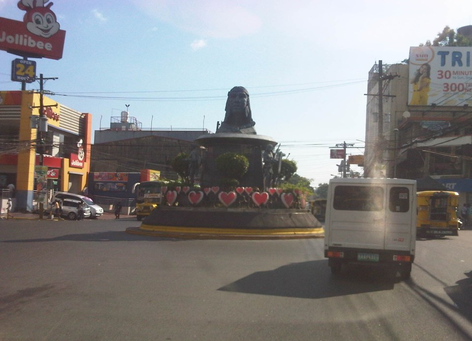 A monument to the Ulo ng Apo, from which the name of the city is said to be derived from, is right in the middle of a rotunda at a major intersection along Rizal Avenue. Around the rotunda are commercial establishments and a major provincial bus terminal.
 There are designated stops for jeepneys along the avenue but these are often crowded out by parked vehicles. As a result, jeepneys could not maneuver properly and end up unloading/loading passengers in the middle of the road.
 On-street parking along curves tend to impede the flow of traffic. There are also issues where electric posts like the one shown in the photo have not been transferred, posing risks to vehicular traffic.
 Another example of a designated jeepney stop along the avenue where parked vehicles constrict maneuvering space for jeepneys.
 A monument to the volunteers of Olongapo during the Mt. Pinatubo episode after the closure of the U.S. Naval Base in what is now a Freeport. I wonder if the building under construction in the photo has enough parking spaces for the traffic it generates.
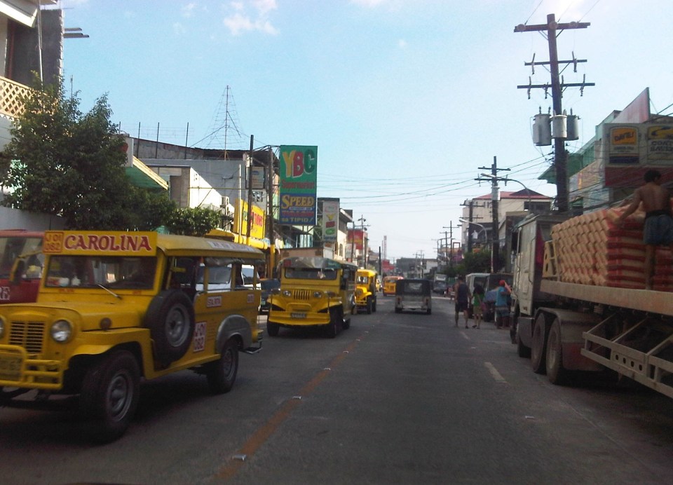 More jeepneys and more on-street parking – there is a perception that there are too many (oversupply) of jeepneys. Note though that most PUJs in Olongapo are not the bigger 20 to 24 seater jeepneys we see in Metro Manila but the older, 16 to 18 seaters like the ones shown in the photo.
 Some on-street parking spaces are “reserved” by establishments. I didn’t mention that on-street parking is free of charge and such situation probably encourages longer parking durations. Perhaps the city should seriously consider parking fees to reduce long-term parking and ensure smoother flow of traffic along its streets. There are examples of these parking schemes in other cities including Makati City that Olongapo can adopt and adjust.
–
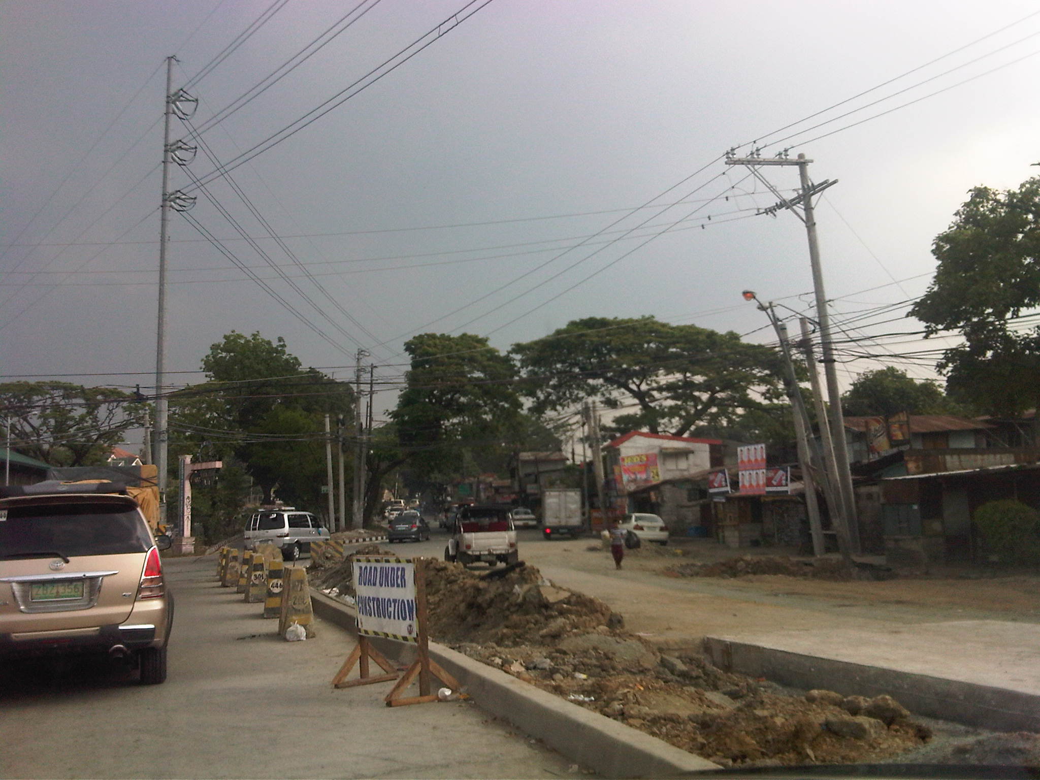
Tandang Sora Avenue road widening
The stretch of Tandang Sora Avenue between Commonwealth Avenue (Luzon Avenue Flyover) and Capitol Hills Drive is currently being widened as part of the Luzon Avenue project. Work here has been delayed by not a few glitches including the issues regarding the right-of-way acquisition. This area used to be home to a lot of informal settlers, including many who have lived in the area for decades as they were tolerated by the land owners. Many had to be relocated and were compensated to give way to the section of Tandang Sora that connects to the also unfinished Luzon Avenue.
The following photos were from a month ago when work was still ongoing along the southbound side of the road. This southbound side is actually the old 2-lane, 2-way section of Tandang Sora that was rehabilitated following completion of work on the expansion northbound lanes.
 Heavy equipment are everywhere along the section like the roller (pison) on the right side of the photo working on base layer of the pavement. The concrete barriers are used to prevent vehicles from entering the work zone.
 Both northbound and southbound traffic were using the northbound side of the road. The median island separating NB and SB sides of the the road is shown in the photo. The building on the right is actually a condemned structure.
 Concrete pavement has been laid out along the SB lanes but was still undergoing curing.
 Approach to the intersection with Capitol Hills Drive
Yesterday, I was able to take a few photos of the same section and found that the rehabilitated southbound lanes were already usable to traffic.
 Tandang Sora junction with Luzon Avenue
 Newly opened southbound lanes – 3 lanes are of PCCP but there are still construction work ongoing including drainage and sidewalk construction.
 Sidewalk and median barriers are in various stages of construction along the section. I think they built barriers to anticipate problems regarding jaywalking.
 Approach to the intersection with Capitol Hill Drive – one problem that needs to be solved along Tandang Sora is roadside parking. Informal settlers who own vehicles park these along the road. There are also stores, eateries and vehicle repair shops along the section that occupy sidewalks and encourage parking by customers.
Once the section is completed and with the future completion of Luzon Avenue, it is expected that traffic will increase along this section. The improved capacity of the road is also expected to ease traffic along the Capitol Hills Driver-Zuzuaregi Street route, which has become congested due to vehicles traveling between Commonwealth and C-5 whose drivers want to bypass the usually constricted Tandang Sora section.
–
Daily penance: traffic congestion along C-5
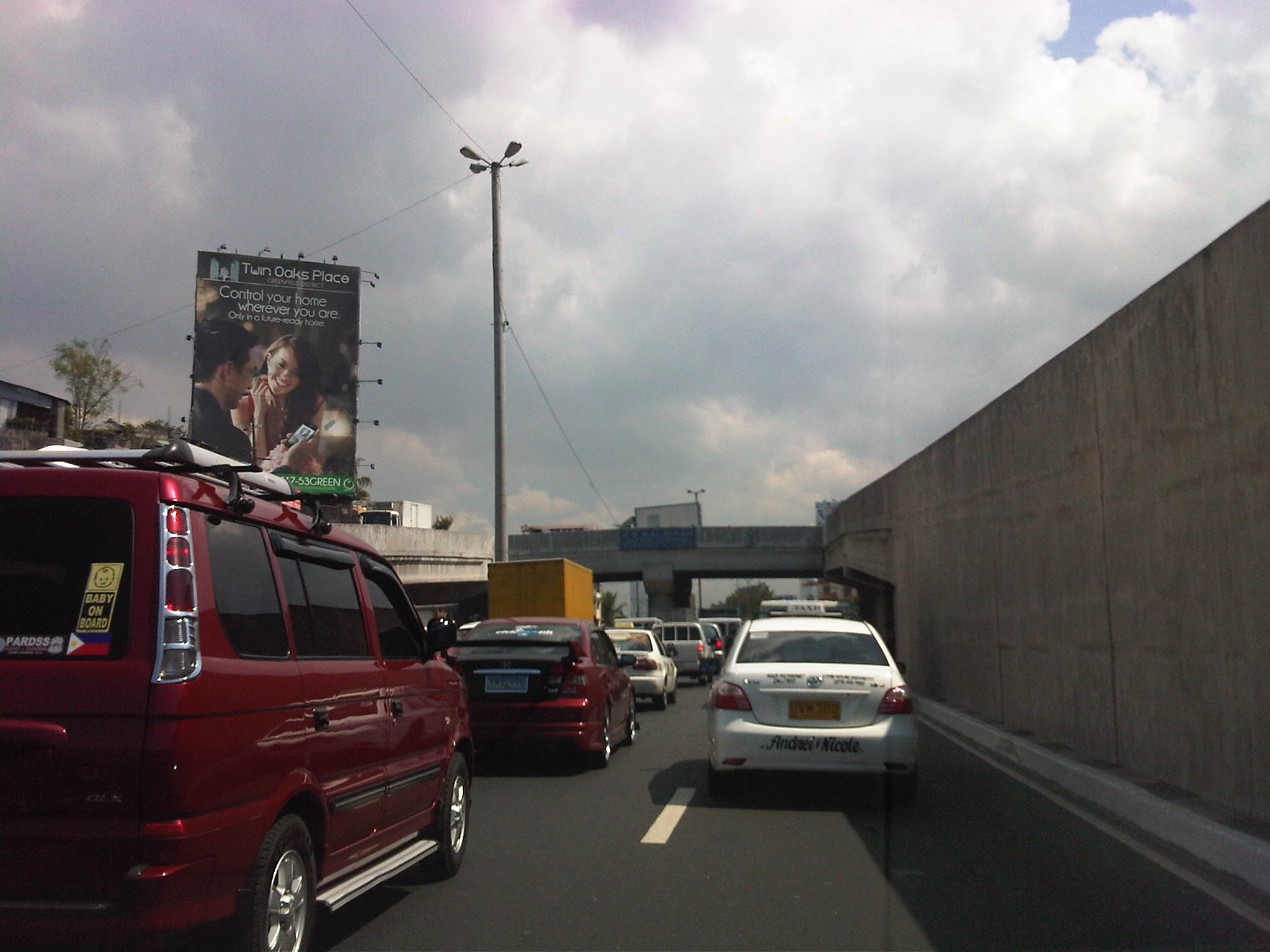
People have been telling me about the traffic congestion along Circumferential Road 5 (C-5) and I am quick to reply that I know the feeling as I’m one of those who have driven or traveled along C-5 and experienced first hand the traffic congestion, which is worst during the mornings (southbound) and late afternoons and evenings (northbound). Midday traffic jams are not uncommon as C-5 is a truck route and large vehicles contribute to clogging especially at bottlenecks like the U-turns slots along the highway and bridge crossing the Pasig River. C-5 has been this way since its opening (or more appropriately the completion of missing links along the main alignment).
It will not get better. It will only get worse. I say so because of the annual increase in vehicle ownership, including motorcycles, in what is now termed as Mega Manila. I dare say so because of the backlog of public transport infrastructure in the metropolis (or megalopolis?). It is well established that efficient public transport infra and services are good incentives for people to commute rather than drive. This means there will be less vehicles on the road and therefore there will be less congestion as basically only those who really need to drive would be using their cars on a regular basis. Of course, it is not as easy at it seems considering trip making and mode choices are in reality complicated matters. But then the availability of viable, acceptable choices for travel, especially in the urban setting allows for people to have better mobility and more equitable use of the transport system than a car-oriented city. Until then, when we do have the public transport system that our cities require, it will be a daily penitensya for many of us traveling and not just along C-5.
 Congestion along the southbound side of C-5 approaching the flyover crossing Ortigas Ave. The flyover can be seen in the horizon.
 Congestion along C-5 southbound in the Bo. Ugong area approaching the junction with Lanuza Avenue. An overpass was proposed for construction along this section but now it doesn’t look like it will do any good considering the bottleneck is the Pasig Flyover and the bridge across Pasig River.
 Congestion along C-5 southbound at the Pasig flyover. The flyover has 2 lanes per direction and vehicle breakdowns or road crashes have resulted in terrible traffic jams.
 Congestion along C-5 northbound at the C-5/Kalayaan junction. The north U-turn flyover, one of two in the area, is shown in the photo. An underpass was initially proposed, designed and approved (with budget from a JBIC loan) at the junction. A previous MMDA Chair, however, didn’t agree and successfully maneuvered for the twin U-turn flyovers to be constructed instead.
–
Rizal Avenue – Part 1: Carriedo – Bambang
Rizal Avenue stretches from Manila northward to Caloocan city from Carriedo to Monumento. What used to be one of the more cosmopolitan streets in Manila was transformed (some say blighted) by the construction of the elevated LRT Line in the early 1980’s. Carriedo, for example, used to be a popular shopping street along with Escolta. Those were times when there were none of the huge shopping malls now scattered in Metro Manila and people came to Manila to shop.
The following photos were taken while we traversed Rizal Avenue as part of a recon we were conducting for a project with the Department of Transportation and Communications (DOTC) back in 2011. I’m not sure if there have been any significant changes along Rizal Avenue and I am not aware of any recent programs to improve conditions under the LRT Line 1.
 Approaching the LRT Line 1 Carriedo Station from the McArthur Bridge
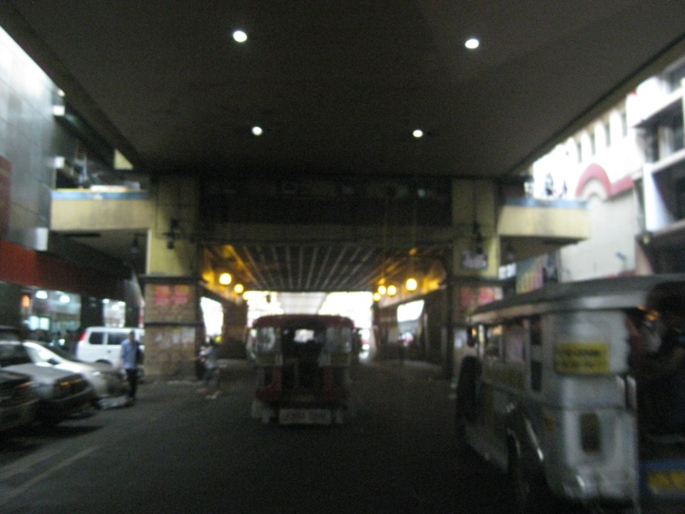 Under Carriedo Station, one experiences first-hand what people have been saying about the area being blighted by the LRT 1 structure
 Poorly lighted? It was broad daylight outdoors when we conducted the recon but underneath an LRT 1 Station it can get quite dark. Of course, aside from the need to improve illumination, perhaps authorities can also improve the environment including the cleanliness of the area under the station. A common complaint is garbage and there are those saying the area smells of piss (i.e., mapanghi).
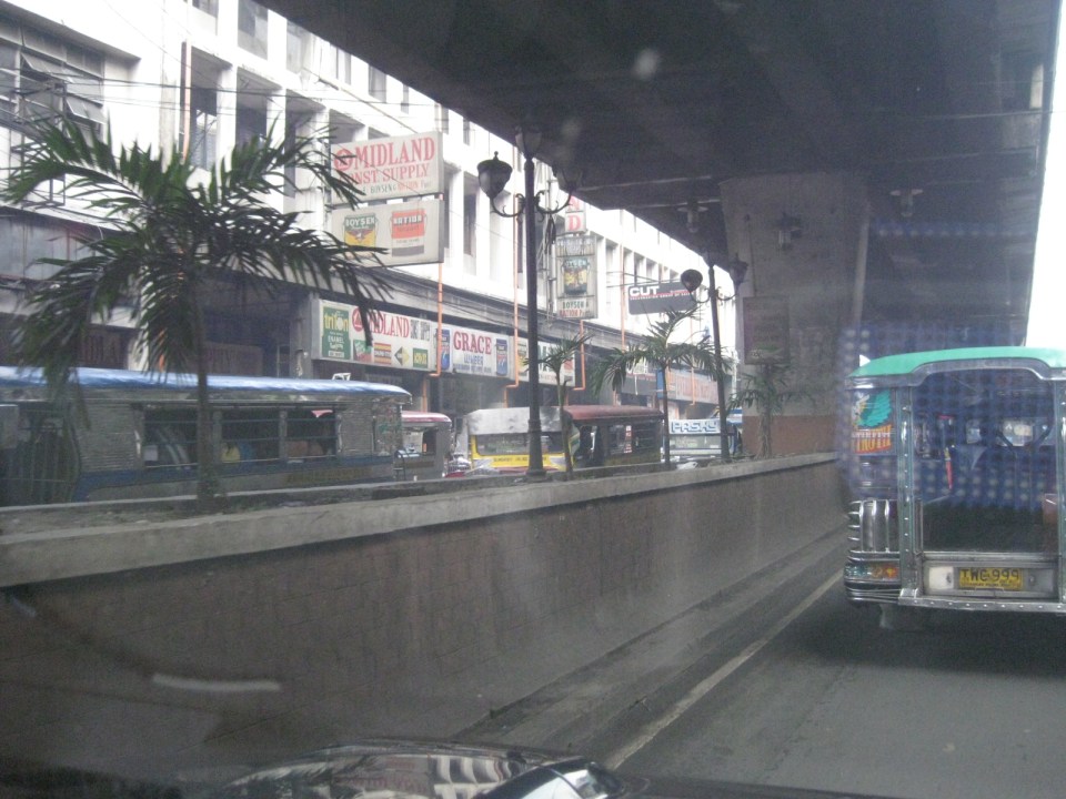
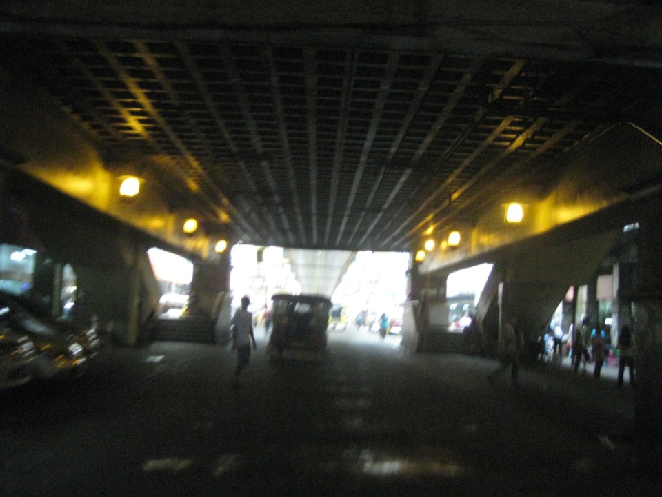
 Past Carriedo Station, it was brighter and perhaps the area can be developed so that stretches can be pedestrian friendly. Maybe there should also be restrictions on vehicle parking, which tends to make the area look congested. It would be good to have a strategically located multilevel facility in the area where most vehicles can park instead of along the streets as shown in the photo.
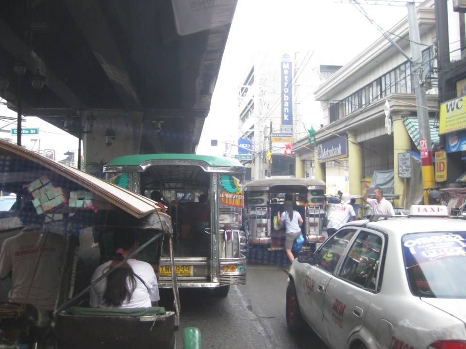
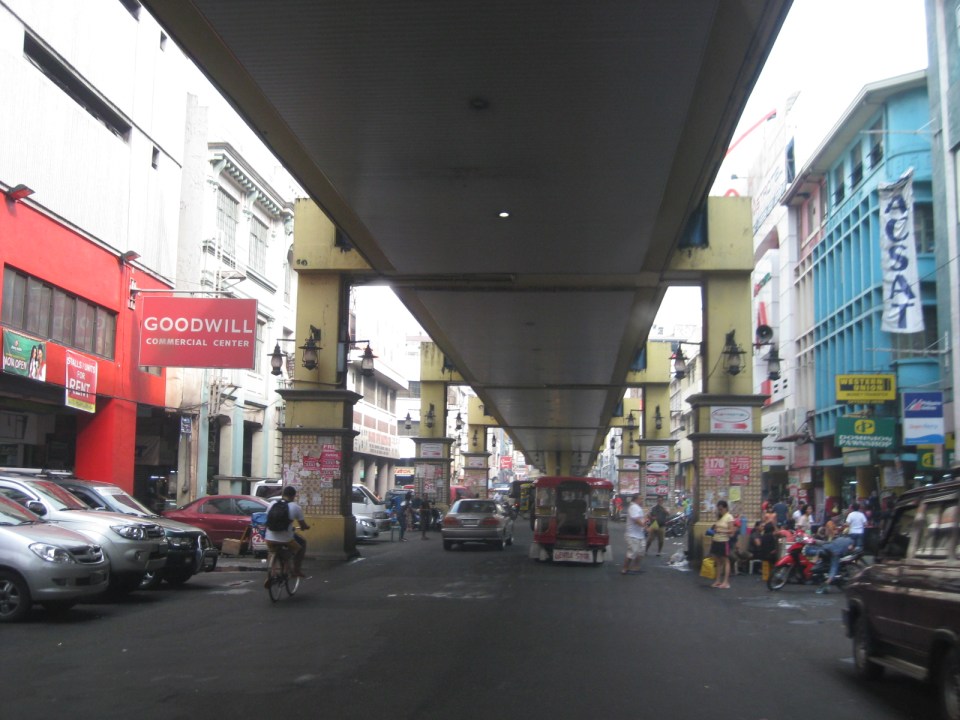
 5More roadside parking plus the presence of tricycles contribute to traffic congestion in the area. People are everywhere walking and crossing anywhere. The arcades where they are supposed to walk along are mainly occupied by vendors or merchandise of stores/shops occupying the ground floors of the buildings along the street.
 Each side of Rizal Avenue is surprisingly wide with 3 lanes per direction. One lane is effectively used for on-street parking while the other two are for general traffic. There are no lane markings at the time we passed by the area so there can be confusion as to lane assignments.
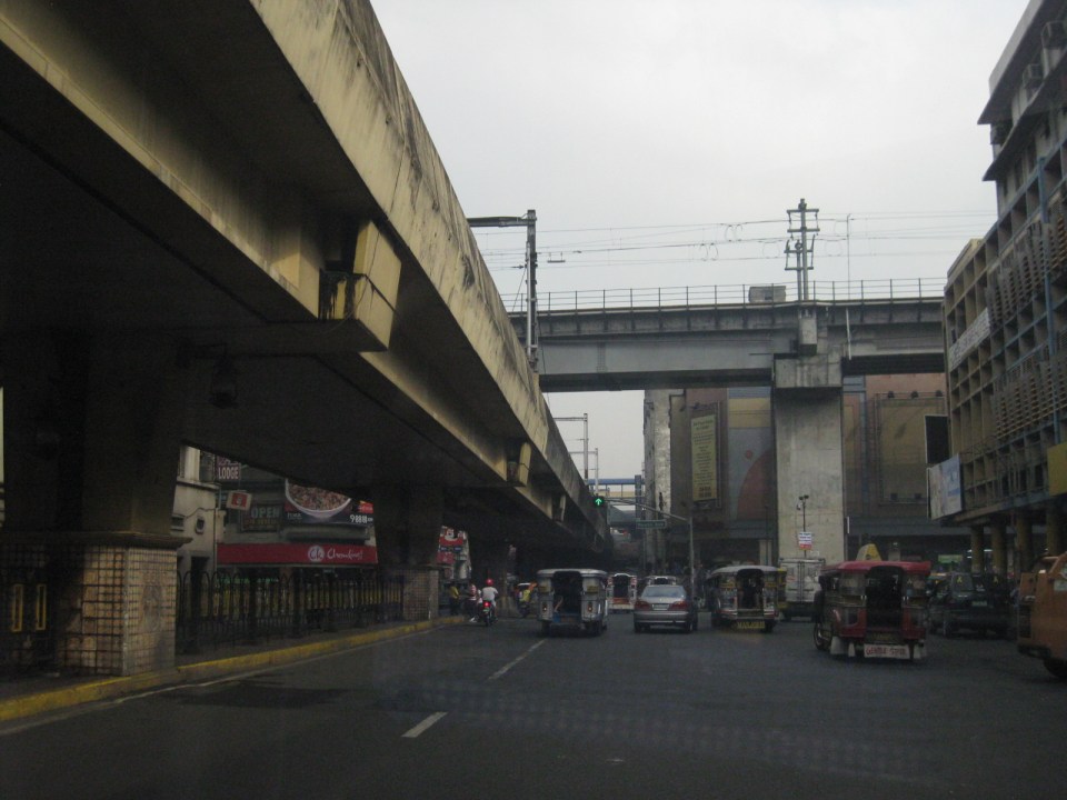 Approach to the junction with Recto Ave. and the LRT Line 2, which is also elevated and at the 3rd level as shown in the photo.
 Rizal Ave.-Recto Ave. intersection – visible downstream in the photo is Doroteo Jose Station
 Provincial bus terminal between Doroteo Jose and Bambang Stations
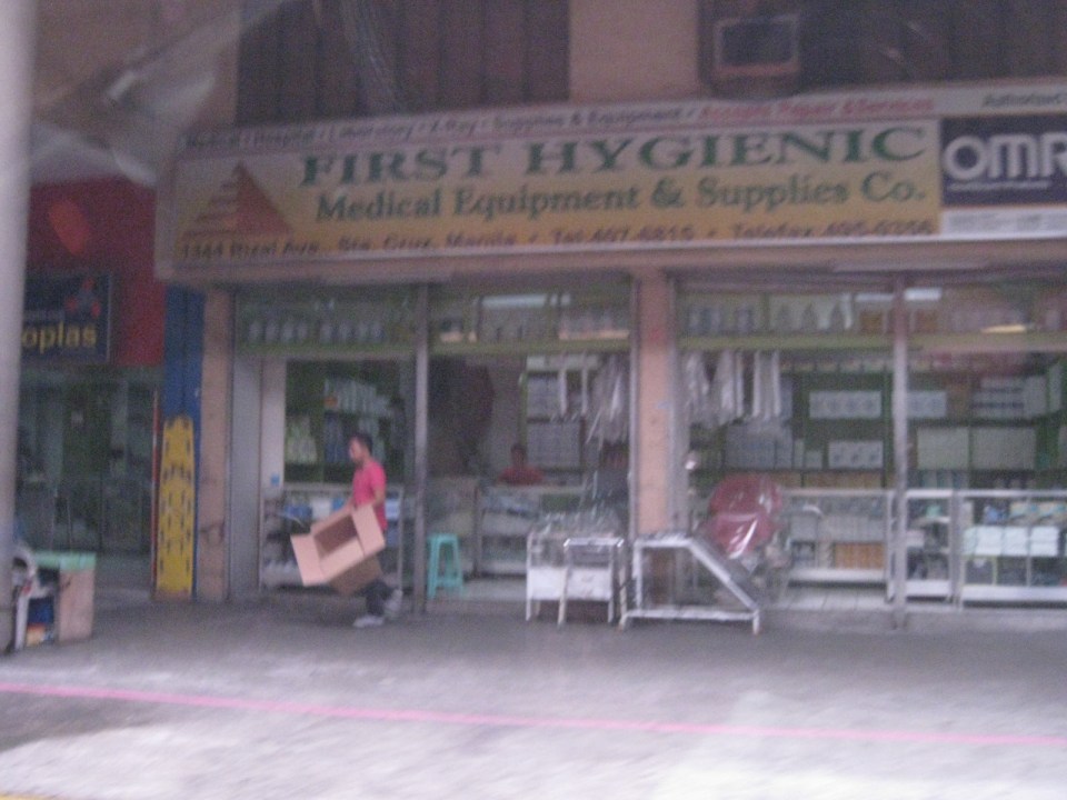 The Sta. Cruz district and particularly the Bambang area is well-known for shops selling medical equipment and supplies. Medical, nursing and other students of allied medical professions as well as professionals come to Bambang to purchase equipment and supplies from these shops, which offer items at lower prices.
 LRT 1 Bambang Station
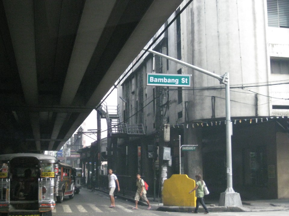 Rizal Ave.-Bambang St. intersection beneath the station
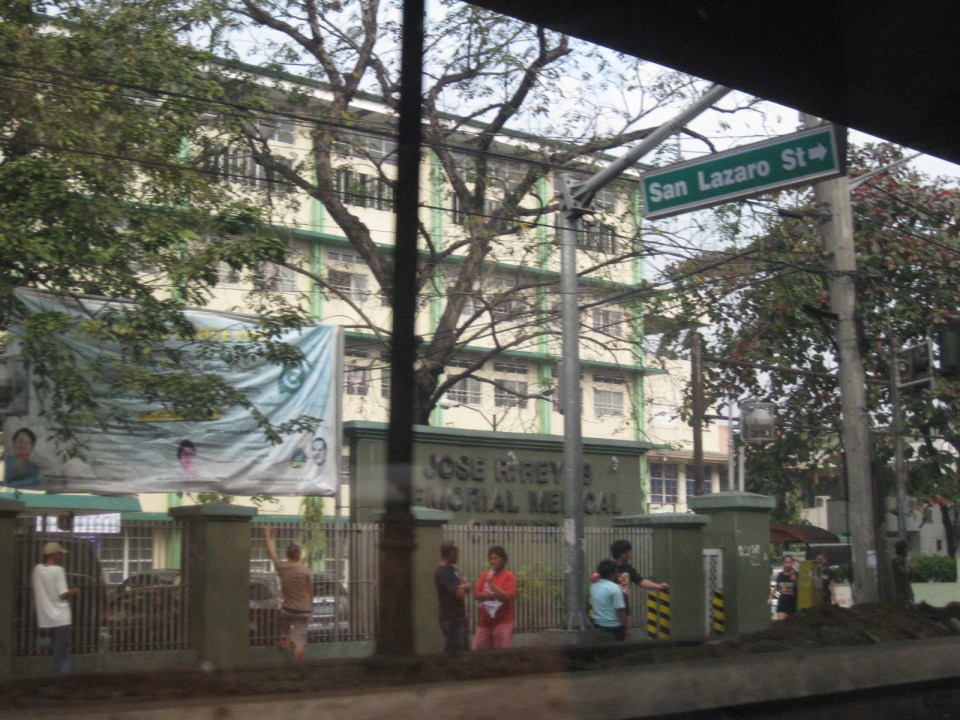 Two large government hospitals are located in the area between Bambang Station and Tayuman Station – San Lazaro Hospital and Jose Reyes Memorial Medical Center. Both are run by the Department of Health (DOH), which is located beside Jose Reyes.
–
Highway 2000 and Barkadahan Bridge
There is an alternate route from the towns of Rizal Province to Taguig and Makati. The route will allow people to avoid the congested Ortigas Avenue, C-5 and EDSA, which is the typical route between the Makati CBD and Bonifacio Global City and the Rizal Province towns along Ortigas Avenue Extension and the Manila East Road including Cainta, Taytay, Antipolo, Angono and Binangonan. The alternate route utilizes a road that was constructed as part of a network of roads intended to encourage development in idle lands in Taytay that came out of the reclamation that was part of the Manggahan Floodway project.
 One-way section beside the Taytay Public Market
 Parts of the market were under renovation
 Past the market, Highway 2000 becomes a 2-way road. There are no lane markings and the pavement shown in the photo indicates a poorly maintained road.
 Along the road are subdivisions, a few commercial establishments, a columbarium under construction, informal settlers and much open space.
 Junction with the Manggahan East Bank Road and approach to the Barkadahan Bridge
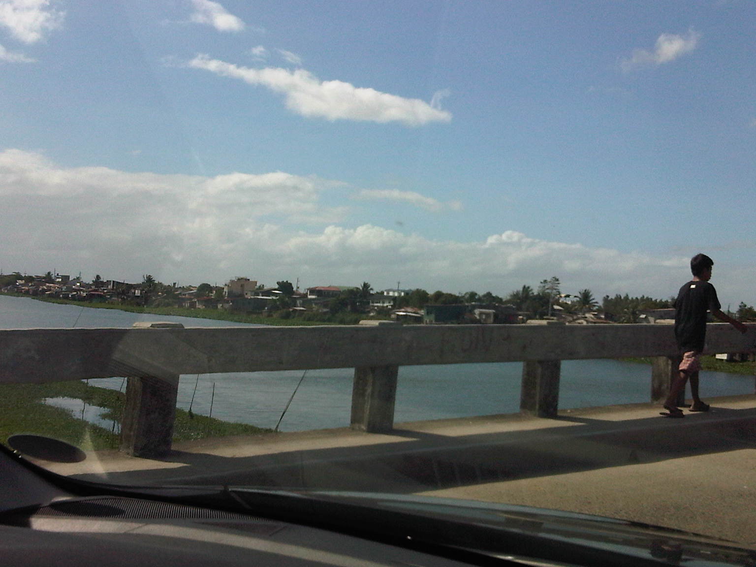
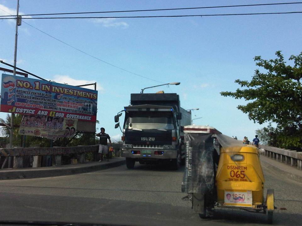 Crossing the East Bank Road to the 2-lane Barkadahan Bridge, you can immediately notice the narrow sidewalks along each side of the bridge. I think they should have designed this to be wider considering the significant number of people crossing the bridge on foot.
 One can have a good view of the southernmost end of the Manggahan Floodway from the bridge.
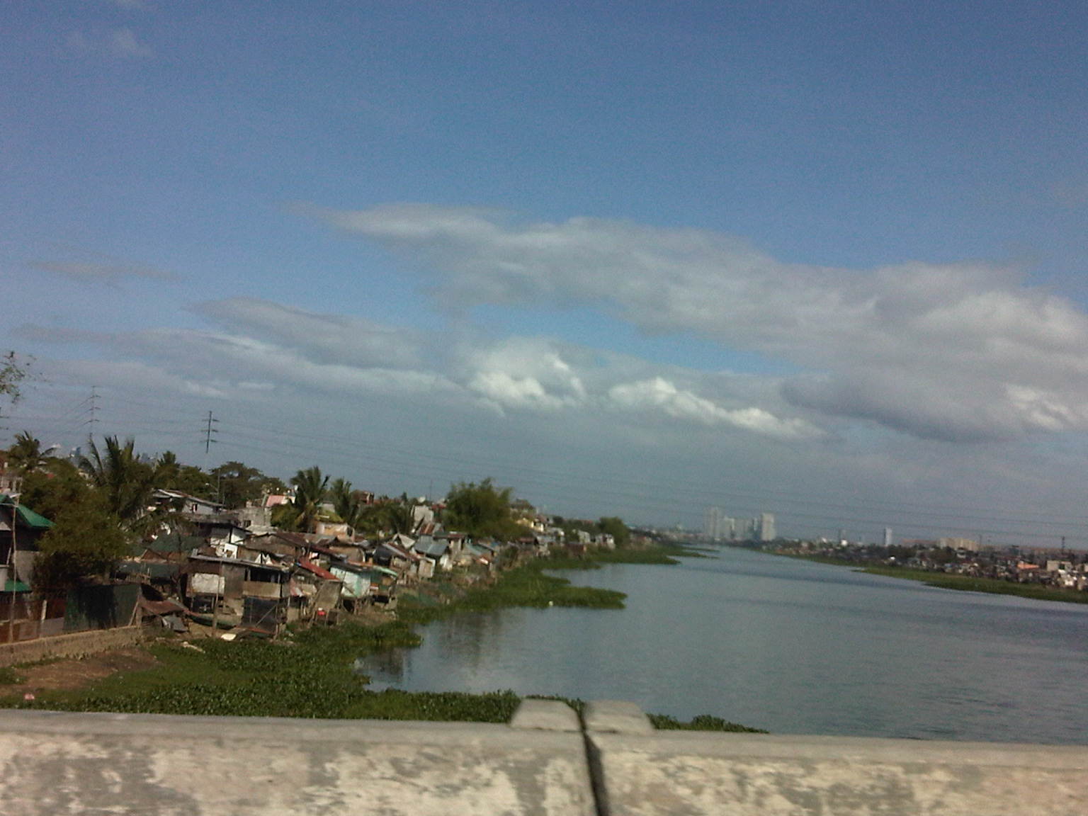
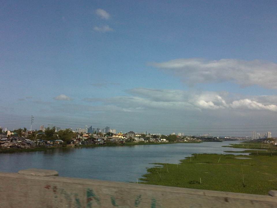 The view shows a lot of informal settlers along both the west and east banks of the floodway and a lot of water lily and kangkong on the waters, which lead to the Laguna de Bay.
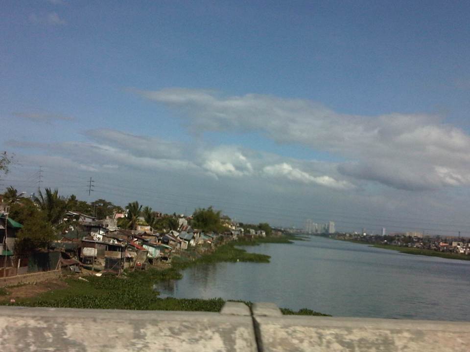 Shanties along the west bank of the floodway. The tall buildings in the horizon and downstream from the bridge are located in Quezon City’s Eastwood along Circumferential Road 5. Behind Eastwood is the Marikina River, which connects to the Manggahan Floodway via the Rosario Weir.
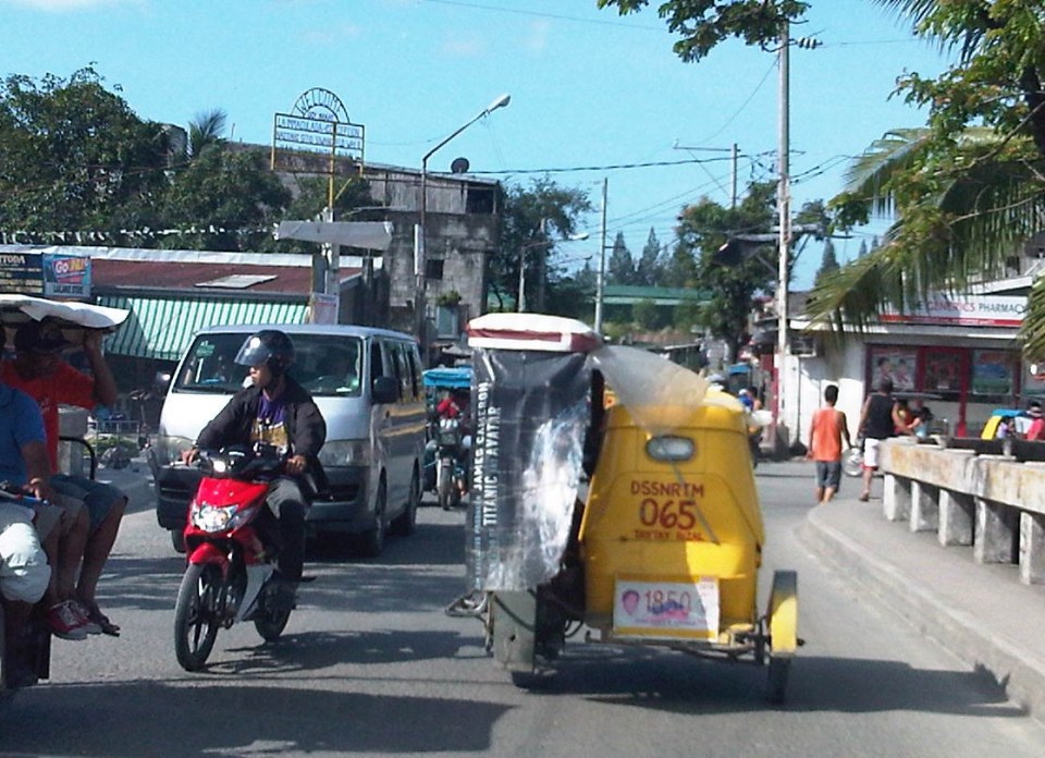 The other end of the Barkadahan Bridge is a junction with the Manggahan West Bank Road and a generally residential area that is still part of Taytay, Rizal.
The same route can also be used by those residing in Pasig and Marikina cities to the east of the Manggahan Floodway as there is a direct connection to Highway 2000 and the Barkadahan Bridge via the East Bank Road of the Floodway.
–
