
Home » Highways and Streets (Page 6)
Category Archives: Highways and Streets
Bike lane master plan for Metro Manila, Metro Cebu and Metro Davao
The Department of Transportation (DOTr) with support from the United Nations Development Program (UNDP) yesterday formally launched the Bike Lane Master Plan for Metro Manila, Metro Cebu and Metro Davao. Yesterday’s event was actually the third and last leg of presentations, which were also made in Cebu and Davao. Here are a few photos I got from the DOTr Facebook page (these are public):
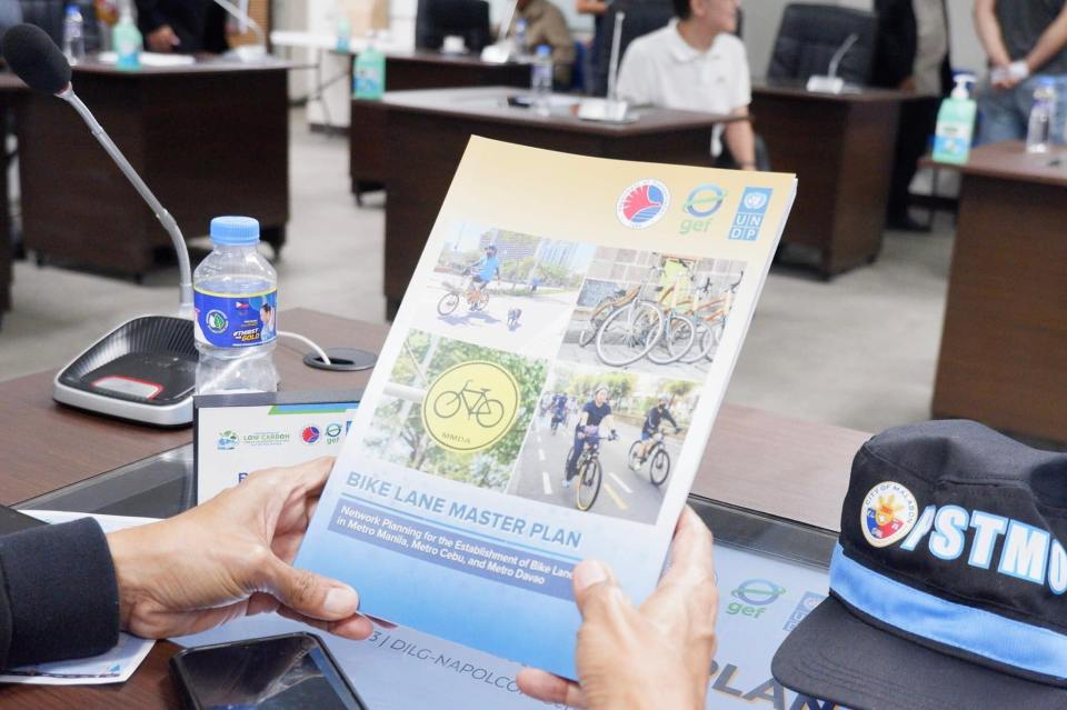 Printed copies of the master plan were distributed to attendees (Photo: DOTr Facebook page)
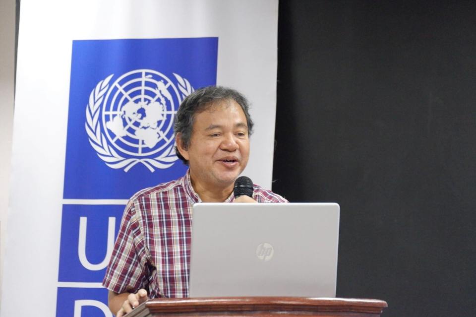 Dr. Ricardo Sigua of the National Center for Transportation Studies presented the highlights or key features of the master plan. The UNDP engaged NCTS to conduct the master planning project for DOTr. (Photo: DOTr Facebook page)
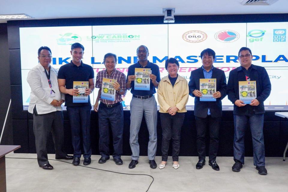 Photo op with participants from the MMDA (Photo: DOTr Facebook page)
While the master plan is most welcome as the country continues to build infrastructure for active transport (mainly walking and cycling), the launch is actually one year late. The project was actually completed last year and though most of the recommendations have yet to be carried out, many items including the inventories are already dated. These master plans though should not be static documents but dynamic in these sense that it would have to be updated regularly. For one, updates would provide the opportunity to reinforce or improve certain aspects of the plan. Updates also provide an opportunity to check whether progress is being made on the targets set in the plan. Also, since the master plan is for three metropolitan areas perhaps it can be part of the foundation for a nationwide plan. However, many plans fail if there is not support or scarce resources allocated for the implementation. Thus, there is a need for resources or allotments especially coming from government to support the realization of the plan.
–
Article share: What’s Incomplete About Complete Streets?
The concept of road diets circulated in Metro Manila more than a decade ago. I recall the Metro Manila Development Authority (MMDA) picked up the concept and attempted to apply it in some parts of Metro Manila. Since there are no evidence of that endeavor surviving now, then we can assume that it was a failure. There is no wonder there as I also recall the effort to be half-hearted and more to get media mileage (cheap talk or lip service) out of it. Road diets eventually evolved into the complete streets (though the literature now will state road diets as part of complete streets). That experience and similar initiatives of varying success (or failure) rates are not unique to the Metro Manila but is actually happening elsewhere including cities in countries where the complete streets have been applied more comprehensively and yet somehow found to be lacking or not as effective a solution as expected. I am sharing an article here that discusses what seems to be lacking or ‘incomplete’ as it is referred to.
Source: What’s Incomplete About Complete Streets?
Quoting from the article:
“What’s missing? First of all, even the best Complete Streets policy can’t solve the problem of fiscal scarcity. Even in a city committed to Complete Streets, street redesign must fight for public dollars with other worthy goals such as education and public safety. As a result, Indianapolis’s improvements are a drop in the bucket. The city maintains 3,400 miles of streets and roads, so its 100 miles of bike lanes affect only 3 percent of the city. Similarly, 2,000 miles of the city’s roads still lack sidewalks.
Second, the quantitative benchmarks seem to focus on sidewalks and bike lanes (Sec. 431-806), and the policy doesn’t mention traffic calming or similar policies. So if the city had a six-lane road with traffic going 60 miles per hour, the Complete Streets policy would not affect that road except to the extent necessary to build a sidewalk or a bike lane.** Thus, even the best Complete Streets policies don’t really address some of the most dangerous features of American street design.”
—
Counting cars: ideal vantage points for intersections and elevated highways
The weekend found us staying at a hotel in Makati in order to be near the recital venue for our daughter. Our room afforded a nice view of the surrounding areas (we were on the 29th floor) but the traffic engineer in me gave in to the temptation to take photos of a major intersection nearby – the Gil Puyat Avenue – Ayala Avenue intersection. These are two of the most prominent streets in the Makati CBD and strategically located at one corner is the Makati City Central Post Office and a stone’s throw away is the Makati City Central Fire Station. At another corner is the RCBC tower that hosts foreign embassies including the offices of the European Union.
 Intersection of Gil Puyat Avenue (formerly Buendia Avenue) and Ayala Avenue
 A view of the skyway in the distance
The view of the intersection gave some flashbacks to times when I was a student and a young researcher who had to find good vantage points for collecting traffic data particularly for intersections. Aside from the movements and the corresponding counts, the junction configuration can clearly be seen from the top and useful for developing models for analysis. There was a time when we coveted such views for traffic simulation. You can can install a camera so that you can record hours of footage to use for data extraction. The video recording also allowed one to revisit the footage in case there are questions regarding the data. The same videos can also be used for image processing for more automated, even intelligent or smart data collection using computers.
–
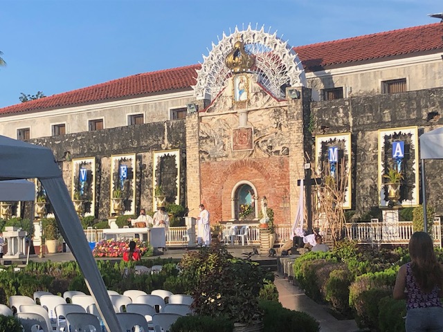
Morning walks in Zamboanga City – Part 3
Part of our walks took us to Fort Pilar and the Shrine of Our Lady of the Pillar. The shrine is originally located within the walls of the Fort, which served as a refuge for citizens when the city was under attack during various times in history. It is near the Paseo so can easily be integrated in our morning walks.
 The Shrine of Our Lady of the Pillar is open/outdoors and there’s a daily early morning Mass
 Instead of candle stands for prayer intentions, there is this trench set-up where you can put your candles and pray nearby.
 The main altar of the shrine apparently faces the sunrise
 Bells at the shrine
 Pigeons just outside the shrine and near the souvenir shops just across from Fort Pilar
 Entrance to Fort Pilar, which is administered by the National Museum of the Philippines
 Plaque describing the fort and its history
More posts on walking in Zamboanga soon!
–
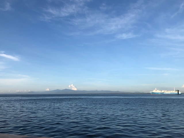
Morning walks in Zamboanga City – Part 2
We took early morning walks in Zamboanga City, when most people are just starting their day. That meant less people and traffic, and one can enjoy the walks without worrying about motor vehicles or crowded streets. A nice route would be from City Hall to Paseo Del Mar and First Pilar and back. This is easily 5,000 to 6,000 steps depending on the variations to the walking route.
 Zamboanga City’s Paseo Del Mar is practically deserted but for a few joggers or walkers around 6:00 AM.
 You can enjoy a walk, jog or run with views of the sea and ships
 The lamps reminded us of similar designs along Roxas Boulevard in Manila and Pasay.
 A view of the port and what used to be the Lantaka Hotel (building at right) from the Paseo Del Mar. During one of the city’s festivals, this area would be the staging ground for colorful vintas.
 This sign for the paseo would likely be a popular photo op spot.
 A potted palm tree and a bench that invites one to sit and enjoy the view
 On a clear day, one can see the island of Sulu
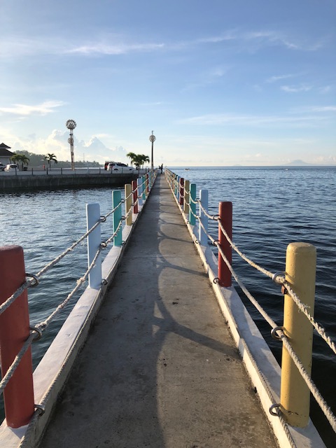 Board walk
 The space is just enough for two people going opposite directions
More photos on walking around Zamboanga City in the next posts!
–
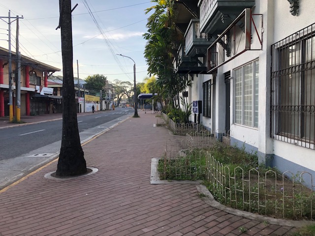
Morning walks in Zamboanga City – Part 1
Before I return to Zamboanga City for another workshop, I wanted to at least post the first of a series about walking in the city. One advantage of staying at a hotel in downtown is that it is close to the parks and city hall. You can also walk towards Lim Boulevard or perhaps towards Fort Pilar on the opposite direction.
 Rizal Park
 Arcade style walkways integrated into the older buildings in downtown Zamboanga City
 Valderosa Street with the Zamboanga City Hall on the right

 Rizal Park viewed from City Hall
 A close up of the Rizal monument
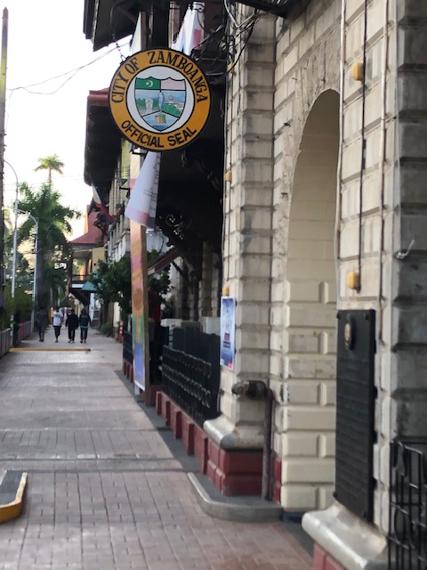 One of the entrances to city hall has the official seal of the city on display.
 Historical market for the building, which was first constructed during the American Period. It states that the building also used to be the Provincial Capitol. It is a heritage structure that is over a century old.
 The sidewalks are wide and paved. Planters are located along the curb to enhance the environment.
 Historical marker on an old house that was the official residence of Gen. John Pershing (yes, that Pershing) and which became BPI’s first branch in the city.
 Other old houses may be found along Valderosa Street. Many if not most are in a state of disrepair.
 Sidewalk fronting what used to be the Lantaka Hotel. Part of the hotel is now with Ateneo de Zamboanga.
 Graffiti on the walls along Valderosa Street
 Section fronting what used to be the Lantana Hotel. It is now part of Ateneo de Zamboanga.
More photos in Part 2, which is coming out soon!
–
Central Luzon Link Expressway (CLLEx)
The recently opened Central Luzon Link Expressway (CLLEx) is a freeway spanning the provinces of Tarlac and Nueva Ecija towards the Cagayan Valley side of Luzon. With the ends at Tarlac City, Tarlac and San Jose City, Nueva Ecija, Phase 1 currently terminates at Aliaga town; connecting to the Guimba-Aliaga Road. That is 18 kilometers of the planned 30.7 kilometers of the first phase, which is to end at Cabanatuan City, Nueva Ecija. Here are some photos taken by colleagues as they traveled to Tuguegarao this weekend.
 Section of SCTEX leading to the junction where the road branches to either the TPLEX or the CLLEx. SCTEX is a tollway operated by Metro Pacific via its Manila North Tollways Corp. while TPLEX is a tollway operated by San Miguel Corp. CLLEx is currently a freeway under the DPWH.
 SCTEX off-ramps to CLLEx (left) or Tarlac City (right)
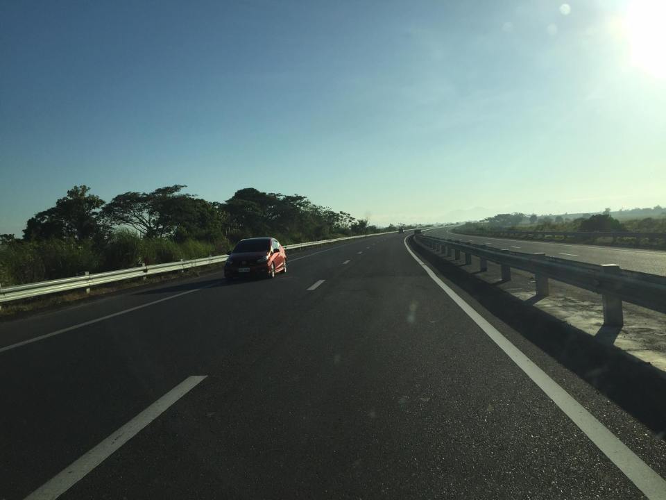 The expressway currently has 2 lanes per direction plus shoulder along either direction. The median barrier is a post & rail semi-rigid structure.
 Many of the traffic signs have yet to be installed
 Not so much traffic along the freeway as shown in the photos. These were taken on a Sunday though and we wonder if there will be more vehicles during the weekdays.
 As the freeway is still uncompleted, the end section in Nueva Ecija is two lane-two way with only cones and bollards separating opposing traffic.
 Exit ramp towards the Guimba-Aliaga Road
There are no stops yet along the freeway. I am not aware if there is a timetable for it to become a tollway. Traffic is still quite low so perhaps making it a tollway will take some time as it might be difficult to have a profitable operation. It would be good to have it as a limited access freeway to establish demand and use for the road.
–
Article share: on pedestrian facilities and climate change
Here is an article that articulates the importance of walking and pedestrian facilities in sustainability and ultimately fighting climate change. It argues that if we had the infrastructure and facilities to make it easier for people to walk, they will and are likely to walk rather than use their cars. This is not limited to short trips as walking can be in combination with public transportation, making it an integral part of trips where public transportation covers the main commute and walking is the proverbial last mile travel.
To quote from the article:
“Walking, biking, and transit need to be prioritized, and treated as legitimate forms of transportation. This means stepping up efforts to collect data on sidewalks the way we do for roads, investing in complete walking networks before engaging in expensive new road projects and making sidewalk construction and maintenance a municipal responsibility rather than an individual one.”
Article share: Redesigning Streets for Livability: A Global View
I am sharing this article on redesigning streets. It is actually a promotion for a book: “Streets For All: 50 Strategies for Shaping Resilient Cities”.
To quote from the article:
“Streets For All: 50 Strategies for Shaping Resilient Cities is an expansive 270-page volume that explores the evolving potential of the most ubiquitous public space in our cities. It offers ideas, tactics and strategies from across the world on how our streets are being, and, can be rethought, recast, repurposed and redesigned towards greater resilience and resourcefulness. The globally diverse opinions and case studies in this book remind us why cities with limited means can offer profound lessons to affluent societies that take their prosperity for granted. And in turn, how the virtues of effective urban administration and reinforcement seen in developed societies could reassuringly serve to inspire less economically developed ones.”
On guerilla tactics in urbanism – guerilla crosswalks
I am sharing this article on guerilla crosswalks in the US. It is interesting as communities or groups concerned with road safety decided to put up interventions (in this case crosswalks) in order to address safety concerns pertaining to pedestrian ROW along roads. In most if not all countries, pedestrians are limited where they may cross and there are jaywalking laws and penalties that are now being regarded as car-centric policies that need to be revised to favor pedestrians more than motor vehicles.
Zipper, D. (December 1, 2022) “The Case for Guerrilla Crosswalks,” Bloomberg CityLab, https://www.bloomberg.com/news/articles/2022-12-01/when-crosswalks-go-rogue [Last accessed: 12/10/2022]
To quote from the article:
“Such acts of unsanctioned “tactical urbanism” are of a kin to many other DIY street interventions, such as pop-up bike lanes. But they are not without risks. Affluent communities could have more residents willing to volunteer time and resources, for example, even though pedestrian deaths are concentrated in low-income neighborhoods. “The locations identified by guerrilla crosswalk activists may or may not coincide with where the planners and engineers have identified as highest need,” said Sam Zimbabwe, the former director of Seattle DOT.
But in Los Angeles, the Crosswalk Collective spokesperson said that the group is “always mindful of who has access to safety installations and who doesn’t,” adding that all its crosswalks to date have been sited in low- and moderate-income neighborhoods of Central and East Los Angeles.
Zimbabwe also noted the limited benefits of paint on faster roads (which the Federal Highway Administration has documented): “Particularly on multilane arterials, only marking a crosswalk without deploying other tools does not address the ‘multiple threat’ problem, where one driver stops but the driver in another lane does not.“ (The Crosswalk Collective spokesperson agreed, saying that the group rejects proposed locations due to safety concerns “all the time.”)
But in the right setting, unauthorized street infrastructure additions can lead to one of two outcomes — and both are constructive. One possibility is that the city removes it, in which case media attention and resident backlash put pressure on local officials to be more responsive to safety requests. (That coverage may also compel more residents to join street safety groups).
The other option is that city officials take the hint and accept what residents have built. Eight years ago, Seattle transportation planner Dongho Chang won the enduring appreciation of local cyclists when he responded to a pop-up bike lane first by thanking activists for their passion, and then by making the bike lane permanent. Now working with the Washington State Department of Transportation, Chang does not share Seattle DOT’s rigid opposition to guerrilla crosswalks. “It would be good to acknowledge the effort that was done by the residents,” he said. “If there is a way to keep the crosswalk, it would be ideal to try to do that.”“
–
This is, of course, in the US where such tactical urbanism might be in vogue in certain cities and communities. Would such be allowed or encouraged in the Philippines? Actually, there are already many cases where tactical urbanism has been applied and usually at the community or barangay level. Prior to the DPWH putting in rumble strips at the approaches of schools, junctions and other locations perceived to be accident or crash prone, people have devised ways to slow down traffic in favor of pedestrian crossings. These include laying down old rubber tires cut and stretched to become humps. There are also barriers laid out to form something like an obstacle course; forcing vehicles to zig-zag instead of going straight along critical sections. These have allowed schoolchildren to cross safe in school zones and pedestrians crossing safely at intersections.
–
