
Home » Infrastructure (Page 24)
Category Archives: Infrastructure
A replacement for NAIA?
Our plane approached Ninoy Aquino International Airport (NAIA) from Manila Bay and so I was able to get a good look at Sangley Point from the air. Sangley Point is currently an Philippine Air Force base although last time I checked some general aviation have been transferred from NAIA to Sangley Point to ease congestion at Manila’s gateway. Recently, Sangley Point has been the subject of much discussions regarding the location of a possible replacement for NAIA. The latter has been experiencing much congestion lately as evident from the frequently delayed flights in and out of the airport, which already has 4 passenger terminals. The assessment is that NAIA won’t be able to handle the steadily growing number of flights, passengers and cargo that it is and would be handling. And so, the conclusion was to determine the location of a new airport that would basically serve the National Capital Region in particular and the rest of the country in general. The last is in reference to NAIA being the prime gateway to the country despite other international airports including Cebu-Mactan and Davao.
There is actually another major airport to the north of Metro Manila in what was formerly a U.S. air base in Pampanga province – Clark. Clark International Airport (also known at one point as Diosdado Macapagal International Airport) was once touted to be the Narita to NAIA’s Haneda (an allusion to the two major gateways in the Kanto region of Japan). Plans for Clark included the construction of a modern railway line (the still-born Northrail) that would have connected Metro Manila with Clark. There is already a modern expressway connecting the two in the North Luzon Expressway (NLEX) and the Subic-Clark-Tarlac Expressway (SCTEX) that connects Clark with the rest of Central Luzon. The newest tollway in the country, the Tarlac-Pangasinan-La Union Expressway (TPLEX), has already completed Phase 1 and will ultimately connect Clark with northern Luzon.
Sangley Point is located to the southwest of NAIA in the province of Cavite. Its location is quite strategic being at the mouth of Manila Bay and current developments related to much reclamation work in the coastal cities and towns of Metro Manila and Cavite invites speculation about Sangley Point as a possible site for a future international airport. The examples of Haneda, Kansai and Hong Kong have been mentioned as references or models for Sangley to follow. However, it is not a simple thing considering the need for extensive reclamation in order to have space for a modern airport with multiple runways and passenger terminal(s) that can handle the projected millions of travellers using the airport. There are also environmental concerns here that need to be addressed, which can be evaluated via a comprehensive environmental impact study.
 Sangley Point airbase as seen from our landing aircraft
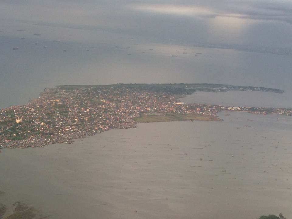 A closer look shows the strip of land that’s pretty much just the runway and a few buildings that serve as terminal and offices.
Whether the proposal for a future international airport at Sangley Point takes off (pun intended) or it is decided that Clark will be the main gateway for what has become a Greater Capital Region (Mega Manila) remains to be seen. There is actually a couple of other proposals put forward before including a site in Bulacan (north of Metro Manila) and at Laguna de Bay (south of Metro Manila). These proposals have basically faded in discussions and only Clark and Sangley Point remain in active consideration. Clark is already there and has a master plan with 3 runways and a huge passenger terminal while Sangley is still basically a concept for the transformation of a small air base and with lots of uncertainties/risks involved especially in implementation. Perhaps what will be for Clark’s advantage and the tipping point is the Bases Conversion and Development Authority’s (BCDA) proposal for a Clark Green City located nearby. The success of this new city is seen partly to be anchored on Clark becoming the main gateway and in tandem with NAIA. In my opinion, this can and would work (and would likely be more cost effective) if the government commits itself to Clark and the required infrastructure to support the airport. This can also help decongesting Metro Manila with a major development in Clark Green City, which is already in the works in as far as BCDA is concerned. As for Sangley, perhaps the question is not whether we can do another Haneda but if we can do it right and within a reasonable time frame given the complexity of the task at hand.
–
Inappropriate designs for pedestrian overpasses
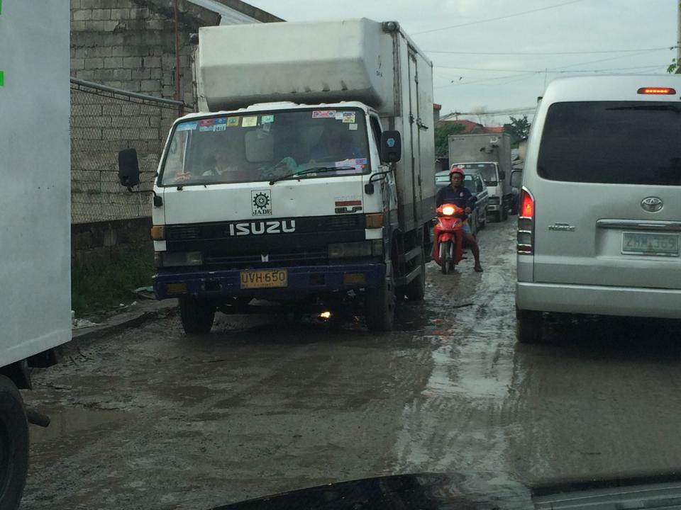
There was a photo that circulated in social media the last two weeks showing electric and telephone cables coming out of the stairs of a steel pedestrian overpass. It was obvious that the people responsible for both the overpass (MMDA) and the cables (power and phone utilities) did not coordinate their work and so people had to risk electrocution to be able to cross the street at what is assumed to be a busy intersection. Such is an example of unsuitable designs and bad implementation of infrastructure projects; in this case, that of a pedestrian facility. There are many other examples of these flawed execution of projects including electric posts in the middle of lanes after road widening projects, short span pedestrian overpasses that are not utilised by people (preferring to cross at ground level) because the road was narrow in the first place. Many are a waste of resources considering they may not have been required in the first place if careful assessment were made about the situation.
The pedestrian overpass under construction at the Masinag junction (photo below) is a good example of what looks like flawed design. The elevated walkway is narrow and is located right at the corners of the intersection. The width is important here because there are many people usually crossing at Masinag and the overpass can become congested for users. The stairs have not yet been constructed but if past designs of overpasses like this is to be considered, the stairs will likely be steep and therefore difficult to use for senior citizens, PWDs and children. Note, too, in the photo that the bridge already obscures part of the traffic signals previously installed at the intersection. This means the lights would have to be reinstalled or transferred so motorists can clearly see the signals.
 Pedestrian overpass under construction at the Masinag junction in Antipolo City
My friends at the DOTC tell me that it is only a matter of time before the Line 2 Extension project is bidded out an construction finally goes underway. Depending on the the final design of the line and end station, there might be a need to revisit the pedestrian overpasses along Marcos Highway. Hopefully, they don’t become like the overpasses along EDSA that had to be raised more due to the elevation of the Line 3 facilities including the catenary for the trains. I’m sure there is a suitable design for pedestrian facilities for crossing the wide Marcos Highway. It only requires careful thinking and creative minds to come together to come up with the appropriate facilities.
–
Compromising on the common station(s) for the Metro Manila rail lines
It seems that the issue regarding the common station for Line 1, Line 3 and the future Line 7 in the North EDSA area has not yet been resolved. The interested private sector parties, Ayala and SM, will not back down on their arguments support each’s proposal for the common station to be located at either of the giant malls that each corporation owns. Ayala’s claim is that the contract for the Line Extension to Cavite stipulates that the common station with Line 3 should be at Trinoma. Meanwhile, SM is claiming the validity of an agreement it made with DOTC on a grand central station to be located across their SM City North EDSA mall. The last one is consistent with an even earlier agreement with the proponents of the future Line 7 for an end station in front of SM.
A compromise solution to the impasse should be in the works and is the responsibility of the DOTC. What if instead of one common station, two stations are made into common ones? There will be no grand central station in the sense that all three lines will terminate as presented in SM’s version nor will there be a common station for Lines 1 and 3 at Trinoma that incorporates a very long walkway to a Line 7 station near Mindanao Avenue. Instead there can be two common stations – one at SM North for Line 1 and Line 7, and another at Trinoma for Line 1 and Line 3. Line 1 will still terminate at Trinoma but can have another stop at SM North where there can be a smooth transfer between Line 1 and Line 7, which terminates at this station. Perhaps there should still be a walkway connecting the two common stations in the interest of pedestrians although seamless fare collection systems and platform design can easily allow Line 7 or Line 3 passengers to ride Line 1 trains between stations to transfer to Line 3 or Line 7.
The common station or stations (depending on what will finally come out of this) should be designed thinking of the best interests of the public who will be using the transit systems and stations. Lost in the discussions are the plight of commuters. Parties claim that their designs are in the best interest of commuters (actually SM has the better set-up of all three lines terminating at one central station) and yet the bottomline for their arguments are very much revenue oriented – not for the transit lines but for their own commercial developments. Its basically one mall vs. another, leaving out the public as incidentals in the discussions. This is why government must intervene and this is where DOTC should show it has a spine after all and is promoting the public good and not favoring one private company over another. And so we’ll wait and see what will eventually come out of this although a lot of people continue to suffer with their inefficient commutes and are definitely becoming more impatient about mass transit systems that should have been constructed a long time ago.
–
The Metro Manila Urban Transportation Strategy and Planning Project (MMUTSTRAP, 1983)
I continue on my feature on past studies on transport in Metro Manila. The Metro Manila Urban Transportation Strategy and Planning Project (MMUTSTRAP) was conducted from November 1982 to April 1983, with support from the Australian Development Assistance Bureau – the precursor of AusAID. The study was conceptualized by a Metro Manila Transportation Policy Committee that consisted of the Ministers of the then Ministry of Transportation and Communications (now DOTC) and Ministry of Public Works and Highways (now DPWH), the Vice Governor of what was the Metro Manila Commission (now MMDA), and the Chief of the Philippine Constabulary/Integrated National Police (now PNP). The Philippine Government-funded study examined alternative futures on Metro Manila’s development and used these as the basis for formulating alternative futures for public transport modes. These futures did not mention UTSMMA and its the recommendations for an RTR but presented pessimistic, most likely and optimistic scenarios for PNR, LRT bus and jeepneys.
The study examined recommendations of past studies, most specifically the more recent MMETROPLAN and MMUTIP. MMUTSTRAP seem to contradict MMETROPLAN’s recommendations to encourage the entry of new bus and jeepney operators rather than restricting or controlling these as it (MMUTSTRAP) concluded that “deregulation is not a viable alternative for urban public transportation in Metro Manila.” It further explained that deregulation is justified on the assumption that the main objective in urban public transport is simply to make it a profitable business. To the contrary, the study pointed out that there are other objectives such as adequate service to the public and safety, which should be placed above profitability. This last statement reverberates over the decades to the present when it seems to many that the objective of urban public transport is more on the “profit side” rather than the “adequate and safe aspect” of something that it supposed to be a public service.
The study explored strategies for traffic management and various travel demand management (TDM) measures including area traffic restraint similar to what Singapore had already implemented at the time. A significant output of MMUTSTRAP was a prioritization plan for transport projects and policies for Metro Manila. This included the ranking of projects for implementation in Metro Manila such as:
- Pending road projects
- Potential road projects
- Urgent traffic signals
- Potential pedestrian projects
- Potential transit projects
- Terminal projects
Examples of the transport projects ranked by MMUTSTRAP are shown in Tables A and B for pending road projects, and potential transit projects. An index was developed based on perceived importance of the project and the associated costs.
Table A – Ranking of pending road projects identified in MMUTSTRAP (1983)
| Brief description | Rank | Index |
| Visayas Avenue extension: Elliptical Road to C-6 | 1 | 66.4 |
| Mindanao Avenue Extension: North Avenue to C-6 | 2 | 66.1 |
| C-5 construction: MacArthur Highway to North Expressway | 3 | 64.0 |
| Makati-Mandaluyong Link Road | 4 | 61.4 |
| Loop Road: from Bicutan to Alabang | 5 | 61.2 |
| C-6 construction: North Expressway to M. Marcos Avenue | 6 | 61.1 |
| Widen R-10: C-1 to Dagat-dagatan Spine | 7 | 60.7 |
| C-3 construction: Rizal Avenue to G. Araneta Extension | 8 | 60.5 |
| C-3 improvement: G. Araneta to Aurora Boulevard | 9 | 59.5 |
| Widen South Superhighway | 10 | 58.7 |
| C-4 interchange with Boni Avenue | 11 | 58.6 |
| C-5 construction: R-4 to Pasig Boulevard to Aurora Boulevard | 12 | 58.5 |
| R-4 construction: EDSA to Pasig/Pateros | 13 | 57.9 |
| R-5 construction: Kapasigan to Taytay Diversion | 14 | 57.7 |
| C-5 construction: North Expressway to Aurora Boulevard | 15 | 56.2 |
| C-3 works: Ayala Avenue to Tripa de Gallina | 16 | 55.9 |
| C-3 construction: N. Domingo to Ayala Avenue | 17 | 55.7 |
| Widen Domestic Road: MIA Road to Airport Road | 18 | 55.5 |
| C-4 extension: Taft Avenue to Roxas Boulevard | 19 | 55.3 |
| C-4 interchange with Roosevelt Avenue | 20 | 55.2 |
| C-4 interchange with Ortigas Avenue | 21 | 54.7 |
| C-4 interchanges with Ayala Avenue and Pasay Road | 22 | 54.1 |
| C-4 interchange with Santolan Road | 23 | 53.7 |
| C-4 interchange with Kamias/East Avenue | 24 | 53.2 |
| C-4 interchange with Buendia Avenue | 25 | 52.2 |
| C-5 construction: R-4 to South Superhighway | 26 | 52.1 |
| Widen Parañaque to Sucat Road | 27 | 51.8 |
| Re-align western 1.6 km of Zapote-Alabang Road | 28 | 49.3 |
| R-10 Construction | 29 | 49.1 |
Notes: The codes C and R stand for Circumferential and Radial, respectively, and refer to the main road network of Metro Manila. These roads are more commonly known by other names such as, for example, EDSA (C-4), Aurora Boulevard (R-6) and España Boulevard (R-7).
Table B – Ranking of potential transit projects identified in MMUTSTRAP (1983)
| Brief description | Ranking based on assessment by project team | Ranking based on evaluation from selected MOTC panel | Index |
| Bus replacementa | 1 | 1 | 55.6 |
| PNR Commuter additional coaches and upgrade | 2 | 2 | 50.8 |
| LRT Line #2 – EDSA | 3 | 3 | 44.4 |
| Surface tramway – Radial road along Españab | – | 4 | 43.9 |
| LRT Line #3 – Radial along España | 4 | 5 | 43.0 |
aAssumed that additional bus units will not be needed in the next 5 years with replacements likely after 1987.
bProject proposed by one of the members of the MOTC panel. This was treated as an alternative (on a mutually exclusive basis) to LRT Line #3, rather than an independent project for ranking.
[Reference: MMUTSTRAP, 1983 – NCTS Library]
Earlier studies recommended projects but did not show lists ranking projects in terms of an objective index or criteria. MMUTSTRAP did a good job in coming up with this idea or basis that was transparent and objective in evaluating projects. The criteria, however, is based mainly on perception of those involved in the study and, arguably, such perceptions may vary according to the knowledge and experiences of those involved in the evaluation. This is where the biases lie in as far as project prioritisation was concerned for this project. Perhaps a more participatory approach could have been conducted? Of course, it can be argued that at this time, both capacity and capability of local governments and national agencies were quite limited and so these have to be dependent on consultants (i.e., the study team) for their assessment and recommendations.
–
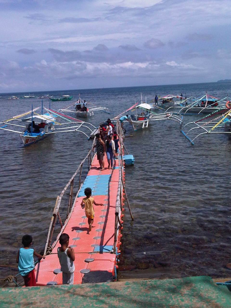
Sabang Port – Puerto Princesa
The jump-off point for visitors to the St. Paul Subterranean River (Underground River) is the Sabang Port at the northwest part of Puerto Princesa. Following are photos taken at Sabang including some showing information on transport and procedures for visitors.
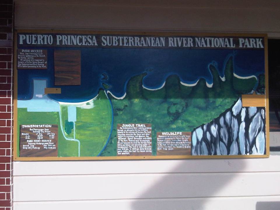 Map of the national park showing some of its features and the transport services to/from the port.
 Information on the management of the national park
 Greetings for visitors
 Puerto Princesa limits the number of visitors to the Underground River and there are procedures for visitors and their accredited guides to follow.
 I caught this scene of children playing football on the sands during low-tide.
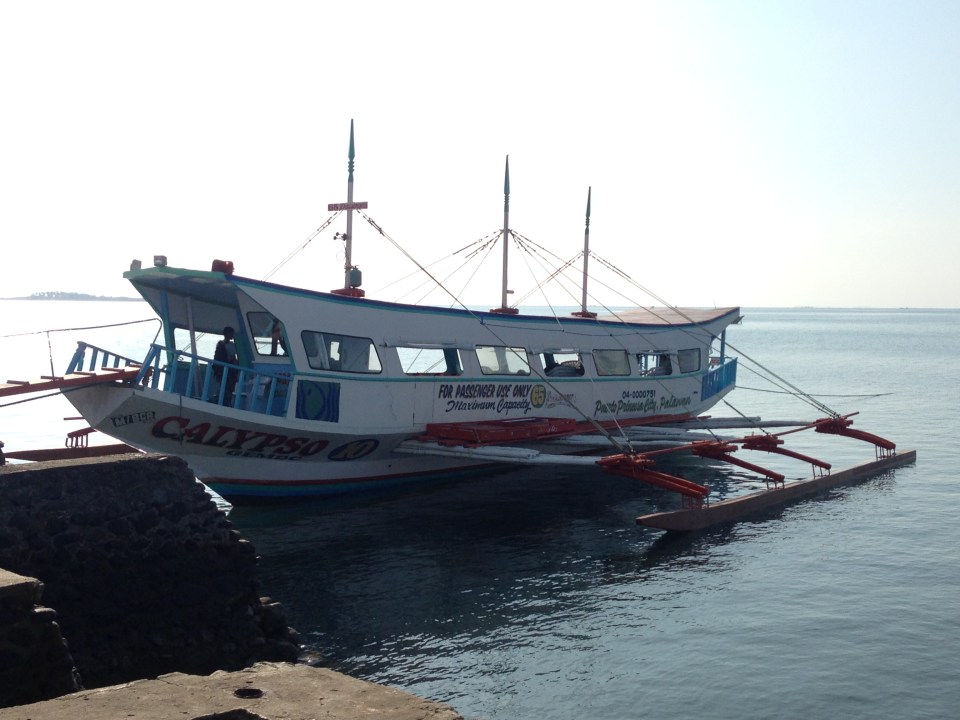
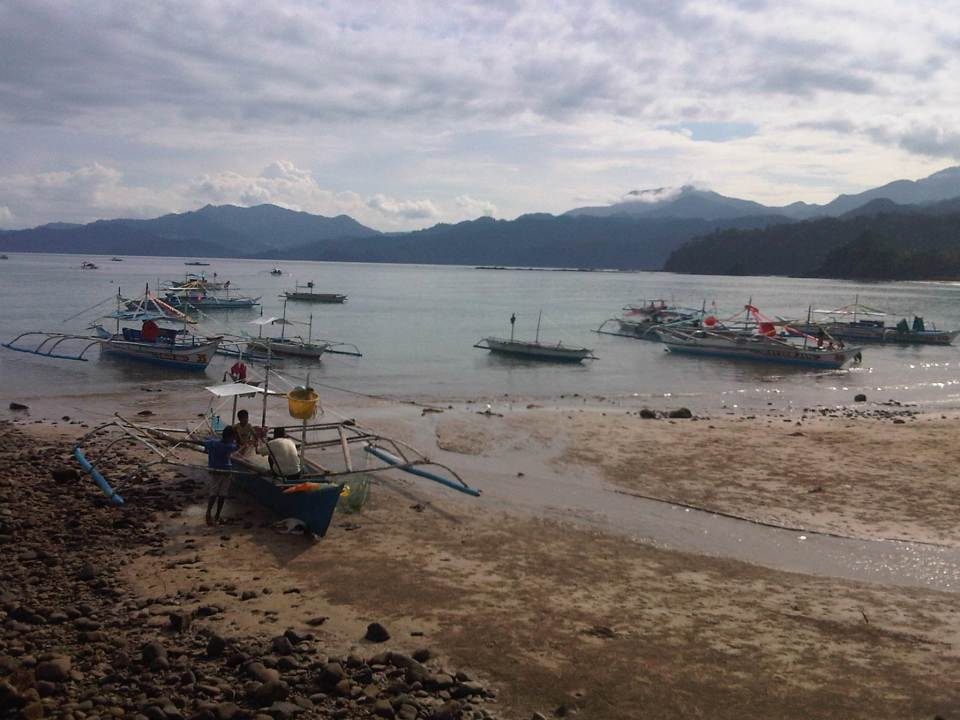 While most boats seem to be for ferrying tourists to the Subterranean River, there are also many fishing boats at Sabang.
 Fishermen fixing up their boat likely before going on a sortie. I could imagine Sabang was like other fishing villages in the Philippines until authorities started promoting attractions like the Underground River. The influx of tourists transformed what was probably a sleepy village into a tourist destination complete with commercial developments like resorts, restaurants and shops.
 Outriggers dot the waters around Sabang Port, their boatmen waiting for their turn to ferry visitors to the Underground River.
 The concrete pier provides a basic but better facility compared to other similar ports around the country. The dispatching of boats is organised and passengers queue in an orderly manner to board the boats assigned to them.
 A boat (left) approaches as another (right) just left, bound for the Underground River.
 Clean restrooms /toilets are a must for tourist destinations. Sayang Port has well-maintained toilets.
 Tourism office at Sabang Port – note the basketball goal post in the photo? The area is also used for other purposes including sports activities. Also noticeable in the photo are street lamps powered by solar energy. We saw some solar-wind power lamps around Puerto Princesa and Sabang’s main road has these for night-time illumination.
 A close-up of the small box showing schedule and cost of transport services to/from Sabang from/to Puerto Princesa city proper. Note that there are only 4 trips per day for public transport (bus or jeepney).
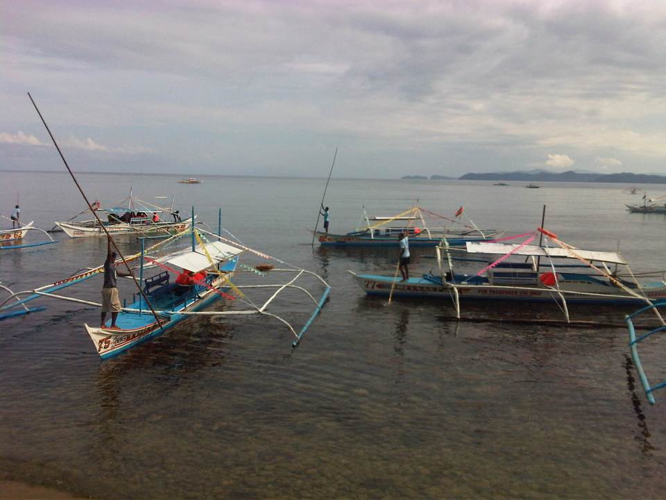 Boatmen manoeuvre their vessels in the crowded waters of Sabang Port.
 Another photo of boats lined up at the port.
 Portable or collapsible sheds or tents at the port often bear the name of the company sponsoring or providing these for port users. Under one, there was a group facilitating the tour of a group of senior citizens from around Puerto Princesa. We got it from our guide that they are given free rides and visits to the Underground River as part of their benefits as senior citizens.
 Visitors get-off from their boats as other vessels queue to unload their passengers. It takes some skill from boatmen to manoeuvre and make sure they don’t collide with other vessels.
 People get off a boat via a makeshift floating jetty
 Scene of the port and boats from the shop and eatery-lined road along the coast.
Advice to tourists: tip your boatmen generously. They serve as your lifeguards and do their best to maintain the boats and the equipment. They don’t get much from ferrying visitors to and from the Underground River and they do have families to feed. Make this tip your contribution to ensuring sustainable tourism in this heritage site that is also considered one of the top natural wonders of the world.
–
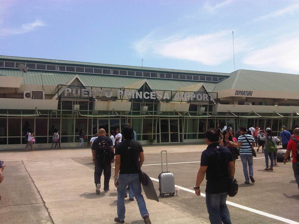
Puerto Princesa Airport
I haven’t been to Puerto Princesa, Palawan since 2010 so I had wanted to see for myself what improvements they have done to their airport. This was considering the city and the province in general have become a very popular and accessible tourist destination featuring pristine beaches, hidden natural attractions as well as vibrant communities around the island. While the airport has been under renovation for a while, the terminal is already nearing if not already at capacity. Surely, as the country continues to promote tourism, Palawan will have a steady increase in the number of visitors and Puerto Princesa Airport will be the main airport access to the main island. The islands of Coron to the north of Palawan is served by a small airport in Busuanga, and El Nido at the northern part of Palawan Island will soon likely be served by another airport. But the jump off point for most of the island including the relatively “unexplored” south will be Puerto Princesa, which is also the centre of business/commerce. While its runway can handle large planes (I once rode on a B747 from Palawan), its terminal cannot handle the number of passengers such airliners are able to carry. The prospect of direct and regular international flights also would require a larger terminal to efficiently handle both domestic and international arrivals and departures.
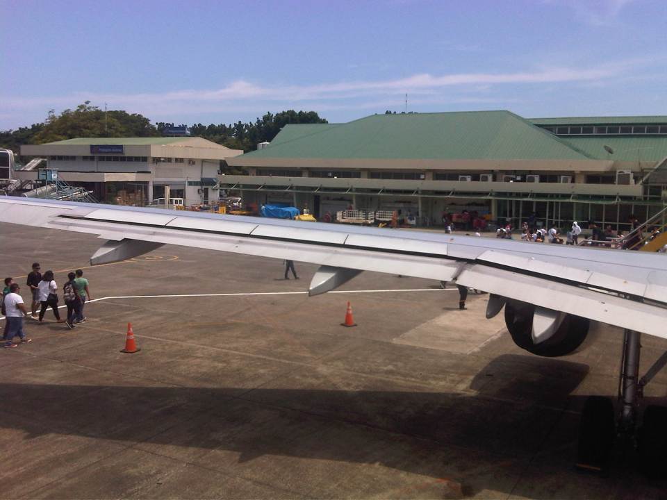 View of the airport upon stepping out from the aft door
 Passengers walk towards the terminal. Many passengers linger or loiter on the tarmac to take photos of themselves with the airport or aircraft in the background. While not unique to the Philippines, lingering on the tarmac is a no-no in many other airports due to security concerns.
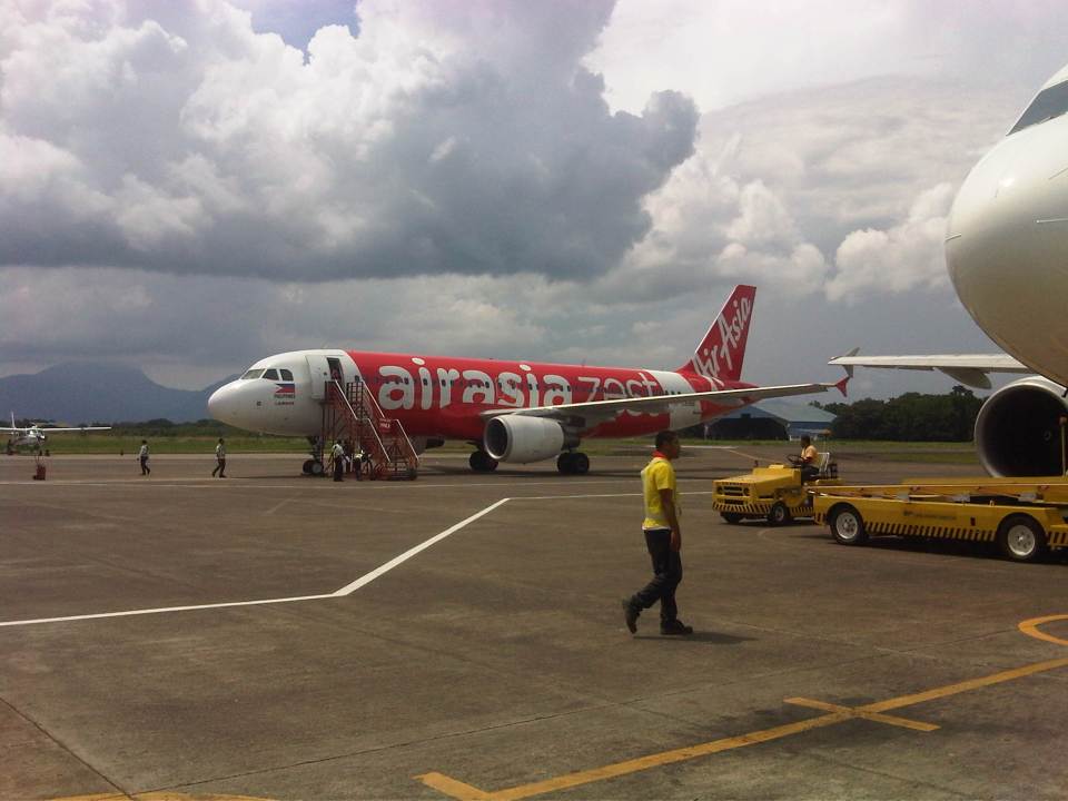 Air Asia recently acquired local budget airlines Zest Air and now services Zest’s domestic destinations like Puerto Princesa.
 We flew Cebu Pacific, which has the most flights servicing Puerto Princesa and had the better schedule for us. Unfortunately, CEB passengers seem to be experiencing a lot of delays. Our flight was delayed by 2 hours, which was definitely a waste of time as we had to go directly to our meeting upon our arrival in the city. Apparently, CEB has already earned the monicker its main competitor had for “planes always late.”
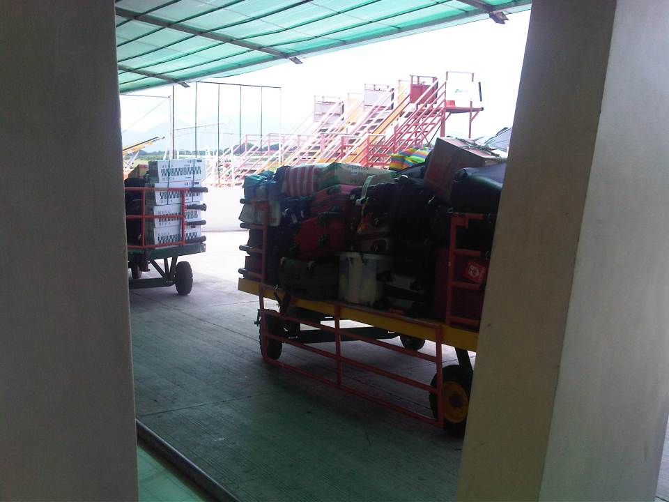 Bags being transported from the aircraft to the baggage claim area. Bags are loaded and unloaded manually so handling can be an issue and a concern especially for those using designer or expensive luggage. On days with inclement weather, luggage can get wet and there is the occasional bags being dropped (and damaged).
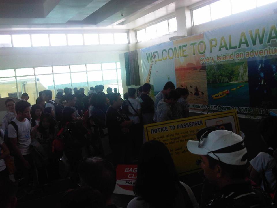 The baggage claim area at Puerto Princesa airport is obviously not so spacious with just a single belt shared by arriving passengers from different flights.
 Crowded but not chaotic. That’s how I would describe the baggage claim area when two flights arrived one almost immediately after the other.
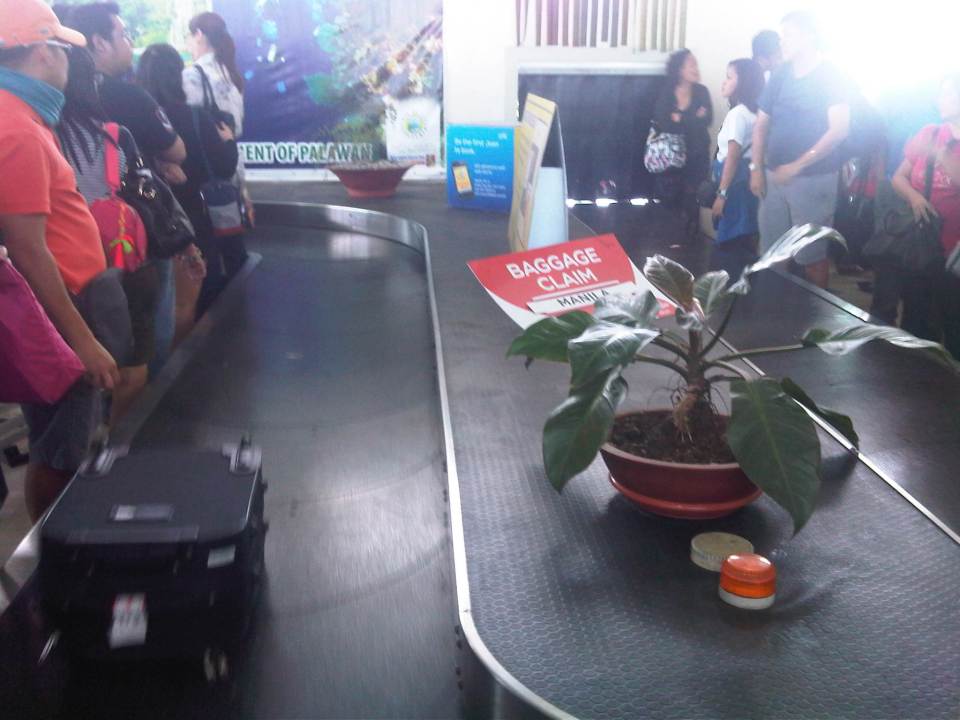 Baggage carousel.
 Sign informing visitors about the policy for going to the Underground River, one of the most popular if not the top attraction in Puerto Princesa.
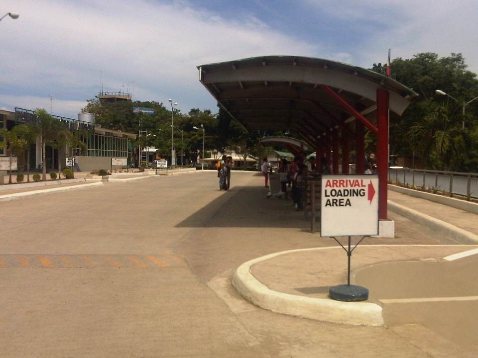 Covered area for loading/unloading passengers and visitors at the airport.
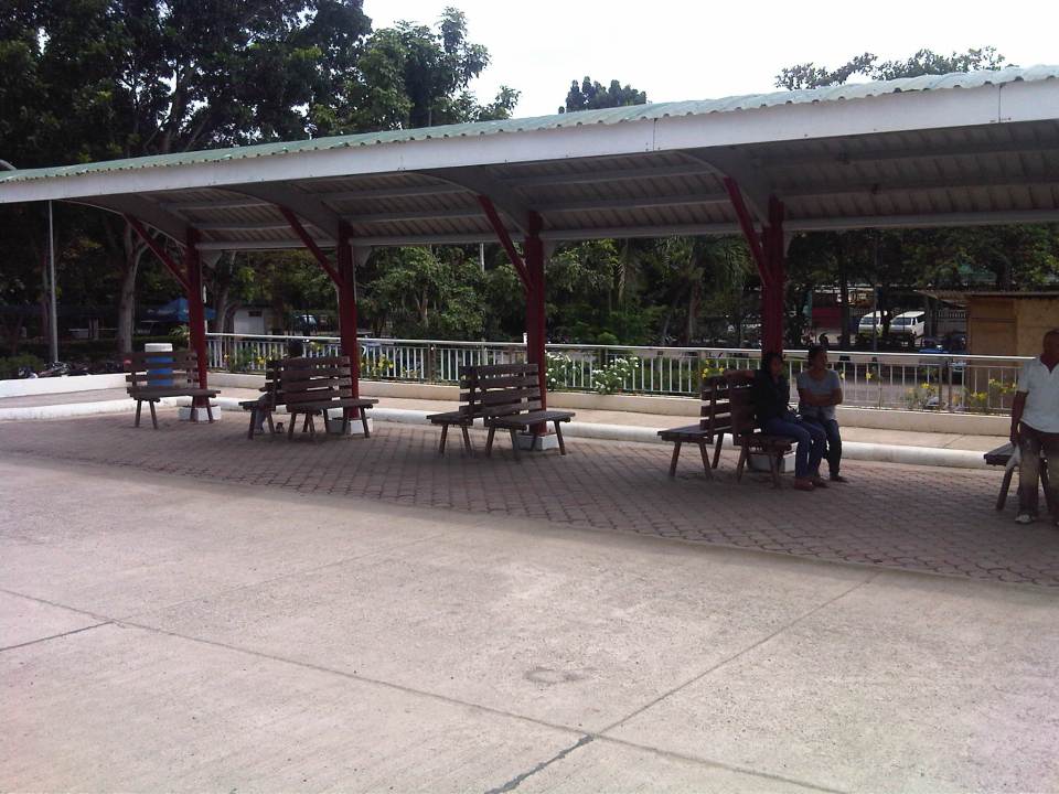
 Waiting area for people fetching passengers just outside the arrival area.
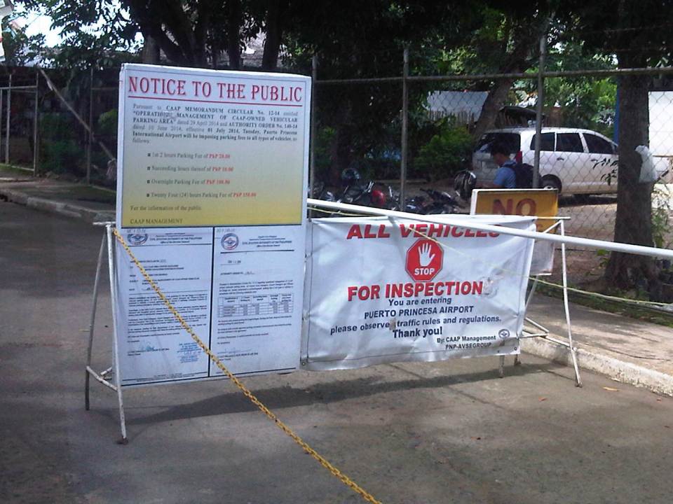 Notices for passengers and others entering the airport driveway.
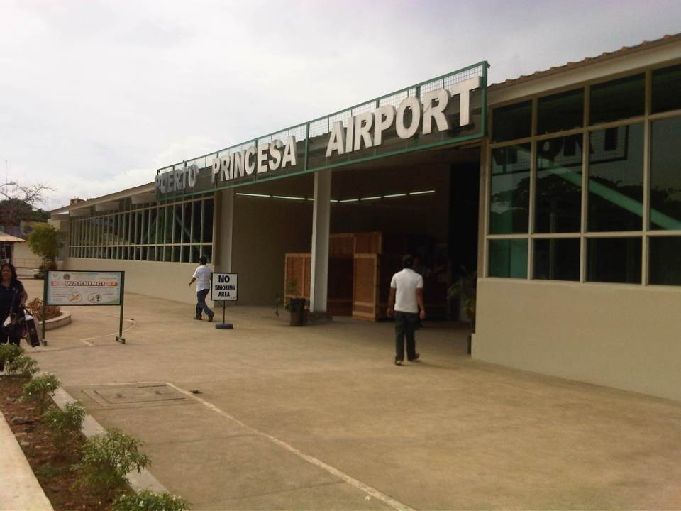 Entrance to the airport.
 Another look at the loading/unloading/waiting area just outside the terminal building.
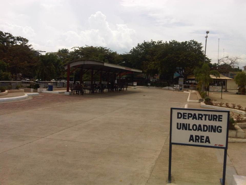 Airport terminal driveway and departure unloading area.
 Departure area under construction/renovation with seats, counters and other materials everywhere.
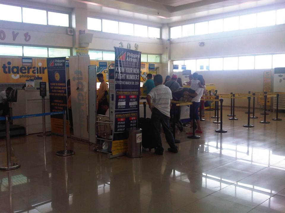 Cebu Pacific check-in counters. Tiger Air flights are operated by Cebu Pacific.
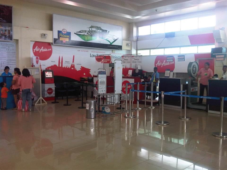 Air Asia Zest check-in counters.
 Entrance to the pre-departure lounge/area.
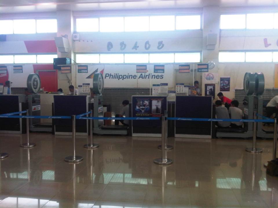 Philippine Airlines check-in counters
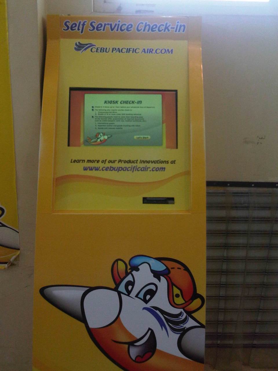 Self service check-in machine by Cebu Pacific. This is very useful for passengers arriving early at the airport for their flights. It allows you to check-in, select seats and get your boarding passes prior to the counters opening for passengers checking-in at the terminal. It’s basically an internet or online check-in so you can go to the internet check-in counter, which usually has a shorter queue.
 Passengers accumulating in near the Cebu Pacific check-in counters. I think airlines shouldn’t have policies preventing passengers arriving early from checking-in. This might be okay for large terminals servicing so many flights but for smaller airports like PPS, Cebu Pacific would probably do better by attending to passengers. Everyone could see that their staff were not at all doing anything behind the counters so they might as well check in passengers so as to reduce and better manage the queuing later on.
 The airport now services international flights but mostly chartered ones. There is an international departure area and a simple immigration counter. These don’t look like they are in regular use.
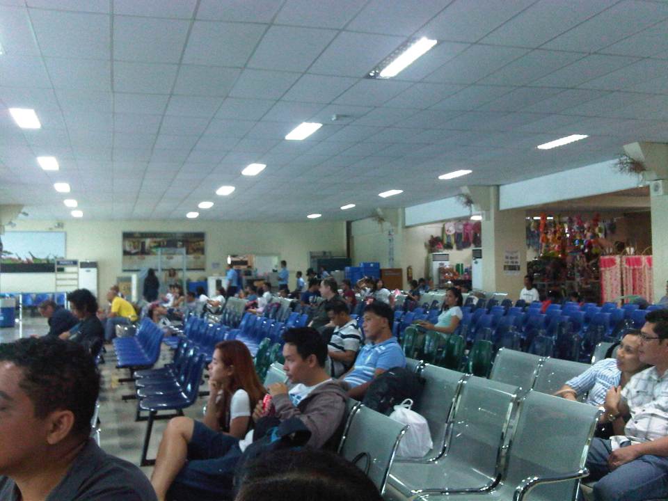 Pre-departure area at the terminal – there seems to be a lot of seats but these are all practically occupied for a single flight. Most aircraft servicing the MNL-PPS route are not wide bodied but the area cannot accommodate 2 plane loads (assuming A319 or A320) of passengers. This is a non-smoking area by law and there is a room for smokers. People though seem to be in-and-out of the room so people seated near the door leading to the smoking room (there are 2 doors) still get a sniff of cigarette smoke.
 Overall, the terminal is clean and orderly. There are 3 gates reserved for each of the airlines (Cebu Pacific, Philippine Airlines and Air Asia Zest) that have the most flights to and from Puerto Princesa.
 Our Cebu Pacific plane was again late by an hour and so that meant we were getting home later in the night. The good thing about it was that it also meant less traffic (both the airport and roads) in Manila compared to a late afternoon arrival.
–
Metro Manila Urban Transport Improvement Project (MMUTIP, 1981)
[Important note: I have noticed that the material on this blog site has been used by certain people to further misinformation including revisionism to credit the Marcos dictatorship and put the blame on subsequent administrations (not that these also had failures of their own). This and other posts on past projects present the facts about the projects and contain minimal opinions, if any on the politics or political economy at the time and afterwards. Do your research and refrain from using the material on this page and others to promote misinformation. I suggest you go to the The Mass Transit System in Metro Manila site for more facts about railway development and history. I do not consent to the use of my articles for the purposes of misinformation and historical revisionism. 10/13/2019]
We continue with our historical features on transport with the Metro Manila Urban Transport Improvement Project (MMUTIP). MMUTIP was implemented from July 1980 to August 1981 with funding from the Overseas Economic Cooperation Fund (OECF) of Japan. MMUTIP recommended for a new franchising system to be adopted by the then Board of Transportation (BOT), with standards covering citizenship, route opening, operating performance and financial capability. It also called for the adoption of measures that will safeguard the integrity of franchise records and the speedy processing and better control of franchise applications. The BOT is the precursor of the Land Transportation Franchising and Regulatory Board (LTFRB).
Additional bus routes were identified by the study and recommended for 5,900 units for daily operations. The study estimated that as much as 1,870 additional units were required for Metro Manila. Meanwhile, the study found the operations of the Metro Manila Transit Corporation (MMTC), the government owned bus company, unprofitable and stated that the government-run company has failed to define objectives and policies particularly in specifying the extent to which MMTC will render public service at the sacrifice of profit (note that MMTC was losing money in part because it was serving missionary routes so as to reduce direct competition with the private companies). I think looking back now, this was perhaps the beginning of the end for MMTC. Some people say that we could probably have used something like the MMTC today to keep public transport operators honest in their operations and also to continue providing services for missionary routes rather than letting these be served by tricycles and jeepneys that will eventually would have to be granted franchises. As it is, such situations often lead to poorly planned transport services including the (mis)determination of the number of PUV units required to serve an area or corridor.
MMUTIP recommended for the control of entry and operation of jeepneys along major bus routes while at the same time calling for a deregulation of entry and operations outside major thoroughfares, which were served or are more suitable for buses. Further, the study called for encouraging tricycle services where bus and jeepney routes are scarce while also stating that these should be limited to local or feeder services. Then as now, tricycles are restricted from national roads.
[Note: A copy of MMUTIP may be found at the National Center for Transportation Studies (NCTS) Library located at their building along Apacible Street at the University of the Philippines Diliman. This is not a public library so access is limited to UP staff and students. Researchers and others from outside UP would have to write to the Director for permission to use the library and its holdings.]
–
Sta. Lourdes Wharf – Puerto Princesa City
The jump-off point to island hopping in Honda Bay is Sta. Lourdes Wharf just north of Puerto Princesa City proper. I have seen this wharf evolve into the modern (compared to other Philippine wharves or ports) facility that it is now. I guess this is possible if both national and local government really put the necessary resources to improve such infrastructure that obviously benefits everyone and not just the tourists who happen to flock to this port for island-hopping trips.
 The local tourism office and amenities like toilets are housed in this building. What it used to be was a building made out of bamboo with nipa and a few iron sheets for roofing. Boats were moored just behind the building in what looked like a chaotic set-up for tourists and islanders. There was no concrete road 5 years ago and the dirt road was a muddy mess during the wet season.
 Philippine Coast Guard station at the wharf
 Outriggers carrying passengers; mostly tourists on the Honda Bay island hopping package
 This larger boat is not necessarily for tourists but for ferrying passengers between the mainland and the smaller islands off Palawan. It is obviously of sturdier design and has a bigger passenger capacity.
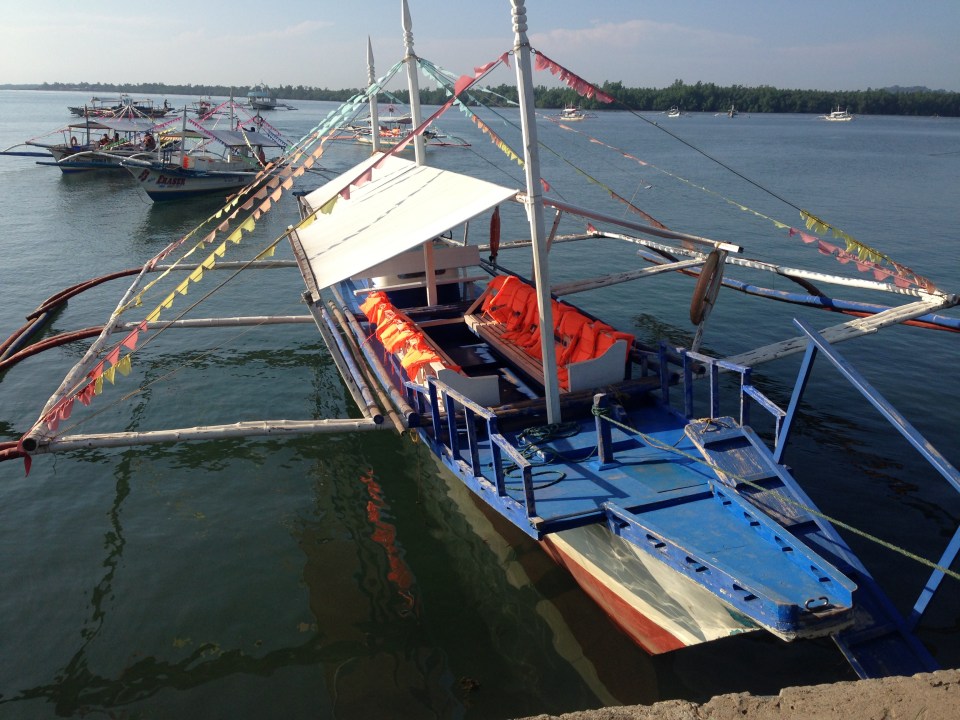 Our outrigger waiting for us to board. The crew consisted of two boatmen – one handling the motor and driving the boat while another was in-charge of handling the line, anchor and maneuvering the boat from the port and towards the sea (with just a bamboo pole as a tool).
 A snapshot of other boats docked along the wharf shows mostly outriggers. In the background at about right is a glimpse of a Philippine National Police fast craft. The PNP has a maritime unit complementing the Philippine Coast Guard and those stationed in Palawan have modern fast craft capable of giving chase to pouchers and pirates in their speedy boats.
 A Chinese boat moored at the PNP dock. This fishing boat was intercepted by Philippine authorities illegally fishing in Philippine waters. This was the subject of well-circulated news reports showing the Chinese were catching endangered species like sea turtles and were carrying live and dead pangolins and other wildlife they were smuggling out of Palawan (with the help of shady Filipinos, of course).
I think the Sta. Lourdes Wharf is a good example of adequate port facilities serving both passengers (including tourists) and goods. It provides for the basic needs of users though there is usually some congestion at the port due to increasing tourism activities. The wharf practically becomes a parking lot to tourist vehicles during certain times of the day and this becomes serious during the peak tourism months. This, however, is a minor concern for now. Access to the wharf is also excellent with good quality concrete roads from the city centre to the wharf; a combination of national and local roads being developed to a standard that makes them “all-weather” and comfortable for use by travellers using all types of vehicles. This is something that can and should be replicated for similar ports around the country not just for tourism areas but basically to address the needs of travellers and goods.
–
Repair C6 now!
The existing roads that comprise what has been designated as Circumferential Road 6 is an important link that serves as an alternate route for people and goods traveling between the eastern towns of Rizal province and Metro Manila to urban centres in Makati (Ayala CBD) and Taguig (Bonifacio Global City) as well as the southern areas of Metro Manila all the way to Laguna and Cavite. During the last dry season or summer, the roads conditions have been quite good such that travellers from Rizal could easily reach BGC or Makati in less than an hour give and take typical congestion during the peak periods.
The situation has significantly worsened since the onset of the wet season as the pavement quickly deteriorated with the combination of heavy rains and heavy vehicles utilising the road. Highway 2000 from Taytay, Rizal was already in bad condition during the summer so it became only worse once the rains came. However, it is the C6 segment from Pasig to Taguig that has deteriorated and is now in a state of disrepair. Following are photos that show how bad the conditions are and which have led to travel times worsening to more than double than what it should be if the roads were in good condition.
 Section in Taguig along the shores of Laguna de Bay where even large trucks avoid the deep holes along the road. These situations along C6 constrict traffic everyday.
 C6 section in Pasig City where what used to be asphalt is now a muddy mess.
 Another section in Pasig City where C6 passes through a relocation area (Lupang Arenda) where local traffic affects through traffic and C6 is probably at its narrowest.
The section from Pateros to Taguig was built as a road dike protecting these areas from floods brought about by the increasing level of Laguna de Bay during the wet season. While it is basically a secondary road compared to the other circumferential roads, traffic has significantly increased along C6 due to many people discovering that you can travel faster between Rizal and Makati or BGC via this road. Sadly, there seems to be little or no attention given to its current state.
I understand that the DPWH has a process for determining whether a road needs to be repaired and given limited resources, the agency also applies a process for prioritisation of road repairs (i.e., there are many other roads that also need repairs). However, there should be a way to allocate resources for the repairs of the road and this includes involving the LGUs whose constituents benefit from the use of the road. Rizal province and towns and Pasig City should take the initiative to find ways to improve the conditions along C6. It is also in the interest of Taguig to improve this road as many of its residents use it, too. Hopefully, the road will be repaired sooner rather than later and travel times will improve again. Of course, this should be the case whether or not the proposed C6 expressway is realised.
–
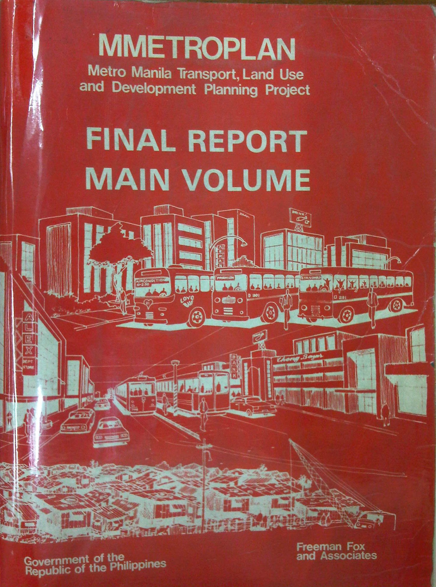
Metro Manila Transport, Land Use and Development Planning Project (MMETROPLAN, 1977)
[Important note: I have noticed that the material on this blog site has been used by certain people to further misinformation including revisionism to credit the Marcos dictatorship and put the blame on subsequent administrations (not that these also had failures of their own). This and other posts on past projects present the facts about the projects and contain minimal opinions, if any on the politics or political economy at the time and afterwards. Do your research and refrain from using the material on this page and others to promote misinformation. I suggest you go to the The Mass Transit System in Metro Manila site for more facts about railway development and history. I do not consent to the use of my articles for the purposes of misinformation and historical revisionism. 10/13/2019]
In a previous article, I had written about the Urban Transport Study for the Manila Metropolitan Area (UTSMMA), which was completed in 1973 and proposed, among others, a rapid rail transit network for Metro Manila. The government proceeded to undertake a feasibility study for the first line of that network almost immediately afterwards. However, something happened a few years later that effectively contradicted UTSMMA’s recommendations and, from what the documents available to us now suggest, effectively doomed the future of transport in Metro Manila.
The Metro Manila Transport, Land Use and Development Planning Project (MMETROPLAN) was implemented from January 1976 to February 1977. It was apparently commissioned by the Philippine Government, and funded by the World Bank, which commissioned the precursor of Halcrow Fox to do the study with a steering group comprised of senior government official dealing with transport at the time.
The MMETROPLAN project team is shown in the photo below. Note the inclusion of some familiar names particularly from the DPWH and DOTC who were then with what was the Department of Public Works, Transportation and Communications (DPWTC) and Department of Public Highways (DPH) before these were reorganised. Note, too, a familiar name under Planning, who is very much active today with his own advocacies.

The study is more expansive in terms of scope as it included components on land use and development planning for Metro Manila. It identified three main strategies to address issues on traffic congestion and public transport requirements, namely:
- Cordon pricing,
- Bus lanes, and
- LRT
Short-term recommendations focused on bus and jeepney operations, recommending that:
- Standard buses (non-airconditioned) be designed for more standing passengers and charge a fare affordable by the poor;
- Premium buses (including Love Bus) be designed for seated passengers and charge a higher fare; this may be used to cross-subsidize Standard bus operations;
- Metro Manila Transit Corporation (MMTC) bus operations should not be further expanded:
- MMTC buses should operate missionary routes, which are generally unprofitable routes.
- There should be no arbitrary exemption on franchises like in the case of MMTC.
- In reference to private bus companies, the project states that “properly regulated competition” provides best course of action for the foreseeable future;
- Jeepneys are suited for low demand but high frequency service
MMETROPLAN also touched on the route structure for road public transport. However, its most far-reaching recommendations on road public transport concern the issuance of franchises for buses and jeepneys. The study recommended that franchises should be issued for a period of a few years instead of 25 years and to define a minimum LOS. The study cautioned against arbitrary restrictions on franchises for buses at the time while mentioning that there were already restrictions for jeepneys. MMETROPLAN further recommended the encouraging of small operators for both jeepneys and buses.
However, MMETROPLAN deviated from the recommendations of UTSMMA in that it struck down the proposal and plans for the Rapid Transit Rail (RTR) network for Metro Manila. The long-term recommendations and conclusions of the study show these and one particular recommendation that probably doomed heavy rail transport and the RTR network is quoted below:
“Heavy Rapid Transit (HRT) would provide public transport passengers with much faster journey, but by 1990 would attract only 2.5% of motorists and would have negligible impact on traffic congestion. Partly because of this and partly because of its very high capital cost, it would be hopelessly uneconomic: the annualized capital costs would be higher than the estimated benefits in 1990…passenger flows are not high enough to exploit its full capacity…and the large savings in time for public transport passengers are not given a high value in Manila, and are not high enough to persuade motorists to change mode.
These results are conclusive, and are unlikely to be changed by any circumstances or reasonable assumptions…it is clear that any other fully segregated public transport system, whether light rail or busway, would also be uneconomic. As such systems would require the appropriation of most, if not all, of the available funds for all transport (including highways) in Metro Manila for the foreseeable future, and as there is not other rationale for their implementation, they have been rejected from further consideration.” (MMETROPLAN, 1977)
The study also did not have good words for the PNR as it concluded that its “routes related poorly to the major demands for movement” and that it would be expensive to improve the PNR at the time. PNR costs were compared to buses and jeepneys with the further concluded that these road transport modes are preferred over an upgraded PNR.
MMETROPLAN assessed the LRT vs. the Monorail in the context of cordon pricing and bus lane strategies. While the monorail was dismissed for reasons that included few monorail systems operating at the time, the study recommended for an LRT along Rizal Avenue, which was considered feasible. These conclusions and recommendations by MMETROPLAN would eventually have far-reaching impacts on Metro Manila’s transport system and the study would be among the most cited in discussions and future planning where land use and transport are discussed in the same light.
For land use planning, the report also provides us with a history of land use planning for Metro Manila, which we can now compare with what actually happened. That is, if the plans made back in the 1970’s were actually implemented and to what extent were they realised. Many of these plans remain controversial to this day and are often invoked whenever there is talk about the perennial flooding and the spectre of earthquakes threatening much of Metro Manila and its surrounding areas in addition to other issues like the transport and traffic problems experienced around what has become a megalopolis.
[Reference: MMETROPLAN, 1977 – NCTS Library]
But what could have influenced the MMETROPLAN study team and government officials to debunk UTSMMA? Why the “about-face” for something that seems to be the JICA Dream Plan circa 1970’s? UTSMMA and the rail rapid transit network, after all, was the product of a vision for future Metropolitan Manila transport by a visionary professor from the University of Tokyo – one Dr. Takashi Inouye of that university’s Department of Urban Engineering. I think the next article will provide us with the answers to these questions regarding the turnaround. Abangan!
–
