
Home » Mode Share
Category Archives: Mode Share
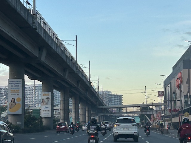
How about a pop-up BRT along Commonwealth Avenue?
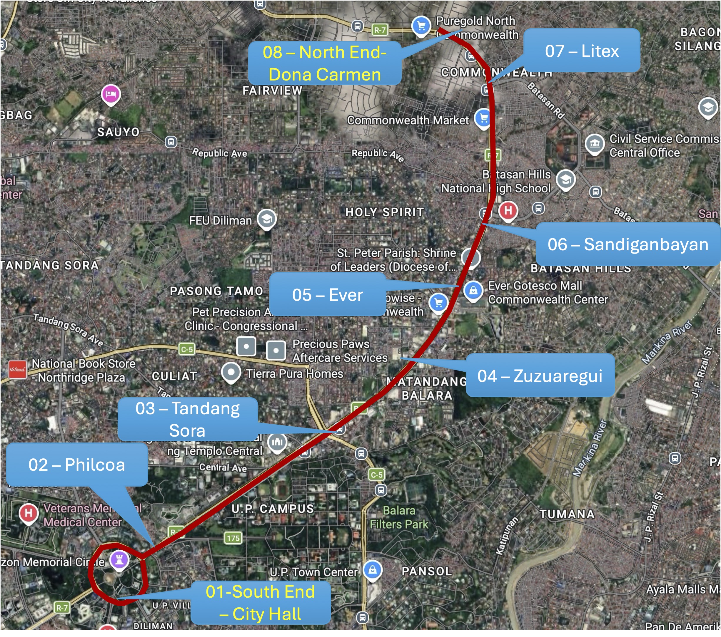
I posted this map on social media showing a possible route for a pop-up BRT (Bus Rapid Transit) along Commonwealth Avenue. This was inspired by the reports this week of the horrendous experience of commuters along this corridor due to the current fuel crisis. It seems that a lot of people have reduced their use of private vehicles in favor of what they thought was adequate public transportation only to find out how lacking the supply was.
While this route can be extended (all the way to Fairview via Regalado, for example), I think the one in the map below would be able to capture a majority of the commuters along the corridor with the end at Dona Carmen being a drop-off/pick-up area for those residing to the north. Quezon City Hall and the Elliptical Road is a no-brainer since the Quezon City Bus service terminates here and people can transfer to one of the other lines that will allow them to travel elsewhere covered by the bus network. Quezon City or DOTr can lease buses and come up with a service contracting scheme to sustain operations. The idea is to first run this pop-up BRT while the crisis in Iran is ongoing. Data collection and assessments should coincide with this to refine the service and perhaps, make recommendations for sustaining this service at least until MRT 7 gets online.
The idea of a pop-up BRT is not really new as there were “proof of concept” runs along Commonwealth and at BGC many years ago. Unfortunately, the BRTs never came to be in both cases; both now missed opportunities as we have come to realize. It’s still a long way before the MRT 7 is up and running. The recent announcement from the proponent that they will probably start operations next year is perceived by many as too late. Government, both national and local, need to be decisive if they want people to be able to go to their workplaces and schools. Maybe this is another opportunity for the more than 70% public transport users to be provided with the services they need while taking advantage of road space being freed up from car dominance?
–
On the rideshare competition among 4 and 2-wheeler companies.
Grab is the current market leader for rideshare or TNVS involving cars or 4-wheeled vehicles. Others like Joyride and Angkas went the way of legalizing motorcycle taxis. Grab applied for the same as they were already operating motorcycles for food and deliveries; competing with another company, Lalamove, which focuses on deliveries. Disallowed by the LTFRB to deploy MC taxis under their brand, they acquired Move It to circumvent the decision.
Meanwhile, as Grab continued their dominance of the rideshare market, the other players decided to offer some competition. I say ‘some’ because the perception is that they have not really gained much vs. Grab. You don’t see many Joyride taxis though a couple of companies appear to be making some impact – In Drive and Green GSM. The latter though is a taxi company that looks to attract people back to the conventional but app-enhanced taxi services
Last week, we saw this car with a familiar brand on its side. Sporting the colors and logo of MC taxi leader Angkas, they coined a brand for their cars – Angcars.
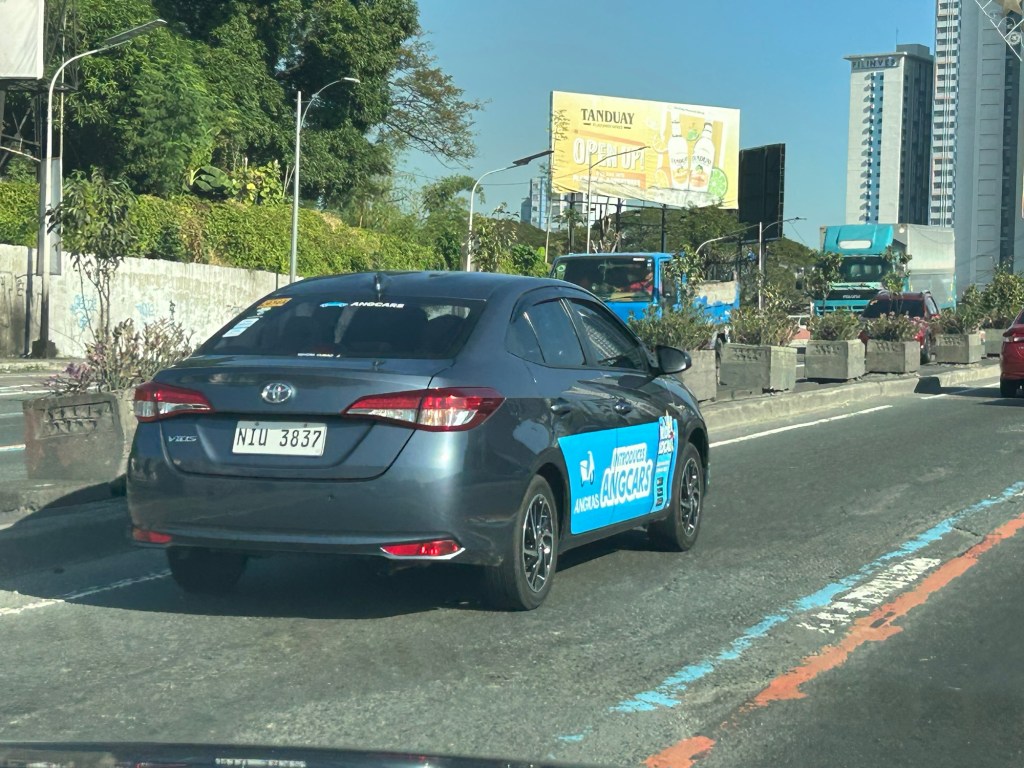
Whether people will take to these competitors for 4 or 2-wheelers so there is not an imbalance of market shares depends on public perception based on the cost and convenience, among other factors, of availing the services of these companies. Conditions may also vary depending on the cities. That is, situations may be different elsewhere like Cebu, Davao or Iloilo.
These modes, however, are still cars and motorcycles, and are regarded as private vehicles in terms of operational characteristics. Even if they are also public utility vehicles (they are for hire with fare rates), these represent a segment of private mode share. There is really a need to improve and improve and expand public transport services in order to retain or increase transit mode shares. Unfortunately, it takes a lot of time and resources to build railways so road-based public transport is still the main option where improvements need to be realized.
–
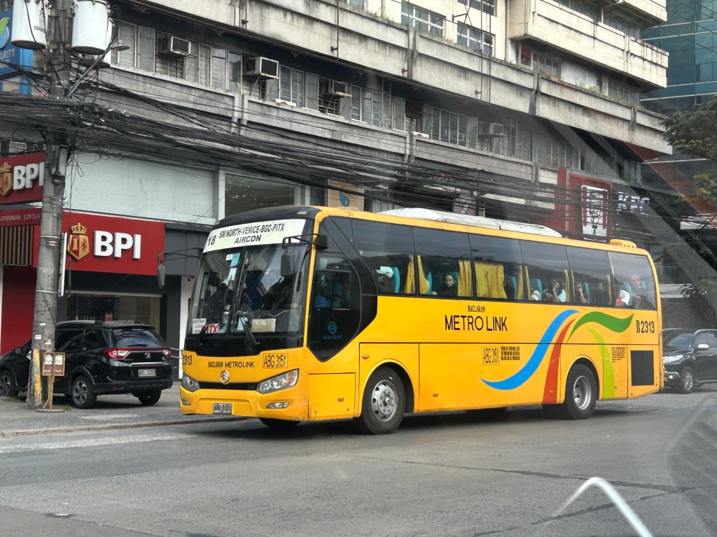
More buses please
The modernization and rationalization initiatives of the government seem to have slowed down. While there are many modern or modernized jitneys on the road, these are mostly in the big cities including Metro Manila and comprise a small percentage of the total jeepneys currently operating around the country.
Buses have been in the mix of these initiatives especially after the pandemic when jeepney operations were suspended and buses were the first to be activated. In the case of Antipolo City in Rizal, bus services between the city and Cubao in Quezon City were introduced. We even thought that they will replace the jeepneys that dominated the routes. Now they are competitors along with Line 2.
There was a real opportunity there for rationalization that involved upgrading to a higher capacity vehicle but that didn’t materialize. In most cases, the so-called modern jeepneys (many really are mini buses) just added to the conventional jeepneys. Were the number of vehicles reduced while increasing passengers capacities? No.
“We need more buses!” is an understatement. We really need more buses but to replace lower capacity vehicles on the road. The inconvenient truth is that we need to phase out jeepneys along certain routes and replace them with buses. Jeepneys may still operate but along shorter routes and would serve as feeder/collector with respect to the main lines operated by rail and buses.
–
Ortigas Avenue Extension counterflow
One traffic scheme that has been constant along Ortigas Avenue Extension is the counterflow scheme. The scheme is applied in the mornings for westbound (outbound from Rizal) traffic. It has been implemented for as long as I can remember; perhaps since the early 1980s. One variant before was a form of “Buhos” where eastbound traffic is stopped for several minutes at certain intervals (6:30am, 7:00am, 7:30am and so on), and westbound traffic is allowed to take all the available lanes during the periods.
Considering this scheme has been implemented for more than 4 decades now, there must be some measure of effectiveness there. It is an example where the directional distribution during the peak hours allow for such scheme to be implemented. Note that the scheme pre dates number coding and similar counterflow schemes elsewhere in other major roads in Metro Manila (correct me if I’m wrong).
The scheme though only shows that there should have been a better transport system put in place along the corridor, which has had a steady growth in travel demand. There should have already been a transit line along this corridor a long time ago. What happened? Was it not in the government’s radar? There was a line proposed and shown in various master plans before.
–
On the chronic congestion along Ortigas Avenue Extension
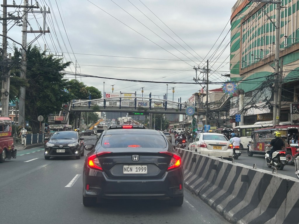
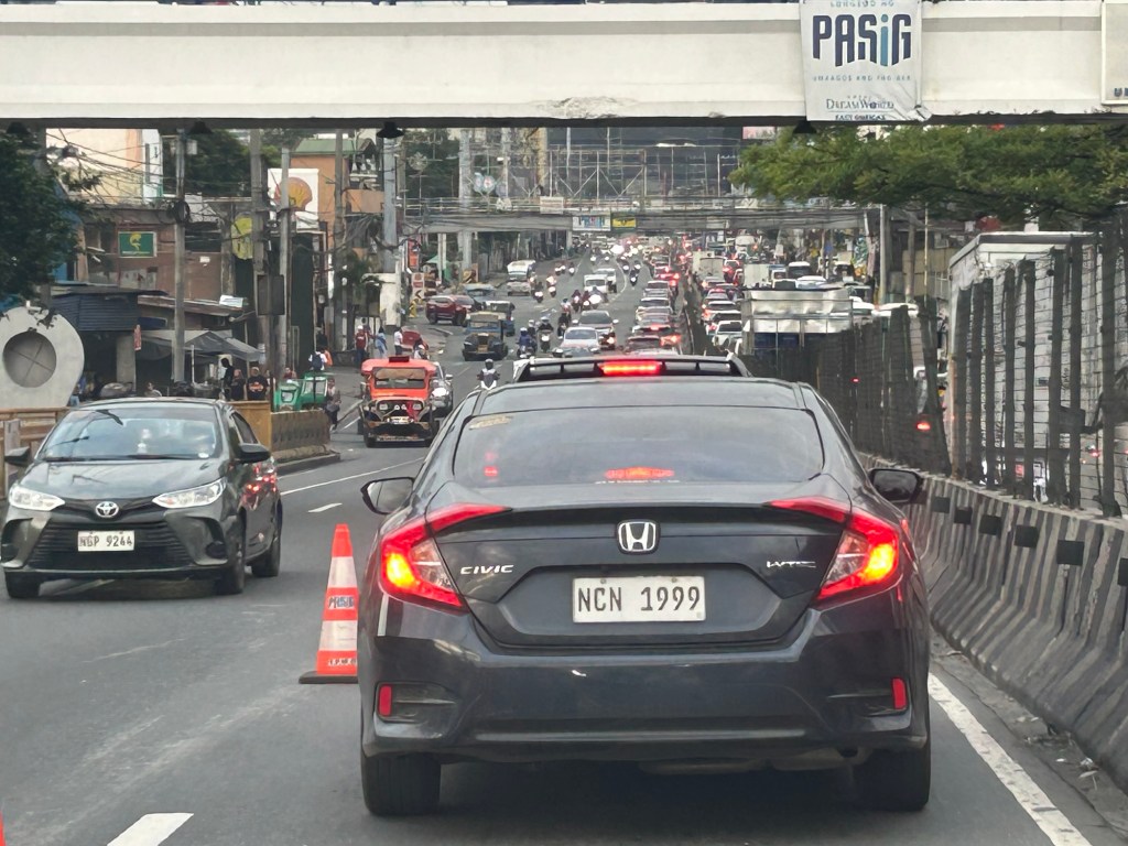
I previously wrote about the counterflow scheme along Ortigas Avenue Extension. While this is usually implemented during the mornings. A similar scheme is not applied in the afternoons or evenings. Apparently, the directional distribution in the afternoons and evenings is not suitable for a counterflow scheme. The photos below show the typical eastbound traffic as seen from the Manggahan Floodway bridge.
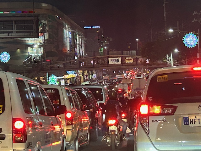 Typical weekday evening traffic along Ortigas Avenue Extension
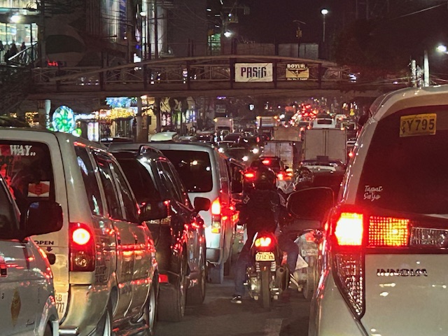 The photos show that the traffic along the opposing direction (westbound) is as heavy as the eastbound traffic. This means a counterflow scheme similar to that in the mornings cannot be implemented during this period.
I have mentioned in the previous article that the corridor already required a mass transit system since the 1980s. Despite the operations of several bus companies over the past decades, these have not been enough (together with jeepneys and vans) to serve the demand along the corridor. It is not uncommon to find so many people stranded along the corridor and waiting to get a ride even during the early mornings. While Lines 2, 3 and 7 were being constructed, people in Rizal who have long endured the traffic along Ortigas Avenue Extension could only wonder why a transit system has not been provided for them. Will the proposed Line 4 be finally constructed? When will it be completed? What could be the traffic impacts of construction considering the limited space available for the construction? Should commuters prepare for more miserable travel once construction is underway?
–
After getting engrossed with EDSA, is Marcos Highway next?
If you monitored the news articles and social media post over the past two decades, there seems to be an obsession for EDSA. Circumferential Road 4 is the busiest corridor in Metro Manila, stretching across several jurisdictions including Caloocan, Quezon City, Mandaluyong, Makati and Pasay City. Aside from the MMDA, national agencies like the DPWH and DOTr have been heavily involved in traffic schemes and transportation infrastructure development along the corridor. These include variants of the travel demand management (TDM) scheme commonly called number coding. Since the 1990s, there’s the Line 3 and several overpasses/flyovers and underpass that have been constructed along major intersections (e.g., EDSA-Shaw, EDSA-Ortigas, EDSA-Kamuning, EDSA-Quezon Avenue, etc.). Nowadays, people are more into the EDSA carousel and most recently the pavement rehabilitation for EDSA. It seems we failed to realize that EDSA is just one corridor. There are others that also demand attention including those in other parts of the country.
Recently, a “carmaggedon” along Marcos Highway was in the headlines or shall I say was trending in social media. There was a lot of excitement for what has been a recurring nightmare to those residing along the corridor. I recall something worse occurred more than 15 years ago (pre-Ondoy), before social media and influencers and digital creators. At the time, Line 2 terminated at Santolan Station. And even back then, the MMDA insisted on playing with their U-turn scheme. I don’t recall a more in-depth study that could have involved micro-simulation modeling being done for the corridor. And since then, populations and traffic have grown steadily and as I’ve written about previously, the extension of Line 2 to Masinag seems to have had little impact on traffic. And so here we are with the MMDA still insisting on tweaking their U-turn schemes and relying mainly on gut-feel instead of a more scientific approach that may actually lead to more sound solutions for the corridor.
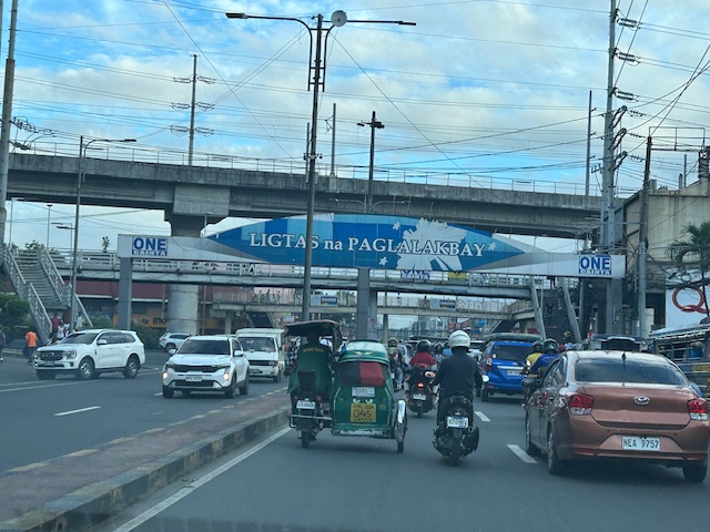 Approach to Marcos Highway from Felix Avenue – that’s the elevated Line 2 superstructure behind the Cainta arch.
 Intersection of Marcos Highway, Felix Avenue and Gil Fernando Avenue – there’s a major foot bridge installed here so people can cross at the intersection, which used to be a signalized junction before the MMDA opted for U-turns for Marcos Highway sections under its jurisdiction.
 Marcos Highway section fronting the Ayala Feliz Mall – the MMDA has played with the location of the U-turn slots in the vicinity of the Marcos Highway-Amang Rodriguez-J.P. Rizal intersection as they tried to determine the “optimum” locations of these slots.
Of course, there is also the case of Commonwealth Avenue. How many carmaggedons have occurred along that corridor? Isn’t it an everyday thing there? And there’s also Ortigas Avenue Extension and many other roads and streets where congestion seems to have been accepted as the norm. How do we make travel easier for most people? How do we improve commutes given the constraints and realities concerning behavior and choices?
–
Reviving an old public transport option
There is some nostalgia about the first air-conditioned public transport mode in the Philippines (correct me if I’m wrong). The Love Bus, as it was called, was operated by the Metro Manila Transit Corporation (MMTC), which is a government owned and controlled corporation. There’s a lot about the MMTC that could be the subject of a series of articles but those are for other days. Suffice it to say here that MMTC provided several types of bus services using different bus models including double deckers. Their most popular though more expensive service is the air-conditioned Love Bus. I was able to take the Love Bus from Cubao to UP Diliman during its waning period of operations in the late 1980s. At the time, the buses entered the campus and I could get off at the nearest stop to Melchor Hall. Those buses terminated at Ateneo near the Blue Eagle Gym. Also, at the time, there were already smaller aircon buses but these were not branded as Love Bus.
I spotted the current incarnation of the Love Bus in the form of a “modernized jeepney.” Like other “modernized jeepneys,” the vehicle is actually a mini-bus. The vehicles are electric and run by Get COMET, a company that used to run an electric jeepney service along Katipunan Avenue. Sometime before the pandemic, they ceased operations. And so this is somewhat a shot at redemption. A comeback given the proliferation of “modernized jeepneys” of various models (many of which are not electric of hybrid).
 This revival of the Love Bus is an electric vehicle operated by GET, which is the company behind the COMET.
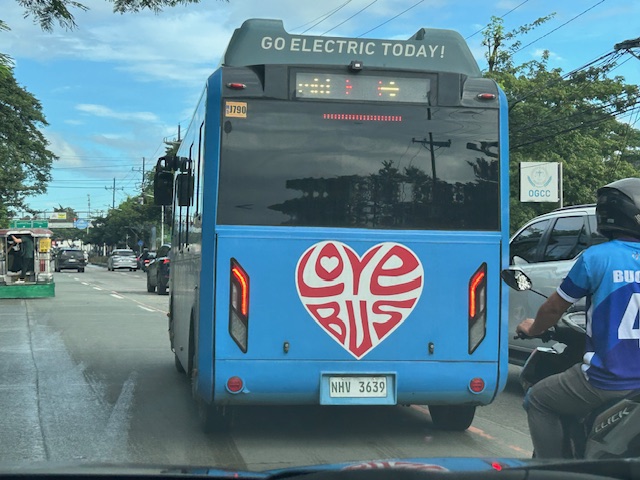 The livery is a throwback to the original Love Bus. They should have also included the “Save Gas” slogan that were in the original buses.
Will these buses stay in business? Will they help popularize public transport? The jury is still out there as currently they are few and there are many competing options along their route. Their presence though is very welcome and perhaps the nostalgia will translate into encouraging more people to take public transportation.
–
Good Transit Is Simple: Lessons in Good Route Design
Here is a quick share of an article on good route design:
Source: Good Transit Is Simple: Lessons in Good Route Design
I won’t be posting a quote from the article as there is really no summary to it. The article identifies the characteristics of a good transit route as well as the “don’t’s” or “no – no’s”.
More Buses, Fewer Riders? Thoughts on the Ridership vs Coverage Tradeoff
Here is a quick share of an article on ridership vs. coverage:
Source: More Buses, Fewer Riders? Thoughts on the Ridership vs Coverage Tradeoff
Basically, there is that question of whether planners or decision makers should prioritize ridership over coverage? Or should it be the other way around? The article provides a detailed discussion of the trade-offs. Perhaps this is again a case of determining which is more suitable for your city?
–
Grab carpool?
I saw this sign at Ayala30 earlier today.
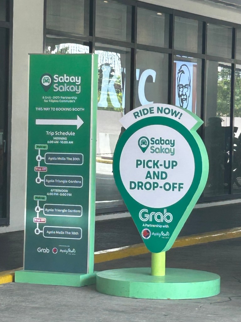
Is Grab going into carpooling? This certainly is not new as at I recall at least one company, Wunder, that tried to make a foothold in Metro Manila back in 2017. It folded after an unsuccessful run that a friend described as dating app masquerading as a TNVS. Seriously though, facilitating carpooling is not an easy task as there are security, safety and trust concerns here that need to be overcome. Perhaps it can be successful with office mates or schoolmates?
–
