
Home » Rural roads
Category Archives: Rural roads
Scenic highways? On the irony of “Daang Kalikasan”
There’s a lot of buzz about new roads nearing completion in the provinces of Pangasinan and Zambales. What is touted as scenic highways became an instant hit and attracted a lot of visitors who apparently wasted little time in trashing the area. The recent news now state that the road has been closed due to the garbage and some road crashes attributed to the influx of tourists in the area:
Mountain roads linking Pangasinan, Zambales closed over accidents, trash
There were a lot of posts that appeared on my social media newsfeed about these roads and the scenery around them. While I have seen a lot of roads with splendid or even magnificent sceneries whenever I go on road trips, the first thing that came to my mind was a question whether the landscape was like that before. I suspected that there used to be forests on these mountains and that the trees were irresponsibly cut down (some people will use the word ‘harvested’ as if they grew and cared for the trees) and never replaced. Some friends from Zambales say there used to be trees there and another recalled old dirt roads in the areas used for logging. So it’s ironic that the road is named “Daang Kailkasan” when nature was practically raped by people who ravaged the land many years ago. Indigenous people who we often refer to as “katutubo” also would likely have never consumed more than what they needed. Scenic? Maybe ‘depressing’ is a more suitable term for these roads.
–
A little bit of history – on how the US interstate highway system came to be
Here’s one of those quick shares that I usually post here. I am a bit of a history buff and mixing that with transport will likely lead to a post like this. Here is a short article about an event in the history of the US Army that happened 100 years ago:
editor@aashto.org (2019) Celebrating Highway History: The US Army’s 1919 Cross-Country Convoy, aashto.org, https://aashtojournal.org/2019/07/12/celebrating-highway-history-the-u-s-armys-1919-cross-country-convoy/ [Last accessed: July 12, 2019]
The article was particularly interesting for me because of two items: the road conditions and the man behind the US inter-state highway system. It took them a little over 2 months to cross the continental US because of poor road conditions. Many people have no sense of history and appreciation of what has been accomplished over the years and how difficult it was to travel at the time. I haven’t done the cross country trip but I have close friends who’ve done it and are thankful for the generally good roads they could use for the experiential road trip. Meanwhile, the person in the article – then Lt. Col. Dwight D. Eisenhower – is a man who made his mark in history at first as the Supreme Commander of the Allied forces in the European Theater in World War 2, who would later on become President of the US. I read elsewhere that the US interstate highway system was designed so aircraft may use them as runways in cases when the US were at war and the enemy had bombed their airports and airfields (just like what the Japanese did in the Pacific).
Do we have similar accounts for our roads and bridges in the Philippines? Were there key persons who may or may not be larger than life figures instrumental in developing our road infrastructure with their vision and leadership (Marcos doesn’t count because of his bogus military record and corrupt regime)? It would be nice to compile these and perhaps it should be a collaboration between the Department of Public Works and Highways (DPWH) and the National Historical Commission (NHC). They could even get the history departments of local universities involved for us to understand the evolution of transportation in this country.
–
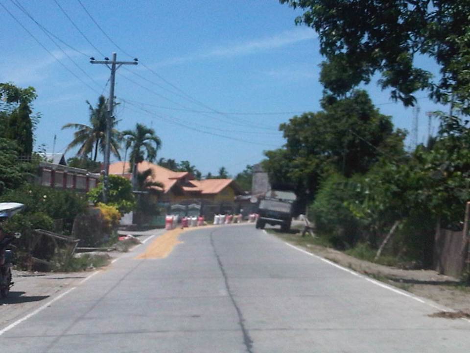
The Tagaytay transportation predicament
The title of this article is actually a bit tame and on the diplomatic side of trying to describe transportation and traffic in this city that was once relaxed a retreat for many. I had wanted to end February on a good note and so I decided to defer posting this until March.
We used to frequent Tagaytay and liked spending some rest and recreation time there to the tune of being there almost once a month at one time. Needless to say, at the time travel to Tagaytay from our home in Antipolo took us only about 2 to 2.5 hours excluding our usual stop at Paseo in Sta. Rosa, Laguna. We liked the city so much that we even considered making it a second home; even inquiring and looking at properties there.
Fast forward to the present and it has become an excruciating travel with the highways leading to the city already congested. It didn’t help that when you got there, you also had to deal with serious traffic congestion. This started not a few years ago when the city approved developments by major players including Robinsons, SM and Ayala. The developments by SM and Ayala proved to be the backbreakers with Ayala coming up with the first mall in the city and SM operating an amusement park beside its prime acquisition that is the Taal Vista Hotel. Now, there is another mall under construction by Filinvest and right at the corner of the rotonda where the Aguinaldo Highway terminates.
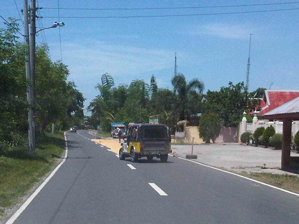
 Vehicles queue along the Tagaytay – Nasugbu Highway towards the Rotonda where Tagaytay traffic enforcers attempt to manage traffic but appear to create more congestion instead.
More on Tagaytay soon…
–
First call for papers for the TSSP 2017 conference
The first call for papers for the 24th Annual Conference of the Transportation Science Society of the Philippines came out last Wednesday, Feb. 15:
–
Data on local roads – digital maps
Here’s another quick reference to an article describing a current undertaking to map the 45,000+ kilometers Philippine road network:
PH undertaking $5M digital mapping of 45,000-km road network
What’s significant with this development is that soon the country will have excellent maps, including 3D and 360-degree views of most if not all local roads. While there are similar maps via Open Street Maps and Google Maps, the latter are not as comprehensive. These maps will be very useful for a lot of applications including transport planning, urban and regional planning, and disaster mitigation. A lot of people are surely looking forward to the completion of this project as well as when the maps can be accessed and used.
–
Local papers presented at the EASTS 2015 conference – University of the Philippines
There were a lot of technical papers from Philippine universities that were presented in the recently concluded 11th International Conference of the Eastern Asia Society for Transportation Studies (EASTS 2015). In the interest of dissemination, I will be featuring a list of papers produced by leading universities in the Philippines that are doing studies on transportation. Following is a list of papers from University of the Philippines Diliman that were presented at the EASTS 2015 held in Cebu City last Sept. 11-13, 2015:
- Innovative Collection of Road and Traffic Data for Road Safety Audit (Aileen Mappala & Ricardo Sigua)
- Study on Safety of Railway/Highway Grade Crossings in the Philippines (Albie Clarito, Beverly May Ramos & Ricardo Sigua)
- Instantaneous Fuel Consumption Models of Light Duty Vehicles and a Case Study on the Fuel Consumption at Different Traffic Conditions in Metro Manila using Shepard’s Interpolation Method (Ernesto Abaya, Karl Vergel, Ricardo Sigua, Edwin Quiros & Jose Bienvenido Biona)
- Development of Drive Cycles and Measurement of Fuel Economies of Light Duty Vehicles in Metro Manila (Ernesto Abaya, Karl Vergel, Ricardo Sigua & Edwin Quiros)
- Selection of Metro Manila BRT Corridors Using Multi- Criteria Assessment (Ricardo Sigua & Cresencio Montalbo, Jr.)
- An Assessment of Walkability in a Medium-Sized Philippine City (Hilario Sean Palmiano, Sheila Flor Javier & Jose Regin Regidor)
- Traffic Noise Measurement, Perception, and Modelling in a University Campus (Hilario Sean Palmiano, John Carlo Villar & Michelle Monelle Quilatan)
- Assessment of Metro Manila Bus Fare Computation (Sylvia Chavez & Hilario Sean Palmiano)
- Estimating Road Roughness Conditions Using Ubiquitous Smartphones and Geographic Information Systems and its Application to Road Network Planning in the Philippines (Joel Cruz & Jun Castro)
- Fuel Economy and Public Utility Jeepneys Using 2% and 5% Coco-Metyl Ester (CME)-Diesel Blends (Edwin Quiros & Karl Vergel)
- Comparison of Fuel Economy of Fuel and Operating Characteristics of Diesel and Auto-LPG Jeepneys through On-Road and Vehicle Tests (Edwin Quiros, Karl Vergel, Ernesto Abaya, Ervin Santos & Jose Gabriel Mercado)
- Challenges of Urban Transport Development in Metro Manila: A look back at the last 40 years (Maria Sheilah Napalang & Jose Regin Regidor)
- An Assessment of the Public Necessity Concept for Estimating the Requirements for Public Transport Vehicle (Arnel Manresa, Karl Vergel & Jose Regin Regidor)
- State of Pavement Engineering in the Philippines and Implications on the Economic Life of National Roads (Maria Sheilah Napalang, Jose Regin Regidor & Nathaniel Diola)
- Planning Metro Manila’s Mass Transit System (Ricardo Jose, Daniel Mabazza, Jose Regin Regidor, Marco Stefan Lagman & Jonathan Villasper)
- Evaluation of Compliance of Dimensions and Selected Systems and Components of Customized Local Road Vehicles (CLRV) with Vehicle Regulations and Standards (Karl Vergel, Rachel Habana, Nonilo Peña, Loreto Carasi, Albert Mariño & Alorna Abao)
- An O-D Approach of Estimating Energy Demand and CO2 Emission for the Luzon Road Transport using Inter- Regional Passenger and Freight Flow Data (Marloe Sundo & Karl Vergel)
- Dignity of Travel: BRT Development in the Philippines (Cresencio Montalbo Jr & Colin Brader)
- Mending a Metropolis – Understanding Passenger Demand Across Metro Manila To Improve Road Transit (Nicholas Greaves & Cresencio Montalbo Jr)
- Accident Hotspot Mapping in Quezon City: The case of Katipunan Avenue (Jerome Ballarta, Nelson Doroy, Ishtar Padao & Cecil Villanueva)
Not included in the list are papers coming out of International Research Groups (IRG) as well as those where involvement by UP faculty were incidental to projects. Many of these papers will soon be posted on the official site of the International Scientific Committee of EASTS as part of either Proceedings or Journal of EASTS. Some may be nominated for the Asian Transport Journal (ATS), which is also published by EASTS.
Transportation research in UP Diliman is the most developed among schools doing research on these topics in the country. Papers came from a variety of disciplines and academic units including Civil Engineering, Mechanical Engineering, Urban Planning, Geography and History. These mostly were and are undertaken through the National Center for Transportation Studies (NCTS), which is with UP Diliman.
Next up: De La Salle University
–
EASTS 2015 – Cebu City, September 11-13, 2015
The 11th International Conference of the Eastern Asia Society for Transportation Studies (EASTS 2015) will be held in Cebu City this September 11-13, 2015. For information on the conference and program, check out their website here:
You can also download a brochure about EASTS here:
The conference is hosted by the Transportation Science Society of the Philippines (TSSP), which is the local affiliate of the EASTS. More information on the TSSP are found below:
–
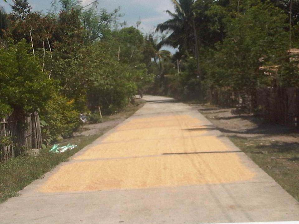
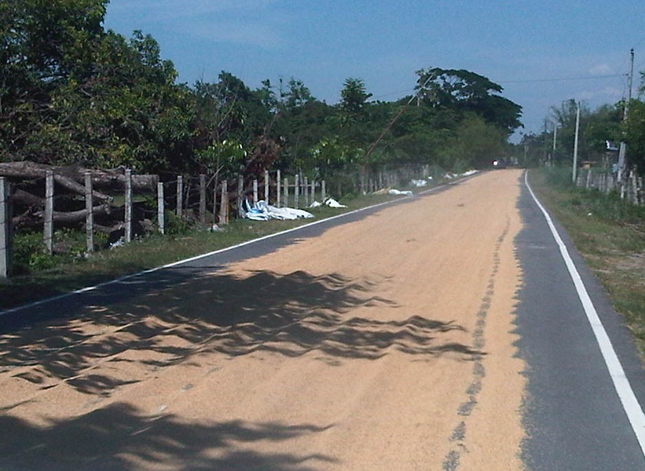
Roads as solar dryers – Part 2
This is a continuation of an earlier post on roads being used as solar dryers. Our trip across Tarlac brought us to more of these facilities being used for agricultural purposes. The following photos are from San Jose and Mayantoc towns, which are obviously predominantly agricultural. The photos show lands devoted to agricultural as far as the eye could see and most are planted with rice.
A friend commented that something should be done to reduce if not eliminate such practices along roads. I replied that this is basically the responsibility of local government units including barangay officials who should be educated about the dangers posed to travellers as well as the deterioration in the quality of the rice as it gets compromised from the waste and grinding they get from vehicles. In terms of practicality and recognising the limitation in funds for solar dryers, roads seem to be the easier and versatile option. Basketball courts and other concreted spaces scattered around the countryside do not make sense where roads would have more use especially to address accessibility issues (e.g., farm to market roads).
Another friend commented on the earlier post that he almost had a collision with another motorcycle rider as the entire road was covered with rice being dried by farmers. I reasoned out that for rural roads with very low traffic, a single lane covered with rice could be tolerable but using the entire road width just is not right. Motorcycle can easily slip or skid along such rice-covered roads resulting in serious injuries if not fatalities. For most cases of what I’ve seen recently, the roads quality as having low traffic and rice is being dried only along one lane so we know at least that people are aware that one lane should at least be free of obstructions.
 1
1
 2
2
 3
3
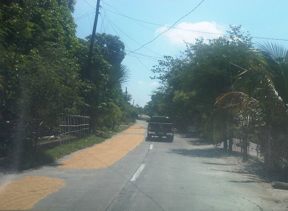
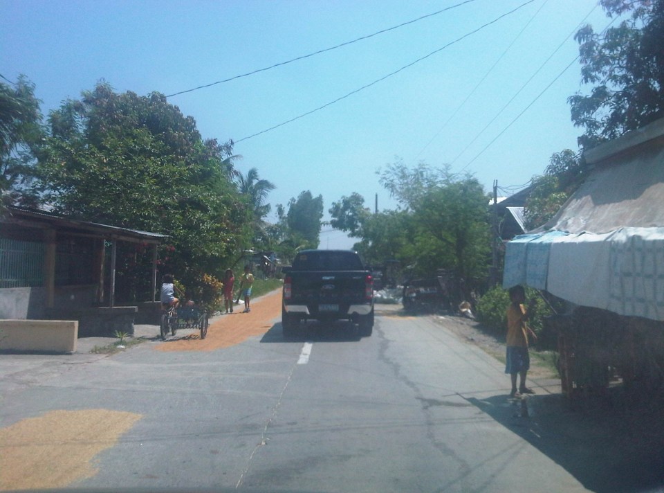 4 – That’s corn being dried just beside the pick-up truck in the photo.
 5
5
 6
6
 7
7
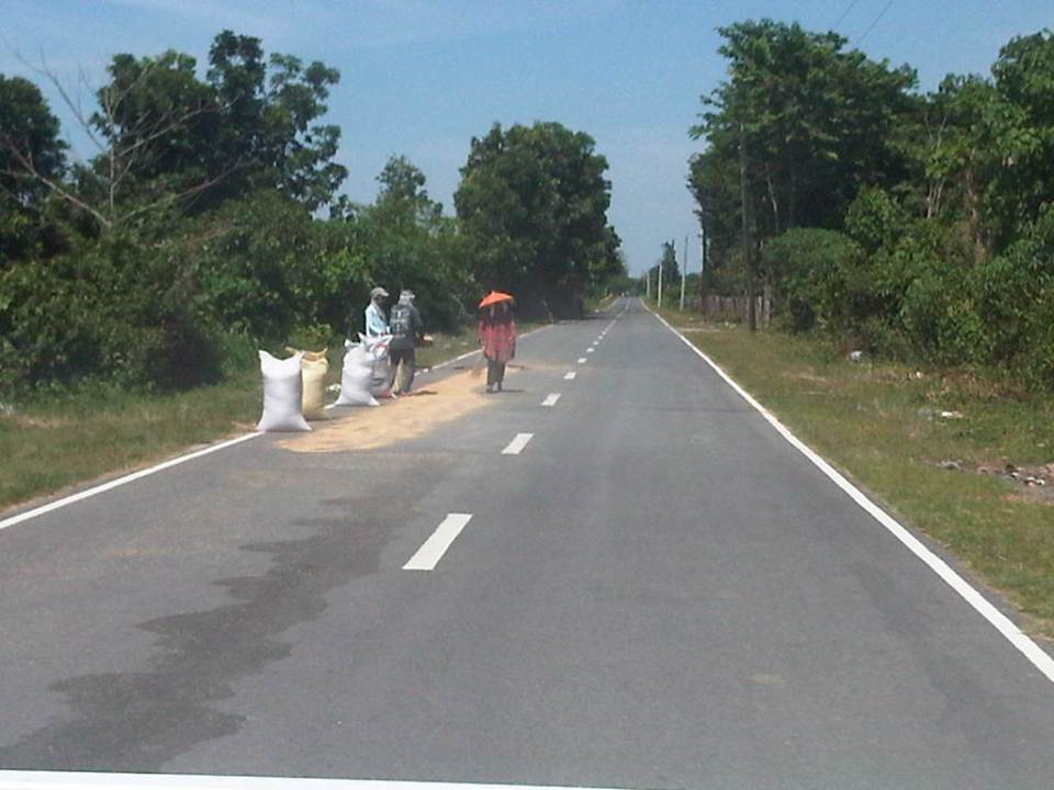
 8 – Bad practice of spreading the grains across the entire road carriageway
 9
9
The last photo is of corn kernels being dried on a basketball court. You can see the cobs piled near the stage, which shelters what looks like sacks of corn. As I mentioned earlier, it is possible to have such basketball courts or social facilities to be used as solar dryers. Even schools grounds can be used for this purpose but only for weekends or during the summer breaks. However, it would be impractical to have basketball courts and plazas scattered all over the countryside just for this purpose especially in places where there aren’t much people in the first place. Roads still offer the more flexible use (i.e., access/FMR and solar dryer) as long as traffic is not significant. Perhaps where traffic is significant (i.e., significantly populated areas) then such “off-road” facilities should be constructed. But again, the responsibility for making sure roads are clear of agricultural products would fall unto the LGUs.
–
Roads as solar dryers – Part 1
We are currently undertaking a project for the Province of Tarlac that looks into the safety along its rural roads (both national and provincial roads) including those providing access to tourism areas in the province. Along many rural roads are agricultural lands producing rice, corn, fruits, vegetables and other products. Often, travellers will encounter roads that serve another purpose other than transport – as solar dryers. Before rice is milled, it needs to be dried first so that it would be easier to remove the husk (i.e., separate the bigas from the ipa – together they are called palay). While it is possible to do this drying on mats (banig) spread over the land/soil this takes time. Meanwhile, portland cement concrete roads offer what seems to be the perfect surface for drying. As such, certain roads have been known to get justification for concreting despite low traffic volumes as they double as solar dryers. There are similar cases for basketball courts or village plazas receiving funding for concreting for the same reasons. Obviously, laying out rice on the roads have implications on the quality of the rice later on as vehicles will inevitably (even inadvertently) pass through the roads. I guess its even worse in cases when the road surface is of asphalt concrete. Following are photos I took along rural roads in Bamban, Capas and San Jose towns of Tarlac.
 1
1
 2
2
 3
3
 4
4
 5
5
 6
6
 7
7
 8
8
 9
9
 10
10
Other items that are usually dried on the roads include tingting (the stems of coconut leaves that are used to make brooms – walis tingting) barbecue and fish ball sticks. I have also seen fish being dried on the road one time during a trip to Northern Luzon. Obviously, among the risks are the rice being grinded by the tires of vehicles (resulting in durog na bigas more suitable for porridge), fuel or oil compromising the rice, and the prospects of animals doing their thing on the road near or on the rice!
More on these solar dryers in the next post!
–
Daang Bakal
The right of way for the old railroad line going up to Antipolo is still there and is now a regular road. Daang Bakal rises from what is now Valley Golf Subdivision (Celso Tuazon Ave. and Taktak Drive) in Cainta, Rizal through Victoria Valley Subdivision (Taktak Drive), Fairmount Hills Subdivision and Hinulugang Taktak (Daang Bakal though often referred to as Taktak Road, which is actually a different road and on the other side of the river), and until part of the Sumulong Memorial Circle in the vicinity of the Antipolo Church (Shrine of Our Lady of Peace and Good Voyage). I took a few photos of Daang Bakal on our way to the Parish of the Immaculate Heart of Mary for Palm Sunday Mass. The photos have been modified as I took it at dusk. The originals were quite dark so I adjusted the brightness. Still, I can only imagine now how this route could have looked like back in the day when the Manila Rail Road line passed through this area. It could have been one of the most scenic rides as it is still a scenic route today.
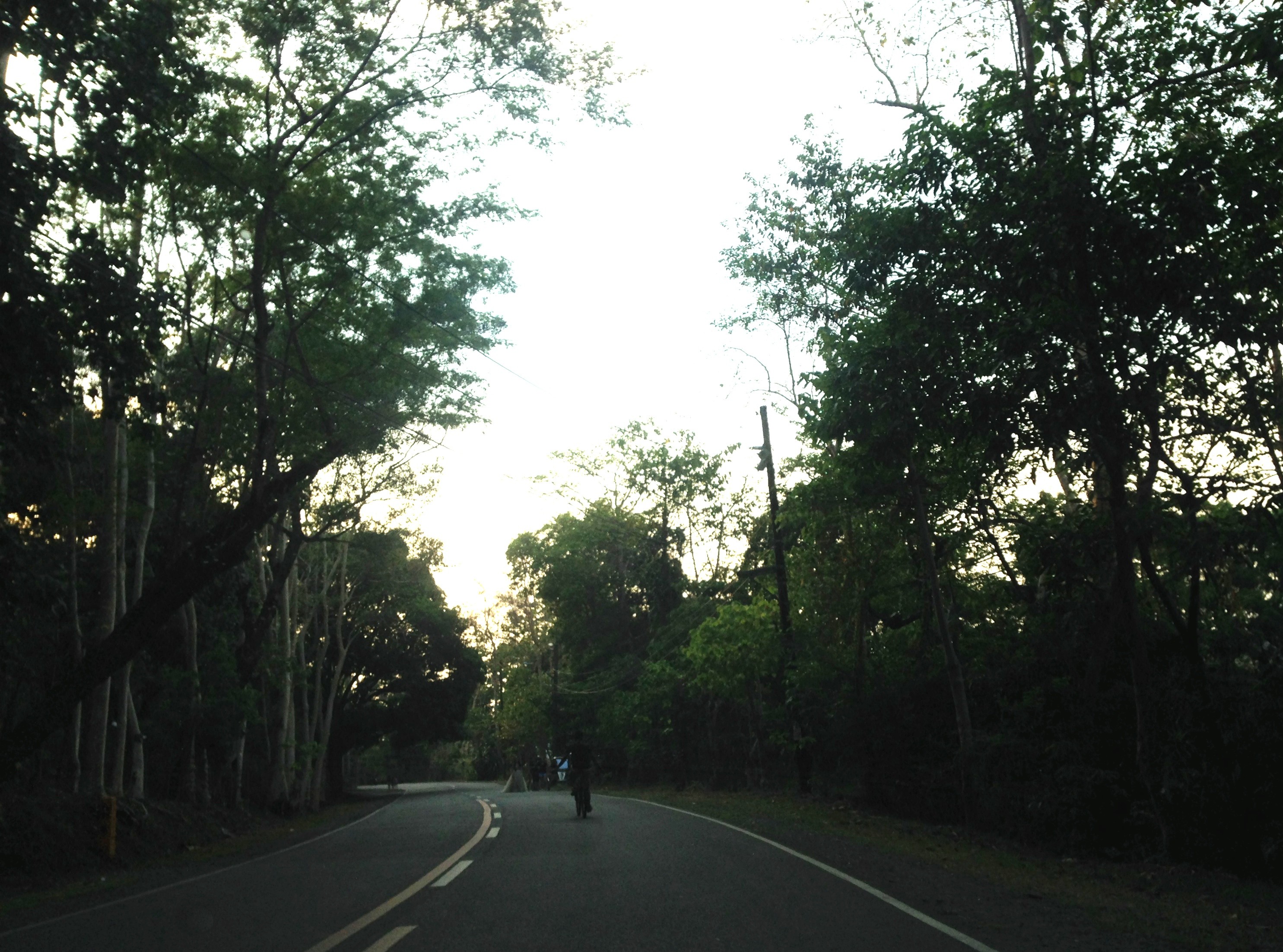


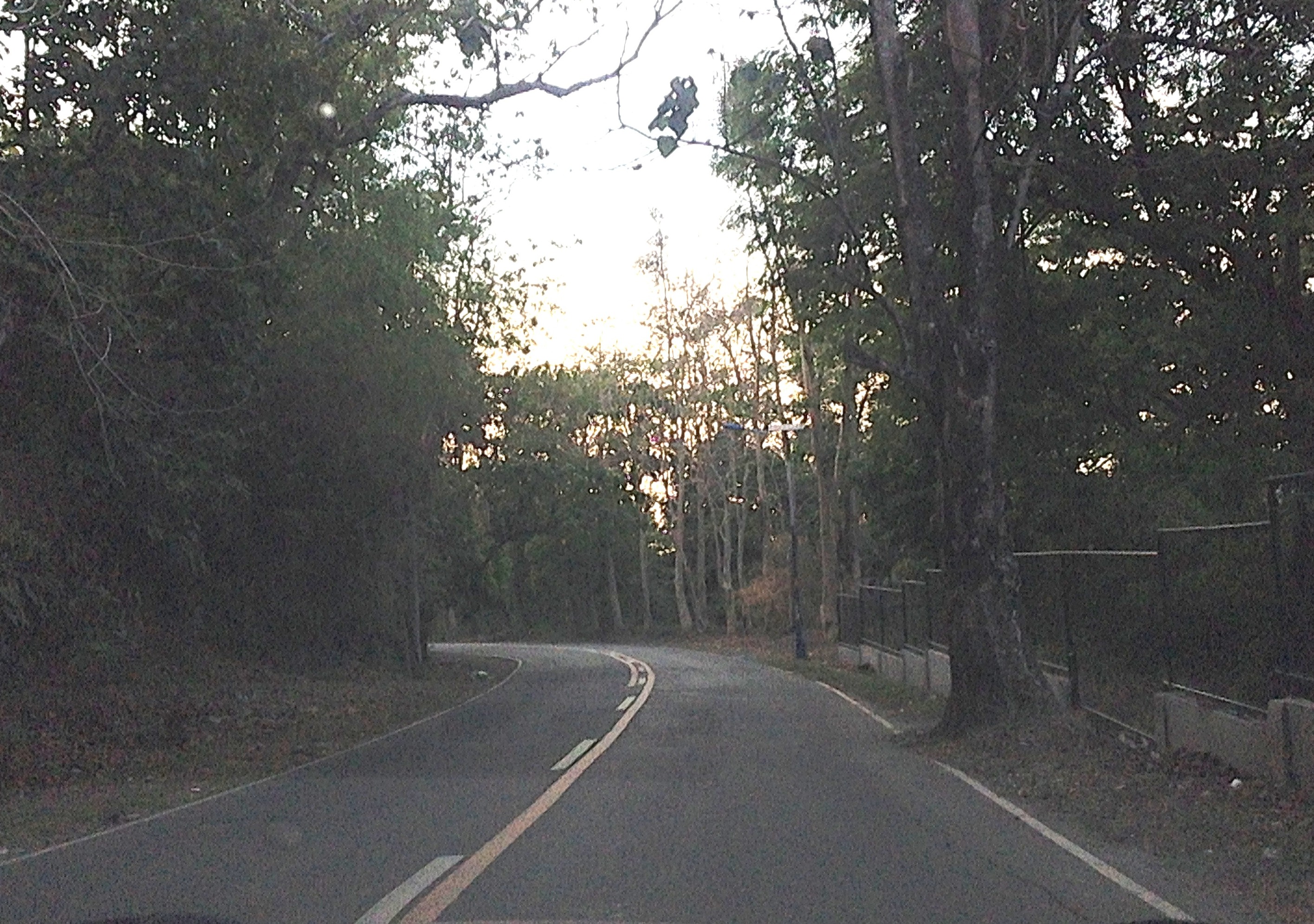
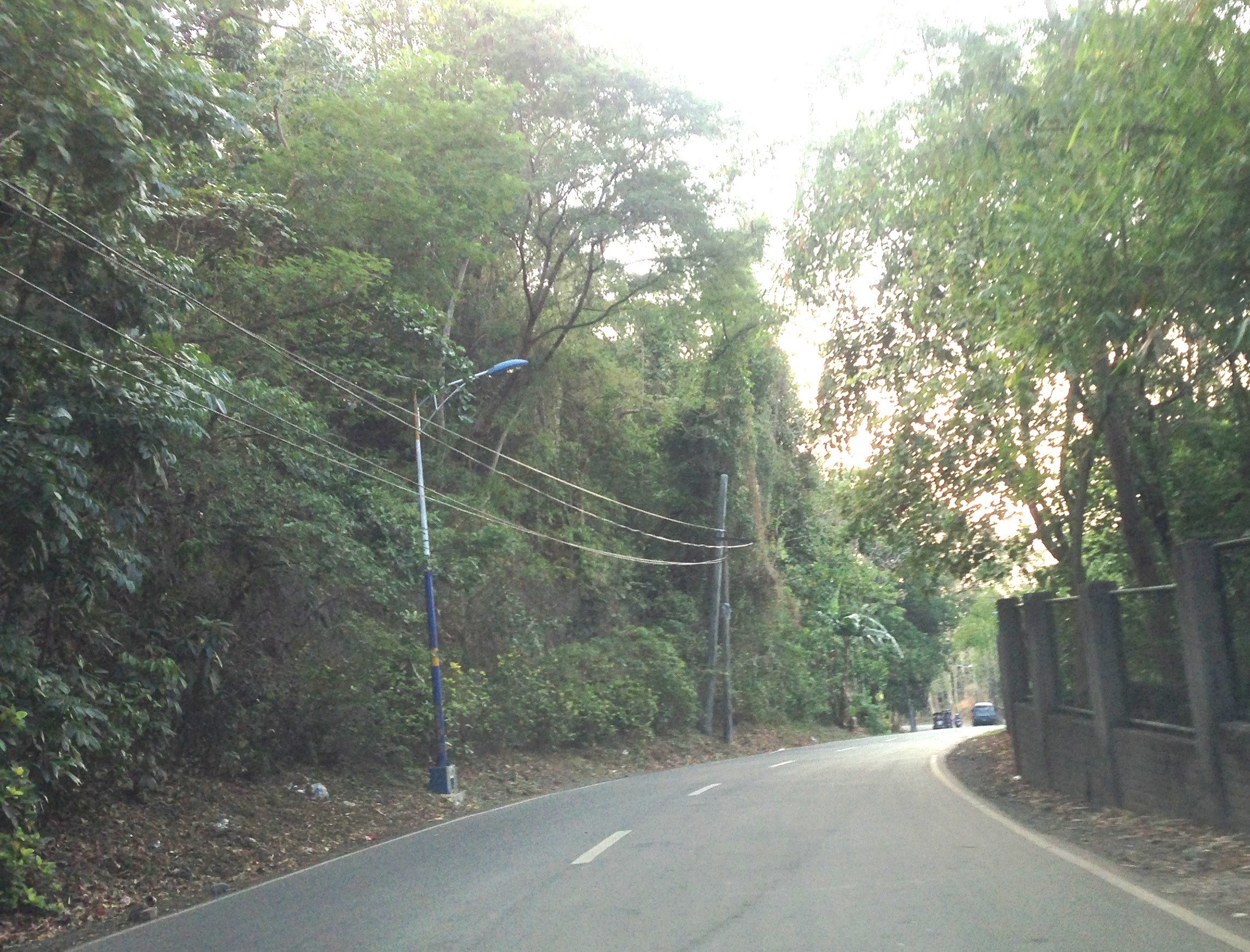
At right in the photos is a fenced property designating the Hinulugang Taktak National Park. Hinulugang Taktak refers to the water falls that used to be one of the more popular destinations in Antipolo. There is actually a popular folk song inviting people to come to Antipolo (“Tayo na sa Antipolo at doon maligo tayo…”) to enjoy the falls. The falls have deteriorated through the years as it has been affected mainly by the settlements around it. There seems to be an effort to rehabilitate the area but it is still closed to the public. The road though is in excellent condition and has low motor traffic volumes. It is popular among cyclists as well as joggers. This Holy Week, the area should have a lot of visitors because of the Parish church in the area, which has an impressive architecture and gardens. The church is perfect for those doing Visita Iglesia or perhaps people just wanting to go to a quiet place for some meditation and prayer.
–
