
Home » Signs and markings
Category Archives: Signs and markings
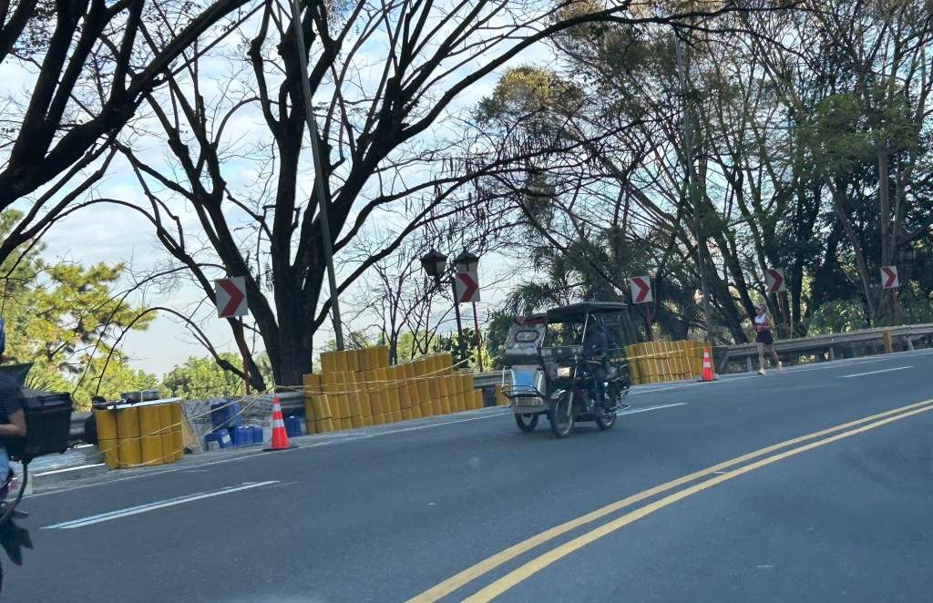
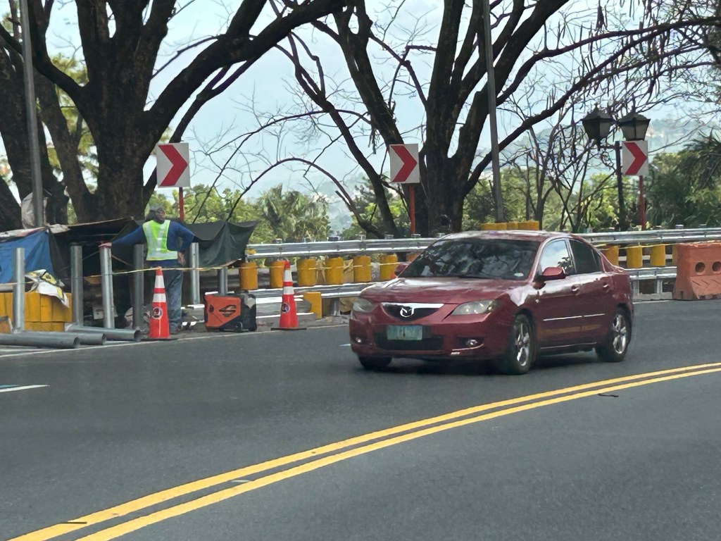
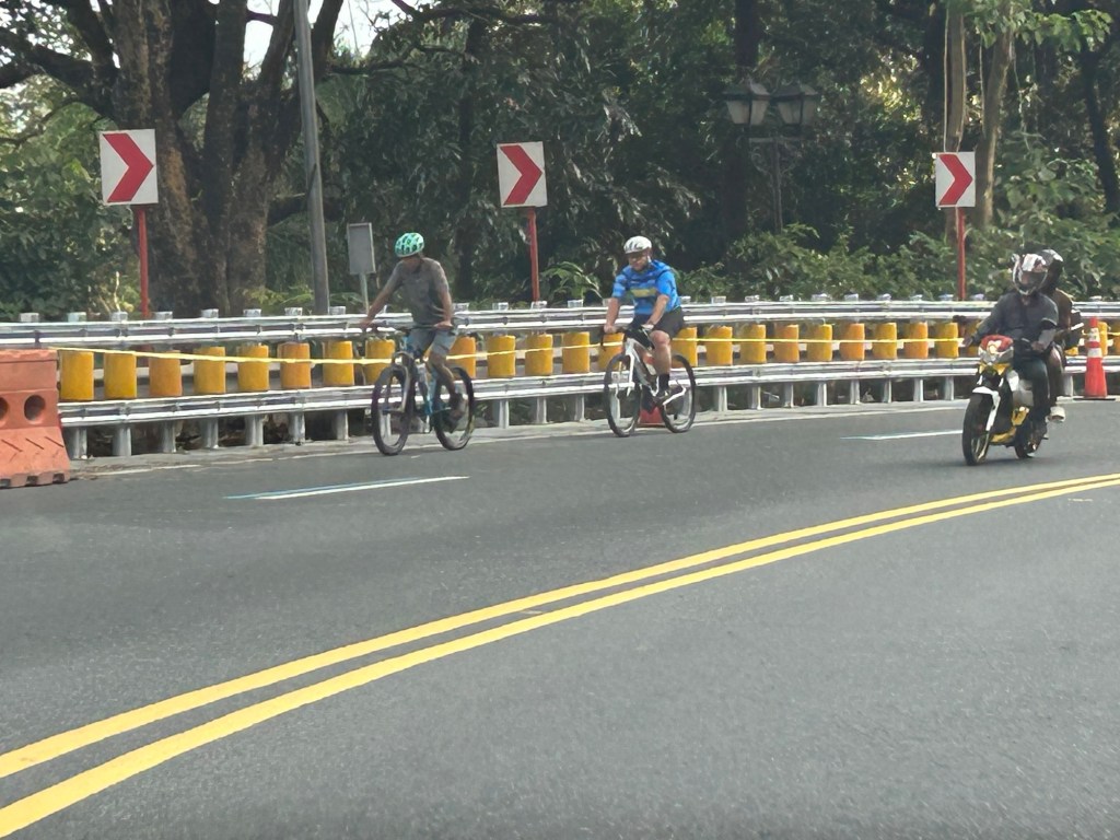
Safety roller barriers along Sumulong Highway
Last week, I observed that the DPWH is currently installing road safety barriers along a section of Sumulong Highway in Antipolo City. Previously, I posted about the same along the Antipolo-Teresa Road, which has treacherous zigzag sections. Here are photos of the ongoing installation work along Sumulong between Padi’s Point and the Oscar Lopez Center.
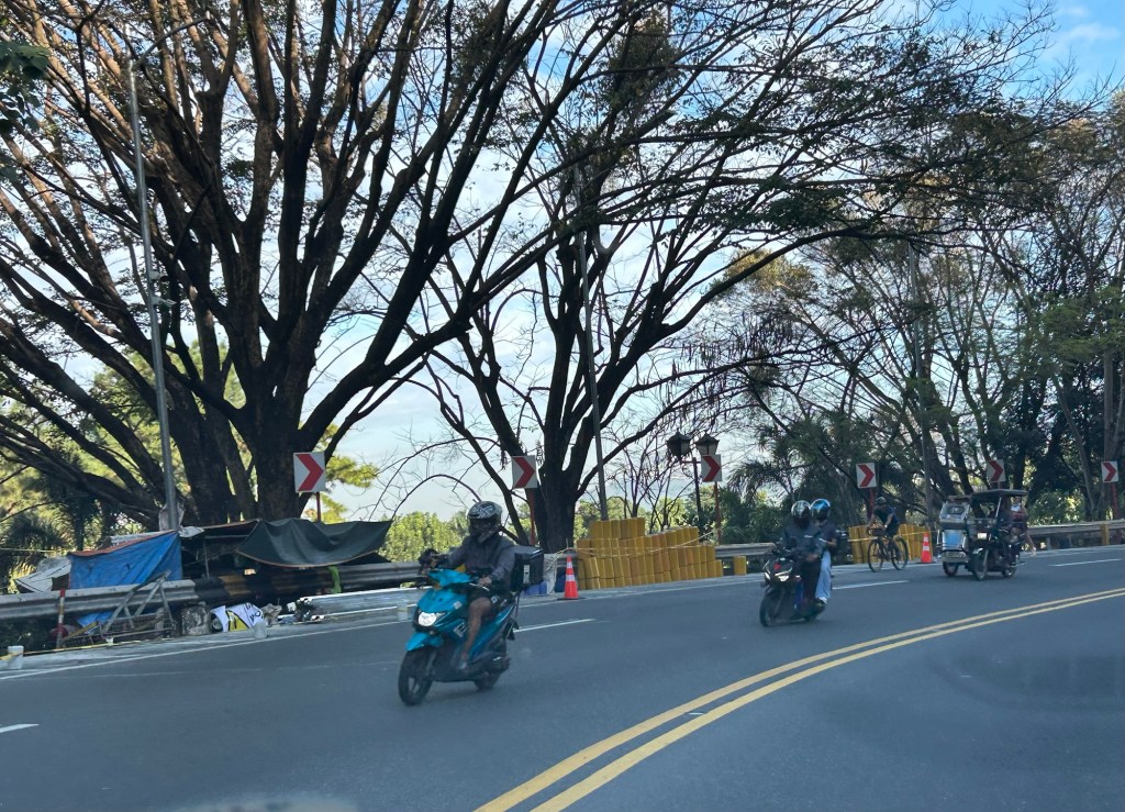
Here is a link to what these barriers are and how they help make roads safer for all users:
https://roadskyguardrail.com/what-is-a-safety-roller-barrier-a-comprehensive-guide
–
Revising the DPWH Design Manuals
A friend posted about the current initiatives in the US as they embark on revising their Manual on Uniform Traffic Control Devices (MUTCD). This manual along with AASHTO’s Geometric Design of Highways and Streets and their Highway Capacity Manual are something like the holy trinity for Highway and Traffic Engineers. These are also the main references for our DPWH for the manuals and guidelines we use in traffic and highways.
Here are a couple of articles calling for the revisions to reflect recent designs mainly from NACTO, which itself publishes guidelines for roads to be more inclusive rather than car-centric:
NACTO (May 2021) Modernizing Federal Standards: Making the MUTCD Work for Cities, https://nacto.org/program/modernizing-federal-standards/
NACTO (May 11, 2021) A Blueprint to Update America’s Street Manual, https://nacto.org/2021/05/11/a-blueprint-to-update-americas-street-manual/
We don’t have to pattern revisions after the MUTCD but then that requires that the DPWH through its Bureau of Research and Standards (DPWH-BRS) do its part in compiling, reviewing, studying and adopting materials from various countries, and developing suitable standards and guidelines for roads in the Philippines. Do they have to reinvent the wheel? Not so and they can still refer to the US manuals as long as again these are localised for our conditions and situations.
–
Whatever happened to those ‘enhanced’ pedestrian crossings?
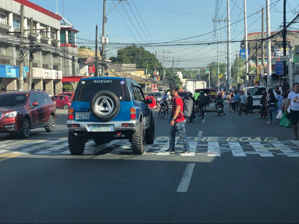
Before the lockdowns, a lot of people seem to have become excited with what a private company did as part of their PR campaign (I’m certain about this because their ads feature these.). That is, they painted on the existing pedestrian crossings in Antipolo City along major roads such as Sumulong Highway and the Sumulong Memorial Circle. While coordination with the LGU was done, there seems to be none with the DPWH considering these are national roads and any matter concerning them are under the agency’s jurisdiction through their District Engineering Office. The following photos were taken prior to the lockdown and as you can see (if you were objective) there’s nothing really notable about them though they appear to enhance the existing crosswalks.
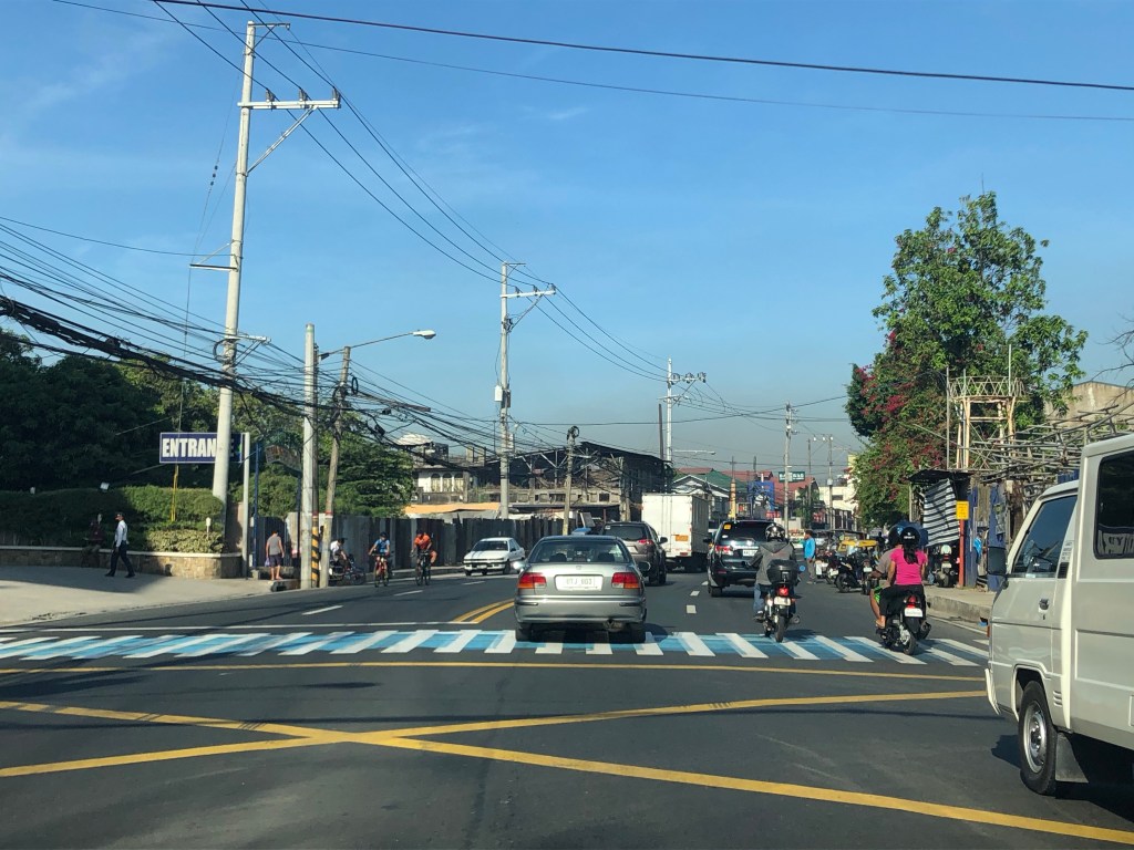
The artwork is practically invisible to motorists especially those on cars whose drivers’ eyes are lower than those driving SUVs, jeepneys, buses or trucks (i.e., larger and taller vehicles).
There is no strong evidence that such works enhance road safety.
There is no strong evidence that such works enhance road safety and you can check on this by doing either a quick or even an extensive search for literature proving significant impact. I guess the key here is to also install other devices such as a speed table or rumble strips for motorists to feel that they are approaching a pedestrian crossing. Also, perhaps instead of just painting on the crosswalks, they could have painted so as to widen the crosswalk. Then they could have increased the visibility for pedestrian crossings. That said, they should also have used the standard paints for these facilities that make them visible at night and could have been more resistant to weathering.
–
What the DPWH says about the installation of ads including those masquerading as signs
So what does the DPWH say about signs and their installation? The DPWH in their Highway Safety Design Standards (Part 2: Road Signs and Pavement Markings Manual) states the following:


It’s plain and simple and yet we find a proliferation of ads masquerading as signs and entities such as the MMDA and LGUs not properly (or strictly) implementing the provisions of the DPWH manual. It is also sad to see practitioners actively trying (and succeeding) to circumvent this provision in the DPWH manual.
–
On unnecessary signages
Most of us who use roads whether as private motorists, public transport users, cyclists or pedestrians would notice a lot of signs along our roads. In fact, there seems to be too many signs along our roads including ads and information signs for commercial establishments. Electronic screens can be particularly distracting to drivers not just for their content but due to their brightness that can affect the eyesights.
However, there are also ads that are masquerading as traffic signs. These are designed as standard traffic signs providing directions to travellers using materials that are typically prescribed for signs produced and installed by the DPWH and LGUs according to the reference manuals.
 Ads and signs along Katipunan Road – the ads are obvious for their commercial purpose. The sign is actually a promotion for a commercial development that is a bit far from this area.
 Here is another sign near the northbound approach to Masinag Junction along Sumulong Highway. The mall chain has a branch near the junction along Marcos Highway but the sign directs you to another along Ortigas Avenue Extension.
I believe the DPWH, MMDA and LGUs should be stricter about road signs. These add to the visual noise that is already present with all the ads (especially electronic ones) along our roads. These, too, have costs for their sponsors and we suspect that these are part of the recommendations made by traffic consultants who also have connections with the suppliers of these signs. If true, then these consultants are making the profession look bad through these questionable recommendations.
–
On the Pasig HOV traffic experiment
Someone shared a post about a traffic scheme they will be implementing along Julia Vargas Avenue in Pasig City. The proposal is for the avenue to have a high occupancy vehicle (HOV) lane where vehicles with 4 or more occupants are to take one lane and all other vehicles the other. I am not entirely sure about the objective other than to promote high occupancies for vehicles. However, it would be nice to see how travellers will be behaving (e.g., complying) and how Pasig (with MMDA?) will be enforcing this scheme.
This is what a segment of Julia Vargas currently looks like with 2 wide lanes designated for motor vehicles (separated by the solid yellow line) and one narrow lane for cyclists (adjacent to the shoulder):

The intent is good but as a major link the scheme can be quite confusing especially for those who are not necessarily frequent users of this road. I assumed the yellow line was painted by the DPWH but it seems it was by Pasig. Perhaps they should have removed the old markings? Or maybe better if they rationalised the carriageway width to accommodate 3 lanes for motor vehicles and 1 wider lane for bicycles? From the photo above, it appears to me that it is possible to have 2 narrow lanes for general traffic and one wider lane for HOVs (in this case defined as having 4 or more occupants) and public utility vehicles. This configuration maximises the capacity of the road while having a the “best” lanes allocated for HOVs and bicycles.
I wish them success on this social experiment. Perhaps there can be valuable learnings from this including the need for connectivity to other links as well.
–
On a proposal to redesign bus stops and signs in Metro Manila
Here’s another quick post but it is something that should be picked up by government agencies particularly the Metro Manila Development Authority (MMDA). The following link is from Sakay.ph, which conducted a study on their own and came up with this:
A Redesign of Bus Stops and Signage in Metro Manila
The idea is not at all a new one considering you will see such appropriate stop designs and signs abroad. These are good designs that make a lot of sense (See the visuals in the article for you to be convinced). Only, the MMDA and other agencies including local government units are notoriously stubborn when it comes to innovative ideas that challenge the templates that they are used to. Perhaps the Land Transportation Franchising and Regulatory Board (LTFRB) and the Department of Public Works and Highways (DPWH) can also take a look at these ideas considering public transport is regulated by LTFRB and the agency can take a progressive stance in ruling for more uniform bus body designs. Meanwhile, the DPWH is in-charge of most road signs along national roads like EDSA and should also be proactive in the design of signage while also keeping in mind the international standards that we need to conform with. As for the buses themselves, the recommendations underline the need to streamline (read: reduce) the number of buses and players and the rationalization (read: simplify) routes in Metro Manila. Maybe they can start doing the livery for the P2P buses to show how the concept works?
–
Arches in La Union and Ilocos Sur
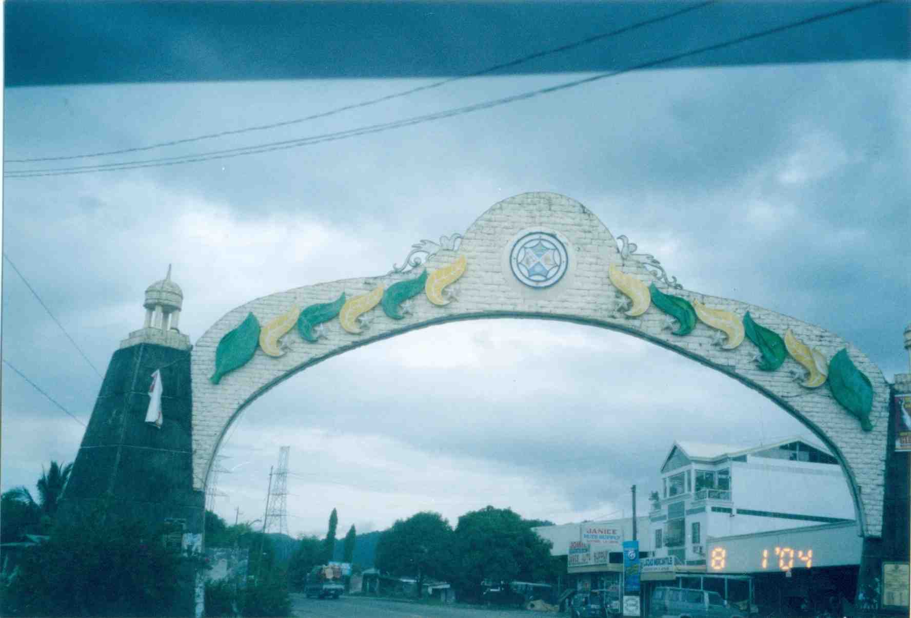
Road travelers are welcomed by arches found at the boundaries of cities and municipalities. These are commonly seen along national roads and often reflect the character, history or product for which the city is known for. The town of Paniqui, Tarlac has a bat featured in its arch while Castillejos, Zambales includes a castle. I stumbled into a lot of old photos recently. Well, probably not so old considering they were taken in 2004 during the time we were implementing nationwide surveys for passenger and freight flow. As our group was assigned to do surveys along McArthur Highway from Tarlac to Ilocos Sur, I frequently took photos using the old Pentax camera I bought during my first visit to Japan in 1996. In 2004, digital cameras were still quite expensive and so were cell phones with cameras. It was cheaper to buy film and have it developed and photos printed. In my case, I usually bought a lot of film when I traveled to Tokyo (it’s cheaper there) and I carried a few rolls whenever I went on trips. The prints I discovered were taken along the national road while we were traveling from La Union to Ilocos Sur. Many of the photos showed arches of towns that I took note of as we proceeded to Vigan. I think I may have missed some but checking the maps I believe I was able to catch most of the arches between Agoo, La Union and Santa, Ilocos Sur.
 Agoo, La Union
 Bauang, La Union
 Balaoan, La Union
 Bangar, La Union
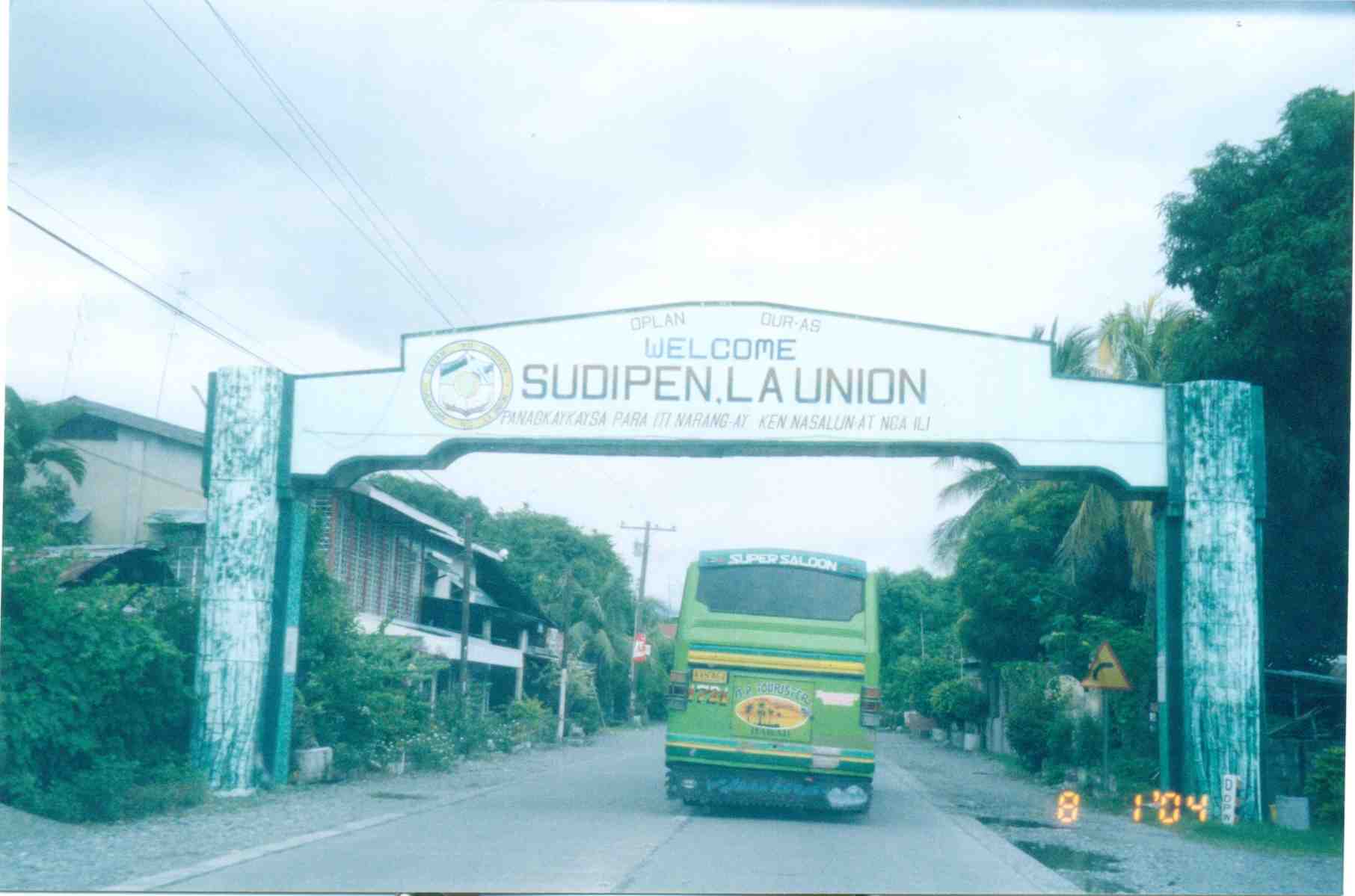 Sudipen, La Union
 Sta. Cruz, Ilocos Sur
 Santa Lucia, Ilocos Sur
 Candon City, Ilocos Sur
 Sta. Maria, Ilocos Sur
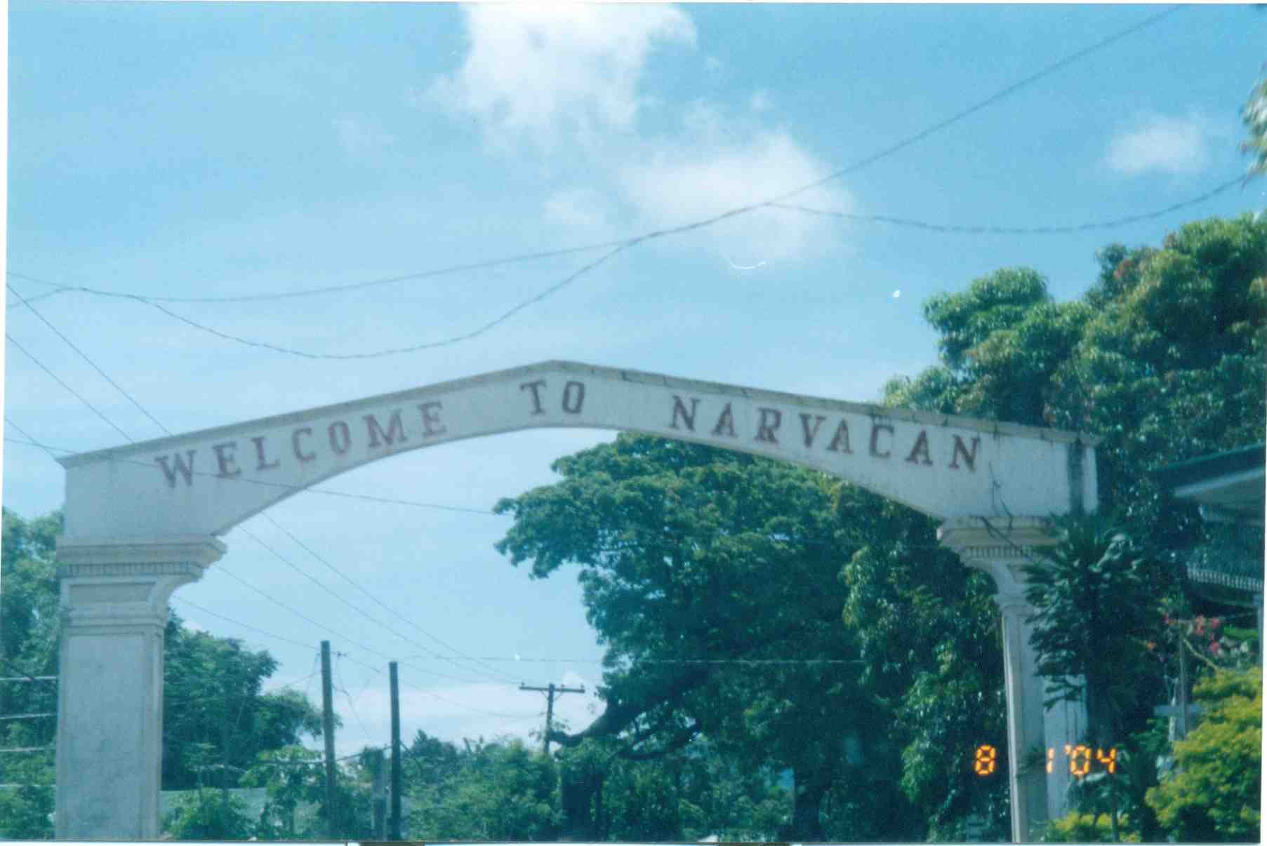 Narvacan, Ilocos Sur
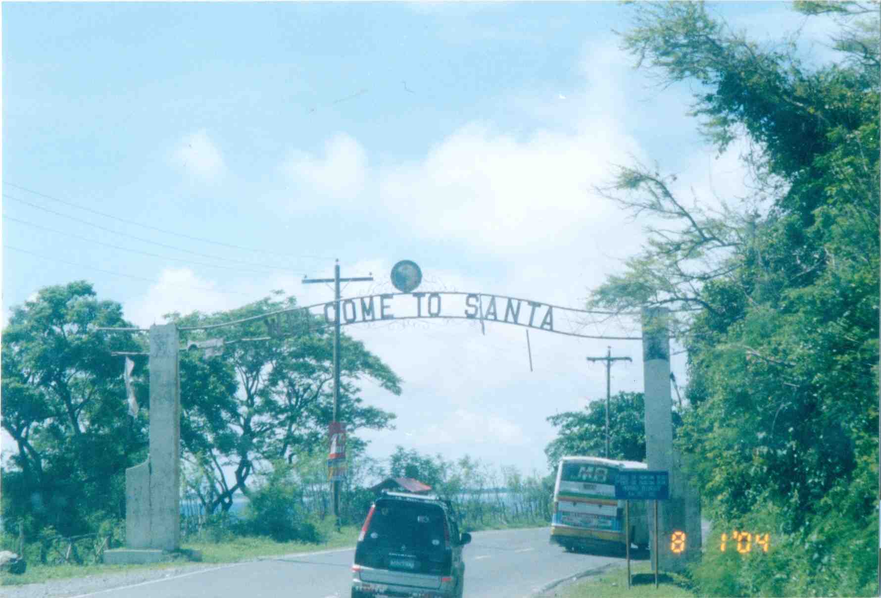 Santa, Ilocos Sur
 Welcome arch for the Province of Ilocos Sur from La Union
 Welcome arch for the Province of La Union from Ilocos Sur
–
Sumulong Highway: Marikina to Masinag
Sumulong Highway stretches from its intersection with A. Tuazon Ave. and A. Bonifacio Ave. in Marikina City, Metro Manila to the intersection with the Taktak Road or M.L. Quezon Ave. in Antipolo City in the Province of Rizal. It serves both as an arterial (for Marikina and Antipolo) and a feeder (with respect to Marcos Highway).
The following photos show the stretch from Marikina to Masinag that shows typical conditions along the highway. These conditions are quite different from those along the stretch from Masinag to Taktak Road in upper Antipolo City.
 Sumulong Highway has a total of 4 lanes (2 per direction) but a lack of pavement markings make it difficult to ascertain the center of the road and the space allocation for traffic. This makes travel less safe as motorists assume they are traveling along the correct space on the road.
 The asphalt-surfaced road has no lane markings but has very good pavement conditions. There is also significant on-street parking as most establishments along the highway have no adequate off-street parking spaces. The section shown above is right in front of a sabungan or coliseum for cockfights.
 There are pedestrian crossings though, near intersections and where there are schools along the highway.
 Only the traffic lanes have asphalt overlay, the shoulders have the concrete surface exposed thereby distinguishing them from the traveled way.
 The shoulders are used as parking spaces for establishments along the highway as shown in the photo. Such practices are also common along national highways around the country.
 Even the barangay hall of Bgy. Mayamot utilizes road space for parking as shown in the left. The Mayamot Barangay Hall is see on the left in the photo. This effectively reduces road capacity leading to traffic slowing down at such sections.
 Another pedestrian crossing, this time in front of a public school right after the barangay hall.
 Some sections have sidewalks for people to walk along but these are also usually blocked or occupied by stuff from the establishments along the street.
 Waiting shed along the highway. I could not say its typical because the more recent ones usually have names or initials of politicians on them. This shed is likely to be old and uses clay tiles for roofing.
 There are also tricycles along the road due to the sidestreets and subdivision entrances connecting to the highway. Public utility tricycles are supposed to be prohibited from using national roads but are common in most provincial areas and CBDs where they are the main mode of transport. In this case, tricycles should be prohibited from using the highway as they are already competing with jeepneys, serving larger areas aside from what should be individual subdivisions or residential districts.
 There are many auto repair and supply shops along this stretch of Sumulong Highway. Such shops typically have many customers who also park along the highway, often occupying road space and causing congestion.
 Approaching the Masinag junction, which is the intersection of Marcos and Sumulong Highways, one sees more commercial establishments on either side, mostly small stores or shops. At the junction is the Masinag Wet Market, which is now in decline after major commercial developments have been constructed in the area including the most recent SM City Masinag.
 Steel barriers placed along the center of the highway to discourage jaywalking – some barriers have been moved by pedestrians to create space for illegal (and risky) crossings such as what is seen just downstream in the middle of the photo (notice the person with the red umbrella?).
 Barriers forcing all traffic to turn right to Marcos Highway – seen across is the approach of Sumulong Highway from Antipolo
Portions of this section of Sumulong Highway are prone to flooding including the intersection with V.V. Soliven Avenue, which leads to SSS Village and other subdivisions. The more recent floodings were due to the heavy monsoon rains from a couple of weeks ago that effectively isolated residential areas in Marikina and Antipolo as vehicles could not exit the subdivisions to major roads like Sumulong and Marcos Highways. It’s quite interesting to note that the drainage systems along these roads including Sumulong have not been upgraded to be able to accommodate run-off from what is turning to be heavier rains due to climate change. Thus, it may be expected that the same sections will be flooded should there be heavy rains particularly due to typhoons and other major weather systems affecting Metro Manila and its environs.
–
Circumferential Road-4: R-10 to Monumento
Circumferential Road 4 or C-4 is perhaps the busiest among the major arterials of Metro Manila. It is usually associated with its longest segment named Epifanio De los Santos Avenue or EDSA, which stretches from the SM Mall of Asia in Pasay City to Monumento in Caloocan City. There are two other segments of C-4: C-4 Road (R-10 to Letre/Samson Road), Letre Road (Malabon City Hall to Samson Road), and Samson Road (Letre/C-4 to Monumento). All in all, the road cuts across eight cities in Metro Manila: Navotas, Malabon, Caloocan, Quezon City, Mandaluyong, Pasig, Makati and Pasay.
 After turning from R-10, one is greeted with a 4-lane road that at the time didn’t have pavement markings to distinguish the lanes.
 After covering some distance, pavement markings appear before reaching the bridge that connected the Navotas part of C-4 with Malabon.
 The bridge spans the Navotas-Malabon River, which goes around this point and meanders back to Malabon and Caloocan.
 Between the first bridge and the next along the way to Monumento, travelers have a view of the section of Navotas-Malabon River meander on the right side. Garbage floating on the river are quite noticeable but not as many as in the past.
 The 4-lane undivided road eventually becomes a divided road with a median island separating opposing flows of traffic.
 Pedestrian overpass with directional signs before the intersection with Dagat-dagatan Avenue.
 This is supposed to be a 4-lane section but it seems the roadside friction, driver behavior and the lack of pavement/lane markings contribute to the perception of limited space along C-4. Pedestrian sidewalks are also used as parking space by jeepneys and trucks as shown in the photo.
 Roadworks at the approach to the intersection with A. Mabini/M.H. Del Pilar from where C-4 is known as Samson Road.
 Intersection with Torres Bugallon – jeepneys crowd at the intersection and this often leads to congestion. Pedestrians cross anywhere and there are also pedicabs (non-motorized three-wheelers) roaming around that also contribute to the chaotic traffic.
 Roadworks along C-4 – also shown in the photo are shanties of informal settlers along the PNR right of way, which crosses C-4 at this point.
 Remnants of the PNR’s Main Line North with a station a few meters from C-4. This should have been part of the proposed Northrail line connecting Metro Manila to Clark, Pampanga.
 Samson Road stretches along a very busy, much built-up district of Caloocan. Near Monumento, there are many big commercial centers including shopping malls around the rotonda known for a memorial for Andres Bonifacio, a national hero who led the revolution for independence from Spain in 1896.
 Samson Road is obviously a national road but tricycles are allowed to operate here; just one of the traffic/transport policies that accommodate such paratransit modes along roads where they are inappropriate.
 In order to address the vehicles counter-flowing or encroaching on the opposing traffic lanes and jaywalking problem, steel barriers were put up in the middle of the road. Overpasses like the one in the photo were constructed to enable people to cross the road. Notice the vehicles parked or standing along the road and on the sidewalks?
 Approach to Monumento with the obelisk at the center island of the rotonda visible at the center of the photo. Also shown in the photo at the roadside is a traffic sign informing travelers that they are approaching a rotonda.
–
