
Home » Traffic flow (Page 2)
Category Archives: Traffic flow
Davao 8th, Manila 14th worst in Tomtom Traffic Index
I just want to share this news report here:
Source: Davao 8th, Manila 14th worst in Tomtom Traffic Index
I have to admit that I still have to figure out in detail how exactly their data were collected and evaluated. However, knowing and experiencing traffic in these cities, I would like to opine that traffic is still worse in Metro Manila cities compared to Davao and perhaps others across the country.
Safety or speed?
We start June by sharing a video on why safety and vehicle speed are incompatible:
I saw this video while browsing an article on “Dangerous by Design”. The article discusses a new publication where road designs are evaluated from the perspective of safety. Most of our roads have been designed with speed in mind. That is, how to facilitate the movement of motor vehicles to ensure they travel faster. Forgotten or, even worse, disregarded is the most important element of safety. Why do we widen roads or insist on higher speeds in populated areas or school zones? Such questions are not addressed directly or not answered at all by agencies in charge of planning, designing, constructing and maintaining roads and bridges. The same is true for agencies or units in charge of traffic regulations or management. The result not surprisingly is an increase in the number of road crashes, fatalities and injuries due to our roads being ‘dangerous by design’.
–
Counterflow irony along Ortigas Avenue Extension, Pasig City
One Friday, I traveled to Ortigas Center from Antipolo via the most direct route using Ortigas Avenue Extension. I was not surprised by the counterflow scheme being implemented starting from De Castro all the way to Rosario Bridge. I was also not surprised that the more congested lane was the counterflow lane. I thought everyone expected the main traffic lanes to be congested as PUVs like jeepneys, buses and vans usually create bottlenecks as they block traffic while passengers board/alight along that section of Ortigas Avenue Extension. Here is what you might encounter in terms of traffic if you opt to stay along the westbound traffic lanes:
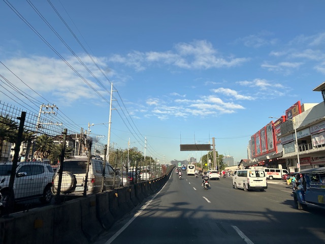 Traffic before the Manggahan floodway bridge at what was generally called Mariwasa. The Filinvest residential development on the left used to be the Mariwasa tiles plant.
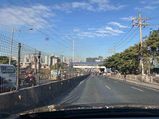 Traffic after the crossing the bridge. Note the pedestrian overpass in the photo.
 Meters after and near the overpass, you can already see the build-up in the Rosario area
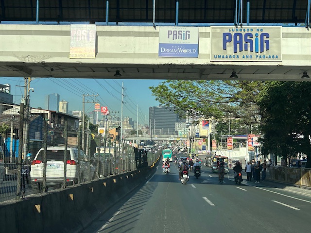
 The Rosario bridge area is usually congested not just because of the PUV operations but also because there is the junction of Ortigas Avenue Extension and Amang Rodriguez Avenue, which is another major thoroughfare connecting this area to other parts of Pasig, Quezon City and Marikina City.
I will post about the counterflow scheme in Bangkok in the next post.
–
Zamboanga’s first flyover
We passed by the construction site of Zamboanga City’s first flyover at the intersection of the Pan Philippine Highway (AH 26) and Veteran’s Avenue. I recall there was a lot of pressure from DPWH for the city to approve its construction. The previous mayor didn’t want to approve the project because the perception was that it was not required and there were other options to consider before a flyover was to be constructed. However, many people including the then congressman and now mayor probably thought the flyover would be the solution to the congestion experienced at the intersection. Add to that the perception that the flyover is also somewhat a symbol of progress.
We won’t know until its completion and the ‘normalization’ of traffic in the area to determine whether the flyover has ‘solved’ traffic congestion in the area. The problem with this approach to ‘solving traffic’ is that it is usually a short-lived alleviation of a symptom of the real problem, which is transportation. Zamboanga City has deferred rationalization of public transport routed despite analysis and plans pointing to a streamlined and optimized transportation system if this was pursued. The City commissioned a Transportation and Traffic Management Plan Study in the previous administration but the plan and its recommendations have been shelved, another example of such being casualties of a change in administration of an LGU.
–
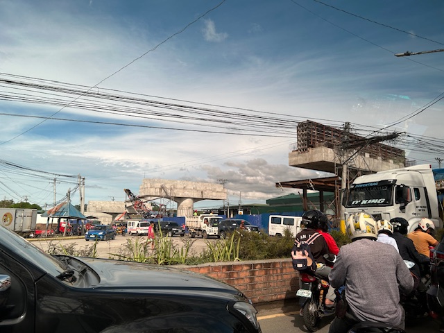
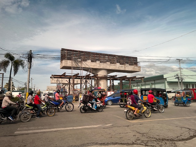
Counterflow lane to Cainta Junction along Felix Avenue
Counterflow traffic schemes seem to be in these days. Cainta used the scheme temporarily while one lane of Felix Avenue was blocked due to the maintenance work being conducted by Manila Water. Following are photos showing the traffic advisory and photos during the counterflow.
 Traffic advisory showing the period when the counterflow traffic scheme was implemented.
 There was a median opening across from a factory’s main gate that allowed vehicles to counterflow.
 The counterflow lane allowed vehicles to bypass the utilities maintenance works being performed by Manila Water’s contractor that blocked the median side lane of Felix Avenue.
 Approach to Cainta Junction
 The counterflow ends at Cainta Junction where left turning vehicles are positioned correctly for the movement. Through traffic were expected to occupy the other/normal approach lanes.
As the Manila Water concluded its maintenance work, the counterflow scheme was already lifted and traffic is back to normal.
–
Tikling junction traffic
Easily a pet peeve along my commute is Tikling or Kaytikling Junction in Taytay, Rizal. I think traffic here is worse than two other major junctions in Rizal Province – Cainta Junction and Masinag Junction in Antipolo City. And that is because of the combination of traffic management (or mismanagement) by elements of the Taytay Municipal Government and motorists lack of understanding of how vehicles should position (or travel) at roundabouts. Of course, the volume of motor vehicle traffic converging at this junction would probably merit traffic signals over a roundabout but for most times when there are no enforcers here, traffic is somewhat more efficiently flowing as drivers and riders are forced to give way in order to not constrict traffic.
 Enforcers often employ the “buhos” system of prioritizing traffic for one leg at a time. However, instead of a quick transition from one leg to another, they tend to give more time to vehicles coming out of the Manila East Road and turning left and (west)bound for Ortigas Avenue Extension. The long time allocated to the latter means long queues for traffic coming down from Antipolo and those from Cainta.
 Enforcers are partial to outbound traffic from Taytay rather than make an effort to have more equitable ‘go’ time for all legs at the junction.
One wonders who is in charge of traffic for Taytay considering they mismanage traffic everyday. [Though I also wonder why the rest of Rizal including Antipolo and Cainta can’t seem to be bothered by the congestion emanating from Tikling.] As if to prove the point of incompetence, another problematic intersection is the Highway 2000 – Barkadahan Bridge – East bank road intersection, which is signalized and yet somehow always congested (or saturated). But that’s another story.
–
A real battle of Katipunan – the search for a transportation solution
Is it obvious that I was alluding to the classic match-ups of the two major universities – Ateneo De Manila University and the University of the Philippines Diliman – that are located along Katipunan Avenue for the title of this article? That is deliberate on my part as there is a ‘real’ battle along Katipunan Avenue, and it does not involve sports.
Following is a recent article from the Philippine Collegian that reports on the current state of traffic along the corridor:
https://phkule.org/article/971/private-cars-mainly-to-blame-for-katipunan-traffic-transport-experts
I have written before and many times about transport and traffic along Katipunan Avenue. This road has been part of my daily commute since 1988 when I was admitted to UP Diliman as a B.S. Civil Engineering major. Back then Katipunan was not as wide as it is now, especially along the section between UP Diliman and the MWSS complex. That section only had 2 lanes then. What is not a wide center island with large, old acacia trees used to be the frontage of MWSS. So now you can probably imagine how much land was ceded by MWSS for road widening.
I also wanted to write about Katipunan in part as a sort of farewell to the former MMDA Chair and Marikina Mayor Bayani Fernando (BF), who recently passed away. Much of how Katipunan looks like and the traffic situation today can be traced to what transpired during his time at MMDA. I will refrain from writing about this and him for now. I am actually thinking of writing a series about BF and his time as Mayor in Marikina, as MMDA Chair, and his brief stint as DPWH Secretary. This short article will do for now.
A zipper lane along Katipunan?
Yesterday, the Metro Manila Development Authority (MMDA) started another experiment along Katipunan Avenue in Quezon City. They introduced a zipper lane along the stretch fronting Ateneo’s Gate 2 and Miriam College’s main gate (about 740m – less than a kilometer). This single lane was supposed to ease traffic congestion along the northbound direction of Katipunan (aka Circumferential Road 5 or C5 or Pres. C.P. Garcia Avenue), which is saturated with vehicles especially during the morning peak.
While we wait for the official pronouncements regarding this experiment, the impacts are likely to be marginal as the original northbound lanes are jammed with vehicles. Thus, there is a tendency for the entry to the zipper lane to be blocked. MMDA staff will also have to stop vehicles at the exit if they will allow the movement of left-turning and U-turning vehicles at the junction with B. Gonzales and Miriam’s main gate. While it may seem an exercise in futility, we have to appreciate the continuing effort of MMDA for such schemes. The bottomline though is the MMDA has limited options to address the hellish traffic along Katipunan. The schools and other establishments would need to put their heads together to formulate a more sustainable solution for this corridor.

The return of carmaggedon and the illusion of low vehicle ownership
Traffic seems to be back to pre-pandemic levels in the Metro Manila and its adjacent provinces. You can experience this along major roads like Commonwealth Avenue, C-5 and yes, EDSA. The number of vehicles on the roads including motorcycles defy what is supposed to be low motor vehicle ownership in Metro Manila (as claimed by DOTr and JICA in the MUCEP report and echoed by groups who cite the report as if it is flawless).
 Intense traffic congestion along C5/Katipunan Avenue. The photo shows traffic on the C5/Katipunan flyover’s northbound side and towards the direction of Ateneo, Miriam and UP Diliman.
The reality appears to be that more households actually own motor vehicles and the inefficiencies and unattractiveness of public transport continues to convince people to take private transportation, including motorcycles, over public transport options. The inconvenient truth according to one senior transport expert is that while cycling has gained ground, the numbers are minuscule compared with those taking either private or public motorized transport. Yes, carmaggedon is back and looks here to stay for a while longer until the so-called game changers like the MM subway and Line 7 are operational. Will they change the commuting behavior or are these too late in as far as solutions are concerned?
–
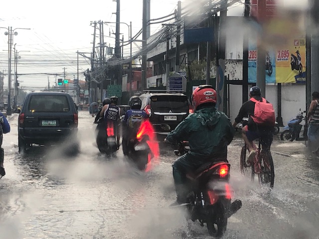
On floods, transport and traffic, again
It’s that time of year again when the heavy rains lead to flash floods along many roads. I took the following photo as we slowly progressed towards Cainta Junction early this week. The Felix Avenue approach was flooded after more than an hour of heavy rains fell upon Cainta and neighboring towns. We learned later that the rains fell on a larger area as EDSA and other major road in Metro Manila also experience flash floods. These cause traffic to slow down if not outright stoppage. Many commuters can get stranded when PUVs are not able to run due to the floods. Deeper waters mean light vehicles including motorcycles and bicycles cannot proceed along certain roads, further exacerbating the traffic situation.
 Motorcyclists emerge from their shelters to travel along flooded roads. A common sight when there are downpours are motorcyclists huddling under overpasses, bridges, or whatever shelter may be available to them. Many bring rain gear but opt to just stop and wait it out until the rain stops.
 A cyclist braves the floods – while pedestrians will likely stop and wait it out for the rains to stop or for the floods to subside, cyclist might just pedal on. They just have to be more careful as potholes and other dangers may be hidden by the floodwaters.
 Cainta Junction has been submerged by so many floods over so many years. Even with the new drainage constructed under and along Ortigas Avenue Extension, Felix Avenue and Bonifacio Avenue, it seems their capacities are not enough to handle the rainwaters. That or perhaps their intakes need to be redesigned to more efficiently take on the heavy rains and the resulting runoff.
–
