
Home » Traffic flow (Page 4)
Category Archives: Traffic flow
Traffic management schemes for the Marcos Highway bridge rehab
The rehabilitation of the Marcos Highway Bridge in Marikina has necessitated traffic management schemes at the bridge itself and along alternative routes to alleviate congestion in the area. These are collectively called traffic or transport systems management (TSM) schemes with the objective of optimising existing infrastructure and resources without necessarily building something entirely new. These are quite different from travel demand management (TDM) schemes that include number coding and truck ban policies that are already being implemented (though Marikina does not implement the number coding scheme).
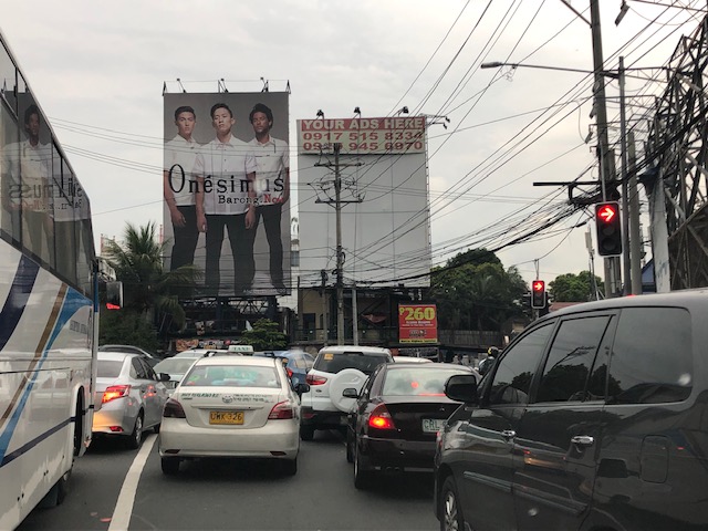 Traffic build-up at the approach to the intersection with FVR Road (To Riverbanks). This is now a signalised intersection as traffic from Blue Ridge/White Plains is now allowed to cross to FVR Road.
 Using the route via FVR Road (Riverbanks) means you don’t have to cross the Marcos Highway Bridge and travellers will merge with those who crossed the bridge just before the Line 2 Santolan Station.
 In the mornings, one lane each is allocated for either the eastbound or westbound traffic. That’s practically a total of 3 lanes (+2 lanes westbound for the SM Marikina Bridge) for the westbound direction and a single lane for the eastbound side. This is logical given the directional distribution of traffic at this time of day and the alternative routes already available to travellers.
Here are a few photos taken on a night time drive. Note that this was taken by a passenger. Don’t even try doing this (taking photos) while driving a vehicle, and especially not while on a motorcycle.
 Entrance to the bridge right after Maj. Dizon – this part is not affected by the rehab works but vehicles position themselves to shift towards the left side, which is the usable part of the bridge.
 Both lanes of the westbound side of the bridge are used for eastbound traffic. Westbound traffic are all along the SM Marikina bridge for a total of 2 lanes each for either direction of flow. The cones are not removed for practicality since they would have to be installed for the morning when one lane is allocated for the westbound traffic.
 Vehicles shift to the right to return to the correct lanes for eastbound traffic along Marcos Highway at the Santolan area. Note the westbound vehicles shifting towards the underpass and SM Marikina on the left.
–
On the impacts of the closure of the Marcos Highway Bridge
The Marcos Highway Bridge was scheduled for rehabilitation in the next four months starting last week. While it will not be totally closed to traffic, the scheme reducing its capacity will surely lead to congestion along Marcos Highway. This congestion should be expected along other roads as well, as travellers, particularly those taking private transport will be using alternative routes in order to avoid this area. Those coming from the east will likely go through Marikina City via the parallel route comprised of Sumulong Highway and A. Bonifacio Avenue. Others will turn to A. Rodriguez (Ligaya). And perhaps others may go via Ortigas Avenue Extension. These alternative routes correspond to the other bridges crossing the Marikina River connecting the Rizal province and part of Marikina and Pasig to Metro Manila.
 A photo of the bridge prior to its partial closure
I will write more on this topic once I get more information on what’s happening to the traffic in the area. Meanwhile, I do know that my usual alternative route via Marikina and Tumana seems to have more than the usual traffic during my commute. While it is easy to attribute this to the partial closure of the Marcos Highway bridge, this could also be just a normal variation in the typical daily traffic for that route.
–
On phantom traffic jams again
I’m sharing this article on phantom traffic jams:
Seibold, B. (2019) Traffic Ghost Hunting: When the biggest problem with traffic is nothing at all, Nautilus, https://medium.com/@NautilusMag/traffic-ghost-hunting-ac071197695d [Last accessed: 4/9/2019]
Have you wondered why the road or path is congested only to find out there seems to be nothing causing it? This is the phantom or ghost traffic jams caused by simple behaviours of travellers whether on motor vehicles, cycles or people like slowing down their movement or changing lanes. These disruptions cause a “ripple effect” on the traffic stream much as like waves are generated by a stimulus on calm waters.
–
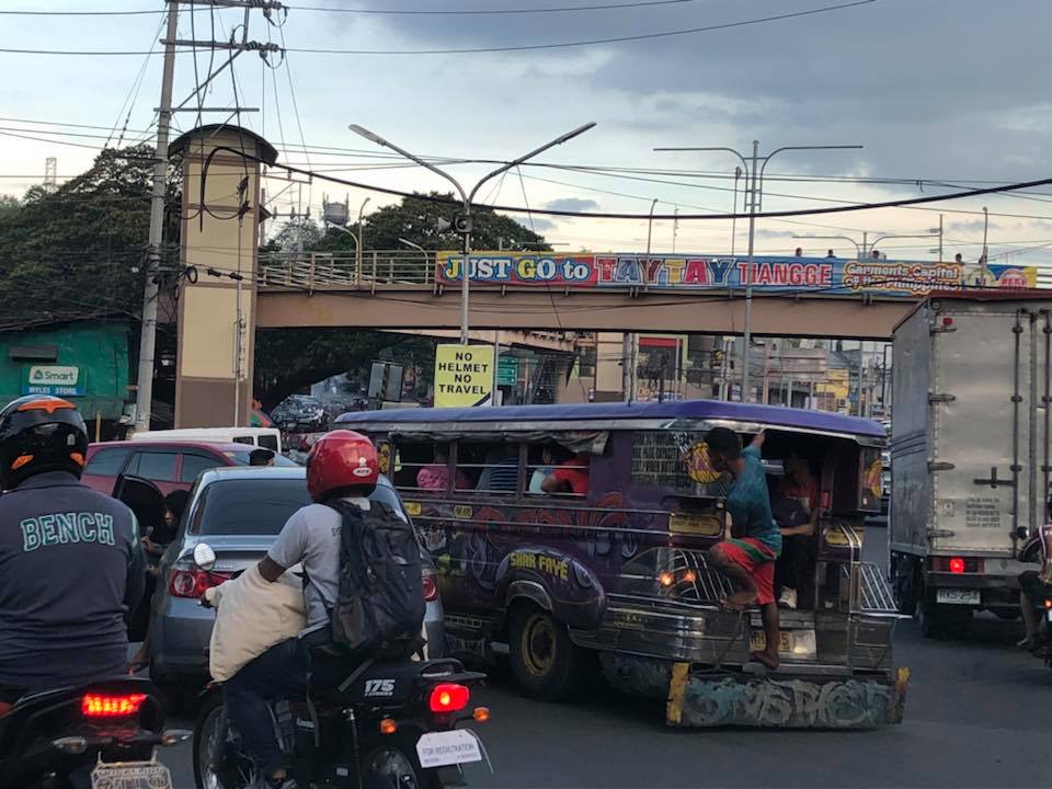
On the traffic flow predicament at Tikling junction…again
During weekends, a constant frustration have been the incidence of severe traffic congestion along Ortigas Avenue Extension. Weekday evenings are usually better in terms of traffic compared to Saturdays. But last Monday, the congestion was so severe the congestion reached Valley Golf and vehicles had to crawl to Tikling. As mentioned in previous posts on this subject, part of the problem is the sheer volume of vehicles that make the roundabout set-up inappropriate for the junction. Then there is also the issue about the people who are supposed to manage traffic but end up mismanaging it. From what I usually observe, they tend to favour vehicles coming from Taytay via the Manila East Road leg and seem oblivious to the build-up of traffic along Ortigas Ave. Ext. eastbound.
 Typical heavy traffic at Tikling Junction
We might finally get a chance to have a solution for this. One of our students took on a topic that will require her to asses the traffic at the intersection to determine, for example, whether the roundabout is suitable or perhaps should be changed into a signalised traffic control. Both analytical approach and microsimulation (using Vissim or the homegrown LocalSim) will be employed. But we will have to wait by May to see some substantial results.
–
On the efficiency of transportation – a crash course on transportation engineering concepts
There is an excellent article on the efficiency of transportation systems:
Gleave, J. (2019) Space/Time and Transport Planning, Transport Futures, https://transportfutures.co/space-time-and-transport-planning-1aae891194e5 [Last accessed: February 25, 2019].
It is highly recommended not just for academics (including students) but also for anyone interested in transportation and traffic. It’s like a crash course in transportation engineering with a lot of basic concepts in traffic engineering and traffic flow theory being presented for easy understanding by anyone. Enjoy!
–
On the unpredictability of EDSA traffic
Much has been written about the traffic along EDSA, which is perhaps Metro Manila’s most famous (some would say infamous) thoroughfare. These include the unpredictability of congestion along this road. While it is hard to believe that traffic congestion is unpredictable for EDSA because very often it is congested, there are times when you just marvel that its free-flowing during the day or shocked that its packed with cars close to midnight. Last week, we experienced both predictability and unpredictability in the sense that we did expect EDSA to be congested near Ortigas (due to the dismissals of schools in the vicinity) but didn’t expect it to be packed during what we thought was “alanganin na oras” that was around 3PM.
 EDSA northbound traffic taken at Guadalupe last October 1, 2018 at 3:30PM.
Interestingly, there was no congestion after Ortigas Avenue and we quickly made up for the time lost in the congestion we experienced from Gil Puyat Avenue. Is this another case of the phantom congestion where the simple disturbances in the traffic stream can create a ripple effect resulting in congestion? Or is this somewhat like an everyday thing? EDSA is not part of my daily commute so I am not so sure about the regularity of this situation but at least the weather didn’t factor in the equation. Heavy rains usually lead to flash floods along this thoroughfare, and these floods will definitely lead intense congestion.
–
On the opposition to “complete streets”
I recently read an article about the opposition to road diets in California, USA:
Tinoco, M. (2018) “How to Kill a Bike Lane”, http://www.citylab.com, https://www.citylab.com/transportation/2018/05/how-to-kill-a-bike-lane/559934/?utm_source=SFTwitter [Last accessed: 5/20/2018]
So far, we know that at least three cities are progressive enough to implement road diets including Marikina City, Pasig City and Quezon City. Iloilo doesn’t count yet since their bike lane was constructed along the very wide Diversion Road. Our recommendations for Tacloban, if implemented by the city, will probably result in the second most comprehensive application of road diets/complete streets in the Philippines after Marikina, which implemented their bikeways network almost 2 decades ago. There are sure to be many who would be opposed to such schemes as many still have the view that streets are for motor vehicles. This car-oriented thinking is something that will be a challenge to advocates of people-oriented transportation systems. Hopefully, many can learn from experiences here and abroad on how to reclaim space for people leading to safer and more inclusive transport for all.
–
Proposed downtown traffic scheme for Tacloban City
The team from the National Center for Transportation Studies of the University of the Philippines presented their recommendations for the traffic scheme in downtown Tacloban City last May 4, 2018 in the city’s Traffic Summit cum City Development Council (CDC) meeting. I am sharing the image showing the proposed traffic circulation and other features for the proposed downtown scheme below:

The scheme calls for a reduction in on-street parking; restricting such to one side of the street only and where applicable. That is, on-street parking is not allowed where there is already off-street parking along establishments, where there are driveways, and within one or two vehicle length from intersection corners. There will also be designated loading/unloading areas for public transport so parking is also prohibited there.
A couple of important features in the scheme are the enhancement of pedestrian facilities, particularly sidewalks, and the introduction of bicycle lanes. These are more clearly shown in the cross-section examples included in the map. Note that for other streets where there are no designated bike lanes indicated, it is assumed that lanes will be shared with motor vehicles. This is an application of the concept of shared right of way or “sharrow” as it is also termed. The scheme is contextualised along the lines of “people-oriented” transport rather than “car-oriented”, and hopefully would lead to a more walkable downtown area and encourage more people to use bicycles. This promotion of active transport should also lead to a healthier city. I will post about the transport plans prepared for the city in future articles here.
–
On the Pasig HOV traffic experiment
Someone shared a post about a traffic scheme they will be implementing along Julia Vargas Avenue in Pasig City. The proposal is for the avenue to have a high occupancy vehicle (HOV) lane where vehicles with 4 or more occupants are to take one lane and all other vehicles the other. I am not entirely sure about the objective other than to promote high occupancies for vehicles. However, it would be nice to see how travellers will be behaving (e.g., complying) and how Pasig (with MMDA?) will be enforcing this scheme.
This is what a segment of Julia Vargas currently looks like with 2 wide lanes designated for motor vehicles (separated by the solid yellow line) and one narrow lane for cyclists (adjacent to the shoulder):
The intent is good but as a major link the scheme can be quite confusing especially for those who are not necessarily frequent users of this road. I assumed the yellow line was painted by the DPWH but it seems it was by Pasig. Perhaps they should have removed the old markings? Or maybe better if they rationalised the carriageway width to accommodate 3 lanes for motor vehicles and 1 wider lane for bicycles? From the photo above, it appears to me that it is possible to have 2 narrow lanes for general traffic and one wider lane for HOVs (in this case defined as having 4 or more occupants) and public utility vehicles. This configuration maximises the capacity of the road while having a the “best” lanes allocated for HOVs and bicycles.
I wish them success on this social experiment. Perhaps there can be valuable learnings from this including the need for connectivity to other links as well.
–
Congestion along C-6 and potential for a public transit corridor
We begin February with a post on a road that’s becoming more popular as a major (as opposed to alternate) route to Bonifacio Global City (BGC) and Makati CBD – Circumferential Road 6. I took the following photo at the approach to the Nagpayong Bridge that is current has only 2 lanes (1 per direction). Another bridge is being constructed along the existing one that will increase capacity for the Pasig River crossing to 2 lanes per direction. This is similar to what was done to the Barkadahan Bridge crossing the Manggahan Floodway in Taytay, Rizal.
The volume of road vehicle traffic is steadily increasing along C-6. The adjacent land use offers a lot of potential for development (hopefully planned) that will feed more traffic along what will become a major thoroughfare in the near future. The land I am referring to are the reclamations on the side of Laguna de Bai along C-6 that are under the jurisdiction of Taguig and similar developments on the opposite side on what was once swampy or marshlands. One wonders if Taguig has a plan for all this or if the city is turning a blind eye and just letting developers do what they want. Most seem to be residential subdivisions and industries-related with a sprinkling of mainly small to medium-sized commercial developments.
Again, I think national and local governments should consider making this a public transport corridor by introducing formal public transport in the form of a scheduled bus service stretching from, say, Bicutan Interchange to Taytay Public Market. The demand along this corridor is steadily rising and only a better connection to C-5 limits an even steeper increase in traffic volume along C-6. The time is now in order to condition commuters about the system and to the unwanted congestion experienced along major roads in the metropolis.
–
