
Home » Transportation
Category Archives: Transportation
On road crashes involving trucks in Antipolo – again
There was another terrible road crash last week (November 25) involving a truck. At least 3 people, all motorcycle riders, died in the crash as the truck slammed into them at the Sumulong Highway-Olalia Road intersection. This was around 7AM, during the peak at the area where a nearby school generates much traffic, and many commuters are traveling along the highway as they head to work and school on a Tuesday morning.
This was along my usual route to the office and at around the same time I pass by the area during my commute. I wondered if I could have been involved if I took that route. Waze directed me instead to Ortigas Avenue Extension that morning as I left for the office.
The cause of the crash were said to be faulty brakes that led to the driver losing control of the vehicles. How many times have we heard or read about this reason? And how can authorities especially the LGU can reduce the likelihood of these crashes? Shouldn’t there be a checkpoint or checkpoints for these trucks to show their maintenance records are up to date? Should there be staff on the lookout through the numerous CCTVs installed for reckless or aggressive driving? Should drivers be regularly tested (random perhaps?) for alcohol or drugs? How can the LGU be more engaged in road safety so as to prevent the loss of lives?
–
Grab carpool?
I saw this sign at Ayala30 earlier today.

Is Grab going into carpooling? This certainly is not new as at I recall at least one company, Wunder, that tried to make a foothold in Metro Manila back in 2017. It folded after an unsuccessful run that a friend described as dating app masquerading as a TNVS. Seriously though, facilitating carpooling is not an easy task as there are security, safety and trust concerns here that need to be overcome. Perhaps it can be successful with office mates or schoolmates?
–
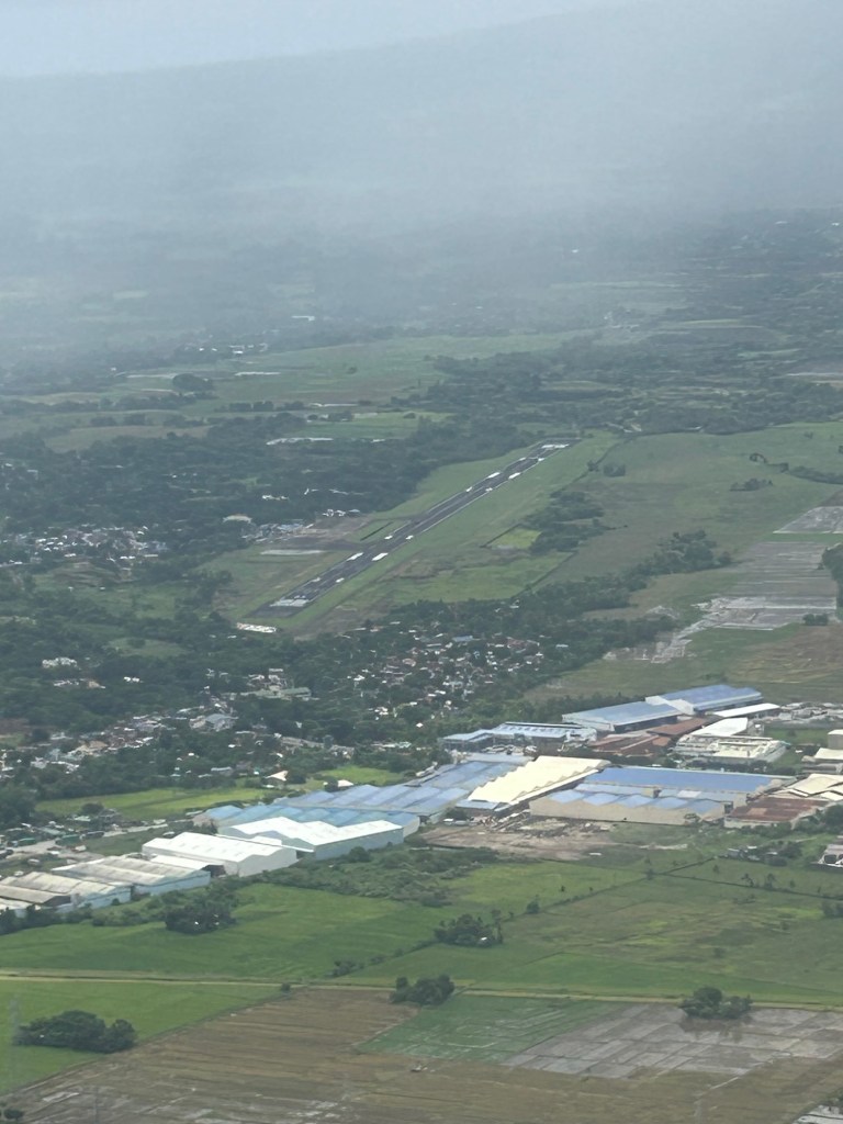
Back in Bicol – arrival at Naga Airport
I posted about the airports in Daraga/Legazpi City and Davao City as I knew I would be traveling to Naga City and likely by air. That likelihood became certainty as horror stories of 14-16 hour travel by bus became unacceptable for short trips where the travel times by road exceeded our actual stay in the city.
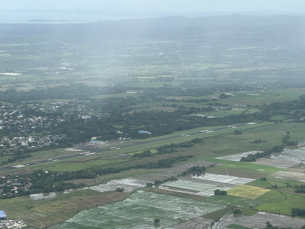
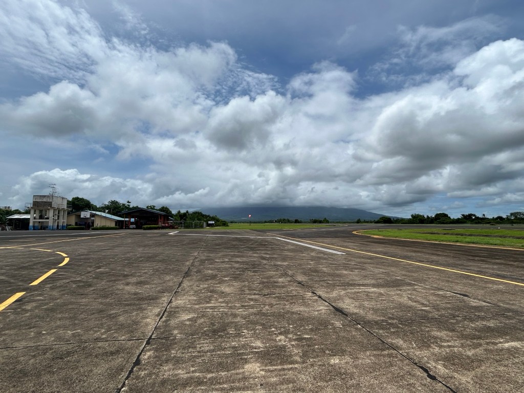
More on Naga City in the next posts!
–
Sentimental for Yokohama
A visit from a couple of professors from Yokohama National University (Yokohama Kokuritsu Daigaku) triggered the sentimental part of me. Among the materials presented were information about life on campus and in Yokohama, which is the second biggest city in Japan after Tokyo. There were also giveaways including a nice folder featuring a photo of Yokohama showing the campus on the foreground and many landmarks in the background.
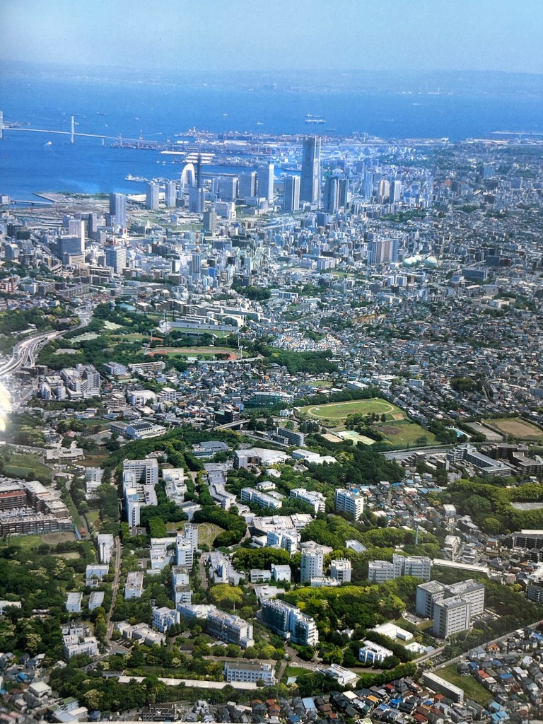
Landmarks in the photo include the Landmark Tower that used to be the tallest building in the country. There is also the Yokohama Bay Bridge that eventually connects to the Aqua Line. And, of course, the Port of Yokohama, which has long been one of the international gateways to Japan.
I have not been to Japan for more than a decade so I look forward to doing another sentimental journey to again visit familiar places and explore new ones.
–
On Transit Oriented Development’s impact on air quality
Here is a quick share of an article on transit oriented development (TOD) and its impacts on the way we travel or commute as well as to our health:
Austin, M. (November 25, 2024) “Transit-Oriented Housing Development Is Great For Density and Walkability. What About Air Quality?” Next City, https://nextcity.org/urbanist-news/transit-oriented-housing-development-air-quality-freeway-pollution [Last accessed: 11/28/2024]
To quote from the article:
“We know that creating transit-oriented districts can have major public health benefits: By concentrating mixed-use development near public transit, residents’ mobility and access to food and services increase, without the need to drive.
But for optimal public health outcomes, it’s essential for planning practitioners to guide decision-makers about the harmful effects of locating housing along freeways and arterials — areas where land is often the easiest to develop. We must implement policies and design strategies that avoid repeating past mistakes and jeopardizing residents’ health.”
–
On the general benefits of public transportation
Here’s another good read that has links to the outcomes of studies pertaining to public transportation’s direct and indirect effects on vehicle miles traveled or VMT (in our case we use vehicle kilometers traveled or VKT):
McCahill, C. (November 12, 2024) “The benefits of transit extend well beyond transit riders,” State Smart Transportation Initiative, https://ssti.us/2024/11/12/the-benefits-of-transit-extend-well-beyond-transit-riders/ [Last accessed: 11/20/2024]
To quote from the article:
“…good transit has a ripple effect on land use and travel behavior. For every mile not driven by transit riders, transit accounts for another six to nine miles not driven among the larger population. “
Note the potential reduction in VKT’s attributed to mass transportation or transit.
–
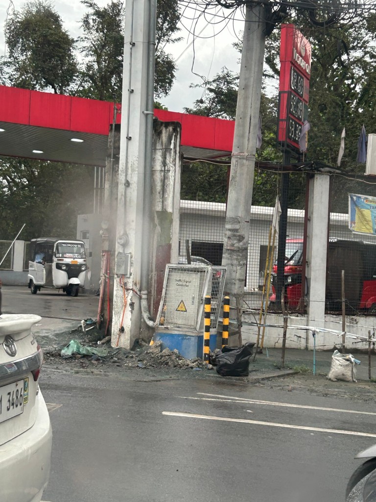
Another fatal crash along Marcos Highway
Another crash happened at a location where a similar crash occurred not so long ago. This was along Marcos Highway where Antipolo, Cainta and Marikina practically converge. The landmark is the Phoenix gas station along the westbound side of the highway. Large trucks may be found parked along Marcos Highway at night and early mornings before dawn, timing their travel with the truck ban being enforced in Metro Manila. According to reports, the car was supposedly making a U-turn and it slammed against one of the parked trucks. I would assume that a turning vehicle in the area would be doing so carefully and would not be speeding. It would be difficult not to notice a parked truck in the area. I would know as this is one of my alternative routes on my daily commutes. The result, a total wreck as shown in the photo below, betrays the speed of the vehicle as well as how risky a maneuver the driver was trying to pull off. Does this look like the aftermath of a slower moving vehicle making a U-turn and slamming into a parked truck? The damage strongly suggests a fast vehicle with the driver losing control (for whatever reason or condition he was in) and slamming mightily against an immobile vehicle.
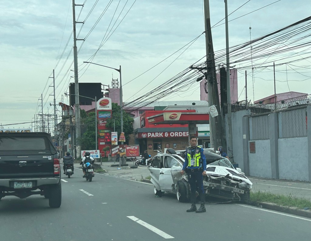
This one was also fatal, claiming the lives of the passengers of the car. Even with arguments on how our roads are supposed to be car-centric or the product of car-centricity, the inconvenient truth is that a major problem with road safety are the ones behind the wheel and driving these vehicles. Even with a ‘perfect’ road, aggressive and unsafe driving or riding behavior will always imperil people. There are also reports of many speeding (even racing) along Marcos Highway. These will likely involve impetuous young people looking for a thrill. They endanger other people with their behavior. So the challenge is for authorities to look into the matter and do their work to reduce the incidence of speeding and risky maneuvers along Marcos Highway and other roads like it.
–
More political garbage along our roads
I was telling some friends who were planning to go to Antipolo this long weekend that they should not be distracted by the images of demonyos and demonyas they’ll see along the way to the Shrine of Our Lady of Peace and Good Voyage.
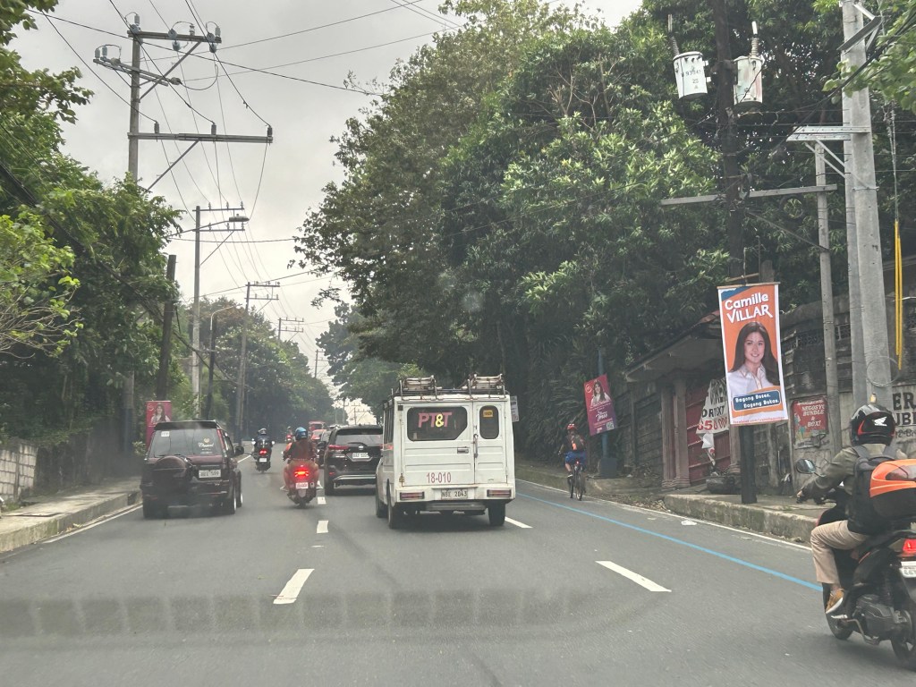
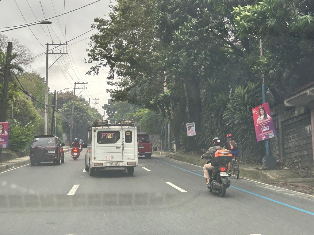
These are electioneering and those who vote for these clowns have no right to complain about their economic situation. You only perpetuate these scums in government.
–
Foggy roads – Part 2
This is supposed to be a follow-up to the post on foggy roads in Tagaytay last month. Unfortunately, I could other things came in the way of finishing this Part 2. Intersections can be quite dangerous if all approaching one have limited visibility. Add to that the flaws in intersection geometry that may contribute to it being risky to travelers. Following is an example along the Tagaytay-Calamba Road with an intersection with Belleview Drive, which is the main access road to Tagaytay Highlands.
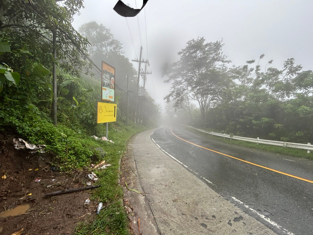 The approach from Tagaytay features a curve. I didn’t notice any streetlights along the road so I can imagine it must be poorly lit at night. What more if there is a thick fog in the area?
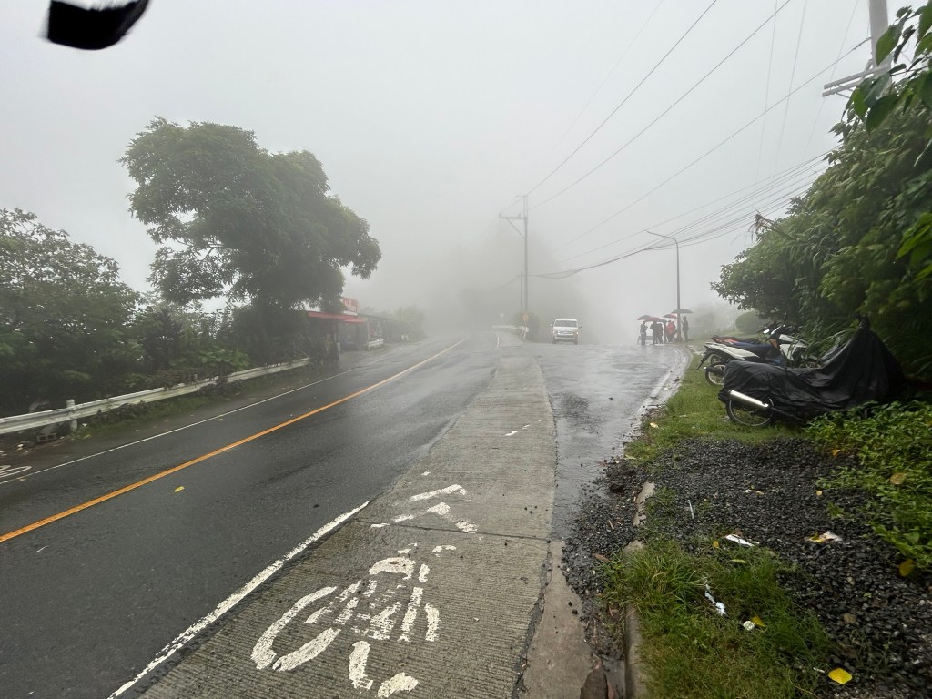 The bike lane is a product of the government’s efforts to come up with a bike lane network along national roads during the pandemic. This is actually the shoulder painted to become a bike lane. This is the view of the intersection approach if you’re coming from Tagaytay. The leg to the right with the people with umbrellas is Belleview Drive and towards Tagaytay Highlands. You can easily miss this if you were not familiar with the area and cruising along the highway. Note the thick fog obscuring your vision of the intersection. The curvature to the left also adds to the complex situation.
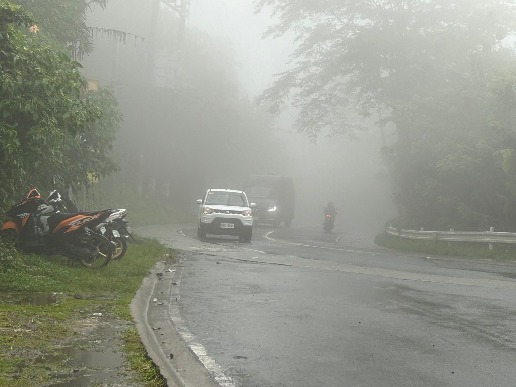 This is a closer look at the highway approach from Tagaytay taken a few minutes after I took the first photo in the article. Note the fog quickly setting in and the limited visibility. The motorcycle moving away from us would disappear into the fog. This is during the daytime and supposedly in broad daylight. Vehicles would need to turn on their lights so others may see them on the road.
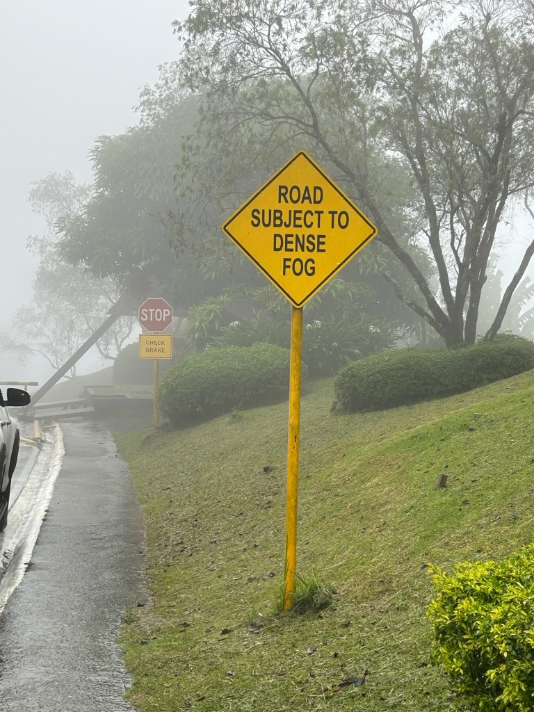 The sign along Belleview Drive states the obvious. There should be more signs like this located strategically along the Tagaytay – Calamba Road and others usually cloaked in the fog we experienced in Tagaytay recently.
I assume there would be similar situations elsewhere including in Baguio City. We also experienced fog (not smog) in Antipolo but these were quick to dissipate unlike the ones in Tagaytay and Baguio.
–
Speed limits and danger zones for trucks
Saw these signs at the back of a long truck as we were stopped before an intersection. One states the speed limits for these vehicles along different roads while the other is a warning sign for other road users especially those who might be less visible when the truck maneuvers (e.g., motorcycle riders, cyclists).
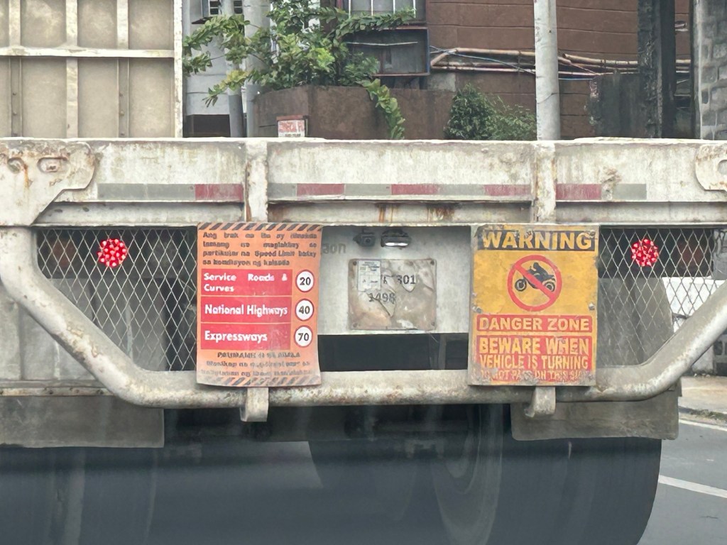
These are important information and fair warning to other road users. However, I think the signs should be bigger to be more visible or conspicuous. You have to be close to the truck for one to read and understand what the signs were. It might be too late by the time one figures out what the warning was about. I’ve read somewhere about people trying to debunk or play down these danger zones for trucks. That is bad opinion and puts drivers and riders heeding it in harm’s way. I think we should always go for what is on the safe side rather than risk being hit by these trucks.
Such information should be part of driver and rider education and perhaps education in general. While these large vehicles pose risks to other road users, they also play an important role particularly for logistics.
–
