
Home » Travel (Page 2)
Category Archives: Travel
Bicol International Airport Departure
Before I go on another trip, here are photos I took of the Bicol International Airport prior to our departure from Daraga. We were just in time to check in for our flight back to Manila so I wasn’t really able to take as many photos as I usually did in other airports. I did take enough for a clear description of what to expect at this terminal.
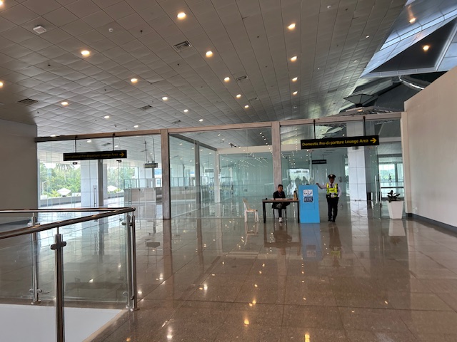
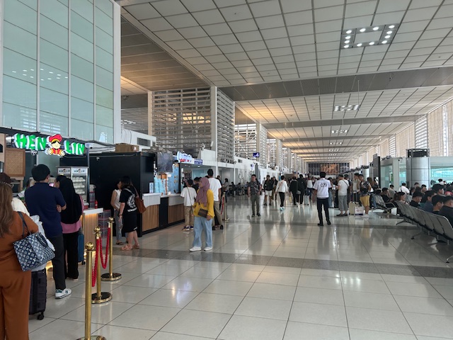
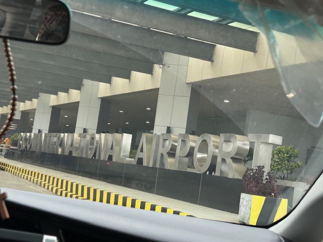 Arriving at the airport terminal’s departure area
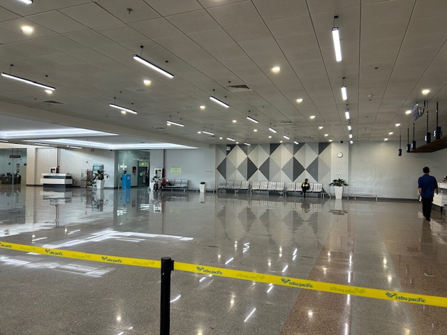
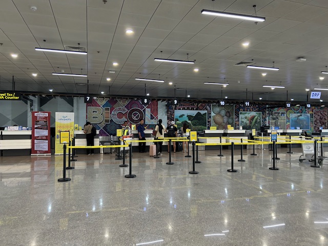 Check-in counters for Cebu Pacific
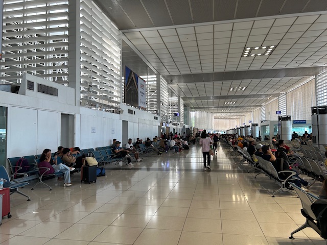
 The terminal features a spacious check-in area.
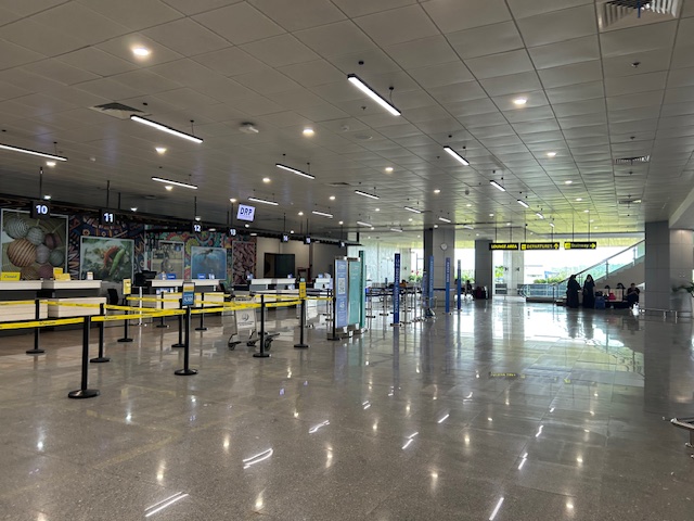
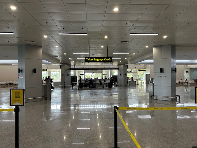
 The area is more spacious than other, more busy airports like Iloilo and Bacolod
 I can imagine that even if there were more flights, queues will not result in the area being too crowded.
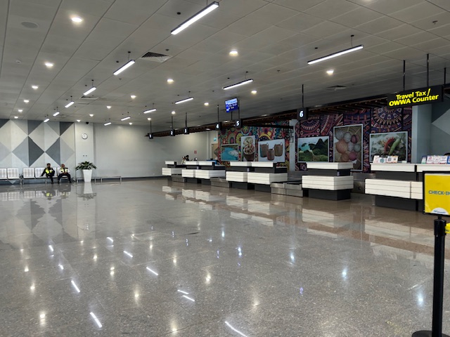
 Another angle seen from the check-in area
 The corridors are also spacious.
 The terminal is well lit.
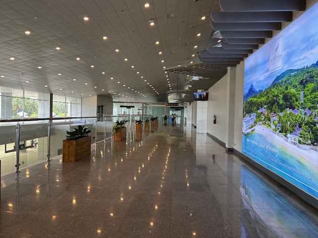
 Entrance to the pre-departure lounge of the airport
I already wrote about and shared photos of the pre-departure lounge including the shops and eating options there. I look forward to visiting Legazpi City and its neighboring areas soon and perhaps get a clear photo of Mayon Volcano.
–
Closed shops at NAIA Terminal 2
Recently, I wrote about the closed shops at NAIA Terminal 3. While there are still shops at the terminal, the pre-departure area was devoid of non-food shops or stalls. The same is true for NAIA Terminal 2. Here are some photos I took a few days ago en route to Davao.
 The north wing practically had no no-food shops. That left side in the photo used to have several souvenir shops and even a Duty Free Philippines shop.
 The same was true for the south wing where only the food stalls remain.
 Other food stalls at the south wing. There are two Cafe France stalls at the terminal pre-departure area, one at each wing. And most people seem to line up there and a couple other stalls as they offer the more substantial meals. Others offer basically merienda or snacks.
 North wing food stalls
Will there be more shops later at the terminals? Maybe, perhaps. But as I mentioned in the previous post and as many have commented, it depends on the cost. Will it be expensive and therefore unattractive to potential concessionaires? Or will the airport operator come up with an attractive contract for shops to return to the terminals? Airports in Bicol, Cebu and Davao, for example, have nice shops that serve the needs of travelers. NAIA being the principal gateway to the country should have nothing less.
–
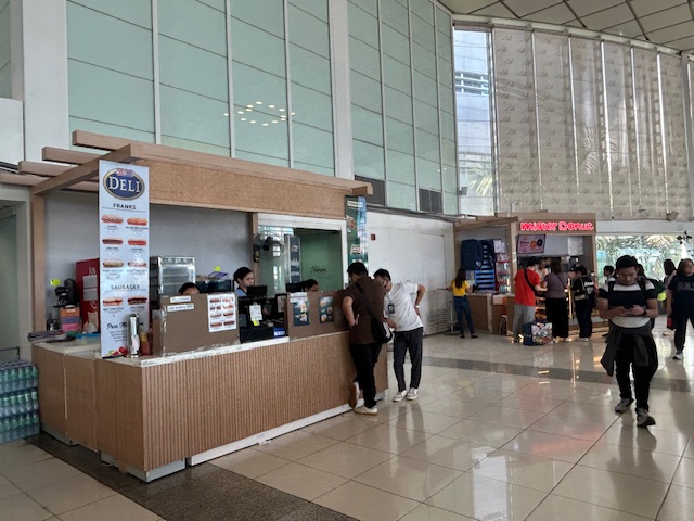
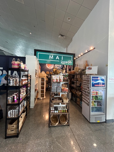
Eats and shops at the Bicol International Airport
This is a continuation of the feature on the Bicol International Airport. I am sharing the following photos below so my readers can be guided about what’s available to eat and/or drink at the terminal.
 Souvenir store at the entrance to the departure lounge
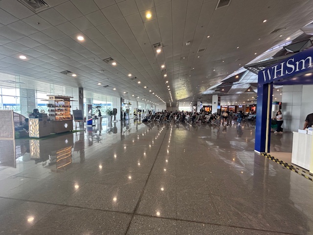 Turning to the pre-departure area – there’s WHSmith
 The terminal has a spacious lounge surrounded by shops
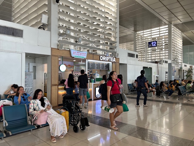
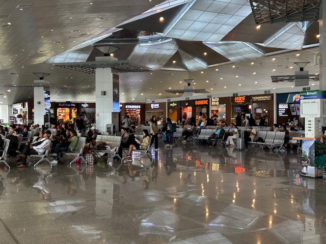
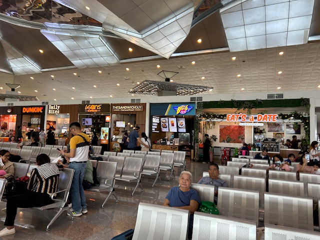 Among the options for the hungry are Eat’s a Date and the familiar Bigg’s, which is a chain that originated in Bicol. I think they are the Bicol equivalent of Bo’s Coffee.
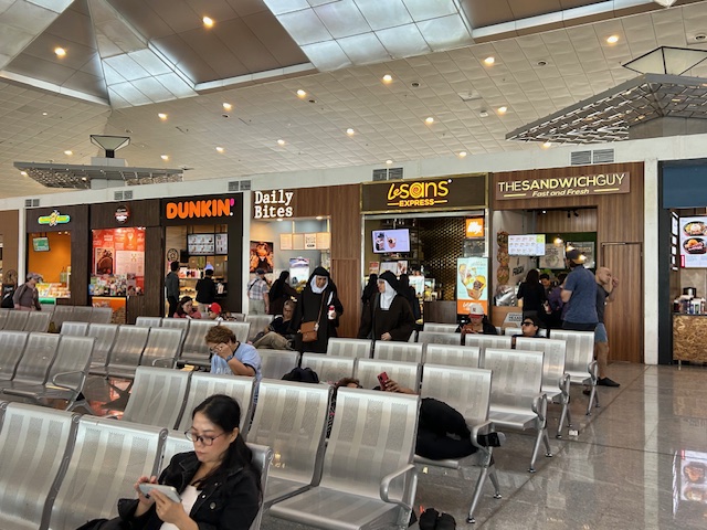 Some are familiar (Dunkin, Potato Corner and Sandwich Guy) while others are probably Bicol-based (LeSans, Daily Bites)
 There are many local products for sale as souvenirs or for personal consumption.
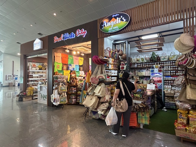 There are handicrafts and shirts at the terminal. I highly recommend the shirt store for the quality and variety of designs. I believe there are better shirts here in general compared to the tourist areas like Cagsawa.
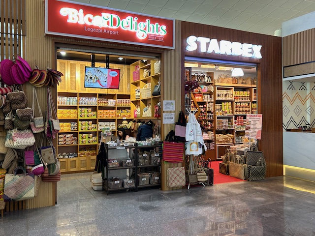
 One shop sells local delicacies especially those with pili nut and chili – two items associated to Bicol.
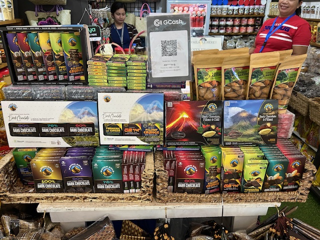
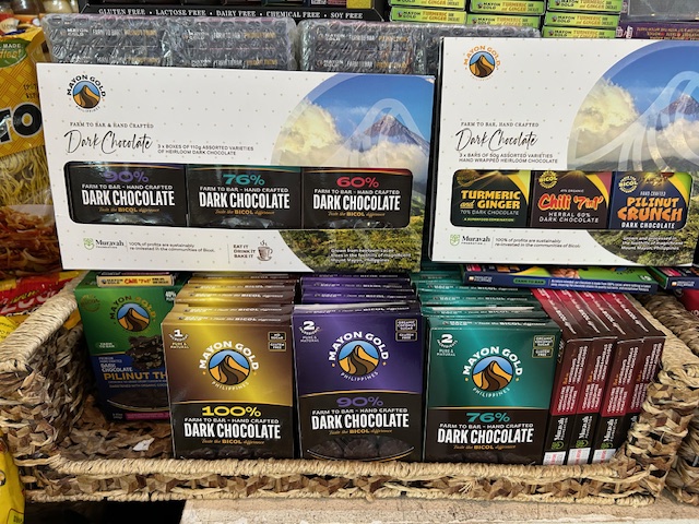 Locally made chocolates are available at the airport. I’ve seen Mayon Gold at the NAIA terminals and can say that their pili nut crunch chocolate is good. I have another blog where I write about chocolates so I will not write about the taste here.
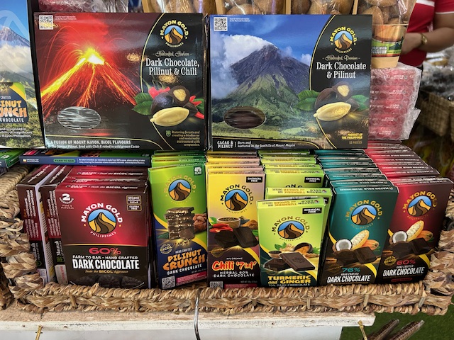 The chocolates come in individual bars for the different variants. They also have box sets or samplers.
More on the airport soon!
–
Sentimental for Yokohama
A visit from a couple of professors from Yokohama National University (Yokohama Kokuritsu Daigaku) triggered the sentimental part of me. Among the materials presented were information about life on campus and in Yokohama, which is the second biggest city in Japan after Tokyo. There were also giveaways including a nice folder featuring a photo of Yokohama showing the campus on the foreground and many landmarks in the background.
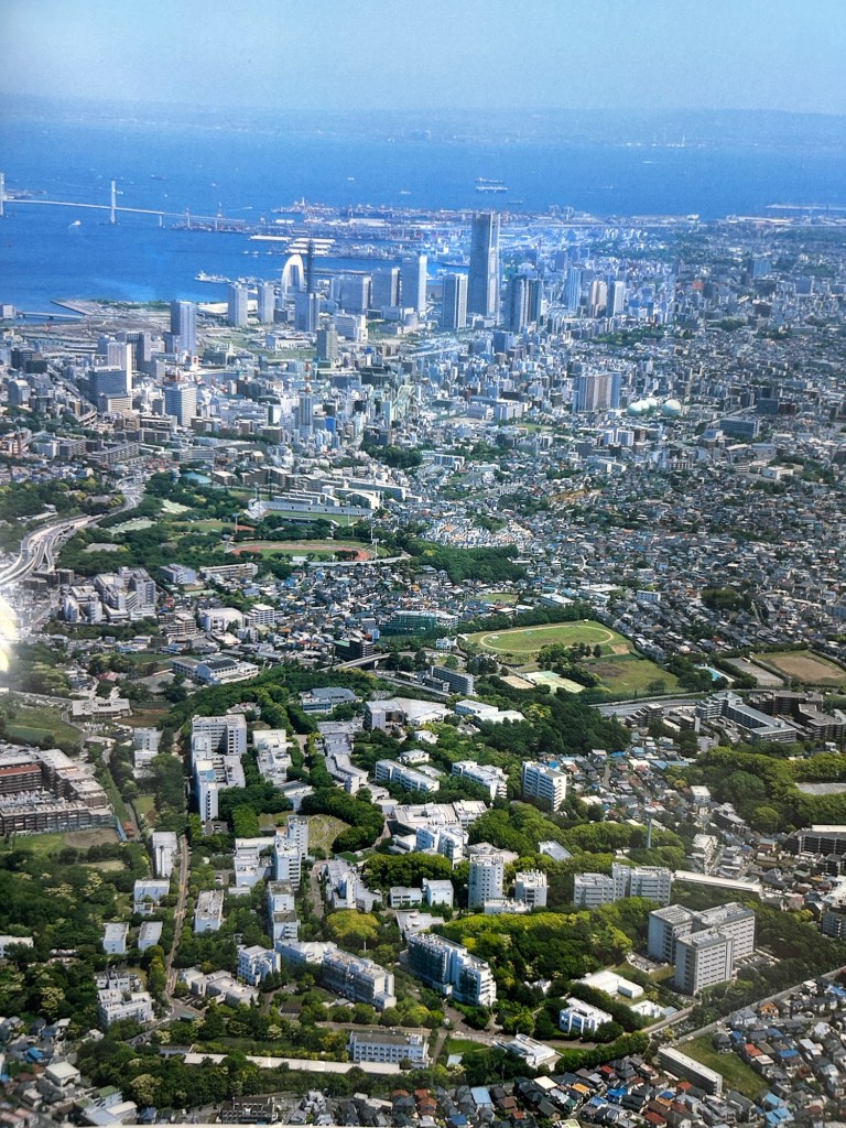
Landmarks in the photo include the Landmark Tower that used to be the tallest building in the country. There is also the Yokohama Bay Bridge that eventually connects to the Aqua Line. And, of course, the Port of Yokohama, which has long been one of the international gateways to Japan.
I have not been to Japan for more than a decade so I look forward to doing another sentimental journey to again visit familiar places and explore new ones.
–
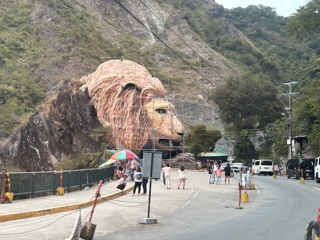
Landmarks – the Lion’s Head, Kennon Road
The main landmark along Kennon Road is the Lion’s Head. I think most people heading to or coming from Baguio have taken a photo of if not with the Lion. Here are photos I took as we descended from Baguio via Kennon Road last December 2024 after participating in a workshop.
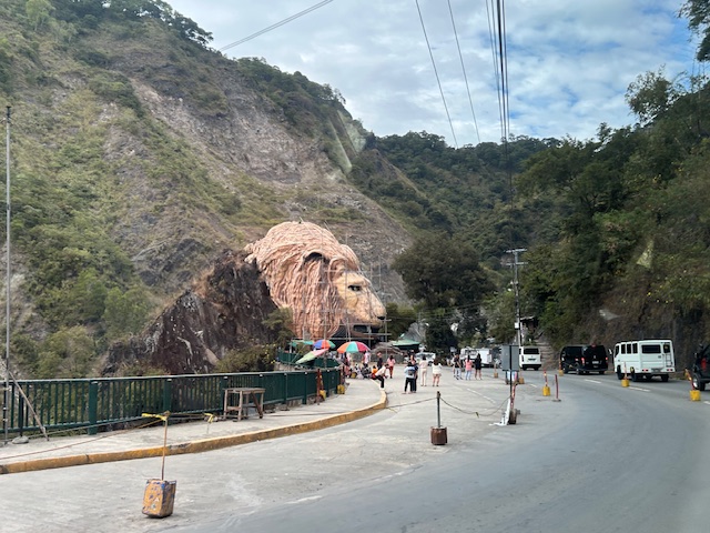 Approaching the Lion’s Head along Kennon Road, the monument appears to be under maintenance with scaffolding around the head.
 An entire section is cordoned off, likely for tourists or visitors. The lane though looks newly paved, perhaps part of a road widening project.
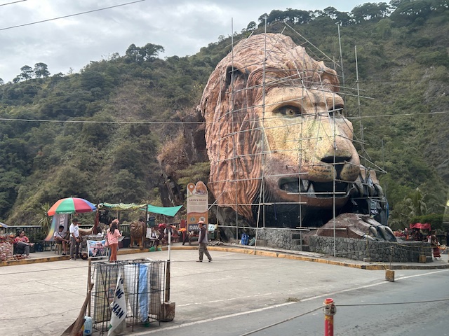 A closer look of the Lion’s Head and the touristy things in the area. Notice there weren’t too many tourists at the time and there weren’t so many shops and vendors set-up.
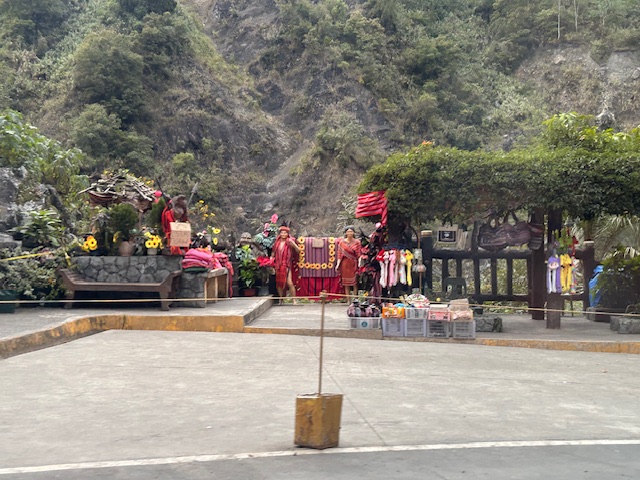 Among the activities are dressing up in local costume and taking photos wearing these with the mountains or the monument in the background.
–
–
Stopover at Sison, Pangasinan
We suddenly exited TPLEX to make a stop in Pangasinan. We were only a couple of exits away from the end of the tollway and the last part of the trip, which was the climb to Baguio via either Marcos Highway or Kennon Road. And we were doing good time until this exit and detour.
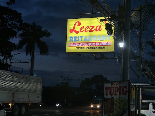 Our stop was at this restaurant in Sison, Pangasinan, which I discovered was a drivers’ stop. Drivers of buses and vans stop here to get a free meal in exchange for them bringing their passengers who will likely eat, drink and shop for pasalubong here.
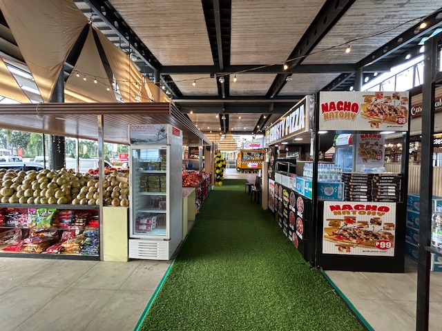
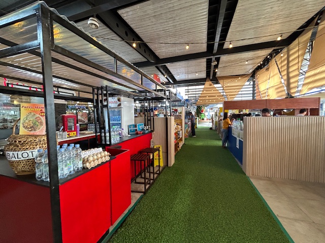
 Pasalubong options including the usual local delicacies including nuts, biscuits, sweets, etc. Many items are not from Pangasinan but may be from neighboring provinces. I even found pastilles from Bulacan being sold here.
 There are also fruits and vegetables for those who want to bring home to use in cooking. Though not a market, the prices at the stop are low as these are sourced from local farms.
 Of course, there’s tupig at the stop. Tupig has its origins in the Ilocos Region so this is one of the places to get this rice cake delicacy.
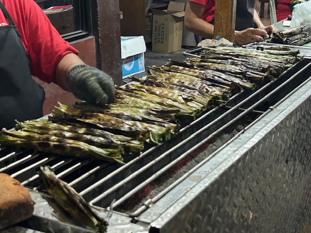 Tupi fresh from the grill
We ended up not going back to the tollway but instead used the Manila North Road to Marcos Highway. Kennon Road was closed to general traffic when we passed by the junction. And so it took us almost 2 hours more to finally get to our hotel instead of about an hour if we had not made this stop.
–
Shops at the NLEX Petron Lakeshore Station
I think the stop we regularly make whenever we are traveling north whether to Clark or beyond is the Petron Station at Lakeshore. It is not too close to Manila and is just before you transfer to SCTEX. Before, there were few establishments here so fewer people used to stop here. Now there are more but not as crowded as other stops that even have outlet shops.
 There are more shops now including those selling local products for souvenirs and fruits.
 There are many selling food and drinks for quick meals of travelers.
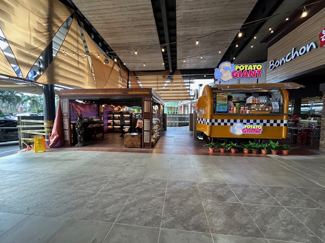 There are many choices for eating now aside from the established cafes and restaurants like McDonald’s, Razon’s, Bonchon, and Starbucks. One can get supplies from the Petron shop at the station.
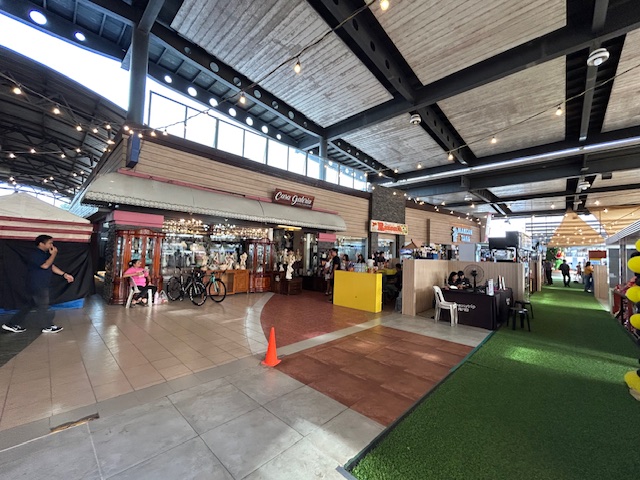 There is also a shop selling home decor and tiangge types selling clothes.
–
Mt. Arayat – the Lonely Mountain
A trip north will usually bring travelers to see a lonely mountain, actually a volcano, that is Mt. Arayat. Located in Pampanga province, you can see Mt. Arayat clearly as you traverse the North Luzon Expressway (NLEX). The volcano is actually visible even from afar on a clear day. I have shared photos of it from our village in Antipolo, Rizal.
 Mt. Arayat as viewed from the NLEX viaduct. On the foreground is the Candaba Swamps
 Another view of the ‘extinct’ volcano dominating the Pampanga landscape. Is it really extinct or perhaps just waiting to be awakened by a force of nature? That was how Mt. Pinatubo became active after a powerful earthquake a year before its big eruption.
I have seen the Mt. Arayat up close on a few occasions. One such time and perhaps the closest I’ve seen it was when we traveled along its foot to get to a wake in a far off Nueva Ecija town. There are actually many plantations or farms around it and along its slopes.
–
Off to Baguio
I’m off to Baguio City after more than 8 years. Though it’s not the first time to use all three expressways (NLEX, SCTEX and TPLEX) going there, I am curious about the developments along the way. TPLEX now extends all the way to Rosario, La Union. Also, there should be a lot of changes already in Baguio city especially after the pandemic and the projects of the current mayor. The latter includes a more people-friendly Session Road that I have yet to see for myself.
I will try to share photos and updates on this trip in future posts even while in Baguio. The city is a sentimental place for me as my first major project after graduating from university was there. And I had experienced walking around the city on many occasions.
–
Political garbage along our roads
While it is not formally campaign season, you’ve probably seen all those ads, posters, tarps and other obviously campaign materials that have sprouted around the country. Even before the filing of COCs, there were already a lot of political garbage (as I refer to them) along our roads. Many that you see on large billboards promote their purported TV or radio shows. Others pretend to be concerned about your safety while traveling (e.g., “Ingat sa biyahe!”, “Ride safe!”, etc.).

The government, particularly the COMELEC, seems to be inutile and inept about these brazen, even flamboyant displays by politicians. And so we end up with a lot of literal and figurative garbage along our streets. These are the politicians that people continue to vote while stating they want changes and reforms in government and society. You vote for these clowns and you get exactly the misery and incompetence that dooms us especially during times of difficulties and calamities.
–
