
Home » Travel (Page 3)
Category Archives: Travel
Welcome arch in Iloilo
We had a small adventure when we were in Iloilo last month. We traveled to the last town to the west just before the border with the Province of Antique. I was expecting to see welcome arches as we crossed one town after another. There was only one town that had this – Guimbal. And practically the whole stretch of the national highway had a signature of the town’s motto that had got something to do about it like a rising sun.
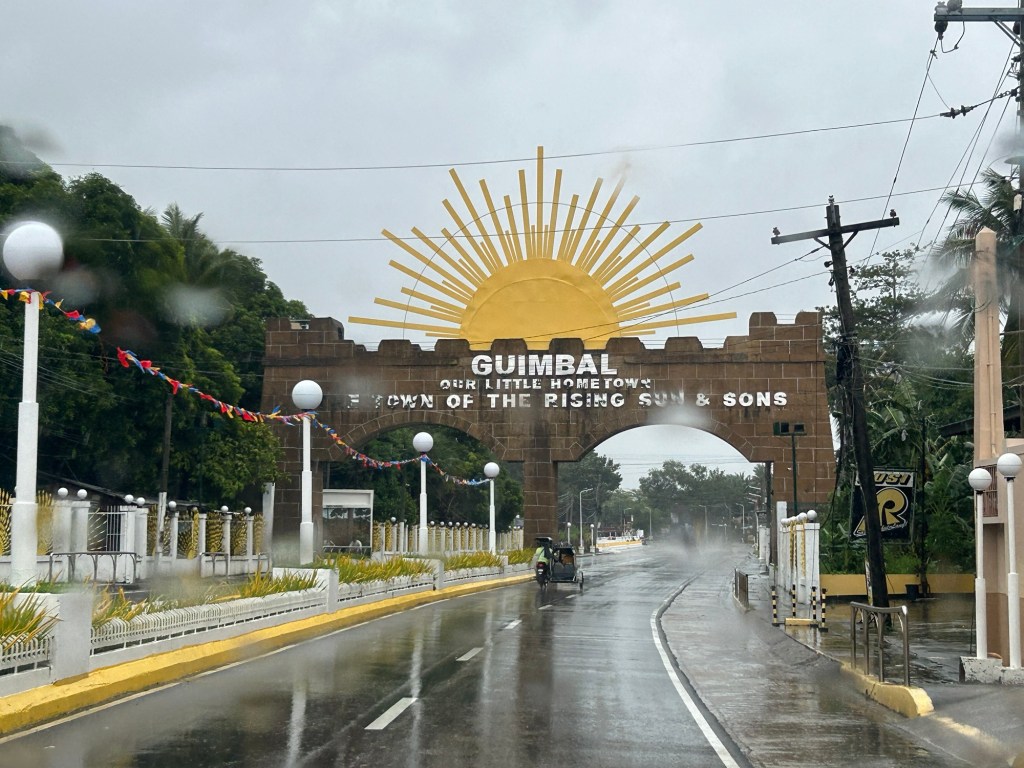
There’s another quite unusual landmark there that I will also be writing about soon. I will leave my readers in suspense for now.
–
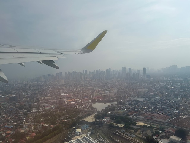
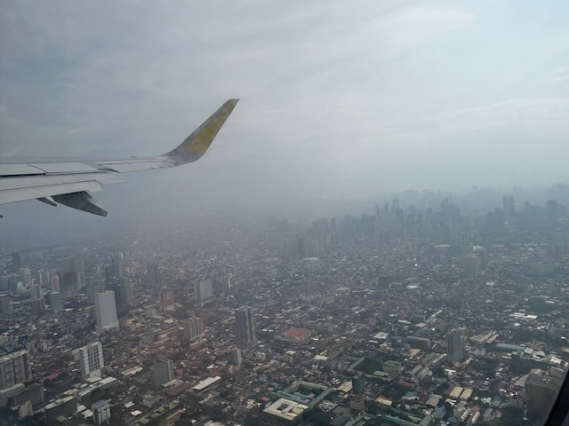
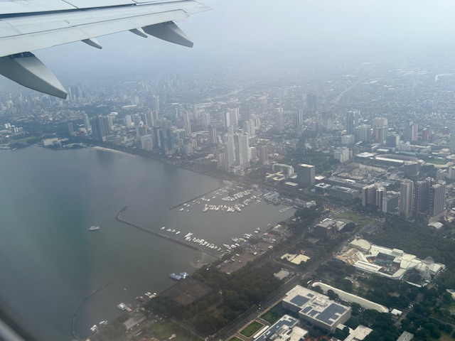
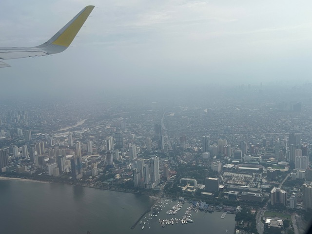
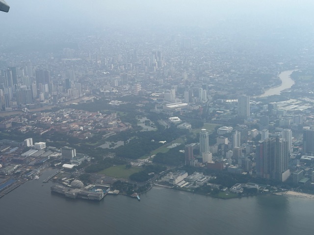
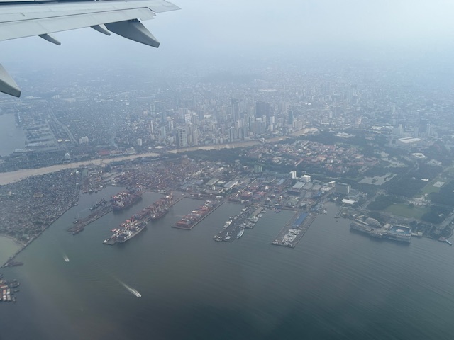
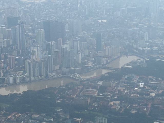
Post Habagat Aerial Photos
We flew to Iloilo just after the Habagat floods that ravaged much of Metro Manila and its surrounding provinces. As our plane took off from Runway 13-31, I figured there was an opportunity to take a few photos of Metro Manila especially as I was seated by the window of the plane.
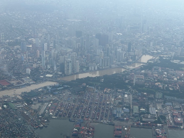
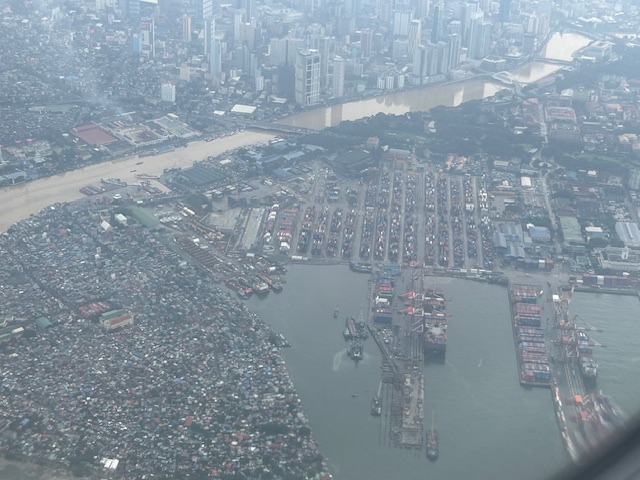
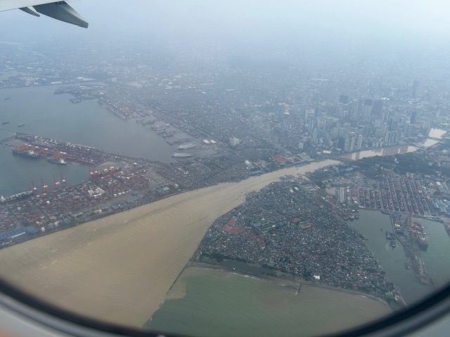
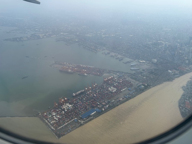
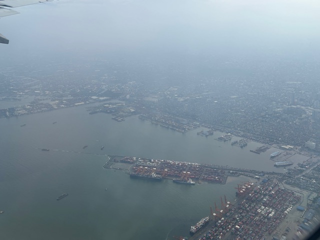
More aerial photos to be posted here soon!
–
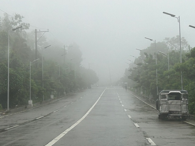
Foggy roads in Tagaytay – Part 1
It’s been a while since the last time I was in Tagaytay. We used to go there at least once a month. Eventually, we grew tired of the traffic and the city becoming quite crowded. Of course, our schedules also became more busy so the drives for a weekend getaway turned into trips for music lessons (for our daughter) and meet-ups with friends. It was a welcome return last July when I had to go to Tagaytay Highlands for a meeting and then join up with our college for a workshop on the other end of the city. Here are some photos of the foggy roads that reminded me of the Tagaytay of old.
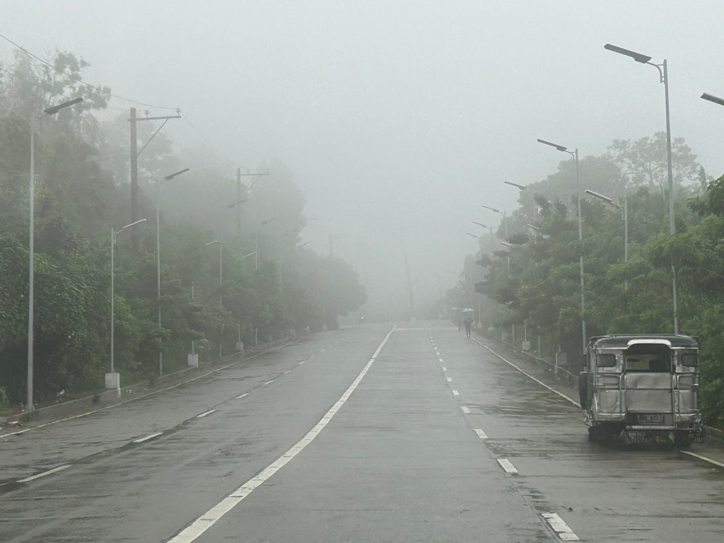
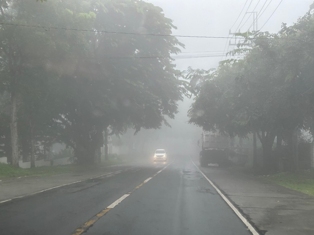
More photos of the foggy roads in the next post!
–
Back in Iloilo
I’m finally back in Iloilo after a very long while. It’s a quick visit so I won’t be able to go to our ancestral home in Cabatuan. The visit to the city though will still be a sentimental one and perhaps update me on the developments there.
I will be posting on this trip soon as I plan to take photos of the bike facilities along the Diversion Road and walk along the Esplanade.
–
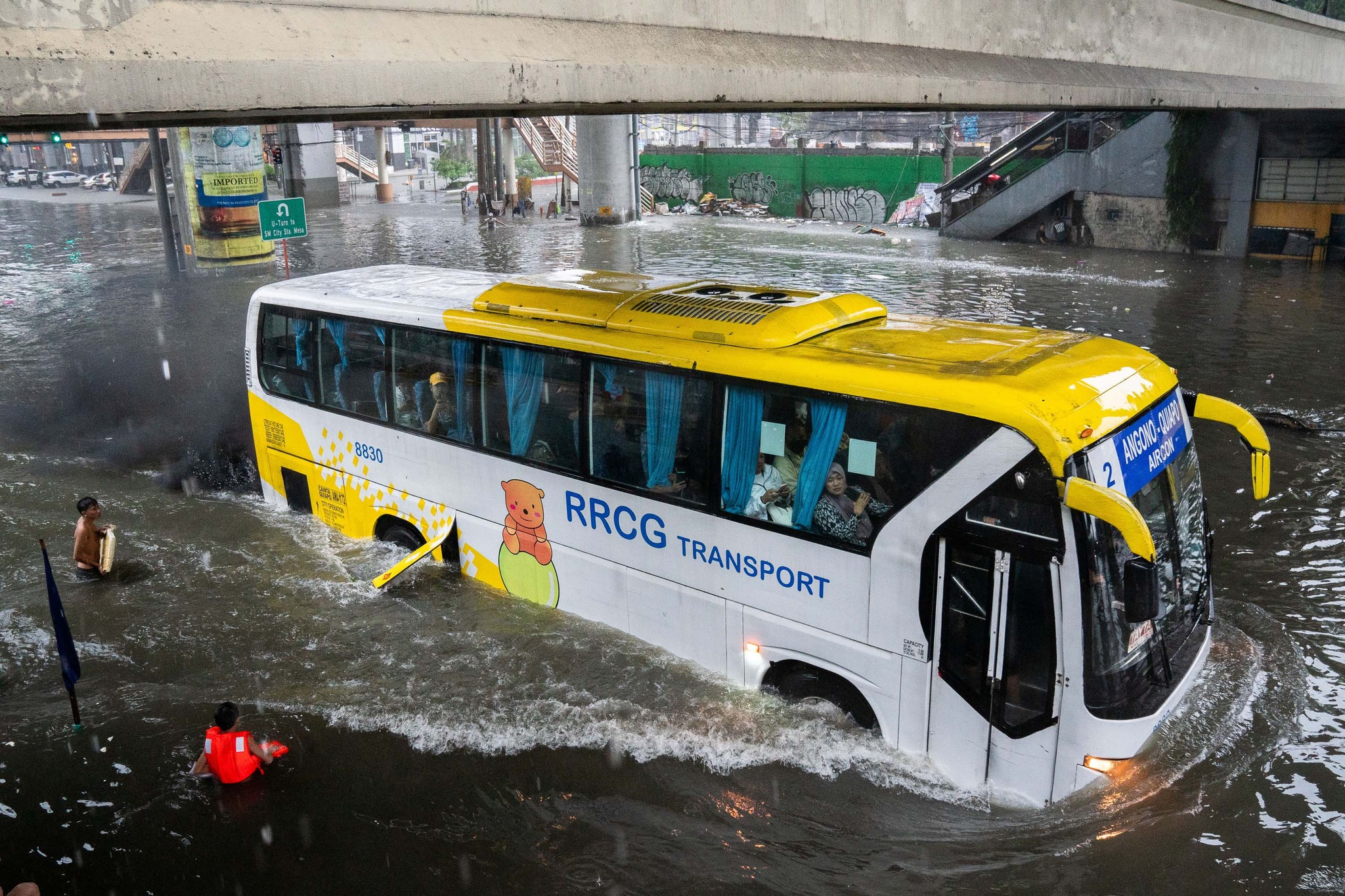
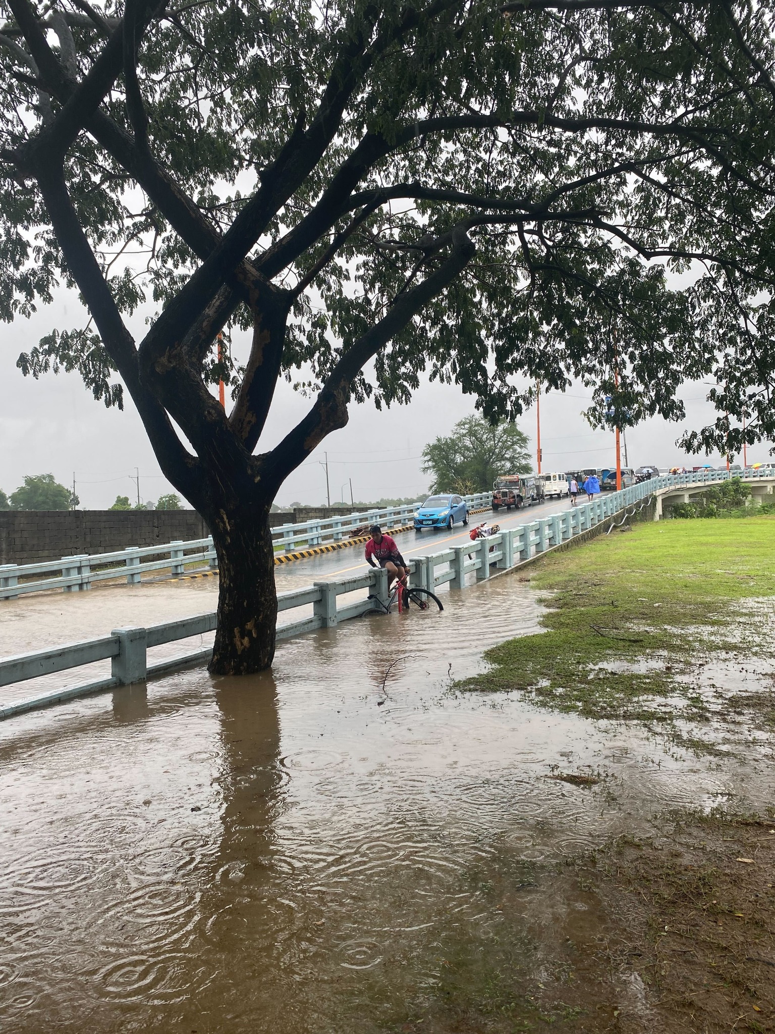
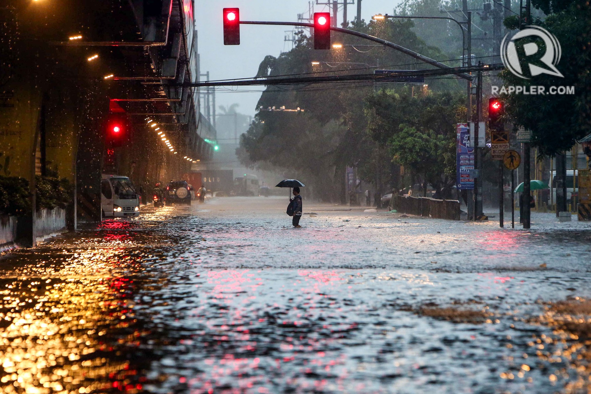
On transportation and floods
Some people say transport and traffic concerns take a backseat to floods and related concerns, which affect other aspects of our lives aside from our commutes. The heavy rains the past days have rendered many streets impassable to most types of vehicles. That means people cannot go to work, school or come home. Lives are disrupted by floods this way. But even more disruptive and disastrous are the damages brought about by flooding in many communities. Homes are submerged. Properties are damaged, many beyond repair or replacement. There is also the psychological aspect of floods especially for those who will experience them for the first time. These will surely add to the already fragile mental health of people still reeling from the effects of the COVID-19 pandemic.
As I write, the Marikina River has breached and many areas of Metro Manila and surrounding provinces of Bulacan, Rizal, Laguna and Cavite are flooded. The floods are now being mentioned along with those brought about by Ondoy (Ketsana) in 2009.
Here are some photos from the internet being shared by various social media accounts including the official pages of Rappler and Inquirer:
–
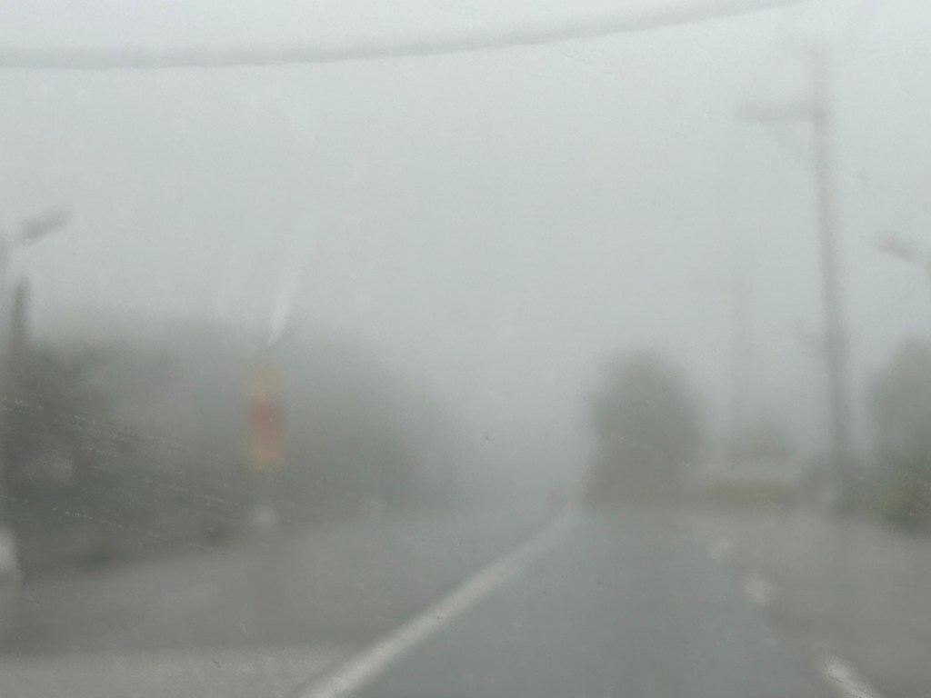
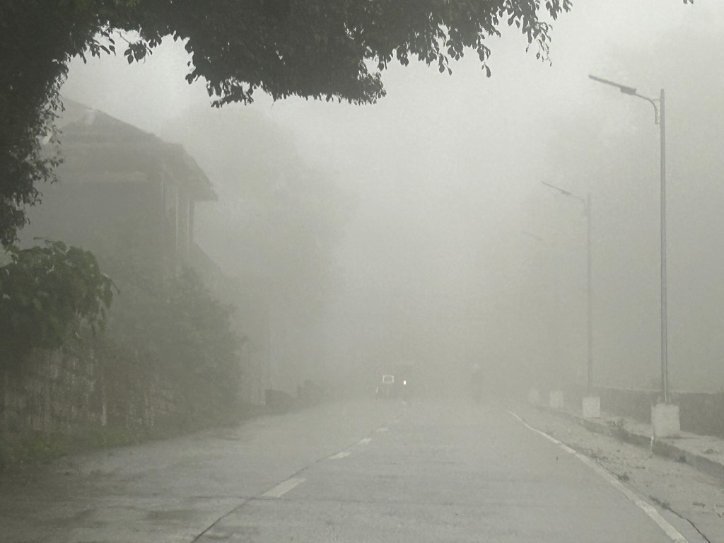
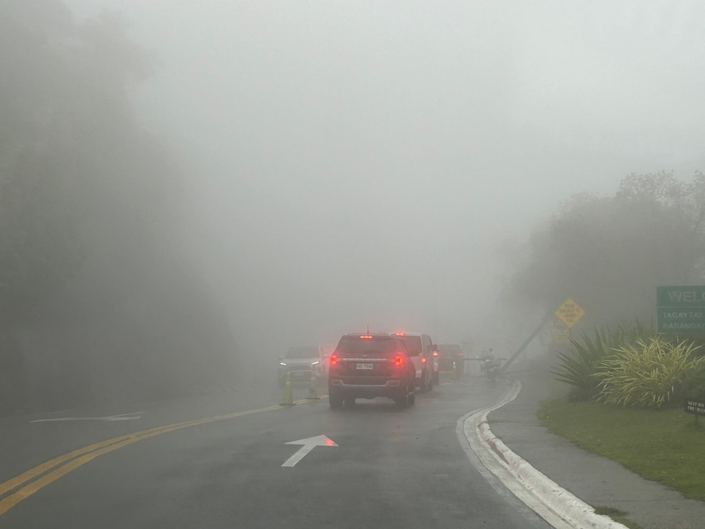
Back in Tagaytay
It’s been a while since I’ve been to Tagaytay. I think the last time was before the pandemic and with family. There used to be a time when we went there at least every month not counting the seminars and workshops we attended there. It was an easy drive from our home in Antipolo to Tagaytay via C6, SLEX and the Sta. Rosa-Tagaytay Road. We had our favorite stopovers with breakfasts usually at the Paseo de Sta. Rosa. Later, as Tagaytay became more crowded and congested, the trips became fewer. Of course, our schedules also became busier but then it wasn’t like we looked forward to the traffic and the crowded attractions there. I’m doing a project there now with my team at the office and that means I get to go there for work. Since we’ll be there anyway, we could have some side trips to eat some good meals (bulalo!) and maybe take some photos of Taal volcano.
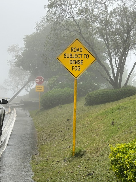
The fog was a quick reminder of the Tagaytay of old that we frequented before. But what we noticed was that it wasn’t cool. It was still somewhat warm if there was no breeze or wind blowing. This was certainly not smog as you can smell the pollution if it was. We even joked that it probably wasn’t because of the volcano as the smell of sulphur would probably be strong. We were in Tagaytay during the weekdays so there were fewer people and traffic. We were told that it was worse on weekends. That was to be expected. And with CALAX, Tagaytay became more accessible to visitors. I will write about the developments there in the next post. I feel there’s just too many buildings and the intense development has made Tagaytay less attractive. I have similar memories and feelings about Baguio but that’s another story to tell or write about.
–
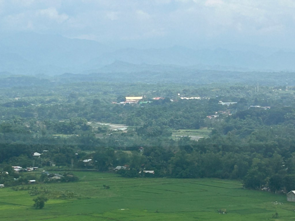
Some aerial photos as we approached Panglao
Here are a few more photos from our plane as we journeyed to Bohol last week. This time, it is from the approach to Panglao. I was expecting the approach for the plane to pass above Cebu. I was rewarded with the following photos:
 Mactan Cebu International Airport as seen from our plane making its approach to Panglao Airport
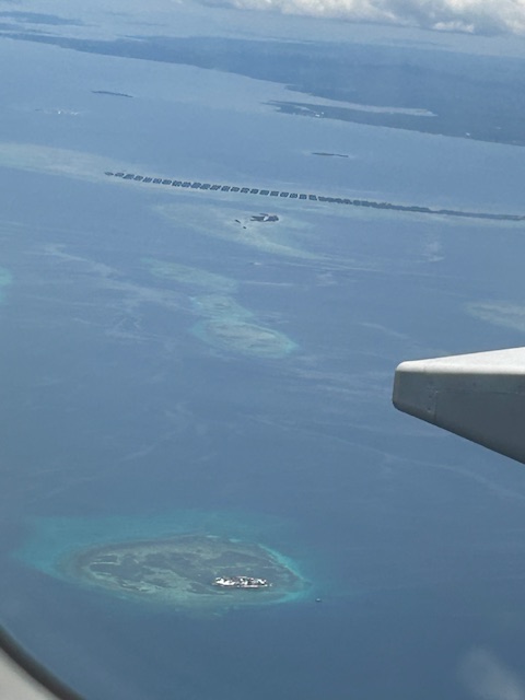 A view of the islands off Mactan and between Cebu and Bohol. There was a view of Olango Island but I wasn’t able to take a photo.
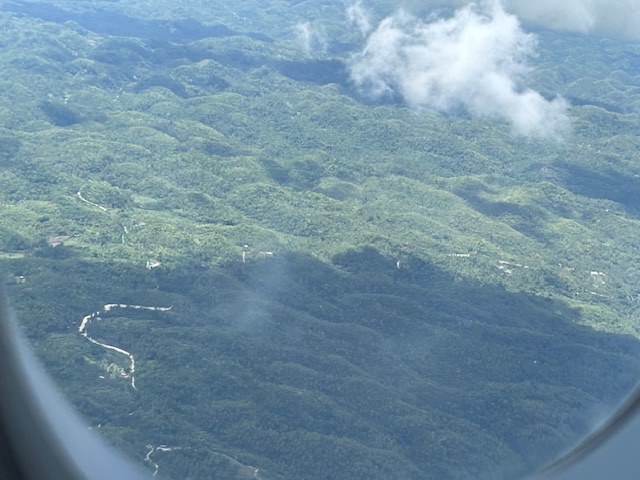 A quick shot of some of the hills at Bohol Island. I am not sure these are the Chocolate Hills but the formation, the geology is the same as the heritage site’s.
–
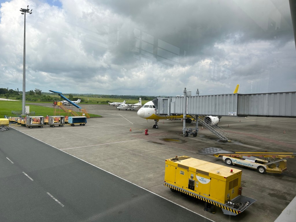
Self check-in and self bag-drop at NAIA Terminal 3
In addition to the self check-in terminals, Cebu Pacific now has self bag drop booths at NAIA Terminal 3. These are easy to use and may lead to quicker processing of passengers. They have staff ready to assist in case passengers encounter some difficulty using the self bag drop terminals.

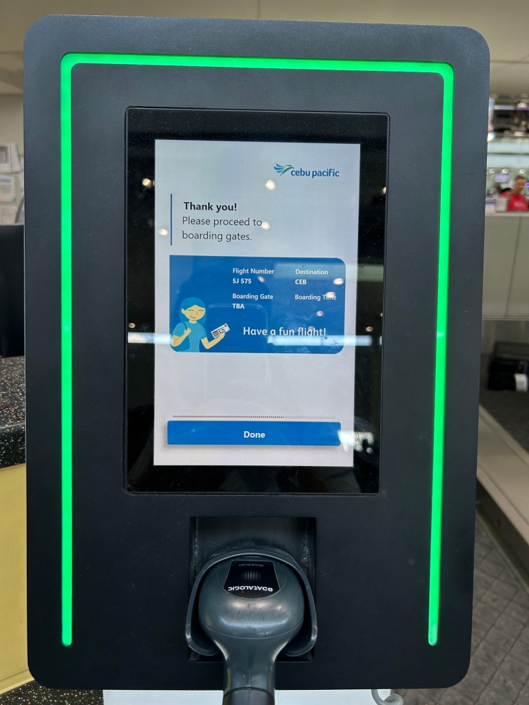
We’ll probably see these terminals in other airports particularly the major ones like Cebu, Davao and Clark. It is a convenience and also reduces the need for staff manning the check-in counters.
–
Change in scenery
We had an off-campus workshop last week in Baras, Rizal, and it was a welcome change in environment and pace. The venue also afforded a view of the provinces of Rizal, Laguna and even Quezon.
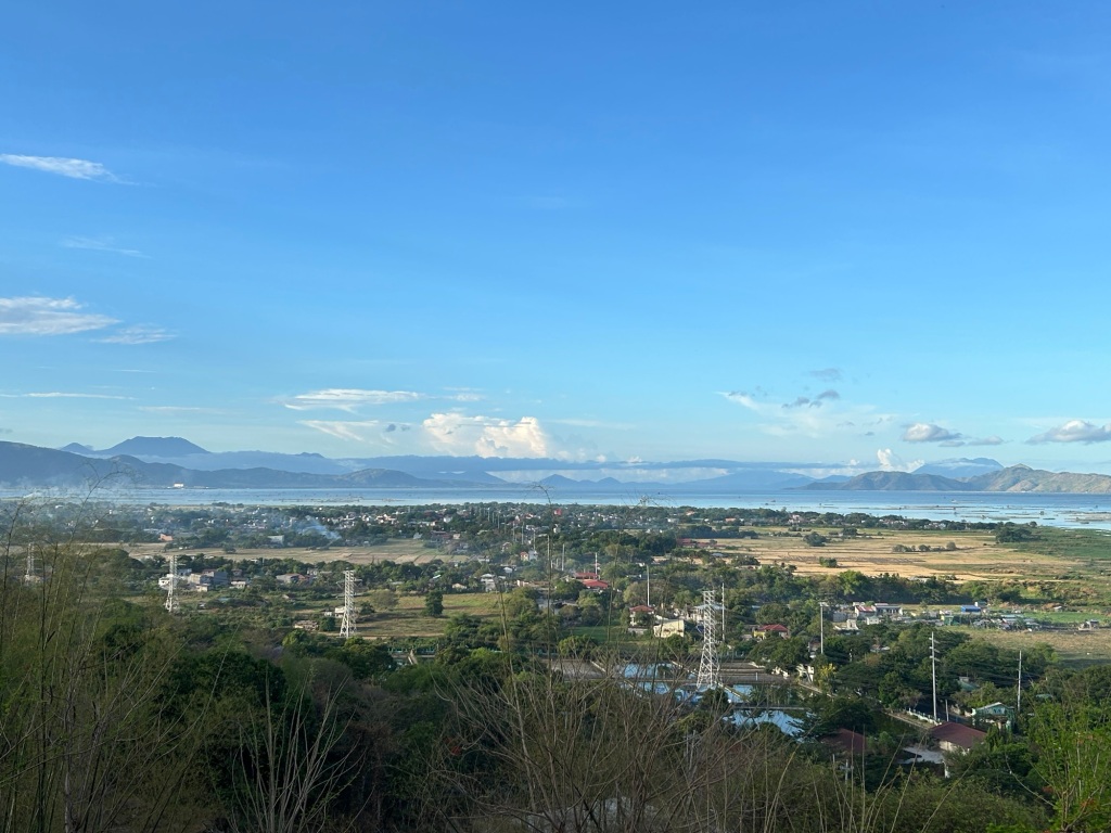 We had a nice view of Laguna de Bai. At the center of the photo is the town proper of Tanay, which has an old church at the center and along the old national road. In the background are mountains, volcanoes actually, including on the left Mt. Banahaw in Quezon Province. Mt. Makiling in Laguna is also in the horizon on the right.
If you notice the power lines in the photo, these connect to the two power plants in the area – the Malaya Thermal Plant and the Pililla Wind Farm both in Pililla, Rizal.
Tanay has a small port and a lighthouse. There are many fish pens in the area so most boats using the port are probably fishing boats. There was a proposal many years ago for extending the ferry service along the Pasig River to towns along the lake. This required clearing the lake of many fish pens to make it navigable. I hear the plans are being revived but I think its a wait and see in as far as these projects are concerned.
–
Fare rates for the Antipolo – Iloilo bus service
I found these information on fare rates for the newly opened Antipolo – Iloilo bus service:

The information above indicates that there are three routes to Iloilo:
1) On the left is the route via the central roads of Panay Island (i.e., via Passi City, Iloilo);
2) In the middle is the route to the east of Panay Island to Kalibo, Aklan and Roxas City, Capiz, and terminates at Estancia, Iloilo; and
3) On the rights is the route along the west and crossing the province of Antique. This terminates at Oton, Iloilo and will pass through the town of Miag-ao, which is famous for its church recognized as a UN Heritage Site.
To book a seat on the bus, here is the step-by-step procedure shared on social media on the official Facebook page of Robinsons Antipolo:

–
