
Home » Walking
Category Archives: Walking
On desire paths
I found this article on desire paths. These are paths made by people based on their preferred ways to get from one place to another. Often, the paths or ways that are constructed and paved are not the shortest or most desirable ones and appear to force people into following them. Perhaps the built pathways are planned or designed to follow a certain aesthetic in as far as infrastructure is concerned. Desire paths often are the most direct routes from one place to another. These shortcuts are defined over time by the wear along the path. In some cases, they eventually become formalized when they are paved or maintained one way or another including trimming of foliage along the paths.
https://www.boredpanda.com/desire-paths-pictures/?utm_source=share&utm_medium=top&utm_campaign=user
Here’s an example at the National Science Complex grounds of the University of the Philippines Diliman:
 Desire path created by students and staff as a shortcut from the complex core to one of the outlier buildings.
–
On the reduced traffic due to the energy crisis
The past weeks have seen traffic reduced along my usual routes for my commute between my home and workplace. This could be attributed to the energy crisis as, apparently, many have chosen to plan their trips and use other options other than private/personal transportation for their travels. The reduction in traffic is probably due to reduced numbers of private cars and motorcycles as people cut down on unnecessary trips. Of course, most schools are off at this time of the year so that means a significant number of trips are off the roads (and rails in the case of Metro Manila).
My travel time is only about 60 to 70% of the usual during peak hours. And about half during off-peak. That is a significant reduction in travel time and perhaps translates to not just reduced fuel consumption in general but also reduced emissions as well. On weekends, I also observed that there are less motorcycle traffic to and from Antipolo where I reside. I am referring to the groups who usually have their recreational rides during weekends. Did bicycle traffic increase? My observation is that there seems to be an increase for the weekdays but it’s about the same on weekends. Bicycles, after all, are not affected by the fuel price hikes. Perhaps people who can bike opt for the mode instead of their motorized vehicles? The only way to determine if indeed there were significant mode shift is to do surveys. But for now, careful observation not of traffic but travel times will suffice as proof of the easing of traffic due to the crisis.
–
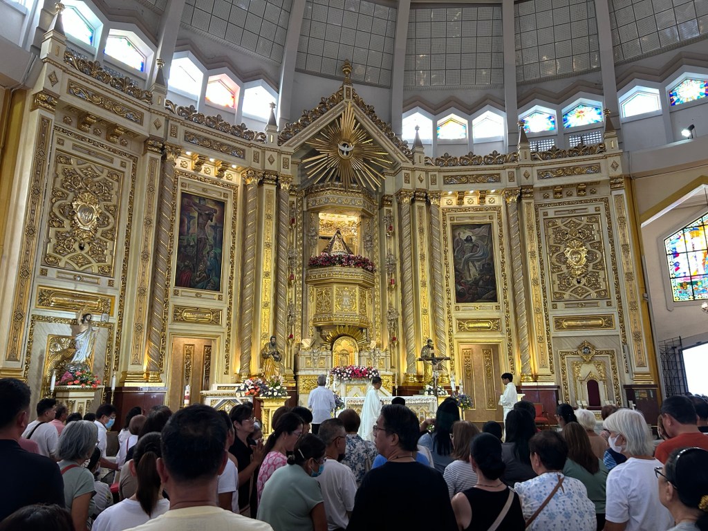
May-time pilgrimage
Last April 30-May 1, there was another ‘Alay Lakad’ to the shrine in Antipolo. The pilgrimage walk started in Quiapo Church (Black Nazarene) and ended at the Antipolo church (Our Lady of Peace and Good Voyage). Dubbed the “Walk for Peace,” there usually was a lot of people considering the number of devotees as well as May 1 being perhaps a holiday. Antipolo and Taytay LGUs at least put up stations for assistance to pilgrims.
We started hearing Mass again at the shrine last Sunday as our daughter prefers going there instead of at the chapel at our village. She’s gone to two Lenten Alay Lakads the past two years so maybe she felt this was a kind of pilgrimage for her, too.
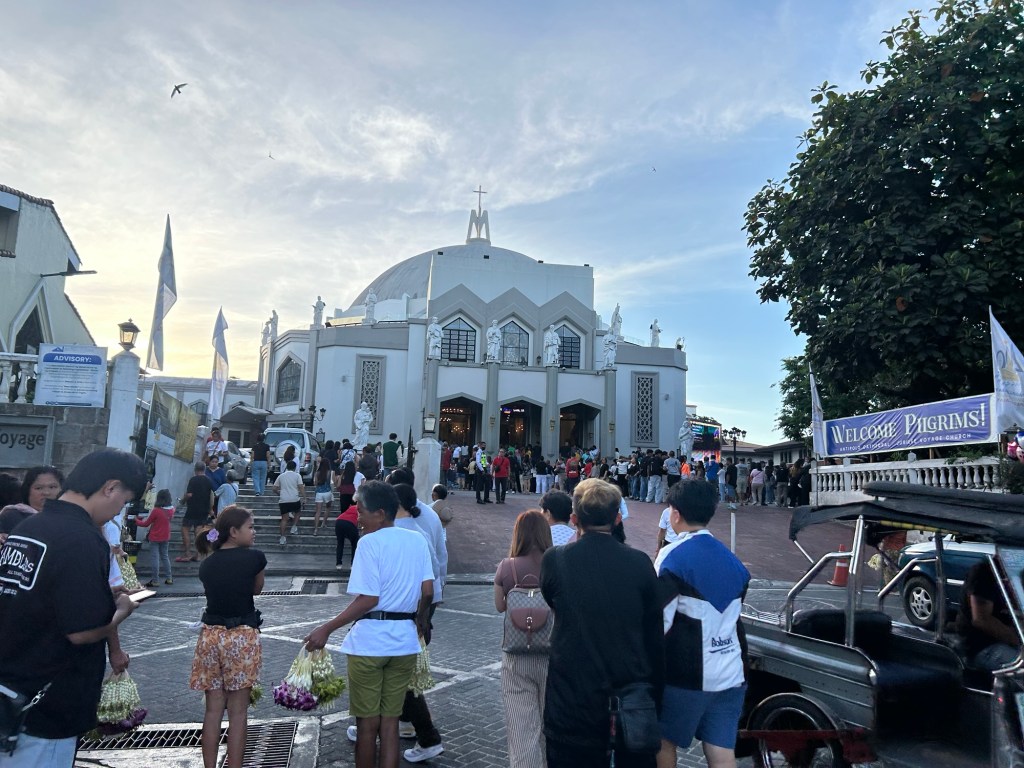
For those walking from Metro Manila, there are two general routes to Antipolo. One is via Ortigas Avenue Extension and Tikling junction and the other is via Sumulong Highway and Masinag junction. You can take public transportation from Cubao or Crossing where there are jeepneys and buses. Many terminate at the Robinsons Antipolo mall terminal. But there are many other smaller terminals around the city including some near the Simbahan itself. There are also many tricycles that can take you to the shrine from various points in Antipolo including the Line 2 station at Masinag. Line 2, of course, is a convenient and fast way to get to Antipolo from Manila and Quezon City.
–
Some thoughts and reflections on transport and the Middle East crisis
Much has been said and written about the ongoing crisis brought about by the US and Israel attacking Iran and the latter retaliating. The prices of fuel have risen rapidly over the past weeks. Consequently, the prices of commodities have also risen. The Philippines is still very much dependent of fossil fuels for transportation with most travel using road-based transport. Even public transportation relies heavily on fossil fuels as buses and jeepneys are mostly using diesel engines. Even paratransit such as trikes and motorcycle taxis use gasoline.
While the energy mix in the country has become more diversified with renewables now having a substantial share, majority of power is produces using coal and natural gas. And so e-powered vehicles are also ultimately dependent on these fuels. Could we have had better transport that could have made our cities more resilient in light of the conflict in the Middle East? Probably, and if we followed and implemented the plans for mass transit systems that were laid out decades ago. Of course, this is already moot and academic given the current situation. The counterfactuals though point to better commuting conditions if projects have not been delayed or shelved.
A colleague and I were just discussing about how MRT 7 could have contributed to the reduction of car use along the Commonwealth Avenue corridor if it was completed according to the original schedule. That was 2019. Even with delays including the impact of the pandemic, it could have been completed a few years ago. If it was operational in 2023, commuters could have already shifted to rail from both private and public road-based transport modes. There was also actually a proposal for a Bus Rapid Transit (BRT) line along Commonwealth about 2 decades ago. That could have been constructed and operational ahead of Line 7 and could have already disrupted commuting preferences along the corridor if it were operated as a true BRT.
There’s just a lot of opportunities already missed that could have alleviated the fuel crisis we have now. Maybe we are really heading towards a bigger crisis when all these price increases lead to a more sweeping increase in the prices of commodities? We hope it doesn’t come to that but we seem to be helpless in this situation where we are caught unprepared for a war we are have nothing to do with.
–
Just keep on walking
After an eventful end to 2025 and start of 2026, I finally was able to get back to walking. I passed on January 1 as there was a haze that blanketed our area. That was due to the fireworks. With more residents in our village and surrounding areas, there has been an increase in fireworks users the past few years. Last weekend, it was nice to have better air quality for my morning walks.

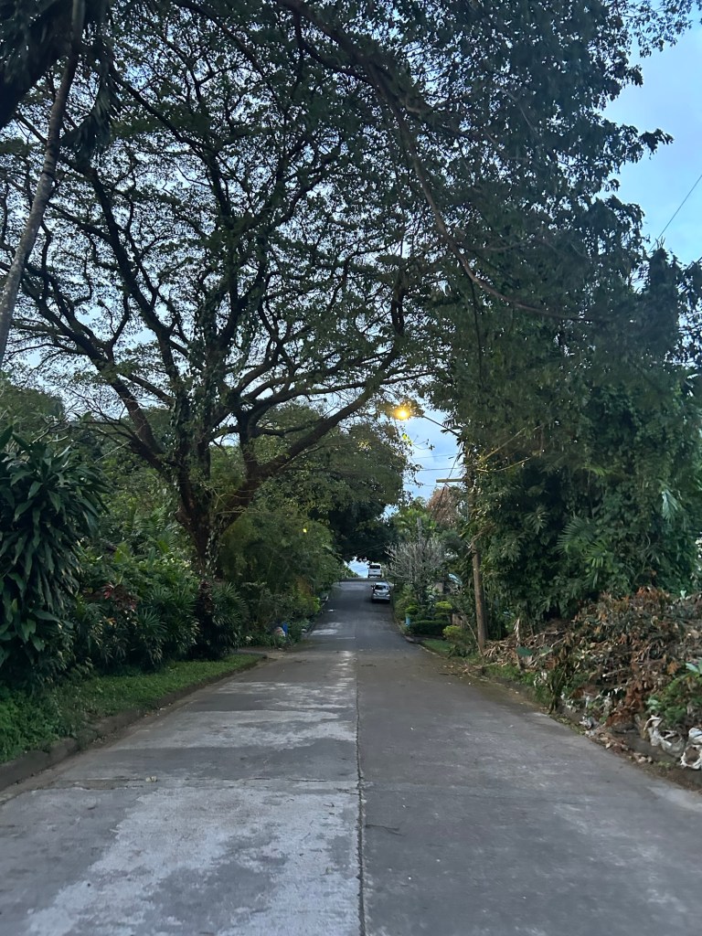
My average step count decreased last year due to a variety of factors including weather. I intend to start strong again this January and hopefully be able to sustain this for the year. It’s really a good thing for my health and wellbeing. And it’s something I would strongly recommend for others- be more active. Set some time for walking whether it’s in the morning, noon or evening.
–
“Nobody Walks Here. It’s Too Hot or Cold or Wet or Dry.”
I’m sharing this article as it provides a clear response to the question about walking under different circumstances. Those circumstances include weather conditions. How many times have we heard people saying “people won’t walk because it’s too hot or rainy” ? Maulan (rainy)! Mainit (too hot)! And yet we find a lot of people walking, even when its extremely hot or the rains are pouring.
Source: “Nobody Walks Here. It’s Too Hot or Cold or Wet or Dry.”
Quoting from the article:
“The human ability to adapt is the key to our spectacular success on this planet. Our problem is that the people who lead our public conversations, our elites of wealth and opinion, are often some of the least adaptable people on earth. And when societies assume that we should listen to those people, we all end up internalizing the message that there’s something wrong with us if we even try to walk…
…Sometimes walking a few blocks is the key to liberty and prosperity in someone’s life. Most people do what makes sense in the place where they live. Only if we recognize that will we make the investments in urban design to make walking more bearable in extreme weather. And only then will our cities include everyone.”
Here’s another quote and a take on what certain people say that often influences our choice for walking:
“The functionality of a city, and of its transport system, arises from the sum of everyone’s choices about how to travel, not just the preferences of elites. When elites make pronouncements about what “people” will tolerate, while really speaking only of themselves, they mislead us about how cities actually succeed. They also demean the contributions of the vast majority of people who are in fact tolerating extreme weather to do whatever will give their lives meaning and value.”
–
The need to be alert while walking, jogging or running in campus
With the recent bad weather, I noticed a big decrease in the number of visitors to the UP Diliman campus. Most of these walk, jog or run for health or recreation. Many of these are often lost in their conversations or too focused on their activity that they become unaware of the dangers of moving under large trees whose branches might fall on them anytime. It is especially true during the wet season and when there are typhoons or storms. The water and wind often bring down the older branches and one can get serious injuries perhaps even die should a large branch fall upon them.
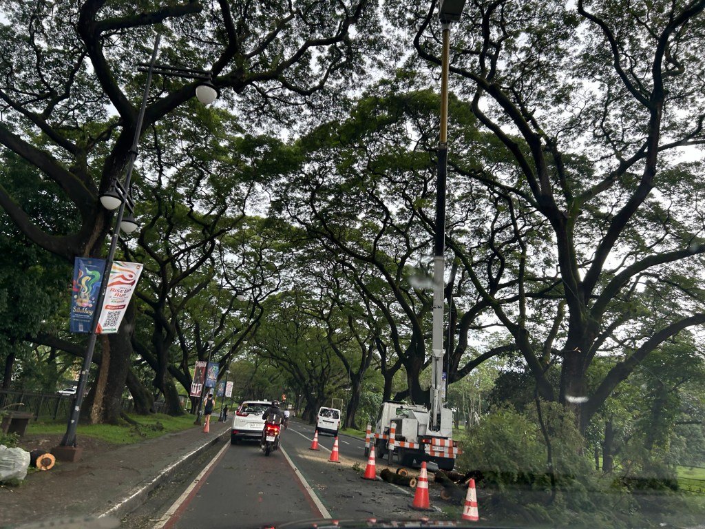
Walkers, joggers and runners (let’s also include cyclists/bikers) need to be aware of these dangers. I myself had a few near misses in the past while walking around the Academic Oval. I know people who have been injured by falling branches while they went around.
–
The need to be alert while walking, jogging or running in campus
With the recent bad weather, I noticed a big decrease in the number of visitors to the UP Diliman campus. Most of these walk, jog or run for health or recreation. Many of these are often lost in their conversations or too focused on their activity that they become unaware of the dangers of moving under large trees whose branches might fall on them anytime. It is especially true during the wet season and when there are typhoons or storms. The water and wind often bring down the older branches and one can get serious injuries perhaps even die should a large branch fall upon them.
Walkers, joggers and runners (let’s also include cyclists/bikers) need to be aware of these dangers. I myself had a few near misses in the past while walking around the Academic Oval. I know people who have been injured by falling branches while they went around.
–
A cityscape revisited
I was posting photos of a familiar sight along one of my walking routes in our neighborhood. Somehow, that route became less frequented as houses were constructed in what old timers here referred to as the second floor. What offered a 360 view of areas surrounding our place was now mostly inaccessible, depriving people of spectacular views.
Last Sunday, we chanced upon the sight below along another of my routes that we now seldom passed.
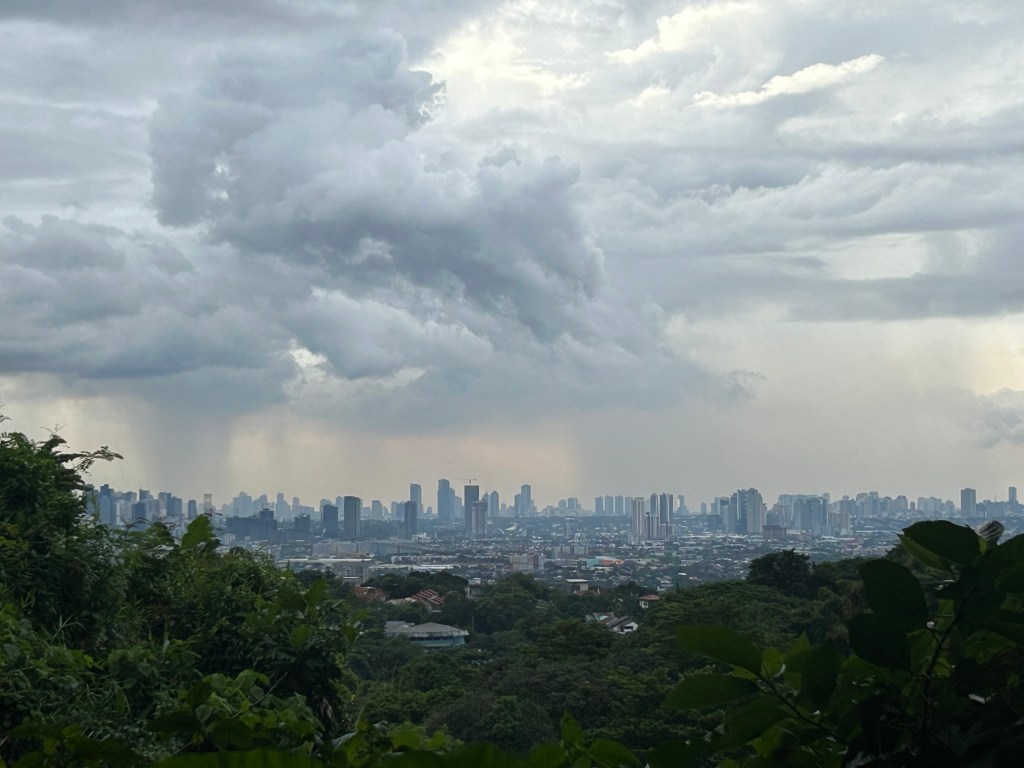
The place where I took the photo will probably also be inaccessible soon as we saw the lots being cleared for construction. We missed the views and soon they’ll be just memories or photos stored in our gadgets.
–
