
Home » Walking (Page 3)
Category Archives: Walking
Article share: On the benefits of sidewalk networks
Here is another quick share of an article by Todd Litman on Planetizen. The article contains a lot of information or data about why we should be investing in sidewalks or pedestrian facilities (i.e., for walking).
Litman, T. (August 6, 2023) “Completing Sidewalk Networks: Benefits and Costs,” Planetizen, https://www.planetizen.com/blogs/124999-completing-sidewalk-networks-benefits-and-costs?utm_source=newswire&utm_medium=email&utm_campaign=news-08142023&mc_cid=cd3b2e2ba5&mc_eid=9ccfe464b1 [Last accessed: 9/23/2023]
To quote from the article:
“Walking is the most basic and universal travel mode, and sidewalks are the most basic walking infrastructure, but they are often overlooked and undervalued in transportation planning. Completing and improving sidewalk networks can help achieve many economic, social and environmental goals.
Recent case studies indicate that typical North American communities spend $30 to $60 annually per capita on sidewalks, and would need to double or triple these spending levels to complete their networks. This is a large increase compared with current pedestrian spending but small compared with what governments and businesses spend on roads and parking facilities, and what motorists spend on their vehicles. Sidewalk funding increases are justified to satisfy ethical and legal requirements, and to achieve various economic, social and environmental goals. There are several possible ways to finance sidewalk improvements. These usually repay their costs thorough savings and benefits.”
–
On the benefits of walkable communities to pregnant women
I break the series on MCIA Terminal 1 to share this interesting article relating walkable communities to healthier pregnancies:
To quote from the article:
“The study, published in the journal of Economics and Human Biology, found that expectant mothers living in walkable counties tend to engage in more walking and exercise and have fewer issues with premature births, low birth weight, gestational diabetes and hypertension. Walking is often recommended as a safer, more moderate activity for pregnant women, so the authors reasoned that living in a more walkable area could have health benefits for them.”
If you’re interested in the details of the study referred to in the article, here is the link to the paper entitled “You’ll never walk alone – the effects of walkability on pregnancy behaviors and outcomes” in the journal Economics & Human Biology:
https://doi.org/10.1016/j.ehb.2023.101269
–
Another look at home location choices
I recently shared an article showing the results of a survey conducted in the US. That survey appears to show that Americans prefer sprawl. But that may be due to many factors including political leanings that are actually mentioned in the article. I share another article that appears to be a reaction to the first one.
Lewyn, M. (August 14, 2023) “Do Americans Really Prefer Sprawl?” Planetizen, https://www.planetizen.com/blogs/125112-do-americans-really-prefer-sprawl?utm_source=newswire&utm_medium=email&utm_campaign=news-08142023&mc_cid=cd3b2e2ba5&mc_eid=9ccfe464b1 [Last accessed: 8/16/2023]
To quote from the article:
“Why do these surveys yield such drastically different results? The Pew survey notes that 3/4 of rural respondents favor the less walkable alternative; thus, that survey was apparently designed to include a representative sample of Americans, including rural Americans who typically do live in very spread-out environments. It seems to me quite natural that rural Americans would prefer rural lifestyles.
But once rural respondents are excluded, the balance between sprawl and walkable communities in the Pew survey becomes almost a toss-up. 57 percent of urban respondents refer houses with smaller yards and more walkability, and an almost-equal percentage of suburban respondents prefer the opposite.”
Again, I wonder what would be the outcomes if a similar survey were done in the Philippines. Will it reveal preferences for single detached homes rather than condos? Who will prefer the latter or the former? What could be the factors affecting home location choices in the Philippines? Cost is definitely a major factor. Commuting times perhaps and even commuting costs? But how do people weigh these factors? And what other influences are there to the decisions to purchase homes?
–
Article on “Fair Share Transportation Planning”
I am sharing this new article from Todd Litman on fair share transportation planning. The content is relevant and very timely in the Philippines considering many people including and especially transport officials are struggling with the thought of allocating resources to provide or improve facilities geared towards more equitable transport systems (e.g., more facilities for active transport).
Here’s the summary as quoted from the article:
“To be efficient and equitable, a transportation system must serve diverse demands. A diverse transportation system allows travelers to use the most efficient option for each trip—safe walking and bicycling for local errands, efficient public transit when traveling on busy travel corridors, and automobiles when they are truly the most cost-effective mode considering all impact—and it ensures that people who cannot, should not, or prefer not to drive receive their fair share of public investments.
Current transportation planning practices are biased in various ways that overinvest in automobile infrastructure and underinvest in more affordable, inclusive, and efficient modes. It is time for planners to reconsider our analysis methods and funding practices to ensure that non-auto modes, and therefore non-drivers, receive their fair share of transportation resources.
This is not anti-car. Motorists have good reasons to support more investments in non-auto modes that reduce their traffic and parking congestion, reduce their chauffeuring burdens and crash risk, and provide better options when their vehicles are unavailable. Everybody wins from a more diverse and efficient transportation system.”
Morning walks in Zamboanga City – Part 3
Part of our walks took us to Fort Pilar and the Shrine of Our Lady of the Pillar. The shrine is originally located within the walls of the Fort, which served as a refuge for citizens when the city was under attack during various times in history. It is near the Paseo so can easily be integrated in our morning walks.
 The Shrine of Our Lady of the Pillar is open/outdoors and there’s a daily early morning Mass
 Instead of candle stands for prayer intentions, there is this trench set-up where you can put your candles and pray nearby.
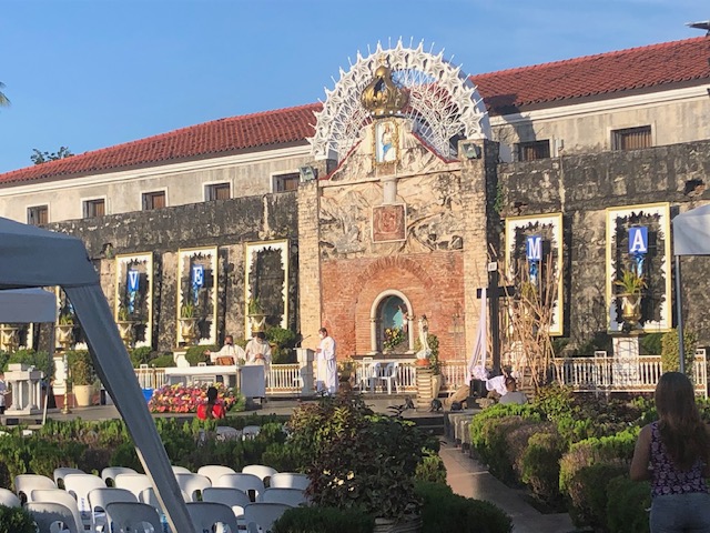 The main altar of the shrine apparently faces the sunrise
 Bells at the shrine
 Pigeons just outside the shrine and near the souvenir shops just across from Fort Pilar
 Entrance to Fort Pilar, which is administered by the National Museum of the Philippines
 Plaque describing the fort and its history
More posts on walking in Zamboanga soon!
–
Cool Walkability Planning
I am sharing this article about planning and design for more walkable streets. The term ‘cool’ in the article refers to temperatures as people are less likely to walk if it is too hot to do so.
From the article:
“Improving walkability (including variants such as wheelchairs, hand carts, low-speed scooters) can provide significant benefits to people, businesses and communities, particularly in dense urban areas where land values are high and vehicle travel is costly. However, walking can be uncomfortable and unhealthy in hot climate cities, particularly those that often experience extreme temperatures (over 40° Celsius, 105° Fahrenheit). These conditions make walking unattractive and infeasible during many days…
A well-planned networks of shadeways (shaded sidewalks) and pedways (enclosed, climate-controlled walkways) incorporated into a compact urban village can provide convenient, comfortable and efficient non-auto access during extreme heat. They can create multimodal communities where residents, workers and visitors rely more on walking and public transit, reduce vehicle use, save on vehicle costs, and require less expensive road and parking infrastructure…
The main obstacle to comprehensive pedway development is the well-entrenched biases that favor motorized travel and undervalue non-motorized modes in transportation planning and investment. Transportation agencies have tools for planning and evaluating roadway improvements, and funding to implement them, but lack comparable tools and funding for walkability improvements such as shadeways and pedways, even if they are more cost effective and beneficial than roadway projects.”
Source: Cool Walkability Planning
Vendors along the boulevard in Zamboanga
Our morning walks allowed us to observe some scenes in the city. Along the R.T. Lim Boulevard, there are stretches of what was probably a public beach. We saw these vendors along the shore selling shellfish and clams.
 Vendors selling shellfish – suddenly I recalled the tongue twister: “She sells sea shells by the sea shore.”
 Conchs are sea snails and considered a delicacy in the Philippines
 Other sea snails that some people generally call kuhol are in buckets to keep them alive and fresh.
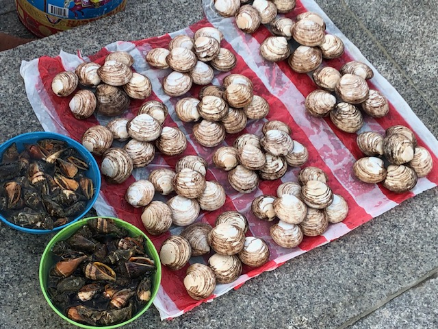 Clams make for good clear soup that will go with any viand for your meals whether it’s lunch or dinner.
These are the scenes you usually miss when you’re driving or riding. Walks or jogs bring you closer and provide the opportunity to stop and look (even inquire or take a few photos). They enhance our walks and allows a glimpse of how life was along the shores when a city like Zamboanga was not as developed as in the present. Manila used to have public beaches before the first reclamation projects eventually wiped them out. The attempt to bring those back in the form of the dolomite beaches don’t really help considering the water pollution that makes swimming or wading risky for people.
–
Morning walks in Zamboanga City – Part 2
We took early morning walks in Zamboanga City, when most people are just starting their day. That meant less people and traffic, and one can enjoy the walks without worrying about motor vehicles or crowded streets. A nice route would be from City Hall to Paseo Del Mar and First Pilar and back. This is easily 5,000 to 6,000 steps depending on the variations to the walking route.
 Zamboanga City’s Paseo Del Mar is practically deserted but for a few joggers or walkers around 6:00 AM.
 You can enjoy a walk, jog or run with views of the sea and ships
 The lamps reminded us of similar designs along Roxas Boulevard in Manila and Pasay.
 A view of the port and what used to be the Lantaka Hotel (building at right) from the Paseo Del Mar. During one of the city’s festivals, this area would be the staging ground for colorful vintas.
 This sign for the paseo would likely be a popular photo op spot.
 A potted palm tree and a bench that invites one to sit and enjoy the view
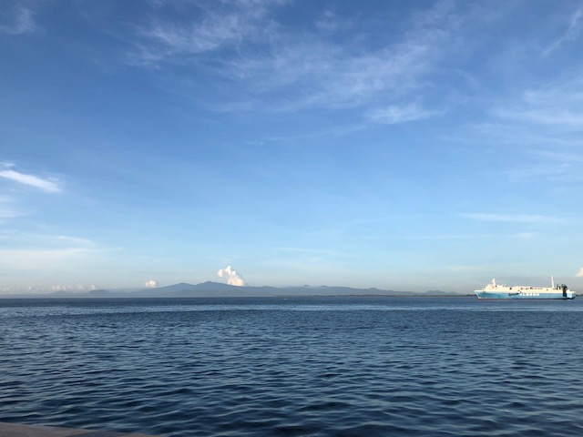 On a clear day, one can see the island of Sulu
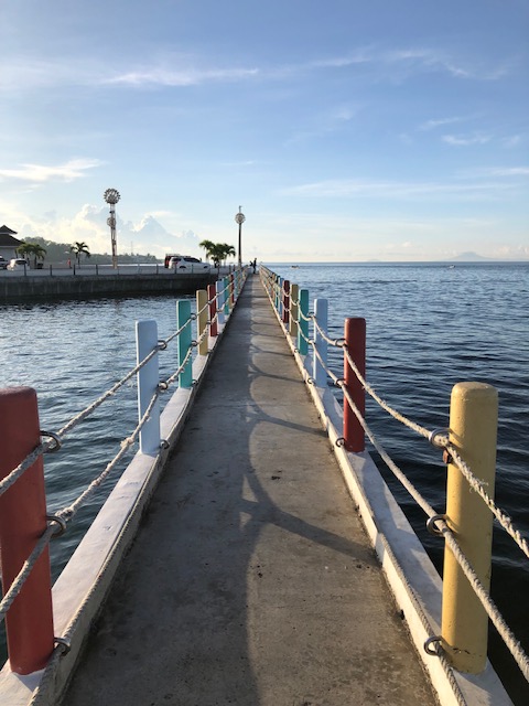 Board walk
 The space is just enough for two people going opposite directions
More photos on walking around Zamboanga City in the next posts!
–
Morning walks in Zamboanga City – Part 1
Before I return to Zamboanga City for another workshop, I wanted to at least post the first of a series about walking in the city. One advantage of staying at a hotel in downtown is that it is close to the parks and city hall. You can also walk towards Lim Boulevard or perhaps towards Fort Pilar on the opposite direction.
 Rizal Park
 Arcade style walkways integrated into the older buildings in downtown Zamboanga City
 Valderosa Street with the Zamboanga City Hall on the right

 Rizal Park viewed from City Hall
 A close up of the Rizal monument
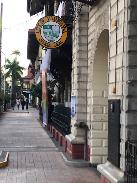 One of the entrances to city hall has the official seal of the city on display.
 Historical market for the building, which was first constructed during the American Period. It states that the building also used to be the Provincial Capitol. It is a heritage structure that is over a century old.
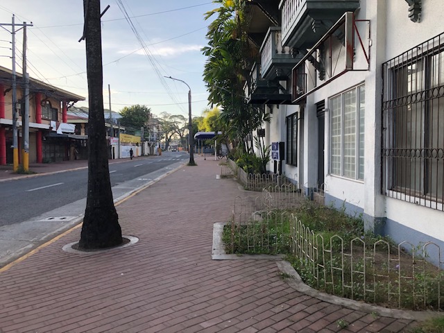
 The sidewalks are wide and paved. Planters are located along the curb to enhance the environment.
 Historical marker on an old house that was the official residence of Gen. John Pershing (yes, that Pershing) and which became BPI’s first branch in the city.
 Other old houses may be found along Valderosa Street. Many if not most are in a state of disrepair.
 Sidewalk fronting what used to be the Lantaka Hotel. Part of the hotel is now with Ateneo de Zamboanga.
 Graffiti on the walls along Valderosa Street
 Section fronting what used to be the Lantana Hotel. It is now part of Ateneo de Zamboanga.
More photos in Part 2, which is coming out soon!
–
Short cuts in Zamboanga City
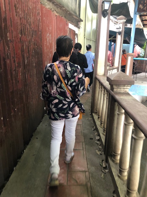
Our capacity building workshop in Zamboanga involved not just lectures and workshops but some practical exercises to demonstrate the surveys needed for road safety assessment of schools. Fortunately, there was a nearby school to our workshop venue and we only needed to walk to the school where participants could set up at certain locations to simulate data collection. Since a couple of teachers participating in the workshop were from the area and the nearby school, they led us to a short cut to get to their school. The route included a walk along a paved path along one of Zamboanga City’s streams.
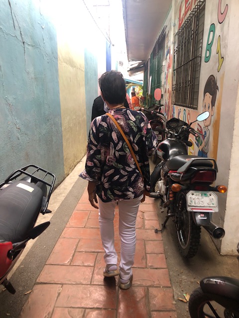
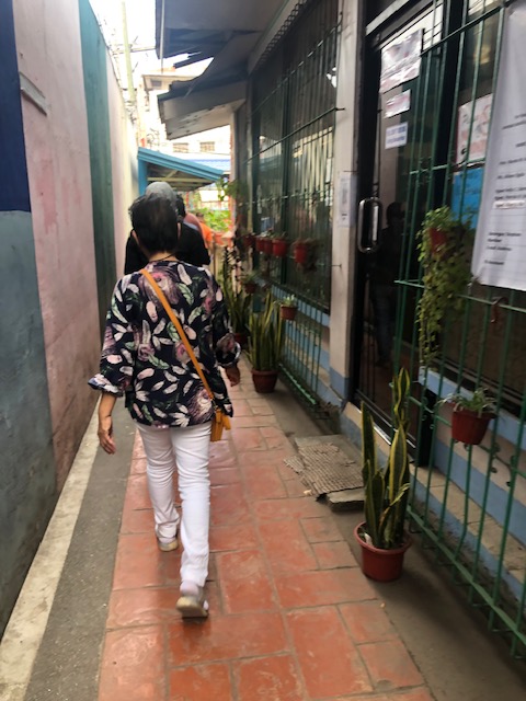
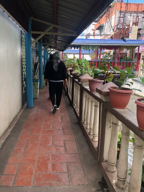

The area had a smell (stink?) to it. That was likely because it was the dry season and the heat meant the dirty water from the stream evaporated and generated the smell. There were even large rats that we saw swimming in the waters! Our guides told us that it was better during the wet season as the water flowed faster and was cleaner due to the rains and runoff. They also related about them bathing in the stream during their childhood days (I assume this was more than 30 years ago.) and before the structures above were constructed. The pathways were clean and secure though and there were others like these that we thought were good examples of pedestrian infrastructure that promote safety as well as encourage walking as a preferred mode of transport especially for short trips.
–
