
Home » Posts tagged 'bicycle lanes' (Page 2)
Tag Archives: bicycle lanes
On designing street for bicycles
There have been a lot of discussion both online and offline about coming up with bike lanes for Metro Manila. Already, there are examples of pop-up bike lanes in some cities while others have had bike lanes and bikeways constructed years ago (e.g., Marikina and Iloilo). While agencies like the DPWH and MMDA have formed technical working groups (TWG) for bike facilities, the perception is that these are moving too slowly (dragging?) and have not produced any gains in so far as design recommendations or guidelines are concerned. Just how important are such guidelines and perhaps at the beginning, context setting, to come up with suitable designs incorporating cycling (and walking) rather than the usual car-centric set-ups? Here’s another article I am sharing that argues for these street designs:
Jaffe, E. (2020) “The most important bike technology is…street design”, medium.com, https://medium.com/sidewalk-talk/the-most-important-bike-technology-is-street-design-401c94065b5c [Last accessed: 7/26/2020]
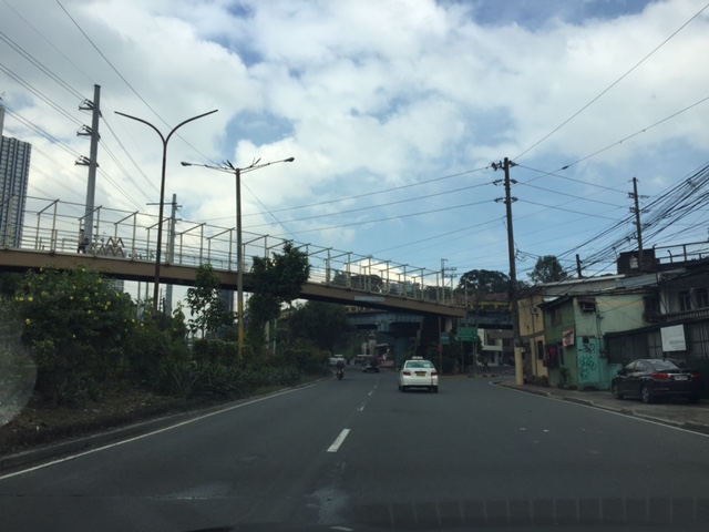
 People biking to work along the Marcos Highway bridge’s painted bike lane
–
Why cycling or bicycles are good for the economy?
You saw that meme shared in social media where they say “why bicycles are bad for the economy”? There’s some humor there but it doesn’t necessarily convince many people to support cycling or biking over motor vehicle use.
Here goes one and note the logic:
“Cycling or bicycles are good for the economy because…it helps reduce car use/dependence. That means less dependence and expenses to fossil fuels. That means more money available to the household for more important stuff like food, homes and education.”
Can you come up with something like that?
Workers on bicycles crossing the Marcos Highway bridge from Marikina towards Quezon City.
–
Reference on Bicycle Facility Preferences and Increasing Bicycle Trips
There are many references that are free for downloading. These include the latest publications from the National Academies Press that includes outputs from the National Academies of Sciences, Engineering and Medicine. I am sharing here and posting also as a reference for me to return to a new publication from the National Cooperative Highway Research Program:
NCHRP Research Report 941: Bicyclist Facility Preferences and Effects on Increasing Bicycle Trips by Watkins, Clark, Mokhtarian, Circella, Handy and Kendall.
The research was supported by the American Association of State Highway and Transportation Officials (AASHTO) in cooperation with the Federal Highway Administration (FHWA).
–
The Julia Vargas Avenue protected bike lane
I thought I already posted an update on the Julia Vargas Avenue in Pasig City. It turned out I was only able to upload photos on my folder but wasn’t able to get to writing about the bike lane. And so we conclude the year 2018 with a positive post of something we would like to see more in 2019 and beyond. We are hopeful that the protected bike lanes along Julia Vargas Avenue, connecting C-5 with the Ortigas Center, will expand and that this example along those of its predecessor bikeways in Marikina and Iloilo would be replicated across the country particularly in highly urbanised cities.
 A view of the westbound bike lane along Julia Vargas at the Ortigas Center. Note that the eastbound bike lane (visible in this photo) is not similarly protected vs. motor vehicle encroachments. It would be preferable for that lane to be protected, too. Parang bitin pa tuloy ang effort nila.
 Another view of the protected bike lane along the westbound side of Julia Vargas Avenue in contrast with the obviously congested lanes available for motor vehicles.
The middle lanes of the carriageway are wide and can accommodate motorcycles though the latter always seem to prefer filtering or splitting the lanes. The median lanes are generally for low occupancy vehicles (less than 3 passengers) while the middle ones are for high occupancy vehicles (3 or more passengers) including UV Express vans and buses.
Happy New Year to all!
–
On the viability of bike lanes in the Philippines
I have been inserting topics on complete streets in the undergraduate and graduate courses I teach at university. Some students have also been researching on best practices and designs that they are supposed to apply to real world situations in Philippine cities. The results are still generally mixed but I like how my undergraduate students are able to grasp the concepts and apply them in the short time they have been ‘exposed’ to the concept. I thought my graduate students, most of them practicing engineers, found it more challenging to unlearn many of the things about street design they have learned from their schools including UP and DLSU, which I thought would have the more progressive programs in Civil Engineering.
Here are a couple of helpful articles that explain the business (economic) case for bike lanes. After all, the most persuasive arguments to convince LGUs to take on bike lanes will always be economics or business. That’s also how you can probably convince the business sector to pitch in and lobby for more active transport facilities especially in the downtown areas.
Jaffe, E. (2015) The Complete Business Case for Converting Street Parking Into Bike Lanes, http://www.citylab.com, https://bikeleague.org/sites/default/files/Bicycling_and_the_Economy-Econ_Impact_Studies_web.pdf?fbclid=IwAR2RDPGy52R27zmpOAFVbiEWGZtMSjyr1Z3Kf56oPVoPI6LUfdreDWpBM5E [Last accessed: 11/1/2018]
Flusche, D. (2012) Bicycling Means Business, The economic benefits of bicycle infrastructure, http://www.bikeleague.org, https://bikeleague.org/sites/default/files/Bicycling_and_the_Economy-Econ_Impact_Studies_web.pdf?fbclid=IwAR2RDPGy52R27zmpOAFVbiEWGZtMSjyr1Z3Kf56oPVoPI6LUfdreDWpBM5E [Last accessed: 11/2/2018]
One issue often brought up by opponents of bike lanes is that there are few references for bike lane design and operations in the country. Perhaps the only really comprehensive example is Marikina City though I know for a fact that the last three of their mayors (yes, including the incumbent) is not so keen about their bikeways. In fact, one mayor tried to dissolve the city’s bikeways office only to relent and allow it to exist but under one of its departments. Iloilo City is supposed to have some bike lanes but it is still more like a landscape architecture experiment than a fully functional system (sorry my katilingbans and panggas). And so we look to the more comprehensive experiences abroad for evidences of viability and success. The bottomline here is that I would rather ask how it can succeed here than state why it will not.
In support of bike lanes
Here is another interesting article about bike lanes but from the perspective of a non-cyclist. I believe this (support for bike lanes) is a view shared by many but not much articulated. The assumption is usually that car-owners would like to have less of other’s cars on the road so they could benefit from the presumed reduction in congestion should more people take up cycling. But then the same can be said for public transportation and its users as well. That is, car-users would want others to take public transport so as to also reduce road congestion; allowing them faster trips/drives.
Lewyn, M. (2018) “A Non-Cyclist’s Case for Bike Lanes,” planetizen.com, https://www.planetizen.com/node/97632?utm_source=newswire&utm_medium=email&utm_campaign=news-03152018&mc_cid=0e22636014&mc_eid=9ccfe464b1 [Last accessed: 3/17/2018]
–
Article on building support for walking and cycling infrastructure
There is another recent article on non-motorized transport (NMT). This is a good read and something that I think should be required for those who are little too serious or staunch about their advocacies.
Doyon, S. (2017) “Building support for walking and bicycling infrastructure” Public Square, A CNU Journal, https://www.cnu.org/publicsquare/2017/11/11/building-support-walking-and-bicycling-infrastructure (Last accessed 11/11/2017)
I believe that if you want to convince people to appreciate and support your cause, you should not take the hardline. Instead, there should be a more persuasive process for wooing people. This is especially true in transportation and the advocacies for walking and cycling. You will not get a lot of support, for example, by condemning car users and telling everyone they should bike instead.
–
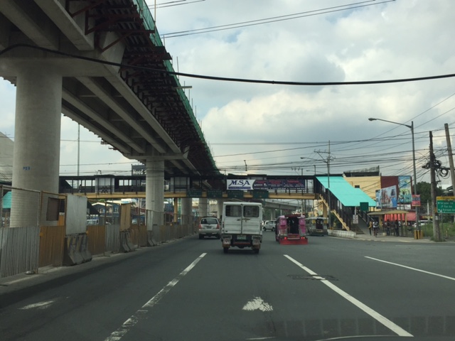
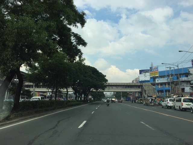
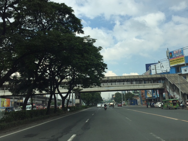
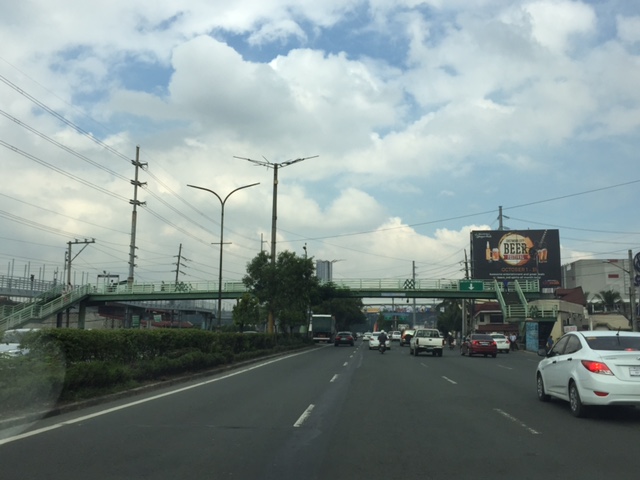
Another look at Marcos Highway pedestrian overpasses – Part 1
My daily commute allows me to have a look at the progress of the LRT Line 2 Extension construction. I also became curious about the situation of the pedestrian facilities along Marcos Highway particularly the crossings since many at first seemed to be affected by the elevated rail structure that was to be built. Now, we already have a good idea of the fates of these pedestrian overpasses. This article shows the conditions/situation of pedestrian overpasses (also called footbridges) along Marcos Highway. Most overpasses are not covered; exposing pedestrians to the elements. Most are also made of steel, which can be traced to the MMDA’s (and later the DPWH’s) preference for these structures.
 Overpass near Filinvest East-Vermont Park gates – the overpass actually is between a technical college and the commercial building across from it.
 The overpass across from Vermont Royale in front of a new Shell service station was actually among the newest facilities along Marcos Highway. Apparently though, it was built without considering the impending construction and design of the Line 2 extension. As such, the overpass needs to be modified or would have to be reconstructed elsewhere near the area.
 Overpass at Town & Country Executive Village that is also near the San Benildo School
 Overpass at Marcos Highway-Felix Avenue-Gil Fernando Avenue intersection – is probably the busiest among the pedestrian overpasses as it is at a busy junction where there are major commercial establishments (i.e., malls) and where many public transport routes converge.
 Robinsons Metro East overpass – this one also survived the clearance requirements with respect to the elevated superstructure for the Line 2 extension. However, since one of the two stations to be built will be nearby if not right across (part of the station at least) from the mall, then the station itself may function as an overpass.
 Overpass at De la Paz – note the ramp for bicycles and wheelchairs. This is one of the more bike- and PWD-friendly facilities along Marcos Highway. The slope is gentle enough for pedestrians, too, especially senior citizens who might have difficulty with steps.
 Overpass at Ligaya – this one also has ramps that make it easier for people to use to cross the busy highway. This will eventually be the closest overpass to the huge Ayala mall (Feliz) currently under construction at the Marikina side of Ligaya. I suspect that there might be a need for another overpass to be built with respect to the mall for one to directly serve the mall’s customers.
 Line 2 Santolan Station overpass connects the Marcos Highway westbound public transport stop with the rail station along the eastbound side of the highway.
 A closer look at the Santolan Station overpass, which is used by a lot of Line 2 passengers who cross the highway to continue on their journeys/commutes via train from their origins in Rizal, Marikina and Pasig. During the mornings, the observer will see a lot of jeepneys and UV Express vehicles emptying of passengers who cross the bridge to get to the station.
 Santolan footbridge – this is actually more complicated than what is seems in the photo because the steel footbridge also connects to the SM City Marikina overpass (which is not included in this compilation but is visible in the photo). The footbridge branches to provide and almost direct connection between the mall and the Line 2 Santolan Station. That structure is shown at
 Monte Vista footbridge allows people to cross Marcos Highway (at its Marikina/Quezon City end) to and from A. Bonifacio Avenue, which is in Marikina City (Barangka)
More on pedestrian overpasses in the next post!
–
Evidence from Montreal: Building bike lanes to reduce car use
I just wanted to share this article showing evidence of car use reduction (and therefore, car traffic along roads) with the provision of bicycle lanes.
Building Bike Lanes Really Does Get More People Out of Their Cars
The article though cautions readers against generalising or assuming great improvements. Some figures mentioned in the article including the following (I took the liberty of copying and pasting):
- “A 10% increase in bike accessibility resulted in only a 3.7% increase in ridership.”
- “…cycling infrastructure also reduced greenhouse gas emissions from cars by 1.7%, a reduction equivalent to converting transit buses to hybrids and electrifying commuter trains.”
These numbers are for the case of Montreal, Canada. Not mentioned are the number of cyclists, vehicle traffic volumes and other pertinent data that are useful in analysis. The article correctly points out the importance of using science (e.g., sound analysis based on good data) in order to convince governments to put up bicycle infrastructure. I would even add that this approach should also be applicable to pedestrian facilities.
–
Bicycle traffic in comparison with motorised vehicle traffic – a case in Iloilo City
I believe that there is a need to have numbers to guide planners and engineers in designing suitable bicycle facilities. It is not enough to claim there is demand since an important requirement for facilities to be provided (i.e., funded and constructed) are numbers for the facilities’ justification. You don’t build mass transit systems, for example, without a valid estimate of ridership. For one, the ridership allows for the determination of revenues. Roads cannot be built without at least a number like the population of communities that will be given accessibility via that road.
Not too long ago, we were able to obtain traffic counts for the Benign S. Aquino Avenue that is also knows as the Iloilo City Diversion Road. The road includes an exclusive bikeway constructed along its airport-bound side that is supposed to benefit cyclists and encourage more people to use bicycles for commuting within the city and between the city and towns along the national highway. The following figures show the AM and PM peak hour traffic at the intersection of the diversion road and Jalandoni Street across from SM City Iloilo. Another figure shows 16-hour traffic at the same location.
 Fig. 1 – AM peak hour traffic along the Iloilo City Diversion Road including bicycle traffic along the exclusive bikeways constructed along the airport-bound side of the highway.
 PM peak hour traffic along the Iloilo City Diversion Road including bicycle traffic along the exclusive bikeways constructed along the airport-bound side of the highway.
 16-hour traffic along the Iloilo City Diversion Road including bicycle traffic along the exclusive bikeways constructed along the airport-bound side of the highway.
The numbers clearly show the current low volume of bicycles along the bikeways in comparison to motor vehicle traffic. Since bicycles are also presumed to carry only 1 passenger per vehicle, then the volume also translates into an even lower share in terms of mode of choice by travellers/commuters. For comparison, jeepneys will likely carry an average of 14 passengers while cars may have an occupancy of 1.5 passengers per vehicle. Perhaps a more direct comparison can be made with motorcycles, which are two-wheeled vehicles like bicycles. Only, motorcycles may typically carry 2 passengers.
I am aware that at least one NGO is employing crowd-sourcing in order to obtain bicycle traffic counts along major corridors. Neither the MMDA nor the DPWH have bicycle counts with both agencies’ traffic counts only covering motorized vehicles. Few, if any, local government units would have their own bicycle traffic counts (Perhaps Marikina has data of bicycle traffic in their city that is well known for having the country’s first and most comprehensive bikeways network?). As such, there is generally a dearth of useful data for planning bikeways. One option that advocates for the “if you build it, they will come” approach is not something that is applicable to many cases especially those that do not yet require exclusive bikeways. The folly is to allocate funding for facilities that will not be utilised by their proposed users.
–
