
Home » Posts tagged 'C-5'
Tag Archives: C-5
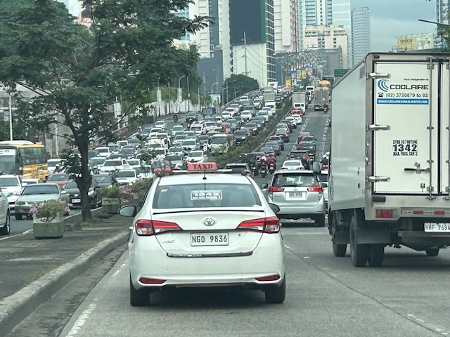
Congested Katipunan again
During the Christmas break, we were reminded just how Katipunan Avenue can be congested due to the trips generated by the institutions along it. These are mainly the schools such as Ateneo, Miriam and UP. Based on my observations and experiences over the past decades though (I started attending UP in the late 1980s), the main culprit is Ateneo with all the private vehicles it generates for its students in all levels (Grade School, High School and College).
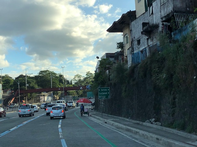
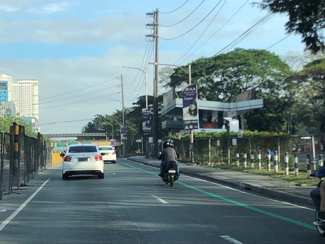
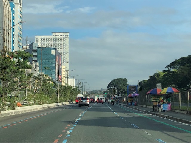
 What “normal” traffic looks like on a typical weekday along Katipunan Avenue
My commute during the break is usually under 1 hour (e.g,, 40-50 minutes). But during the times when there’s school, it’s always more than an hour (e.g., 75 to 105 minutes). Will the situation improve? Will there be a mass transit system along C-5 to alleviate the traffic conditions? We can probably hope so but it doesn’t seem to be in the near horizon right now. The Metro Manila subway, after all, is expected to be operational in the 2030s!
–
A widened Col. Bonny Serrano Avenue and opportunities for complete streets
Col. Bonny Serrano Avenue is one of the major roads directly connecting EDSA (C-4) and C.P. Garcia Avenue (C-5). The last time I used the road was before the pandemic. So it came as a surprise to pass by last weekend and see the avenue had been widened. I guess that pretty much “solved” the traffic along this usually busy thoroughfare that is part of jeepney routes to Cubao (via Murphy – referring to Camp Aguinaldo, which was formerly Camp Murphy). The avenue was renamed after a Korean War Hero (my uncle fought under him with the 10th Battalion Combat Team in the Korean War in the 1950s). It was called Santolan Road before.
 What used to be a 4-lane road is now an 8-lane road
The area used for road widening was carved out of Camp Aguinaldo. The headquarters of the Armed Forces of the Philippines (AFP) gave up quite a lot of square meters for this project and you can see from the photo the now very wide avenue. I thought perhaps they could have placed a median island where they could have also planted some trees (note how exposed to the sun the area is). They also could have designed protected bike lanes along either side of the road. These could have connected the EDSA and C5 bike lanes. And, of course, they should have also improved the pedestrian sidewalks. You can see how narrow the sidewalks are and how electric and light posts block pedestrians using the sidewalks. There were opportunities here for the application of complete streets and its not too late to do just that.
I assume there are many men in uniform who use bicycles for their commutes and recreation. Camp Crame is just across EDSA from Camp Aguinaldo and Bonny Serrano Avenue also passes along the headquarters of the Philippine National Police (PNP). Down the road towards Marikina City in Libis is another camp, Camp Atienza, which is home to the 51st Engineering Brigade of the Philippine Army. I mention these camps as I know many there regularly use Bonny Serrano for commuting and many use bicycles. A cousin-in-law (my wife’s first cousin) who is an army officer bikes a lot from Camp Atienza and Camp Aguinaldo and tells me there are many enlisted men who bike to work.
–
Katipunan bike lanes?
Here are photos of the bike lanes along Katipunan Avenue (Circumferential Road 5). The lanes are basically just marked with a solid green line but without any signs or pavement markings reinforcing this designation. The lanes are not protected ones like the example along the eastbound bike lane along Julia Vargas Avenue in Pasig City. And so, as expected, there are many motor vehicles encroaching upon the Katipunan bike lane including parked or standing vehicles as shown in one of the photos below.
 The bike lane is derived from the outermost lane of Katipunan
 Here is the bike lane along the southbound side of Katipunan at the approach to Tuazon Avenue. That’s a pedicab on the bike lane so one can easily appreciate the dimensions particularly the width of the lane.
 Bike lane along the northbound side of Katipunan approaching Ateneo’s Gate 2
 The bike lane along with the designated truck lane and motorcycle lane.
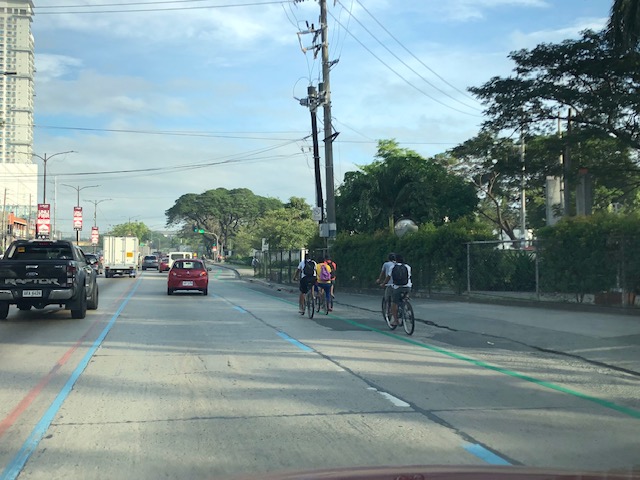 Here are cyclists using the lane past Ateneo’s Gate 3 and approaching the main gate of Miriam College
I’ll try to sketch a few recommendations into the photos as I have done in a past article:
On the Pasig HOV lane experiment
This can also be used for exercises I assign to my graduate and undergraduate classes when we’re on the topic of complete streets.
–
“Great wall” of trucks along C5
The Metro Manila Development Authority (MMDA) has implemented a truck lane policy along Circumferential Road 5 during the last administration. It has continued at present and a long line of trucks are regularly observed along C-5 whenever the truck ban is lifted during what is designated as off-peak hours for all other traffic. Many travelers have termed the line as a “Great Wall of trucks” although in many instances, the line is “breached” by vehicles needing to shift lanes along this major thoroughfare. Strict implementation by the MMDA and the affected LGUs as well as the compliance of most trucks have led to the maximization of the occupancy of the designated truck lanes. These are easily observable along most of C-5 and particularly along sections close to the CBDs (e.g., BGC, Ortigas, Eastwood, etc.). Following are a few photos showing the long line of trucks along C-5:


Here’s another photo I took earlier last month:

We have a couple of students now at UP Diliman who are studying the policy and taking a look at the traffic and pavement conditions along C-5. Interesting would be their comparisons of traffic along the truck and non-truck lanes during both peak and off-peak periods as well as for weekdays and weekends. Interesting, too, will be their assessment of pavement conditions. So this will be something to look forward to once the research is completed this coming May 2017.
–
Proposals for EDSA and some alternate roads
The hellish traffic congestion along EDSA and other roads in Metro Manila spawned a bunch of ideas for alleviating congestion. Among those that were offered as solutions are the following:
- Odd-Even Scheme – suggested by the Philippines President himself in a speech delivered in Mandaluyong City
- Car-pooling (and HOV lanes) – suggested by the DPWH Secretary in another forum
- Bus Rapid Transit (BRT) and/or express bus – proposed and being studied by the DOTC
What seems to have been forgotten was a proposal to have two lanes of EDSA, one on either direction, devoted to bicycles. This proposal now seems to be the most viable compared to the above three and could have the potential for major behaviour change towards a departure from motor vehicle use. Cycling along with walking does not require fuel and these modes also promote healthy lifestyles. Also, this could become the ultimate example for road diets, which can also be applied along other roads as well. What sounds or reads like an outrageous idea (i.e., bicycle lanes along EDSA) might just be revolutionary and result in what could be a tipping point for sustainable transport in the midst of traffic mayhem.
EDSA has become the proverbial battleground representing the war with traffic congestion. However, EDSA is just one part of our arterial network comprised of circumferential and radial roads. There is also C-5 (also known for its sections – Katipunan, E. Rodriguez, C.P. Garcia), which is also a very congested road but along which there are few fixed route public transport services. It is a primary alternative route (to EDSA)for people traveling between the northern and southern halves of Metro Manila. It also serves as a collector and distributor, being connected with major radial roads like Aurora Boulevard, Ortigas Avenue and Shaw Boulevard as well as to the South Luzon Expressway. C-5 is a major truck route, however, and so carries a lot of heavy vehicles during the permitted times under the truck ban scheme being implemented in Metro Manila. C-5 is already ripe for a mass transit system and should have one along it. The quickest to put up would be a bus system on exclusive lanes. Strategically though, a rail transit line (likely elevated) should already be planned and implemented and with as seamless as possible connections to current and future lines along major corridors.
There are other routes that can be considered which I think have been overlooked (too much focus on EDSA?). C-6, for example, badly needs to be improved and this has started but is being implemented at a slow pace. This could have significant positive impacts on traffic coming from the east (towns of Rizal province) that are bound primarily for Makati and BGC. But then there also has to be a good road bypassing the narrow and already congested streets of Taguig and Pateros that are currently the only roads connecting C-5 and C-6. The roads on the Rizal side (attention: Cainta and Taytay) also need to be improved including Highway 2000 and the Barkadahan Bridge. Perhaps the Rizal Provincial Government should also get involved in this as such routes are in the best interest of Rizalenos. And then there is also the highly urbanized city of Antipolo that is a major destination and already is the 7th most populous city in the country, whose residents also use this route, which is often a faster option to Ortigas and C-5 despite the poor conditions of roads.
–
