
Home » Posts tagged 'Commonwealth Avenue'
Tag Archives: Commonwealth Avenue
How about a pop-up BRT along Commonwealth Avenue?
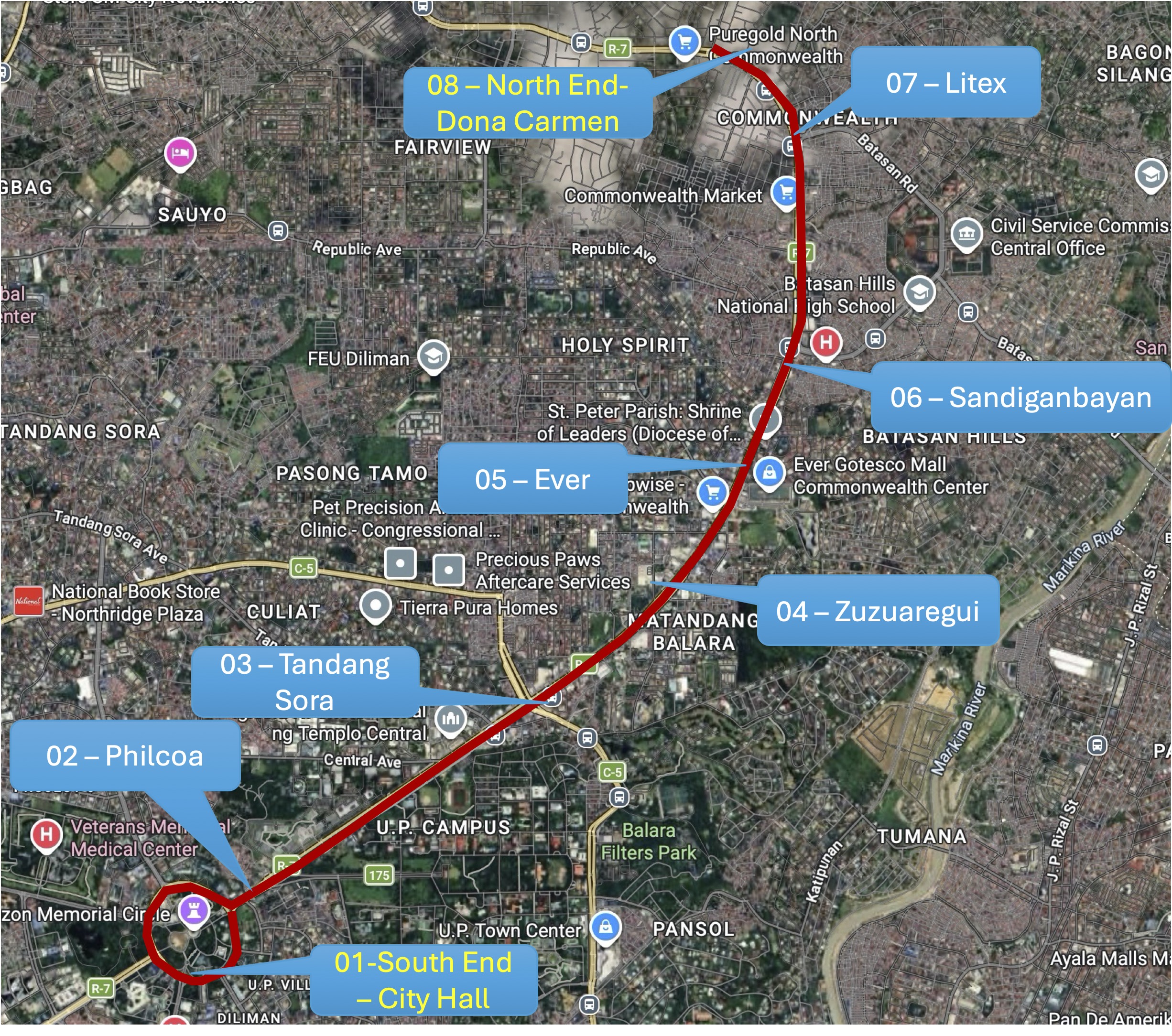
I posted this map on social media showing a possible route for a pop-up BRT (Bus Rapid Transit) along Commonwealth Avenue. This was inspired by the reports this week of the horrendous experience of commuters along this corridor due to the current fuel crisis. It seems that a lot of people have reduced their use of private vehicles in favor of what they thought was adequate public transportation only to find out how lacking the supply was.
While this route can be extended (all the way to Fairview via Regalado, for example), I think the one in the map below would be able to capture a majority of the commuters along the corridor with the end at Dona Carmen being a drop-off/pick-up area for those residing to the north. Quezon City Hall and the Elliptical Road is a no-brainer since the Quezon City Bus service terminates here and people can transfer to one of the other lines that will allow them to travel elsewhere covered by the bus network. Quezon City or DOTr can lease buses and come up with a service contracting scheme to sustain operations. The idea is to first run this pop-up BRT while the crisis in Iran is ongoing. Data collection and assessments should coincide with this to refine the service and perhaps, make recommendations for sustaining this service at least until MRT 7 gets online.
The idea of a pop-up BRT is not really new as there were “proof of concept” runs along Commonwealth and at BGC many years ago. Unfortunately, the BRTs never came to be in both cases; both now missed opportunities as we have come to realize. It’s still a long way before the MRT 7 is up and running. The recent announcement from the proponent that they will probably start operations next year is perceived by many as too late. Government, both national and local, need to be decisive if they want people to be able to go to their workplaces and schools. Maybe this is another opportunity for the more than 70% public transport users to be provided with the services they need while taking advantage of road space being freed up from car dominance?
–
After getting engrossed with EDSA, is Marcos Highway next?
If you monitored the news articles and social media post over the past two decades, there seems to be an obsession for EDSA. Circumferential Road 4 is the busiest corridor in Metro Manila, stretching across several jurisdictions including Caloocan, Quezon City, Mandaluyong, Makati and Pasay City. Aside from the MMDA, national agencies like the DPWH and DOTr have been heavily involved in traffic schemes and transportation infrastructure development along the corridor. These include variants of the travel demand management (TDM) scheme commonly called number coding. Since the 1990s, there’s the Line 3 and several overpasses/flyovers and underpass that have been constructed along major intersections (e.g., EDSA-Shaw, EDSA-Ortigas, EDSA-Kamuning, EDSA-Quezon Avenue, etc.). Nowadays, people are more into the EDSA carousel and most recently the pavement rehabilitation for EDSA. It seems we failed to realize that EDSA is just one corridor. There are others that also demand attention including those in other parts of the country.
Recently, a “carmaggedon” along Marcos Highway was in the headlines or shall I say was trending in social media. There was a lot of excitement for what has been a recurring nightmare to those residing along the corridor. I recall something worse occurred more than 15 years ago (pre-Ondoy), before social media and influencers and digital creators. At the time, Line 2 terminated at Santolan Station. And even back then, the MMDA insisted on playing with their U-turn scheme. I don’t recall a more in-depth study that could have involved micro-simulation modeling being done for the corridor. And since then, populations and traffic have grown steadily and as I’ve written about previously, the extension of Line 2 to Masinag seems to have had little impact on traffic. And so here we are with the MMDA still insisting on tweaking their U-turn schemes and relying mainly on gut-feel instead of a more scientific approach that may actually lead to more sound solutions for the corridor.
 Approach to Marcos Highway from Felix Avenue – that’s the elevated Line 2 superstructure behind the Cainta arch.
 Intersection of Marcos Highway, Felix Avenue and Gil Fernando Avenue – there’s a major foot bridge installed here so people can cross at the intersection, which used to be a signalized junction before the MMDA opted for U-turns for Marcos Highway sections under its jurisdiction.
 Marcos Highway section fronting the Ayala Feliz Mall – the MMDA has played with the location of the U-turn slots in the vicinity of the Marcos Highway-Amang Rodriguez-J.P. Rizal intersection as they tried to determine the “optimum” locations of these slots.
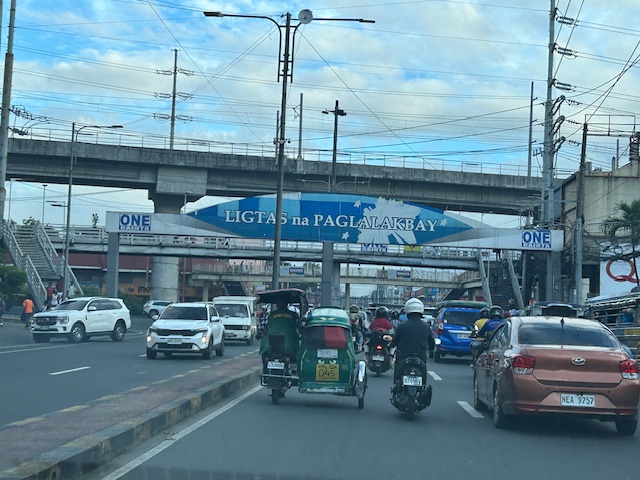
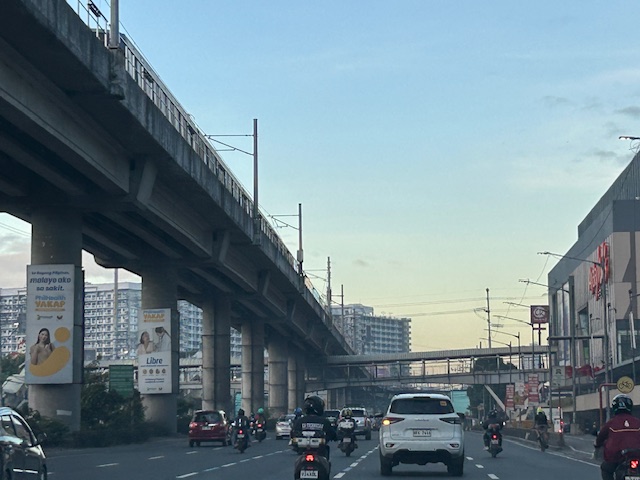
Of course, there is also the case of Commonwealth Avenue. How many carmaggedons have occurred along that corridor? Isn’t it an everyday thing there? And there’s also Ortigas Avenue Extension and many other roads and streets where congestion seems to have been accepted as the norm. How do we make travel easier for most people? How do we improve commutes given the constraints and realities concerning behavior and choices?
–
On the Tandang Sora flyover’s closure
The signs announcing the closure of the Tandang Sora flyover along Commonwealth Avenue are doing the rounds of social media. So are the traffic management plans (i.e., the re-routing maps for the area) that are being shared by many and soliciting a variety of reactions. The reactions are often angry or sad for those likely affected by the closure and the re-routing via Luzon Avenue, Congressional Avenue and Philcoa. The demolition of the flyover to give way to the future MRT-7 station will definitely lead to traffic congestion and longer travel times to a lot of commuters, whether using public or private transportation. However, there are only few comments so far about the impacts on pedestrians. Will the pedestrian footbridges be demolished, too? Will they be redesigned or replaced considering the high volume of pedestrians crossing this major intersection? Following are photos taken underneath the Tandang Sora flyover as we waited to make a U-turn. These show the pedestrian footbridges in the area that allow people to safely cross the wide Commonwealth Avenue.
 View of the steel truss footbridge that goes underneath the Tandang Sora flyover
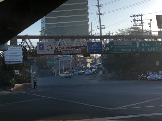 There are many signs installed on the footbridge including the speed limit for Commonwealth Avenue and a reminder to fasten seatbelts. Others are directional signs including those designating the lanes for public utility vehicles and motorcycles.
 There is another steel footbridge that is of more recent design and construction connecting to the old truss bridge. This allows pedestrians to continue on to cross Tandang Sora. This example is actually one that invites questions pertaining to design. Why have two distinct designs instead of building on the previous one? Another case of “pwede na iyan” ?
 Here’s another view of the two footbridges – one spanning Commonwealth and the other across Tandang Sora. Will these be demolished, too, to give way to the MRT-7 station? And will the MRT-7 Station design include a provision for non-passengers to cross Commonwealth and Tandang Sora? This seems to be the most logical way to design the station; integrating pedestrian (and cycling) needs to the infrastructure. But then again, that remains to be seen and perhaps someone can share the design of the Tandang Sora station for this to be scrutinized.
–
