
Home » Posts tagged 'curvature'
Tag Archives: curvature
Some old drawing tools for clothoids
I took some photos of old (vintage if you prefer) drawing tools that I have at our laboratory at the university. We found this in the storage many years ago and people seem to have forgotten about them. Instead of heading for storage or being forgotten or worse, thrown away, we decided to keep them at our laboratory mainly to show our students how certain highway or street curves were drawn in the ‘old days’. I am currently the custodian of this and another set that I have kept at my other office at the civil engineering building.
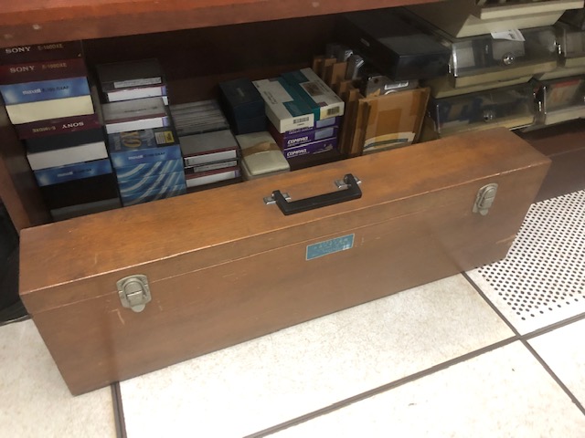 The wooden box is at my office at UP Diliman
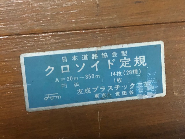 The sign basically translates to clothoid drawing tools made by a company based in Setagaya in Tokyo. There are 14 instruments in the box for clothoid parameter values of A = 20m to 350m.
 Opening the box shows slots holding instruments for drawing clothoids or spiral curves
 Some of the instruments from the case – the large one on top is for A = 300m and 350m (scale 1:1000)
 Comparison of size of instruments for (top) A = 60m and 65m, and (bottom) A = 30m and 35m (scale 1:1000)
 Instrument for A = 30m and 35m (Scale 1:1000)
 A protractor came along with the set but I assume other instruments such as a compass were used in drawing/drafting the curves.
I shall take photos of the other set when I get to visit the other office. These will be for records purposes as well as for posterity. These are practically museum pieces that are now perhaps rarely if even used.
–
Vertical curves along the Pan Philippine Highway
We start the month of March with a compilation of photos of vertical curves (mostly sags). These were taken along the Andaya Highway, which serves as the main bypass road in Camarines that allows travellers to bypass, for example, Daet.


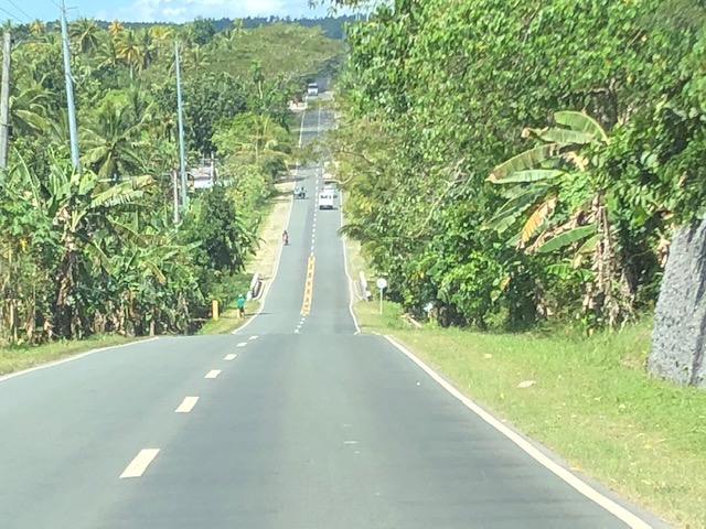
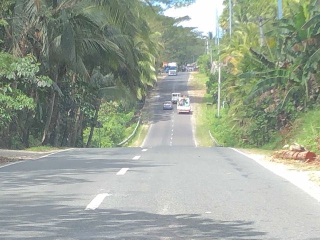

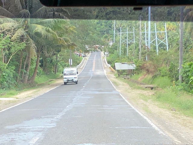


These photos do not have captions and I leave it to my readers to have an appreciation of the features of these sections. These include wide carriageways with paved shoulders. There are also sections that have no shoulders. For most photos, the pavement appears to be in good condition. However, the same cannot be said for much of the highway, sections of which are being rehabilitated along with several bridges.
–
Another look at the Bitukang Manok
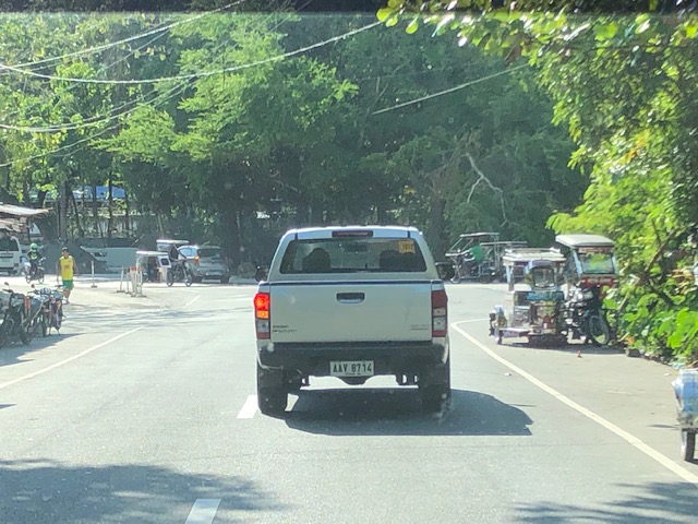
I recently featured photos of the old zigzag road along the Pan Philippine Highway that is more popularly known as the “Bitukang Manok”. Those photos were taken on an early morning while we were on our way to Bicol earlier this month. Following are photos of the old zigzag road taken on the afternoon of our return trip to Manila.
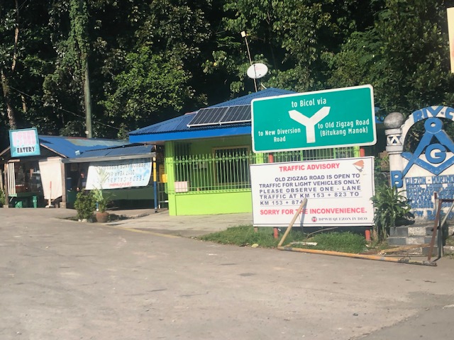
 Crossroads – at the intersection at the southern end where travellers decide whether to take the Bitukang Manok or the newer and easier bypass road
 The sign states: Vehicles with 6 or more wheels are prohibited from using the old zig-zag road.
 Sign for the Quezon National Forest Park – this designation is attributed to a former President and local congressman
 Here’s a photo of one of the more challenging sections. A team of flagmen manage traffic by giving turns to either direction, ensuring slower speeds and wider turning at the hairpin curve. Travelers often toss coins as a token of gratitude for these flagmen who man this challenging section of the national highway 24 hours/day.
 The barriers and signs along Bitukang Manok have been upgraded and are well-maintained.
 Approach to the northern end of the old zigzag road
 Directional sign at the other end of Bitukang Manok showing the options for travellers and another advisory stating the prohibition of large vehicles along the old zigzag road.
–
