
Home » Posts tagged 'expressways'
Tag Archives: expressways
On C-6 and the proposal for another expressway, Part 2
The recent announcement and launch of the Southeast Metro Manila Expressway (SEMME) included this map showing the (very) rough alignment for the proposed tollway. The map also shows the proposed locations of interchanges including one in Tikling and another in Masinag. There is also another in Tumana. From the looks of this, the SEMME will be a skyway or elevated expressway/tollway.
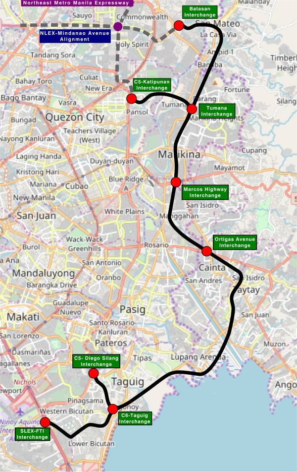
My first impression is that this elevated tollway will pass through predominantly residential areas with columns rising from private subdivisions. It doesn’t help that the topography also means the columns will be built along hilly or mountainous terrain, thereby making construction more challenging than the elevated tollways in Metro Manila.
Do we really need another circumferential road and particularly another tollway? I think that is a very important question that not only needs to be asked but also answered the right way. I, for my part, don’t believe we need another tollway, elevated or not, as this will not solve the so-called traffic problem. In fact, it creates more problems than what is supposed to be solved with the induced traffic this will generate and its promotion of car-centricity. For the price and effort of such an infrastructure, you will get more bang for your buck with a mass transit line or lines. Road congestion can only be solved by constructing the public transport system we needed decades ago.
–
On C-6 and the proposal for another expressway, Part 1
I’ve written about Circumferential Road 6 many times in the blog. Mostly, these were about the existing sections along the Laguna de Bai in Taguig and Pasig cities of Metro Manila and Taytay in Rizal Province. I share below two maps showing different alignments of C-6. The first one is a rather old one from the 1990s that I recall was from a presentation of a friend at DPWH.
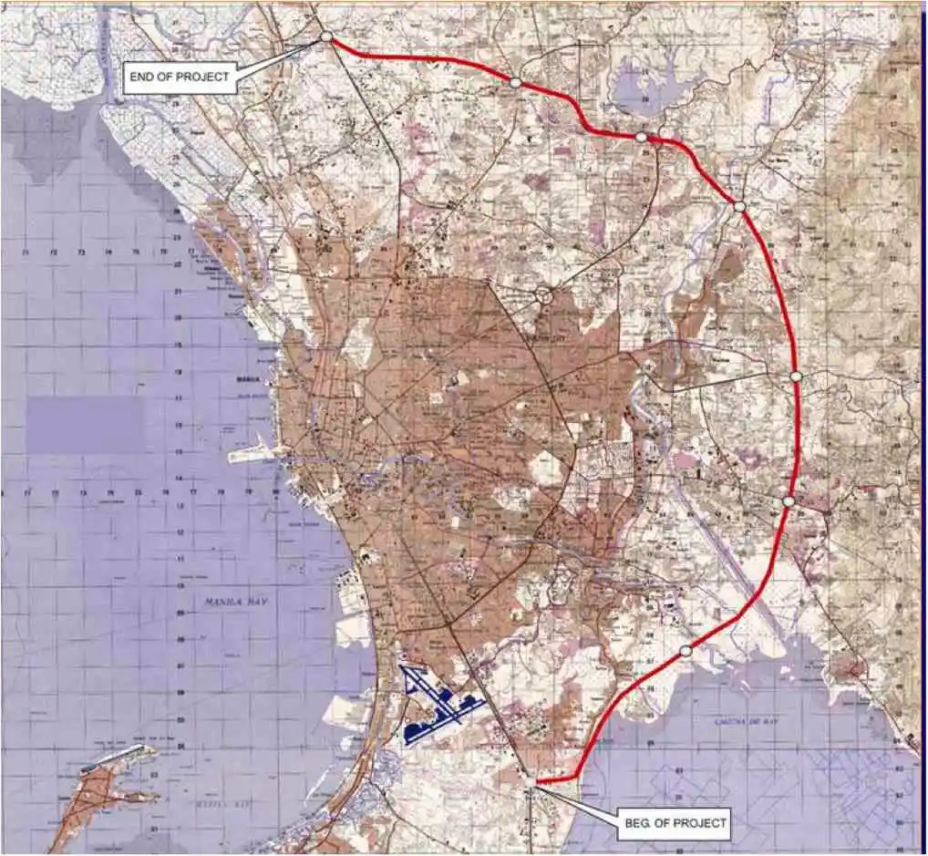 An old map I got from the DPWH a long time ago that I have used in my lectures.
The second map is supposed to be more recent, perhaps in the last 5 to 10 years if not more recent. This shows a more realistic alignment composed of what looks like existing road sections that were connected to form a semblance of a circumferential alignment.
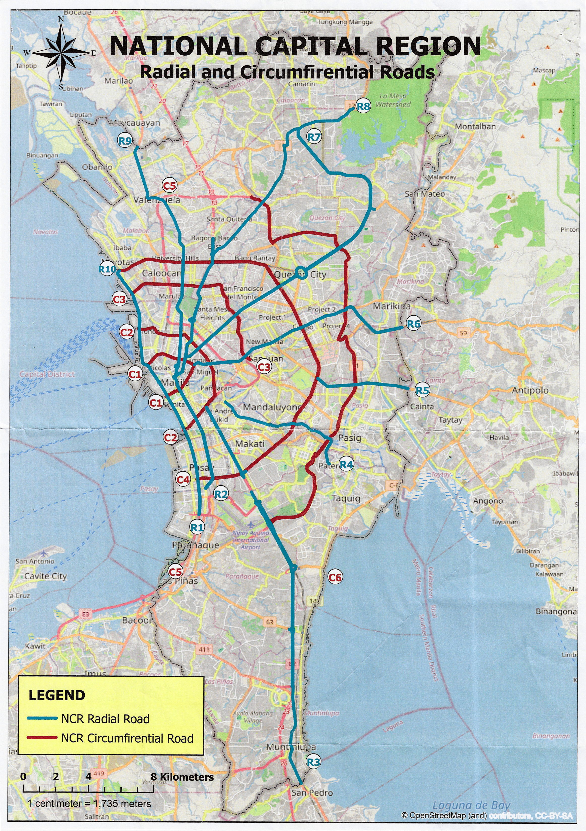 Here is a more recent map that’s also attributed to the DPWH.
In the first map, you will notice that the proposed alignment is more circular and smoother. This means that the road would have had a mostly new alignment instead of utilizing existing roads like Circumferential Road 5 before it. The newer sections for the latter were the ones connecting the existing roads. For the second map, noticeable is the somewhat forced connections of what looks like existing roads on the map. And while for Map 1 the alignment will be passing under the La Mesa reservoir, the alignment for Map 2 will circle the watershed like a coastal road. The alternative alignments presented an interesting exercise for students of highway engineering particularly for the topic of alignment design. Do you pick an entirely new alignment, sketch it out and determine the crossings and other constraints or do you try to make do of what roads are existing and perhaps improve (i.e., widen) these to produce an arterial?
The proposed alignment for what is now called the Southeast Metro Manila Expressway (SEMME) seems closer to the alignment in Map 1 than the one in Map 2. I will write about the proposed expressway that was recently launched in the next post.
–
Another look at the Candaba viaduct’s new lanes
I recently wrote about the new lanes along the Candaba viaduct and my thoughts about them being used as variable lanes (i.e., more lanes assigned along the peak or heavier traffic direction). Only this January 2, I observed that the lanes were being used instead for the southbound traffic as the older southbound viaduct appeared to be closed to traffic. Perhaps that side is up for rehabilitation or maintenance work?
 The new lanes between the two viaduct structures are now in use.
 These are assigned to southbound traffic while the original lanes appear to be closed off.
–
New lanes along the NLEX Candaba Viaduct
Heading to Baguio, I noticed the new lanes in the middle of the NLEX viaduct. The viaduct was actually two bridges constructed over the Candaba Swamp. The soil being too soft for a normal road, the viaduct allowed for two way traffic with each bridge carrying northbound or southbound vehicles. The recall that the original bridges each had 2 lanes plus a shoulder lane. Each now have 3 lanes plus shoulder after expansion years ago. The additional lanes in the middle probably required additional columns to be built with more modern foundations than the original viaduct. The new structures had to be integrated with the older viaducts. Here are photos of the completed sections:


You can go to Google Maps if you want to see what the lanes looked like under construction. Here is a screenshot:

Screenshot
The middle lanes look like they can be used as variable lanes. That is, all or some of the lanes may be used to serve the direction with the heavier traffic. The directions can change depending on the time of day, day of the week or the season. I don’t know at this time though how exactly this can or will be implemented as there are no signs to guide motorists for variable lanes. What signs am I referring to? Here are examples from Bangkok showing overhead signs assigning lanes for the direction with heavier traffic:
 A close up of the signs designating lanes for traffic
 In the example above, 4 lanes including one counterflow lane are assigned to traffic along the southbound direction.
–
Increase in parking rates at NAIA
A friend shared this notice about the increase in parking rates at NAIA.
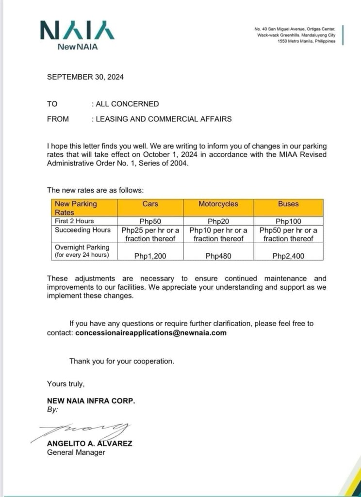
Parking at any of the terminals has been quite difficult if not horrendous. Everyone seems to be bringing their car to the airport for pick up and drop offs as well as leaving them for a night or more while traveling abroad or somewhere in the country. And then there are those who park there because the rates are supposed to be cheaper than the hotels and mall around the airport (e.g., the case of Terminal 3). Will the increase in the rates discourage unwanted or unnecessary parking? Perhaps not because people are still quite dependent on cars as their primary mode in and out of NAIA.
Access to the airport remains road-dependent. Granted there are many options like ride hailing, airport bus and taxis, these are all road based. They share the same roads that are often congested. The tollways are not enough to ease traffic in the area, which aside from airport generated trips include those from offices and industries in the area.
Too long has the need for a rail access for the terminals and government has failed to provide it. It would at least have engaged private sector for this provision but it took so long. Perhaps the Metro Manila subway will change that but we have to wait a long while to find out.
–
Skyway to the south
Instead of going via C5 and then SLEX en route to Tagaytay last week, we opted to take the Skyway via Quezon Avenue. The travel was smooth between 6:30 AM and 7:30 AM maybe because it was a Thursday and regular classes have not yet resumed (i.e., less trips). Note the counter flow lane adjacent to the median? This is implemented likely due to the experience of heavier traffic along the northbound (Metro Manila-bound) direction during the mornings. I wonder if the reverse is implemented in the afternoons/evenings.

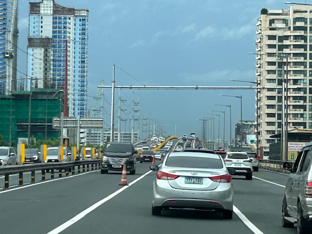
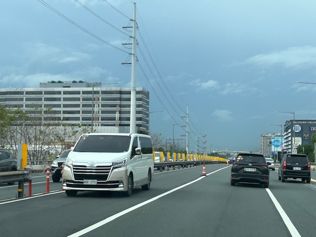
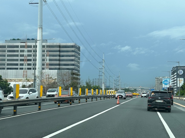


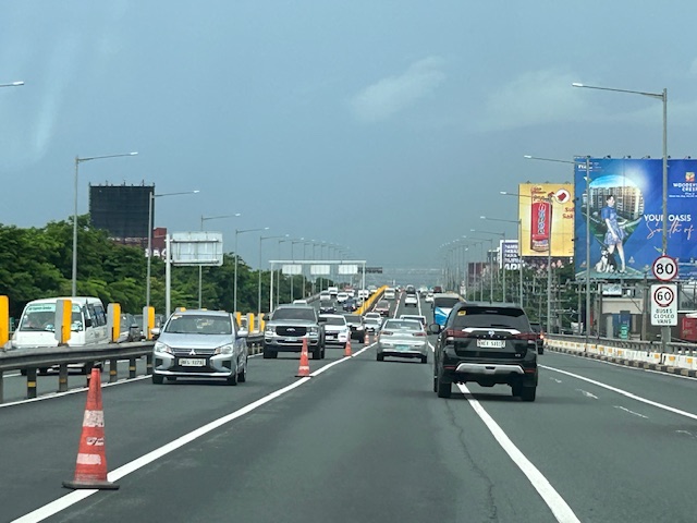
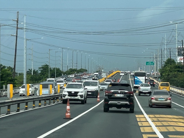
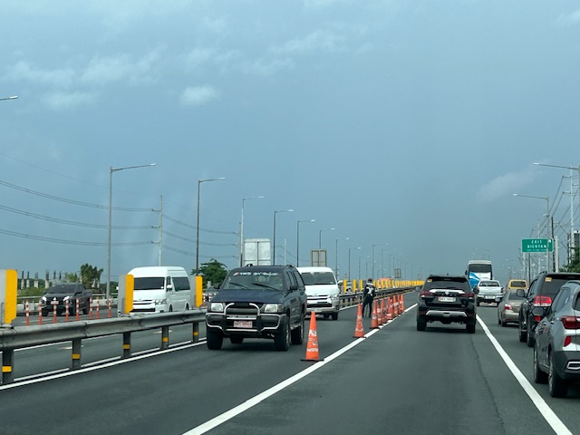
Note that there was more traffic as we traveled between Makati and Muntinlupa. The traffic represented commuters residing in the south and traveling to Metro Manila for work purposes.
Central Luzon Link Expressway (CLLEx)
The recently opened Central Luzon Link Expressway (CLLEx) is a freeway spanning the provinces of Tarlac and Nueva Ecija towards the Cagayan Valley side of Luzon. With the ends at Tarlac City, Tarlac and San Jose City, Nueva Ecija, Phase 1 currently terminates at Aliaga town; connecting to the Guimba-Aliaga Road. That is 18 kilometers of the planned 30.7 kilometers of the first phase, which is to end at Cabanatuan City, Nueva Ecija. Here are some photos taken by colleagues as they traveled to Tuguegarao this weekend.
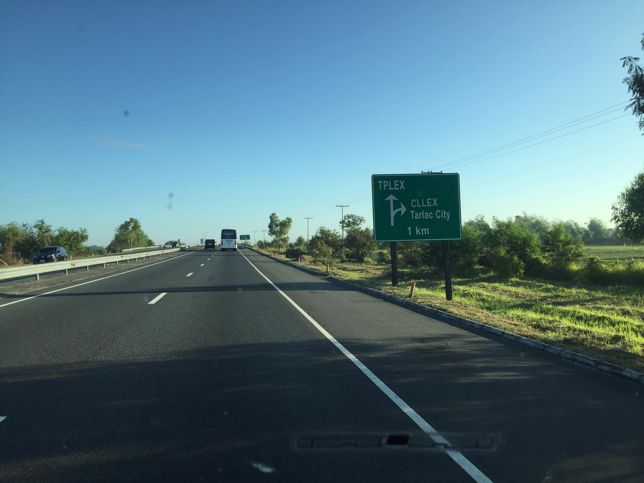 Section of SCTEX leading to the junction where the road branches to either the TPLEX or the CLLEx. SCTEX is a tollway operated by Metro Pacific via its Manila North Tollways Corp. while TPLEX is a tollway operated by San Miguel Corp. CLLEx is currently a freeway under the DPWH.
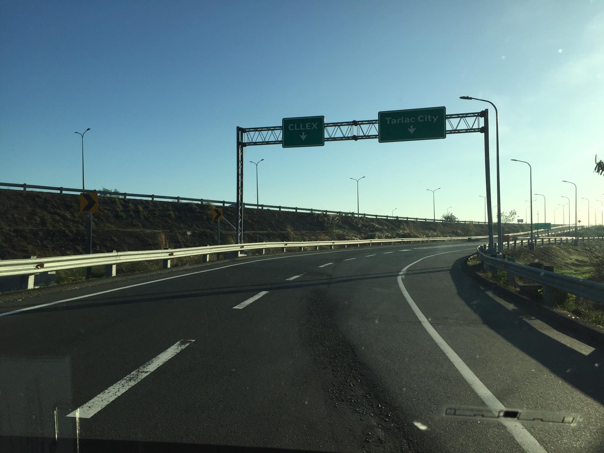 SCTEX off-ramps to CLLEx (left) or Tarlac City (right)
 The expressway currently has 2 lanes per direction plus shoulder along either direction. The median barrier is a post & rail semi-rigid structure.
 Many of the traffic signs have yet to be installed
 Not so much traffic along the freeway as shown in the photos. These were taken on a Sunday though and we wonder if there will be more vehicles during the weekdays.
 As the freeway is still uncompleted, the end section in Nueva Ecija is two lane-two way with only cones and bollards separating opposing traffic.
 Exit ramp towards the Guimba-Aliaga Road
There are no stops yet along the freeway. I am not aware if there is a timetable for it to become a tollway. Traffic is still quite low so perhaps making it a tollway will take some time as it might be difficult to have a profitable operation. It would be good to have it as a limited access freeway to establish demand and use for the road.
–
On housing and transportation
I’ve written about how we should not be trying to isolate transportation as if it is singly at fault for the transport and traffic mess many of us are in at present. There are many factors affecting travel behavior including mode choice. Travel distances, travel times and mode choices are not a consequence of transportation system (including infrastructure) alone. Land development and pricing especially those pertaining to housing are critical in how people decide where to live. These are intertwined with transportation and can be quite complex without the proper data or information to help us understand the relationship. That understanding, we are to assume, should lead us to the formulation of policies intended to correct unwanted trends and perhaps encourage more compact developments that are closer to desirable concepts such as the 15-minute city.
Here is an interesting article to enrich the discussion on this topic:
Dion, R. (October 28, 2021) “Coupling Housing and Mobility: A Radical Rethink for Freeways,” Planetizen.com, https://www.planetizen.com/features/115126-coupling-housing-and-mobility-radical-rethink-freeways?utm_source=newswire&utm_medium=email&utm_campaign=news-11012021&mc_cid=85ec2b565f&mc_eid=9ccfe464b1%5BLast accessed: 11/3/2021]
The first thing that came to my mind are residents of northern and southern Metro Manila and the surrounding provinces. Many chose to buy houses there and beyond (i.e., Bulacan, Laguna and Cavite) and yet work or study in Metro Manila CBDs like Makati, Ortigas and BGC. And they do use the tollways (e.g., NLEX, SLEX, CaviTEX, Skyway) to get to their workplaces and schools.
This is also a relevant and timely topic in the Philippines as many cities are already headed for sprawls that will inevitably put more pressure on transportation infrastructure development that usually leans towards car-oriented projects (e.g., road widening, new roads, flyovers, etc.) rather than people-oriented ones (e.g., modern public transportation systems, bikeways, pedestrian infrastructure). Note that only Tokyo has developed an extensive enough railway system to cover the sprawl that is the Tokyo Metropolitan Area, which if interpreted loosely also includes Yokohama, Kawasaki and Chiba in the sprawl. No, we cannot build as fast to have as dense a railway network as Tokyo’s or other cities with similar rail systems. And so we have to figure out another way to address this problem.
–
PAREX or PARES?
Much has already been written and said about the proposal by San Miguel Corporation (SMC) to build an elevated expressway atop (or along the banks) of the Pasig River. The project is called the Pasig River Expressway or PAREX. Although it has caught the attention of the public quite recently, the idea or concept is something that was already brought up and studies even before SMC took it up. I recall seeing this concept and even discussing about this with a close friend who was involved in modeling the traffic for an elevated highway along the Pasig River during the PNoy administration for the Metro Manila Development Authority (MMDA). The MMDA then was chaired by someone who is now a senator of the country. There was apparently no opposition then for this project that probably was dismissed or shelved as it had no takers at the time. Fast forward to the present and the concept was picked up or somehow fell into SMC. The latter did some work on it, pitched it to government and, one way or another, got it approved. Being a major project under a high profile company pitched to a government that went by its “build, build, build” slogan, it wasn’t so difficult to get this hyped.
Opposition to the PAREX comes from a broad mix of professionals, environmentalists and civil society groups who questioned not just the idea or concept but the process that led to government practically giving the green light for this project. Some have countered that perhaps, instead of PAREX there should be PARES. PARES would be a Pasig River Esplanade, inspired by the Iloilo River Esplanade. Maybe this is a better option. Maybe we could even have a tramline along the river if the ROW permits it. Or, perhaps instead of an elevated expressway (with the BRT and bike lane add-ons that were obviously included to soften the image of the tollway) there can be a elevated monorail along the Pasig River. This can be designed to have a minimal footprint and could certainly have branches such as one along the Marikina River. These two options alone provide alternatives that SMC should at least consider and study very well. The options might give the company a way to save face (literally and figuratively).
–
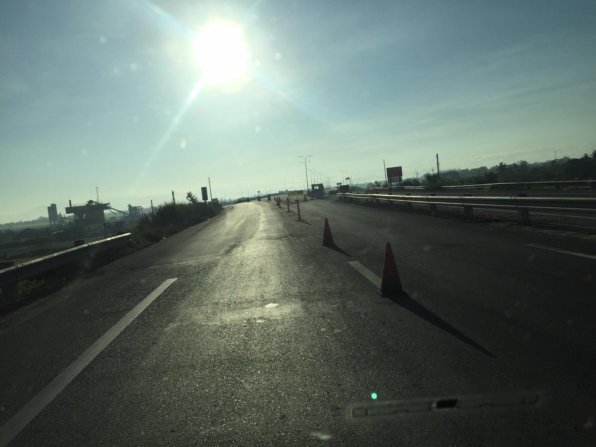
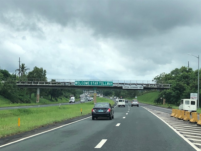
On the STAR Tollway, some recent photos
A trip earlier this year allowed me to take a few photos of the STAR Tollway. STAR stands for Southern Tagalog Arterial Road, which was what the expressway was before it became a tollway. I have memories of this being a regular highway in the early 1990s. Then, it was still a two lane road and there were even animals walking around and at times crossing the highway. Later, even after it became an expressway, the ROW was still not secured (i.e., fenced) so motorists would regularly encounter animals creating unsafe situations to both.

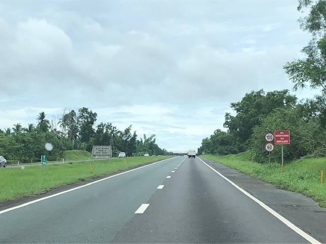
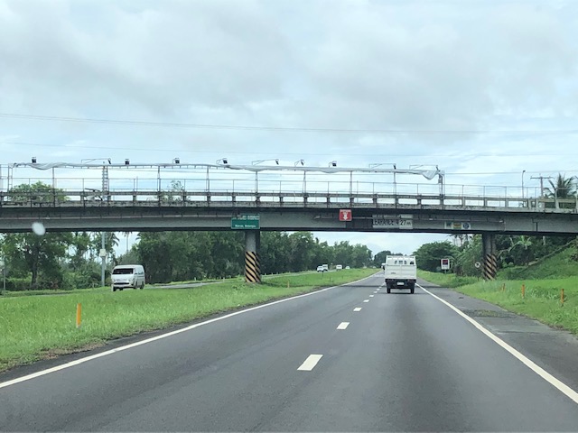

Noticeable in the photos are the wide medians. These are typically used for expansion (i.e., additional lanes) when the time comes that the capacity of the tollway is no longer enough to cater to the demand. Both the NLEX and SLEX used to have these wide medians that are now part of the motorway. Are there alternate uses or purposes for this median? Perhaps, and this has been done abroad, one could fit bicycle paths there? Or maybe install solar panels to generate power? Or maybe do both?
–
