
Home » Posts tagged 'expressways'
Tag Archives: expressways
More urban expressways for Metro Manila?
I’ve written about expressways before and particularly about where they probably are most suitable and where they shouldn’t be constructed. Here is the article I posted here in 2021: https://d0ctrine.com/2021/05/03/in-defense-of-expressways/
I will not comment anymore about the alignment of the proposed SALEX but here is a “without” and “with” elevated tollway that’s based on a photo of Padre Faura we took while doing a recon around the PGH compound last Friday.
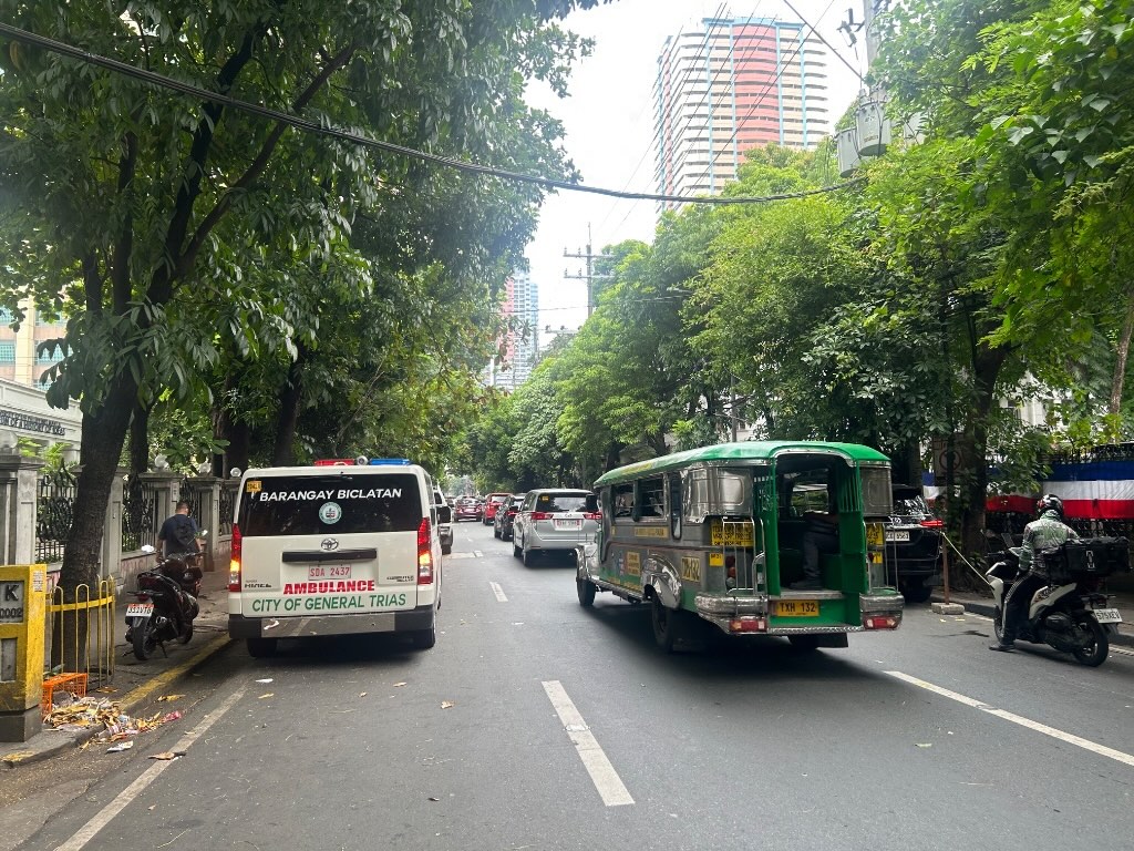 Photo of section of Padre Faura Street fronting U.P. Manila’s Museum of Ideas
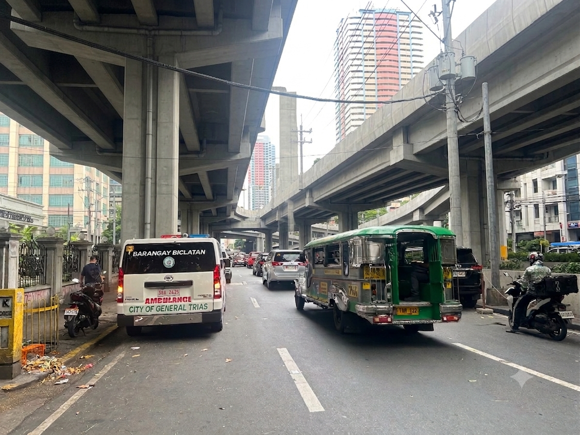 AI-assisted image showing the transformation of the section once the proposes SALEX is constructed. The elevated tollway should be higher than the renders you see on social media because there is the Line 1 along Taft Avenue.
Can the trees be saved? Maybe and by saved we don’t mean that they will be transferred. They should be retained where they are.
Why is San Miguel so intent in constructing these tollways? Is it really to “solve” Metro Manila traffic? Most objective, level-headed experts will tell you that the solution involved public and active transportation rather than more tollways. Who is whispering to Ramong Ang’s ears and advising him to build more of these tollways (and bridges)? Your guess is probably as good as mine…
–
A tollway over Padre Faura?
We had a recon survey of the streets surrounding the UP Manila and UP PGH compound this morning. We walked the entire time and got to see firsthand the conditions along the streets including Pedro Gil and Padre Faura. I’ve seen and read a lot about the proposed SALEX with an alignment that will have the proposed tollway above Padre Faura.
I can’t imagine the blight that the elevated tollways will have on Padre Faura. It will surely affect traffic along the street during construction. There is a lot of AI-generated renders of what it will look like. However, not clearly shown would be the effect of the tollway on a narrow street like Padre Faura. It will be higher than the Line 1 along Taft Avenue though so most renders you see on social media are incorrect in terms of elevation.
Were the establishments along Padre Faura consulted before the alignment of the proposed tollway was submitted for approval? That alone seems to be a glaring flaw in the PPP law considering the location of the tollway. Why is another tollway for construction in the metropolis when what are required are mass transit lines and better public transport?
–
No more Panay-Boracay Bridge?
The news today included two items welcomed by various groups including environmental advocates. One was about the proposed bridge connecting Boracay Island to Panay. The other was on the halt on the tree cutting related to the SALEX project. Both involved San Miguel Corporation. I wrote about the proposed bridge last April and how it was not at all a necessity considering the character of Boracay. It would have been a folly to build a bridge, free or tolled, to a small island that’s main attraction is its beaches. Unlimited, easy access would bring droves of people there and lead to faster deterioration of the conditions including the environment. If the government decides on another freeze in activities for the island to recover, that will surely mean losses for the bridge concessionaire. Do we really need to bring in more traffic to an island that’s exceeded its carrying capacity?
I have not written about the tree-cutting but have written about the loss of trees elsewhere including roads where we have done fieldwork along in the past. I recall the Kamatchile trees that used to line up along long sections of McArthur Highway in Tarlac. They’re lost now after the DPWH cut them down for their road widening projects. The same happened to other trees, including very old one that are hard to replace, along other national roads in many provinces where DPWH implemented its road widening projects despite having no demand for it in many cases. This is the problem if the main Key Performance Indicator (KPI) of the DPWH is kilometers of road widened. Of course, in this case, the question is if the tollway is actually necessary. My frustration and disappointment is that government keeps encouraging tollway development with the private sector when the biggest challenge is the development of mass transit systems for our rapidly growing cities. The incentives should go there instead of more tollways.
–
On C-6 and the proposal for another expressway, Part 2
The recent announcement and launch of the Southeast Metro Manila Expressway (SEMME) included this map showing the (very) rough alignment for the proposed tollway. The map also shows the proposed locations of interchanges including one in Tikling and another in Masinag. There is also another in Tumana. From the looks of this, the SEMME will be a skyway or elevated expressway/tollway.
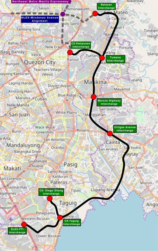
My first impression is that this elevated tollway will pass through predominantly residential areas with columns rising from private subdivisions. It doesn’t help that the topography also means the columns will be built along hilly or mountainous terrain, thereby making construction more challenging than the elevated tollways in Metro Manila.
Do we really need another circumferential road and particularly another tollway? I think that is a very important question that not only needs to be asked but also answered the right way. I, for my part, don’t believe we need another tollway, elevated or not, as this will not solve the so-called traffic problem. In fact, it creates more problems than what is supposed to be solved with the induced traffic this will generate and its promotion of car-centricity. For the price and effort of such an infrastructure, you will get more bang for your buck with a mass transit line or lines. Road congestion can only be solved by constructing the public transport system we needed decades ago.
–
On C-6 and the proposal for another expressway, Part 1
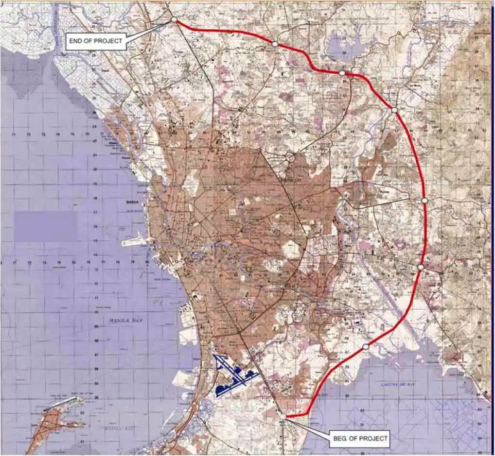
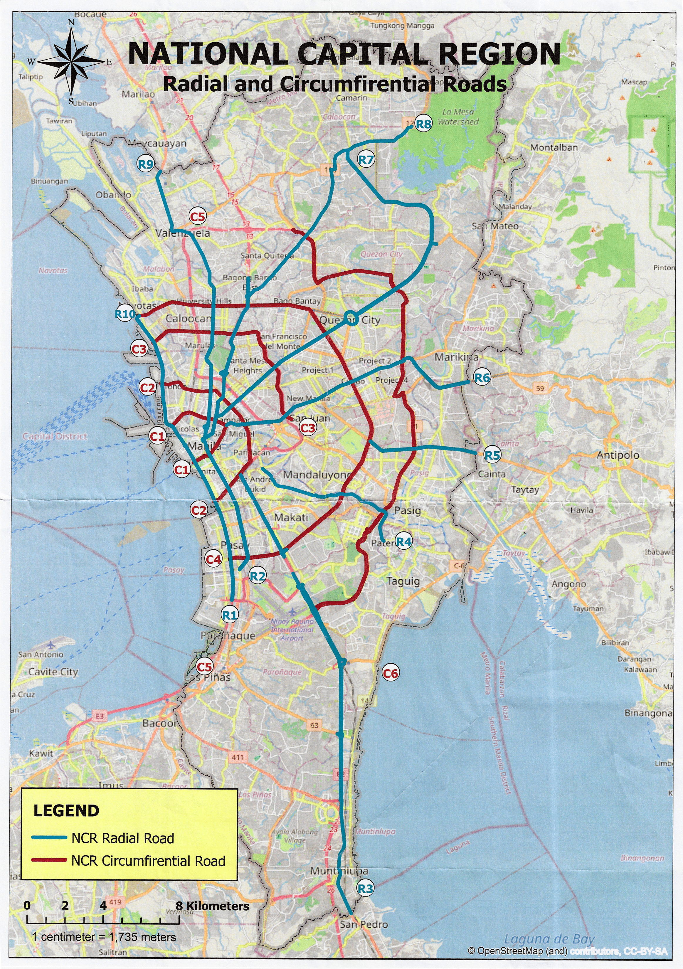
I’ve written about Circumferential Road 6 many times in the blog. Mostly, these were about the existing sections along the Laguna de Bai in Taguig and Pasig cities of Metro Manila and Taytay in Rizal Province. I share below two maps showing different alignments of C-6. The first one is a rather old one from the 1990s that I recall was from a presentation of a friend at DPWH.
 An old map I got from the DPWH a long time ago that I have used in my lectures.
The second map is supposed to be more recent, perhaps in the last 5 to 10 years if not more recent. This shows a more realistic alignment composed of what looks like existing road sections that were connected to form a semblance of a circumferential alignment.
 Here is a more recent map that’s also attributed to the DPWH.
In the first map, you will notice that the proposed alignment is more circular and smoother. This means that the road would have had a mostly new alignment instead of utilizing existing roads like Circumferential Road 5 before it. The newer sections for the latter were the ones connecting the existing roads. For the second map, noticeable is the somewhat forced connections of what looks like existing roads on the map. And while for Map 1 the alignment will be passing under the La Mesa reservoir, the alignment for Map 2 will circle the watershed like a coastal road. The alternative alignments presented an interesting exercise for students of highway engineering particularly for the topic of alignment design. Do you pick an entirely new alignment, sketch it out and determine the crossings and other constraints or do you try to make do of what roads are existing and perhaps improve (i.e., widen) these to produce an arterial?
The proposed alignment for what is now called the Southeast Metro Manila Expressway (SEMME) seems closer to the alignment in Map 1 than the one in Map 2. I will write about the proposed expressway that was recently launched in the next post.
–
Another look at the Candaba viaduct’s new lanes
I recently wrote about the new lanes along the Candaba viaduct and my thoughts about them being used as variable lanes (i.e., more lanes assigned along the peak or heavier traffic direction). Only this January 2, I observed that the lanes were being used instead for the southbound traffic as the older southbound viaduct appeared to be closed to traffic. Perhaps that side is up for rehabilitation or maintenance work?
 The new lanes between the two viaduct structures are now in use.
 These are assigned to southbound traffic while the original lanes appear to be closed off.
–
New lanes along the NLEX Candaba Viaduct
Heading to Baguio, I noticed the new lanes in the middle of the NLEX viaduct. The viaduct was actually two bridges constructed over the Candaba Swamp. The soil being too soft for a normal road, the viaduct allowed for two way traffic with each bridge carrying northbound or southbound vehicles. The recall that the original bridges each had 2 lanes plus a shoulder lane. Each now have 3 lanes plus shoulder after expansion years ago. The additional lanes in the middle probably required additional columns to be built with more modern foundations than the original viaduct. The new structures had to be integrated with the older viaducts. Here are photos of the completed sections:


You can go to Google Maps if you want to see what the lanes looked like under construction. Here is a screenshot:

Screenshot
The middle lanes look like they can be used as variable lanes. That is, all or some of the lanes may be used to serve the direction with the heavier traffic. The directions can change depending on the time of day, day of the week or the season. I don’t know at this time though how exactly this can or will be implemented as there are no signs to guide motorists for variable lanes. What signs am I referring to? Here are examples from Bangkok showing overhead signs assigning lanes for the direction with heavier traffic:
 A close up of the signs designating lanes for traffic
 In the example above, 4 lanes including one counterflow lane are assigned to traffic along the southbound direction.
–
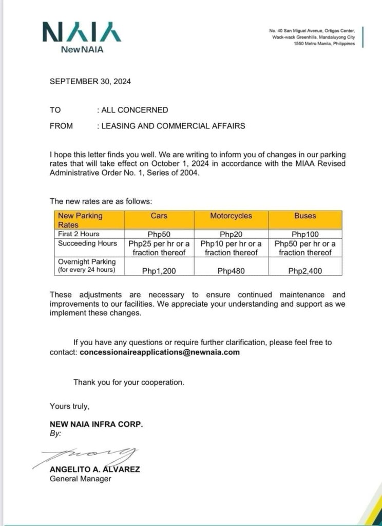
Increase in parking rates at NAIA
A friend shared this notice about the increase in parking rates at NAIA.
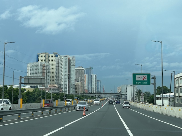
Parking at any of the terminals has been quite difficult if not horrendous. Everyone seems to be bringing their car to the airport for pick up and drop offs as well as leaving them for a night or more while traveling abroad or somewhere in the country. And then there are those who park there because the rates are supposed to be cheaper than the hotels and mall around the airport (e.g., the case of Terminal 3). Will the increase in the rates discourage unwanted or unnecessary parking? Perhaps not because people are still quite dependent on cars as their primary mode in and out of NAIA.
Access to the airport remains road-dependent. Granted there are many options like ride hailing, airport bus and taxis, these are all road based. They share the same roads that are often congested. The tollways are not enough to ease traffic in the area, which aside from airport generated trips include those from offices and industries in the area.
Too long has the need for a rail access for the terminals and government has failed to provide it. It would at least have engaged private sector for this provision but it took so long. Perhaps the Metro Manila subway will change that but we have to wait a long while to find out.
–
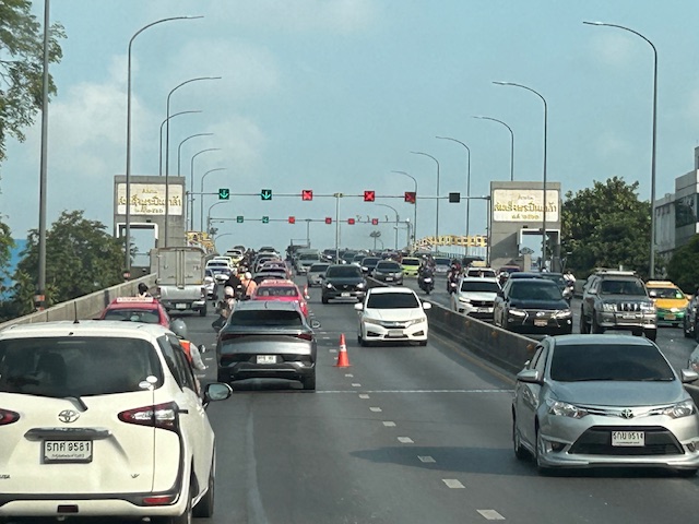
Skyway to the south
Instead of going via C5 and then SLEX en route to Tagaytay last week, we opted to take the Skyway via Quezon Avenue. The travel was smooth between 6:30 AM and 7:30 AM maybe because it was a Thursday and regular classes have not yet resumed (i.e., less trips). Note the counter flow lane adjacent to the median? This is implemented likely due to the experience of heavier traffic along the northbound (Metro Manila-bound) direction during the mornings. I wonder if the reverse is implemented in the afternoons/evenings.

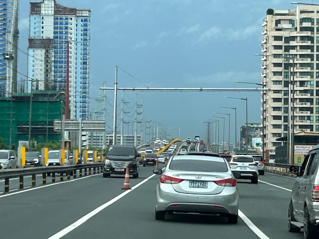
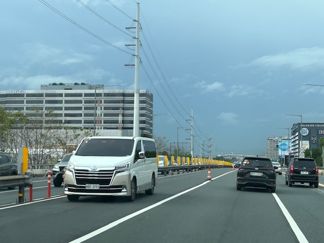
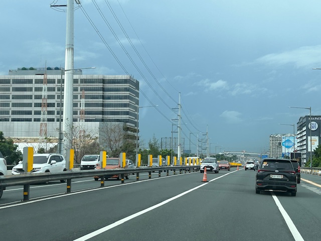


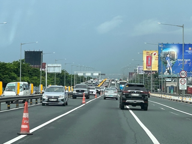
Note that there was more traffic as we traveled between Makati and Muntinlupa. The traffic represented commuters residing in the south and traveling to Metro Manila for work purposes.
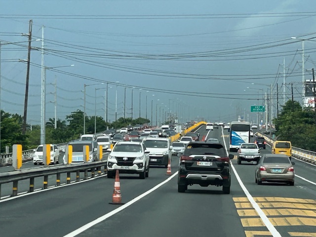
Central Luzon Link Expressway (CLLEx)
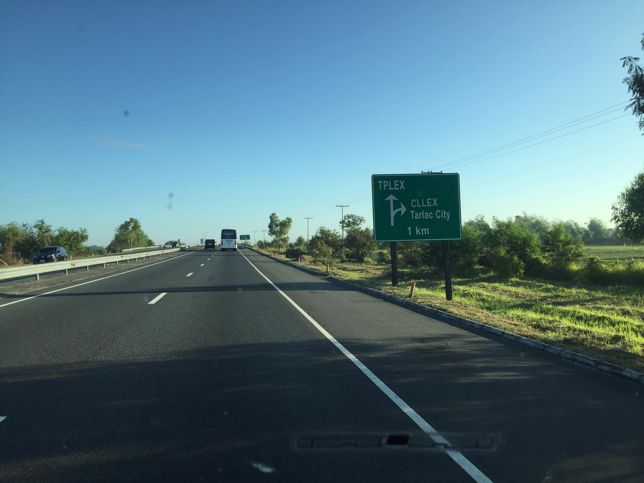
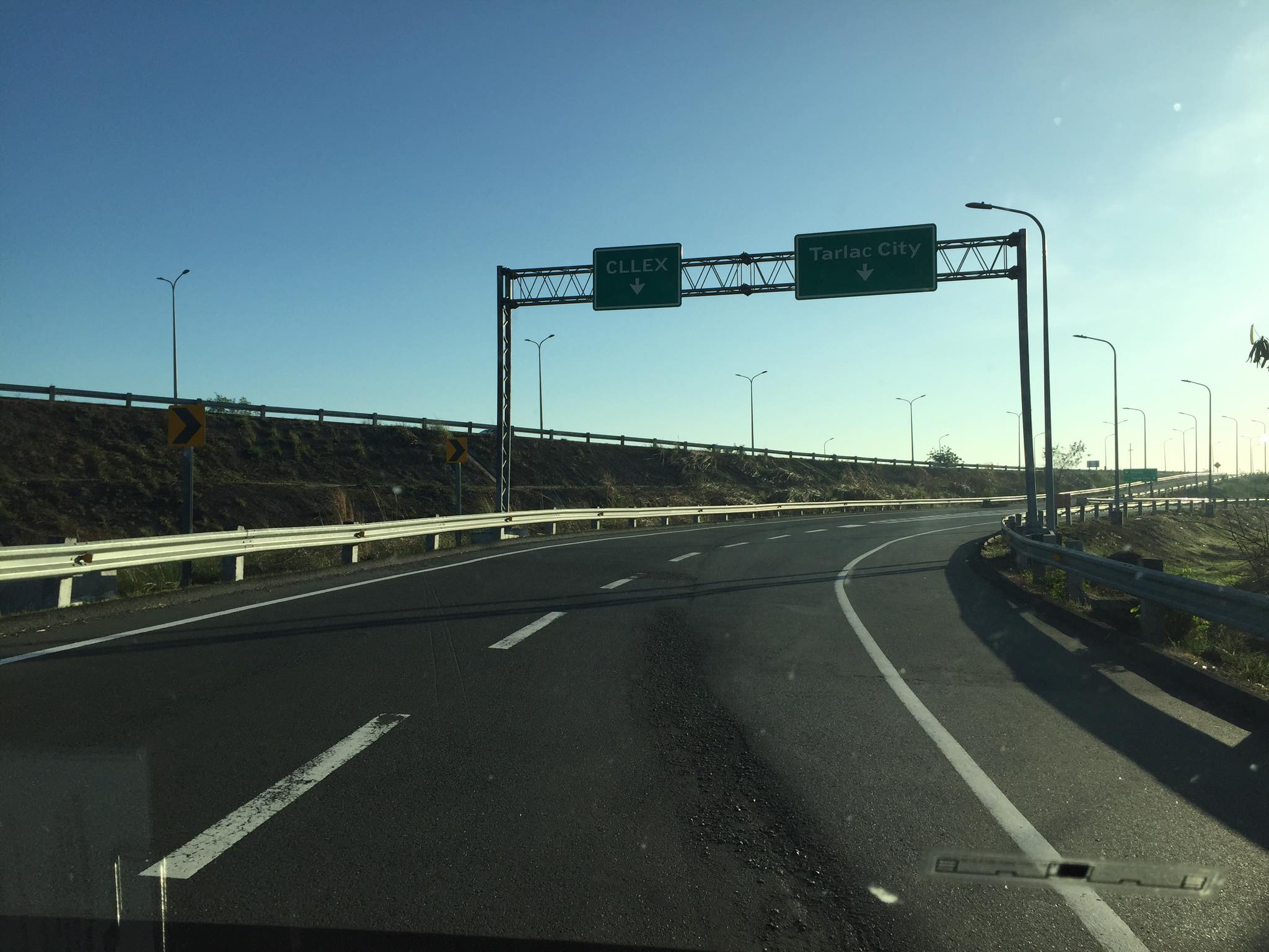
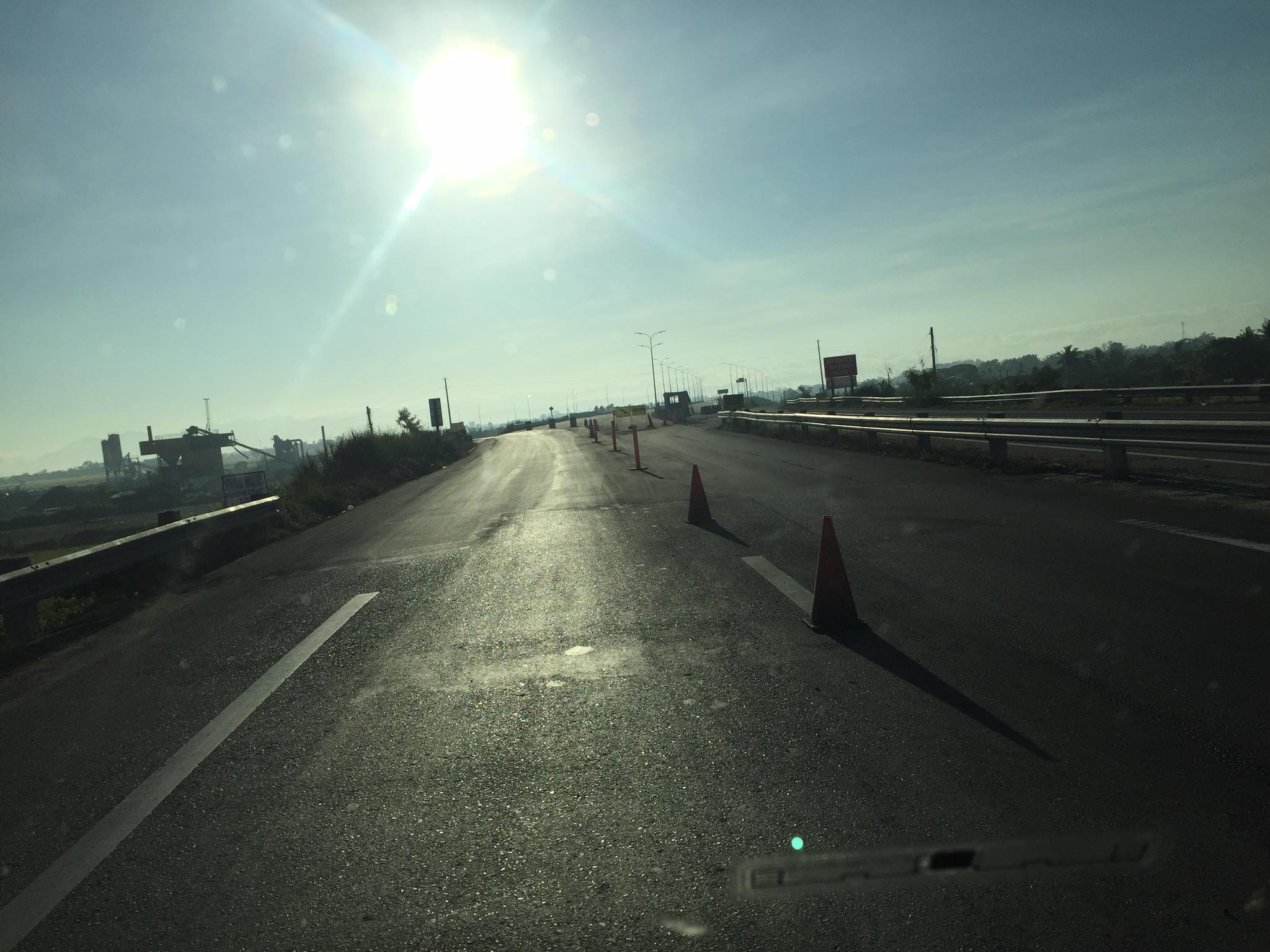
The recently opened Central Luzon Link Expressway (CLLEx) is a freeway spanning the provinces of Tarlac and Nueva Ecija towards the Cagayan Valley side of Luzon. With the ends at Tarlac City, Tarlac and San Jose City, Nueva Ecija, Phase 1 currently terminates at Aliaga town; connecting to the Guimba-Aliaga Road. That is 18 kilometers of the planned 30.7 kilometers of the first phase, which is to end at Cabanatuan City, Nueva Ecija. Here are some photos taken by colleagues as they traveled to Tuguegarao this weekend.
 Section of SCTEX leading to the junction where the road branches to either the TPLEX or the CLLEx. SCTEX is a tollway operated by Metro Pacific via its Manila North Tollways Corp. while TPLEX is a tollway operated by San Miguel Corp. CLLEx is currently a freeway under the DPWH.
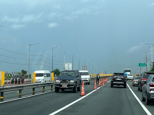
 SCTEX off-ramps to CLLEx (left) or Tarlac City (right)
 The expressway currently has 2 lanes per direction plus shoulder along either direction. The median barrier is a post & rail semi-rigid structure.
 Many of the traffic signs have yet to be installed
 Not so much traffic along the freeway as shown in the photos. These were taken on a Sunday though and we wonder if there will be more vehicles during the weekdays.
 As the freeway is still uncompleted, the end section in Nueva Ecija is two lane-two way with only cones and bollards separating opposing traffic.
 Exit ramp towards the Guimba-Aliaga Road
There are no stops yet along the freeway. I am not aware if there is a timetable for it to become a tollway. Traffic is still quite low so perhaps making it a tollway will take some time as it might be difficult to have a profitable operation. It would be good to have it as a limited access freeway to establish demand and use for the road.
–
