
Home » Posts tagged 'footbridges'
Tag Archives: footbridges
On at-grade crossings and footbridges
Here’s a quick share of an article on how at-grade crossings are generally better and preferred over footbridges:
When Footbridges Cost Lives and At-Grade Crossings Save Them
The article effectively articulates the case for at-grade crossings and presents the facts and references in support of these crossings. I will only add here that context is still important along with an appreciation or understanding of the volume of traffic and occupancy of vehicles along the roads. Commonwealth Avenue, for example, requires footbridges but there should be better designs for these footbridges than the current ones along this highway. I think we lack good designs that we can refer to and this leads to a summary dismissal of footbridges where they are actually most suitable.
–
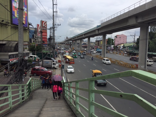
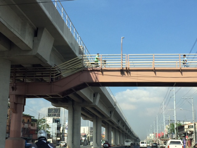
Another misplaced pedestrian footbridge?
There are soil tests currently being performed along L. Sumulong Memorial Circle across from Dela Paz National High School. This would probably be for the foundations of a pedestrian footbridge in the area that will, in theory, reduce if not eliminate pedestrian crossings in the area. On most days when there’s school, there are a lot of people, mostly students, crossing here. The result is traffic slowing down along both sides of the road that happens to be near the junction with Pinagmisahan Road. Is this enough reason to build a footbridge here? Probably and tempting enough for those who look for ‘easy’ solutions rather than come up with something that is less car-centric than a footbridge where the crossing is short and quick if done on the ground rather than via an overpass.
 Soil tests across from Dela Paz National High School.
There should be a solution here along the lines of complete streets rather than the usual pedestrian footbridge that’s a favorite of local and national government officials, planners and engineers who appear to be too lazy to come up with a more suitable treatment to improve safety in a high pedestrian and vehicle traffic area.
–
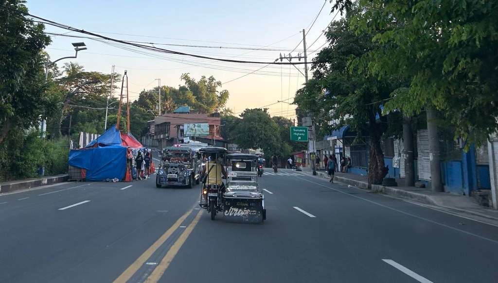
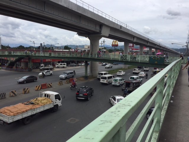
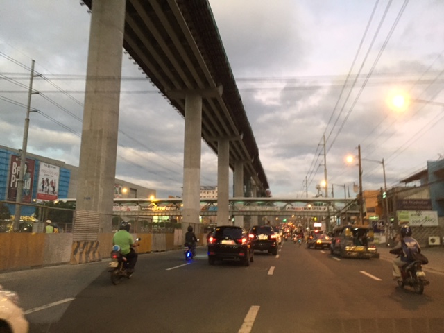
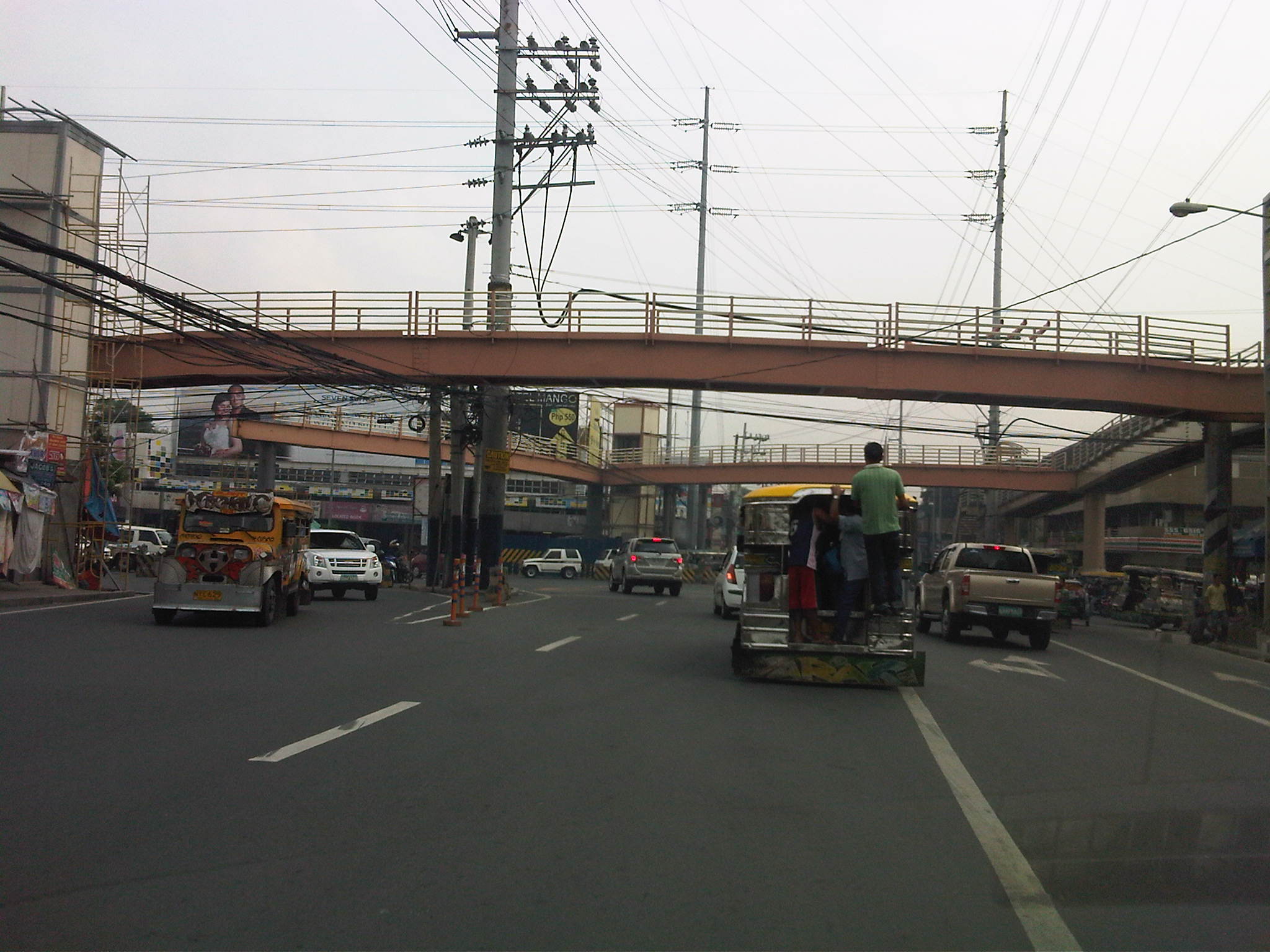
Footbridges along Sumulong Highway – Part 1
There are several new pedestrian footbridges along Sumulong Highway. The intent is simple – provide a safe crossing for people considering the high volume of traffic along the highway and the high risk of being hit by vehicles. Speed is an issue here considering the highway’s slopes and curves. Footbridges present a quick solution. However, it is not necessarily the most appropriate given the objective of improving safety. Perhaps slowing down or ‘calming’ traffic is a better approach?
 A new pedestrian footbridge near the San Pedro Calungsod Church. The intention is for people to use this footbridge to cross to or from the church. Considering the relatively narrow carriageway, crossing on road level is actually the shortest and most efficient way. However, the volume and speed of traffic is a major consideration here and elsewhere along Sumulong Highway.
 This pedestrian overpass or footbridge near Fatima University Hospital is intended for students and staff of the university and hospital. While many, even most, use the overpass, there are a significant number of people who prefer crossing directly on the highway. Before, there were school personnel, usually a guard, who helps people cross. I don’t see them anymore. Even Antipolo does not have traffic enforcers or aides in the area.
More on these pedestrian footbridges.
–
On the Tandang Sora flyover’s closure
The signs announcing the closure of the Tandang Sora flyover along Commonwealth Avenue are doing the rounds of social media. So are the traffic management plans (i.e., the re-routing maps for the area) that are being shared by many and soliciting a variety of reactions. The reactions are often angry or sad for those likely affected by the closure and the re-routing via Luzon Avenue, Congressional Avenue and Philcoa. The demolition of the flyover to give way to the future MRT-7 station will definitely lead to traffic congestion and longer travel times to a lot of commuters, whether using public or private transportation. However, there are only few comments so far about the impacts on pedestrians. Will the pedestrian footbridges be demolished, too? Will they be redesigned or replaced considering the high volume of pedestrians crossing this major intersection? Following are photos taken underneath the Tandang Sora flyover as we waited to make a U-turn. These show the pedestrian footbridges in the area that allow people to safely cross the wide Commonwealth Avenue.
 View of the steel truss footbridge that goes underneath the Tandang Sora flyover
 There are many signs installed on the footbridge including the speed limit for Commonwealth Avenue and a reminder to fasten seatbelts. Others are directional signs including those designating the lanes for public utility vehicles and motorcycles.
 There is another steel footbridge that is of more recent design and construction connecting to the old truss bridge. This allows pedestrians to continue on to cross Tandang Sora. This example is actually one that invites questions pertaining to design. Why have two distinct designs instead of building on the previous one? Another case of “pwede na iyan” ?
 Here’s another view of the two footbridges – one spanning Commonwealth and the other across Tandang Sora. Will these be demolished, too, to give way to the MRT-7 station? And will the MRT-7 Station design include a provision for non-passengers to cross Commonwealth and Tandang Sora? This seems to be the most logical way to design the station; integrating pedestrian (and cycling) needs to the infrastructure. But then again, that remains to be seen and perhaps someone can share the design of the Tandang Sora station for this to be scrutinized.
–
Marcos Highway-Felix Avenue-Gil Fernando Avenue pedestrian overpass
Here’s are some photos of the pedestrian overpass structure at the intersection of Marcos Highway, F. Felix Avenue (formerly Imelda Avenue) and Gil Fernando Avenue (formerly A. Tuazon Avenue).
 Here’s a view of Marcos Highway and the elevated Line 2 Extension from the structure crossing Felix Avenue between Soliven/Tropical and Sta. Lucia. Also shown is the overpass crossing Marcos Highway.
 View towards Sta. Lucia and Robinsons Metro East
 Stairs to Sta. Lucia – notice the gap in the railings along the elevated Line 2 superstructure? That is where the Emerald Station will be constructed.
–
Ortigas Center walkways under construction
Currently under construction at the Ortigas Center are elevated walkways that are part of the Ortigas Greenways Project. Following are some photos I took a few weeks back (they’re old!), and so the current state should show significant progress from what is in the photos.
 Elevated walkways are currently under construction at the Ortigas Center. This part can be seen along Julia Vargas Ave. at the intersection with Garnet St.
 Structure at F. Ortigas, Jr.
 Close-up of the F. Ortigas part of the elevated walkways
 Walkway section under construction along the approach of ADB Ave./San Miguel Ave.
 Crossing under construction at the intersection of Julia Vargas with San Miguel Ave. (to the left) and ADB Ave. (to the right).
 View of the F. Ortigas crossing walkway along the eastbound direction of Julia Vargas Ave.
This project is perhaps one of the most hyped pedestrian facilities in Metro Manila and if I recall right, the concept for this can be traced to workshops conducted during one of the Transport Forums organized by the Asian Development Bank (ADB), whose headquarters are located in Ortigas Center. It took a while to be realized but should be completed soon. This won’t be the first of its kind in Metro Manila as Makati already has one connecting office and residential buildings to Greenbelt and Glorietta. I really do hope it is able to reduce congestion in the area but this would require studies after the facilities are opened for public use. We need more of these around Metro Manila as well as other major cities. We direly need facilities to encourage walking as a preferred mode over motorized transport.
–
On walking and the old pedestrian overpass at UPIS
I decided to go for a long walk one day last April. I walked from our office to the UP Town Center, which was just under 2 kilometers away, to purchase something. I could have taken my car or perhaps rode a jeepney but I wanted to see for myself how easy or difficult it was to walk that distance. It turned out that it wasn’t a difficult walk at all. From Melchor Hall, I crossed the street so that I could walk along the inner part of the Academic Oval. I then took a short cut through the trail in front of Malcolm Hall at the edges of the Sunken Garden, emerging just near the grandstand. From there, I crossed towards Vinzons Hall and then walked towards and along Shuster Street near UP Integrated School. I exited the campus at the portal at the end of Shuster and crossed Katipunan using the old pedestrian overpass that connected the main campus with what used to be UPIS on the other side of C-5.
 The pedestrian overpass is an old structure compared to many of its kind around Metro Manila. The design is quite massive considering it is a concrete structure. The photo above was taken towards the direction of UP Town Center.
 The steps are quite steep on either side of the overpass
 Here’s a photo of a person carefully walking down the steps of the overpass.
 The photo above was taken towards the direction of the UP campus.
The overpass used to be dirty, unkempt, and to many was revolting enough that it was rare to find people using it to cross Katipunan. Most people crossed the busy thoroughfare on the ground, often braving the traffic and taking on the risk of getting hit by a vehicle. Since the overpass was integrated with the UP Town Center (i.e., it is physically connected to the mall and there security personnel posted there), more people now use it. MMDA also fenced much of the median of Katipunan in the area and so the only way to cross the stretch of UP Town Center from Shuster to C.P. Garcia is via either of the two pedestrian overpasses (there’s a second, newer steel structure near C.P. Garcia).
As for the walk to Town Center and back, I thought it was safe, convenient and invigorating (nothing like some walking to help in blood circulation). I took a leisurely pace (not brisk) for my walk so I could enjoy the environment. You tend to see a lot of things when you take such walks and the campus is full of activities, sights and sounds, to help make the walk enjoyable such that you won’t even notice the time and perhaps, won’t even mind the exercise.
–
Vermont Royale pedestrian overpass
There was a comment on a previous article asking if the pedestrian overpass across Vermont Royale along Marcos Highway is already usable. The photo in that article showed a still-to-be modified overpass. Following are photos taken last Sunday of the overpass. It shows the lowered mid-section passing under the Line 2 extension structure.
 The modified pedestrian overpass across Vermont Royale along Marcos Highway
 That’s a pedestrian and a cyclist using the overpass
–
Another look at Marcos Highway pedestrian overpasses – Part 2
I purposely didn’t include the overpasses at and near the Masinag Junction because I felt they deserved their own article. For one, the area will be the location of the future end station of the current LRT Line 2 Extension project. Here are a couple of photos of the overpasses in the area.
 Overpass at SM City Masinag – note the tall columns for the elevated tracks of Line 2. Will the Masinag Station be located that high or will it be at a lower level, perhaps closer to the SM City overpass?
The overpass at SM City Masinag is something that has been replicated in many other locations where an SM mall has been constructed. Note the similarity of the situation with the likes of SM City Iloilo, SM City Novaliches where SM built pedestrian facilities to allow for safe crossings between the mall and the area across from it along the highway. In many cases, it is the mall which provided the overpass in coordination with the local government unit and, I assume, the DPWH.
 Overpasses at Masinag Junction – there are actually 4 bridges here, each spanning one leg of the junction.
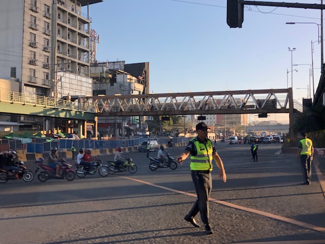
One of the intents for these is to eliminate at-grade pedestrian crossings at the junction. While crossing have been reduced significantly, there are still many “pasaway” who cross even when there is a green light for vehicular traffic along the leg they are crossing. Traffic enforcers here are quite lax about this and don’t seem to put in an effort to inform people about the overpass. There is no excuse for those who might claim they are too old or weak to climb the steps since the overpass has 4 working elevators for those unable to make the stairs. I noticed though that most of those using the elevators are able bodied people who probably are just too lay to take the stairs.
–
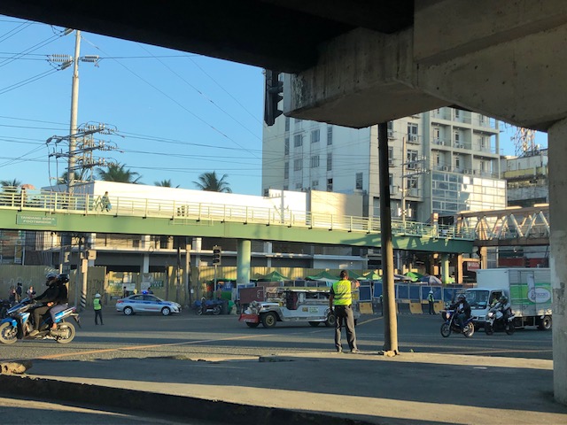
Construction of pedestrian overpass at Masinag
What’s been causing a lot of traffic jams the past week emanating from the Masinag area is the installation of the pedestrian overpasses (or footbridges, if you prefer the term) at the junction. Components of the overpasses were constructed and installed intermittently over several months already. Last Sunday, major works were undertaken including the raising of the main girders that are also to be the walkways for pedestrians. The work entailed closing sections or parts of the intersection and resulted in monstrous traffic jams along both Marcos Highway and Sumulong Highway. The congestion spread to local roads that were used to divert traffic as work was underway during the daytime. Yes, daytime! I found it unusual that such works would be undertaken when traffic was already significant for the two major roads here even if it were a Sunday. Most people had little or no information about this including residents of Antipolo and Marikina who were the most affected by partial closures.
 The still unfinished pedestrian facility at Masinag Junction
The pedestrian facility at Masinag junction has four spans that are supposed to cover crossings across all four legs of the intersection. Thus, theoretically, pedestrians may cross any time despite the busy traffic at ground level. I haven’t seen the stairs yet but if they are much like other footbridges including recent ones of similar design, then I would say that they are not that friendly to senior citizens, persons with disabilities and those who want to cross with their bicycles. Then there are those who are just too lazy to use the overpass and instead would just risk it by braving traffic as they cross at ground level. Already, many pedestrians choose to cross the roads a few meters from the intersection (it used to be that they crossed at the intersection) and it will take a lot of education and enforcement to make most people use the footbridges. Meanwhile, Antipolo should ensure that vendors do not set up shop at the overpasses. This facility is for walking and not shopping.
Among the implications of the four overpasses is the need to re-install traffic signals at the intersection as the current set-up is already obscured by the pedestrian structure. Incidentally, that it also why Antipolo City had to assign personnel to manage traffic at the intersection for much of the day. It is expected that the signals will be installed where motorists can easily see them. The pedestrian facility is also expected to enhance safety at the intersection especially for pedestrians as well as ease congestion for vehicular traffic. Call it car-oriented but it is a necessity given the steadily increasing volume of traffic at the junction. Until there is a good public transport system to help reduce the number of motor vehicles on roads such as Sumulong and Marcos Highways, cars and the like will continue to rule our road space. Ultimately, the provision of pedestrian facilities (hopefully, appropriately designed) is a people-oriented endeavor that should be promoted.
–
