
Home » Posts tagged 'highways'
Tag Archives: highways
An aerial view of the PNR’s rail revival
I would just like to share a few photos I took while our plane was turning towards our Bicol destination upon take off from NAIA.
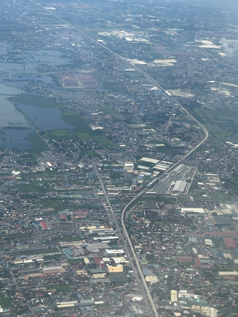
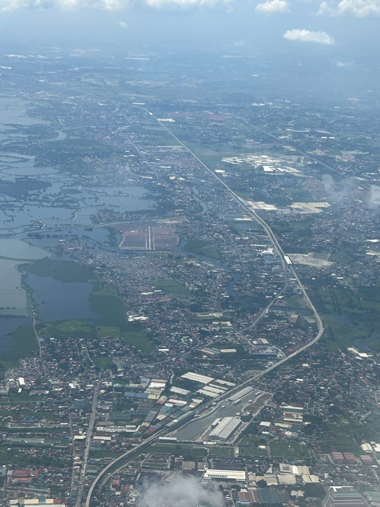
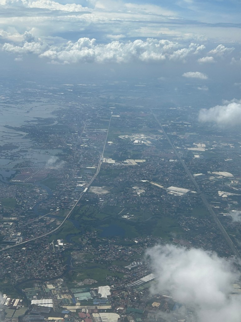
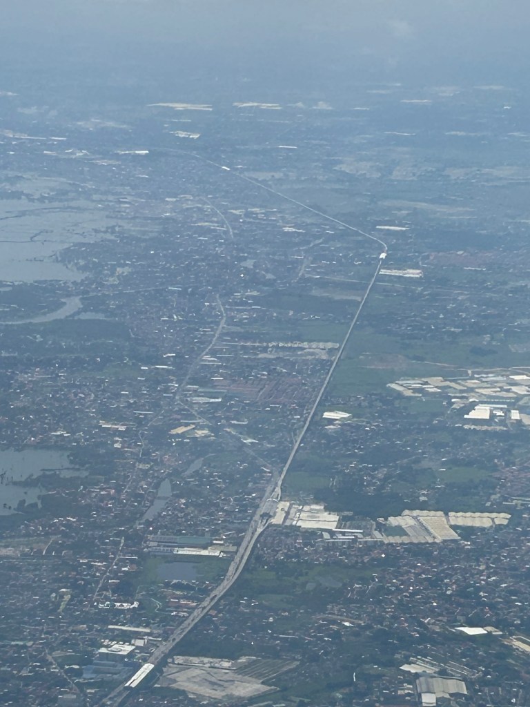
I will again pose the following questions to my readers: will the NSCR become the game changer it’s supposed to be for both long distance travel and commuting (super commuting for some cases)? Will it decongest McArthur Highway and NLEX? Will there be a significant shift from car use to rail? Or will those taking road-based public transport be the ones mainly shifting to rail?
–
Rain and fog along Sumulong Highway
I just wanted to share a few photos of the conditions along Sumulong Highway these past days. With Felix Avenue and Ortigas Avenue Extension frequently flooded during this season, our commutes would usually be along Sumulong and Marcos Highways.
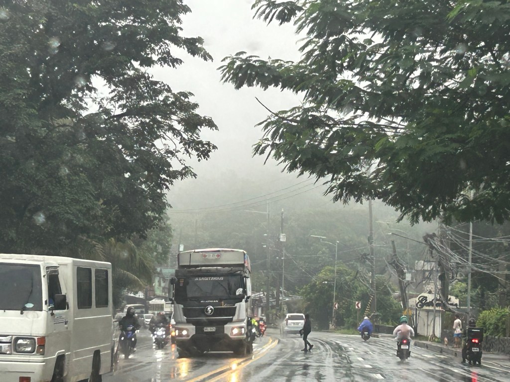
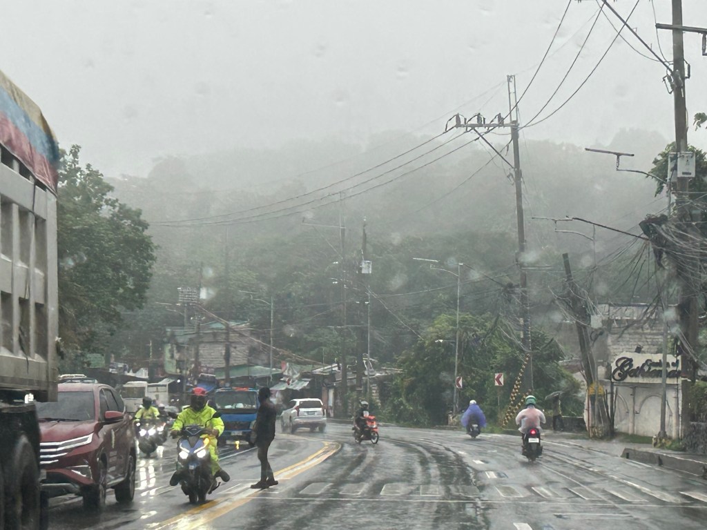
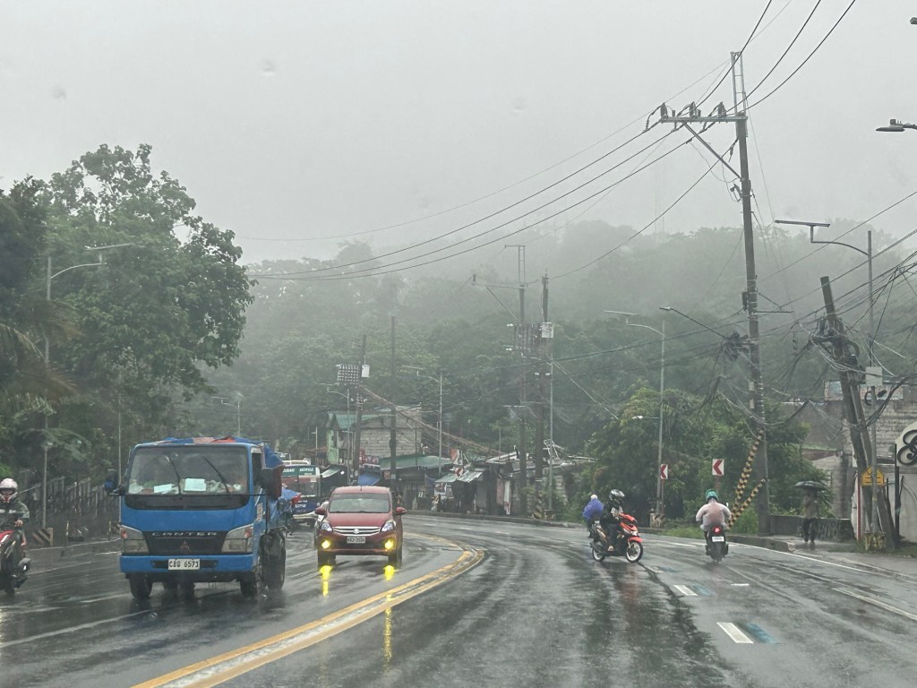
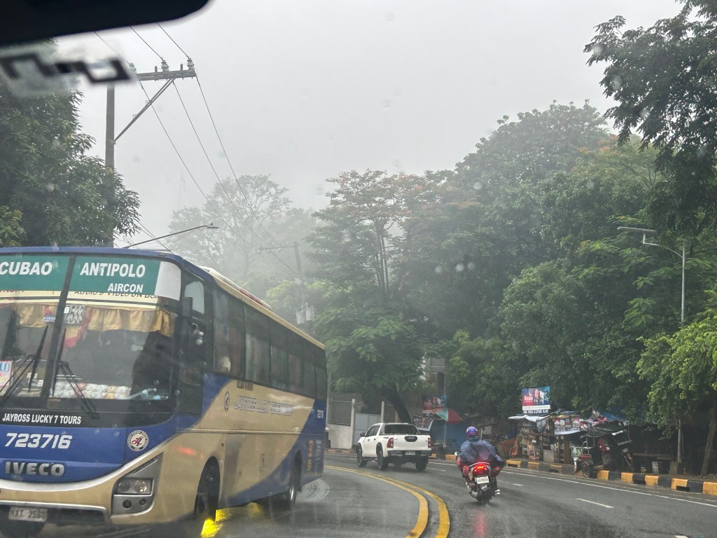
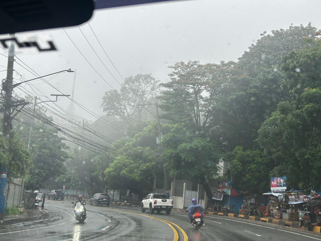
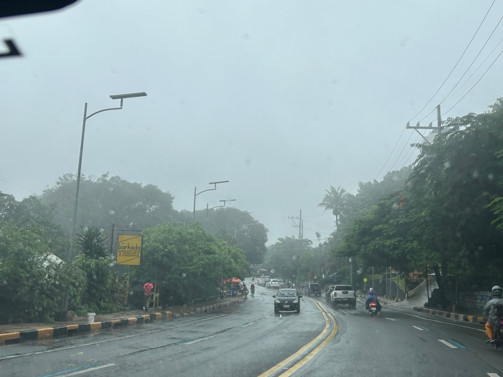
Despite the conditions of the road, there are still many who drive or ride recklessly. Speeding, weaving and cutting on slippery pavements increase the likelihood of crashes, which are preventable if only people will slow down and be more cautious.
–
On C-6 and the proposal for another expressway, Part 1
I’ve written about Circumferential Road 6 many times in the blog. Mostly, these were about the existing sections along the Laguna de Bai in Taguig and Pasig cities of Metro Manila and Taytay in Rizal Province. I share below two maps showing different alignments of C-6. The first one is a rather old one from the 1990s that I recall was from a presentation of a friend at DPWH.
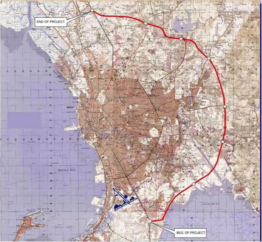 An old map I got from the DPWH a long time ago that I have used in my lectures.
The second map is supposed to be more recent, perhaps in the last 5 to 10 years if not more recent. This shows a more realistic alignment composed of what looks like existing road sections that were connected to form a semblance of a circumferential alignment.
 Here is a more recent map that’s also attributed to the DPWH.
In the first map, you will notice that the proposed alignment is more circular and smoother. This means that the road would have had a mostly new alignment instead of utilizing existing roads like Circumferential Road 5 before it. The newer sections for the latter were the ones connecting the existing roads. For the second map, noticeable is the somewhat forced connections of what looks like existing roads on the map. And while for Map 1 the alignment will be passing under the La Mesa reservoir, the alignment for Map 2 will circle the watershed like a coastal road. The alternative alignments presented an interesting exercise for students of highway engineering particularly for the topic of alignment design. Do you pick an entirely new alignment, sketch it out and determine the crossings and other constraints or do you try to make do of what roads are existing and perhaps improve (i.e., widen) these to produce an arterial?
The proposed alignment for what is now called the Southeast Metro Manila Expressway (SEMME) seems closer to the alignment in Map 1 than the one in Map 2. I will write about the proposed expressway that was recently launched in the next post.
–
Welcome arch in Iloilo
We had a small adventure when we were in Iloilo last month. We traveled to the last town to the west just before the border with the Province of Antique. I was expecting to see welcome arches as we crossed one town after another. There was only one town that had this – Guimbal. And practically the whole stretch of the national highway had a signature of the town’s motto that had got something to do about it like a rising sun.
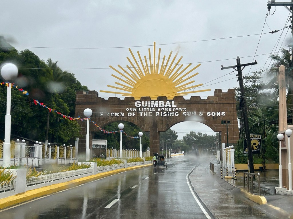
There’s another quite unusual landmark there that I will also be writing about soon. I will leave my readers in suspense for now.
–
Lower speed limits may not slow drivers, a before-and-after study shows
I am sharing this article on drivers not reducing their speeds after speed limits have been lowered along certain roads. My first reaction after reading the article is that it is that perhaps in the US case, the after study was conducted quite early and before people have become aware, understood and adjusted to the lower speed limits. The responses or reactions to lower speed limits (particularly those posted or on signs) may vary among cities and countries. In the Philippines, where drivers and riders appear to be oblivious to speed limits, other interventions may be required including some types of traffic calming devices. This is very much a concern particularly in school zones where children are exposed to the risks of being run over by motor vehicles speeding along the roads and not minding the speed limits in the area.
Here is the Research report:
Source: Lower speed limits may not slow drivers, a before-and-after study shows
Arches along the Manila East Road
Last October, our office had our first out-of-town workshop since the onset of the COVID-19 pandemic. The venue was not so far – a resort in Baras, Rizal. Along the way, I was able to take a few photos of the arches along the Manila East Road, which is the main highway connecting the towns of Rizal Province.
 One side of the Morong, Rizal arch with the text stating the traveler is leaving the town. The other side is Baras, Rizal.
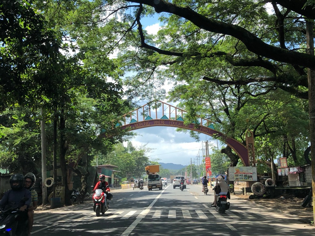 The other side with the text stating one is entering the town of Morong “where education comes first”.
 At the other end is another arch and the town of Teresa.
Many arches have been demolished, casualties of the DPWH’s road widening program. Many of these have not been replaced. These were landmarks to many travelers and the designs used to describe or highlight what a town was known for (e.g., there was a big bat at the center of the arch of Paniqui, Tarlac).
–
Article share: What’s Incomplete About Complete Streets?
The concept of road diets circulated in Metro Manila more than a decade ago. I recall the Metro Manila Development Authority (MMDA) picked up the concept and attempted to apply it in some parts of Metro Manila. Since there are no evidence of that endeavor surviving now, then we can assume that it was a failure. There is no wonder there as I also recall the effort to be half-hearted and more to get media mileage (cheap talk or lip service) out of it. Road diets eventually evolved into the complete streets (though the literature now will state road diets as part of complete streets). That experience and similar initiatives of varying success (or failure) rates are not unique to the Metro Manila but is actually happening elsewhere including cities in countries where the complete streets have been applied more comprehensively and yet somehow found to be lacking or not as effective a solution as expected. I am sharing an article here that discusses what seems to be lacking or ‘incomplete’ as it is referred to.
Source: What’s Incomplete About Complete Streets?
Quoting from the article:
“What’s missing? First of all, even the best Complete Streets policy can’t solve the problem of fiscal scarcity. Even in a city committed to Complete Streets, street redesign must fight for public dollars with other worthy goals such as education and public safety. As a result, Indianapolis’s improvements are a drop in the bucket. The city maintains 3,400 miles of streets and roads, so its 100 miles of bike lanes affect only 3 percent of the city. Similarly, 2,000 miles of the city’s roads still lack sidewalks.
Second, the quantitative benchmarks seem to focus on sidewalks and bike lanes (Sec. 431-806), and the policy doesn’t mention traffic calming or similar policies. So if the city had a six-lane road with traffic going 60 miles per hour, the Complete Streets policy would not affect that road except to the extent necessary to build a sidewalk or a bike lane.** Thus, even the best Complete Streets policies don’t really address some of the most dangerous features of American street design.”
—
Counting cars: ideal vantage points for intersections and elevated highways
The weekend found us staying at a hotel in Makati in order to be near the recital venue for our daughter. Our room afforded a nice view of the surrounding areas (we were on the 29th floor) but the traffic engineer in me gave in to the temptation to take photos of a major intersection nearby – the Gil Puyat Avenue – Ayala Avenue intersection. These are two of the most prominent streets in the Makati CBD and strategically located at one corner is the Makati City Central Post Office and a stone’s throw away is the Makati City Central Fire Station. At another corner is the RCBC tower that hosts foreign embassies including the offices of the European Union.
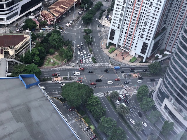 Intersection of Gil Puyat Avenue (formerly Buendia Avenue) and Ayala Avenue
 A view of the skyway in the distance
The view of the intersection gave some flashbacks to times when I was a student and a young researcher who had to find good vantage points for collecting traffic data particularly for intersections. Aside from the movements and the corresponding counts, the junction configuration can clearly be seen from the top and useful for developing models for analysis. There was a time when we coveted such views for traffic simulation. You can can install a camera so that you can record hours of footage to use for data extraction. The video recording also allowed one to revisit the footage in case there are questions regarding the data. The same videos can also be used for image processing for more automated, even intelligent or smart data collection using computers.
–
Central Luzon Link Expressway (CLLEx)
The recently opened Central Luzon Link Expressway (CLLEx) is a freeway spanning the provinces of Tarlac and Nueva Ecija towards the Cagayan Valley side of Luzon. With the ends at Tarlac City, Tarlac and San Jose City, Nueva Ecija, Phase 1 currently terminates at Aliaga town; connecting to the Guimba-Aliaga Road. That is 18 kilometers of the planned 30.7 kilometers of the first phase, which is to end at Cabanatuan City, Nueva Ecija. Here are some photos taken by colleagues as they traveled to Tuguegarao this weekend.
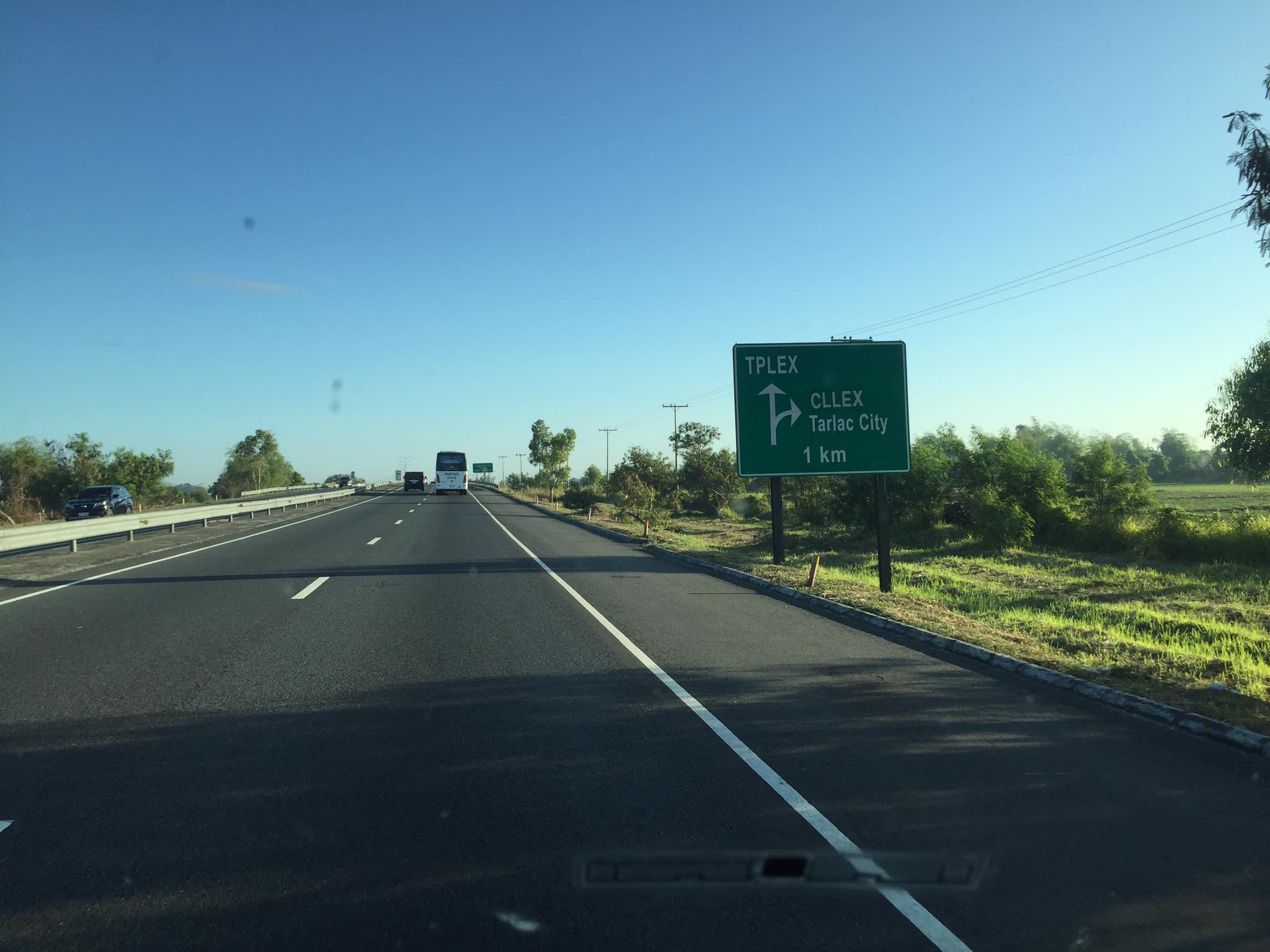 Section of SCTEX leading to the junction where the road branches to either the TPLEX or the CLLEx. SCTEX is a tollway operated by Metro Pacific via its Manila North Tollways Corp. while TPLEX is a tollway operated by San Miguel Corp. CLLEx is currently a freeway under the DPWH.
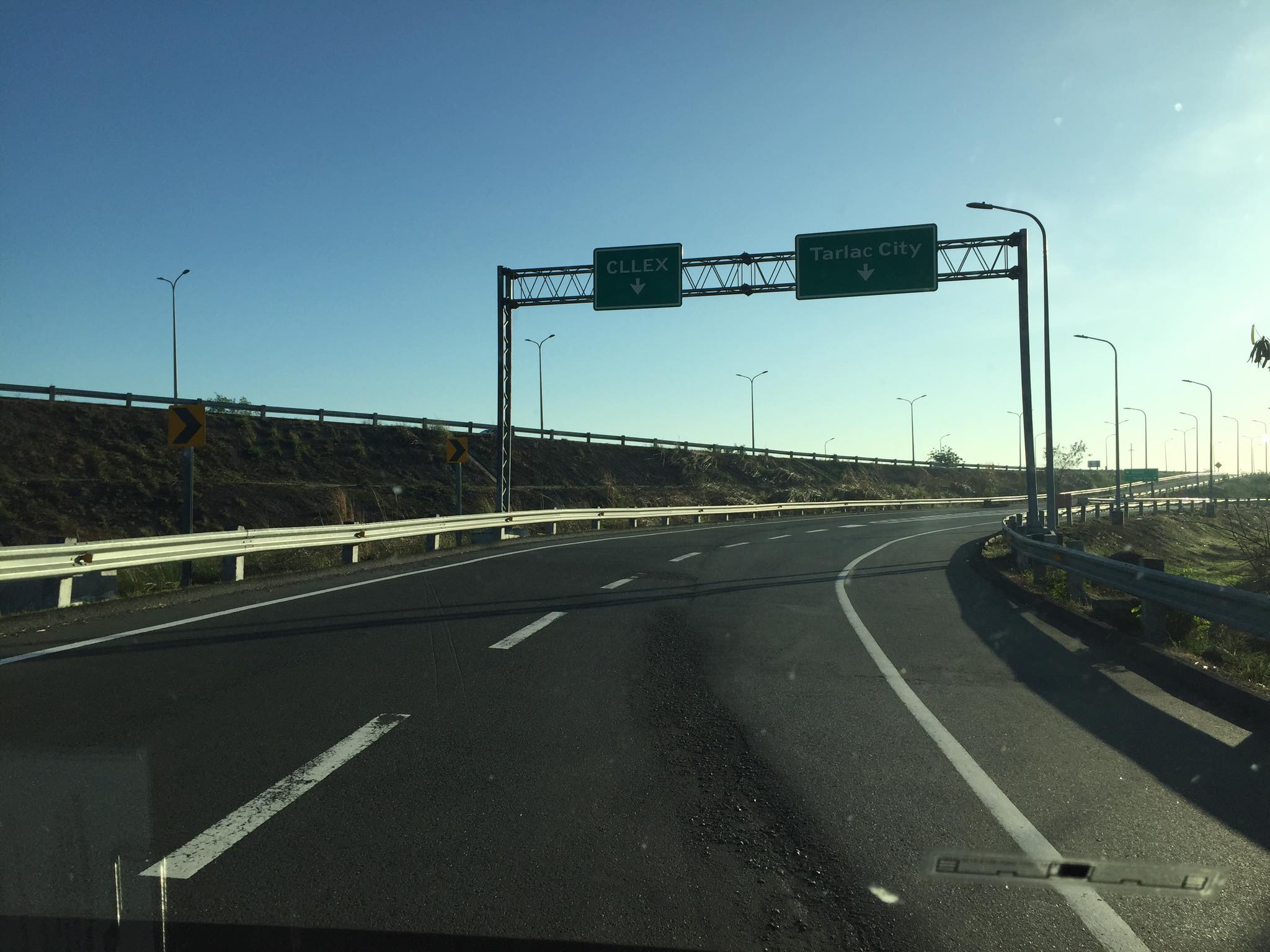 SCTEX off-ramps to CLLEx (left) or Tarlac City (right)
 The expressway currently has 2 lanes per direction plus shoulder along either direction. The median barrier is a post & rail semi-rigid structure.
 Many of the traffic signs have yet to be installed
 Not so much traffic along the freeway as shown in the photos. These were taken on a Sunday though and we wonder if there will be more vehicles during the weekdays.
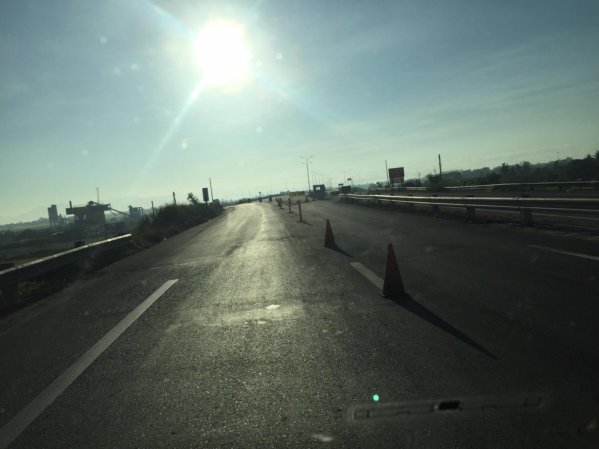 As the freeway is still uncompleted, the end section in Nueva Ecija is two lane-two way with only cones and bollards separating opposing traffic.
 Exit ramp towards the Guimba-Aliaga Road
There are no stops yet along the freeway. I am not aware if there is a timetable for it to become a tollway. Traffic is still quite low so perhaps making it a tollway will take some time as it might be difficult to have a profitable operation. It would be good to have it as a limited access freeway to establish demand and use for the road.
–
On addressing global warming
Here is another quick share of an article; this time on “warming”. The evidence for global warming is strong and we need to address this pressing issue if future generations are to survive a planet that is heating up fast.
Litman, T. (August 31, 2022) “Cool Planning for a Hotter Future,” Planetizen.com, https://www.planetizen.com/blogs/118535-cool-planning-hotter-future?utm_source=newswire&utm_medium=email&utm_campaign=news-09012022&mc_cid=ead7ee914a&mc_eid=9ccfe464b1 [Last accessed: 9/5/2022]
To quote:
“Many of these strategies provide significant co-benefits. For example, reducing road and parking supply with more efficient traffic and parking management helps reduce infrastructure costs and traffic problems, and by reducing impervious surface area it reduces stormwater management costs. Planting more urban shade trees helps create more attractive neighborhoods and increase wildlife habitat. Improving natural ventilation creates more comfortable and healthier buildings, as summarized below.”
I recall people calling for more trees to be planted along roads and how our city streets can become something like Orchard Road in Singapore. I agree with having more trees and other plants, landscaping, along our roads. I also lament the times (and it continues) when the DPWH chopped so many old trees along national roads for road widening projects that didn’t need to destroy so many that gave those roads shade as well as character. We need more change in mindsets particularly when we design highways and streets towards sustainability and yes- reducing heat.
–
