
Home » Posts tagged 'history'
Tag Archives: history
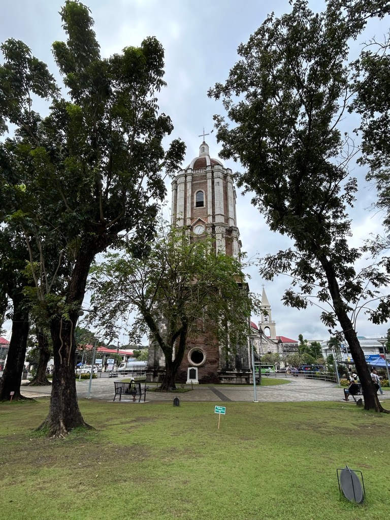
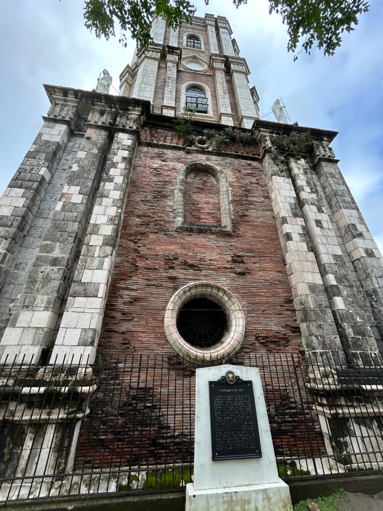
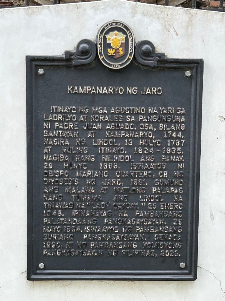
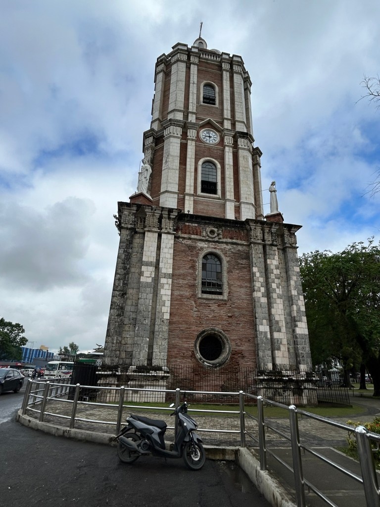
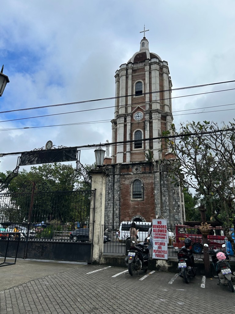
Landmarks: the Jaro Belltower
Here are some photos of a landmark in Iloilo that served as the reference for many jeepney routes. I recall from childhood that we rode the jeepney from Cabatuan and transferred here to another jeepney bound for city proper. Going home, we Di the reverse. We also hopped on a jeepney here to go to other towns like Leganes or farther districts of the city such as Molo or Arevalo. Of course, it’s different now after all the rerouting of public transport. Provincial jeepneys now terminate at the periphery of the city and no longer reach Jaro.
–
Reviving an old public transport option
There is some nostalgia about the first air-conditioned public transport mode in the Philippines (correct me if I’m wrong). The Love Bus, as it was called, was operated by the Metro Manila Transit Corporation (MMTC), which is a government owned and controlled corporation. There’s a lot about the MMTC that could be the subject of a series of articles but those are for other days. Suffice it to say here that MMTC provided several types of bus services using different bus models including double deckers. Their most popular though more expensive service is the air-conditioned Love Bus. I was able to take the Love Bus from Cubao to UP Diliman during its waning period of operations in the late 1980s. At the time, the buses entered the campus and I could get off at the nearest stop to Melchor Hall. Those buses terminated at Ateneo near the Blue Eagle Gym. Also, at the time, there were already smaller aircon buses but these were not branded as Love Bus.
I spotted the current incarnation of the Love Bus in the form of a “modernized jeepney.” Like other “modernized jeepneys,” the vehicle is actually a mini-bus. The vehicles are electric and run by Get COMET, a company that used to run an electric jeepney service along Katipunan Avenue. Sometime before the pandemic, they ceased operations. And so this is somewhat a shot at redemption. A comeback given the proliferation of “modernized jeepneys” of various models (many of which are not electric of hybrid).
 This revival of the Love Bus is an electric vehicle operated by GET, which is the company behind the COMET.
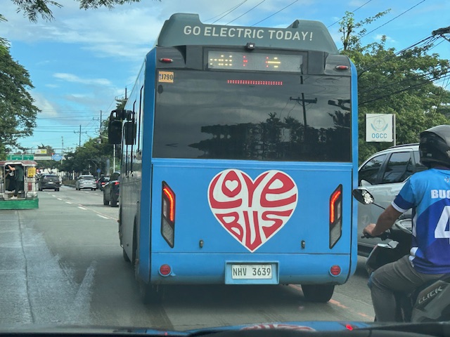 The livery is a throwback to the original Love Bus. They should have also included the “Save Gas” slogan that were in the original buses.
Will these buses stay in business? Will they help popularize public transport? The jury is still out there as currently they are few and there are many competing options along their route. Their presence though is very welcome and perhaps the nostalgia will translate into encouraging more people to take public transportation.
–
The mobile stores of my childhood days
I took a photo of this animal (cow) drawn cart as we passed it in Taytay en route to Makati via C-6. These used to be larger and wagons drawn by one or even two animals (usually cows or bulls). Families lived in those wagons and were somewhat nomadic in a sense that they traveled while selling products like walis tambo (brooms for indoor use like those in the photo), walis tingting (brooms made of coconut stems also in the photo to the rear of the cart), baskets, and other handicrafts. I have memories of their regular if not frequent visits to our village in Cainta in the 1970s and early 1980s. Eventually, they vanished. I see some from time to time but only like the one in the photo below. I have not seen the larger wagons.
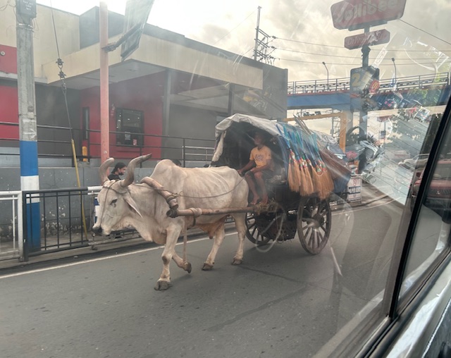 The cart was pulled by a bull that looked emaciated to me. I hope they’re able to feed this animal and care for it considering this is probably their most valuable asset.
While this seems like a spectacle these days, they were the mobile stores of the past; often traveling in groups. I wonder how long there will be animal-drawn carts like this.
–
On the future of transportation – some history lessons
I found this interesting article that basically is a history lesson on transportation systems and infrastructure:
Dillard, G. (October 21, 2024) “Our infrastructure is Not Our Destiny,” Medium.com, https://medium.com/the-new-climate/our-infrastructure-is-not-our-destiny-6d7f8355144a [Last accessed: 11/17/2024]
To quote from the article:
“We’ll never build out a network of electric-car charging stations, they say, or How could we possibly replace all of these highways with mass transit? But the infrastructure that dominates our world today once seemed impossible, until it didn’t…
As we begin to imagine a new way of organizing our economy, let’s remember that infrastructure isn’t destiny, nor is it forever. Today, our fossil-fuel present may feel like the only “practical” way to do things — just as the canals, and then the railroads, once felt like the only possibility.
So the next time a transition away from cars, fossil fuels, and the other technologies that dominate our world seems impossible, think about Hermon Bronson and Robert Fulton, who surely thought that canals were the infrastructure of the future. They were wrong, and so are the people who tell us that it’s impossible or impractical to build a greener world.”
Perhaps we can take a look at our transportation infrastructure development history and the way it’s going now. It would be good to contextualize all those planned tollways and inter-island bridges against what is really most urgent these days (i.e., mass transit, active transport for our rapidly growing cities). I’ve always stated here about how some infra are nice to have but aren’t as urgent as others that need more push and support and will be utilized by and benefit more than fewer people.
–
Old maps of Rizal Province
I found these two old maps of the Province of Rizal. I was trying to trace their sources but couldn’t find them yet. These were shared from social media pages.
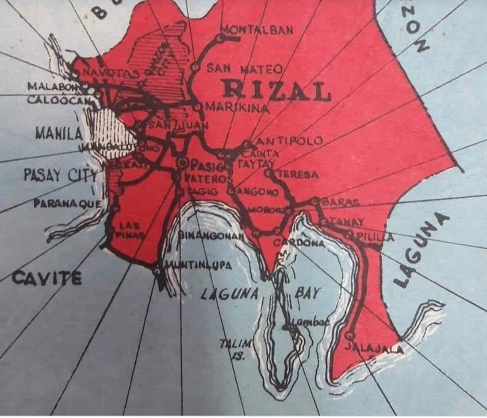
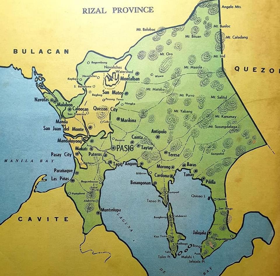
The second map clearly shows the Rizal towns that eventually became part of Metro Manila in the 1970s. These include Navotas, Malabon, Caloocan, Marikina, Pasig, Tagig, Mandaluyong, Makati, Pateros, Paranaque, Las Pinas and Muntinlupa. Pasig used to be the capital of the province; hence, Kapitolyo, which is still in Pasig. Note, too, that Caloocan was connected via a narrow strip between Quezon City and Bulacan. That part of Bulacan is the then town of Valenzuela that was also integrated with Metro Manila. I wrote about a ‘what if’ a while ago where politics would have been different in the province if it remained as it is before the creation of Metro Manila. History teaches us a lot of things including decisions made that led to how we are today. That certainly applies to transportation and definitely applies to politics if you come to think of it particularly for Rizal.
–
On mountain biking and its history
Here is another quick share of a rather informative and amusing article about cycling, particularly about mountain-biking:
Septer, Q. (June 29, 2024) “The Poetry of Cycling,” Medium.com, https://medium.com/the-new-outdoors/the-poetry-of-cycling-dffeb752b510 [Last accessed: 8/24/2024]
To quote from the article:
“Mountain biking continues to ascend in popularity. New trails are built. New records are set. New technologies are fine-tuned to the subtleties of the sport’s sub-disciplines. But the ethos of mountain biking hasn’t changed all that much since the days of the Buffalo Soldiers, more than a century ago, when folks simply wondered how far a bicycle might take them.”
–
A real battle of Katipunan – the search for a transportation solution
Is it obvious that I was alluding to the classic match-ups of the two major universities – Ateneo De Manila University and the University of the Philippines Diliman – that are located along Katipunan Avenue for the title of this article? That is deliberate on my part as there is a ‘real’ battle along Katipunan Avenue, and it does not involve sports.
Following is a recent article from the Philippine Collegian that reports on the current state of traffic along the corridor:
https://phkule.org/article/971/private-cars-mainly-to-blame-for-katipunan-traffic-transport-experts
I have written before and many times about transport and traffic along Katipunan Avenue. This road has been part of my daily commute since 1988 when I was admitted to UP Diliman as a B.S. Civil Engineering major. Back then Katipunan was not as wide as it is now, especially along the section between UP Diliman and the MWSS complex. That section only had 2 lanes then. What is not a wide center island with large, old acacia trees used to be the frontage of MWSS. So now you can probably imagine how much land was ceded by MWSS for road widening.
I also wanted to write about Katipunan in part as a sort of farewell to the former MMDA Chair and Marikina Mayor Bayani Fernando (BF), who recently passed away. Much of how Katipunan looks like and the traffic situation today can be traced to what transpired during his time at MMDA. I will refrain from writing about this and him for now. I am actually thinking of writing a series about BF and his time as Mayor in Marikina, as MMDA Chair, and his brief stint as DPWH Secretary. This short article will do for now.
Musings on rainy day commutes
I sympathize with a lot of people whose activities were disrupted by the inclement weather the past days. The rains from the other night and today resulted in floods around Metro Manila and Rizal (where I live). The forecast of more rains during the past days made government suspend classes at all levels for both public and private schools. However, many and particularly students have already traveled to their schools as some announcements came late or not early enough for those who usually leave home early to avoid the usual traffic congestion around schools.
I myself used to leave our home early to go to school. As I took public transportation to the university, I had to leave before 6:00 AM (even earlier if it was raining) to be able to get a jeepney ride and have a comfortable trip (shorter travel time than when I leave later in the morning). I had one transfer at what used to be the K-Mart terminal. Both legs of the trip were via jeepneys. I recall silently cursing the guards at Ateneo for prioritizing what seemed to be an infinite number of cars entering and exiting that university via their Gates 2 and 3. At the time, Ateneo still operated the blue school buses and you can see few students on those buses. I observed already then that most of their students probably had their own vehicles to take them to school. Once past the gauntlet of Ateneo and Miriam (which was Maryknoll before), traffic was smoother. And to think that there was no C.P. Garcia yet and Katipunan at the UP Diliman and MWSS areas was not as wide as it is now. The old Katipunan section was basically a two lane road with UP on one side and MWSS on the other. What is now a center island with large acacia trees used to be the frontage of MWSS. UP’s walls were lined with eateries and small stores catering to students and workers.
My commutes during the wet season can be quite difficult as you can’t simply hang on to the jeepney (at the back) when it’s pouring. And when the weather’s particularly bad, there were flooding along my route, not to mention where I resided. I also remember wading in floodwaters along Katipunan (yes, there were floods along Katipunan before) because the road was impassable to vehicles and the only way to get home was to walk from UP to Aurora Boulevard. Our home in Cainta was often flooded during typhoons, and I also waded in floodwaters along portions of Felix/Imelda Avenue an in our village. The flood experiences probably deserve separate articles here and I will share some stories as soon as I can organize my thoughts and memories of these. Of course, I will relate these to transportation as there were lots I learned from these experiences. The frustration though is that it seems we have yet to do in order to address climate’s and weather’s impacts on transportation.
–
Morning walks in Zamboanga City – Part 3
Part of our walks took us to Fort Pilar and the Shrine of Our Lady of the Pillar. The shrine is originally located within the walls of the Fort, which served as a refuge for citizens when the city was under attack during various times in history. It is near the Paseo so can easily be integrated in our morning walks.
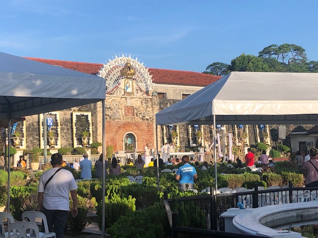 The Shrine of Our Lady of the Pillar is open/outdoors and there’s a daily early morning Mass
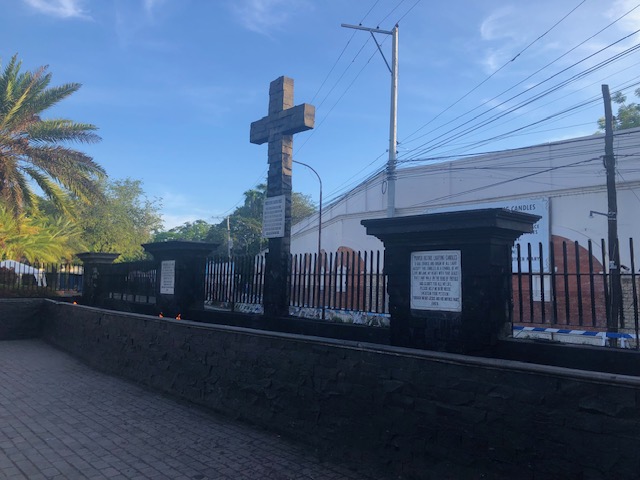 Instead of candle stands for prayer intentions, there is this trench set-up where you can put your candles and pray nearby.
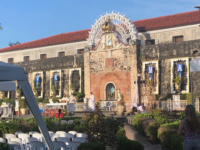 The main altar of the shrine apparently faces the sunrise
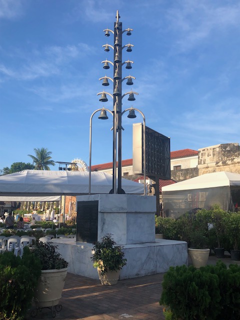 Bells at the shrine
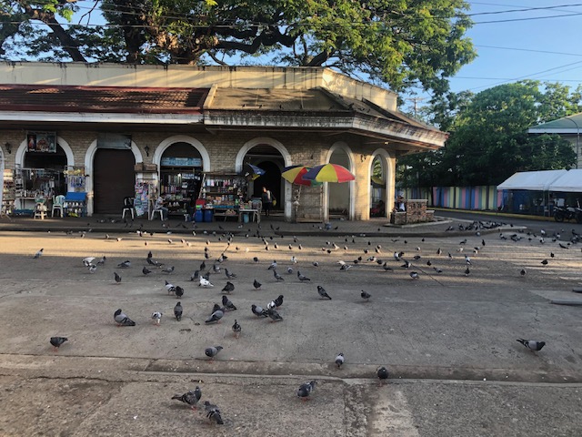 Pigeons just outside the shrine and near the souvenir shops just across from Fort Pilar
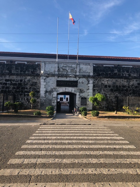 Entrance to Fort Pilar, which is administered by the National Museum of the Philippines
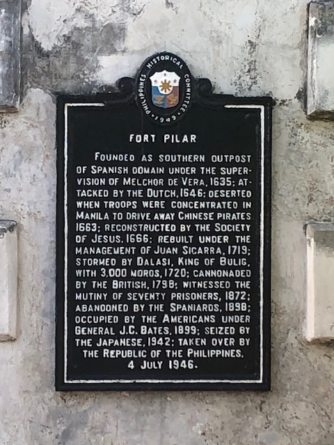 Plaque describing the fort and its history
More posts on walking in Zamboanga soon!
–
On San Francisco’s cable cars
Here a quick share of an article on San Francisco’s iconic cable cars:
Carren, D. (May 11, 2023) “Why SF cable cars are so iconic: a history,” The Bold Italic, https://thebolditalic.com/why-sf-cable-cars-are-so-iconic-a-history-895e30e50784 [Last accessed: 5/14/2023]
From the article:
“Though a scant remnant of what they once were, the three remaining lines are almost always packed with riders, running every 8 minutes for 16 hours a day, clanking along with a lurch’s awkward grace and an artful clattering. The crowd hangs tight to the handholds and the poles and their hats through hairpin turns, and a daring few lean out with one arm, wildly waving to signal all is still quite well.”
I have been to SF a few times and enjoyed using the cable cars among other modes to go around the city. In fact, in one of our stays in SF, we deliberately booked a hotel close to the end point of one of the lines so we can use it more frequently to go to downtown SF.
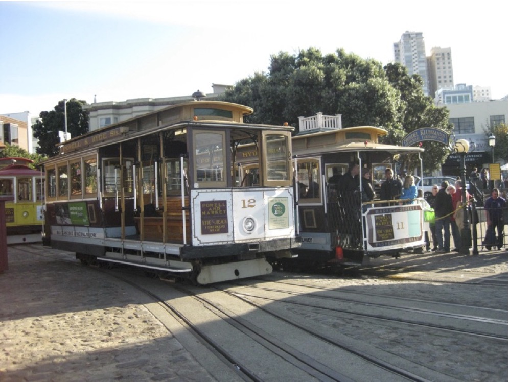 San Francisco’s cable cars at the Hyde Street turnabout ca. 2011.
–
