
Home » Posts tagged 'history' (Page 5)
Tag Archives: history
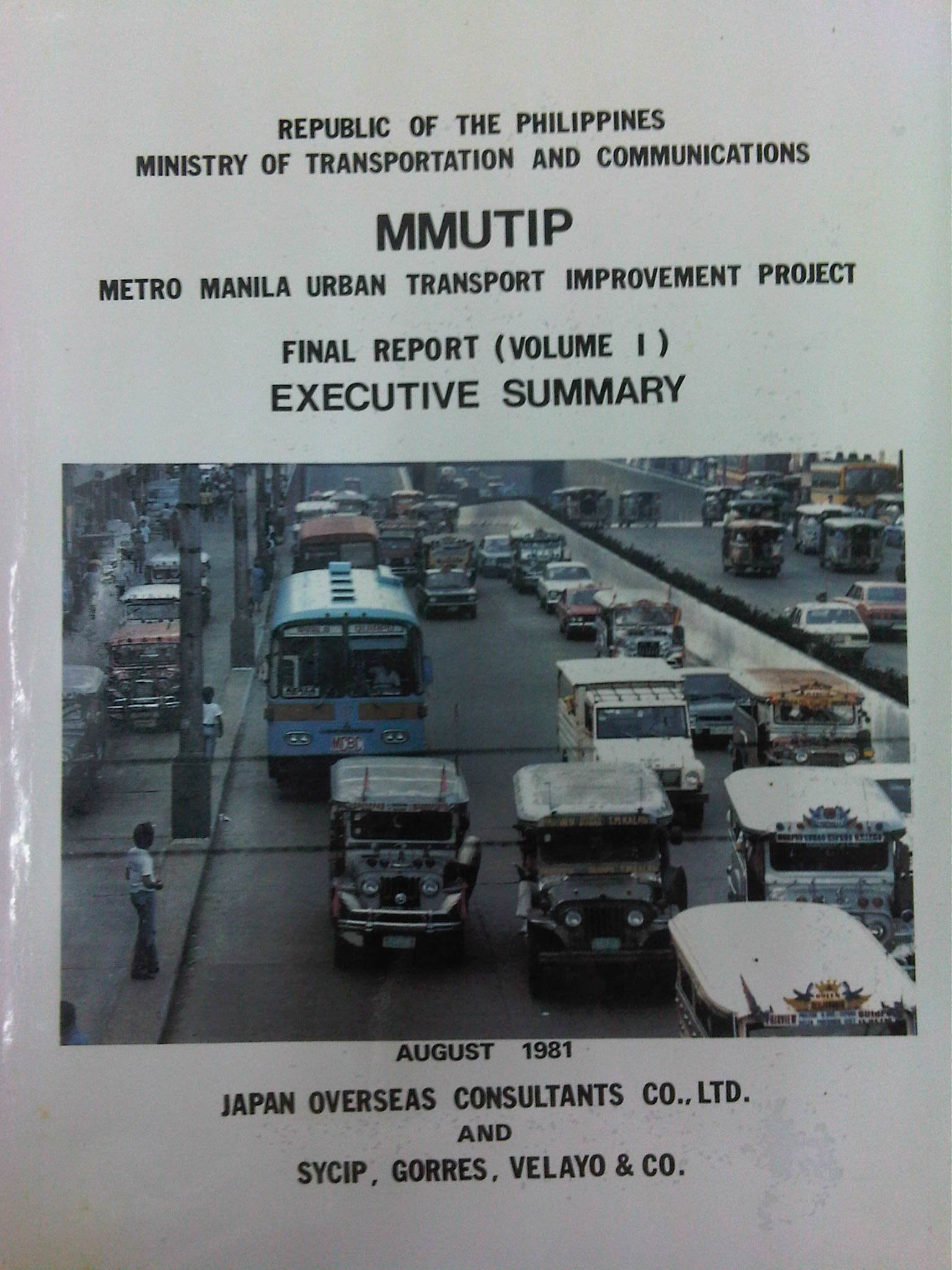
Metro Manila Urban Transport Improvement Project (MMUTIP, 1981)
[Important note: I have noticed that the material on this blog site has been used by certain people to further misinformation including revisionism to credit the Marcos dictatorship and put the blame on subsequent administrations (not that these also had failures of their own). This and other posts on past projects present the facts about the projects and contain minimal opinions, if any on the politics or political economy at the time and afterwards. Do your research and refrain from using the material on this page and others to promote misinformation. I suggest you go to the The Mass Transit System in Metro Manila site for more facts about railway development and history. I do not consent to the use of my articles for the purposes of misinformation and historical revisionism. 10/13/2019]
We continue with our historical features on transport with the Metro Manila Urban Transport Improvement Project (MMUTIP). MMUTIP was implemented from July 1980 to August 1981 with funding from the Overseas Economic Cooperation Fund (OECF) of Japan. MMUTIP recommended for a new franchising system to be adopted by the then Board of Transportation (BOT), with standards covering citizenship, route opening, operating performance and financial capability. It also called for the adoption of measures that will safeguard the integrity of franchise records and the speedy processing and better control of franchise applications. The BOT is the precursor of the Land Transportation Franchising and Regulatory Board (LTFRB).
Additional bus routes were identified by the study and recommended for 5,900 units for daily operations. The study estimated that as much as 1,870 additional units were required for Metro Manila. Meanwhile, the study found the operations of the Metro Manila Transit Corporation (MMTC), the government owned bus company, unprofitable and stated that the government-run company has failed to define objectives and policies particularly in specifying the extent to which MMTC will render public service at the sacrifice of profit (note that MMTC was losing money in part because it was serving missionary routes so as to reduce direct competition with the private companies). I think looking back now, this was perhaps the beginning of the end for MMTC. Some people say that we could probably have used something like the MMTC today to keep public transport operators honest in their operations and also to continue providing services for missionary routes rather than letting these be served by tricycles and jeepneys that will eventually would have to be granted franchises. As it is, such situations often lead to poorly planned transport services including the (mis)determination of the number of PUV units required to serve an area or corridor.
MMUTIP recommended for the control of entry and operation of jeepneys along major bus routes while at the same time calling for a deregulation of entry and operations outside major thoroughfares, which were served or are more suitable for buses. Further, the study called for encouraging tricycle services where bus and jeepney routes are scarce while also stating that these should be limited to local or feeder services. Then as now, tricycles are restricted from national roads.
[Note: A copy of MMUTIP may be found at the National Center for Transportation Studies (NCTS) Library located at their building along Apacible Street at the University of the Philippines Diliman. This is not a public library so access is limited to UP staff and students. Researchers and others from outside UP would have to write to the Director for permission to use the library and its holdings.]
–
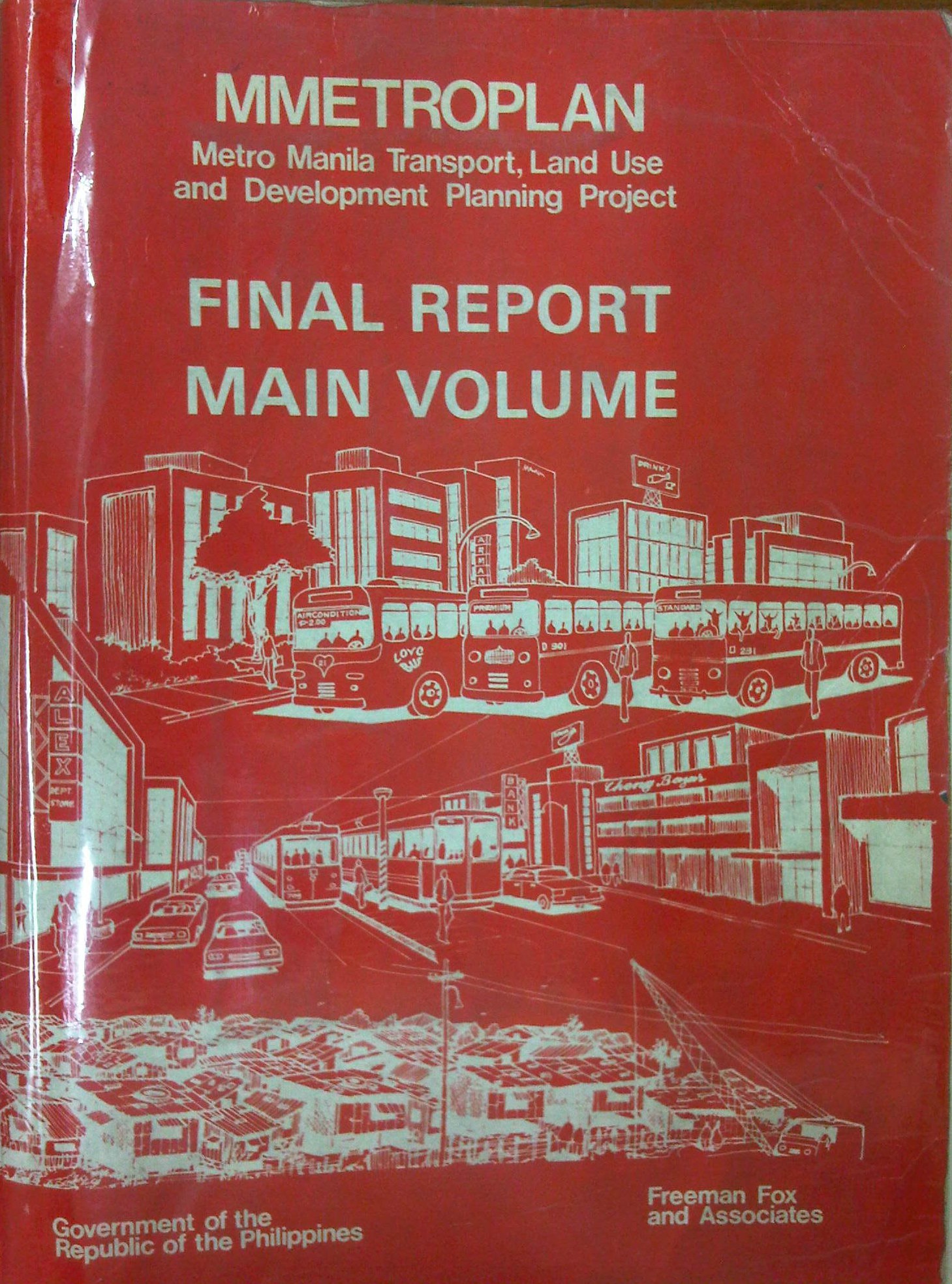
Metro Manila Transport, Land Use and Development Planning Project (MMETROPLAN, 1977)
[Important note: I have noticed that the material on this blog site has been used by certain people to further misinformation including revisionism to credit the Marcos dictatorship and put the blame on subsequent administrations (not that these also had failures of their own). This and other posts on past projects present the facts about the projects and contain minimal opinions, if any on the politics or political economy at the time and afterwards. Do your research and refrain from using the material on this page and others to promote misinformation. I suggest you go to the The Mass Transit System in Metro Manila site for more facts about railway development and history. I do not consent to the use of my articles for the purposes of misinformation and historical revisionism. 10/13/2019]
In a previous article, I had written about the Urban Transport Study for the Manila Metropolitan Area (UTSMMA), which was completed in 1973 and proposed, among others, a rapid rail transit network for Metro Manila. The government proceeded to undertake a feasibility study for the first line of that network almost immediately afterwards. However, something happened a few years later that effectively contradicted UTSMMA’s recommendations and, from what the documents available to us now suggest, effectively doomed the future of transport in Metro Manila.
The Metro Manila Transport, Land Use and Development Planning Project (MMETROPLAN) was implemented from January 1976 to February 1977. It was apparently commissioned by the Philippine Government, and funded by the World Bank, which commissioned the precursor of Halcrow Fox to do the study with a steering group comprised of senior government official dealing with transport at the time.
The MMETROPLAN project team is shown in the photo below. Note the inclusion of some familiar names particularly from the DPWH and DOTC who were then with what was the Department of Public Works, Transportation and Communications (DPWTC) and Department of Public Highways (DPH) before these were reorganised. Note, too, a familiar name under Planning, who is very much active today with his own advocacies.

The study is more expansive in terms of scope as it included components on land use and development planning for Metro Manila. It identified three main strategies to address issues on traffic congestion and public transport requirements, namely:
- Cordon pricing,
- Bus lanes, and
- LRT
Short-term recommendations focused on bus and jeepney operations, recommending that:
- Standard buses (non-airconditioned) be designed for more standing passengers and charge a fare affordable by the poor;
- Premium buses (including Love Bus) be designed for seated passengers and charge a higher fare; this may be used to cross-subsidize Standard bus operations;
- Metro Manila Transit Corporation (MMTC) bus operations should not be further expanded:
- MMTC buses should operate missionary routes, which are generally unprofitable routes.
- There should be no arbitrary exemption on franchises like in the case of MMTC.
- In reference to private bus companies, the project states that “properly regulated competition” provides best course of action for the foreseeable future;
- Jeepneys are suited for low demand but high frequency service
MMETROPLAN also touched on the route structure for road public transport. However, its most far-reaching recommendations on road public transport concern the issuance of franchises for buses and jeepneys. The study recommended that franchises should be issued for a period of a few years instead of 25 years and to define a minimum LOS. The study cautioned against arbitrary restrictions on franchises for buses at the time while mentioning that there were already restrictions for jeepneys. MMETROPLAN further recommended the encouraging of small operators for both jeepneys and buses.
However, MMETROPLAN deviated from the recommendations of UTSMMA in that it struck down the proposal and plans for the Rapid Transit Rail (RTR) network for Metro Manila. The long-term recommendations and conclusions of the study show these and one particular recommendation that probably doomed heavy rail transport and the RTR network is quoted below:
“Heavy Rapid Transit (HRT) would provide public transport passengers with much faster journey, but by 1990 would attract only 2.5% of motorists and would have negligible impact on traffic congestion. Partly because of this and partly because of its very high capital cost, it would be hopelessly uneconomic: the annualized capital costs would be higher than the estimated benefits in 1990…passenger flows are not high enough to exploit its full capacity…and the large savings in time for public transport passengers are not given a high value in Manila, and are not high enough to persuade motorists to change mode.
These results are conclusive, and are unlikely to be changed by any circumstances or reasonable assumptions…it is clear that any other fully segregated public transport system, whether light rail or busway, would also be uneconomic. As such systems would require the appropriation of most, if not all, of the available funds for all transport (including highways) in Metro Manila for the foreseeable future, and as there is not other rationale for their implementation, they have been rejected from further consideration.” (MMETROPLAN, 1977)
The study also did not have good words for the PNR as it concluded that its “routes related poorly to the major demands for movement” and that it would be expensive to improve the PNR at the time. PNR costs were compared to buses and jeepneys with the further concluded that these road transport modes are preferred over an upgraded PNR.
MMETROPLAN assessed the LRT vs. the Monorail in the context of cordon pricing and bus lane strategies. While the monorail was dismissed for reasons that included few monorail systems operating at the time, the study recommended for an LRT along Rizal Avenue, which was considered feasible. These conclusions and recommendations by MMETROPLAN would eventually have far-reaching impacts on Metro Manila’s transport system and the study would be among the most cited in discussions and future planning where land use and transport are discussed in the same light.
For land use planning, the report also provides us with a history of land use planning for Metro Manila, which we can now compare with what actually happened. That is, if the plans made back in the 1970’s were actually implemented and to what extent were they realised. Many of these plans remain controversial to this day and are often invoked whenever there is talk about the perennial flooding and the spectre of earthquakes threatening much of Metro Manila and its surrounding areas in addition to other issues like the transport and traffic problems experienced around what has become a megalopolis.
[Reference: MMETROPLAN, 1977 – NCTS Library]
But what could have influenced the MMETROPLAN study team and government officials to debunk UTSMMA? Why the “about-face” for something that seems to be the JICA Dream Plan circa 1970’s? UTSMMA and the rail rapid transit network, after all, was the product of a vision for future Metropolitan Manila transport by a visionary professor from the University of Tokyo – one Dr. Takashi Inouye of that university’s Department of Urban Engineering. I think the next article will provide us with the answers to these questions regarding the turnaround. Abangan!
–
Urban Transport Study in Manila Metropolitan Area (UTSMMA, 1973)
[Important note: I have noticed that the material on this blog site has been used by certain people to further misinformation including revisionism to credit the Marcos dictatorship and put the blame on subsequent administrations (not that these also had failures of their own). This and other posts on past projects present the facts about the projects and contain minimal opinions, if any on the politics or political economy at the time and afterwards. Do your research and refrain from using the material on this page and others to promote misinformation. I suggest you go to the The Mass Transit System in Metro Manila site for more facts about railway development and history. I do not consent to the use of my articles for the purposes of misinformation and historical revisionism. 10/13/2019]
With the recent approval of JICA’s Dream Plan for Mega Manila, I thought it was timely to look back at similar plans developed for Metro Manila and its surrounding areas. At the time these plans were made, I guess they were all regarded as “dream plans” in their own ways. Let us start with what is probably the original dream plan, the Urban Transport Study in Manila Metropolitan Area (UTSMMA, 1973). The project was implemented from March 1971 to September 1973 with the assistance of the Government of Japan’s Overseas Technical Cooperation Agency (OTCA), the precursor of today’s Japan International Cooperation Agency (JICA). Being the first comprehensive study for a metropolitan area that was yet to be formally consolidated and called Metro Manila, UTSMMA set the stage for future transport studies for the metropolis. Among the study’s main recommendations is one proposing for a mass transit system restricted to railways. A Rapid Transit Railway (RTR) network was recommended in the form of subways in the inner area bound by EDSA, and elevated in the suburban areas. Brief descriptions of the proposed lines are as follows:
- Line 1 (27.1 km) – from Construction Hill to Talon via central Quezon Boulevard, Manila downtown and the International Airport
- Line 2 (36.0 km) – from Novaliches to Cainta via Manila downtown and Pasig
- Line 3 (24.3 km) – Along Highway 54 (C-4): half a circle route about 12 km from Manila downtown
- Line 4 (30.1 km) – From Marikina to Zapote via Cubao, Manila downtown and the Manila Bay area
- Line 5 (17.6 km) – From Meycauayan to Manila downtown running between Line No. 2 and PNR
- PNR improvement (56.4 km) – From Bocaue to Muntinglupa via Tutuban Station
The following that was posted here before in another article shows a map illustrating the recommended RTR network for the Manila Metropolitan area. (Note that the map was enhanced from the original black and white to clearly show the proposed lines back then.)  UTSMMA also recognized the important roles of buses and jeepneys in the future, and recommended that these be used for feeder services once the rail systems have been constructed and operational. As a result of the study, a Feasibility Study for the Manila Rapid Transit Railway Line No. 1 was conducted and completed in June 1976. The study, which was supported by JICA, noted that “the implementation should be initiated immediately” in light of the estimated heavy traffic demand along the corridor. This project could have been the first major transport project for Metro Manila if it had been implemented. Unfortunately, despite a favorable assessment in this study, the proposed RTR Line 1 was not implemented after a contrary assessment by a subsequent study, MMETROPLAN, which is discussed in the succeeding section of this report. The estimated costs of construction of recommended transport infrastructure were provided in the Final Report of the study including indicative costs and benefits of proposed urban expressways and urban rapid transit railways. [Reference: UTSMMA, 1973 – NCTS Library] Whenever I go back to UTSMMA and the network of proposed railway lines, I can’t help but wonder what could have been one of the more efficient transport systems in Asia or even in the world. What happened? Why was this plan not realised? The answer may be found in the next big study conducted for Metro Manila that also included in much detail its land use and development plans. Next: MMETROPLAN, 1977 –
Daang Bakal and Antipolo’s attractions
I recently wrote about the old railway line that used to run between Manila and Antipolo via a route passing through the town of Cainta that used what was probably the gentlest slope at the time – through what is now Valley Golf, Victoria Valley and Fairmont Subdivisions. Here are some more photos along Daang Bakal, the old Manila Rail Road line that is now a road.
 Daang Bakal is a scenic route and one can only imagine how this place looked like when it was still a railway line and the areas along it were still undeveloped.
 Hinulugang Taktak has been designated as a National Park and the areas along Daang Bakal at least have been preserved. Users of this road are quite limited to residents of exclusive subdivisions with gates along the road and trips generated by the Immaculate Heart Parish near the Fairmont gate. Public transportation is provided by tricycles that have a terminal at the intersection of Daang Bakal and Taktak Road.
 The temporary fence that was made out of tarpaulin material is now in tatters. There is road construction work ongoing though but mainly for the access roads connecting to Pinagmisahan. The concreted area at the right side of the road in the photo seems to be for parking rather than road widening. Traffic is low along Daang Bakal and will probably not require road widening for the foreseeable future.
 The main entrance and facilities for Hinulugang Taktak are still closed and there seems to be no activity to indicate that the rehabilitation project is not moving at all.
–
Daang Bakal
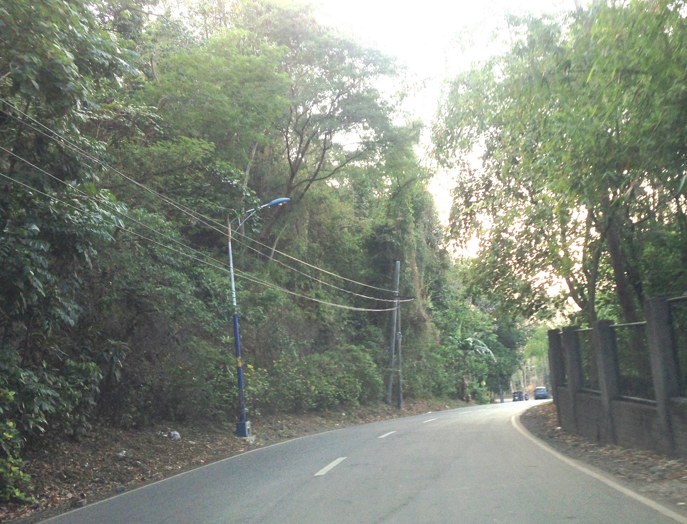
The right of way for the old railroad line going up to Antipolo is still there and is now a regular road. Daang Bakal rises from what is now Valley Golf Subdivision (Celso Tuazon Ave. and Taktak Drive) in Cainta, Rizal through Victoria Valley Subdivision (Taktak Drive), Fairmount Hills Subdivision and Hinulugang Taktak (Daang Bakal though often referred to as Taktak Road, which is actually a different road and on the other side of the river), and until part of the Sumulong Memorial Circle in the vicinity of the Antipolo Church (Shrine of Our Lady of Peace and Good Voyage). I took a few photos of Daang Bakal on our way to the Parish of the Immaculate Heart of Mary for Palm Sunday Mass. The photos have been modified as I took it at dusk. The originals were quite dark so I adjusted the brightness. Still, I can only imagine now how this route could have looked like back in the day when the Manila Rail Road line passed through this area. It could have been one of the most scenic rides as it is still a scenic route today.


At right in the photos is a fenced property designating the Hinulugang Taktak National Park. Hinulugang Taktak refers to the water falls that used to be one of the more popular destinations in Antipolo. There is actually a popular folk song inviting people to come to Antipolo (“Tayo na sa Antipolo at doon maligo tayo…”) to enjoy the falls. The falls have deteriorated through the years as it has been affected mainly by the settlements around it. There seems to be an effort to rehabilitate the area but it is still closed to the public. The road though is in excellent condition and has low motor traffic volumes. It is popular among cyclists as well as joggers. This Holy Week, the area should have a lot of visitors because of the Parish church in the area, which has an impressive architecture and gardens. The church is perfect for those doing Visita Iglesia or perhaps people just wanting to go to a quiet place for some meditation and prayer.
–
Is it “Commonwealth” or “Commondeath” Avenue?
There is an excellent article appearing today in the Philippine Star written by Arch. Paulo Alcazaren aptly titled “‘Commondeath’ Avenue.” I stumbled on when it was shared by a friend, Dr. Dayo Montalbo, who is a faculty member of the UP School of Urban and Regional Planning. It provides a rare insight into the history of our highways and streets in Metro Manila. It is required reading for planners and engineers with backgrounds in civil engineering, architecture, urban planning, etc., and, I must say, for anyone who can appreciate history and how we seem to not have learned (or refused to learn) from it. It certainly should be required reading for students who want to become future planners and engineers.
When the MMDA “discovered” plans where it was indicated how wide the RROW for Commonwealth should be and started acquiring land left and right from those who were supposed to have been encroaching on the avenue, including UP Diliman, it apparently didn’t study the old plans and the context by which the capitol, Commonwealth, UP and other institutions where laid out back in the day. That interpretation translated into what we see now as probably the widest highway in the country.
I see the article as something that can be used by the DPWH and the MMDA as an input to whatever planning or engineering they plan along Commonwealth. The avenue is just too wide and definitely not friendly to people. Perhaps it should be transformed into the parkway it was meant to be in the first place.
