
Home » Posts tagged 'Katipunan'
Tag Archives: Katipunan
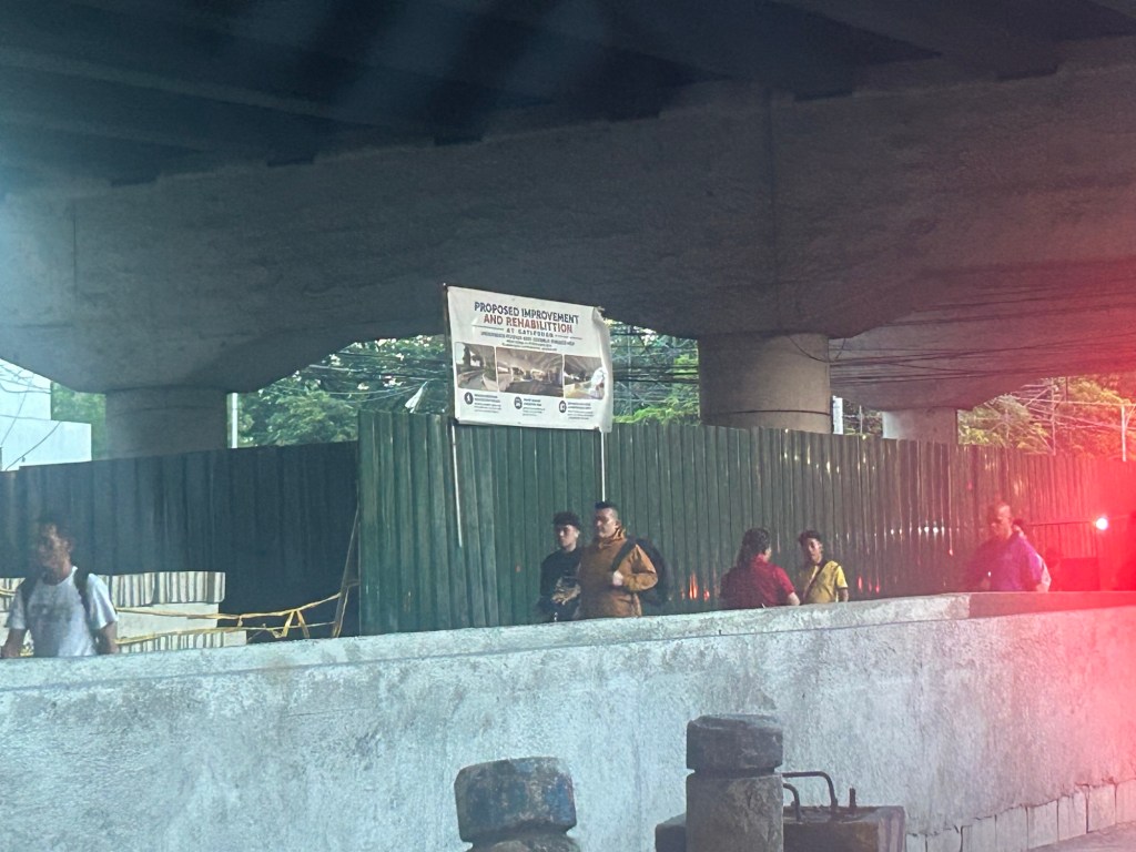
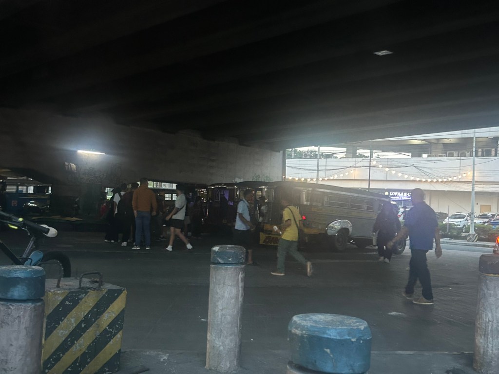
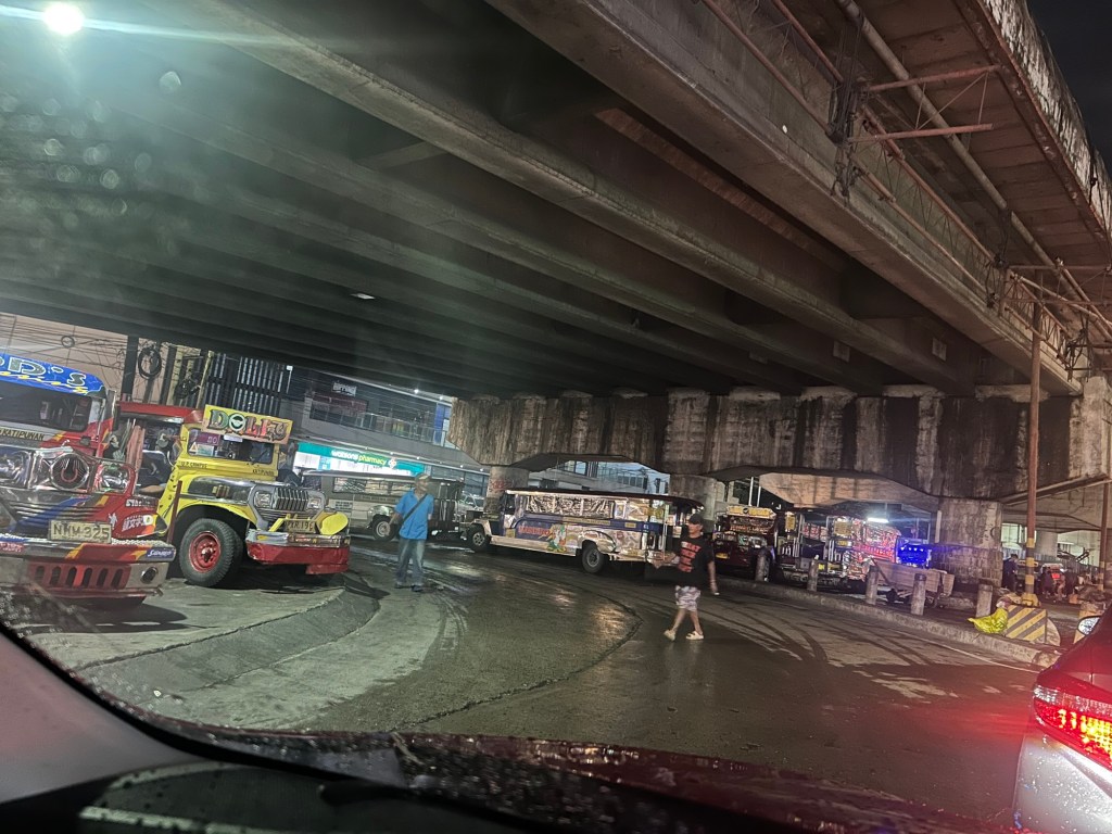
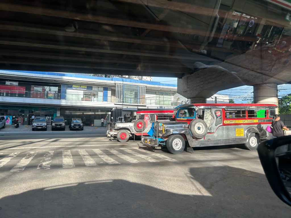
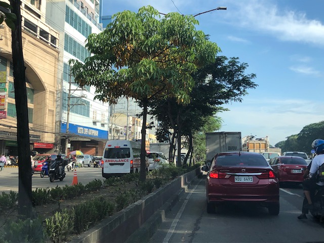
Updates on the Katipunan jeepney terminal
Here are some photos I took while waiting for the green light
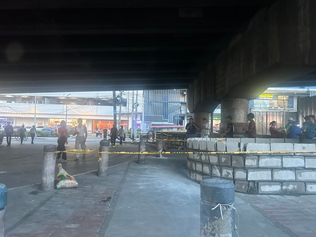
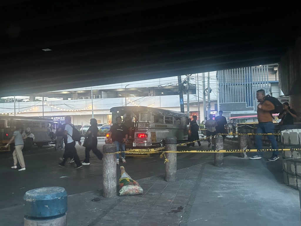
The bottom line is that the terminal will not be completely displaced. Jeepney parking spaces though have been reduced. I wonder where the other jeepneys spend their idle time considering not all Katipunan jeepneys are allowed entry to the UP Diliman campus.
–
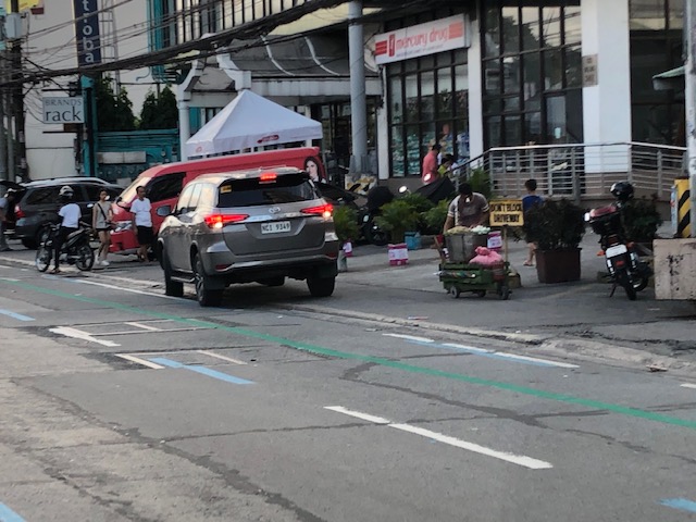
On the Katipunan jeepney terminal
The Katipunan jeepney terminal under the Katipunan-Aurora flyover is still there. I read some social media posts saying otherwise and that it was removed due to a greening project by the MMDA. As this was along my regular commute, it was easy to check the situation there.
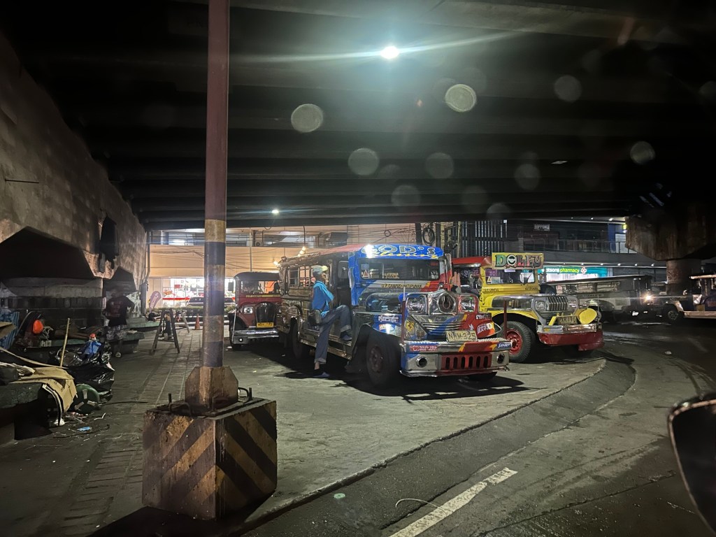
Business is as usual at the terminal. What are now subject to some construction work are the bicycle parking and plant boxes under the flyover that are close to the terminal.
–
Congested Katipunan again
During the Christmas break, we were reminded just how Katipunan Avenue can be congested due to the trips generated by the institutions along it. These are mainly the schools such as Ateneo, Miriam and UP. Based on my observations and experiences over the past decades though (I started attending UP in the late 1980s), the main culprit is Ateneo with all the private vehicles it generates for its students in all levels (Grade School, High School and College).
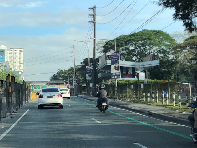
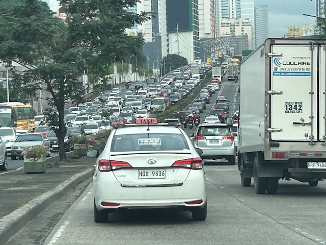 What “normal” traffic looks like on a typical weekday along Katipunan Avenue
My commute during the break is usually under 1 hour (e.g,, 40-50 minutes). But during the times when there’s school, it’s always more than an hour (e.g., 75 to 105 minutes). Will the situation improve? Will there be a mass transit system along C-5 to alleviate the traffic conditions? We can probably hope so but it doesn’t seem to be in the near horizon right now. The Metro Manila subway, after all, is expected to be operational in the 2030s!
–
Still on the Katipunan zipper lane
I’ve occasionally arrived at Katipunan with the experimental zipper lane still in use. I usually take Major Dizon from Marcos Highway in order to have a chance of using the zipper lane. That is, I take the left-most lane of C5 so I am in a good position in case the lane was available when I get to the Ateneo area. Perhaps it is already assumed that the right most lanes are already dedicated to vehicles bound for Ateneo or Miriam (mostly Ateneo I suppose).
So far, I’ve been able to use the zipper lane only once. On the other times, I stay on the left-most lane (beside the island) of Katipunan/C5. The zipper is relatively short as vehicles return to the correct side of the road at Ateneo Gate 3. The merging there means slower movement of both the zipper lane and the median lane traffic. So is the zipper lane a success? I would say the experiment is just above “marginal success” (or pasang awa) given its limited application. It doesn’t hurt to implement the scheme as traffic along the southbound side of Katipunan is generally light anyway.
–
A real battle of Katipunan – the search for a transportation solution
Is it obvious that I was alluding to the classic match-ups of the two major universities – Ateneo De Manila University and the University of the Philippines Diliman – that are located along Katipunan Avenue for the title of this article? That is deliberate on my part as there is a ‘real’ battle along Katipunan Avenue, and it does not involve sports.
Following is a recent article from the Philippine Collegian that reports on the current state of traffic along the corridor:
https://phkule.org/article/971/private-cars-mainly-to-blame-for-katipunan-traffic-transport-experts
I have written before and many times about transport and traffic along Katipunan Avenue. This road has been part of my daily commute since 1988 when I was admitted to UP Diliman as a B.S. Civil Engineering major. Back then Katipunan was not as wide as it is now, especially along the section between UP Diliman and the MWSS complex. That section only had 2 lanes then. What is not a wide center island with large, old acacia trees used to be the frontage of MWSS. So now you can probably imagine how much land was ceded by MWSS for road widening.
I also wanted to write about Katipunan in part as a sort of farewell to the former MMDA Chair and Marikina Mayor Bayani Fernando (BF), who recently passed away. Much of how Katipunan looks like and the traffic situation today can be traced to what transpired during his time at MMDA. I will refrain from writing about this and him for now. I am actually thinking of writing a series about BF and his time as Mayor in Marikina, as MMDA Chair, and his brief stint as DPWH Secretary. This short article will do for now.
A zipper lane along Katipunan?
Yesterday, the Metro Manila Development Authority (MMDA) started another experiment along Katipunan Avenue in Quezon City. They introduced a zipper lane along the stretch fronting Ateneo’s Gate 2 and Miriam College’s main gate (about 740m – less than a kilometer). This single lane was supposed to ease traffic congestion along the northbound direction of Katipunan (aka Circumferential Road 5 or C5 or Pres. C.P. Garcia Avenue), which is saturated with vehicles especially during the morning peak.
While we wait for the official pronouncements regarding this experiment, the impacts are likely to be marginal as the original northbound lanes are jammed with vehicles. Thus, there is a tendency for the entry to the zipper lane to be blocked. MMDA staff will also have to stop vehicles at the exit if they will allow the movement of left-turning and U-turning vehicles at the junction with B. Gonzales and Miriam’s main gate. While it may seem an exercise in futility, we have to appreciate the continuing effort of MMDA for such schemes. The bottomline though is the MMDA has limited options to address the hellish traffic along Katipunan. The schools and other establishments would need to put their heads together to formulate a more sustainable solution for this corridor.

The return of carmaggedon and the illusion of low vehicle ownership
Traffic seems to be back to pre-pandemic levels in the Metro Manila and its adjacent provinces. You can experience this along major roads like Commonwealth Avenue, C-5 and yes, EDSA. The number of vehicles on the roads including motorcycles defy what is supposed to be low motor vehicle ownership in Metro Manila (as claimed by DOTr and JICA in the MUCEP report and echoed by groups who cite the report as if it is flawless).
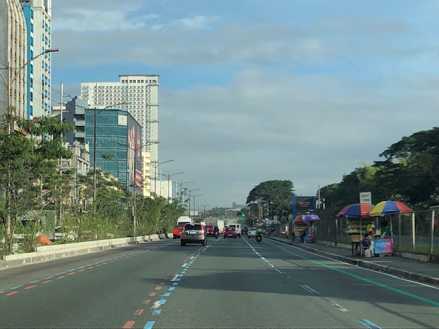
 Intense traffic congestion along C5/Katipunan Avenue. The photo shows traffic on the C5/Katipunan flyover’s northbound side and towards the direction of Ateneo, Miriam and UP Diliman.
The reality appears to be that more households actually own motor vehicles and the inefficiencies and unattractiveness of public transport continues to convince people to take private transportation, including motorcycles, over public transport options. The inconvenient truth according to one senior transport expert is that while cycling has gained ground, the numbers are minuscule compared with those taking either private or public motorized transport. Yes, carmaggedon is back and looks here to stay for a while longer until the so-called game changers like the MM subway and Line 7 are operational. Will they change the commuting behavior or are these too late in as far as solutions are concerned?
–
Katipunan bike lanes?
Here are photos of the bike lanes along Katipunan Avenue (Circumferential Road 5). The lanes are basically just marked with a solid green line but without any signs or pavement markings reinforcing this designation. The lanes are not protected ones like the example along the eastbound bike lane along Julia Vargas Avenue in Pasig City. And so, as expected, there are many motor vehicles encroaching upon the Katipunan bike lane including parked or standing vehicles as shown in one of the photos below.
 The bike lane is derived from the outermost lane of Katipunan
 Here is the bike lane along the southbound side of Katipunan at the approach to Tuazon Avenue. That’s a pedicab on the bike lane so one can easily appreciate the dimensions particularly the width of the lane.
 Bike lane along the northbound side of Katipunan approaching Ateneo’s Gate 2
 The bike lane along with the designated truck lane and motorcycle lane.
 Here are cyclists using the lane past Ateneo’s Gate 3 and approaching the main gate of Miriam College
I’ll try to sketch a few recommendations into the photos as I have done in a past article:
On the Pasig HOV lane experiment
This can also be used for exercises I assign to my graduate and undergraduate classes when we’re on the topic of complete streets.
–
Addressing congestion due to school traffic congestion
There are two important traffic news stories yesterday:
- MMDA successfully clears parked vehicles outside La Salle Greenhills
- MMDA sets drop off, pick-up points for Ateneo students
For some reason that’s a bit surprising for many, the MMDA seems to have solved two of the most enduring issues on traffic congestion along two major thoroughfares. LSGH is along Ortigas Avenue while Ateneo is along Katipunan Avenue (C-5). Both have high trip generation rates and a significant percentage of their trip gen is comprised of private vehicles. While, Ateneo’s trip generation has led to traffic congestion due to the sheer number of trips the university attracts, the congestion due to La Salle is due to the poor traffic management and lack of parking spaces for vehicles attracted by the school.
I only wonder why it took so much time to address these problems considering the solutions mentioned in the articles are basically ones that could have been implemented years ago. In the case of La Salle, good old fashioned traffic enforcement apparently did the trick. But then, the MMDA even with the LGU constraint could have been stricter before whether when they were under Bayani Fernando (BF) or any of his successors as MMDA Chair. With Ateneo, the scheme is very similar if not the same as what BF proposed over a decade ago when he was MMDA Chair. At that time though a touchy issue was the U-turn scheme he installed along Katipunan that cost trees and the former service road on the west side of the avenue. We can only hope that these claimed ‘successes’ will be sustained and ensure smoother flow of traffic along the major roads they directly affect.
–
Will a flyover at Katipunan-C.P. Garcia solve the traffic problem in the area?
I read a news article about the proposal by the Department of Public Works and Highways (DPWH) to construct a left-turn flyover at the intersection of Katipunan Avenue (C5) and C.P. Garcia Avenue in Quezon City. The flyover is supposed to be for vehicles turning left from the northbound side of Katipunan to C.P. Garcia Ave., which goes through the University of the Philippines Diliman
Will the flyover solve the traffic congestion problem in the area, particularly at the intersection and Katipunan in general? I would say no, it would not solve the congestion problem both for the intersection and for Katipunan. This assessment is due to the following reasons:
- The overpass does not address the root cause of congestion in the area, which is trip generation related. There are many major trip generators along Katipunan alone including three major schools (UP, Ateneo and Miriam) and a mall (UP Town Center). Add to this the traffic generated by the high density residential developments along Katipunan (notice the high rise condominiums lining up across Ateneo and Miriam?) and the through traffic coming from various areas that use C5’s Katipunan section.
- Congestion is caused by saturated intersections corresponding to Ateneo Gate 3 and main gate of Miriam College. Traffic going in and out of these schools are favored over through traffic along C5 resulting in congestion in the area. Perhaps it would be more appropriate to build overpasses to bypass these intersections.
- Congestion is caused by vehicles bound for and coming from the UP Town Center. The congestion due to traffic generated by the commercial development is actually alarming considering it is not yet completed and trips attracted and produced is not yet at full potential.
- The heaviest flows at the Katipunan-C.P. Garcia intersection are along Katipunan (northbound and southbound through traffic). Logic and traffic engineering principles point to grade separation to be more appropriate for such traffic and NOT for the left turn movement. A flyover should also be able to bypass UP Town Center as vehicles bound for the mall already blocks traffic along both sides of Katipunan and directly affects the intersection.
I think the DPWH should do well to re-assess their proposal along the lines of the reasons I have listed here rather than continue with the folly of building a left turn overpass alone. UP Diliman should also resist this overpass as, based on the news article, it would mean UP giving up some 8,000 square meters of its property for the project. UP already has given a lot for widening C.P. Garcia but that goes without saying that a through flyover might also require UP to give up property and particularly from its National Science Complex for such a project.
–
