
Home » Posts tagged 'landmarks'
Tag Archives: landmarks
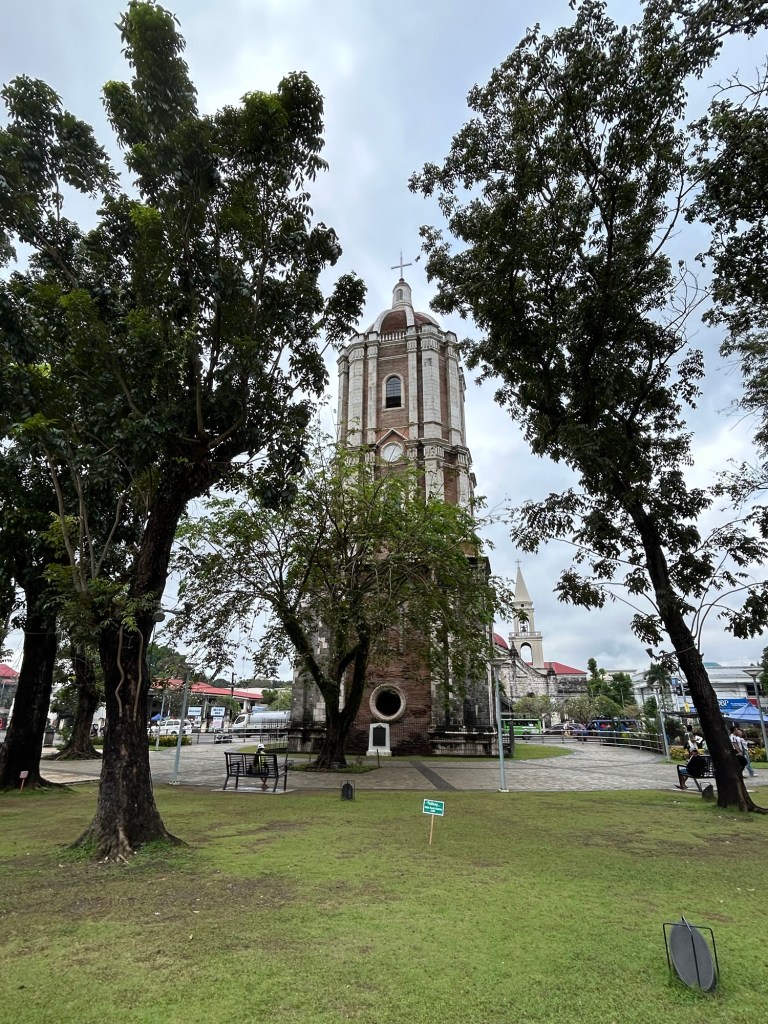
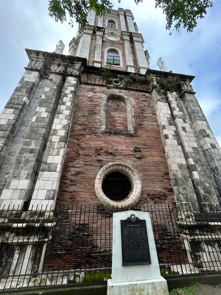
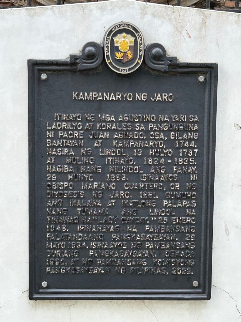
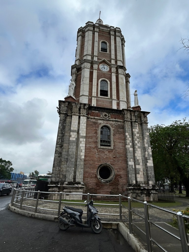
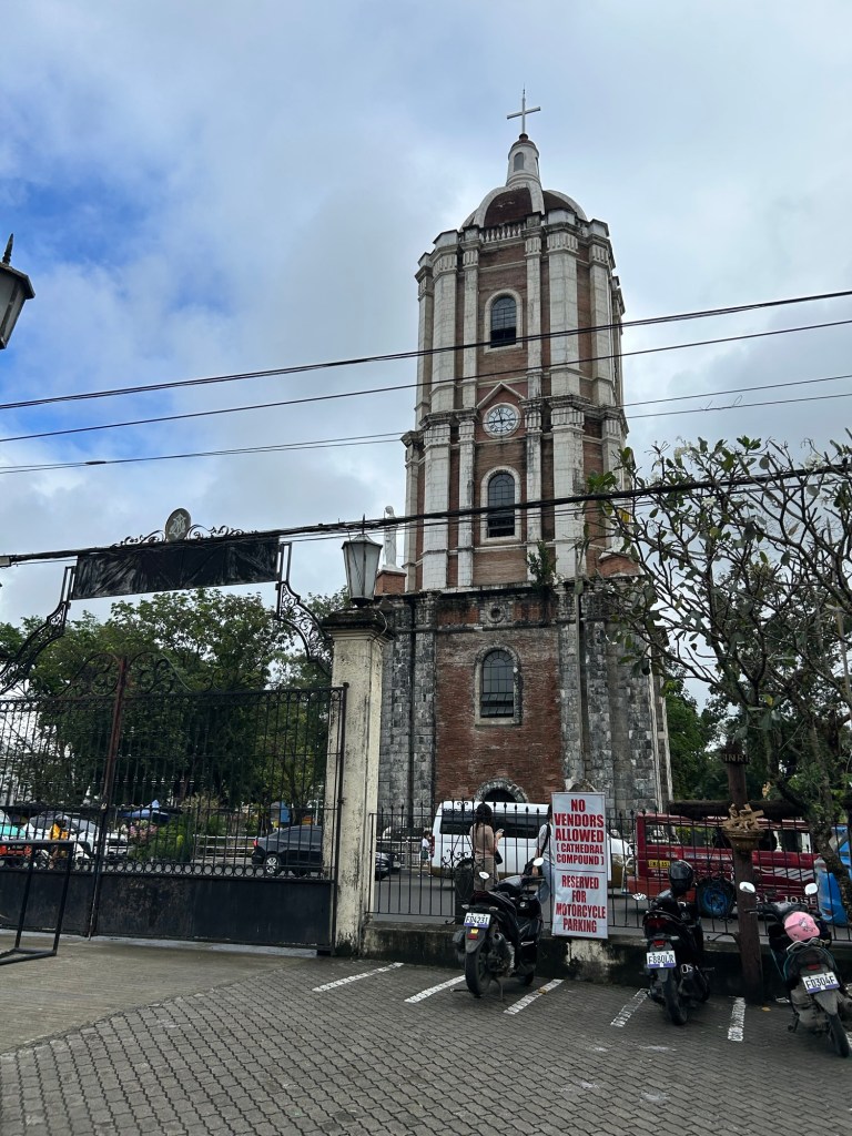
Landmarks: the Jaro Belltower
Here are some photos of a landmark in Iloilo that served as the reference for many jeepney routes. I recall from childhood that we rode the jeepney from Cabatuan and transferred here to another jeepney bound for city proper. Going home, we Di the reverse. We also hopped on a jeepney here to go to other towns like Leganes or farther districts of the city such as Molo or Arevalo. Of course, it’s different now after all the rerouting of public transport. Provincial jeepneys now terminate at the periphery of the city and no longer reach Jaro.
–
Aerial photos – reclamation projects in Manila Bay
Last week’s travel allowed me to take aerial photos of the reclamation projects in Manila Bay. Here are the photos:
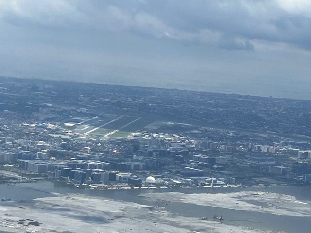
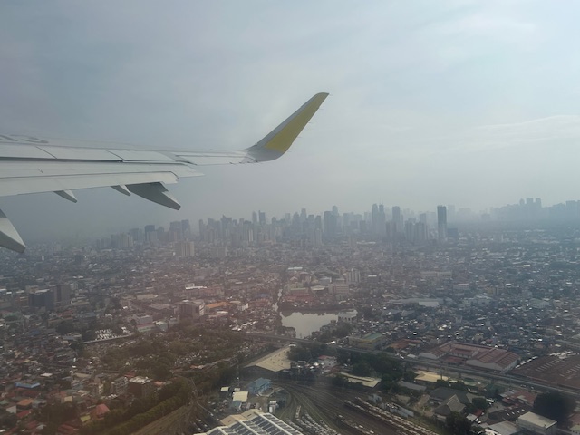
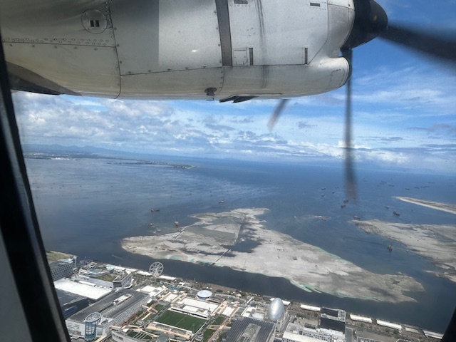 The view as we lifted off from NAIA shows SM’s reclamation project across from the MOA complex.
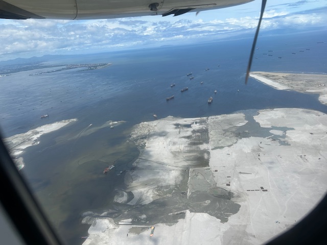 Our plane then climbed and afforded this close-up of sorts of the reclamation across from the now closed Sofitel Hotel.
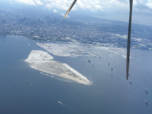
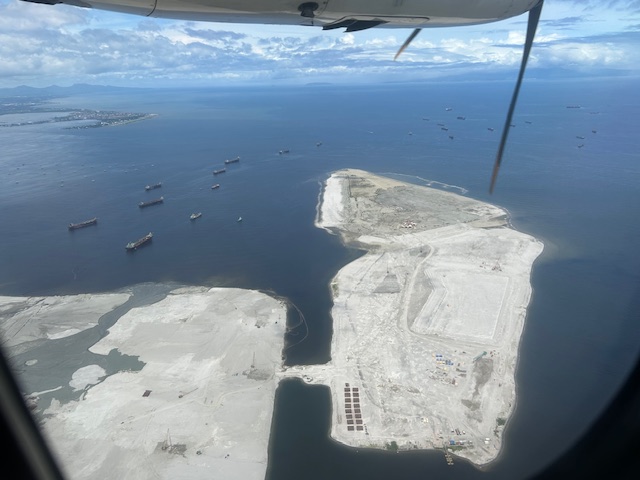 Past the largest of the three reclaimed lands is another man-made island.
 As our plane turned left, we were able to see all three reclamation projects
 A close-up of the reclamation across the MOA complex. Also in the photo is NAIA.
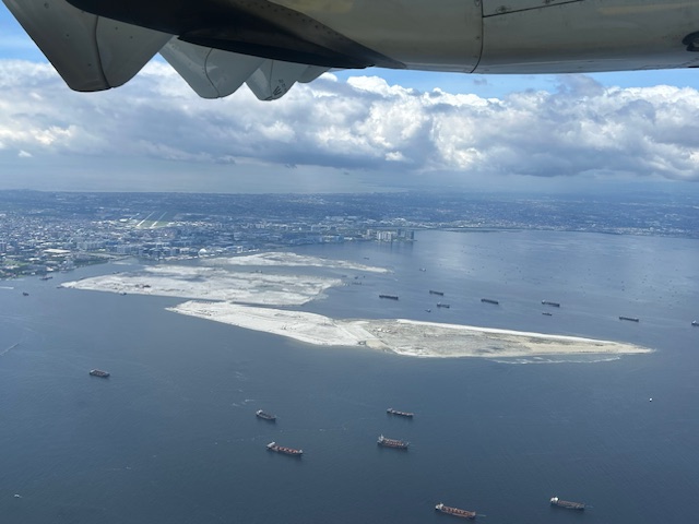
 All three reclamations in one photo as we continued to turn towards the south and southeast (towards Bicol).
More aerial photos soon!
–
Sentimental for Yokohama
A visit from a couple of professors from Yokohama National University (Yokohama Kokuritsu Daigaku) triggered the sentimental part of me. Among the materials presented were information about life on campus and in Yokohama, which is the second biggest city in Japan after Tokyo. There were also giveaways including a nice folder featuring a photo of Yokohama showing the campus on the foreground and many landmarks in the background.
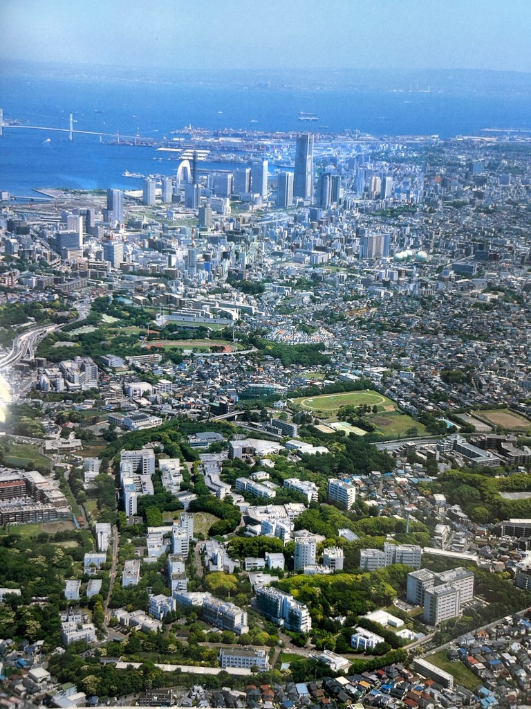
Landmarks in the photo include the Landmark Tower that used to be the tallest building in the country. There is also the Yokohama Bay Bridge that eventually connects to the Aqua Line. And, of course, the Port of Yokohama, which has long been one of the international gateways to Japan.
I have not been to Japan for more than a decade so I look forward to doing another sentimental journey to again visit familiar places and explore new ones.
–
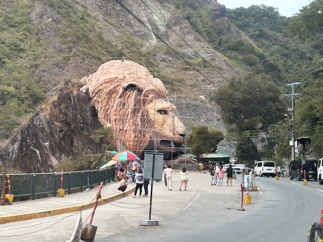
Landmarks – the Lion’s Head, Kennon Road
The main landmark along Kennon Road is the Lion’s Head. I think most people heading to or coming from Baguio have taken a photo of if not with the Lion. Here are photos I took as we descended from Baguio via Kennon Road last December 2024 after participating in a workshop.
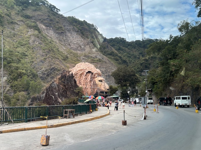 Approaching the Lion’s Head along Kennon Road, the monument appears to be under maintenance with scaffolding around the head.
 An entire section is cordoned off, likely for tourists or visitors. The lane though looks newly paved, perhaps part of a road widening project.
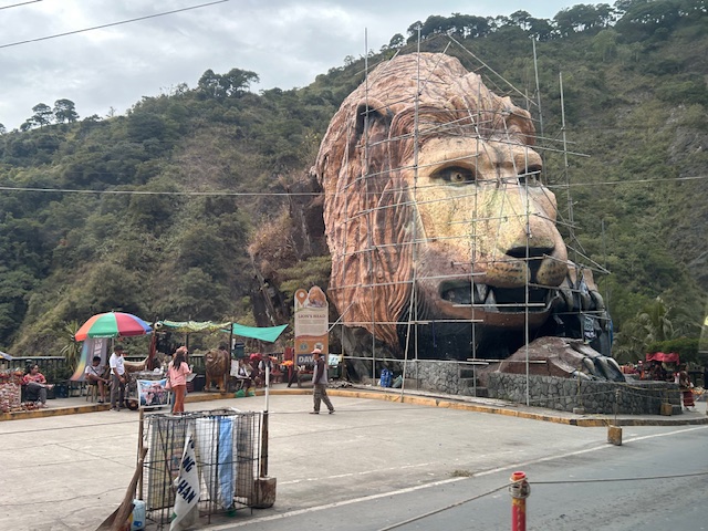 A closer look of the Lion’s Head and the touristy things in the area. Notice there weren’t too many tourists at the time and there weren’t so many shops and vendors set-up.
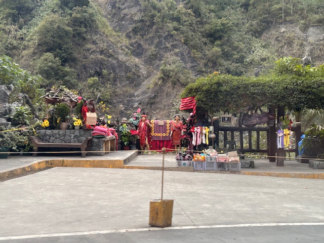 Among the activities are dressing up in local costume and taking photos wearing these with the mountains or the monument in the background.
–
–
Mt. Arayat – the Lonely Mountain
A trip north will usually bring travelers to see a lonely mountain, actually a volcano, that is Mt. Arayat. Located in Pampanga province, you can see Mt. Arayat clearly as you traverse the North Luzon Expressway (NLEX). The volcano is actually visible even from afar on a clear day. I have shared photos of it from our village in Antipolo, Rizal.
 Mt. Arayat as viewed from the NLEX viaduct. On the foreground is the Candaba Swamps
 Another view of the ‘extinct’ volcano dominating the Pampanga landscape. Is it really extinct or perhaps just waiting to be awakened by a force of nature? That was how Mt. Pinatubo became active after a powerful earthquake a year before its big eruption.
I have seen the Mt. Arayat up close on a few occasions. One such time and perhaps the closest I’ve seen it was when we traveled along its foot to get to a wake in a far off Nueva Ecija town. There are actually many plantations or farms around it and along its slopes.
–
Welcome arch in Iloilo
We had a small adventure when we were in Iloilo last month. We traveled to the last town to the west just before the border with the Province of Antique. I was expecting to see welcome arches as we crossed one town after another. There was only one town that had this – Guimbal. And practically the whole stretch of the national highway had a signature of the town’s motto that had got something to do about it like a rising sun.
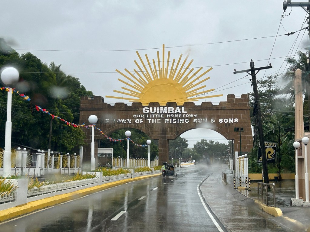
There’s another quite unusual landmark there that I will also be writing about soon. I will leave my readers in suspense for now.
–
Back in Iloilo (again) and a note on landmarks
One landmark that I have been familiar with since I was a child is the Jaro Cathedral belfry. The building is located at the plaza across from the church. The area has been neglected for a long time and I am glad to see the city developing the area to become more attractive and useful as a park for the benefit of its citizens and visitors.
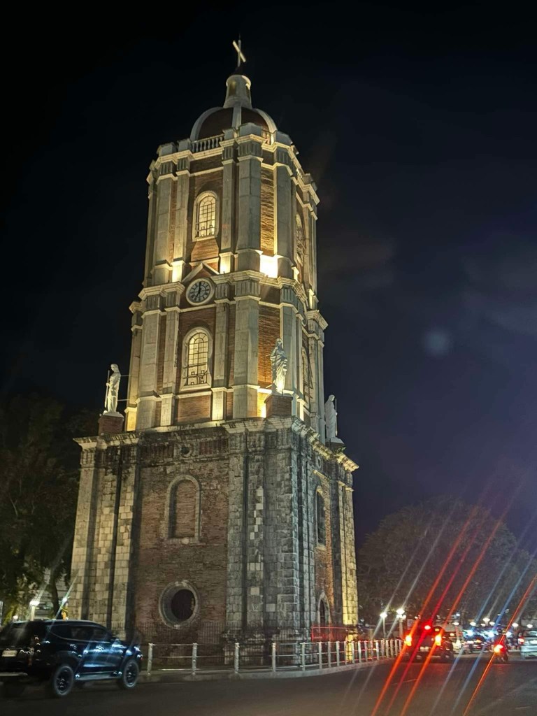
The area, I’ve been told, is being developed as part of a program towards coming up with more open spaces like parks particularly where there are already plazas around the city. I have memories of getting a ride back to my father’s hometown whenever we went to the city usually to eat or shop. The informal jeepney terminals used be around the plaza. Other jeepneys rounded the streets for their return trips instead of stopping at a terminal. Now you have to travel to the provincial jeepney terminals at the outskirts of the city to get a ride to the other towns.
–
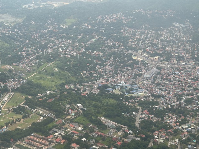
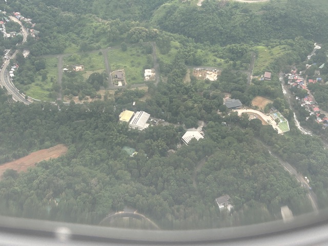
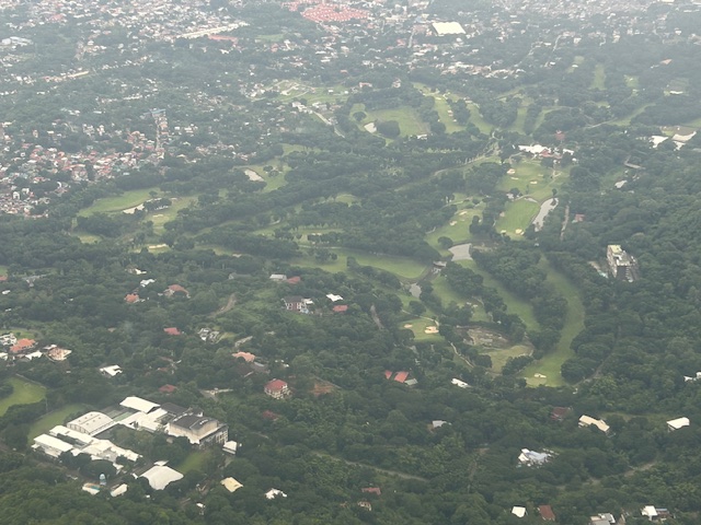
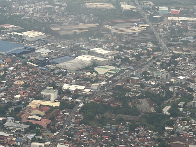
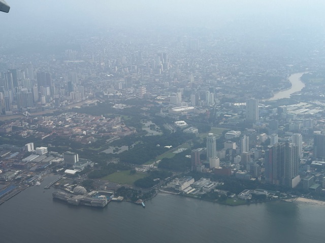
Aerial photos of Rizal
Following is a continuation of my recent post on aerial photos I took when I went to Iloilo for some meetings. This set is from our plane’s approach to land at NAIA. The path led us through Rizal province and the following photos mainly of Antipolo and Cainta.
–
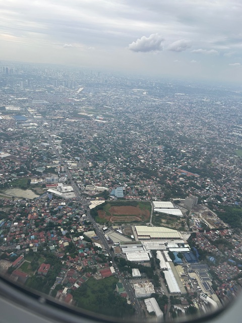
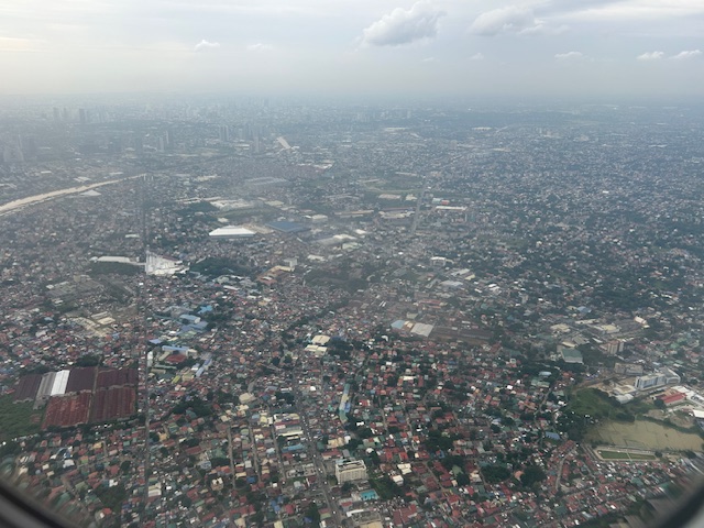
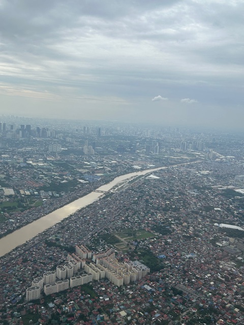
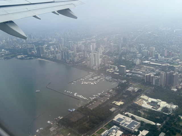
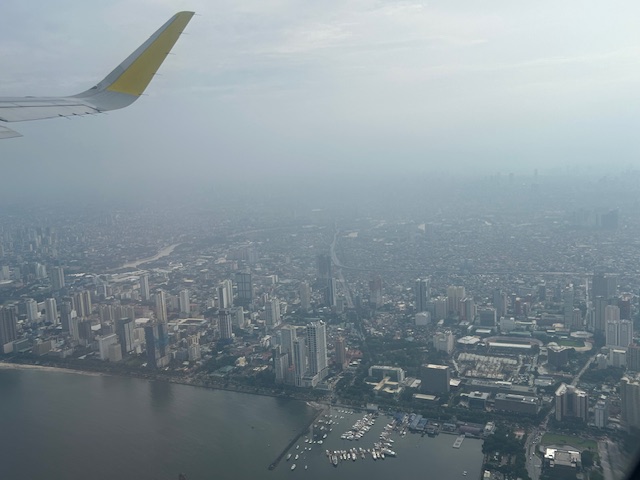
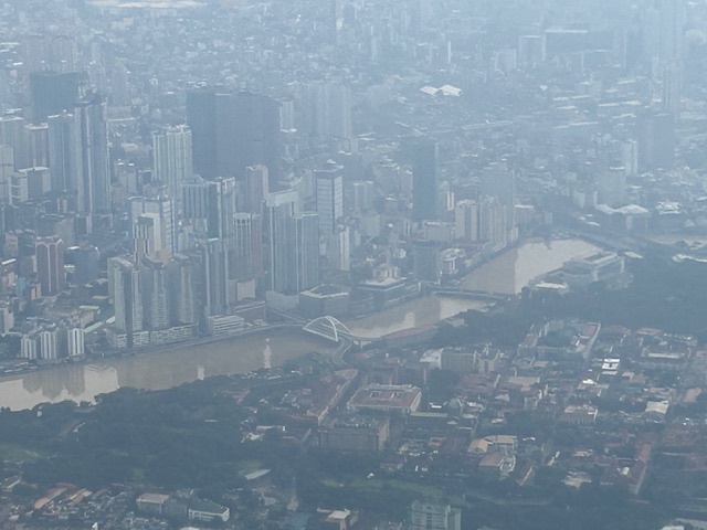
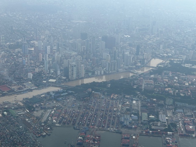
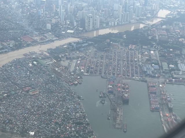
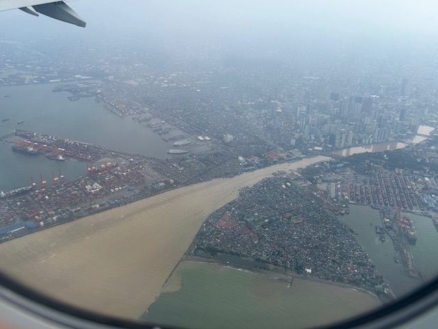
Post Habagat Aerial Photos
We flew to Iloilo just after the Habagat floods that ravaged much of Metro Manila and its surrounding provinces. As our plane took off from Runway 13-31, I figured there was an opportunity to take a few photos of Metro Manila especially as I was seated by the window of the plane.
More aerial photos to be posted here soon!
–
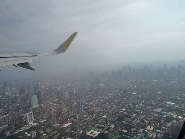
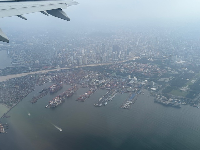
Some photos after taking off from NAIA
I took a few photos as our plane took off last week on our way to Panglao. The photos are not as good as I wanted them as I wasn’t seated at the window.
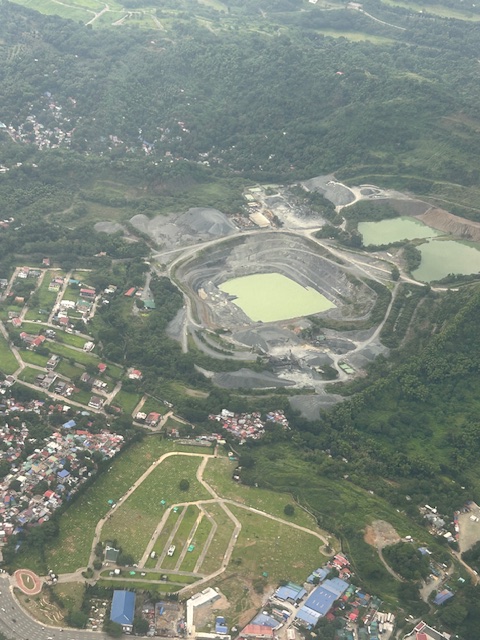
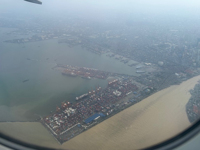
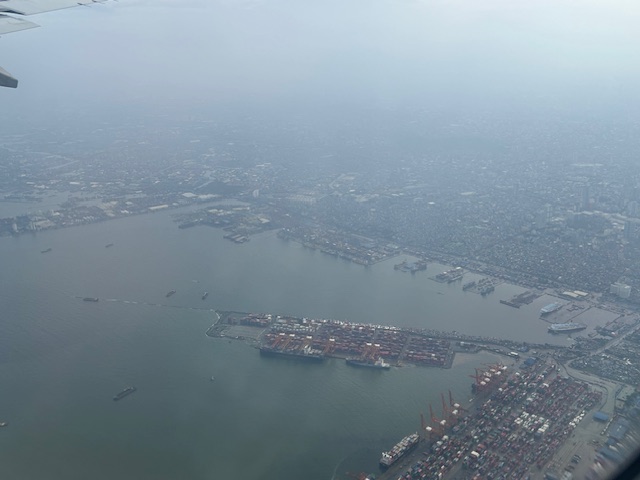
 Reclamation at Manila Bay – there are currently several reclamation projects with various proponents. The projects were halted at one point during the start of the current administration. Some if not all have resumed implementation.
 A closer look at one of the reclamation areas. Note, too, the ships anchored around the area.
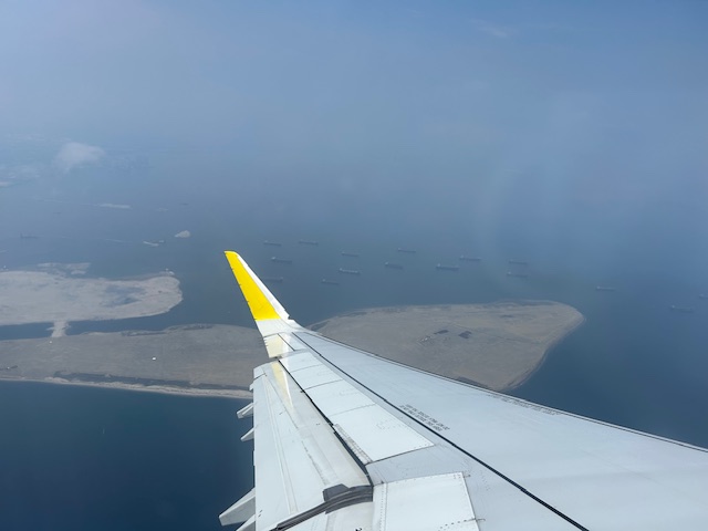
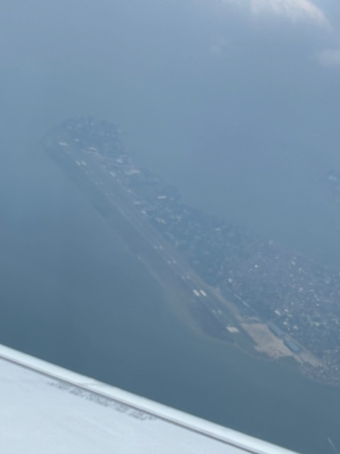 Sangley Point airbase as seen from our airplane. This is proposed to be the location of an airport recommended by a JICA study to replace NAIA. Not in the photo is the controversial former resort that is now a suspicious enclave.
The reclamation projects are also quite controversial considering many of the proponents involved Chinese companies. I have it from a reliable source who was involved in two of the projects that the project land values are sky high. So who would be able to afford settling, locating or residing in whatever will be developed in these reclaimed land? It would be very expensive for the typical Filipino and many local companies will probably balk at the property values. Whatever the developments would be, let’s just hope they don’t go the way of the former Island Cover Resort that is now allegedly a POGO facility.
–
